Mori Atlas logo
National parkTuron National Park

Discover the protected landscape identity of this New South Wales national park.

Turon National Park National Park: Mapped Boundaries and Geographic Atlas Context

Turon National Park stands as a key protected landscape within New South Wales, Australia, offering rich opportunities for geographic discovery. This page provides detailed mapped boundaries and essential context for understanding its place in the broader atlas. Explore the unique natural terrain and conservation significance of Turon National Park.

Gold rush heritageRiver valleysNew South WalesGreat Dividing RangeSandstone landscapesNative wildlife

Turon National Park

National park

Park overview

Structured park overview, official facts, and landscape profile for Turon National Park

Turon National Park park facts, protected area profile, and essential visitor context
Review the core facts for Turon National Park, including designation, size, terrain, visitor scale, habitats, and operating context in one park-focused overview.

About Turon National Park

Turon National Park occupies a meaningful position in New South Wales's protected area network as a preservation of both natural and historical values. Located along the Turon River in an elevated section of the Great Dividing Range, the park encompasses terrain that proved significant during the mid-nineteenth century gold rush period. Remnants from this era remain visible across the landscape, providing a tangible connection to Australia's colonial mining history while the surrounding bushland has regenerated to form functional native ecosystems. The park's relative remoteness and difficult vehicle access have contributed to its preservation of a character that feels removed from the more heavily modified pastoral lands that surround it. Visitors who venture to Turon National Park encounter a landscape where steep sandstone formations rise above valley floors lined with sheoak and eucalypt, creating habitats that support populations of wallabies, owls, and numerous bird species.

Quick facts and research context for Turon National Park

Turon National Park covers terrain within the Great Dividing Range, with valley floors at approximately 750 metres above sea level and plateau tops reaching around 850 metres. The park was formally established in 2002 after being first proposed in 1983, making it one of the newer national park designations in New South Wales. The Turon River flows through the park, supporting sheoak woodlands along its banks while eucalypt forests dominate the steeper slopes. Historical remnants from the 1851 gold rush era remain visible throughout the park, representing a cultural layer that coexists with the area's natural values.

Park context

Deeper park guide and search-rich context for Turon National Park

Turon National Park history, landscape, wildlife, and travel context
Explore Turon National Park through its history, landscape character, ecosystems, wildlife, conservation priorities, cultural context, and seasonal travel timing in a structured park guide built for atlas discovery and search intent.

Why Turon National Park stands out

Turon National Park is best known for its dual identity as both a heritage landscape and a relatively untouched wilderness area in the central tablelands of New South Wales. The park preserves physical evidence of the colonial gold rush era while protecting native Australian ecosystems that include significant populations of red-necked wallabies and a diversity of bird species. The dramatic contrast between the red sandstone escarpments and the green sheoak-lined river valleys creates a distinctive visual character that sets this park apart from other protected areas in the region.

Turon National Park history and protected-area timeline

The Turon River area gained prominence during the Australian gold rush of 1851, when prospectors flood into the region seeking fortune in the alluvial deposits along the watercourse. This historical episode left lasting marks on the landscape that remain observable today, even though the mining activity itself was relatively short-lived in intensity. The land was progressively cleared for pastoral use in the decades following the gold rush, with evidence of this past clearing still apparent in certain areas. Conservation proposals for the area emerged in 1983, recognising the ecological and heritage values that persisted despite the pastoral modifications. It took nearly two decades for these proposals to translate into formal protection, with Turon National Park officially established in 2002 under the management of the NSW National Parks and Wildlife Service.

Turon National Park landscape and geographic character

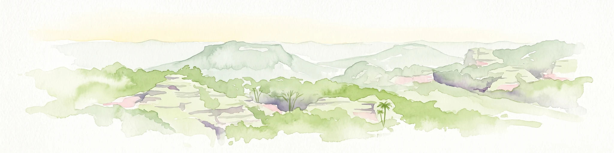
The physical character of Turon National Park is defined by its location within the Great Dividing Range, where elevated plateaus and steep valleys create a landscape of considerable topographic variation. The Turon River has carved a valley through sandstone terrain, and the valley floor supports vegetation communities quite different from the exposed ridge tops. Sheoak trees grow prominently along the riverbanks, forming distinctive woodland along the watercourse, while various eucalypt species cover the slopes and higher ground. The sandstone geology contributes red and orange hues to exposed rock faces, particularly visible on the plateau surfaces where wallabies can be observed resting during daylight hours. The park sits at altitudes that result in cool conditions for much of the year, with sub-zero temperatures recorded regularly during winter months.

Turon National Park ecosystems, habitats, and plant life

The ecosystems within Turon National Park reflect the transition from river valley to elevated sandstone plateau that characterises much of the park's extent. The sheoak woodlands along the Turon River represent a vegetation community adapted to the moister conditions near the watercourse, while mixed eucalypt forests dominate the steeper slopes and ridgelines. These vegetation types provide habitat for a range of native species, creating functional ecological communities that have recovered to varying degrees from the historical land uses that preceded formal protection. The diversity of bird species present within the park is notable, with numerous native species inhabiting the different habitat zones that the landscape provides.

Turon National Park wildlife and species highlights

Wildlife observation represents one of the distinctive experiences available within Turon National Park, with several species present in notable populations. Red-necked wallabies are commonly encountered, spending daylight hours resting on the sandstone plateau surfaces before descending to the valley floor at dusk. The powerful owl, a significant bird of prey in Australian ecosystems, is present in the park and can be heard vocalising at night throughout much of the year. The diverse birdlife includes numerous native species that inhabit the sheoak woodlands along the river and the eucalypt forests on the slopes, creating opportunities for bird observation across multiple habitat types.

Turon National Park conservation status and protection priorities

Turon National Park contributes to the protected area network of New South Wales by preserving a landscape that combines historical heritage values with functional native ecosystems. The establishment of the park in 2002 formalised protection for an area that had been recognised as worthy of conservation since 1983, creating a framework for the ongoing preservation of the Turon River corridor and its associated habitats. The park's position within the Great Dividing Range places it within a region of ecological significance, and the protection of the steep sandstone terrain helps preserve habitats that support populations of native wildlife including wallabies and owls.

Turon National Park cultural meaning and human context

The cultural heritage of Turon National Park is strongly linked to the colonial history of New South Wales, specifically the gold rush era that transformed many parts of the state during the mid-nineteenth century. The 1851 gold rush brought significant human activity to the Turon River valley, and physical evidence of this period remains visible within the park boundaries today. This historical layer exists alongside the longer indigenous history of the broader region, though the Wikipedia source does not provide detailed information about indigenous heritage specific to the park area. The combination of gold rush remnants with the natural landscape creates a cultural environment where human history and Australian bushland intersect.

Top sights and standout views in Turon National Park

The gold rush heritage remnants scattered throughout Turon National Park provide a tangible connection to colonial-era Australian history that is relatively uncommon in the national park estate. The populations of red-necked wallabies that can be observed on the sandstone plateau tops, particularly during early morning and late afternoon, offer accessible wildlife viewing opportunities. The sheoak-lined sections of the Turon River create scenic river valley scenes that contrast with the more exposed ridgetop terrain. The park's location within the Great Dividing Range, approximately 150 kilometres from Sydney, positions it as a relatively accessible wilderness experience for residents of the greater Sydney region.

Best time to visit Turon National Park

The cooler months from late autumn through early spring tend to offer more comfortable conditions for exploring Turon National Park, as summer temperatures in the elevated terrain can be high while winter brings regular sub-zero conditions. The high altitude location means that weather conditions can change rapidly, and visitors should be prepared for cool temperatures even during periods when lowland areas remain mild. The park's remote character and limited road access mean that visitors should check current conditions before travelling, particularly after periods of rainfall when even four-wheel-drive vehicles may struggle to reach the valley floor.

Park location guide

Geography guide, regional context, and park location map for Turon National Park

Turon National Park park geography, regions, and map view in Australia
Understand where Turon National Park sits in Australia through a broader geographic reading of the surrounding landscape, nearby location context, and its mapped position within the national park landscape.

How Turon National Park fits into Australia

Australia is a constitutional monarchy and federal parliamentary democracy comprising six states and ten territories. With a population of nearly 28 million, it is one of the world's most urbanised countries, with most people concentrated on the eastern seaboard. The country has a high Human Development Index and is known for its cultural diversity, ancient Aboriginal heritage, and unique wildlife.

Wider geography shaping Turon National Park in Australia

Australia occupies the entire Australian continent, the island of Tasmania, and numerous smaller islands. It is the world's flattest and driest inhabited continent, featuring vast deserts in the interior (the Outback), tropical rainforests along the eastern coast, and a coastline bordering the Indian and Pacific Oceans.

Map view of Turon National Park

Use this park location map to pinpoint Turon National Park in Australia, understand its exact geographic position, and read its mapped placement within the surrounding landscape more clearly.

Pigeon | © OpenStreetMap contributors

Location context for Turon National Park

New South Wales
Park atlas

Compare Turon National Park with adjacent protected landscapes, tracing the geographic spread of natural areas across the central New South Wales region.

Discover Nearby National Parks and Protected Areas Surrounding Turon National Park, New South Wales
Browse national parks and protected areas near Turon National Park, exploring the diverse conservation landscapes of central New South Wales, Australia. Compare different river valleys, sandstone terrain, and remote wilderness areas within the broader Great Dividing Range, tracing the full geographic context of the region's protected sites.
National parkNew South Wales

Gardens of Stone National Park: National Park Protected Landscape and Geographic Atlas

New South Wales protected area and mapped terrain exploration.

Delve into the protected landscape of Gardens of Stone National Park, an important national park situated in New South Wales, Australia. This page offers an atlas-centric view, focusing on the park's distinct geographic identity, its mapped protected boundaries, and its contribution to the regional context of protected lands. Understand the fundamental landscape character and terrain that define this significant natural area for structured geographic discovery.

Area
150.8 km²
Established
1994
IUCN
II
Relief
Highland
National parkNew South Wales

Wollemi National Park: Mapping Australia's Protected Natural Landscape in New South Wales

Detailed geographic context and protected area exploration.

Wollemi National Park is a critical component of New South Wales' protected natural areas, offering rich opportunities for geographic discovery. This national park provides a distinct focus for understanding the mapped terrain and regional landscape context of Australia. Explore its position within New South Wales, uncovering the details that define its unique protected status and natural geography for dedicated atlas exploration.

Area
5,017.03 km²
Established
1979
IUCN
Ib
Relief
Mountain
National parkNew South Wales

Yengo National Park: Protected Landscape Identity and Geographic Context

Explore its mapped terrain and wilderness character.

Yengo National Park in New South Wales, Australia, is a vast protected area known for its remote wilderness character and significant geographical landmarks such as Mount Yengo. As a vital part of the Greater Blue Mountains World Heritage Site, the park showcases rugged mountainous terrain and diverse natural landscapes. This entry focuses on its atlas-value, detailing the park's mapped boundaries, regional geography, and its identity as a significant protected landscape for nature exploration.

Area
1,543.28 km²
Established
1988
IUCN
Ib
Relief
Mountain
National parkNew South Wales

Kanangra-Boyd National Park: A Protected Landscape within New South Wales' Geography

Mapped boundaries and regional park context.

Kanangra-Boyd National Park represents a significant protected area, offering valuable insights into the natural landscapes and geographic context of New South Wales. As a national park, it provides a clear example of mapped terrain and protected land distribution, crucial for anyone exploring the atlas of Australian conservation areas. Understanding this park contributes to a broader appreciation of its regional geography and specific landscape identity.

Area
686.6 km²
Established
1969
IUCN
Ib
Relief
Mountain
National parkAustralia

Cattai National Park: Australia's Premier Colonial Heritage Protected Landscape

Mapped riverfront geography and historical Australian park context.

Cattai National Park represents a vital entry in Australia's atlas of protected areas, offering unparalleled insight into the nation's early colonial history alongside its natural riverine landscapes. The park's designation as a national park highlights its importance in preserving not only the unique geography of the Hawkesbury River floodplain but also significant historical sites like the Hope Farm Mill, Australia's oldest industrial site. Exploring Cattai National Park allows for a deep dive into mapped protected boundaries and the layered cultural and natural terrain of the Sydney region.

Area
4.24 km²
Established
1992
IUCN
II
Access
Easy access
National parkAustralia

Scheyville National Park: An Australian National Park's Mapped Protected Landscape and Regional Geography

Explore the protected boundaries and natural terrain of this park.

Scheyville National Park represents a vital protected area within Australia, offering a unique lens for geographic exploration. As a national park, its boundaries and landscape characteristics are essential for understanding its place in the regional geography. This content facilitates structured discovery of its natural terrain and mapped extent, providing foundational context for atlas-based learning about Australia's protected lands.

Area
9.2 km²
Established
1996
IUCN
V
Relief
Upland
National parkNew South Wales

Abercrombie River National Park: A Protected Landscape in New South Wales

Explore its national park designation and mapped geography.

Delve into the details of Abercrombie River National Park, a designated national park situated in New South Wales. This entry focuses on its identity as a protected landscape, providing a geographically specific atlas perspective. Understand the extent of its mapped boundaries and its contribution to the regional geography, offering a clear view of its protected area status for discovery and reference.

Area
190 km²
Established
1995
IUCN
II
Relief
Mountain
National parkNew South Wales

Goulburn River National Park: New South Wales National Park with River Ecosystems and Heritage

Explore mapped protected lands and regional geography.

Goulburn River National Park offers a significant protected landscape within New South Wales, Australia, celebrated for its expansive Goulburn River frontage and diverse natural terrain. This national park is pivotal for understanding regional geography, featuring sandstone geological formations and serving as a critical habitat for endangered species, including the regent honeyeater. Its extensive river corridor also protects numerous Aboriginal heritage sites, contributing a rich layer of cultural significance to its conservation value. MoriAtlas helps users explore the mapped boundaries and environmental context of this vital protected area.

Area
722.96 km²
Established
1983
IUCN
II
Relief
Mixed relief

Common questions about visiting, size, designation, and location context for Turon National Park

Turon National Park FAQs for park facts, access, geography, and protected area context
Find quick answers about Turon National Park, including protected-area facts, park geography, trail and visitor context, and how the park fits into its surrounding country and regional landscape.
MoriAtlas Explorer

Continue Your Protected Areas Search Across the Global Atlas

Deepen your exploration by continuing the structured search for national parks and protected areas worldwide. Utilize the comprehensive filtering capabilities to compare different conservation landscapes and refine your understanding of global park geography. Discover more about the distribution and characteristics of protected natural areas.

Global natural geography