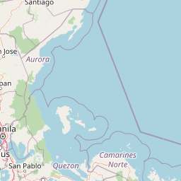
Why Upper Marikina River Basin Protected Landscape stands out
The protected landscape is best known for safeguarding the watershed that supplies and historically supplied water to Metro Manila, and for encompassing the forested upper catchment of the Marikina River along the southern Sierra Madre. It is also recognized for its long institutional history, making it one of the older continuously protected forest reserves in the Philippines. The presence of Wawa Dam, an early twentieth-century structure built to supply water to Manila, anchors the area's identity as a working hydrological landscape as well as a protected ecological zone.
Upper Marikina River Basin Protected Landscape history and protected-area timeline
The origins of the Upper Marikina River Basin Protected Landscape go back to the American colonial period. On July 26, 1904, Governor-General Luke Edward Wright issued Executive Order No. 33, which set aside a tract of land in the Province of Rizal as the Mariquina Reservation. The order's stated goal was to protect the watershed of the Mariquina River, then the source of Manila's water supply, with the early twentieth-century Wawa Dam in Rodriguez serving as a key piece of infrastructure for that purpose.
The reservation's original boundaries ran from Mount Cayabasan along the northern boundary of Rizal Province, southward along the crest of the mountains to a point northeast of the town of Varas, before turning west toward the ridge midway between Antipolo and Boso-Boso and north again to Mount Bantay. The original tract encompassed roughly one hundred square miles of forested mountain land.
For more than a century the area functioned as the Marikina Watershed Reservation. In November 2011, President Benigno S. Aquino III issued Presidential Proclamation 296, redesignating the area as the Upper Marikina River Basin Protected Landscape and placing it under the Department of Environment and Natural Resources within the framework of the National Integrated Protected Areas System (NIPAS) Act of 1992. This upgraded status replaced the older reservation designation with a stronger, ecologically oriented protection category.
Upper Marikina River Basin Protected Landscape landscape and geographic character
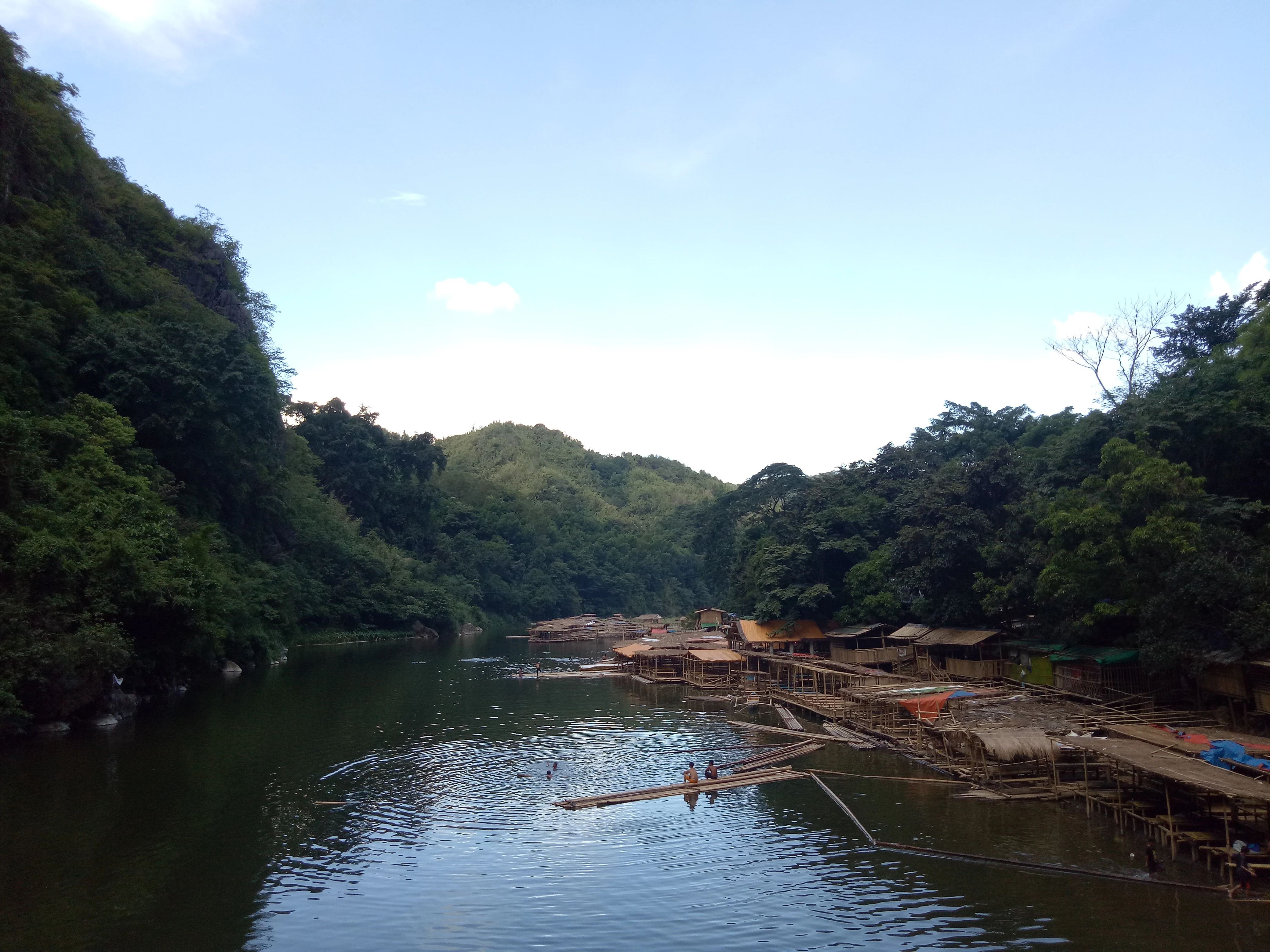
The protected landscape occupies the upper drainage basin of the Marikina River on the southern flanks of the Sierra Madre Mountains. Its topography is dominated by forested ridges and valleys, with peaks such as Mount Cayabasan and Mount Bantay anchoring the historical reservation boundaries. Creeks and small rivers descend these slopes and converge into the main stem of the Marikina River, which then passes through the Wawa Dam in Rodriguez.
The terrain shifts from steep mountain forest in the north and east to more rolling country toward Antipolo and the lower portions of Rodriguez and San Mateo. The presence of Wawa Dam, an early 1900s structure, signals the long-standing human engineering footprint on what is otherwise a forested mountain landscape.
Further downstream, outside the official protected boundary, the river enters a more urbanized setting as it passes through Marikina City, where features such as the historic American-era levee and the remnant waterway known as Patay na Ilog reflect the long interaction between the river's natural course and the surrounding settlements.
Upper Marikina River Basin Protected Landscape ecosystems, habitats, and plant life
Ecologically, the Upper Marikina River Basin Protected Landscape represents a significant block of southern Sierra Madre forest embedded in a network of adjacent reserves. The watershed's elevation gradient and continuous forest cover create conditions for a range of forest types, from lowland dipterocarp communities on the lower slopes to montane forest at higher elevations within the Sierra Madre range.
Its protected status and its location, bordering the Pamitinan Protected Landscape, Kaliwa Watershed Forest Reserve, and Angat Watershed Forest Reserve, mean that the basin functions as part of a much larger contiguous forest landscape. This connectivity is ecologically important because it allows wildlife movement and helps maintain watershed functions such as water filtration, flow regulation, and soil retention across tens of thousands of hectares.
The forest also plays a critical role in moderating runoff into the Marikina River, which feeds into a flood control system that drains, in part, into Laguna de Bay. By stabilizing slopes and absorbing rainfall, the protected landscape helps reduce the severity of downstream flooding in Metro Manila.
Upper Marikina River Basin Protected Landscape wildlife and species highlights
As a sizable block of forested watershed on the edge of Metro Manila, the Upper Marikina River Basin Protected Landscape supports wildlife typical of the southern Sierra Madre, including forest-dependent birds, mammals, and reptiles associated with lowland and mid-elevation Philippine forest. The protection status of the area, together with its connections to neighboring reserves, helps maintain habitat for species that rely on large, contiguous blocks of forest.
The basin's creeks and rivers also support freshwater aquatic life, and the surrounding forest provides cover and foraging habitat for species moving along the Sierra Madre corridor. Local landmarks such as the rivers near Avilon Zoo in Rodriguez highlight the area's broader role as a zone where wildlife, including captive and wild populations, coexists with adjacent human settlements.
Upper Marikina River Basin Protected Landscape conservation status and protection priorities
The Upper Marikina River Basin Protected Landscape is one of the older protected areas in the Philippines, with a conservation history stretching back more than a century. Its original 1904 designation as a watershed reservation reflected an early recognition that protecting forested mountain catchments was essential for safeguarding urban water supplies, in this case for Manila.
Its 2011 redesignation as a protected landscape under Presidential Proclamation 296 embedded the area more firmly in the modern Philippine conservation framework. By placing the landscape under the Department of Environment and Natural Resources and the National Integrated Protected Areas System, the proclamation aligned its management with broader ecological objectives, including biodiversity protection, watershed integrity, and sustainable use.
The landscape's conservation value is amplified by its position within a network of adjacent reserves, including Pamitinan Protected Landscape, Kaliwa Watershed Forest Reserve, and Angat Watershed Forest Reserve. Together these areas form one of the most important forest and watershed complexes near Metro Manila, supporting both biodiversity conservation and the hydrological security of the national capital region.
Upper Marikina River Basin Protected Landscape cultural meaning and human context
The Upper Marikina River Basin Protected Landscape carries a layered human history. The river that drains it has long shaped settlements along its banks, and places like Barangay Tumana in Marikina City preserve place names and ecological knowledge tied to the river, including the Tagalog origin of Tumana as a term for a fertile highland above water level.
American colonial-era infrastructure, including Wawa Dam and the levee that shifted the Marikina River's course near Marikina City, marks an early period of large-scale engineering intervention in the watershed. Remnant waterways such as Patay na Ilog, the so-called 'dead river,' preserve traces of these interventions in the present-day landscape and local memory.
The nearby town of Antipolo, with the San Jose welcome arch marking the edge of Rizal's mountain communities, reflects the broader cultural identity of the upland settlements that have long coexisted with the watershed. Together these elements connect the protected landscape to a wider regional heritage shaped by the river.
Top sights and standout views in Upper Marikina River Basin Protected Landscape
The Upper Marikina River Basin Protected Landscape stands out for combining an unusually long protection history with a vital contemporary hydrological role. Originally set aside to secure Manila's water supply, it remains a cornerstone of the regional watershed network, with Wawa Dam as a tangible link to that early purpose.
Its scale, roughly 26,000 hectares of forested Sierra Madre terrain, and its position within a larger network of adjacent reserves make it one of the most significant peri-urban forest blocks in the Philippines. Few protected areas elsewhere in the country combine the proximity to a megacity, the historical depth, and the upstream-downstream linkages that define this basin.
Best time to visit Upper Marikina River Basin Protected Landscape
The protected landscape's character shifts meaningfully with the rainy season in the Philippines. From roughly June through November, rainfall is heaviest, and the Marikina River and its tributaries swell, swelling both the visible river scenery and the risk of downstream flooding in Metro Manila. During these months the forested slopes are at their greenest and most dramatic, but travel within the basin can be affected by weather conditions and flood control operations.
The drier months, generally from December into May, bring calmer flows, clearer conditions for exploring the upper river and its tributaries, and easier access to mountain areas such as those around Rodriguez, Tanay, and Antipolo. Visitors interested in hiking, river scenery, and outdoor activities in the watershed often find this period more comfortable for safety and visibility.