
Mori Atlas logo
Biosphere reserveReserva de la biosfera de Urdaibai

Mapping the tidal estuary, coastal cliffs, and forested mountains of the Basque region

Reserva de la biosfera de Urdaibai: A Comprehensive Geographic and Landscape Atlas Analysis

(Reserva de la Biosfera de Urdaibai)

Reserva de la biosfera de Urdaibai defines the coastal character of the Basque Country through its intricate network of Oka River tidal marshes, Atlantic oak woodlands, and limestone karst hills. This protected area serves as a critical migratory corridor for waterfowl and a landmark of geological diversity where sea, estuary, and mountain converge. Understanding its boundaries offers insight into the conservation of wetland complexes and the interplay between human heritage and protected natural terrain.

biosphere reserveestuarywetlandsmigratory birdsbirdwatchingatlantic coast
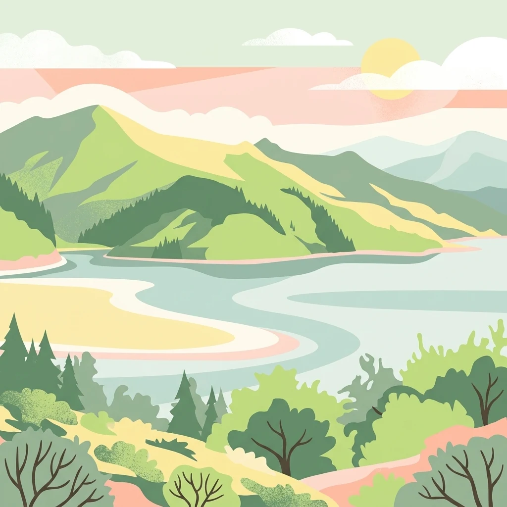
A minimalist, flat-color digital illustration depicting an estuary winding between green hills under a soft sun.

Reserva de la biosfera de Urdaibai

Biosphere reserve

Park overview

Structured park overview, official facts, and landscape profile for Urdaibai Biosphere Reserve

Urdaibai Biosphere Reserve park facts, protected area profile, and essential visitor context

Review the core facts for Urdaibai Biosphere Reserve, including designation, size, terrain, visitor scale, habitats, and operating context in one park-focused overview.

About Urdaibai Biosphere Reserve

Urdaibai Biosphere Reserve stretches along the Cantabrian coast of Biscay, covering roughly 22,000 hectares that span twenty-two municipalities and capture the entire catchment of the Oka River. Roughly ten percent of the territory of Bizkaia lies within its boundaries, making it one of the most significant protected area in the Basque Country and a cornerstone of the region's environmental identity.

The reserve's core is the estuary of the Oka, also historically called the estuary of Mundaka or Gernika, which runs about twelve kilometers inland from the Cantabrian Sea. Tidal influence dominates the system, with a mean tidal range of around four and a half meters renewing the entire estuary once or twice a day. The result is an extensive mosaic of open water, intertidal mudflats, sand flats, saltmarsh, dunes, and reclaimed polders where traditional grazing continues. This combination makes the estuary the ecological heart of the reserve and a Ramsar-listed wetland of international importance.

Surrounding the low-lying estuary, the landscape rises into gentle mountains shaped by the folded geology of the Basque Arc. The highest points within the reserve, along the Astogana ridge and surrounding the valley, remain under nine hundred meters, yet they frame dramatic views over the entire protected area and the Bay of Biscay. From Astogana, near Mount Oiz, observers can take in the reserve in a single glance, and on clear days even glimpse distant ranges such as the Moncayo.

Fragmented outcrops of limestone form a remarkable karst landscape of caves, dolinas, and enclosed valleys such as those of Bollar, Basondo, and Malluku. These limestone hills carry a distinctive Mediterranean-influenced vegetation on the Cantabrian coast: holm oak woodlands with strawberry trees, known locally as encinar cantábrico. Elsewhere, planted forests of Monterey pine and eucalyptus dominate the slopes, while remnants of native pedunculate oak woods and gallery alder forests along the rivers preserve fragments of the original Atlantic forest. Coastal cliffs, beaches with dune systems such as Laida and Laga, and small islands like Izaro and Sandindere add further diversity.

Urdaibai's setting combines rich ecological value with a strong cultural layer. The area has been inhabited since the Upper Paleolithic, as shown by the prehistoric cave art of Santimamiñe and the Roman port of Forua. The historic towns of Bermeo and Gernika blend fishing heritage, Basquetown culture, and symbolic political importance, with the Casa de Juntas and the Tree of Gernica. Today the reserve remains an inhabited, working landscape where farming, forestry, fishing, surfing, and conservation all coexist under the framework of its dedicated management plan.

Protection and recognition

Examine the documented conservation scope and international designation history for this reserve.

Reserva de la Biosfera de Urdaibai Protection Status and International Recognition

Reserva de la biosfera de Urdaibai maintains a mixed protection scope with structured administrative oversight across its regional landscape. Official conservation data compiles management parameters and recognized status records for analytical reference.

Protection details

Protection scope
Mixed
Transboundary protection
No
Park context

Deeper park guide and search-rich context for Urdaibai Biosphere Reserve

Urdaibai Biosphere Reserve history, landscape, wildlife, and travel context

Explore Urdaibai Biosphere Reserve through its history, landscape character, ecosystems, wildlife, conservation priorities, cultural context, and seasonal travel timing in a structured park guide built for atlas discovery and search intent.

Why Urdaibai Biosphere Reserve stands out

Urdaibai is best known for its tidal estuary and its role as one of the most important wetland stopovers for migratory birds on the northern Spanish coast. The Oka estuary supports large flocks of spoonbills, herons, ospreys, and a wide variety of wintering waterfowl, while the marshes of Gautegiz Arteaga, watched from the Urdaibai Bird Center, anchor its international ornithological reputation. It is equally recognized for the variety of landscapes compressed into a relatively small area: Cantabrian holm oak forests on limestone hills, Atlantic oak woodlands, sand dunes and beaches, dramatic cliffs such as those of Cape Machichaco and the Peñón de Ogoño, and small islands like Izaro with their seabird colonies. The reserve is also famous as the symbolic setting of Gernika, with the Tree of Gernika and the historic Juntas Generales of Bizkaia, and as a surf destination at Mundaka, home to one of the most celebrated left-hand waves in Europe.
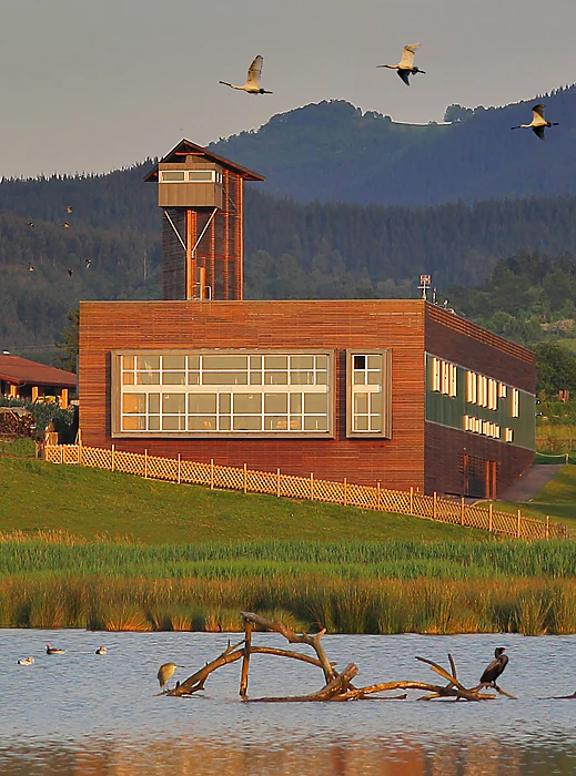
Modern wood-clad visitor center building with an observation tower, situated next to a marshy wetland with birds flying overhead and resting on a log.
The Urdaibai Bird Center, a primary educational facility overlooking the wetlands of the Urdaibai Biosphere Reserve.

Urdaibai Biosphere Reserve history and protected-area timeline

The human story of Urdaibai stretches back tens of thousands of years. Occupation is documented from the Upper Paleolithic through Santimamiñe cave, with layer after layer of prehistoric use into the Neolithic, Bronze Age, and Iron Age. During the era of the Roman Empire, the small port of Forua on the hillside above the estuary handled regional trade, and a necropolis later found beneath the church of San Martín de Tours contains an almost unbroken sequence of burials from Roman times to the nineteenth century.

In the Middle Ages, the estuary became a major focal point of Biscayan coastal life. Bermeo, founded in 1236, served as the capital of the Señorío de Bizkaia from 1476 to 1602, while Gernika, founded in 1366, became the seat of the Juntas Generales of Bizkaia beneath the famous oak tree that still symbolizes Basque liberties. The Franciscan convent on Izaro was visited by several Spanish monarchs, including Enrique IV and the Catholic Monarchs, before being abandoned in 1719, when the island passed to Bermeo.

The modern history of the reserve begins in 1984, when UNESCO's Man and the Biosphere committee designated the Estuary of Mundaka as a Biosphere Reserve, recognizing both its natural richness and its long-standing human presence. In 1986 the Spanish Parliament approved a specific law to protect and regulate the territory. Over the following decade, additional designations followed: inclusion in the Ramsar list of internationally important wetlands, declaration as a Special Protection Area for Birds, and recognition as a hunting refuge.

The Basque Government created the Patronato in 1990 to manage the reserve, and approved the Plan Rector de Uso y Gestión in 1993, replacing it with an updated framework in 2003. The Plan de Armonización y Desarrollo de las Actividades Socioeconómicas, functioning as a local Agenda 21, was approved in 1998. In 2008, the Urdaibai Bird Center opened in the restored buildings of the old Orueta area, becoming a reference point for bird research and public outreach, and in 2015, the Ekoetxea Center moved into the renovated Torre Madariaga, reinforcing the reserve's role as a hub for biodiversity education and sustainable development.

Urdaibai Biosphere Reserve landscape and geographic character

The landscape of Urdaibai combines three clearly differentiated zones that meet along the Oka estuary. Inland, the mountains form a ring of forested ridges and limestone hills, dominated by gently folded crests that rarely exceed nine hundred meters and are arranged around the watershed of the Oka, with branches of the watershed outlined by the Basque Arc geological structure. Astogana, near Mount Oiz, marks the high southern edge of the reserve, while the eastern boundary runs through the ridges of Ereñozar and Atxarre.

In the middle ground, the river Oka carves a valley that gradually flattens into lowlands of farmland, pastures, polder fields, and marsh. The Atlantic countryside, with scattered caseríos (traditional Basque farmhouses) and patches of cultivated land between wooded slopes, forms the cultural and visual backbone of the reserve. The Corte de la Ría, an artificial straightening of the original meandering estuary carried out in the early twentieth century, gave rise to extensive reclaimed polders, known locally as munas, where polder embankments and tidal valves keep the lowlands defensible.

Along the coast, the terrain becomes more dramatic. To the west, Cape Machichaco forms a sandstone headland marking the limit of the reserve, with sea cliffs dropping to a wave-cut platform. To the east, the massive Peñón de Ogoño rises sharply above the bay of Laga and Elantxobe, its limestone cliffs pierced by sea caves. Between those extremes lies the open estuary with its dunes, beaches, and saltmarsh, and offshore the island of Izaro closes the bay like a natural guardian, while small islets like Sandindere and Txatxarramendi dot the inner estuary. The cumulative effect is a compact landscape of sea, estuary, farmland, forest, and limestone karst in unusually close proximity.
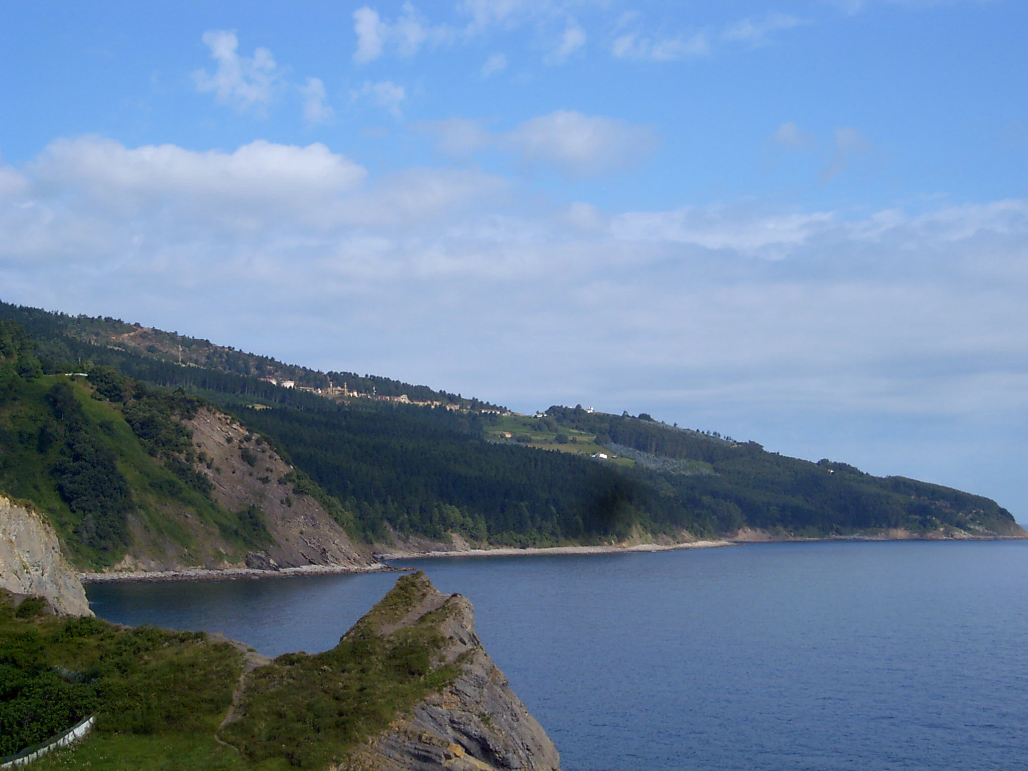
A wide shot of the rocky, green coastline at Matxitxako Cape meeting the calm deep blue ocean under a partly cloudy sky.
The rugged coastal cliffs of Matxitxako Cape within the Urdaibai Biosphere Reserve.

Urdaibai Biosphere Reserve ecosystems, habitats, and plant life

Urdaibai's natural identity is shaped by the meeting of Atlantic, Mediterranean, and tidal influences on a small coastal territory. The estuary, dominated by the daily cycle of the tides, supports the largest and best-preserved saltmarsh in the Basque Country. Vegetation grades from open saline waters with seagrass beds of Zostera noltii to Spartina flats, rushbeds, and reedbeds where salt-tolerant willows and alders fringe the channels.

The karst limestone hills carry a distinctive Mediterranean-style Cantabrian holm oak forest, with holm oaks mixed with strawberry trees, Phillyrea, and other evergreen shrubs. This encinar cantábrico, found particularly around Atxarre, Ereñozar, and Atxapunta, is one of the reserve's most characteristic plant communities and provides refuge for larger mammals. In contrast, the inland slopes still hold fragments of Atlantic deciduous woodland, including pedunculate oak forests such as those of Elexalde and Oraldey, as well as gallery forests of alder, ash, hazel, and birch that follow the streams down to the marsh.

Where the original forests have been replaced, much of the reserve is now occupied by planted forests of Monterey pine and eucalyptus, often on former farmland. These plantations dominate large portions of the slopes but are ecologically less rich than the natural woodlands. On coastal dunes, specialized psammophilous vegetation survives where human pressure allows, and in the interior cottage-garden patches of meadow and pasture maintain the classic Atlantic Basque countryside. The ornithological richness of the area is closely tied to this habitat diversity: the same small territory supports cliff-nesting seabirds, forest passerines in the oakwoods, farmland specialists in the countryside, and the rich waterbird communities of the estuary.
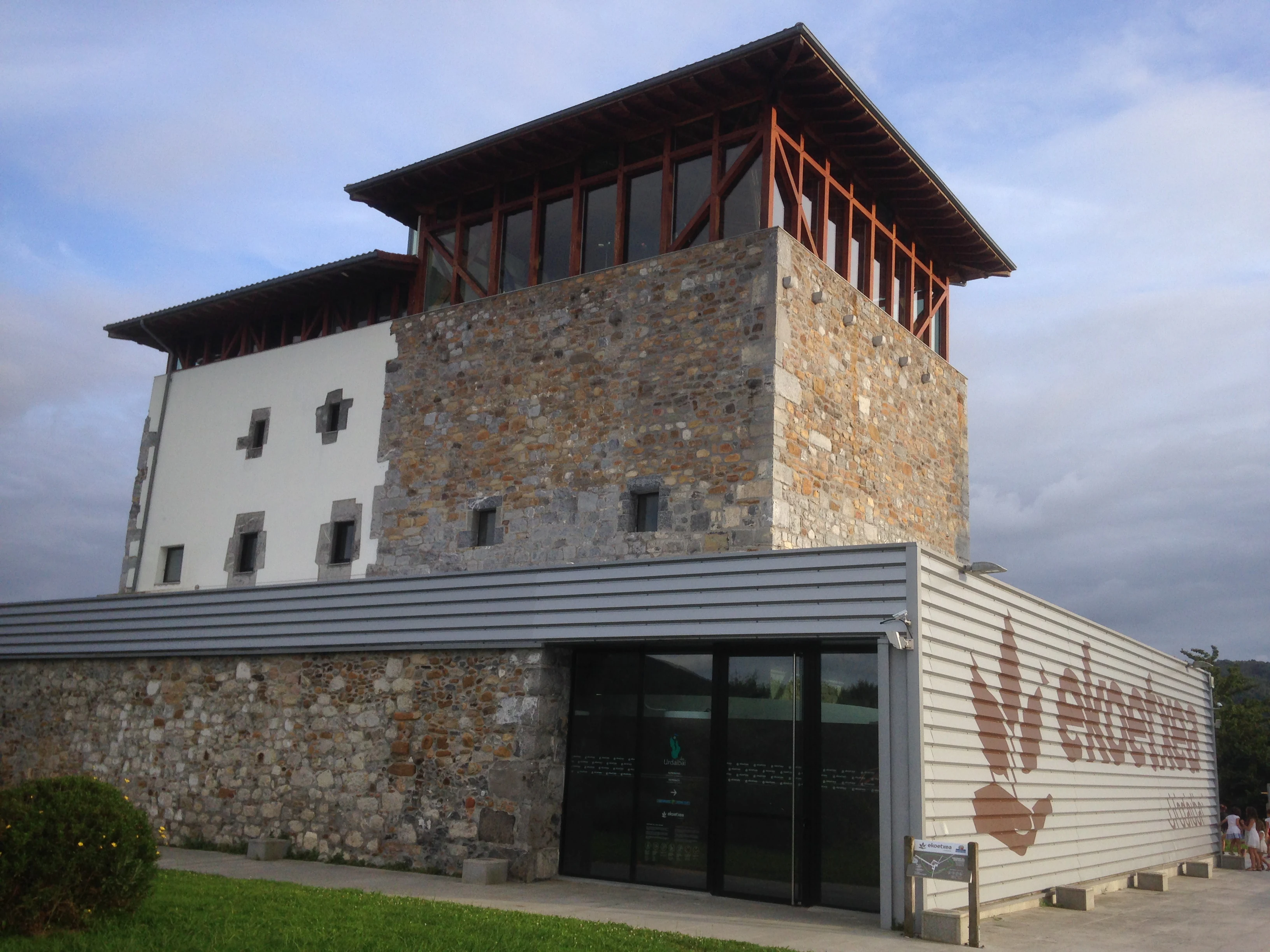
The Ekoetxea Urdaibai visitor center in Busturia, featuring a stone tower with a wooden gallery attached to a modern, single-story metal-clad building.
Ekoetxea Urdaibai, an environmental education center housed within the historic Madariaga Tower.

Urdaibai Biosphere Reserve wildlife and species highlights

Wildlife is the most public face of Urdaibai's conservation effort, with birds at the center of its reputation. The estuary lies on a major migratory flyway between Europe and Africa, and its mix of mudflats, saltmarsh, dunes, lagoons, cliffs, and woodlands supports a remarkable variety of resident and migratory species. Notable waterbirds include grey herons, little egrets, spoonbills, ospreys, bitterns, and large flocks of wintering ducks such as wigeons, while the Orueta lagoon in Gautegiz Arteaga has become a key breeding site for species like the common pochard and the black-winged stilt.

The Urdaibai Bird Center, established in 2008, coordinates ringing programs and ecological studies, and has helped establish Urdaibai as one of the most important ornithological hotspots on the Cantabrian coast. Rare visitors such as brent geese, eiders, velvet scoters, long-tailed ducks, and whooper swans appear in winter, while seabird colonies on Izaro and the cliffs of Machichaco and Ogoño host shags, cormorants, and yellow-legged gulls. Inland, the mature woodlands and farmland support a wide array of smaller birds, among them kingfishers, European robins, common firecrests, and dartford warblers, as well as common buzzards and short-toed snake eagles soaring along the coastal ridges.

Mammals include the protected European mink, polecats, European wildcats, genets, beech martens, wild boar, and roe deer, while amphibians such as salamanders, marbled newts, and Iberian frogs remain in the damper forests and streams. Brown trout, loach, and eels populate the river Oka, with sea species such as corkwing wrasse, flatfish, and mullet in the ria itself. The varied invertebrate fauna includes some 250 identified insect species and 77 arachnid species, several of which are protected.
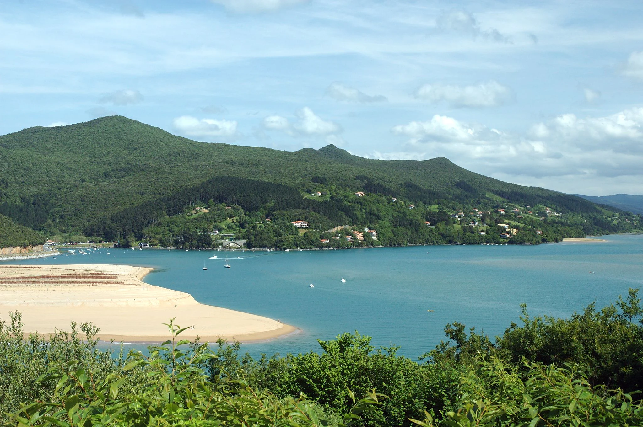
A wide shot showing a sandy beach curving into a wide blue estuary, backed by green hills and forests under a partly cloudy sky.
A view of the sandy Laida beach and the mouth of the Mundaka estuary within the Urdaibai Biosphere Reserve.

Urdaibai Biosphere Reserve conservation status and protection priorities

Urdaibai's conservation significance rests on a layered system of designations that reflect both global and regional recognition of its value. UNESCO designated it as a Biosphere Reserve in 1984, while the Spanish Council of Ministers added it to the Ramsar list of internationally important wetlands in 1992, recognizing the Oka estuary in particular as vital habitat for migratory waterbirds. The territory is also a European Special Protection Area for Birds, incorporated into the Natura 2000 network, and a Hunting Refuge under Biscayan provincial law.

The Spanish law of 1989 and the Plan Rector de Uso y Gestión form the backbone of its protection framework. The reserve is divided into zones with different degrees of protection: special protection areas for the estuary, the coastal strip, the Cantabrian holm oak forests, and the archaeological heritage; general protection areas where agriculture and forestry continue under regulated conditions; agricultural areas of interest; managed forest lands; built-up nuclei; and common rural lands. The Basque Government manages these zones through the Patronato, supported by a Council of Cooperation that brings in civic and scientific voices, and Ekoetxea, the Basque Biodiversity Center, established at the Torre Madariaga, anchors public education.

Conservation priorities include the recovery of dunes such as those of Laida and Laga, the control of invasive species like Baccharis halimifolia, and the gradual replacement of pine and eucalyptus plantations with native woodland. Long-running volunteer initiatives have removed invasive plants, restored dune vegetation, and supported scientific monitoring, while projects such as the regeneration of the Orueta lagoon have improved conditions for breeding waterbirds. Together these efforts aim to safeguard the reserve's ecological complexity and its role as a refuge for migratory species, while still allowing traditional land uses and sustainable development under an Agenda 21-style plan.

Urdaibai Biosphere Reserve cultural meaning and human context

Urdaibai's identity is inseparably tied to Basque culture and the long human history of the Busturialdea region. Euskara, the Basque language, remains a living presence alongside Spanish in everyday life, sustaining a vivid tradition of local stories, customs, dances, and a complex mythology that predates the arrival of Christianity. Religious festivals, traditional fairs such as the October livestock fair of Gernika, and the Bermeo fishing festival, Arrain Azoka, are part of the reserve's living cultural calendar.

The historic landscape carries traces of many eras. Prehistoric paintings in the Santimamiñe cave link this coast to the broader network of Magdalenian rock art along the Atlantic Arc, while the Roman port of Forua, the Iron Age hillfort of Arrola, and the medieval Castillo de Arteaga together form a layered heritage. The Ercilla Tower in Bermeo, the Gothic-Renaissance church of Gernika, and the Casa de Juntas, with the sacred Tree of Gernika, embody centuries of Basque political identity. Tourism adds another cultural layer: Mundaka is renowned worldwide as one of Europe's top surfing destinations, while agro-tourism, birdwatching, and heritage tourism connect visitors with the reserve's rural and natural character.
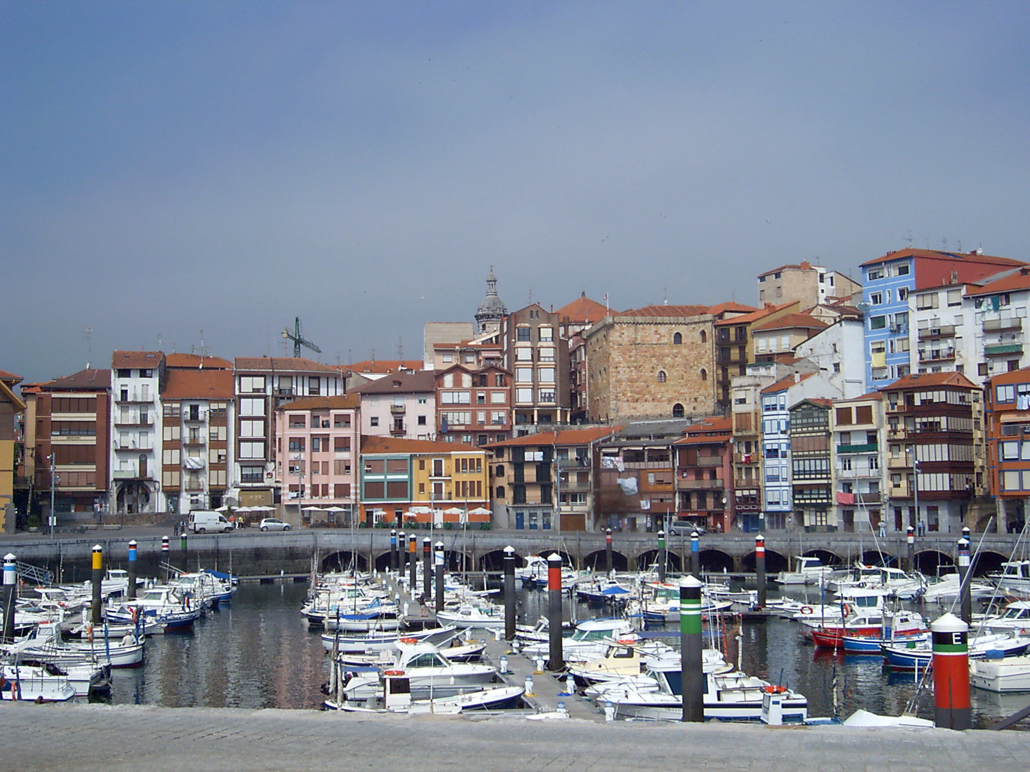
A wide view of the old port of Bermeo, featuring a dense cluster of colorful traditional buildings overlooking a harbor filled with small fishing boats and pleasure craft under an overcast sky.
The historic old port and marina of Bermeo, located within the Urdaibai Biosphere Reserve.

Top sights and standout views in Urdaibai Biosphere Reserve

Urdaibai's highlights include the tidal estuary of the Oka, the marshlands of Gautegiz Arteaga, the cliffs and seabird colonies of Cape Machichaco and the Peñón de Ogoño, the island of Izaro, and the Cantabrian holm oak forests that thrive on the limestone hills along the coast. The reserve is a key stopover for spoonbills, herons, and many other waterbirds, as well as a Ramsar-listed wetland of international importance.

Complementing these natural features is a rich cultural layer: the prehistoric cave of Santimamiñe with its Magdalenian art, the Basque political symbolism of Gernika and the Tree of Gernika, the medieval Castillo de Arteaga, and the surf-famous left-hand wave at Mundaka. The Urdaibai Bird Center and the Ekoetxea biodiversity center at Torre Madariaga make the reserve a leading destination for conservation education, while a network of viewpoints, especially Astogana near Mount Oiz, offers sweeping views over the entire protected territory.
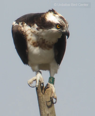
An osprey with dark brown wings, white chest, and yellow eye perched on a wooden post against a pale sky, with a green leg band visible.
An osprey, recognizable by its distinct brown and white plumage, perched on a post at the Urdaibai Bird Center.

Best time to visit Urdaibai Biosphere Reserve

Urdaibai's mild Atlantic climate gives the reserve year-round appeal, with average temperatures moderating between roughly eight degrees Celsius in winter and around twenty degrees in summer. Rain is frequent in every season, so any visit is best planned with flexible expectations for visibility and short detours to viewpoints, forests, or interpretive centers.

Spring and autumn are especially rewarding for naturalists. Migratory birds peak during spring passage, while autumn brings the first winter visitors and the Atlantic countryside takes on rich seasonal colors. This is the right time to combine wetland visits with woodland walks, lookout points such as Astogana, and cultural stops in Gernika and Bermeo. Summer is the most popular season for beachgoers and surfers, particularly at Laida, Laga, and Mundaka, but the marshes remain active and the Bird Center continues to host educational activities throughout the season. Winter, while quieter and cooler, is excellent for observing rare waterfowl such as brent geese, eiders, and whooper swans that join the regular residents of the estuary.

Monthly climate preview

Track long-term temperature ranges and monthly precipitation averages across the protected landscape.

Reserva de la biosfera de Urdaibai Climate Normals and Annual Weather Patterns

Historical data records mean monthly temperatures spanning from 9.74 degrees Celsius to 21.13 degrees Celsius alongside daily precipitation ranging between 1.4 mm and 4.87 mm. Analyzing the complete twelve-month climatology profile provides deeper insight into long-term environmental trends across the protected coordinate.
Annual mean15 °C
10 °C21 °C
Jan10°
Feb10°
Mar11°
Apr12°
May15°
Jun18°
Jul20°
Aug21°
Sep19°
Oct17°
Nov13°
Dec11°
Warmest month
August

21.1 °C

Coolest month
February

9.7 °C

Wettest month
November

4.9 mm/day

Driest month
August

1.4 mm/day

Park location guide

Geography guide, regional context, and park location map for Urdaibai Biosphere Reserve

Urdaibai Biosphere Reserve park geography, regions, and map view in Spain

Understand where Urdaibai Biosphere Reserve sits in Spain through a broader geographic reading of the surrounding landscape, nearby location context, and its mapped position within the national park landscape.

How Urdaibai Biosphere Reserve fits into Spain

Spain, officially the Kingdom of Spain, is a unitary parliamentary constitutional monarchy located in Southern and Western Europe. The country occupies most of the Iberian Peninsula and includes territories in the Mediterranean and Atlantic. With a population of approximately 49.6 million and an area of 506,030 km², Spain is a major European economy and cultural force. Its capital is Madrid, and the country is known for its diverse landscapes ranging from mountainous regions to coastal areas.

Wider geography shaping Urdaibai Biosphere Reserve in Spain

Spain occupies the Iberian Peninsula in Southern and Western Europe. Peninsular Spain is bordered to the north by France, Andorra, and the Bay of Biscay; to the east and south by the Mediterranean Sea and Gibraltar; and to the west by Portugal and the Atlantic Ocean. The territory includes the Canary Islands in the Atlantic Ocean, the Balearic Islands in the Mediterranean Sea, and the autonomous cities of Ceuta and Melilla in mainland Africa. Spain features diverse terrain including the Pyrenees in the northeast, the Sierra Nevada in the south, and the Meseta Central plateau.

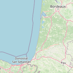
Map view of Urdaibai Biosphere Reserve

Use this park location map to pinpoint Urdaibai Biosphere Reserve in Spain, understand its exact geographic position, and read its mapped placement within the surrounding landscape more clearly.

Pigeon | © OpenStreetMap contributors

Location context for Urdaibai Biosphere Reserve

Basque Country
Natural feature types

Examine the Natural Feature Geography of Reserva de la biosfera de Urdaibai

Continue geographic discovery by analyzing the specific natural features of Reserva de la biosfera de Urdaibai. This collection facilitates detailed understanding of the coastal and inland terrains that define the reserve, connecting marshes, cliffs, and forests within the broader MoriAtlas regional context.
Recorded earthquake history

Explore the Recorded Earthquake History of the Reserva de la biosfera de Urdaibai

Review the documented seismic events associated with the Reserva de la biosfera de Urdaibai landscape through our historical catalogue. MoriAtlas provides detailed access to recorded earthquake data, allowing you to examine regional seismic history relative to the unique terrain of the Oka estuary and Biscay coastline.

Reserva de la biosfera de Urdaibai Earthquake History

Catalogued events

17 events

Strongest magnitude

Magnitude 4.2

Most recent event

Dec 7, 2025

This history includes earthquakes recorded inside the park or within 50 km of its borders

Visual reference collection highlighting coastal wetlands, estuaries, and forested terrain

Reserva de la biosfera de Urdaibai Photos and Landscape Scenery

Visual records capture the tidal marshes, dramatic sea cliffs, and complex river valleys that define the protected landscape. Detailed photography illustrates the diverse habitats and geographical features shared across the regional ecosystem.

Modern wood-clad visitor center building with an observation tower, situated next to a marshy wetland with birds flying overhead and resting on a log.

A wide view of a large sandy tidal estuary at low tide, with low green hills in the background under a clear blue sky.

A wide shot of the rocky, green coastline at Matxitxako Cape meeting the calm deep blue ocean under a partly cloudy sky.

The Ekoetxea Urdaibai visitor center in Busturia, featuring a stone tower with a wooden gallery attached to a modern, single-story metal-clad building.

A wide shot showing a sandy beach curving into a wide blue estuary, backed by green hills and forests under a partly cloudy sky.

A sandy beach in the foreground leads to a small, tree-covered island in the water, with rolling green hills and a mountain peak in the background.

A wide view of the old port of Bermeo, featuring a dense cluster of colorful traditional buildings overlooking a harbor filled with small fishing boats and pleasure craft under an overcast sky.

An osprey with dark brown wings, white chest, and yellow eye perched on a wooden post against a pale sky, with a green leg band visible.

A wide mountain landscape view showing rolling forested hills, green pastures, and a distant valley under a clear blue sky.

A historic stone tower building surrounded by green lawns and a stone wall under a cloudy sky.

A wide angle mountain landscape view looking down over a valley, green hills, and forested slopes towards the distant coast.

A gated entrance to a natural limestone cave opening in a cliff face; a sign on the metal gate reads SANTIMAMINE.

A wide shot of a sandy beach in the foreground leading to the Oka river estuary, with hills and a small town in the background under a cloudy sky.

A medieval-style stone castle or tower with crenellated walls and a prominent tower, surrounded by trees and a grassy foreground.

A calm, still lagoon reflecting a nearby grassy hill and a small white tower structure nestled among trees in the background under a blue sky.

A coastal landscape shot looking across the Mundaka estuary with the town of Mundaka visible on the shore and lush green hills in the background.

Park atlas

Compare adjacent coastal wetlands, river estuaries, and regional mountain terrain.

Other Protected Areas and Parks Near Reserva de la biosfera de Urdaibai

Browsing other protected areas near Reserva de la biosfera de Urdaibai reveals how coastal wetlands and limestone ranges connect across the regional landscape. Comparing these neighboring natural territories provides broader geographical context for northern Spain.
Nature reserveNouvelle-Aquitaine
About 86 km away#1 closest

East

Réserve naturelle régionale d'Errota Handia: Protected Wetland and Basque Geographic Atlas

Examining the ecological terrain of a historic French millpond reserve

Explore the structured geography of Réserve naturelle régionale d'Errota Handia, a compact but ecologically significant nature reserve in the Pyrénées-Atlantiques. This resource provides a detailed look at the park boundaries, wetland-woodland mosaic, and the historic hydraulic infrastructure that defines this unique Basque landscape, offering an essential perspective for understanding regional conservation in southwestern France.

Area
0.095 km²
Established
2001
IUCN
IV
Biosphere reserveLa Rioja
98 km away#2 closest

South

Valles del Jubera, Leza, Cidacos y Alhama: Protected Landscapes in La Rioja, Spain

A biosphere reserve featuring limestone gorges and dinosaur fossil sites

Valles del Jubera, Leza, Cidacos y Alhama forms a distinct mid-mountain region in northern Spain where four river valleys have carved deep passages into the earth. The area serves as a vital protected landscape containing rich paleontological history, thermal springs, and traditional Mediterranean forests. This atlas entry details the natural boundaries and geographic character of one of Spain's significant biosphere reserves.

Area
1,196.69 km²
Established
2003
A soft watercolor illustration showing rolling green hills, patches of trees, and a distant horizon in shades of light green and pale yellow.
Nature reserveNouvelle-Aquitaine
About 124 km away#3 closest

East

Réserve naturelle régionale du site des carrières de Tercis-les-Bains Protected Landscape

Geological stratotype and Cretaceous fossil reference site in Nouvelle-Aquitaine

This unique nature reserve in southwestern France protects a globally significant Cretaceous geological sequence within former limestone quarries. It serves as a vital scientific landmark for stratigraphy, housing extensive fossil records and structural evidence of salt-driven geology, all set within the scenic terrain of the Adour river basin.

Area
0.448 km²
Established
2015
IUCN
IV
Relief
Lowland
A horizontal watercolor illustration showing soft, stylized hills, valleys, and forest patches in muted greens, pinks, and yellows.
Protected landscapeCastilla y León
141 km away#4 closest

South

Sabinares del Arlanza-La Yecla: A Detailed Protected Landscape and Map of Burgos

Ancient juniper woodlands and deep limestone ravines in Castilla y León.

This protected area centers on the remarkable juniper forests and the narrow, vertical walls of the La Yecla gorge. The landscape serves as an essential habitat for cliff-nesting raptors while bridging the terrain between the Sierra de la Demanda foothills and the Arlanza River basin. The map captures the geological diversity of these limestone structures and the expansive botanical value found within this significant Spanish natural entity.

Area
391.74 km²
Established
2020
IUCN
V
Relief
Upland
Marine protected areaAsturias
143 km away#5 closest

Northwest

El Cachucho Marine Protected Area: Submarine Seamount and Cantabrian Sea Geography

Offshore protected landscapes and deep sea terrain mapping

El Cachucho represents a critical offshore protected area, defined by its massive seamount structure and proximity to the Asturian coastline. This marine habitat encompasses a complex array of geomorphological features, including rocky escarpments and submarine canyons that channel sediment across the narrow northern Iberian shelf, offering a detailed perspective on deep sea environmental architecture.

Area
57 km²
Relief
Upland
Climate
Temperate
Access
Remote access
Watercolor illustration of a mountain landscape with green forests and a body of water.
National parkSpain
151 km away#6 closest

West

Picos de Europa National Park: Dramatic Limestone Peaks and Protected Landscape Atlas

Explore Spain's historic national park and UNESCO Biosphere Reserve.

Picos de Europa National Park offers an unparalleled exploration of dramatic limestone peaks, deep glacial valleys, and extensive Atlantic forests. As Spain's oldest national park and a UNESCO Biosphere Reserve, it presents a remarkable study in karst landscape evolution and biodiversity conservation. This protected area, spanning significant territory across northern Spain, provides a rich geographic context for understanding regional natural heritage and mapped natural features.

Area
671.27 km²
Established
1918
IUCN
II
Relief
Mountain
National parkHautes-Pyrénées
160 km away#7 closest

East

Pyrénées National Park: Protected Landscape & Transboundary Protected Area Atlas

Discover Hautes-Pyrénées' dramatic glacial terrain and alpine environments.

Pyrénées National Park is a significant protected area in France's Hautes-Pyrénées department, renowned for its dramatic glacial cirques, high-altitude lakes, and extensive mountain landscapes. Established as a national park, it offers rich geographic context for atlas exploration, showcasing millions of years of geological formation shaped by tectonic uplift and glacial carving. This park is also notable for its transboundary conservation efforts with Spain, contributing to a broader protected region. Explore its unique terrain, from towering limestone formations to alpine meadows, and understand its place within the Pyrenean mountain range.

Area
458 km²
Established
1967
IUCN
II
Relief
Mountain
Nature reserveGironde
About 184 km away#8 closest

Northeast

Réservoirs de Piraillan Nature Reserve: Mapping the Coastal Ecology of the Cap Ferret Peninsula

A protected mosaic of saltwater basins and pine-forested islets in Gironde.

Explore the structured geography of Réservoirs de Piraillan, a forty-hectare classified natural reserve situated on the Cap Ferret peninsula in southwestern France. This site offers a rare contrast between historical fish reservoirs and dense maritime pine forest, providing a protected habitat for diverse bird and insect populations adjacent to the Bassin d'Arcachon. Understand the interplay between these saltwater pools and the wider coastal terrain of the Gironde department through detailed mapping and landscape data.

Area
0.4 km²
Established
1943
Relief
Lowland
Climate
Mediterranean

Common questions about visiting, size, designation, and location context for Urdaibai Biosphere Reserve

Urdaibai Biosphere Reserve FAQs for park facts, access, geography, and protected area context

Find quick answers about Urdaibai Biosphere Reserve, including protected-area facts, park geography, trail and visitor context, and how the park fits into its surrounding country and regional landscape.
MoriAtlas Explorer

Continue Your Protected Areas Search Across the Global Atlas

Deepen your exploration by continuing the structured search for national parks and protected areas worldwide. Utilize the comprehensive filtering capabilities to compare different conservation landscapes and refine your understanding of global park geography. Discover more about the distribution and characteristics of protected natural areas.

Global natural geography