Mori Atlas logo
Protected areaUroczyska Roztocza Wschodniego

A dense forest sanctuary of the Eastern Roztocze ridge in southeastern Poland

Uroczyska Roztocza Wschodniego: Investigating the Protected Landscape Boundaries and Regional Geography

(Uroczyska Roztocza Wschodniego (PLH060093))

Uroczyska Roztocza Wschodniego represents a core protected area on the Eastern Roztocze ridge, serving as an vital site of community importance for the European Union. This forested terrain spans the Podkarpackie and Lubelskie regions, featuring contiguous stands of Carpathian beech, oak-hornbeam, and riparian woodland. The site serves as a crucial habitat corridor for large carnivores and specialized forest-dwelling species, maintained within a cohesive framework of regional conservation that overlaps significantly with the South Roztocze Landscape Park.

Natura 2000site of community importanceEastern Roztoczeforest sanctuarybeech forestoak-hornbeam forest

Uroczyska Roztocza Wschodniego

Protected area

Park overview

Structured park overview, official facts, and landscape profile for Uroczyska Roztocza Wschodniego

Uroczyska Roztocza Wschodniego park facts, protected area profile, and essential visitor context

Review the core facts for Uroczyska Roztocza Wschodniego, including designation, size, terrain, visitor scale, habitats, and operating context in one park-focused overview.

About Uroczyska Roztocza Wschodniego

Uroczyska Roztocza Wschodniego sits on the Eastern Roztocze, a forested highland belt that forms part of the watershed between the Vistula and Bug river basins in southeastern Poland. The site lies west of Hrebenne and straddles the administrative border between Lubelskie and Podkarpackie voivodeships, a geography that gives it a continuous forested character rather than a fragmented patchwork. Roughly the entire area of around 5,810 hectares falls within the South Roztocze Landscape Park, embedding the Natura 2000 site within a wider national-level landscape protection framework.

At its core, the site is a forest sanctuary. Its plant communities are derived largely from the natural vegetation patterns of the Roztocze, with beech forests, oak-hornbeam forests, and riverine forest stands dominating the woody habitats. Beyond the forests, smaller open habitats such as fresh meadows add structural variety and support different ecological niches, particularly for amphibians and invertebrates. A strict nature reserve, Jalinka, lies within the site's boundaries and represents the most strictly protected nucleus of forest habitat.

The site's importance within the EU Natura 2000 network lies in the preservation of multiple habitat types listed under Annex I of the Habitats Directive. These include fertile Carpathian beech forest, acidophilous beech forest, oak-hornbeam groves, riparian forests, and dry lichen-rich pine forests. Together they describe a broad gradient from moist, fertile lowland and slope forests to drier pine-dominated communities on poorer soils, creating a habitat mosaic typical of the Eastern Roztocze but increasingly rare in heavily altered landscapes elsewhere in Poland.

The fauna of Uroczyska Roztocza Wschodniego mirrors this habitat richness. Large carnivores such as wolf and Eurasian lynx are present, reflecting the value of the connected, undisturbed forest tracts for species that need extensive territories. The bat fauna is particularly significant, with species such as the greater mouse-eared bat, Bechstein's bat, and western barbastelle using older forests and tree hollows. Wetland and stream-dependent species like the crested newt, fire-bellied toad, Eurasian beaver, and European otter point to functioning aquatic and riparian habitats within the forested matrix. The stag beetle is also recorded, indicating the presence of old broadleaved trees with decaying wood.

Quick facts and research context for Uroczyska Roztocza Wschodniego

Uroczyska Roztocza Wschodniego (site code PLH060093) is a Natura 2000 site of community importance created in 2011 and located on the Eastern Roztocze, west of Hrebenne. It covers roughly 5,810 hectares of predominantly contiguous forest, almost entirely overlapping with the South Roztocze Landscape Park.

The site hosts one strict nature reserve, the Jalinka reserve, and contains several Annex I habitat types under the EU Habitats Directive, including fertile Carpathian beech forest, acidophilous beech forest, oak-hornbeam groves, riparian forest, lichen-rich dry pine forest, and fresh meadows.

Protection and recognition

Examine the documented conservation status and official designation framework for Uroczyska Roztocza Wschodniego

Uroczyska Roztocza Wschodniego Protection Status and Natura 2000 Recognition

Uroczyska Roztocza Wschodniego maintains documented terrestrial protection status supported by imported Natura 2000 recognition records. Review official designation details and administrative frameworks associated with this protected landscape.

International recognition

Protection details

Protection scope
Terrestrial
Transboundary protection
No
Park context

Deeper park guide and search-rich context for Uroczyska Roztocza Wschodniego

Uroczyska Roztocza Wschodniego history, landscape, wildlife, and travel context

Explore Uroczyska Roztocza Wschodniego through its history, landscape character, ecosystems, wildlife, conservation priorities, cultural context, and seasonal travel timing in a structured park guide built for atlas discovery and search intent.

Why Uroczyska Roztocza Wschodniego stands out

Uroczyska Roztocza Wschodniego is best known for its extensive, well-preserved forest complexes on the Eastern Roztocze, especially the stands of Carpathian beech forest and oak-hornbeam forests that anchor its Natura 2000 identity. The site is also notable for its population of large mammals such as wolf and Eurasian lynx, and for a strong bat community that includes rare forest-dwelling species like Bechstein's bat and the western barbastelle. Another defining feature is the site's near-complete overlap with the South Roztocze Landscape Park, which ties its habitat value directly to Poland's broader system of protected landscapes in the region.

Uroczyska Roztocza Wschodniego history and protected-area timeline

Uroczyska Roztocza Wschodniego was formally designated as a site of community importance within the Natura 2000 network in 2011, marking its recognition as an area of European importance for habitat conservation. The designation built on the long-standing protection of the landscape it overlaps with, since nearly the entire territory lies within the South Roztocze Landscape Park. Within the Natura 2000 site, the Jalinka nature reserve provides an even older layer of formal protection for the most sensitive forest habitats.

The site's history is essentially a story of preserved forest continuity rather than active restoration, as large portions of its woodland have retained their natural character well enough to qualify as priority habitats under EU law. Published documentation of the area in regional Natura 2000 inventories, such as the 2012 regional review by the Regional Directorate for Environmental Protection in Rzeszów, helped establish its role in the broader conservation framework of the Podkarpacie region.

Uroczyska Roztocza Wschodniego landscape and geographic character

The landscape of Uroczyska Roztocza Wschodniego is defined above all by extensive, closed-canopy forest that covers the rolling terrain of the Eastern Roztocze ridge. This is an upland landscape shaped by geological processes that left the Roztocze as a distinct belt of forested hills between the lowlands of the surrounding regions. Within the site, the forest cover is unusually cohesive, which is one of the main reasons the area qualifies for habitat-based protection at the European level.

The terrain transitions between gentler slopes supporting broadleaved beech and oak-hornbeam forests and drier sites where pine-dominated communities with ground lichens take over. Along watercourses, narrow bands of riparian forest follow stream valleys, creating corridors of moist woodland that contrast with the drier upland stands. Small patches of fresh meadow break up the forest cover, adding open ground to an otherwise tree-dominated landscape.

Viewed at a regional scale, the site overlaps almost entirely with the South Roztocze Landscape Park, meaning the protected landscape extends well beyond the Natura 2000 boundary and frames the site within a much larger area of landscape-level protection.

Uroczyska Roztocza Wschodniego ecosystems, habitats, and plant life

Ecologically, Uroczyska Roztocza Wschodniego represents one of the better-preserved forest ecosystems of the Eastern Roztocze. The site concentrates multiple Annex I habitats within a single contiguous area, which is increasingly uncommon in lowland and upland Poland. Fertile Carpathian beech forest and acidophilous beech forest form much of the canopy, while oak-hornbeam groves cover transitional sites and riparian forests line the streams.

Drier, sandy or shallow-soil sites host inland dry pine forests with a characteristic lichen ground layer, often referred to as chrobotkowy forest in regional forestry terminology. These pine communities support a very different set of species from the broadleaved stands and add important structural diversity. The combination of fresh meadows with surrounding forest edges further increases habitat diversity, especially for insects, amphibians, and birds that benefit from ecotones between open and wooded habitats.

The site's natural value is closely tied to the continuity of these habitats and to the low level of human disturbance across much of the area, which allows sensitive species to maintain viable populations within the broader Roztocze landscape.

Uroczyska Roztocza Wschodniego wildlife and species highlights

The wildlife of Uroczyska Roztocza Wschodniego reflects the maturity of its forest habitats and the integrity of its riparian systems. Among large mammals, both wolf and Eurasian lynx are present, indicating the importance of large, connected forest tracts for predators that need extensive, low-disturbance ranges.

The forest bat community is particularly significant. Greater mouse-eared bat, Bechstein's bat, and western barbastelle all occur in the area, with Bechstein's bat and the barbastelle particularly tied to old-growth broadleaved forests with suitable tree roosts. These species are often used as indicators of high-quality deciduous woodland.

Wetland and stream habitats support a complementary set of species. Crested newt and fire-bellied toad use pools and slow-moving waters within or near the forest matrix, while Eurasian beaver and European otter signal healthy riparian corridors and clean, functioning streams. The presence of the stag beetle, a saproxylic species dependent on decaying broadleaved wood, reinforces the value of the older beech and oak stands within the site.

Uroczyska Roztocza Wschodniego conservation status and protection priorities

The conservation significance of Uroczyska Roztocza Wschodniego rests on its inclusion in the Natura 2000 network as a site of community importance, which obliges Poland to maintain the favorable conservation status of its listed habitats and species. Multiple habitat types from Annex I of the EU Habitats Directive are represented, including Carpathian beech forest, acidophilous beech forest, oak-hornbeam groves, riparian forest, dry lichen-rich pine forest, and fresh meadows.

The near-complete overlap with the South Roztocze Landscape Park adds a second major layer of protection, placing the site within a larger landscape-level framework that regulates land use across a broader area. Within this combined framework, the Jalinka nature reserve represents the strictest protection tier and acts as a core conservation area for the most sensitive forest habitats.

The site's value for conservation also lies in its role as a refuge for species that have declined across much of central Europe, including large carnivores, specialist forest bats, and amphibians tied to traditional rural landscapes. By preserving a substantial block of forest and its associated habitat mosaic, the site contributes directly to the connectivity and resilience of the wider Roztocze ecological network.

Uroczyska Roztocza Wschodniego cultural meaning and human context

The name Uroczyska, which translates roughly as forest sanctuaries or wild tracts, reflects a regional tradition of recognizing discrete, old-feeling forest areas as distinct places within the Roztocze landscape. The forests have long been part of local identity in the borderland between the Lubelskie and Podkarpackie regions, where land use has historically combined forestry, small-scale agriculture, and settlement along the forest edges. The South Roztocze Landscape Park itself is an expression of this regional cultural framing of the landscape as a protected heritage of natural and scenic value.

Top sights and standout views in Uroczyska Roztocza Wschodniego

Uroczyska Roztocza Wschodniego stands out for combining contiguous old-growth forest habitats with a near-complete overlap with the South Roztocze Landscape Park, an unusual pattern of layered protection.

It is equally notable for hosting multiple Annex I forest habitat types within one site, supporting larger carnivores such as wolf and lynx, and maintaining a bat assemblage that includes species strongly tied to mature deciduous woodland.

Best time to visit Uroczyska Roztocza Wschodniego

Spring and early summer often bring the most active wildlife observations, when amphibians are breeding in forest pools and bats are emerging from roosts in old trees. Late spring and early summer are also the best time to experience fresh meadows in bloom within the broader landscape.

Autumn highlights the broadleaf forests, when beech and oak stands shift color and fruiting trees draw in animal activity. Winter can offer quieter conditions and a clearer sense of the site's forest continuity, though access depends on conditions in the surrounding landscape park.

Monthly climate preview

Long-term temperature ranges and monthly precipitation averages recorded across the protected landscape

Uroczyska Roztocza Wschodniego Climate Normals and Annual Weather Patterns

Recorded measurements at a representative coordinate reveal long-term monthly temperature swings alongside steady precipitation patterns throughout the year. Consulting the complete twelve-month statistical profile allows researchers to analyze detailed thermal shifts across this protected area.
Annual mean8 °C
-4 °C20 °C
Jan-4°
Feb-3°
Mar
Apr
May14°
Jun18°
Jul20°
Aug19°
Sep14°
Oct
Nov
Dec-3°
Warmest month
July

19.7 °C

Coolest month
January

-4.4 °C

Wettest month
July

2.8 mm/day

Driest month
January

1.2 mm/day

Park location guide

Geography guide, regional context, and park location map for Uroczyska Roztocza Wschodniego

Uroczyska Roztocza Wschodniego park geography, regions, and map view in Poland

Understand where Uroczyska Roztocza Wschodniego sits in Poland through a broader geographic reading of the surrounding landscape, nearby location context, and its mapped position within the national park landscape.

How Uroczyska Roztocza Wschodniego fits into Poland

Poland, officially the Republic of Poland, is a Central European country spanning from the Baltic Sea in the north to the Carpathian Mountains in the south. It borders Germany, Czech Republic, Slovakia, Ukraine, Belarus, Lithuania, and Kaliningrad Oblast. The country has a temperate climate, diverse landscapes, and is known for its rich history, cultural heritage, and strong economic position within the EU.

Wider geography shaping Uroczyska Roztocza Wschodniego in Poland

Poland occupies 312,696 km2 in Central Europe, extending from the Baltic Sea coast in the north to the Sudetes and Carpathian Mountains in the south. It borders Germany to the west, Czech Republic and Slovakia to the south, Ukraine and Belarus to the east, and Lithuania and Kaliningrad Oblast to the northeast. The landscape includes lowland plains, uplands, and mountain ranges.

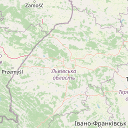
Map view of Uroczyska Roztocza Wschodniego

Use this park location map to pinpoint Uroczyska Roztocza Wschodniego in Poland, understand its exact geographic position, and read its mapped placement within the surrounding landscape more clearly.

Pigeon | © OpenStreetMap contributors

Location context for Uroczyska Roztocza Wschodniego

Podkarpackie Voivodeship
Park atlas

Compare surrounding forest landscapes and connected conservation zones across the Eastern Roztocze

Parks Near Uroczyska Roztocza Wschodniego and Regional Protected Areas

Users viewing Uroczyska Roztocza Wschodniego can browse nearby national parks and protected areas sharing similar woodland habitats. Extending the geographic review across the surrounding region reveals broader conservation patterns and adjacent forest terrain.
Nature reservePoland
About 8.9 km away#1 closest

Northwest

Rezerwat przyrody Minokąt Nature Reserve: Geography, Forest Terrain, and Mapping

Protected Carpathian forest within the Roztocze landscape

Located in the Narol commune, Rezerwat przyrody Minokąt protects a rare, mature Carpathian fir-beech forest ecosystem. The reserve provides a critical study in regional geography, characterized by rolling upland terrain and fertile woodland soils that anchor the broader Roztocze Protected Landscape Area and regional conservation efforts.

Area
0.231 km²
Established
1996
Relief
Upland
Scope
Terrestrial
Nature reservePoland
11 km away#2 closest

Northwest

Uroczyska Puszczy Solskiej: Protected Forest and Peatland Landscape in Eastern Poland

Natura 2000 nature reserve encompassing diverse lowland forest mosaics

Uroczyska Puszczy Solskiej spans over 34,000 hectares of eastern Poland, forming a vital protected mosaic of raised bogs, transitional mires, and varied forest communities. This area provides a crucial reference for peatland and wetland ecology, supporting a wide range of forest-dependent species within a landscape shaped by glacial and fluvial processes.

Area
346.715 km²
Established
2009
Relief
Lowland
Climate
Temperate
Protected areaPodkarpackie Voivodeship
27 km away#3 closest

Southwest

Łukawiec Protected Area Mapping and Landscape Context in the Podkarpackie Voivodeship

Fragmented forest and wetland habitats in southeastern Poland

Łukawiec represents a vital ecological intersection in the Podkarpackie Voivodeship, preserving rare forest types and wetland systems on the Płaskowyż Tarnogrodzki plateau. This site is defined by its complex mosaic of riparian woodlands, Molinia meadows, and boggy coniferous patches that sustain a variety of protected animal species.

Area
22.702 km²
Established
2011
Relief
Upland
Scope
Terrestrial
A minimalist watercolor painting showing rolling green hills and distant mountain ridgelines in soft pastel tones of green and violet against a white background.
Protected areaAlbania
30 km away#4 closest

Southwest

Primeval Beech Forests of the Carpathians and Other Regions of Europe: Protected Area and Forest Atlas

A transnational network of old growth beech forest reserves across Europe.

Examine the geographic distribution and protected boundaries of the Primeval Beech Forests of the Carpathians and Other Regions of Europe. This site highlights the continent's most intact beech forest ecosystems, illustrating essential ecological processes from the Balkans and Carpathians to the Alps and Western Europe.

Area
583.53 km²
Established
2007
Relief
Mountain
Access
Access unknown
National parkLviv Oblast
About 33 km away#5 closest

Southeast

Yavoriv National Nature Park: Protected Landscape and Regional Geography in Lviv Oblast

Mapped protected area boundaries and natural terrain context.

Yavoriv National Nature Park is a designated national park within Lviv Oblast, Ukraine. This page provides detailed geographic information, focusing on the park's protected landscape identity and its mapped terrain. Understanding its location in Western Ukraine, near the Carpathian gateway, offers valuable context for atlas-based exploration of protected areas and natural features within the region.

Area
71.08 km²
Established
1998
IUCN
II
Relief
Highland
Nature reservePoland
About 34 km away#6 closest

Northwest

Rezerwat przyrody Debry Nature Reserve: Geography, Forest Ecology, and Protected Boundaries

Exploring the Carpathian-linked landscapes of the Polish Roztocze

Rezerwat przyrody Debry stands as a significant nature reserve in eastern Poland, known for protecting a mosaic of upland fir and fertile beech forest communities. The landscape features deep, characteristic erosional incisions that host a rich array of montane plant species. This area is essential for understanding the regional distribution of protected forest ecosystems and the complex relief of the Roztocze plateau.

Area
1.796 km²
Established
1983
Relief
Upland
Climate
Temperate
Nature reservePodkarpackie Voivodeship
About 34 km away#7 closest

Southwest

Rezerwat przyrody Moczary: Geographic Overview and Protected Forest Reserve Mapping

Botanical sanctuary and lowland forest habitat in Podkarpackie.

Rezerwat przyrody Moczary represents a focused, twelve-hectare protected forest area known for its exceptional concentration of glacial relicts and diverse herbaceous understory. Located within the Natura 2000 Łukawiec site, this reserve offers a detailed look at lowland oak-hornbeam ecology and sub-Carpathian botanical signatures across the Płaskowyż Tarnogrodzki mesoregion.

Area
0.124 km²
Established
2004
Relief
Lowland
Scope
Terrestrial
Watercolor painting of a lake surrounded by trees and hills under a pale sky
National parkLublin Voivodeship
36 km away#8 closest

West

Roztocze National Park: Geographic Insights into Poland's Premier Upland Protected Forest Area

Mapping forest heritage and river valleys in the Lublin Voivodeship.

Roztocze National Park offers a detailed look at one of Poland's most significant upland protected landscapes. Explore the distribution of ancient monument trees, the expansive Wieprz river valley, and the diverse terrain of the Roztocze range. This overview provides a clear understanding of the park's physical boundaries, forest ecosystems, and its role as a critical wildlife corridor within the broader Lublin Voivodeship geography.

Area
84.83 km²
Established
1974
IUCN
II
Visitors
134K annual

Common questions about visiting, size, designation, and location context for Uroczyska Roztocza Wschodniego

Uroczyska Roztocza Wschodniego FAQs for park facts, access, geography, and protected area context

Find quick answers about Uroczyska Roztocza Wschodniego, including protected-area facts, park geography, trail and visitor context, and how the park fits into its surrounding country and regional landscape.
MoriAtlas Explorer

Continue Your Protected Areas Search Across the Global Atlas

Deepen your exploration by continuing the structured search for national parks and protected areas worldwide. Utilize the comprehensive filtering capabilities to compare different conservation landscapes and refine your understanding of global park geography. Discover more about the distribution and characteristics of protected natural areas.

Global natural geography