
Mori Atlas logo
Nature reserveVal di Mello

Tracing the vertical relief, glacial cirques, and protected boundaries of this iconic Lombardy mountain valley.

Val di Mello Nature Reserve: A Detailed Geographic Overview of Italy's Alpine Granitic Landscapes

Val di Mello represents a uniquely concentrated Alpine landscape where pale granitic walls, known locally as ghiandone, descend from three thousand meter peaks to the valley floor. This protected nature reserve in the Lombardia region of Italy offers a complex geographic study of tributary valleys, perennial snowfields, and dramatic rock monoliths. The terrain provides a vertical cross-section of high-altitude Alpine environments set against the backdrop of the Monte Disgrazia massif.

Alpine valleyLombardynature reservegranite landscaperock climbingbouldering
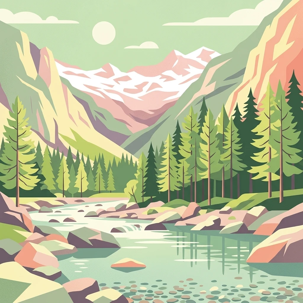
A flat-style digital illustration of a mountain valley with a river flowing through it, flanked by pine forests and high, light-colored granite peaks under a pale sun.

Val di Mello

Nature reserve

Park overview

Structured park overview, official facts, and landscape profile for Val di Mello

Val di Mello park facts, protected area profile, and essential visitor context

Review the core facts for Val di Mello, including designation, size, terrain, visitor scale, habitats, and operating context in one park-focused overview.

About Val di Mello

Val di Mello occupies a fundamental place within the broader Val Masino system, lying on the Lombard side of the central Alps in northern Italy. Oriented broadly from west to east, the valley begins near the small settlement of San Martino and stretches inward until it meets the slopes and subsidiary peaks of the Monte Disgrazia group. Its name derives not from the valley itself but from the nearby village of Mello, whose inhabitants historically held grazing rights in these high pastures, a connection that continues to shape the cultural identity of the area.

The defining character of Val di Mello is its geology. Large tracts of the valley are composed of a compact granitoid rock known locally as ghiandone, which weathers into smooth, pale, and exceptionally clean faces. These walls rise continuously from the forested valley bottom up through the alpine zone to summits that exceed three thousand meters, giving the landscape an almost luminous appearance. The combination of this rock quality, the sheer vertical extent, and the dramatic relief between valley floor and peaks has made the area a magnet for climbers and nature enthusiasts from across Europe.

In January 2009 the Lombardy Region formally recognized Val di Mello as a nature reserve, making it the largest protected area in the region. The reserve has been organized into three zones: an integral zone that permits only authorized forestry personnel, a landscape zone that includes the riverbed and the small rural hamlets, and a managed zone covering the remainder of the valley and its tributary valleys, including Val del Ferro. Sustainable tourism criteria guide accommodation and food services within the landscape zone, while vehicle access is restricted in certain periods to protect the valley's character.

The valley also hosts one of the great high-level Alpine trails, the Sentiero Roma, which links the upper basins of the secondary side valleys such as Val Cameraccio, Val Torrone, Val di Zocca, Val Qualido, and Val del Ferro. Although today the small glaciers are reduced largely to perennial snow patches, the cirques and glacial features still shape the valley's upper amphitheaters, leaving a deeply carved and varied terrain. Val di Mello therefore stands out both as a natural reserve and as a culturally significant Alpine landscape where geology, ecology, and outdoor recreation intersect.

Quick facts and research context for Val di Mello

Val di Mello is a side valley of Val Masino within the province of Sondrio, Lombardy, on the north side of the Lombard Alps adjacent to the Monte Disgrazia massif. It was formally recognized in 2009 by the Lombardy Region as a nature reserve, becoming the largest protected area in the region, and is divided into integral, landscape, and managed zones. The valley is internationally noted as a bouldering and rock-climbing site, anchored by the granitic monolith of Sasso Remenno and more than two thousand boulder problems across its rock surfaces.

Protection and recognition

Documented establishment records and official territorial conservation metrics

Val di Mello Protection Status and Designated Terrestrial Conservation History

Val di Mello maintains a recorded terrestrial protection scope established in the year 2009 without transboundary status or external international recognition sources. Official conservation records outline the baseline designation framework for this protected alpine landscape.

Protection details

Protection scope
Terrestrial
Designated year
2009
Transboundary protection
No
Park context

Deeper park guide and search-rich context for Val di Mello

Val di Mello history, landscape, wildlife, and travel context

Explore Val di Mello through its history, landscape character, ecosystems, wildlife, conservation priorities, cultural context, and seasonal travel timing in a structured park guide built for atlas discovery and search intent.

Why Val di Mello stands out

Val di Mello is best known for its vast expanse of clean, pale granitic walls of the rock type known locally as ghiandone, which fall from high Alpine summits toward the valley floor and create an unusually bright and vertical landscape. The valley is internationally recognized as a top-tier rock climbing and bouldering destination, home to the iconic Sasso Remenno monolith and to climbing routes first established in the late 1970s. It is also distinguished by the high-altitude Sentiero Roma, which links the heads of the main tributary valleys along some of the most spectacular terrain in the Alps.
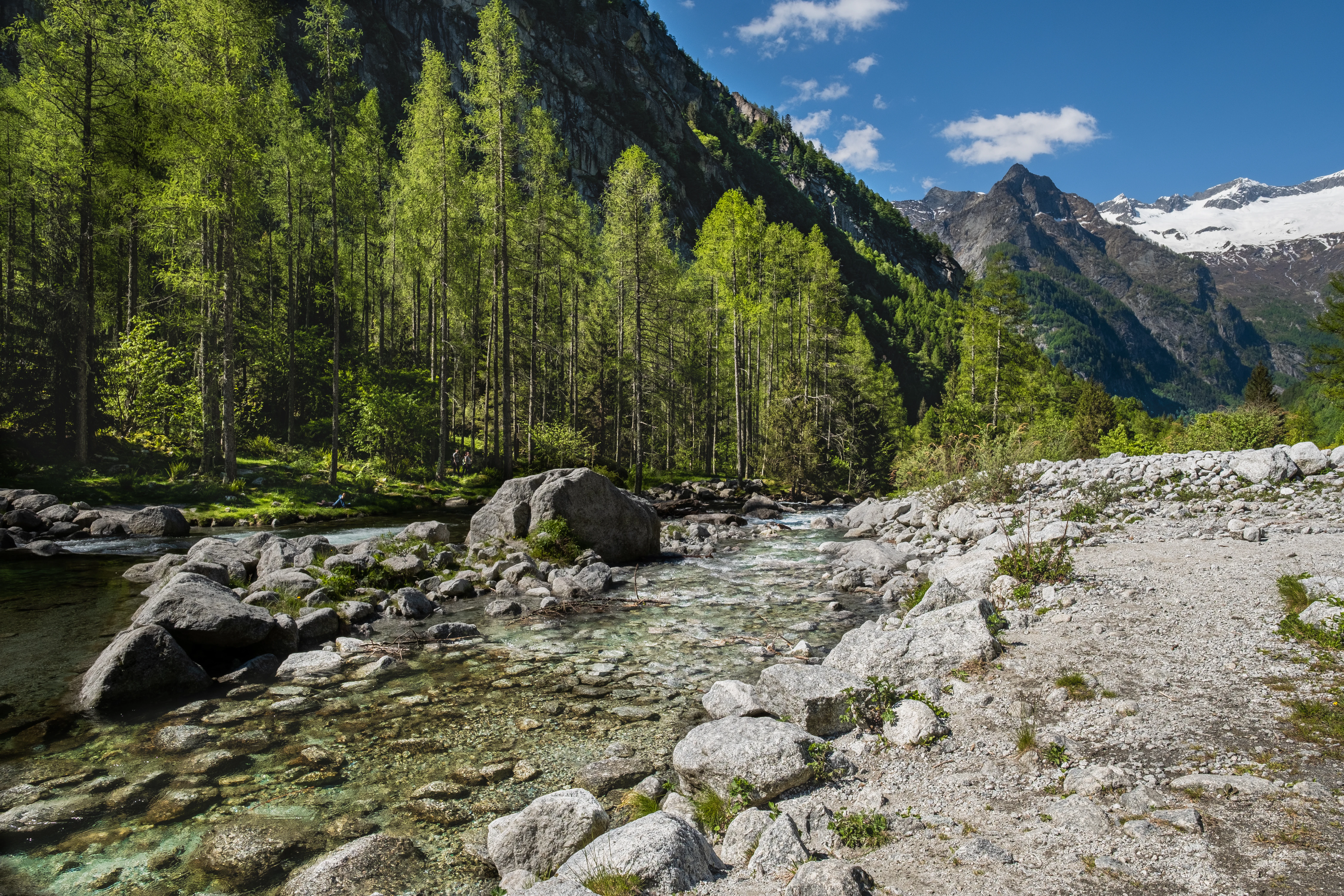
A clear, shallow mountain stream winds through a valley with large boulders, a pine forest, and snow-dusted granite mountains in the background under a blue sky.
A peaceful stream flowing through the granite-rich valley of Val di Mello, surrounded by dense coniferous forests and distant snow-capped mountains.

Val di Mello history and protected-area timeline

Val di Mello carries a deep historical link to the nearby village of Mello, whose residents, known historically as melat, held long-standing grazing rights in the valley even though the village itself lies roughly twenty kilometers to the west on the Costiera dei Cech. This pastoral connection shaped early land use and gave the valley its name long before any formal protection existed.

For most of its modern history Val di Mello remained a relatively remote Alpine valley known primarily to local herders, hunters, and a small community of mountaineers. The turning point came in the late 1970s, when Italian climbers began to open the valley's now-famous rock routes. The crack climb Luna Nascente was first ascended in 1978, and other landmark routes quickly followed, establishing the area as a serious rock-climbing destination. Over time, bouldering culture also took root, eventually leading to the large international gathering known as Melloblocco.

In January 2009 the Lombardy Region formally established the Val di Mello nature reserve, making it the largest protected area in Lombardy and introducing a tiered zoning system designed to balance conservation, traditional land use, and sustainable tourism. This designation marked the institutional recognition of a landscape whose natural and recreational value had already been acknowledged by climbers, hikers, and ecologists for decades.

Val di Mello landscape and geographic character

Val di Mello is a deeply carved Alpine valley whose terrain compresses an unusual vertical range into a relatively short horizontal distance. The valley floor sits below one thousand meters, while surrounding peaks rise above three thousand meters, and the dominant Monte Disgrazia massif forms a dramatic backdrop at the head of the valley. From the watershed ridge, the summit of Monte Disgrazia remains visible across the divide.

The valley runs broadly west to east, which produces a marked contrast between its two sides. The left (orographic) side faces north and remains shaded and shadowy, characterized by short, steep, and very wild subsidiary gullies that see comparatively little human traffic. The opposite side lies in full sun and opens into a series of large tributary valleys: Val Cameraccio, Val Torrone, Val di Zocca, Val Qualido, and Val del Ferro. These secondary valleys display spectacular rock walls, glacial cirques, and plateaus broken by waterfalls. Above them, small remnant glaciers and perennial snowfields cling to the highest cirques, while below, the floor supports forests and meadows crossed by the stream that gives the valley its name.

The most visually defining element of the landscape is the enormous extent of pale rock faces. These walls, formed of a compact granitoid known locally as ghiandone, sweep from the high summits almost down to the valley bottom, creating a continuous vertical canvas of clean, bright stone threaded by forest. The result is a landscape that feels at once wild, luminous, and unusually concentrated in its vertical relief.

Val di Mello ecosystems, habitats, and plant life

Ecologically, Val di Mello reflects the strong gradients typical of inner Alpine valleys, with vegetation shifting rapidly from mixed broadleaf and coniferous forest along the stream and lower slopes, through subalpine woodland, into open pasture, alpine meadow, and ultimately bare rock and residual snowfields near the summits. The diversity of exposures matters: the shaded north-facing slopes retain cooler, moister plant communities, while the sunny south-facing slopes support drier, more open habitats and richer meadow floras during the summer months.

The river itself and the lateral tributaries shape much of the valley's ecological identity, carving the floor, feeding small alpine lakes, and creating the humid microclimates along which forest patches persist. Glacial action has left behind classic cirques, moraines, and erratic boulders, including the iconic Sasso Remenno monolith, which is the largest of its kind in Europe. These geo-ecological features form a mosaic of habitats across a relatively small area, contributing to the sense of compressed biological and geological variety that defines the valley.

With its nature reserve designation in 2009, the valley's three-zone structure was designed to keep the most sensitive areas intact while still allowing traditional rural land use and low-impact visitor activity in the landscape zone, supporting both ecological function and the long-standing human presence connected to grazing and forest management.

Val di Mello wildlife and species highlights

Val di Mello supports the typical wildlife assemblage of an inner Alpine valley in Lombardy, where forested lower slopes, alpine meadows, rocky cliffs, and high-elevation snow patches each contribute distinct species. The combination of undisturbed cliffs and varied exposures provides habitat for cliff-nesting birds of prey, while the mosaic of forest patches and open meadows supports ungulates and small mammals that thrive in transition habitats.

The valley's protected status, particularly within the integral reserve zone, has reinforced its role as a refuge for wildlife sensitive to disturbance. Traditional grazing practices associated with the historical rights of the melat from the village of Mello continue to shape grassland habitats, maintaining open areas that benefit a range of meadow and edge species.

Val di Mello conservation status and protection priorities

Val di Mello gained formal protection in January 2009, when the Lombardy Region declared it a nature reserve and made it the largest protected area in the region. The reserve is structured into three complementary zones: an integral reserve, a landscape reserve, and a managed reserve, each with its own access rules and land-use approach.

The integral zone, located on the shaded orographic left side of the valley, is the most strictly protected, accessible only to authorized forestry personnel. The landscape zone encompasses the riverbed and the small rural settlements along it, balancing traditional rural life with conservation criteria, including sustainable-tourism standards set by municipal and provincial authorities. The managed reserve covers the broader valley and its key tributaries, including Val del Ferro, allowing controlled recreation such as hiking and climbing while protecting ecological values. Vehicle access into the landscape zone is restricted to certain periods and subject to a daily vehicle cap, with summer access generally closed to cars, reducing pressure on the valley's most sensitive areas.

Val di Mello cultural meaning and human context

Val di Mello has a long cultural link to the village of Mello, located on the Costiera dei Cech roughly twenty kilometers west of the valley. Although not directly adjacent, the village's inhabitants known as melat have held traditional grazing rights in the valley for centuries, a connection that gave the valley its name and continues to influence land use, particularly in the form of seasonal pastoral activity.

The valley also carries a strong mountaineering heritage. Italian climbers forged some of the area's most iconic routes in the late 1970s, including the crack climb Luna Nascente in 1978, and the area became a focal point of Italian free climbing and, later, bouldering culture. The annual international Melloblocco gathering grew out of this tradition, drawing climbers from across Europe and embedding Val di Mello in the broader story of European outdoor and climbing culture.

Top sights and standout views in Val di Mello

The single most distinctive highlight of Val di Mello is the immense sweep of pale granitic walls, which descend almost uninterrupted from peaks above three thousand meters toward the valley floor below one thousand meters. This unusually continuous vertical relief gives the valley an immediately recognizable, luminous character rare even within the Alps.

Equally distinctive is the Sasso Remenno monolith, the largest granitic monolith of its kind in Europe, around which much of the valley's climbing culture has been built. Combined with the high-altitude Sentiero Roma trail linking the great tributary valleys, the area's status as Lombardy's largest nature reserve, and a climbing tradition reaching back to the late 1970s, these features make Val di Mello a place of unusually concentrated natural and cultural significance.

Best time to visit Val di Mello

Val di Mello is best experienced in the warmer months, when snow has receded from the approach trails and the granite walls are fully accessible for hiking, climbing, and bouldering. Late spring through early autumn is typically the most rewarding period for general visitation, with summer bringing the widest range of activities but also the busiest conditions and restrictions on car access into the protected landscape zone.

Outside this window, conditions in an inner Alpine valley become considerably more demanding, with snow, reduced accessibility, and limited services. Visitors should generally expect a strong seasonal rhythm, with the warm season offering the valley's broadest accessibility and the most favorable conditions for exploring both the valley floor and the higher trails such as the Sentiero Roma.


Monthly climate preview

Examine long term temperature patterns and monthly precipitation averages across representative protected terrain.

Val di Mello Climate Normals and Annual Temperature Rhythm

Representative coordinates record measured monthly temperature ranges alongside shifting daily precipitation averages throughout the year. Reviewing complete monthly climate normals helps quantify thermal variation and moisture distribution across high elevation terrain.
Annual mean1 °C
-10 °C11 °C
Jan-10°
Feb-9°
Mar-6°
Apr-1°
May
Jun
Jul11°
Aug11°
Sep
Oct
Nov-4°
Dec-8°
Warmest month
July

11 °C

Coolest month
January

-9.5 °C

Wettest month
June

5 mm/day

Driest month
February

1.8 mm/day

Park location guide

Geography guide, regional context, and park location map for Val di Mello

Val di Mello park geography, regions, and map view in Italy

Understand where Val di Mello sits in Italy through a broader geographic reading of the surrounding landscape, nearby location context, and its mapped position within the national park landscape.

How Val di Mello fits into Italy

Italy is a unitary parliamentary republic in Southern and Western Europe, located on the Italian Peninsula with the Alps to the north. It borders France, Switzerland, Austria, Slovenia, Vatican City, and San Marino, and shares maritime boundaries with several Mediterranean countries. The country has approximately 59 million residents and uses the Euro as its currency.

Wider geography shaping Val di Mello in Italy

Italy occupies a boot-shaped peninsula in southern Europe, bordered by the Alps to the north. It shares land borders with France, Switzerland, Austria, Slovenia, Vatican City, and San Marino. The country includes the Mediterranean islands of Sicily and Sardinia, along with approximately 800 smaller islands.

Map view of Val di Mello

Use this park location map to pinpoint Val di Mello in Italy, understand its exact geographic position, and read its mapped placement within the surrounding landscape more clearly.

Pigeon | © OpenStreetMap contributors

Location context for Val di Mello

Lombardia

Explore high-resolution imagery documenting the vertical granite walls, glacial cirques, and alpine forest habitats of Lombardy

Val di Mello Photos and Landscape Scenery: Visualizing the Italian Alps Protected Area

Examine detailed Val di Mello photos and landscape scenery to understand the dramatic vertical relief of the Italian Alps. Visual documentation reveals the expansive pale granitic rock faces, protected valley floor habitats, and glacial terrain defining the nature reserve.

A clear, shallow mountain stream winds through a valley with large boulders, a pine forest, and snow-dusted granite mountains in the background under a blue sky.

A bright, clear alpine lake with turquoise water reflecting surrounding pine trees, set against a backdrop of steep, rugged mountains under a sunny sky.

Park atlas

Compare adjacent Alpine reserves and connected mountainous terrain.

Explore Parks Near Val di Mello and Surrounding Regional Protected Landscapes

Visitors exploring Val di Mello can browse other protected areas across the surrounding region to compare alpine terrain and granite formations. Continuing through adjacent valley networks reveals broader geographic patterns across the wider mountain ecosystem.
A horizontal watercolor illustration showing stylized, overlapping mountain ridges in shades of soft green, pink, and yellow against a white background.
Natural monumentGraubünden
About 20 km away#1 closest

Northeast

Roseggletscher Natural Monument: Alpine Glacier Geography and Proglacial Lake Mapping

Protected landscape data for the Bernina range in Graubünden.

Examine the geographic boundaries and terrain of the Roseggletscher, a protected natural monument situated in the upper Val Roseg. This record captures its glacial extent, the emergence of the Lej da Vadret proglacial lake, and its role within the wider Bernina glacier ensemble of southeastern Switzerland.

Area
6.38 km²
Relief
Mountain
Climate
Alpine
Access
Moderate access
Regional parkGraubünden
About 28 km away#2 closest

Northwest

Naturpark Beverin: Exploring Alpine Gorges and Cultural Landscapes in Graubünden

A regional nature park shaped by high alpine ridges and ancient settlement traditions.

Naturpark Beverin encompasses a vast, multi-layered environment in the Swiss Alps. The area is defined by the sharp vertical contrast between carved river gorges like the Viamala and high-elevation ridges. Beyond the rugged mountain terrain, this protected landscape preserves centuries of pastoral history through the distinct settlement traditions of its Romanesque and Walser valleys.

Area
515 km²
Established
2013
Relief
Mountain
Climate
Alpine
A soft watercolor illustration of a green alpine valley with distant mountains in light yellow and purple tones.
Regional parkCanton of Graubünden
About 38 km away#3 closest

Naturpark Calancatal: Protected Alpine Valleys and Mountain Geography in Graubünden

Mapping regional landscapes and mountain terrain in Southern Switzerland

Spanning 13,900 hectares, Naturpark Calancatal protects a near-entire alpine side valley defined by the Calancasca stream. From high glacier-fed headwaters to Mediterranean-influenced gorges, the park offers a unique look at the diverse mountain terrain, alpine pastures, and protected forests within the Canton of Graubünden.

Area
139.21 km²
Established
2024
Relief
Mountain
Climate
Alpine
Watercolor illustration of a panoramic mountain landscape with soft green hills, rolling ridgelines in shades of pink and purple, and small patches of blue water in the foreground.
Regional parkCanton of Graubünden
About 38 km away#4 closest

North

Parc Ela: Regional Nature Park and Alpine Geography in the Canton of Graubünden

A vertical protected landscape in the Swiss Alpine arc.

Parc Ela encompasses a remarkable span of Swiss Alpine geography, protecting everything from low-lying forested gorges at seven hundred meters to high-altitude peaks over three thousand meters. The park serves as a vital refuge for threatened insect species and large alpine mammals, while preserving the linguistic and architectural heritage of the Albula and Oberhalbstein valleys. Explore the mapped terrain where paleontological treasures meet historic trade routes.

Area
659 km²
Established
2012
Relief
Mountain
Climate
Alpine
A soft watercolor painting of a river winding through a valley with green trees, grassy plains, and distant purple hills against a white background.
Nature reserveGraubünden
About 39 km away#5 closest

Northeast

Naturschutzgebiet Isla Glischa-Arvins-Seglias Nature Reserve in Graubünden

Mapped alluvial terrain and alpine river geography

Situated in the broad valley floor of the Upper Engadin, this nature reserve protects one of the most significant alpine floodplain zones in the Swiss canton of Graubünden. The area features a complex network of river channels, gravel lakes, and marshes that are currently undergoing active revitalization to restore natural riverine processes and support rare riparian ecosystems.

Area
0.867 km²
Established
1992
IUCN
IV
Relief
Upland
Watercolor painting of a calm lake surrounded by rolling hills and soft greenery.
Nature reserveLombardia
About 44 km away#6 closest

Southwest

Lago di Piano Nature Reserve: Glacial Geography and Protected Wetland Landscapes

Protected marshland basin in the Lombardy pre-Alps

Lago di Piano sits as a rare lowland wetland oasis carved by ancient glacial activity in the Lombardy foothills. This reserve preserves a complex network of floating vegetation, reed beds, and drumlin-framed valleys, providing a vital study of pre-Alpine geography and protected-area conservation within northern Italy.

Area
0.72 km²
Relief
Lowland
Climate
Temperate
Access
Easy access
A horizontal watercolor illustration depicting soft, rolling green hills and distant mountain ridgelines against a pale yellow sky.
Nature reserveLombardia
About 48 km away#7 closest

Southeast

Riserva naturale Boschi del Giovetto di Paline: Protected Forest and Mountain Geography

A mapped nature reserve across Lombardy mountain slopes

Situated between the provinces of Bergamo and Brescia, this nature reserve offers a detailed look at old-growth coniferous woodlands and subalpine pasture management. The site serves as a vital ecological bridge within the Orobic Prealps, defined by its steep altitudinal transition, glacial landforms, and the distinctive dome-shaped ant colonies that shape the local forest ecology.

Area
5.97 km²
Established
1985
IUCN
IV
National parkGraubünden
About 48 km away#8 closest

Northeast

Swiss National Park: Geographic Context and Protected Alpine Wilderness in Graubünden

A comprehensive look at the Engadin valley's premier wilderness sanctuary

Spanning over 170 square kilometers in the canton of Graubünden, the Swiss National Park offers an unparalleled example of a strictly protected Alpine ecosystem. This atlas profile details the park's distinct topography, from the subalpine pine forests near the Ofenpass to the delicate karst lake basins at Macun, providing a deep look into its history as a central reference site for wilderness restoration and geological research.

Area
170.3 km²
Established
1914
IUCN
Ia
Relief
Mountain

Common questions about visiting, size, designation, and location context for Val di Mello

Val di Mello FAQs for park facts, access, geography, and protected area context

Find quick answers about Val di Mello, including protected-area facts, park geography, trail and visitor context, and how the park fits into its surrounding country and regional landscape.
MoriAtlas Explorer

Continue Your Protected Areas Search Across the Global Atlas

Deepen your exploration by continuing the structured search for national parks and protected areas worldwide. Utilize the comprehensive filtering capabilities to compare different conservation landscapes and refine your understanding of global park geography. Discover more about the distribution and characteristics of protected natural areas.

Global natural geography