
Mori Atlas logo
Wildlife reserveValle de los Cirios

Tracing the mapped boundaries and rugged mountainous terrain of Mexico's expansive arid wilderness

Valle de los Cirios Wildlife Reserve: An Atlas of Protected Desert Landscapes in Baja California

(Área de Protección de Flora y Fauna Valle de los Cirios)

Valle de los Cirios Wildlife Reserve forms a massive ecological anchor across the Baja California peninsula, stretching between the Pacific Ocean and the Sea of Cortez. This protected area preserves a diverse mosaic of desert plains, high mountain sierras, coastal dunes, and palm-filled oases. As one of the most significant arid landscapes in North America, the reserve supports exceptional levels of biological endemism and intact habitat connectivity.

Baja California Desertdesert ecosystemSonoran Desertcirio cactuscolumnar cactiendemic species
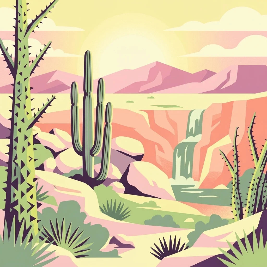
A stylized vector illustration of a desert landscape at sunrise, showing a tall cirio tree in the foreground left, a saguaro-like cactus in the center, and a small waterfall flowing into a pool in the middle-ground, set against a backdrop of desert mountains.

Valle de los Cirios

Wildlife reserve

Park overview

Structured park overview, official facts, and landscape profile for Valle de los Cirios

Valle de los Cirios park facts, protected area profile, and essential visitor context

Review the core facts for Valle de los Cirios, including designation, size, terrain, visitor scale, habitats, and operating context in one park-focused overview.

About Valle de los Cirios

Valle de los Cirios is one of the most important arid-land conservation areas in the Americas. Located in the southern portion of the state of Baja California and administered by Mexico as a Flora and Fauna Protection Area, the reserve covers approximately 2,521,776 hectares across the municipality of San Quintín. Its sheer size makes it the largest reserve of its type in Mexico and gives it continental-scale significance for desert wildlife.

The protected area's defining feature is its geographic position between two seas. The Pacific Ocean lies to the west and the Gulf of California, also known as the Sea of Cortez, lies to the east. The reserve forms the central belt of the Baja California peninsula, with a long coastline of alternating cliffs, beaches, points, and bays. Inland, the terrain is dominated by an intricate mosaic of mountain ranges, high mesas, dry lagoons, deep canyons, sandy plains, and semi-mobile dune fields. Together, these landforms create a vast, varied, and surprisingly well-preserved desert landscape.

The reserve is part of the Baja California Desert ecoregion, within the broader North American Deserts biogeographic realm. Vegetation patterns shift with elevation and substrate, blending Sonoran Desert flora with elements of the California Floristic Province. Coastal halophytic vegetation, riparian galleries, palm-filled oases, and dune plant communities add further diversity to the ecological mosaic.

Valle de los Cirios stands out not only for its landscapes but also for its ecological integrity. Because of its size and the relatively low level of human disturbance across much of its interior, the reserve functions as a critical corridor for wildlife movement and a refuge for species with large home ranges. It is also an important stopover for migratory birds, bats, and butterflies traveling along the Pacific Flyway.

Recognized for its natural values since 1980 and placed on Mexico's Tentative List for UNESCO World Heritage inscription in 2004, the reserve remains a benchmark for desert conservation in Mexico and an important reference point for understanding the biogeography of the Baja California peninsula.

Quick facts and research context for Valle de los Cirios

Valle de los Cirios is officially designated as a Flora and Fauna Protection Area (Área de Protección de Flora y Fauna) under the administration of Mexico's National Commission of Natural Protected Areas (CONANP). Established by decree on June 2, 1980, it covers roughly 2.5 million hectares, making it the largest reserve of its category in Mexico and the largest terrestrial protected area in the country.

The reserve sits within the Baja California Desert ecoregion and spans the central portion of the peninsula, with terrain ranging from coastal cliffs and dunes to inland mountain ranges. It is positioned between the Pacific Ocean and the Gulf of California, and borders the El Vizcaíno Biosphere Reserve to the south. The area has been on Mexico's Tentative List for UNESCO World Heritage inscription since 2004.

Protection and recognition

Documented management scope and international recognition details

Valle de los Cirios Protection Status and Official Designation Framework

Valle de los Cirios maintains a mixed protection scope governed by established conservation frameworks. Official records organize the documented designation history and administrative management parameters.

Protection details

Protection scope
Mixed
Transboundary protection
No
Park context

Deeper park guide and search-rich context for Valle de los Cirios

Valle de los Cirios history, landscape, wildlife, and travel context

Explore Valle de los Cirios through its history, landscape character, ecosystems, wildlife, conservation priorities, cultural context, and seasonal travel timing in a structured park guide built for atlas discovery and search intent.

Why Valle de los Cirios stands out

Valle de los Cirios is best known for its vast stands of the cirio cactus, a sculptural endemic columnar plant that grows tall, slender, and sparsely branched, giving the desert an almost otherworldly appearance. The reserve protects one of the most important populations of this species anywhere on the peninsula. It is equally recognized as one of the most biodiverse deserts on Earth, with a remarkable concentration of endemic cacti, reptiles, and mammals. Large, wide-ranging species such as desert bighorn sheep, mule deer, and puma move freely through its connected mountain and desert habitats, reinforcing the reserve's reputation as a stronghold for intact arid-land wildlife in North America.
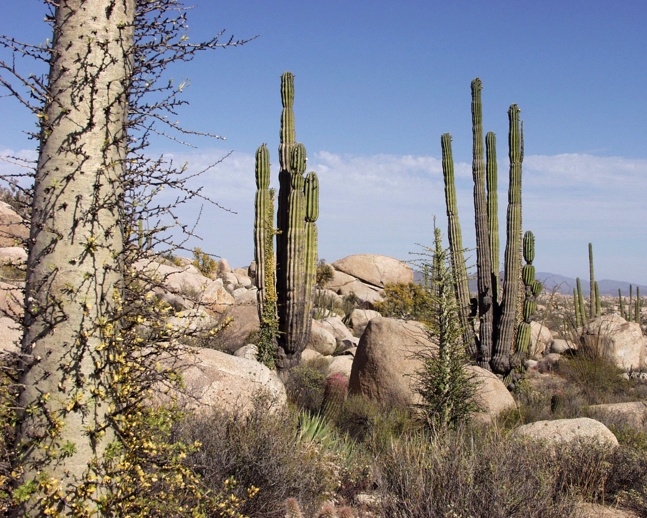
A desert landscape featuring tall columnar cardon cacti and a thick, thorny tree trunk in the foreground, set against a background of large granite boulders and clear blue sky.
Characteristic desert landscape of the Catavina region in Valle de los Cirios, featuring large cardon cacti and cirio trees among granite boulders.

Valle de los Cirios history and protected-area timeline

Valle de los Cirios was officially decreed as a Flora and Fauna Protection Area on June 2, 1980, by the Mexican federal government. The designation placed the central portion of the Baja California peninsula under permanent protection, recognizing both the exceptional biodiversity of the region and the need to safeguard its arid-land ecosystems from expanding development pressures.

The reserve falls under the management of the Comisión Nacional de Áreas Naturales Protegidas (CONANP), the federal agency responsible for Mexico's natural protected areas. In 2004, Valle de los Cirios was added to Mexico's Tentative List for UNESCO World Heritage status, formally acknowledging its outstanding natural value and its potential as a candidate for international recognition.

The long human history of the region predates the reserve by millennia. Rock art sites, including examples of the monumental Gran Mural style, have been documented within the protected area, and the landscape also contains traces of the historic Mission of San Borja Ádac, reflecting centuries of human interaction with this desert environment.

Valle de los Cirios landscape and geographic character

The landscape of Valle de los Cirios is defined by its dramatic physiographic diversity. Although classified as a desert reserve, it is far from being uniformly flat or barren. Much of the interior is mountainous and broken, comprising numerous sierras, broad valleys, elevated mesas, dry lagoons, deep canyons, and seasonal arroyo channels.

In the northern portion of the reserve, the Sierra de la Asamblea and the nearby Sierra de Calamajué rise near the Gulf of California coast. The Sierra de la Asamblea reaches 1,660 meters in elevation and hosts the southernmost relict population of pinyon pine on the peninsula. Below these mountains lie expansive valleys such as Calamajué, Laguna Seca, and Agua Amarga. To the west, along the Pacific slope, a complex of mesas and canyons dominates the northwest, including the Mesa de San Carlos and the Mesa de Santa Catarina. The Sierra de Colombia, the most important mountain chain on the Pacific side, runs through this region.

The central belt of the reserve, between roughly 29° and 30° north latitude, contains an irregular plateau dotted with plains such as San Agustín, Buenos Aires, and Santa Teresa, along with the rocky Cataviñá region and the dry lagoons of Chapala and La Güija. The southern half of the reserve is dominated by the Sierra de la Libertad, the most prominent mountain chain in the entire protected area. Oriented north to south and stretching from near Bahía de los Ángeles, it contains Cerro de la Sandía, the highest point in the reserve at 1,810 meters.

The reserve's long coastline is shaped by alternating cliffs, sandy beaches, points, bays, and sheltered coves. Hydrographically, the interior drains into two main systems: westward to the Pacific and eastward to the Gulf of California. In the southwest, the enormous Llano del Berrendo supports vast sandy plains and an extensive area of semi-mobile dunes. Together, these features give the reserve a striking visual variety and help explain why it supports such a wide range of ecological communities.

Valle de los Cirios ecosystems, habitats, and plant life

Valle de los Cirios hosts a rich mosaic of desert vegetation, shaped largely by its position within the Sonoran Desert but enriched by elements of the California Floristic Province. The result is a landscape where plant communities shift with elevation, substrate, and exposure, allowing multiple ecosystems to coexist within a single protected area.

The most visually iconic vegetation type is the cirio forest, dominated by the columnar cirio cactus (Fouquieria columnaris), often growing alongside the massive cardón (Pachycereus pringlei), torote (Pachycormus discolor), and creosote bush, locally known as gobernadora (Larrea tridentata). Agaves, yuccas, and Ambrosia species further diversify the desert scrub. In the rocky San Julián valley, dense growths of epiphytes such as Tillandsia recurvata and foliose lichens thrive in sheltered microclimates.

The sandy Llano del Berrendo supports its own distinctive community, with Frankenia palmeri, Yucca valida, and Atriplex julacea covering the open plain. Halophytic vegetation hugs sections of the coast, while dune and marsh plant communities occupy narrow stretches of shoreline. Riparian corridors along arroyos and isolated oases host palm groves featuring Brahea armata, Washingtonia robusta, and Washingtonia filifera, both at the northern or southern limits of their ranges within the reserve.

With documented flora totals in the hundreds of species, including a remarkable 46 cactus species, Valle de los Cirios is widely regarded as one of the most botanically diverse deserts in the world. The high level of endemism reflects both the peninsula's long isolation and the reserve's intact Ecological gradients.

Valle de los Cirios wildlife and species highlights

The wildlife of Valle de los Cirios is shaped by its enormous size, intact desert habitats, and position as a biological corridor crossing the central Baja California peninsula. The reserve supports unusually complete representations of arid-land fauna, including large mammals, distinctive reptiles, and rich birdlife.

Among large mammals, the desert bighorn sheep (borrego cimarrón) is the most emblematic and serves as a flagship species for both the state of Baja California and the regional university. The reserve also supports the mule deer (venado bura), the only cervid on the peninsula, as well as pumas, bobcats, coyotes, kit foxes, gray foxes, desert cottontails, and black-tailed hares. The peninsular pronghorn once inhabited the southwestern plains and, although thought to be extirpated by the 1960s, has been occasionally reported again, raising hopes for its persistence.

Reptile diversity is exceptional, with 53 documented reptile species, including 22 endemic to the Baja California peninsula. Rattlesnakes are the only venomous reptiles present, while lizards make up the majority of the herpetofauna. The lizard Urosaurus lahtelai is known only from localities near Cataviñá, Oasis Santa María, and Las Arrastras, making the reserve a center of reptile endemism.

The reserve is part of the Pacific Flyway and serves as a crucial resting and refueling area for migratory birds, bats, and butterflies. Resident birdlife includes California quail, desert wrens, white-winged doves, turkey vultures, common ravens, red-tailed hawks, Harris's hawks, and golden eagles, the last of which has been reported soaring over the highest peaks. Invertebrate diversity is equally notable, with dozens of scorpion, butterfly, and ant species, many of them endemic to the peninsula.

Valle de los Cirios conservation status and protection priorities

Valle de los Cirios is one of the cornerstones of desert conservation in Mexico. Established as a federal protected area in 1980 and managed by CONANP, it preserves an exceptionally large and ecologically intact arid landscape. Its scale allows it to function as a refuge and a corridor for wide-ranging species that need extensive, connected habitats to survive, making it especially important for bighorn sheep, mule deer, and puma.

The reserve harbors an extraordinary concentration of endemic plants and animals, particularly among cacti and reptiles. Of the more than 2,800 species documented, over 100 fall under some risk category within Mexico's official NOM-059 standards, underscoring the conservation urgency of protecting these populations. The reserve also plays a key role in supporting migratory species along the Pacific Flyway.

In 2004, Valle de los Cirios was added to Mexico's Tentative List for UNESCO World Heritage inscription, recognizing its outstanding universal natural value. Together with the neighboring El Vizcaíno Biosphere Reserve, it forms part of one of the largest contiguous protected desert complexes in the world, contributing significantly to the long-term viability of arid-land ecosystems across the Baja California peninsula.

Valle de los Cirios cultural meaning and human context

Beyond its natural heritage, Valle de los Cirios preserves an important cultural legacy. Scattered throughout the reserve are rock art sites, including examples of the monumental Gran Mural style, a distinctive regional tradition of large-scale paintings left by Indigenous peoples of the Baja California peninsula.

The reserve's landscape also contains traces of the Mission of San Borja Ádac, a reminder of the Spanish missionary era and the long history of human presence in an otherwise sparsely populated desert region. These cultural features sit alongside living ranching and regional land-use traditions, providing a layered historical context for an area whose identity is overwhelmingly defined by its natural environment today.

Top sights and standout views in Valle de los Cirios

Valle de los Cirios brings together exceptional biological richness and dramatic desert scenery on a continental scale. Visitors and researchers value its vast cirio forests, its high concentration of endemic cacti and reptiles, and the presence of large mammals that still roam relatively undisturbed mountain ranges. The reserve's coastal cliffs, palm-filled oases, and sweeping dune fields add further variety to a landscape that remains one of the best-preserved arid ecosystems in North America.

Its inclusion on Mexico's Tentative List for UNESCO World Heritage in 2004 cements Valle de los Cirios as a place of international conservation significance, while its sheer size makes it a key anchor for protecting desert biodiversity across the Baja California peninsula.

Best time to visit Valle de los Cirios

Given the predominantly arid and very warm to temperate climate of Valle de los Cirios, the cooler months generally offer the most comfortable conditions for exploring this desert environment. Late autumn through early spring tends to bring milder daytime temperatures, clearer skies, and more favorable conditions for hiking and wildlife observation. Spring can be particularly rewarding when winter rains trigger wildflower displays across the desert floor, while the high sierras remain cooler than the lower plains at any time of year.

Monthly climate preview

Long-term representative point measurements for temperature and precipitation rhythm

Valle de los Cirios Climate Normals and Measured Annual Temperature Patterns

Valle de los Cirios exhibits measured monthly temperature swings from moderate winter lows to high summer maximums alongside consistently low precipitation levels across the representative coordinate. Reviewing the complete twelve-month climatology profile reveals precise monthly variations and long-term temperature averages for protected area analysis.
Annual mean20 °C
12 °C29 °C
Jan12°
Feb13°
Mar15°
Apr18°
May20°
Jun25°
Jul28°
Aug29°
Sep27°
Oct21°
Nov16°
Dec12°
Warmest month
August

28.7 °C

Coolest month
December

12.3 °C

Wettest month
February

1 mm/day

Driest month
June

0 mm/day

Park location guide

Geography guide, regional context, and park location map for Valle de los Cirios

Valle de los Cirios park geography, regions, and map view in Mexico

Understand where Valle de los Cirios sits in Mexico through a broader geographic reading of the surrounding landscape, nearby location context, and its mapped position within the national park landscape.

How Valle de los Cirios fits into Mexico

Mexico, officially the United Mexican States, is a country in North America spanning the Sierra Madre mountain ranges, coastal plains, and tropical regions. It borders the United States to the north, Guatemala and Belize to the southeast, and has coastlines along the Pacific Ocean, Gulf of Mexico, and Caribbean Sea. With a population exceeding 130 million, Mexico is home to one of the world's most significant concentrations of Indigenous languages alongside Spanish.

Wider geography shaping Valle de los Cirios in Mexico

Mexico occupies a land area of 1,972,550 km2, making it the thirteenth-largest country in the world. The terrain is highly diverse, featuring the Sierra Madre Occidental and Sierra Madre Oriental mountain ranges, the Mexican Plateau, coastal lowlands along the Pacific and Gulf/Caribbean margins, and the Yucatan Peninsula. The country spans multiple climate zones from desert in the north to tropical rainforest in the south.

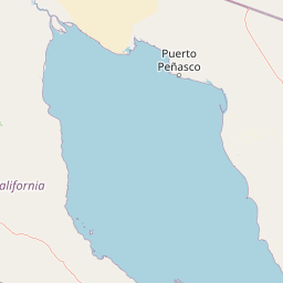
Map view of Valle de los Cirios

Use this park location map to pinpoint Valle de los Cirios in Mexico, understand its exact geographic position, and read its mapped placement within the surrounding landscape more clearly.

Pigeon | © OpenStreetMap contributors

Location context for Valle de los Cirios

Baja California

Explore high-resolution imagery showcasing columnar cirio cactus forests, mountain sierras, and arid coastal terrain.

Valle de los Cirios Photos and Landscapes: Visualizing the Protected Desert

Visual documentation captures the vast ecological diversity of Valle de los Cirios, ranging from dense stands of endemic cacti to rugged desert mountain ranges. Examining these protected landscapes reveals the distinctive physiographic character and structural complexity of one of North America's premier arid reserves.

A desert landscape featuring tall columnar cardon cacti and a thick, thorny tree trunk in the foreground, set against a background of large granite boulders and clear blue sky.

Park atlas

Compare nearby desert ecosystems, mountain ranges, and connected arid protected landscapes.

Parks Near Valle de los Cirios and Related Protected Areas in the Surrounding Region

Browsing other protected areas near Valle de los Cirios reveals the broader ecological connectivity of the Baja California peninsula. Examining adjacent desert reserves provides essential context for understanding regional wildlife corridors and varied arid terrain.
Watercolor painting of a mountainous landscape with pine trees, rolling hills, and a pastel sky
National parkBaja California
About 102 km away#1 closest

North

Sierra de San Pedro Mártir National Park: Protected Landscape and Geographic Exploration

National park boundaries and natural terrain in Baja California.

Sierra de San Pedro Mártir National Park is a vital protected landscape situated in Baja California. This destination offers users a focused atlas exploration of its national park status, detailing its geographic setting and mapped protected area. Understand the park's specific place within the region, examining its natural terrain and boundaries for a clear geographic context, essential for any structured discovery of Mexico's conserved lands.

Area
729.09 km²
Established
1947
IUCN
II
Relief
Mountain
A watercolor painting showing a coastal landscape with pale pink foreground, green vegetation, a light-colored bay, and soft-hued mountains in the background.
Biosphere reserveBaja California
About 196 km away#2 closest

Southeast

Bahía de los Ángeles Biosphere Reserve: Geography and Protected Area Atlas

Coastal desert, volcanic islands, and Sea of Cortez marine channels

Spanning 1,500 square miles, this biosphere reserve preserves the dramatic transition from the arid Baja California desert to the deep, productive waters of the Gulf of California. The protected area encompasses a diverse chain of volcanic islands, including Isla Ángel de la Guarda, and supports high biological productivity driven by deep submarine canyons and marine currents.

Area
3,879.56 km²
Established
2007
Relief
Mixed relief
Climate
Arid
National parkEnsenada Municipality
About 236 km away#3 closest

North

Constitution 1857 National Park National Park: Mapped Protected Landscape Discovery

Geographic context and park boundaries for Ensenada Municipality.

Delve into the protected landscape of Constitution 1857 National Park, a key national park entity located in the Ensenada Municipality. This resource highlights the park's distinct geographic features and mapped protected area, crucial for atlas exploration and understanding the regional natural terrain. Gain structured insight into the park's identity and its role within the wider geographic context.

Area
50.09 km²
Established
1962
IUCN
II
Relief
Mountain
National parkBaja California
About 253 km away#4 closest

Southeast

San Lorenzo Marine Archipelago National Park: Protected Area and Mapped Landscape Geography

Explore its national park status and regional context in Baja California.

Delve into San Lorenzo Marine Archipelago National Park, a key protected area contributing to Baja California's diverse geography. As a national park, its mapped boundaries and unique landscape characteristics provide essential data for atlas exploration and understanding regional conservation efforts. This entry focuses on the park's identity as a mapped protected entity, ideal for researchers and explorers seeking structured geographic insights into natural reserves.

Area
504.42 km²
Established
2005
IUCN
II
Relief
Upland
Wildlife reserveCalifornia
About 318 km away#5 closest

North

Little Picacho Wilderness: Exploring the Protected Volcanic Terrain and Desert Geography

A rugged wilderness reserve in southeastern California

Little Picacho Wilderness is a protected desert landscape located along the lower Colorado River corridor. The area is defined by dramatic volcanic ridges, Picacho Peak, and extensive arid desert washes. This wildlife reserve serves as an important refuge for desert bighorn sheep, desert tortoises, and free-roaming wild horse herds, offering a clear window into the rugged geography of the Sonoran Desert.

Area
154.65 km²
Established
1994
IUCN
Ib
Relief
Mountain
A soft, painterly watercolor illustration showing gentle green hills sloping down to a calm, reflective body of water with a light, pastel sky.
Biosphere reserveBaja California
About 320 km away#6 closest

West

Isla Guadalupe Biosphere Reserve: Remote Island Geography and Protected Marine Landscapes

Mapped terrain and volcanic ecosystem boundaries in the Mexican Pacific.

Located in the Pacific Ocean west of the Baja California peninsula, Isla Guadalupe features a dramatic north-south oriented landscape. The protected area encompasses high-elevation pine forests, recovering chaparral slopes, and vital offshore habitats. This summary provides essential geographic context regarding the reserve boundaries, terrain features such as Mount Augusta, and its ecological status as a key oceanic protected area.

Area
253.8 km²
Established
2005
Relief
Mountain
Climate
Mediterranean
Wildlife reserveCalifornia
About 327 km away#7 closest

North

Fish Creek Mountains Wilderness: Mapping the Rugged Colorado Desert Plateau in California

Exploring desert ridges and ancient shoreline remnants

Fish Creek Mountains Wilderness offers a study in desert geomorphology, rising as an abrupt plateau above the surrounding basin. This Bureau of Land Management protected area contains intricate erosional landforms, including twisting canyons and natural rock tanks sustained by limestone outcrops. These features create a critical desert wildlife habitat that maintains moisture long after seasonal storms, offering a quiet, undisturbed perspective on the broader Imperial County landscape.

Area
86.7 km²
Established
1994
IUCN
Ib
Relief
Mountain
Nature reserveSonora
About 333 km away#8 closest

Southeast

Isla San Pedro Mártir Nature Reserve: Mapping the Geography of the Gulf of California

Isolated rocky terrain and productive marine sanctuary

Isla San Pedro Mártir serves as a distinct protected area marked by its extreme isolation and dramatic vertical cliffs. The reserve acts as a core seabird nesting site supported by nutrient-rich cold-water upwellings in the Gulf of California, providing a vital example of arid island and marine geography.

Area
2.729 km²
Scope
Mixed

Common questions about visiting, size, designation, and location context for Valle de los Cirios

Valle de los Cirios FAQs for park facts, access, geography, and protected area context

Find quick answers about Valle de los Cirios, including protected-area facts, park geography, trail and visitor context, and how the park fits into its surrounding country and regional landscape.
MoriAtlas Explorer

Continue Your Protected Areas Search Across the Global Atlas

Deepen your exploration by continuing the structured search for national parks and protected areas worldwide. Utilize the comprehensive filtering capabilities to compare different conservation landscapes and refine your understanding of global park geography. Discover more about the distribution and characteristics of protected natural areas.

Global natural geography