
Mori Atlas logo
Biosphere reserveVallée du Fango

Mapping the altitudinal sequence from alpine peaks to Mediterranean coastal estuary ecosystems.

Vallée du Fango: A Comprehensive Geographic Atlas of the Corsican Biosphere Reserve Landscape

(Falasorma-Dui Sevi Biosphere Reserve)

The Vallée du Fango represents a unique Mediterranean watershed that spans from high-mountain slopes near Capu Tafunatu to the coastal dunes of the Mediterranean Sea. This biosphere reserve preserves a vertical mosaic of natural terrain, including dense Piriu holm oak forests, maritime pine stands, and a rare wild river corridor. The area serves as a primary reference for ecological continuity in western Corse, showcasing diverse riparian habitats and ancient woodland structures within its protected boundaries.

biosphere reservecorsehaute-corsemediterranean landscaperiver valleyholm oak forest
A digital illustration of a mountainous valley featuring a central waterfall flowing into a river that curves through a landscape of green forests and rugged cliffs, under a sunlit sky.

Vallée du Fango

Biosphere reserve

Park overview

Structured park overview, official facts, and landscape profile for Vallée du Fango

Vallée du Fango park facts, protected area profile, and essential visitor context

Review the core facts for Vallée du Fango, including designation, size, terrain, visitor scale, habitats, and operating context in one park-focused overview.

About Vallée du Fango

The Vallée du Fango is one of the most ecologically distinctive protected areas in Corsica, located on the rugged western side of the island and shaped around the basin of the Fango river. Designated a UNESCO Biosphere Reserve on 1 March 1977 and renamed and expanded as Falasorma-Dui Sevi in 2020, the reserve covers roughly the entire watershed of the Fango across the communes of Galéria, Manso, and Calenzana. Coordination is handled by the Parc Naturel Régional de Corse together with a management committee that brings together local municipalities, the Office National des Forêts, and regional ecological associations.

The reserve is built around a continuous ecological gradient, beginning at high elevations near Capu Tafunatu, where Laricio pine stands give the forest its upper character, and descending through maritime pine woodlands to the famous old-growth holm oak forest of Piriu. Below those, the valley opens onto a mosaic of maquis, riparian corridors, coastal dunes, and a small estuary often referred to locally as the Fango delta. The combination of steep slopes, torrential streams, natural pools, and cascades makes the valley a striking physical landscape, while its relatively low human footprint has preserved a remarkably intact sense of Mediterranean wilderness.

What sets the Vallée du Fango apart is the unusual combination of features it concentrates in a single drainage basin: ancient trees, a river of near-rainwater quality, dune and estuary habitats on the coast, traditional transhumance routes through the high passes, and a well-documented fauna including Corsican trout, European eel, the Corsican mouflon, and the European pond terrapin at the estuary. The site carries multiple layers of recognition (UNESCO Biosphere Reserve, Natura 2000 site, Wild River Site label, ZNIEFF inventories for the holm oak forest and the estuary, and a hunting and wildlife reserve), reflecting both its ecological importance and its positioning within broader French and European conservation networks.

Quick facts and research context for Vallée du Fango

The Vallée du Fango sits in the Filosorma region of western Corsica, in the department of Haute-Corse, and is managed under the broader UNESCO Biosphere Reserve designation Falasorma-Dui Sevi. The watershed covers roughly 25,110 hectares across the communes of Galéria, Manso, and Calenzana, with the strict core centered on the old-growth Piriu forest.

Its central feature is the Fango river, whose waters are notably pure thanks to rhyolite-based geology that produces very low mineralization. The biosphere reserve was created in 1977 and extended in 1990, with a further renaming and expansion in 2020; the basin is also classified as a Natura 2000 area and the river carries an official "Wild River Site" label. The area supports Corsican trout, European eel, freshwater blenny, and the Corsican mouflon, with the estuary particularly valued for its halophytic vegetation and dune cordons.

Protection and recognition

Documented protection history and official designation records for the landscape

Vallée du Fango Protection Status and International Recognition

Historical protection records for Vallée du Fango document a mixed management scope established in 1977. Official recognition sources include the Falasorma-Dui Sevi UNESCO Biosphere Reserve designation.

International recognition

Protection details

Protection scope
Mixed
Designated year
1977
Transboundary protection
No
Core area
43.98 km²
Buffer area
77.12 km²
Park context

Deeper park guide and search-rich context for Vallée du Fango

Vallée du Fango history, landscape, wildlife, and travel context

Explore Vallée du Fango through its history, landscape character, ecosystems, wildlife, conservation priorities, cultural context, and seasonal travel timing in a structured park guide built for atlas discovery and search intent.

Why Vallée du Fango stands out

Vallée du Fango is best known for its exceptionally clear river running through a near-pristine Mediterranean mountain valley, and for the Piriu forest, whose ancient holm oaks are considered among the oldest of their kind in the world. The reserve showcases a complete altitudinal sequence of Mediterranean vegetation, from high-altitude Laricio pines at the headwaters, through maritime pine and holm oak forests, down to the unusual dune and estuary vegetation at the mouth of the Fango. The valley is also known ecologically for its long ecological continuity: the holm oak woodland has not been exploited for timber since the mid-19th century, and the combination of low human pressure, high water quality, and diverse habitats makes the site a textbook example of western Corsican natural heritage.
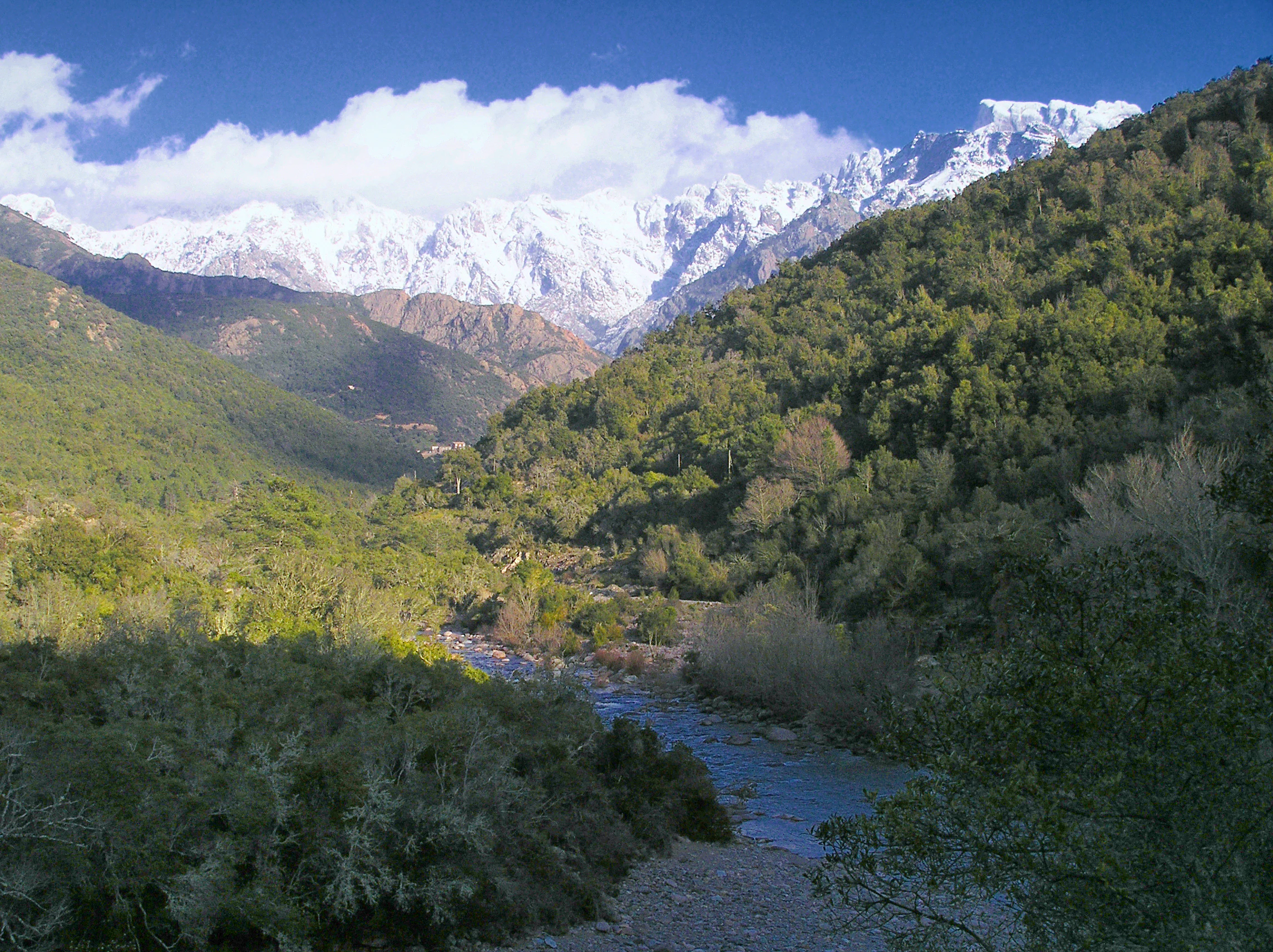
A wide landscape view of a mountain valley with a river flowing through a forested basin towards a high snow-capped mountain peak under a blue sky.
A view of the Fango Valley in Corsica with the snowy peak of Paglia Orba in the background.

Vallée du Fango history and protected-area timeline

The Vallée du Fango was designated a UNESCO Biosphere Reserve under the Man and the Biosphere Programme on 1 March 1977, recognizing the watershed's outstanding Mediterranean character. In 1990, the reserve was extended to encompass a more complete portion of the Fango basin and its surrounding landscapes. The reserve was then renamed and reconfirmed as Falasorma-Dui Sevi in 2020, reflecting a broader geographic and ecological scope.

Historically, the valley was a key section of the traditional transhumance corridor that connected the Niolo and Filosorma regions. Herds passed seasonally via the mountain passes of Guagnerola and Caprunale, and the long-term pressure of grazing contributed to the ecological transition from older forest cover to the maquis formations that today occupy many south-facing slopes. Within the reserve's strict core, the Piriu holm oak forest is a much older ecological reference point: it has not been harvested since 1850, allowing some trees to reach ages that place them among the oldest known individuals of their species. More recently, management history has been shaped by the river contract concluded between 2014 and 2019, by the acquisition of estuary lands by the Conservatoire du Littoral, and by the implementation of the Wild River Site label through the Office de l'Environnement de la Corse.

Vallée du Fango landscape and geographic character

The landscape of the Vallée du Fango is a tightly compressed vertical sequence of Mediterranean environments, running from the highest Corsican ranges down to a coastal estuary. At the top, the watershed begins around Capu Tafunatu, whose summit exceeds 2,250 meters, releasing the Fango into a steep mountain course. From there, the river descends rapidly through a narrow, forested corridor, cutting across ancient bedrock dominated by rhyolite, a geology that gives the water its striking clarity.

Midway through the basin, the relief opens into the broader Filosorma landscape, where steep slopes are covered with Laricio pines at altitude, maritime pines on middle elevations, and a dense holm oak canopy in the lower forest belt. Slopes are fractured by numerous torrents feeding natural pools, cascades, and small solution basins eroded from the bedrock. Towards the coast, the valley widens into a low-lying area where dunes, lagoons, riparian woodland, and the estuary of the Fango create a softer coastal expression of the same Corsican mountain system seen further inland.
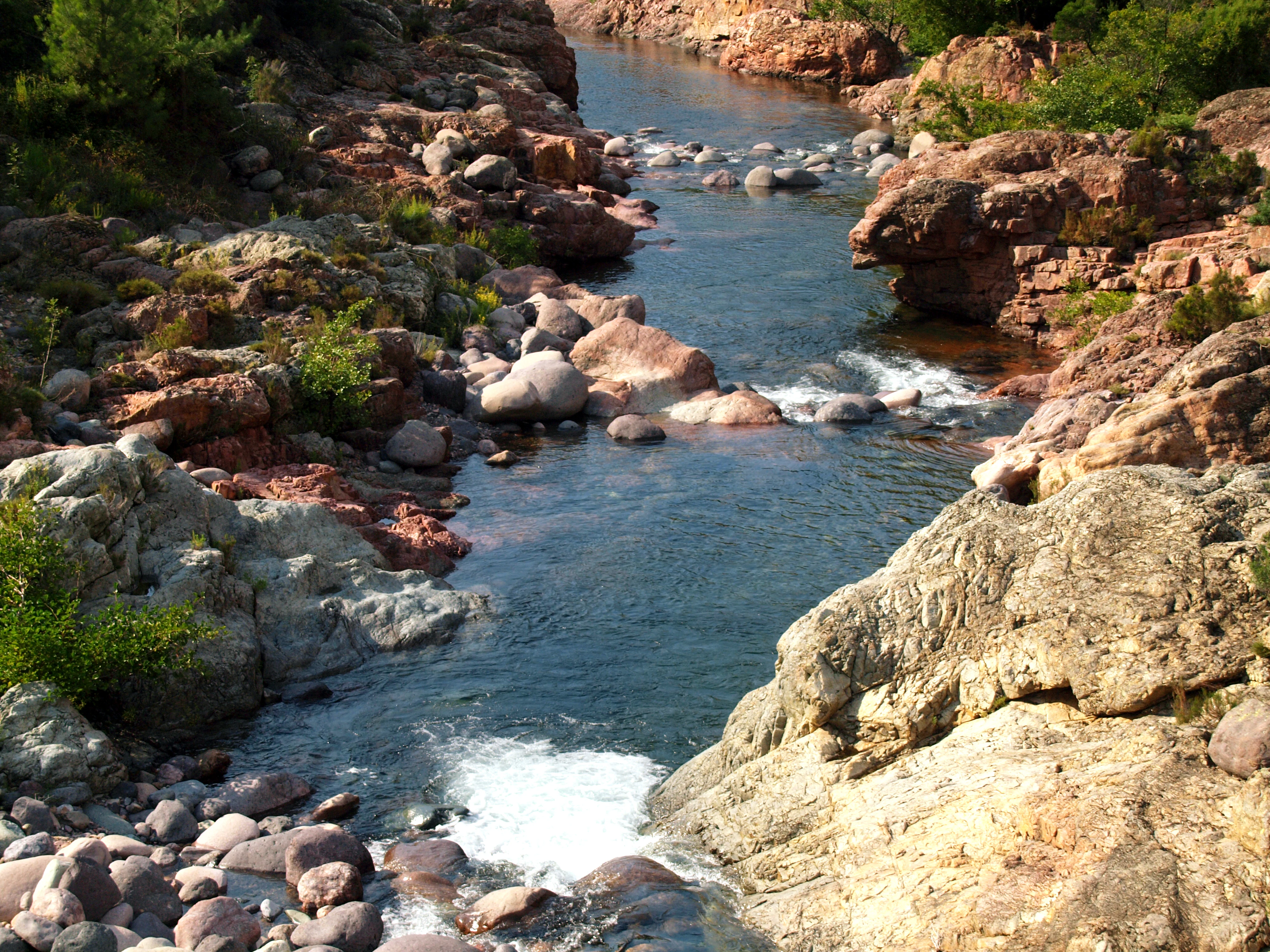
A high-angle view looking down into the Fango River as it flows through a rocky gorge with red-toned stones and lush green shrubs.
The clear waters of the Fango River flowing between rocky banks in the Vallée du Fango biosphere reserve.

Vallée du Fango ecosystems, habitats, and plant life

Ecologically, the Vallée du Fango represents an unusually complete Mediterranean mosaic. At the highest elevational tier, Laricio pine (Pinus nigra subsp. laricio) dominates the montane zone, reflecting the climatic conditions typical of the inner ranges of Corsica. Below this, maritime pine (Pinus pinaster) and black pine stands give way to the exceptional holm oak (Quercus ilex) forest of Piriu. This ancient woodland is the reserve's most distinctive habitat, set apart by both its age structure and by decades without harvesting.

Lower in the basin, the vegetation opens into Corsican maquis, composed of species such as juniper, the endemic Corsican heather, and bay laurel formations. The Fango's corridor supports well-developed riparian vegetation, notably alder and willow galleries along the river margins, while the coastal sector features dune cordons with their specialized halophytic flora and a remarkable stabilization layer of holm oaks growing on sand.

Historical pedological research suggests that, around 2,500 years ago, the area's forests were dominated by Laricio pines and Ericaceae. The current configuration of maritime pine and holm oak took shape over the last one to two millennia, shaped by species migration and by shifts in fire regimes linked to traditional slash-and-burn agriculture.
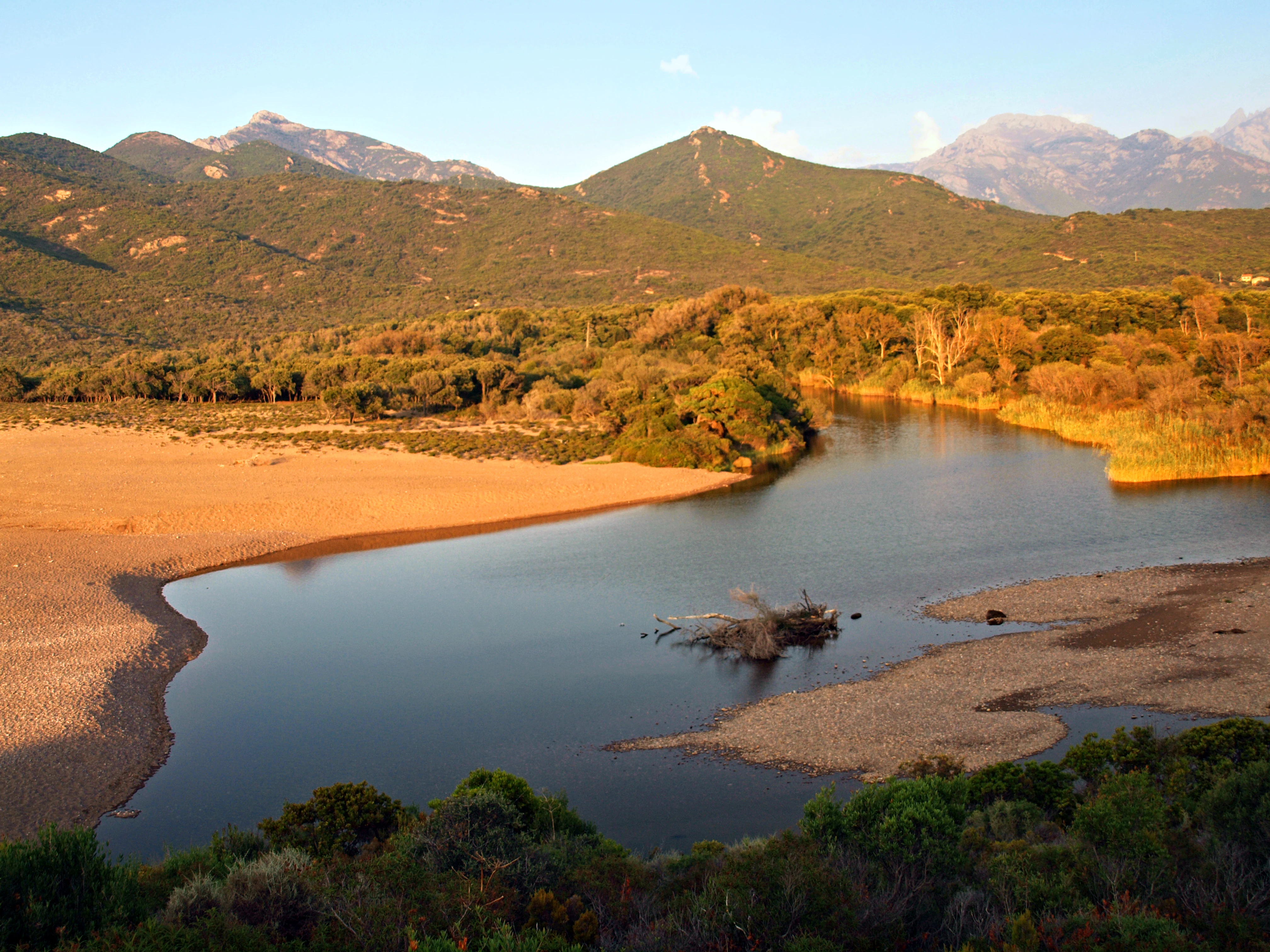
An elevated view of the Fango River delta featuring calm, dark water flowing toward the Mediterranean coast, surrounded by sandy banks, dense Mediterranean vegetation, and distant mountain ranges under warm golden hour light.
The delta of the Fango River near Galeria, Corsica.

Vallée du Fango wildlife and species highlights

The fauna of the Vallée du Fango reflects the same vertical organization that characterizes its vegetation. The river system is the most ecologically distinctive zoological feature: Corsican trout (Salmo trutta macrostigma) inhabits the upper reaches as far downstream as the Montestremu area, while European eel and the freshwater blenny occupy the middle course of the Fango. These aquatic species benefit directly from the exceptionally high-quality water measured across all physical, chemical, and ecological indicators in modern monitoring.

In the terrestrial habitats, the ancient holm oak forest provides refuge for forest birds of prey such as the northern goshawk, alongside river-associated species like the white-throated dipper. The Corsican mouflon, an endemic and emblematic mammal of the island's mountain forests, is also present in the reserve's woodland mosaic. The estuary, meanwhile, hosts a notable population of the European pond terrapin (Emys orbicularis galloitalica), a subspecies with a limited Mediterranean range, which depends on the slow-moving waters and riparian cover preserved along the lower Fango.

Vallée du Fango conservation status and protection priorities

From a conservation standpoint, the Vallée du Fango carries unusually dense recognition within both national and international frameworks. It has been part of UNESCO's Man and the Biosphere network since 1977, was expanded in 1990, and was renamed Falasorma-Dui Sevi in 2020. The watershed is classified as a Natura 2000 site, and the river itself has received the "Site rivière sauvage" label awarded by the Office de l'Environnement de la Corse. The strict core of the biosphere reserve, centered on the Piriu forest, has been protected from extraction since 1850 and now forms one of the most important old-growth holm oak stands in the Mediterranean.

Two major ZNIEFF inventories (the holm oak forest of the Fango basin and the estuary) reinforce the conservation value of the area, and parts of the forest are held by the Office National des Forêts as a hunting and wildlife reserve since 1994. The estuary's dune systems and riparian habitats have further benefited from land purchases by the Conservatoire du Littoral, providing long-term protection from the pressures of informal camping. A river contract between 2014 and 2019, with a budget around 1.8 million euros, supported coordinated restoration and management of the entire watershed.

Vallée du Fango cultural meaning and human context

The Vallée du Fango belongs historically to the pieve of Filosorma, a traditional administrative and cultural subdivision of western Corsica that still defines the identity of the communes today. The valley was once a central segment of the seasonal transhumance routes that moved livestock between the Niolo highlands and the coastal Filosorma region, using the passes of Guagnerola and Caprunale. This long pastoral history left a cultural as well as ecological imprint: the open maquis landscapes visible today are the legacy of centuries of grazing and fire.

Local human presence in the reserve remains very low, with an estimated total population of around 450 inhabitants across the relevant communes. Today, economic activity is dominated by extensive livestock farming, small-scale agriculture, and a growing tourism sector centered on the river's reputation for clear water and natural swimming pools. The summer visitor flow along the Fango is intense relative to the area's sparse settlement, creating both cultural opportunity and a key contemporary management challenge for the reserve.

Top sights and standout views in Vallée du Fango

Three elements most strongly define the Vallée du Fango: its exceptionally pure river running through a near-wilderness Mediterranean landscape; the Piriu holm oak forest, whose centuries-old trees are believed to be among the oldest of their species anywhere; and the unusual combination, in a single watershed, of high mountain forests, ancient woodlands, maquis, riparian corridors, dunes, and an estuary hosting the European pond terrapin. The reserve's UNESCO status, its Natura 2000 classification, and its Wild River Site label together reflect a depth of ecological recognition rare for a Mediterranean drainage basin of this size.

Best time to visit Vallée du Fango

The Vallée du Fango experiences a strongly seasonal visit pattern, with the river's natural swimming pools and clear water drawing the largest crowds in the summer months. Summer brings the warmest conditions for river-based activity, but it is also when the valley's modest infrastructure is most heavily used, with unusually high daily visitor numbers relative to its very low permanent population. Outside the peak summer period, the valley offers quieter conditions, cooler temperatures at altitude, and a more contemplative view of the river, forests, and estuary, while the maritime climate of the west Corsican coast moderates conditions through most of the year.

Monthly climate preview

Month-by-month averages for temperature and precipitation across representative terrain

Vallée du Fango Climate Normals: Annual Temperature and Precipitation Rhythm

Representative coordinates record long-term monthly temperature and precipitation cycles spanning 1991 through 2020 at Vallée du Fango. Exploring the complete twelve-month climate profile reveals detailed seasonal variations in average maximum and minimum values.
Annual mean15 °C
8 °C24 °C
Jan
Feb
Mar10°
Apr12°
May16°
Jun20°
Jul23°
Aug24°
Sep20°
Oct16°
Nov12°
Dec
Warmest month
August

23.8 °C

Coolest month
February

7.6 °C

Wettest month
November

3.2 mm/day

Driest month
July

0.3 mm/day

Park location guide

Geography guide, regional context, and park location map for Vallée du Fango

Vallée du Fango park geography, regions, and map view in France

Understand where Vallée du Fango sits in France through a broader geographic reading of the surrounding landscape, nearby location context, and its mapped position within the national park landscape.

How Vallée du Fango fits into France

France is a unitary semi-presidential republic and one of the world's largest economies. It borders Belgium, Luxembourg, Germany, Switzerland, Italy, Monaco, Andorra, and Spain, with a maritime border to the United Kingdom. The country is known for its cultural influence, art, cuisine, and political history spanning centuries.

Wider geography shaping Vallée du Fango in France

France is located in Western Europe. Metropolitan France extends from the Rhine to the Atlantic Ocean and from the Mediterranean Sea to the English Channel and North Sea. The country borders Belgium, Luxembourg, Germany, Switzerland, Italy, Monaco, Andorra, Spain, and has a maritime border with the United Kingdom.

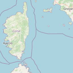
Map view of Vallée du Fango

Use this park location map to pinpoint Vallée du Fango in France, understand its exact geographic position, and read its mapped placement within the surrounding landscape more clearly.

Pigeon | © OpenStreetMap contributors

Location context for Vallée du Fango

Corse

Visualizing the terrain, river corridors, and forest habitats of Corsica

Vallée du Fango Photos and Protected Area Landscapes

Visual documentation reveals the vertical geography and diverse habitats characterizing the protected watershed. Photographic records capture the transition from alpine peaks down to coastal estuaries and ancient holm oak forests.

A wide landscape view of a mountain valley with a river flowing through a forested basin towards a high snow-capped mountain peak under a blue sky.

A jagged mountain peak with steep, dark rocky ridges and small patches of snow in the crevices under a partly cloudy blue sky.

A high-angle view looking down into the Fango River as it flows through a rocky gorge with red-toned stones and lush green shrubs.

An elevated view of the Fango River delta featuring calm, dark water flowing toward the Mediterranean coast, surrounded by sandy banks, dense Mediterranean vegetation, and distant mountain ranges under warm golden hour light.

Park atlas

Compare regional Mediterranean landscapes and connected mountain watersheds.

Explore Protected Areas and Parks Near Vallée du Fango

Browse other protected areas near Vallée du Fango to examine similar Mediterranean river valleys and ancient forest reserves. Expanding geographic comparison across the surrounding region reveals shared ecological patterns and diverse terrain variations.
Marine protected areaFrance
Mapped location lies within the park boundary#1 closest

Northeast

Sanctuaire Pelagos Marine Protected Area: Mediterranean Geography and Seascape

A transboundary conservation zone spanning 87,500 square kilometers.

Sanctuaire Pelagos represents a unique collaborative effort in marine conservation across the Mediterranean. Spanning the waters between France, Italy, and Monaco, this protected maritime area is defined by its deep-sea canyons and nutrient-rich currents that sustain diverse cetacean populations. Its immense scale and international governance make it a focal point for understanding Mediterranean marine biodiversity and environmental policy.

Area
87,500 km²
Established
1999
IUCN
IV
Relief
Lowland
National parkTuscany
About 105 km away#2 closest

East

Arcipelago Toscano National Park: Protected Islands and Mediterranean Landscape Atlas

Explore Tuscany's unique archipelago geography and protected natural terrain.

Arcipelago Toscano National Park offers a unique perspective on Mediterranean island ecosystems through its comprehensive atlas and mapped landscape context. Covering seven main islands and surrounding marine areas off the coast of Tuscany, this park protects dramatic granite cliffs, endemic flora, and vital habitats for marine and avian life. Understand its geographic scope, protected boundaries, and the distinctive natural terrain that defines this significant Italian conservation landscape.

Area
746.63 km²
Established
1996
IUCN
II
Relief
Mixed relief
National parkItaly
About 139 km away#3 closest

Southeast

Arcipelago di La Maddalena National Park: An Italian National Park Defined by Archipelago Geography

Discover mapped protected boundaries and regional landscape context.

Arcipelago di La Maddalena National Park stands as a vital protected area within Italy, characterized by its distinctive archipelago geography. This national park offers a unique lens through which to explore mapped natural landscapes, understand protected land distribution, and contextualize its regional geographic significance. Dive into the detailed mapping of its protected territories to appreciate the full scope of this significant natural asset for structured atlas discovery.

Area
201.46 km²
Established
1994
IUCN
II
Relief
Lowland
Watercolor illustration of a coastal landscape with green hills, shoreline, and blue sea under a pale yellow sky
National parkSardinia
About 152 km away#4 closest

South

Asinara National Park: National Park Protected Landscape and Geographic Setting

Explore mapped terrain and protected area context within Sardinia.

Asinara National Park stands as a key protected landscape within the Italian national park system, located off the coast of Sardinia. This entry provides detailed geographic context, focusing on its mapped boundaries and the unique natural terrain that defines this island sanctuary. MoriAtlas facilitates a structured discovery of Asinara National Park, enabling users to understand its protected area status and its significant position within the broader regional geography of Sardinia for atlas exploration.

Area
51.7 km²
Established
1997
IUCN
II
Relief
Mixed relief
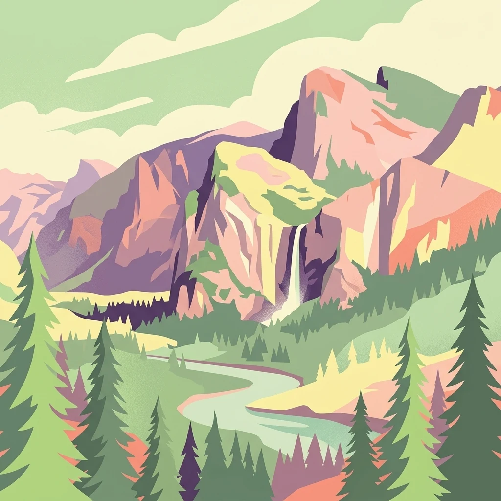
A digital illustration of a valley featuring jagged mountain peaks, a waterfall, a winding river, and pine forests in the foreground.
Marine protected areaMonaco
About 174 km away#5 closest

Northwest

Larvotto and Portier Coastal Reserve: Marine Protected Area and Coastal Habitat Atlas

Mapped marine refuge along the dense Monaco shoreline.

The Larvotto and Portier Coastal Reserve represents a distinct marine protected area in Monaco, featuring significant seagrass meadows and transplanted rocky habitats. This coastal zone acts as an essential refuge for Mediterranean biodiversity, providing a rare example of structured marine conservation embedded within a highly developed urban landscape.

Area
0.23 km²
Watercolor painting of distant purple hills and foreground pine trees in soft washes of green, yellow, and red on a white background.
State or regional parkProvence-Alpes-Côte d'Azur
About 178 km away#6 closest

Northwest

Parc naturel départemental du Vinaigrier: Protected Limestone Landscapes near Nice

Regional state park with diverse Mediterranean woodland ecosystems

Parc naturel départemental du Vinaigrier offers a dense, 25 hectare mosaic of limestone plateaus and slopes near the Mediterranean coast. Its landscape is defined by traditional dry stone terraces and a rare flowering ash forest, creating a significant ecological bridge between the urban expansion of Nice and the hilly interior of the Alpes-Maritimes.

Area
0.25 km²
Established
1980
IUCN
IV
Watercolor painting of a park landscape with a foreground pond, grassy areas, and rolling hills in the background.
State or regional parkProvence-Alpes-Côte d'Azur
About 179 km away#7 closest

Northwest

Parc de Vaugrenier: Regional Protected Area and Archaeological Landscape in France

Wetland habitats and historic trails in Alpes-Maritimes

Parc de Vaugrenier protects a diverse hundred-hectare expanse between Antibes and Villeneuve-Loubet. Its terrain bridges Mediterranean woodland and lush freshwater meadows, distinguished by a rare collection of exotic trees and remnants of the ancient Via Julia Augusta. This park provides a quiet geographic contrast to the surrounding coastal urbanization of the French Riviera.

Area
1 km²
Established
1995
Visitors
500K annual
Relief
Lowland
A soft watercolor painting of a coastal landscape with rolling hills, distant mountains, and green vegetation against a light sky.
Marine protected areaProvence-Alpes-Côte d'Azur
About 181 km away#8 closest

Northwest

Parc maritime départemental Estérel-Théoule: Marine Protected Area and Coastal Geography

A vital Mediterranean corridor along the French Riviera coast

This marine protected area preserves a unique underwater mosaic where rocky shallows, sandy patches, and Posidonia seagrass meadows converge. Located offshore from the Estérel massif, the site provides a continuous conservation corridor between inland natural spaces and the Mediterranean Sea, offering insight into the littoral environment of the French Riviera.

Area
3.5 km²
Water
Water-dominated
Season
Seasonal

Common questions about visiting, size, designation, and location context for Vallée du Fango

Vallée du Fango FAQs for park facts, access, geography, and protected area context

Find quick answers about Vallée du Fango, including protected-area facts, park geography, trail and visitor context, and how the park fits into its surrounding country and regional landscape.
MoriAtlas Explorer

Continue Your Protected Areas Search Across the Global Atlas

Deepen your exploration by continuing the structured search for national parks and protected areas worldwide. Utilize the comprehensive filtering capabilities to compare different conservation landscapes and refine your understanding of global park geography. Discover more about the distribution and characteristics of protected natural areas.

Global natural geography