Mori Atlas logo
Protected landscapeVânători-Neamț Natural Park

Discover the mapped boundaries and regional setting of this protected natural landscape.

Vânători-Neamț Natural Park: Protected Landscape and Geographic Context in Neamț County

(Parcul Natural Vânători-Neamț)

Vânători-Neamț Natural Park represents a significant protected landscape within Romania's Neamț County, offering a unique focal point for geographic exploration. As a designated protected area, its mapped boundaries and regional setting provide crucial context for understanding the natural terrain of Western Moldavia. This MoriAtlas entry details the park's protected status, anchoring it within the broader atlas of Romanian conservation lands and allowing for map-based discovery of its surrounding geography and landscape characteristics.

Protected landscapeEuropean bisonCarpathian mountainsForest reservesEastern RomaniaNature conservation

Vânători-Neamț Natural Park

Protected landscape

Park overview

Structured park overview, official facts, and landscape profile for Vânători-Neamț Natural Park

Vânători-Neamț Natural Park park facts, protected area profile, and essential visitor context
Review the core facts for Vânători-Neamț Natural Park, including designation, size, terrain, visitor scale, habitats, and operating context in one park-focused overview.

About Vânători-Neamț Natural Park

Vânători-Neamț Natural Park represents a significant protected area within Romania's network of natural parks, established in 2003 to preserve the ecological and cultural values of the Eastern Carpathian Foothills region. The park's location near Târgu Neamț places it in the heart of Moldavia, a region with rich historical heritage and deep connections to Romanian national identity. The protected area encompasses diverse landscapes including deciduous forests, grassy meadows, river corridors, and agricultural lands that together create a characteristic Carpathian mosaic. The park's designation as an IUCN Category V protected landscape acknowledges that its natural values are inseparable from the human communities and traditional land use patterns that have shaped the terrain over generations. Seven communes and the town of Târgu Neamț fall partially within the park's boundaries, creating a management context where conservation must balance with sustainable community development.

Quick facts and research context for Vânători-Neamț Natural Park

Vânători-Neamț Natural Park occupies 306.31 square kilometers in northeastern Romania's Neamț County, extending into neighboring Suceava County. The park lies at the foot of the Stânișoara Mountains within the Eastern Carpathian Foothills, a region known for its blend of forest-covered ridges and river valleys. Two significant waterways, the Cracău and Ozana rivers, traverse the protected area, contributing to its ecological diversity. The park encompasses territories of seven communes and the town of Târgu Neamț, making it a community-based protected area where conservation integrates with local land management.

Park context

Deeper park guide and search-rich context for Vânători-Neamț Natural Park

Vânători-Neamț Natural Park history, landscape, wildlife, and travel context
Explore Vânători-Neamț Natural Park through its history, landscape character, ecosystems, wildlife, conservation priorities, cultural context, and seasonal travel timing in a structured park guide built for atlas discovery and search intent.

Why Vânători-Neamț Natural Park stands out

Vânători-Neamț Natural Park is renowned as one of Romania's primary stronghold for the European bison, also known as the wisent. The park maintains a protected population of approximately 17 European bison within a dedicated 180-hectare enclosure in the Vânători-Neamț commune area. This conservation success represents one of the few successful reintroduction programs for the species in Romania, allowing visitors the rare opportunity to observe these magnificent animals in their natural Carpathian habitat. The European bison holds deep cultural significance in Romania, particularly in the historical region of Moldavia where the aurochs head appears as a heraldic symbol representing strength and wilderness.

Vânători-Neamț Natural Park history and protected-area timeline

The Vânători-Neamț Natural Park was formally established in 2003 as part of Romania's expansion of its protected areas network following changes in national environmental legislation. The park's creation reflected growing recognition of the Carpathian region's ecological significance and the need to protect remaining wilderness areas in the eastern part of the country. The European bison reintroduction program represents one of the park's most notable conservation achievements, establishing a viable population within a specially designed protected enclosure. The park's name reflects both its location near the town of Vânători-Neamț and the Romanian term for hunters, referencing the area's long history as a traditional hunting ground before protection status was granted.

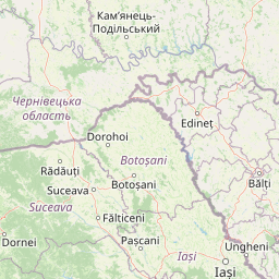
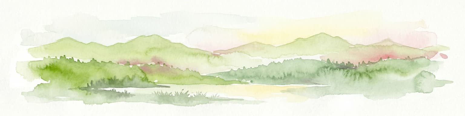
Vânători-Neamț Natural Park landscape and geographic character

The park sits in the Eastern Carpathian Foothills, a transition zone between the higher mountain ranges of the Southern Carpathians and the lowland plains of northeastern Romania. The terrain consists of rounded hills, broad valleys, and rolling uplands that create a gently undulating landscape distinctive to this part of the Carpathians. The Stânișoara Mountains rise to the west of the park, contributing to the scenic backdrop and influencing local climate patterns. The Cracău and Ozana rivers flow through the protected area, creating riparian corridors that support additional biodiversity and add visual variety to the landscape. Forest patches of deciduous trees alternate with open meadows and agricultural fields, producing the mosaic pattern typical of Carpathian rural landscapes.

Vânători-Neamț Natural Park ecosystems, habitats, and plant life

The ecological character of Vânători-Neamț Natural Park reflects the Carpathian region's status as one of Europe's important biodiversity areas. The combination of forests, meadows, and river valleys creates multiple habitat types supporting diverse plant and animal communities. The park's location in the Eastern Carpathians positions it within a biogeographic zone that harbors many species found nowhere else in Europe. Deciduous forest habitats dominate the higher ground, while grasslands and wetland areas occur along watercourses and in valley bottoms. The protection framework acknowledges the importance of maintaining the traditional landscape structure that has evolved through centuries of pastoral and agricultural use.

Vânători-Neamț Natural Park wildlife and species highlights

The European bison stands as the flagship species of Vânători-Neamț Natural Park, representing one of the few successful populations of this endangered megafauna in Romania. The park's protected enclosure of approximately 180 hectares provides suitable habitat for a small herd of these impressive animals, allowing visitors opportunities to observe them in surroundings that approximate their natural behavior. Beyond the European bison, the park supports populations of other large mammals typical of Carpathian forests, including species that have survived in reduced numbers across the region. The diverse habitats created by the forest-meadow-river mosaic support bird communities and smaller mammals that contribute to the park's overall ecological richness.

Vânători-Neamț Natural Park conservation status and protection priorities

Vânători-Neamț Natural Park contributes to Romania's commitment to maintaining biodiversity within the Carpathian mountain corridor, one of Europe's most significant wilderness areas. The European bison population represents a particularly important conservation achievement, as the species was driven to near extinction in the early twentieth century and remains endangered across its former range. The park's Category V protected landscape designation recognizes that meaningful conservation in this region must integrate with ongoing human use of the land, rather than attempting to exclude all human activity. This approach allows traditional agricultural and forestry practices to continue while providing formal protection for the landscape's key ecological values.

Vânători-Neamț Natural Park cultural meaning and human context

The park lies within Moldavia, a historical Romanian province with a distinctive cultural identity reflected in architecture, traditions, and national symbolism. The aurochs head, representing the wild ancestor of domestic cattle, appears as a heraldic symbol throughout Moldavian coat of arms and royal insignia, demonstrating the deep historical connection between the region and these large grazing animals. Although the true aurochs is now extinct, the European bison that survives in the park can be understood as a living legacy of the wild herds that once roamed the Carpathian foothills. The town of Târgu Neamț, the nearest urban center to the park, has historical significance as a medieval fortress town and religious center, adding cultural context to visits.

Top sights and standout views in Vânători-Neamț Natural Park

The opportunity to observe European bison in a natural setting constitutes the primary highlight for visitors to Vânători-Neamț Natural Park, offering one of the best chances in Romania to see these impressive animals. The park's location within the Eastern Carpathians provides scenic walking opportunities through rolling forested terrain with views toward mountain backgrounds. The blend of protected nature with traditional rural landscapes offers a distinctive Carpathian experience where agricultural activities continue alongside conservation efforts. The proximity to Târgu Neamț allows visitors to combine nature exploration with cultural visits to this historic Moldavian town.

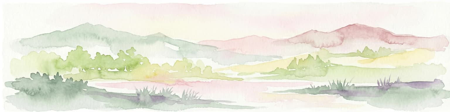
Best time to visit Vânători-Neamț Natural Park

The park can be visited throughout the year, with each season offering different experiences of the Carpathian landscape. Spring and summer bring lush vegetation and active wildlife activity, making these months popular for nature observation and hiking. Autumn produces characteristic golden colors across the deciduous forests, creating particularly scenic conditions for photography and walking. Winter snow transforms the rolling hills into a quiet winter landscape, though some facilities may have reduced access during colder months. The European bison can be observed year-round within their protected enclosure area.

Park location guide

Geography guide, regional context, and park location map for Vânători-Neamț Natural Park

Vânători-Neamț Natural Park park geography, regions, and map view in Romania
Understand where Vânători-Neamț Natural Park sits in Romania through a broader geographic reading of the surrounding landscape, nearby location context, and its mapped position within the national park landscape.

How Vânători-Neamț Natural Park fits into Romania

Romania is a unitary semi-presidential republic located in Southeast and Central Europe. It borders Ukraine, Hungary, Serbia, Bulgaria, Moldova, and the Black Sea. The country has a population of approximately 19 million and covers an area of 238,397 km². Bucharest is the capital and largest city. Romania joined the European Union in 2007.

Wider geography shaping Vânători-Neamț Natural Park in Romania

Romania lies on the lower course of the Danube River, north of the Balkan Peninsula, and on the northwestern shore of the Black Sea. The terrain is varied, featuring the Carpathian Mountains in the center, the Transylvanian Plateau, the Moldavian Plateau, and plains along the Danube and in the south. The country has a diverse landscape that includes forests, meadows, and wetland areas.

Map view of Vânători-Neamț Natural Park

Use this park location map to pinpoint Vânători-Neamț Natural Park in Romania, understand its exact geographic position, and read its mapped placement within the surrounding landscape more clearly.

Pigeon | © OpenStreetMap contributors

Location context for Vânători-Neamț Natural Park

Neamț County
Park atlas

Trace the Geographic Spread of Carpathian Protected Areas and Compare Nearby Park Landscapes

Explore Nearby Protected Landscapes and Parks Surrounding Vânători-Neamț Natural Park
From Vânători-Neamț Natural Park, browse a curated selection of other protected areas, tracing their geographic context across the Eastern Carpathian Foothills and surrounding regional terrain. Compare adjacent park landscapes, conservation efforts, and the diverse habitats that define this part of northeastern Romania through detailed atlas views.
National park

Cheile Bicazului-Hășmaș National Park: Protected Area Geography and Mapped Landscape Identity

Discover Romania's National Park mapped boundaries and regional context.

Cheile Bicazului-Hășmaș National Park represents a vital component of Romania's protected natural areas, offering rich geographic detail for atlas enthusiasts. This national park's mapped landscape and defined protected boundaries provide essential context for understanding regional geography and conservation efforts. Explore the specific identity of this protected terrain and its significance within the broader Romanian atlas.

Area
65.75 km²
Relief
Mountain
Scope
Mixed
Water
Minor water
National park

Călimani National Park: Romania's Premier National Park Protected Landscape

Explore mapped boundaries and regional geographic context.

Uncover the geographic identity of Călimani National Park, a designated national park in Romania. This resource offers detailed insights into its protected landscape, mapped terrain, and surrounding natural context. Navigate through its specific park boundaries and understand how it fits into the wider regional geography, providing a clear atlas-style overview for dedicated discovery.

Area
240.41 km²
Established
2000
IUCN
II
Relief
Mountain
Protected landscapeMureș County

Defileul Mureșului Superior Natural Park: Protected Landscape Mapping and Geography

Explore Mureș County's premier protected landscape.

Access detailed mapping and geographic context for Defileul Mureșului Superior Natural Park. As a protected landscape situated in Romania's Mureș County, this entity offers crucial insights into regional natural terrain and protected area distribution. Explore its mapped boundaries and understand its significance within the broader atlas of protected lands.

Area
91.56 km²
Established
2007
IUCN
V
Relief
Mixed relief
National park

Rodna Mountains National Park: Explore Protected Landscape and Geographic Atlas

Discover the mapped terrain and protected area context.

Rodna Mountains National Park represents a key protected landscape within Romania, offering rich opportunities for geographic discovery. This page provides detailed insight into its mapped boundaries and how it integrates into the regional terrain. Delve into the structured atlas data to understand the park's protected area status and its significance within the natural geography.

Relief
Mountain
Scope
Terrestrial
Watercolor illustration of a mountainous landscape with forests, a lake, and distant peaks.
National parkChernivtsi Oblast

Cheremosh National Nature Park: Protected Landscape and Geographic Context in UA

Explore mapped boundaries within Chernivtsi Oblast

Cheremosh National Nature Park represents a vital protected area within Ukraine's Chernivtsi Oblast. This entry offers a structured exploration of the park's geographic identity, focusing on its mapped boundaries and its significance as part of the regional natural landscape. Delve into the terrain and understand how Cheremosh National Nature Park contributes to the mapped geography of western Ukraine, providing a foundation for atlas-based discovery.

Area
71 km²
Established
2009
IUCN
II
Relief
Mountain
National parkChernivtsi Oblast

Vyzhnytsia National Nature Park: Protected National Park Landscape Exploration

Mapped boundaries and regional terrain in Chernivtsi Oblast.

Delve into the specific protected landscape of Vyzhnytsia National Nature Park, a designated national park in Ukraine's Chernivtsi Oblast. This detailed entry provides context on its geographic positioning, mapped natural features, and the surrounding regional terrain, aiding in structured atlas exploration and understanding its significance within the protected areas network.

Area
7,928.4 km²
Established
1995
IUCN
II
Relief
Mountain
Protected landscapeVrancea County

Putna-Vrancea Natural Park: A Protected Landscape in Vrancea County's Carpathian Mountains

Explore mapped terrain, natural park boundaries, and regional geography.

Putna-Vrancea Natural Park, designated as a protected landscape, offers detailed geographic insights into the Vrancea Mountains in Romania. Users can explore the park's mapped terrain, understand its protected boundaries, and contextualize its natural park status within Vrancea County and the broader Eastern Carpathians region. This atlas-focused view highlights the unique landscape features and regional geographic significance of this Romanian protected area.

Area
302.04 km²
Established
2005
IUCN
V
Relief
Mountain
Watercolor illustration of a mountainous landscape with rolling hills, a river, and green vegetation
Protected landscapeMaramureș County

Maramureș Mountains Natural Park: Protected Landscape and Carpathian Geography

Explore the mapped boundaries and dramatic terrain of Romania's largest nature park.

Delve into the Maramureș Mountains Natural Park, a protected landscape covering extensive tracts of the northern Carpathian Mountains. This page provides detailed geographic context, showcasing the park's mapped boundaries, diverse alpine terrain, and its role within the broader regional geography of Maramureș County. Understand the natural features and protected area significance of this expansive Carpathian wilderness for structured atlas exploration.

Area
1,488.5 km²
Established
2004
IUCN
V
Relief
Mountain

Common questions about visiting, size, designation, and location context for Vânători-Neamț Natural Park

Vânători-Neamț Natural Park FAQs for park facts, access, geography, and protected area context
Find quick answers about Vânători-Neamț Natural Park, including protected-area facts, park geography, trail and visitor context, and how the park fits into its surrounding country and regional landscape.
MoriAtlas Explorer

Continue Your Protected Areas Search Across the Global Atlas

Deepen your exploration by continuing the structured search for national parks and protected areas worldwide. Utilize the comprehensive filtering capabilities to compare different conservation landscapes and refine your understanding of global park geography. Discover more about the distribution and characteristics of protected natural areas.

Global natural geography