
Mori Atlas logo
Protected landscapeVictoria Forest Park

Traversing the rugged mountain ranges and river valleys of the South Island West Coast

Victoria Forest Park: Mapping the Largest Protected Beech Forest Landscape in New Zealand

Victoria Forest Park represents a sprawling 2,069 square kilometre protected landscape situated between the West Coast towns of Greymouth, Westport, and Reefton on New Zealand's South Island. This expansive region features a complex geography of beech forests, mountain ranges, and vital river catchments that support threatened bird species. The area also preserves remnants of nineteenth century coal and gold mining heritage embedded within its dense, natural terrain.

forest parkbeech forestindigenous forestWest CoastSouth IslandNew Zealand
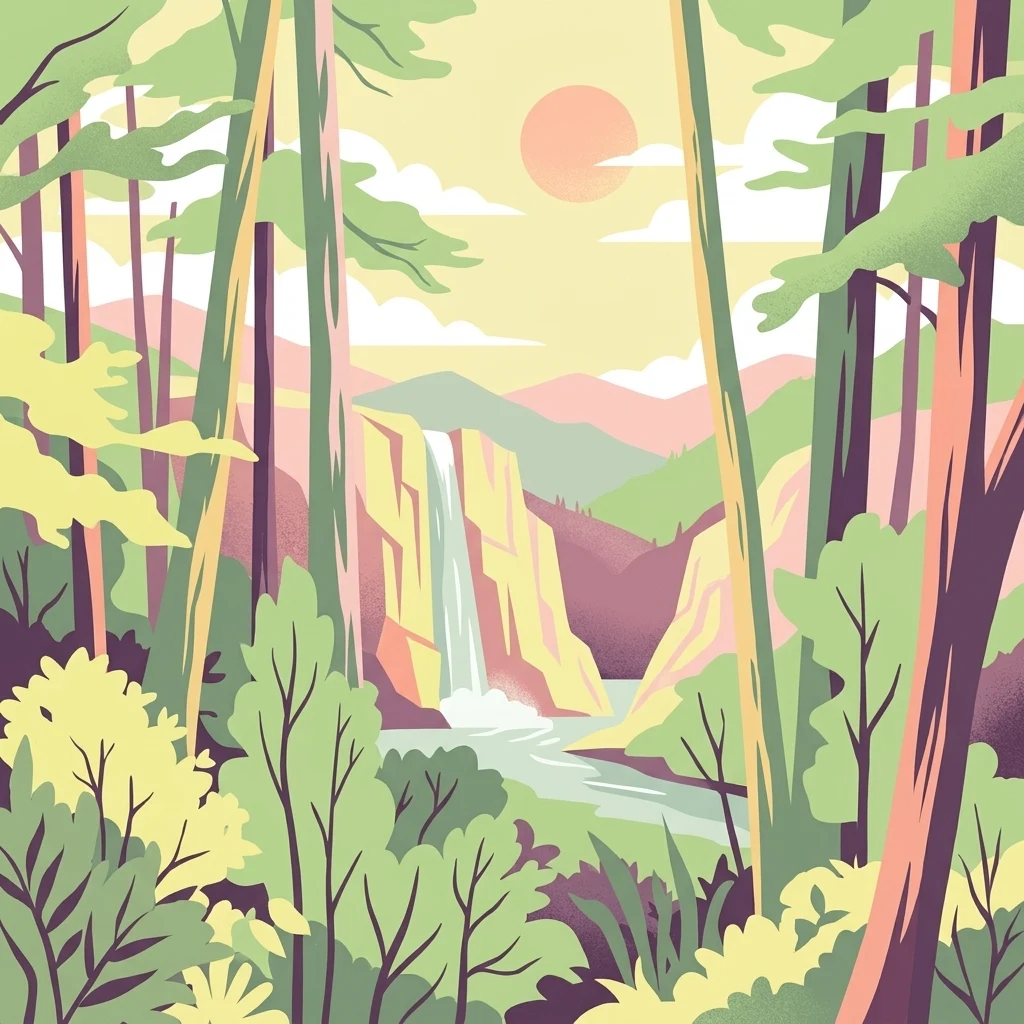
A stylized flat illustration of a sunlit forest with tall trees in the foreground and a waterfall flowing into a river between rocky hills in the distance.

Victoria Forest Park

Protected landscape

Park overview

Structured park overview, official facts, and landscape profile for Victoria Forest Park

Victoria Forest Park park facts, protected area profile, and essential visitor context

Review the core facts for Victoria Forest Park, including designation, size, terrain, visitor scale, habitats, and operating context in one park-focused overview.

About Victoria Forest Park

Victoria Forest Park is the largest forest park in New Zealand, sprawling across a substantial portion of the West Coast region's interior on the South Island. Covering around 206,899 hectares of rugged terrain between the catchments of the Grey, Inangahua, and Maruia Rivers, the park extends across the Victoria and Brunner Ranges and forms a vast belt of indigenous forest between the better-known coastal towns of Greymouth and Westport and the historic mining town of Reefton on its southwestern edge.

The defining character of the park is its extensive beech forest. Across New Zealand, beech forests are the country's largest remaining indigenous forest type, in large part because they typically occupy steep, cold, mountainous country that was unsuitable for the broad-scale agricultural clearing that transformed much of lowland New Zealand after European settlement. Within Victoria Forest Park, this ecological inheritance is unusually well preserved, with all five New Zealand beech species present: red, silver, mountain, black, and hard beech.

The park is more than a single contiguous forest block. It spans substantial river valleys and high country, and its beech-clad ranges give way to alpine zones and rocky basins. Old mining tracks and relics from the nineteenth-century gold and coal boom around Reefton are still found within the park, marking a period when communities pushed deep into these otherwise challenging landscapes. Some small-scale mining continues to be authorised within parts of the park, and the area has periodically been the subject of debate over resource development, including oil and gas exploration permits.

From a biodiversity perspective, Victoria Forest Park is significant because its beech forests sustain a complex web of ecological interactions that exist nowhere else in quite the same form. Native scale insects in the beech bark produce honeydew that feeds tui, bellbirds and kaka, while a suite of threatened birds, invertebrates, and snails have come to depend on the continuity of these forests. Because so many of these species have evolved without mammalian predators, the introduction of stoats, rats, cats, possums, and wasps has had a profound and ongoing impact, making the park an important site for invasive-species management as well as habitat protection.

Administered by the New Zealand Department of Conservation, Victoria Forest Park is one of the fourteen forest parks that emerged from conservation pressure during the 1970s and 1980s, with Victoria Forest Park itself receiving formal forest-park status in 1981. Today, the park is recognised as a key piece of New Zealand's protected-area network, valued as much for its ecological function as for its sheer size and continuity of indigenous forest cover.

Quick facts and research context for Victoria Forest Park

Victoria Forest Park is the largest of the fourteen New Zealand forest parks created during the twentieth century, with a total area of roughly 206,899 hectares. It lies inland on the West Coast of the South Island, between Reefton on its southwestern edge and the broader West Coast region centred on Greymouth and Westport.

The park is administered by the Department of Conservation and is dominated by indigenous beech forest that includes all five New Zealand beech species. Reefton, the main nearby town, was founded in the 1880s as a coal and gold mining centre, and old mining equipment remains scattered through parts of the park.

Protection and recognition

Examine documented terrestrial protection scope and conservation status details.

Victoria Forest Park Protection Status and International Recognition Facts

Victoria Forest Park maintains a documented terrestrial protection scope within official conservation inventories. Detailed records outline the foundational designation framework and administrative management history.

Protection details

Protection scope
Terrestrial
Transboundary protection
No
Park context

Deeper park guide and search-rich context for Victoria Forest Park

Victoria Forest Park history, landscape, wildlife, and travel context

Explore Victoria Forest Park through its history, landscape character, ecosystems, wildlife, conservation priorities, cultural context, and seasonal travel timing in a structured park guide built for atlas discovery and search intent.

Why Victoria Forest Park stands out

Victoria Forest Park is best known for its massive expanse of pristine beech forest, making it one of the most important remaining strongholds of New Zealand's largest surviving indigenous forest type. Because beech forests in New Zealand tend to grow on steep mountain terrain unsuited to agriculture, the park's forests were largely left untouched by colonial clearing, and today they support all five native beech species in a single continuous protected landscape. The park is also notable for the ecological relationships that unfold across its beech canopy. The scale insects living in beech bark produce honeydew that sustains nectar-feeding birds such as tui, bellbirds, and kaka, while the same forests shelter threatened species including great spotted kiwi, blue duck, rock wren, Powelliphanta snails, and several endemic parakeets. These layered forest and freshwater systems have made Victoria Forest Park a focal point for both conservation research and forest-park management in New Zealand.
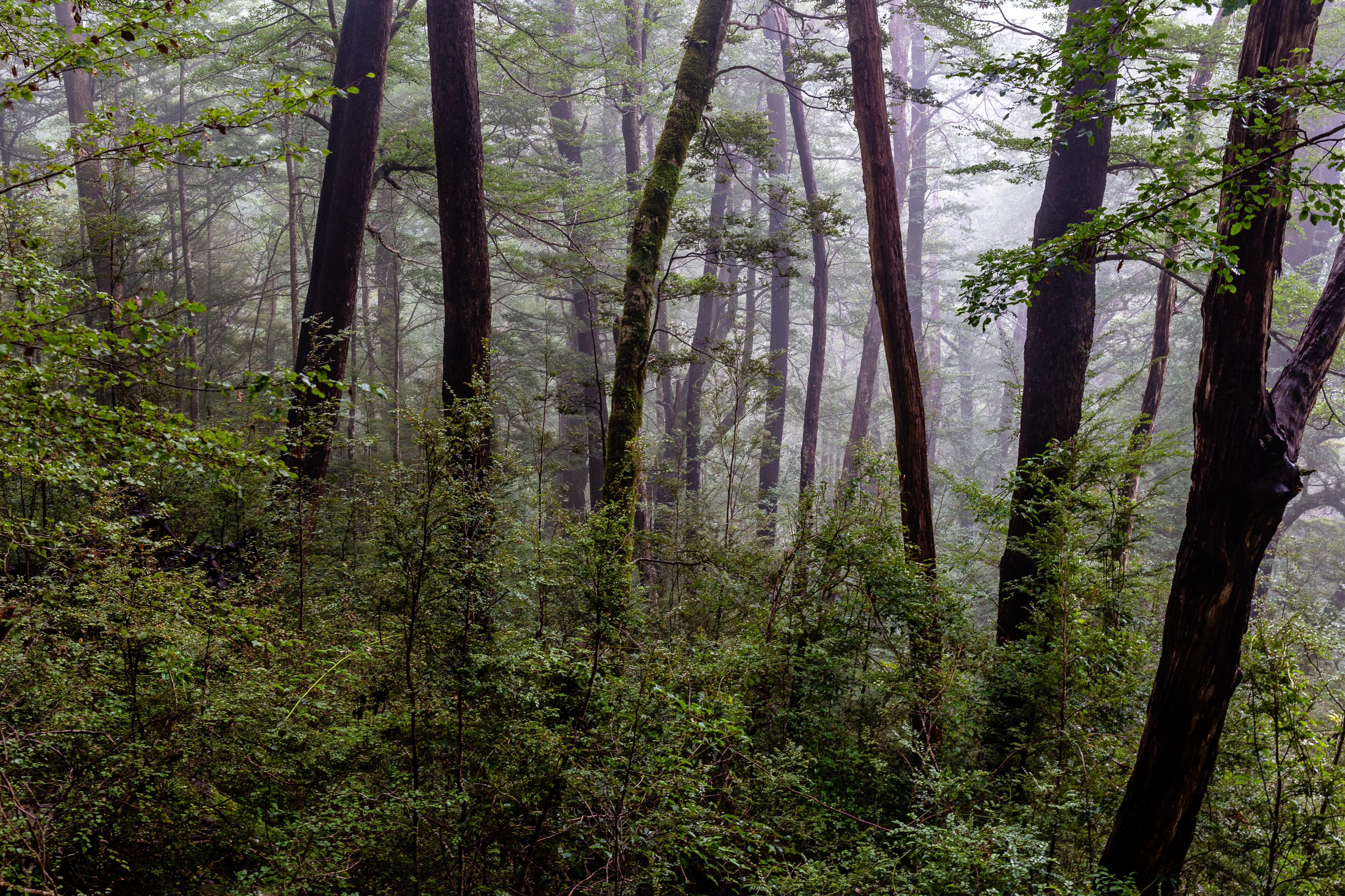
A dense, misty forest scene with tall, dark tree trunks and lush green undergrowth.
Misty, temperate native beech forest within Victoria Forest Park.

Victoria Forest Park history and protected-area timeline

The modern Victoria Forest Park emerged from a wave of conservation advocacy in New Zealand that pushed for the formal protection of native forests during the 1970s. Fourteen forest parks were created across the country in response to this pressure, and Victoria Forest Park joined this protected-area network in 1981, becoming the largest of them and bringing its extensive West Coast beech forests under formal forest-park protection administered by the Department of Conservation.

Long before that designation, the area had been shaped by human activity in a very different form. The town of Reefton, situated on the south-western edge of what is now the park, was founded in the 1880s as a gold and coal mining centre. Prospectors and miners pushed into the surrounding bush and ranges, and old mining equipment and relics can still be found within the park's boundaries. After the initial mining boom faded, the forest country that had been too rugged for farming gradually came to be valued for its ecological significance instead, providing the political foundation for its eventual inclusion in the forest-park system.

More recent history has been defined by ongoing tension between conservation and resource use. Small-scale mining, principally gold extraction, has continued in parts of the park, with permit footprints expanded and varied over time and additional applications refused. In April 2014, the park attracted renewed public attention when the New Zealand government approved new oil and gas exploration permits within it. Alongside these debates, the Department of Conservation has progressively implemented pest management programmes targeting introduced mammals and wasps in order to protect the park's vulnerable native fauna.

Victoria Forest Park landscape and geographic character

Victoria Forest Park occupies a broad block of rugged West Coast country on the South Island of New Zealand, between the coastal settlements of Greymouth and Westport and the inland town of Reefton. The park spans an area of roughly 206,899 hectares, making it substantially larger than the other New Zealand forest parks and a defining feature of the region's inland geography.

The terrain is dominated by the Victoria and Brunner Ranges, a network of stout, forest-clad mountains and ridges that descend into deep river valleys. The park's three principal river systems, the Grey, Inangahua, and Maruia, all rise or flow through this landscape, carving valleys and feeding the wider West Coast river network. These rivers and their associated valleys give the park a distinctly dissected character, with alternating bands of forested slopes, river flats, and steeper broken country.

Above the forested belts, the higher elevations transition into subalpine and alpine zones. This is the environment frequented by alpine species such as the kea, the world's only alpine parrot, and provides the high-altitude refuges that are increasingly important for species like the great spotted kiwi, which has been forced into higher country by pressure from introduced predators. Rocky basins and exposed bluffs above the tree line also support small populations of rock wren, one of New Zealand's most threatened alpine birds.

At the lower end of the landscape, remnants of the nineteenth-century mining industry around Reefton are integrated into the park's geography. Old tracks, pits, and mining relics remain scattered across parts of the forest and river valleys, tracing the gold and coal history of the area and giving the otherwise natural landscape a layered human dimension.

Victoria Forest Park ecosystems, habitats, and plant life

The ecological identity of Victoria Forest Park is fundamentally defined by its beech forests, which together form one of the largest continuous stands of indigenous beech forest in New Zealand. All five New Zealand beech species occur here, comprising red, silver, mountain, black, and hard beech, often growing in distinct altitudinal bands across the park's ranges. Because beech forest tends to occupy steep mountain terrain that was unsuitable for farming, these forests have largely escaped the broad-scale clearance that transformed much of lowland New Zealand, leaving Victoria Forest Park as a critical stronghold for the country's largest remaining indigenous forest type.

Beyond the beech canopy itself, the park supports a layered system of dependent flora. Three species of mistletoe are closely tied to the survival of beech forest: crimson mistletoe (Peraxilla colensoi), red mistletoe (Peraxilla tetrapetala), and Alepis flavida. These mistletoes rely on native birds for pollination and dispersal, and their continued presence in the park is closely linked to the health of the surrounding forest community. Where possums have been able to browse intensively, mistletoe populations have visibly declined, an example of how a single introduced herbivore can reshape an entire forest community.

The park's river systems add a second major ecological dimension. The Grey, Inangahua, and Maruia Rivers and their tributaries carve deeply through the forested ranges, and the clean, fast-flowing stretches within the park provide habitat for native aquatic species including the blue duck, one of the world's few waterfowl species that lives permanently on rivers. Above the river valleys, the park's elevation gradient supports a transition from dense lowland beech and podocarp-influenced forest through montane forest and into subalpine scrublands and exposed alpine habitats, giving the park a strong vertical ecological structure.

Victoria Forest Park wildlife and species highlights

Victoria Forest Park supports a rich community of forest birds, alpine species, and invertebrates, many of which are nationally threatened. Because New Zealand's native fauna evolved largely without mammalian predators, the arrival of stoats, rats, cats, and possums has had a dramatic impact, and the park is an important refuge for species struggling elsewhere on the mainland.

Among the signature birds of the park is the great spotted kiwi, a large, brown, flightless kiwi restricted to the northern South Island. Populations have shrunk by an estimated 30 percent since European settlement, partly because stoats and possums predate eggs and chicks; in Victoria Forest Park, surviving birds have largely retreated to higher, colder terrain less favourable to introduced predators. The kaka, a forest parrot, is also present in the park, though its numbers fluctuate strongly with the beech mast cycle, as it nests primarily in years of heavy beech seeding when predator numbers also spike.

The park's beech forests sustain a complex nectar-feeding guild. Bellbirds, one of New Zealand's most important native pollinators for plants such as mistletoes, fuchsia, and kōwhai, are still found in the park despite past declines linked to ship rats and stoats. Tui and the yellow-crowned parakeet also feed on the honeydew produced by native scale insects living in beech bark. South Island tomtit, a small cavity-nesting forest bird, is common across the park, while the kea, the world's only alpine parrot, inhabits the higher elevations along the West Coast of the South Island. Small numbers of rock wren, classified as Nationally Vulnerable, live above the tree line within the park.

The park also holds important populations of the western weka, a large flightless bird classified as vulnerable, and once supported species such as the South Island kōkako and the red-crowned parakeet, both of which have been lost from the mainland but survive in reduced distributions elsewhere. In the forest understorey and leaf litter, the park is home to a striking array of Powelliphanta snails, New Zealand's giant carnivorous land snails, of which at least twenty-one species and roughly fifty-one subspecies exist nationally and many are classed as threatened.

Victoria Forest Park conservation status and protection priorities

Conservation is central to the identity and operation of Victoria Forest Park, both because of the ecological value of its forests and because those forests are under continuous pressure from introduced species. The park functions as one of New Zealand's most important reservoirs of indigenous beech forest, an ecosystem type that covers an enormous area of mountain country and remains largely intact precisely because it was unsuitable for clearing and farming.

A defining conservation issue in the park is the impact of introduced mammals. Stoats, rats, mice, possums, cats, and mustelids predate native birds, browse mistletoe foliage, and disrupt pollination and seed dispersal networks. The beech mast cycle intensifies this pressure: every four to six years, when beech trees seed heavily, rodent and stoat populations surge, dramatically raising predation risk for hole-nesting and ground-nesting species such as kaka, mohua, robins, bellbirds, and blue duck. Because nearly half of New Zealand's non-marine endemic bird species have already been lost since European settlement, Victoria Forest Park's role as a refuge for the remainder is significant.

In addition to mammalian predators, common and German wasps have emerged as a major threat. The wasps compete with native birds and insects for the sugary honeydew produced by beech-bark scale insects, and studies suggest that within New Zealand beech forests the biomass of wasps now exceeds the combined biomass of birds, rodents, and stoats, with honeydew availability reduced by more than 90 percent in heavily infested sites.

Management responses inside the park have focused on integrated pest control, including aerial poisoning, bait stations, and trapping, with research exploring the use of secondary poisoning to control stoats and cats in South Island beech forests. Recreational hunting of introduced mammals is also used as a supplementary tool, though conservation managers generally view it as insufficient on its own to protect the most vulnerable resident species. Questions over mining footprints and the granting of oil and gas exploration permits within the park have made conservation versus resource use an ongoing policy issue for the area.

Victoria Forest Park cultural meaning and human context

The cultural context of Victoria Forest Park is closely tied to the mining heritage of the West Coast town of Reefton and the surrounding inland valleys. Reefton was established as a gold and coal mining settlement in the 1880s, at a time when the rugged forested ranges of the area attracted prospectors and miners working difficult terrain. The legacy of that era remains physically present in the park, with old mining equipment and relics still scattered through parts of the forest, offering a tangible connection between modern conservation and the older extractive history of the region.

In a broader New Zealand context, the park also reflects the evolution of public attitudes toward native forests. The forest-park concept emerged during the 1970s as part of growing public pressure to secure legal protection for indigenous forests that had survived clearance largely through accident of topography rather than design. This shift, from a landscape valued primarily for its mineral resources to one valued for its indigenous ecology, forms an important part of the park's cultural narrative, alongside the older story of frontier mining and bush settlement.

Top sights and standout views in Victoria Forest Park

Victoria Forest Park is distinguished by being New Zealand's largest forest park, with roughly 2,069 square kilometres of predominantly indigenous beech forest on the South Island's West Coast. It is one of the few places where all five of New Zealand's beech species grow together, making its forests ecologically significant at a national scale.

Among its standout qualities are the layered ecological relationships that unfold across its beech canopy, the survival of threatened species such as great spotted kiwi, blue duck, rock wren, and Powelliphanta snails within its river valleys and alpine zones, and the ongoing conservation efforts that have turned the park into a working laboratory for predator control in South Island beech forests. Together with its nineteenth-century mining heritage around Reefton, these features give the park a distinctive blend of ecological, scientific, and historical significance.

Best time to visit Victoria Forest Park

Victoria Forest Park's character is shaped strongly by the seasons, both climatically and ecologically. The park's West Coast climate is generally wet, with rainfall supporting the dense beech forests and mossy understorey that define the landscape. Summer and early autumn tend to bring more settled, drier conditions that make the rivers, forest walks, and access roads more comfortable, while the cooler winter months can render higher elevations snowy and some alpine tracks more demanding.

From a wildlife perspective, timing is also influenced by the beech mast cycle. Every four to six years, heavy beech seeding triggers a surge in rodent and stoat populations, which can dramatically affect predator pressure on native birds that breed in such years. Travellers interested in both comfortable conditions and active birdlife may find late spring through early autumn the most rewarding window, when forest access is generally easier, bird activity is high, and the alpine zones are accessible without deep winter snow.
Monthly climate preview

Long-term monthly temperature and precipitation data for South Island

Victoria Forest Park Climate Normals and Annual Weather Patterns

Representative coordinate records show measured variations in average temperature and precipitation across the annual cycle for Victoria Forest Park. Examining the complete twelve-month climate profile reveals detailed monthly distributions for long-term planning and comparison.
Annual mean9 °C
5 °C14 °C
Jan14°
Feb14°
Mar13°
Apr10°
May
Jun
Jul
Aug
Sep
Oct
Nov10°
Dec12°
Warmest month
February

14.1 °C

Coolest month
July

5 °C

Wettest month
October

5.6 mm/day

Driest month
February

3.9 mm/day

Park location guide

Geography guide, regional context, and park location map for Victoria Forest Park

Victoria Forest Park park geography, regions, and map view in New Zealand

Understand where Victoria Forest Park sits in New Zealand through a broader geographic reading of the surrounding landscape, nearby location context, and its mapped position within the national park landscape.

How Victoria Forest Park fits into New Zealand

New Zealand is an island nation in the southwestern Pacific Ocean comprising two main islands and numerous smaller islands. Located east of Australia across the Tasman Sea, it features varied topography with the Southern Alps running along the South Island and volcanic terrain on the North Island. The country was settled by Maori people between 1280 and 1350, followed by European exploration beginning in 1642, and became a Dominion in 1907 before gaining full independence in 1947.

Wider geography shaping Victoria Forest Park in New Zealand

New Zealand lies in the southwestern Pacific Ocean, east of Australia across the Tasman Sea. The country consists of two main islands, the North Island and South Island, plus over 600 smaller islands. The North Island features volcanic plateaus and hills while the South Island is dominated by the Southern Alps mountain range. The country has a long coastline and is surrounded by the Pacific Ocean.

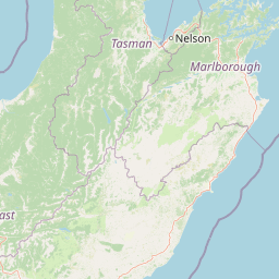
Map view of Victoria Forest Park

Use this park location map to pinpoint Victoria Forest Park in New Zealand, understand its exact geographic position, and read its mapped placement within the surrounding landscape more clearly.

Pigeon | © OpenStreetMap contributors

Location context for Victoria Forest Park

South Island

Explore protected area views, native beech forests, and rugged mountain terrain across New Zealand.

Victoria Forest Park Photos and Landscape Scenery Visual Guide

Examine detailed photographs showcasing the extensive native beech forests, alpine ridges, and river valleys defining Victoria Forest Park. Visual documentation reveals the rugged mountain terrain and protected habitats supporting rare indigenous wildlife throughout the region.

A dense, misty forest scene with tall, dark tree trunks and lush green undergrowth.

Park atlas

Compare adjacent West Coast reserves and connected mountain ranges

Parks Near Victoria Forest Park and Surrounding Protected Landscapes

Browse other protected areas near Victoria Forest Park to examine regional forest continuity and mountain terrain across the South Island. Comparing nearby conservation reserves reveals broader patterns in native beech ecosystems and protected landscapes.
National parkWest Coast Region
About 11 km away#1 closest

West

Paparoa National Park: Detailed Geographic Atlas of Karst Formations and Coastal Terrain

Discover protected landscape boundaries and unique New Zealand geology.

Paparoa National Park, located in the West Coast Region of New Zealand, offers a unique window into complex karst geology and dynamic coastal landscapes. This national park is characterized by extensive limestone cave systems, underground rivers, and the famous Pancake Rocks and Blowholes. The park's geography includes dramatic mountain terrain within the Paparoa Range and a striking coastline, providing a rich dataset for mapping protected area context and understanding regional natural features. It stands apart for its subterranean wonders and eroded limestone formations.

Area
429.7 km²
Established
1987
IUCN
II
Relief
Mountain
National parkNew Zealand
About 39 km away#2 closest

Northeast

Nelson Lakes National Park: Alpine Geography and Glacial Lakes Atlas

Explore New Zealand's protected mountain terrain and natural landscapes.

Nelson Lakes National Park provides a deep dive into a dramatic alpine environment situated at the northern edge of New Zealand's Southern Alps. This national park is characterized by its striking glacial lakes, Rotoiti and Rotoroa, and the extensive mountain ranges that surround them, offering a rich context for understanding protected land distribution. Explore the park's mapped geography, its distinct beech forest ecosystems, and the rugged natural terrain that makes it a significant feature within the broader South Island landscape.

Area
1,018.8 km²
Established
1956
IUCN
II
Relief
Mountain
A watercolor painting showing a panoramic view of lush green hills leading to a water feature, with soft-colored mountains in the background under a pale sky.
Marine protected areaWest Coast
About 47 km away#3 closest

West

Punakaiki Marine Reserve: Mapped Protected Waters and West Coast Geographic Context

Exploring marine habitats and coastal land-sea corridors

Punakaiki Marine Reserve provides a critical look at marine conservation geography in New Zealand. Located along the West Coast, the reserve encompasses a variety of seafloor substrates and coastal formations that define the boundary between the Tasman Sea and the rugged limestone landscapes of the region. This atlas entry provides essential context for understanding the reserve's role in linking terrestrial and marine ecosystems.

Area
35.2 km²
Established
2014
Relief
Lowland
Climate
Temperate
Watercolor painting of mountains, green valleys, and a winding river under a soft sky
National parkWest Coast Region
About 56 km away#4 closest

Northeast

Kahurangi National Park: A National Park of Ancient Geology and Diverse Protected Landscapes in New Zealand

Explore the mapped natural terrain and regional geographic context.

Kahurangi National Park is distinguished by its extraordinary geological diversity, representing New Zealand's finest Paleozoic rock sequence and expansive karst features. Covering a vast area in the West Coast Region, it protects a remarkable array of natural landscapes, from coastal cliffs and nikau palm forests to alpine tussock basins and deep gorges. This national park is crucial for understanding New Zealand's natural heritage, offering a rich tapestry of mapped terrain and protected biodiversity for dedicated geographic exploration.

Area
5,193 km²
Established
1996
IUCN
II
Relief
Mixed relief
Protected landscapeCanterbury
About 57 km away#5 closest

Southeast

Lake Sumner Forest Park: Geography and Protected Landscape Atlas for Canterbury

Mountainous river valleys and remote beech forests

Spanning over 100,000 hectares of the Canterbury high country, Lake Sumner Forest Park stands as a prime example of New Zealand's protected backcountry. This mapping resource details the park's river-carved terrain, subalpine fringes, and its role as a connective wilderness area between major South Island mountain ranges.

Area
1,051 km²
Relief
Mountain
Climate
Temperate
Access
Moderate access
National parkNew Zealand
About 60 km away#6 closest

South

Arthur's Pass National Park: Dramatic Alpine Protected Landscape in the Southern Alps

Explore the unique geography and mapped boundaries of this South Island national park.

Arthur's Pass National Park, a substantial protected area within New Zealand's Southern Alps, presents a compelling focus for geographic and atlas exploration. Characterized by dramatic alpine terrain shaped by ancient glacial forces, the park exhibits a striking ecological contrast between its drier eastern beech forests and wetter western rainforests. Users can delve into the mapped park boundaries and understand the regional landscape context of this unique protected area, making it a key destination for understanding New Zealand's natural geography.

Area
1,184.7 km²
Established
1929
IUCN
II
Relief
Mountain
Protected landscapeMarlborough Region
About 98 km away#7 closest

Northeast

Mount Richmond Forest Park: Geography and Protected Landscapes in the Marlborough Region

Expansive native bush and mountain peak terrain

Mount Richmond Forest Park stands as one of the largest protected forest areas on the South Island of New Zealand. Dominated by dense native bush and rugged subalpine ridges, the park offers a complex topography of river valleys and high-altitude peaks, including its namesake Mount Richmond. It serves as a vital conservation landscape and a core segment of the regional geography between Nelson and the Marlborough district.

Area
1,659 km²
Established
1977
Relief
Mountain
Scope
Terrestrial
A soft watercolor illustration featuring a panoramic view of rolling green hills, distant mountains, a meandering stream, and wildflowers in the foreground.
Protected landscapeSouth Island
About 108 km away#8 closest

South

Craigieburn Forest Park: Protected Alpine Landscape and Southern Alps Geography

High country terrain from beech forests to alpine ridges.

Situated along the eastern flanks of the Southern Alps, Craigieburn Forest Park offers a complex mountain geography that serves as both a recreational hub and an ecological restoration zone. The area features a clear transition from beech-clad valley floors and glacial terraces to wide tussock basins and craggy summits, providing a detailed look at the diverse natural terrain of the Canterbury region.

Area
446.948 km²
Established
1967
Relief
Mountain
Climate
Alpine

Common questions about visiting, size, designation, and location context for Victoria Forest Park

Victoria Forest Park FAQs for park facts, access, geography, and protected area context

Find quick answers about Victoria Forest Park, including protected-area facts, park geography, trail and visitor context, and how the park fits into its surrounding country and regional landscape.
MoriAtlas Explorer

Continue Your Protected Areas Search Across the Global Atlas

Deepen your exploration by continuing the structured search for national parks and protected areas worldwide. Utilize the comprehensive filtering capabilities to compare different conservation landscapes and refine your understanding of global park geography. Discover more about the distribution and characteristics of protected natural areas.

Global natural geography