Mori Atlas logo
National parkWashington-Slagbaai National Park

Analyzing the diverse terrain, saline wetland systems, and coastal boundaries of Bonaire's northern wilderness

Washington-Slagbaai National Park: A Comprehensive Geographic Atlas of Bonaire Protected Landscapes

Washington-Slagbaai National Park serves as the primary terrestrial protected area on the island of Bonaire, encompassing 5,643 hectares of diverse arid habitat. This geographic index covers the park's distinct transition from rocky coastal shorelines and mangrove systems to the inland saline complexes of Goto and Slagbaai. The terrain reaches its highest point at Brandaris, providing a critical vantage point for understanding the island's unique limestone geography and long-standing plantation heritage.

Caribbean national parkisland parkcoastal dunesmangrovessalinassalt lakes
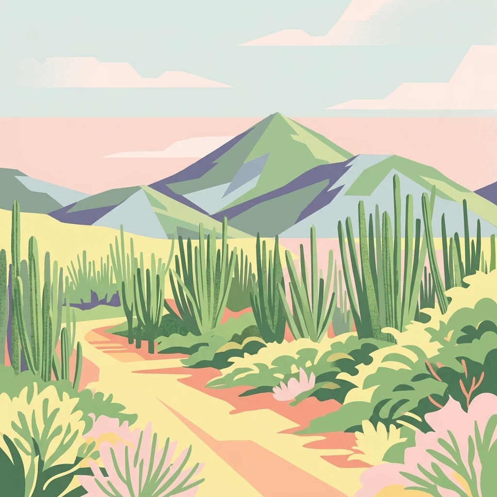
A stylized flat-design illustration of a desert landscape featuring a trail through cacti and shrubs leading to a central mountain peak under a pastel sky.

Washington-Slagbaai National Park

National park

Park overview

Structured park overview, official facts, and landscape profile for Washington-Slagbaai National Park

Washington-Slagbaai National Park park facts, protected area profile, and essential visitor context

Review the core facts for Washington-Slagbaai National Park, including designation, size, terrain, visitor scale, habitats, and operating context in one park-focused overview.

About Washington-Slagbaai National Park

Washington-Slagbaai National Park occupies the northwestern corner of Bonaire, the second-largest of the so-called ABC islands in the southern Caribbean. Stretching from coastal dunes and rocky shores inland across mangrove-lined lagoons and dry woodland, the park represents a substantial share of the island's natural land area not devoted to urban development or salt industry operations. Its roughly 5,643 hectares include the territory of the former Washington Plantation as well as the natural harbor of Slagbaai, giving the park both ecological and historical significance.

The park's landscape is unusually varied for such a small island. Visitors moving from one end of Washington-Slagbaai to the other encounter shifting environments: sandy beaches and dunes along the shoreline, mangrove fringes where freshwater seeps meet the sea, broad salt flats that attract wading birds, and interior hills crowned by the Brandaris. This diversity is the product of Bonaire's geological history, much of which is shaped by ancient coral limestone, former seabeds, and a dry tropical climate that has produced both arid scrubland and concentrated hypersaline wetlands.

Ecologically, Washington-Slagbaai serves as a critical refuge for wildlife on an island where natural habitat is constrained by salt pans, residential development, and former plantation lands. The park's salinas are internationally recognized under the Ramsar Convention, which has highlighted their importance for flamingos and migratory waterbirds since 1971. On land, the park shelters a flora of around 340 species and provides habitat for protected parrots, seabirds, and reptiles. Because of this combination of habitats and long-standing protection, Washington-Slagbaai is considered the terrestrial counterpart to Bonaire's globally known marine park system.

The park is also a place of cultural memory. The visitor center at the entrance interprets the layered history of land use on the former Washington estate, connecting the protected landscape today to centuries of plantation agriculture, salt extraction, and local habitation. Managed by STINAPA, the National Parks Foundation Bonaire, the park balances conservation of these natural and cultural values with low-impact public access, offering an entrance point into Bonaire's broader network of protected areas.

Quick facts and research context for Washington-Slagbaai National Park

Washington-Slagbaai National Park lies in the northwest of Bonaire, a Caribbean island that is part of the Kingdom of the Netherlands. The protected area encompasses about 5,643 hectares and was established in 1969, making it Bonaire's first national park. Two of its salt lakes, Slagbaai and Goto, were designated as Ramsar wetlands in 1971, underscoring their international ecological importance.

Protection and recognition

Documented protected area designations and Ramsar wetland recognition records.

Washington-Slagbaai National Park Protection Status and International Recognition

Washington-Slagbaai National Park holds official international recognition as a documented Ramsar wetland site within its protected area boundaries. Structured conservation records outline the verified designation history and management framework associated with the reserve.
Park context

Deeper park guide and search-rich context for Washington-Slagbaai National Park

Washington-Slagbaai National Park history, landscape, wildlife, and travel context

Explore Washington-Slagbaai National Park through its history, landscape character, ecosystems, wildlife, conservation priorities, cultural context, and seasonal travel timing in a structured park guide built for atlas discovery and search intent.

Why Washington-Slagbaai National Park stands out

Washington-Slagbaai is best known for its combination of Caribbean coastal landscapes and inland salinas. The park's salt lakes are famous gathering and breeding grounds for flamingos, while the surrounding dunes, mangroves, and dry forests reflect the character of a small island environment where marine, wetland, and arid habitats meet within a relatively compact area. Just as distinctive is the park's historical layering, since the protected zone was built around the former Washington Plantation, with its old salt pans and the natural harbor of Slagbaai. The presence of the Brandaris, Bonaire's highest peak, adds a striking topographic element to an otherwise flat island, making the park a reference point for understanding Bonaire's overall natural geography.
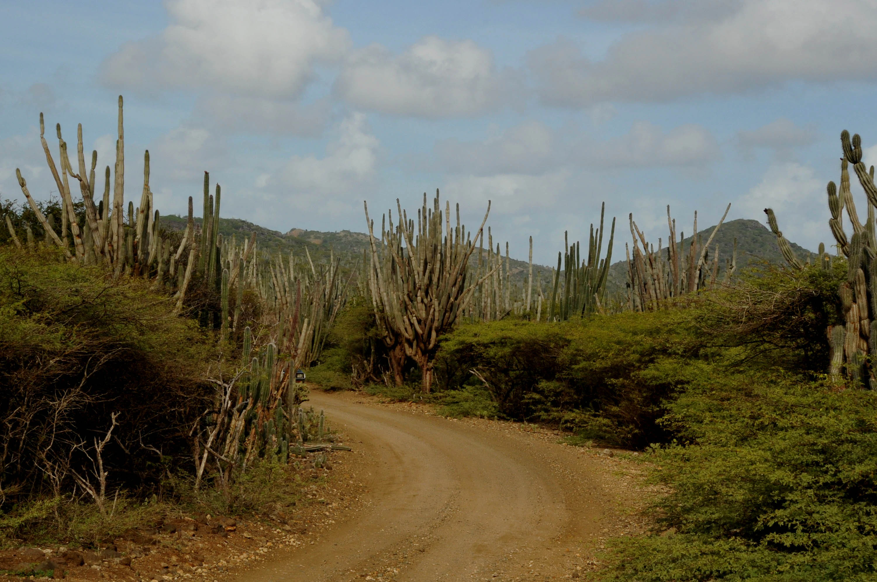
A curving dirt road through a dry landscape in Washington-Slagbaai National Park, surrounded by tall candle cacti and scrubby vegetation with hills in the background under a blue sky.
A dirt road winds through the arid, cactus-filled landscape of Washington-Slagbaai National Park.

Washington-Slagbaai National Park history and protected-area timeline

Washington-Slagbaai National Park was established in 1969, making it Bonaire's first national park and one of the earliest terrestrial protected areas in the Dutch Caribbean. Its creation reflected a growing recognition that the island's most ecologically valuable lands, including the former Washington Plantation and the natural harbor of Slagbaai, needed formal protection from further agricultural and industrial pressure.

The cultural history embedded in the park goes back considerably further. The area had long been in use as agricultural land, with the Washington Plantation shaping much of the inland terrain. Salt production operations also left a lasting imprint on the landscape, particularly through the salt pans that today form the park's famous salinas. These same salinas of Slagbaai and Goto were designated as internationally important wetlands under the Ramsar Convention in 1971, just two years after the park's founding, cementing the area's conservation status on the international stage.

In more recent decades, management has been handled by STINAPA, the National Parks Foundation Bonaire, which also administers the surrounding Bonaire National Marine Park. The visitor center at the entrance was developed to interpret the area's plantation history and its transition into a protected natural landscape. Conservation programs within the park have also worked to protect species such as the yellow-shouldered amazon parrot, whose local population has recovered since the late 2000s following restrictions on illegal capture for the pet trade.

Washington-Slagbaai National Park landscape and geographic character

Washington-Slagbaai's landscape is defined by the meeting of Caribbean coast and arid interior. Along its northern edge, the park features sandy beaches, dunes, and rocky shorelines that frame the clear waters of the sea. Moving inland, the terrain transitions into mangrove wetlands, where salt-tolerant trees grow along the edges of lagoons and tidal channels that connect to the ocean.

The heart of the park is dominated by salinas, broad, shallow salt lakes whose bright surfaces and pale shorelines are visually striking against the surrounding scrubland. Slagbaai and Goto are the two main saline systems, their high salinity levels creating a unique environment that supports specialized plants and serves as a feeding and breeding ground for flamingos. These salt flats are among the most recognizable features of the park and give it much of its visual character.

Beyond the wetlands, the park covers dry woodland and low scrub typical of Bonaire's limestone interior. The terrain gradually rises toward the south, culminating in the Brandaris, the highest point on Bonaire at 241 meters. From the slopes and summit of the Brandaris, visitors gain wide views across the island's flat interior, the salinas, and the surrounding Caribbean Sea, providing a rare sense of elevation and scale in an otherwise low-lying island geography.

Washington-Slagbaai National Park ecosystems, habitats, and plant life

The natural environment of Washington-Slagbaai reflects the broader ecology of the ABC islands, where a dry tropical climate, porous limestone substrate, and exposure to Caribbean weather have produced a mosaic of specialized habitats. The park holds approximately 340 plant species, representing a high degree of botanical diversity given the relatively compact area and arid conditions. Many of the plant families recorded in the park are represented by only a single species, indicating a flora that includes many endemic or geographically restricted lineages.

A defining feature of the park's nature is the coexistence of three very different habitats. Dunes and beaches along the coast support salt-tolerant grasses and pioneer shrubs adapted to shifting sands and salt spray. Mangrove fringes provide sheltered environments for crustaceans, juvenile fish, and nesting birds, while also stabilizing the interface between marine and terrestrial zones. Inland salinas create hypersaline environments where only specialized vegetation can survive, yet where large concentrations of flamingos and shorebirds find rich feeding grounds.

Washington-Slagbaai National Park wildlife and species highlights

Washington-Slagbaai is best known for its flamingo populations, which are strongly associated with the park's salinas such as Slagbaai and Goto. These salt lakes offer shallow water and abundant invertebrate prey, and specific zones have been set aside as protected nesting areas where flamingos can build their mud nests without disturbance. The flamingos of Bonaire are among the most studied Caribbean populations, and the park's wetlands play a central role in their ongoing conservation.

Beyond flamingos, the park supports a wide range of resident and migratory shorebirds, seabirds, and land birds across its varied habitats. Mangroves shelter herons and other wading birds, while coastal and open-water areas attract terns and pelicans. Among the park's most distinctive resident species is the yellow-shouldered amazon parrot, a protected parrot whose chicks have historically faced heavy pressure from egg predators such as rats and feral cats, as well as from human capture for the pet trade. Following international protection under CITES and local conservation efforts, the population of this parrot has shown signs of recovery since around 2008.

The park's reptiles, insects, and smaller fauna also contribute to its ecological character, occupying dry woodland, scrub, and shoreline habitats. The combination of arid land species, wetland specialists, and coastal birds gives Washington-Slagbaai a layered wildlife profile that matches the diversity of its landscapes.

Washington-Slagbaai National Park conservation status and protection priorities

As Bonaire's first national park, Washington-Slagbaai has long been central to the island's conservation framework. Its establishment in 1969 laid the groundwork for a broader network of protected areas that today includes marine parks around Bonaire and protected zones on neighboring islands. The park's conservation value was further reinforced in 1971, when the salinas of Slagbaai and Goto were recognized under the Ramsar Convention as internationally significant wetlands, placing the area among the first Ramsar sites in the Caribbean.

The park's protected status covers a remarkable concentration of habitats within a small footprint, from dunes and mangrove to dry forest and salt lakes. This range makes it a critical refuge for native flora and fauna that would otherwise be threatened by habitat loss, salt industry expansion, or development. The presence of the Brandaris, Bonaire's highest point, also adds a conservation dimension tied to watershed function and inland habitat integrity.

Active conservation within the park includes habitat protection for flamingo nesting sites, measures to safeguard the yellow-shouldered amazon parrot, and broader biodiversity monitoring coordinated by STINAPA, the National Parks Foundation Bonaire. The park is therefore not only a scenic destination but also a working conservation area whose ecological importance is formally recognized both locally and through international agreements.

Washington-Slagbaai National Park cultural meaning and human context

Washington-Slagbaai carries a strong cultural imprint from its origins as part of the former Washington Plantation. The land that now forms the core of the park was historically shaped by plantation agriculture, salt extraction, and the local use of Slagbaai, the natural harbor whose name translates roughly as 'bay of slaughter' or 'slaughter bay.' These layers of human activity have left traces in the landscape, particularly in the form of salt pans, plantation ruins, and altered vegetation patterns.

The visitor center near the park entrance was developed to present this layered history alongside the natural interpretation of the area's ecosystems, reflecting the intertwined relationship between human land use and contemporary conservation on Bonaire. Papiamentu, the local Creole language, is part of the park's cultural geography, visible in the local-language name Parke Nashonal Washington Slagbaai. Today the park is understood as both a natural and a cultural landscape, where the history of the plantation era is preserved alongside the island's natural heritage.

Top sights and standout views in Washington-Slagbaai National Park

Among Washington-Slagbaai's standout features are its internationally protected salinas, which combine striking scenery with major ecological value for flamingos and other waterbirds. The presence of the Brandaris, Bonaire's highest peak, adds a unique topographic dimension to a national park located on a generally flat island. The park's origin in the historic Washington Plantation also gives it an unusually rich cultural dimension, weaving together natural beauty and human history in a single protected landscape.

Best time to visit Washington-Slagbaai National Park

Washington-Slagbaai can be appreciated throughout the year, but the dry season, generally spanning the earlier months of the year, tends to offer clearer skies, drier roads through the park's dirt tracks, and concentrated wildlife viewing around the salinas as water levels stabilize. The rainy season, which typically arrives later in the year, brings more vegetation, greener landscapes, and changing waterbird activity in the salinas, though unpaved routes through the park can become more difficult after heavy showers. Most flamingo activity is centered around the salinas year-round, with nesting behavior tied to conditions in the salt lakes. Early morning visits offer cooler temperatures and the most active birdlife, while the late part of the day tends to feature softer light over the dunes, salinas, and the slopes of the Brandaris.
Monthly climate preview

Long-term representative point measurements tracking monthly temperature and precipitation rhythm

Washington-Slagbaai National Park Climate Normals and Annual Weather Patterns

Washington-Slagbaai National Park records sustained warm monthly temperatures alongside measurable shifts in precipitation totals across the representative coordinate. Reviewing the complete twelve-month climatology profile provides deeper analytical insight into long-term environmental patterns.
Annual mean27 °C
26 °C29 °C
Jan27°
Feb26°
Mar26°
Apr27°
May27°
Jun28°
Jul28°
Aug28°
Sep29°
Oct28°
Nov28°
Dec27°
Warmest month
September

28.5 °C

Coolest month
February

26.2 °C

Wettest month
November

3.1 mm/day

Driest month
March

0.3 mm/day

Park location guide

Geography guide, regional context, and park location map for Washington-Slagbaai National Park

Washington-Slagbaai National Park park geography, regions, and map view in Caribbean Netherlands

Understand where Washington-Slagbaai National Park sits in Caribbean Netherlands through a broader geographic reading of the surrounding landscape, nearby location context, and its mapped position within the national park landscape.

How Washington-Slagbaai National Park fits into Caribbean Netherlands

The Caribbean Netherlands (Dutch: Caribisch Nederland) is a geographic region of the Netherlands located outside Europe in the Caribbean. It is made up of three special municipalities known as the BES islands: Bonaire, Sint Eustatius, and Saba. The region has a population of around 31,980 and a total area of 322 square kilometres. Although legally part of the country of the Netherlands, the islands are classified as overseas territories of the European Union, meaning most EU law does not automatically apply there.

Wider geography shaping Washington-Slagbaai National Park in Caribbean Netherlands

The Caribbean Netherlands is located in the Caribbean Sea, outside the European part of the Netherlands. Bonaire, including the islet Klein Bonaire, is part of the Leeward Antilles and sits close to the coast of Venezuela. Sint Eustatius and Saba lie in the main Lesser Antilles group, south of Sint Maarten and northwest of Saint Kitts and Nevis.

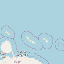
Map view of Washington-Slagbaai National Park

Use this park location map to pinpoint Washington-Slagbaai National Park in Caribbean Netherlands, understand its exact geographic position, and read its mapped placement within the surrounding landscape more clearly.

Pigeon | © OpenStreetMap contributors

Location context for Washington-Slagbaai National Park

Bonaire
Recorded earthquake history

Review Recorded Seismic Events Near Washington-Slagbaai National Park

Examine the historical record of earthquakes documented within the proximity of Washington-Slagbaai National Park. This catalogue offers a clear, data-driven perspective on regional seismic activity by mapping recorded events against the unique island geography of Bonaire.

Washington-Slagbaai National Park Earthquake History

Catalogued events

1 event

Strongest magnitude

Magnitude 4

Most recent event

Jun 3, 2013

This history includes earthquakes recorded inside the park or within 50 km of its borders

Visual reference for coastal dunes, inland salinas, and protected island habitats

Washington-Slagbaai National Park Photos and Landscape Scenery

Visual documentation captures the diverse terrain and protected habitats of Washington-Slagbaai National Park, ranging from coastal wetlands to arid interior scrublands. Examining park imagery reveals the distinctive landscape character shaped by shallow salt lakes, mangrove systems, and limestone elevations.

A curving dirt road through a dry landscape in Washington-Slagbaai National Park, surrounded by tall candle cacti and scrubby vegetation with hills in the background under a blue sky.

A landscape view showing a dirt path leading through a field of tall, vertical cacti, with arid, rolling green hills in the background under a cloudy sky.

Park atlas

Compare adjacent island reserves and connected coastal landscapes.

Parks Near Washington-Slagbaai National Park and Regional Protected Areas

Browse other parks and protected areas near Washington-Slagbaai National Park to study related coastal habitats and island geography. Comparing regional wildlife refuges expands geographic context across surrounding conservation zones.
Watercolor painting of a landscape featuring green trees, hills, and cacti under a light blue sky
National parkCuracao
About 76 km away#1 closest

West

Christoffelpark National Park: Curacao's Volcanic Terrain and Protected Landscape Atlas

Explore mapped boundaries and unique dry forest ecosystems.

Christoffelpark represents Curacao's most vital protected natural area, offering a deep dive into its unique geography and landscape. This national park preserves the island's highest peak, Christoffelberg, alongside distinctive dry forest ecosystems, endemic species, and the remnants of colonial plantations. Explore the mapped terrain, understand the regional context, and appreciate the rich natural and cultural heritage that defines this important protected landscape on Curacao.

Area
10.4 km²
Established
1978
IUCN
II
Relief
Mixed relief
National parkVenezuela
137 km away#2 closest

South

Morrocoy National Park: Venezuela's Coastal National Park with Distinct Protected Geography

Explore the mapped protected landscape and regional context.

Morrocoy National Park stands as a key protected area within Venezuela, offering a distinct focus for geographic exploration. As a national park, its mapped boundaries delineate a significant natural landscape critical for understanding regional conservation and the country's broader atlas of protected lands. Discover the unique geographic characteristics and the atlas-driven context of this important Venezuelan protected area.

Area
320.9 km²
Established
1974
IUCN
II
Relief
Mixed relief
National parkVenezuela
147 km away#3 closest

East

Archipiélago Los Roques National Park: Venezuela's Caribbean Marine Protected Landscape Explorer

Mapped coral reefs, protected islands, and Caribbean geography.

Archipiélago Los Roques National Park is a critical national park in Venezuela, safeguarding a remarkable archipelago in the Caribbean Sea. The park's landscape is defined by its vibrant coral reef systems, pristine white-sand beaches, and diverse marine habitats. Users can explore the geographic extent of this protected marine area, understanding its importance for conservation and its unique position within the southern Caribbean's natural geography.

IUCN
II
Climate
Tropical
Scope
Marine
Water
Water-dominated
National parkFalcón State
151 km away#4 closest

Southwest

Médanos de Coro National Park: Venezuela's Unique Arid Landscape and Protected Dune System

Explore the mapped geography of this coastal desert in Falcón State.

Médanos de Coro National Park represents a remarkable protected area within Venezuela's Falcón State, renowned for its spectacular and active sand dune systems. This national park encompasses approximately 91 square kilometers of unique terrain, including large sand formations, salt marshes, and mangrove swamps, contributing to its designation as a key conservation site for arid coastal ecosystems. Users can explore the park's distinctive landscape, understand its geographic context, and discover the patterns of wind-sculpted dunes that define this Venezuelan national park.

Area
91 km²
Established
1974
IUCN
II
Relief
Lowland
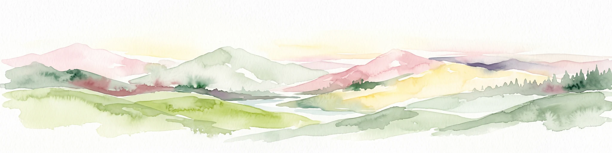
A watercolor painting showing a wide, panoramic view of rolling green hills, distant mountains in shades of pink and muted green, and clusters of evergreen trees against a white background.
National parkAruba
About 165 km away#5 closest

West

Arikok National Park: Mapping the Protected Landscapes and Geological Features of Northern Aruba

Exploring the terrain, coastal cliffs, and cultural heritage of Aruba's premier reserve.

Spanning over 7,000 acres, Arikok National Park forms the core of Aruba's conservation landscape. The park showcases a complex geological story, from the ancient volcanic Aruba Lava Formation and Batholith to the younger, porous limestone plateaus of the south. This protected zone provides a vital refuge for endemic species such as the Aruban rattlesnake and burrowing owl, while preserving layered cultural remnants from Arawak petroglyphs to early gold mining ruins.

Area
32 km²
Established
2000
IUCN
II
Visitors
10K annual
National parkVenezuela
About 168 km away#6 closest

Southwest

Cueva de la Quebrada del Toro National Park: Venezuelan National Park Protected Landscape

Explore its mapped boundaries and regional geographic context.

This page details Cueva de la Quebrada del Toro National Park, highlighting its status as a national park within Venezuela. Understand the park's geographic setting, its role as a protected landscape, and its mapped presence within the country's natural reserves. It provides essential context for exploring its protected boundaries and regional significance for atlas-based discovery.

Area
48.85 km²
Established
1961
IUCN
II
Relief
Upland
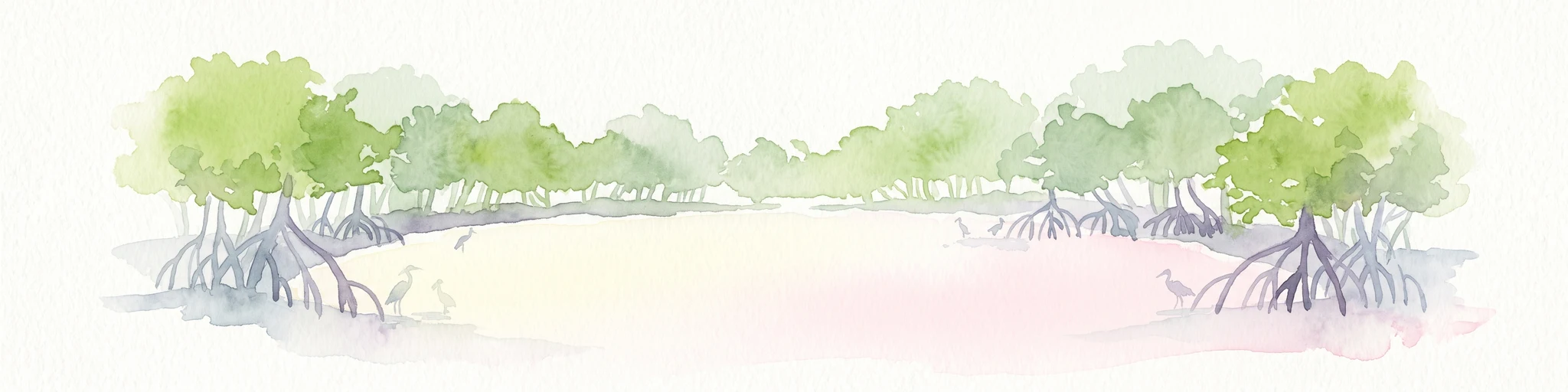
Watercolor painting of mangrove trees with exposed prop roots lining a sandy shore.
Marine protected areaAruba
About 170 km away#7 closest

West

Marine Park Aruba: An Atlas of Protected Coastal Waters and Marine Conservation Zones

Mapping the four-part reserve network across the island coastline

Marine Park Aruba consists of four separate marine protected areas that safeguard the most ecologically significant coastal waters of the island. The reserves protect a diverse array of marine landscapes, ranging from calm mangrove lagoons and seagrass beds to intricate fringing coral reefs. This data-driven overview tracks the park boundaries and regional distribution of these critical Caribbean habitats.

Area
60.2 km²
Established
2019
Relief
Lowland
Climate
Tropical
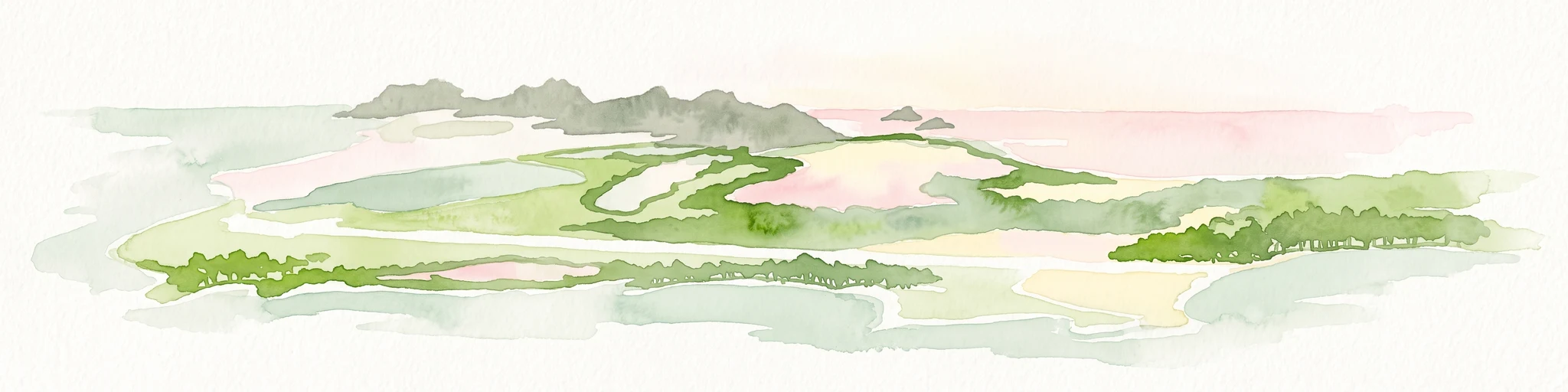
A wide watercolor illustration showing green islands and vegetation surrounded by pale water, with distant grey hills and a soft pink sky.
National parkDependencias Federales
About 175 km away#8 closest

East

Parque nacional Archipiélago de Los Roques: Caribbean Coral Atoll and Marine Protected Area

Mapping the reef architecture and maritime geography of the Dependencias Federales

Explore the expansive marine geography of Parque nacional Archipiélago de Los Roques, a massive protected coral atoll system. This unique environment features vibrant reef barriers, extensive seagrass meadows, and shallow turquoise lagoons that define one of the Caribbean's most significant conservation zones.

Area
2,112 km²
Established
1972
IUCN
II
Relief
Lowland

Common questions about visiting, size, designation, and location context for Washington-Slagbaai National Park

Washington-Slagbaai National Park FAQs for park facts, access, geography, and protected area context

Find quick answers about Washington-Slagbaai National Park, including protected-area facts, park geography, trail and visitor context, and how the park fits into its surrounding country and regional landscape.
MoriAtlas Explorer

Continue Your Protected Areas Search Across the Global Atlas

Deepen your exploration by continuing the structured search for national parks and protected areas worldwide. Utilize the comprehensive filtering capabilities to compare different conservation landscapes and refine your understanding of global park geography. Discover more about the distribution and characteristics of protected natural areas.

Global natural geography