
Why Werra bis Treffurt mit Zuflüssen stands out
The area is especially known for protecting Thuringia's largest continuous population of the European bullhead, a small bottom-dwelling fish, and for its exceptional significance for the brook lamprey, a jawless fish dependent on clean gravelly streams. It is also recognized for the river's unusual status as Germany's longest flowing brackish watercourse, a direct result of more than a century of potash mining in the Werra potash region. Equally distinctive are the Werra floodplain landscapes with inland salt sites, dissolution lakes, oxbows and species-rich meadows. The protected section connects source brooks in the slate highlands with lowland river valleys that link to the natural regions of the eastern Hessian Highlands and the Lower Werra Highland, combining upland, lowland and floodplain habitats in a single long Natura 2000 corridor.
Werra bis Treffurt mit Zuflüssen history and protected-area timeline
The protection history of Werra bis Treffurt mit Zuflüssen is closely tied to the European Union's Natura 2000 program. In June 2004 the Thuringian Ministry for the Environment proposed the area for designation. The proposal was then forwarded through the German Federal Ministry for the Environment to the European Commission. In November 2007 the site was confirmed as a Site of Community Importance, and in July 2008 it was formally incorporated into the EU's transnational network of special areas of conservation, whose goal is to maintain biological diversity.
Following the Thuringian proposal, the German Federal Agency for Nature Conservation required a border adjustment with the neighboring state of Hesse. This was addressed through the creation of the Hessian FFH area Werra zwischen Philippsthal und Herleshausen, which protects the river sections that cross into Hesse. Combined with the Thuringian "Thüringer Natura 2000-Erhaltungsziele-Verordnung" of 29 May 2008, this completed the formal legal protection framework on both sides of the border.
Management planning began with field surveys: the forest portion was documented by ThüringenForst's forestry research center in Gotha with a reference date of 1 January 2018, while the open-land portion, the meadows, water bodies and floodplain habitats, was surveyed between April 2018 and November 2019 by a consortium led by RANA and INL. Within the EU Water Framework Directive, the Werra downstream of the Schwaba confluence was classified as a focal waterway for connectivity, and between 2004 and 2008 many weirs below the Grimmelshausen dam were made passable, fish passes were installed, and some weirs were dismantled, although hydropower facilities still present fish-protection challenges. The long-term ecological state of the river, however, continues to reflect more than a century of potash mining discharges, which have made the Werra Germany's longest flowing brackish waterway.
Werra bis Treffurt mit Zuflüssen landscape and geographic character
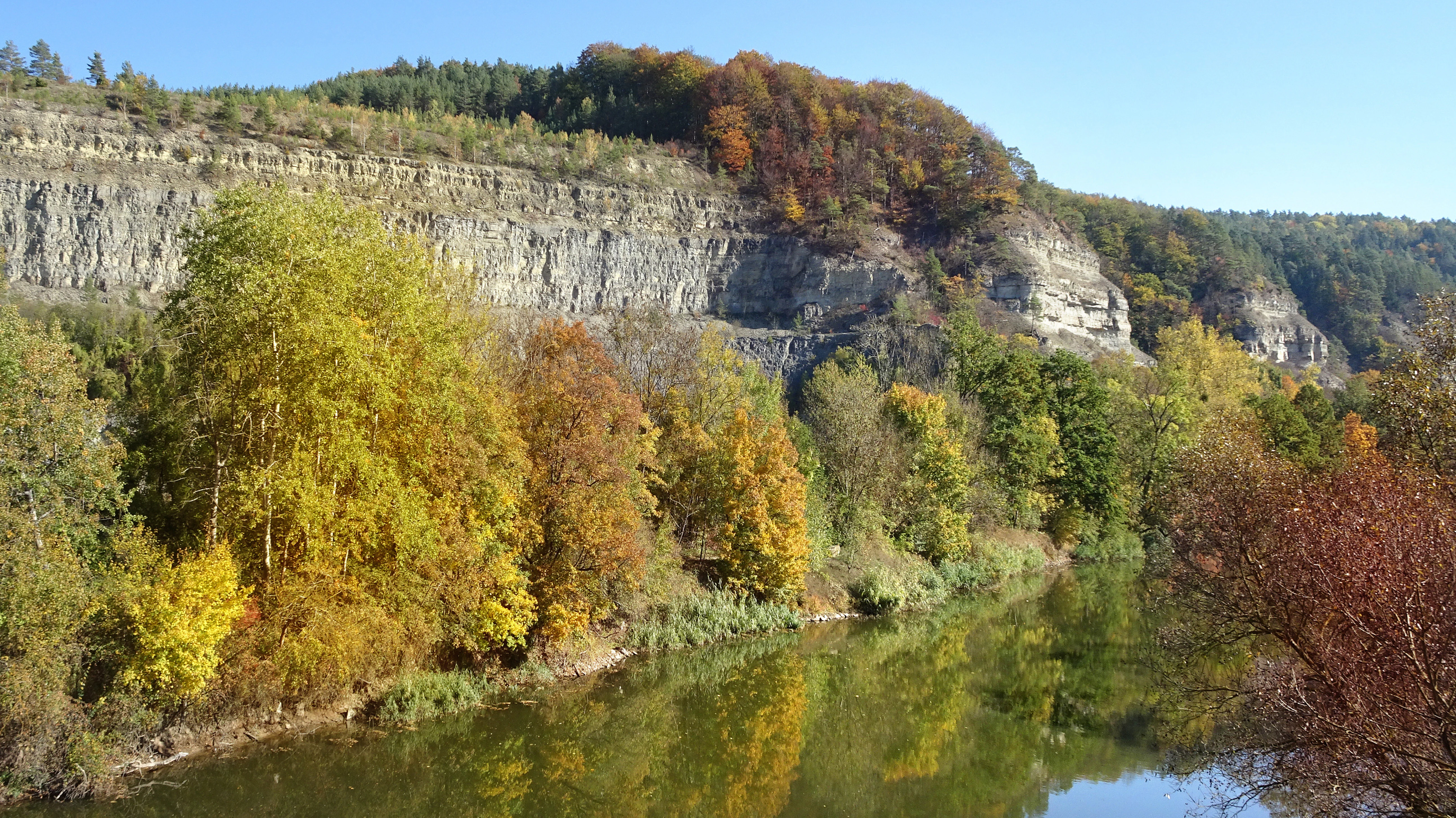
The protected landscape follows the long course of the Werra from a highland source to a lowland exit near the Hessian border. In its upper section, in the Thuringian Slate Mountains, the protected area covers steep forested valleys with flat moors in the valley floors, fast-flowing mountain brooks, and source meadows. Near Leutersdorf and Vachdorf, the terrain rises into limestone country marked by near-vertical cliff faces, karst features, and the Meininger Kalkplatten.
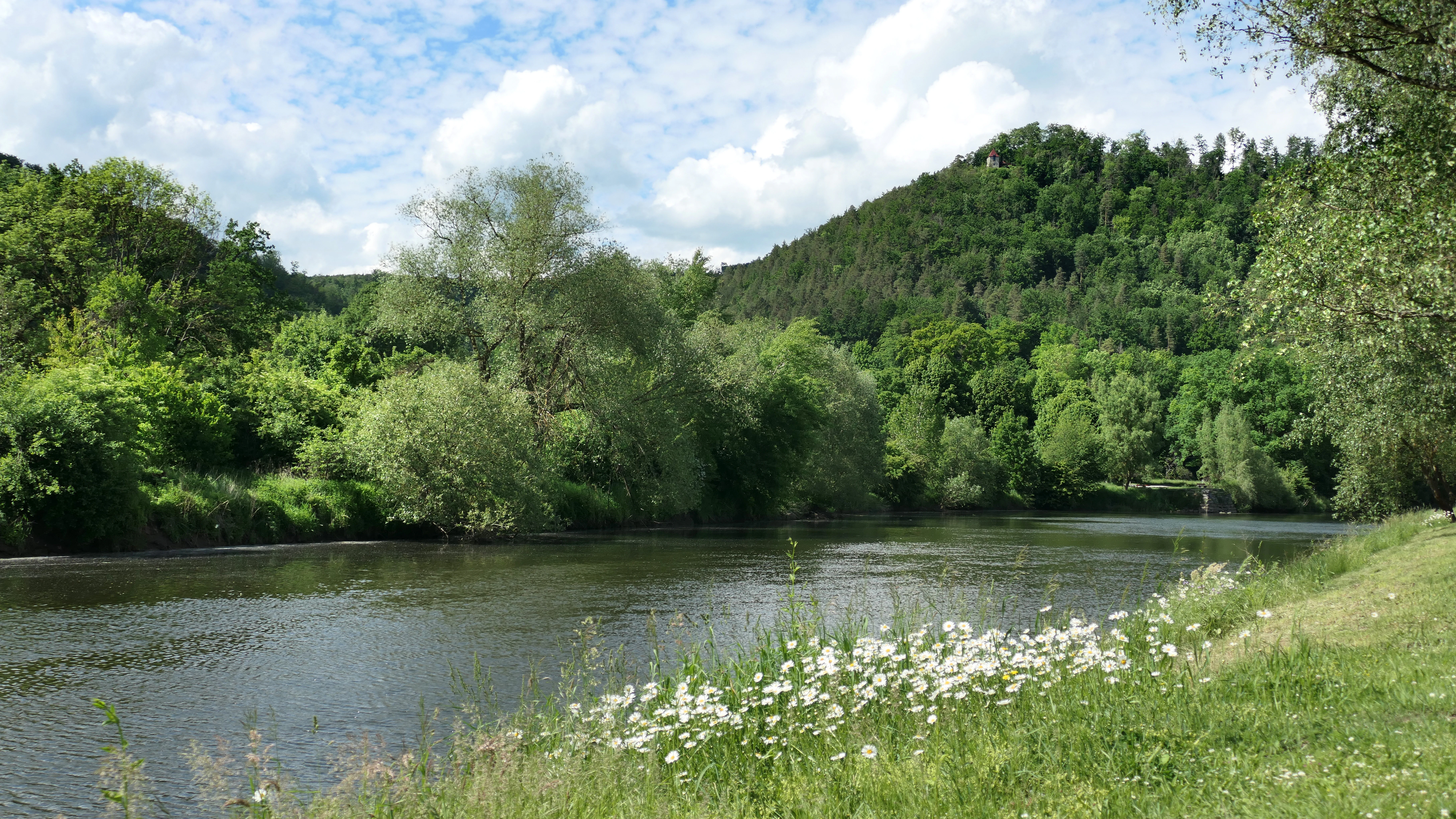
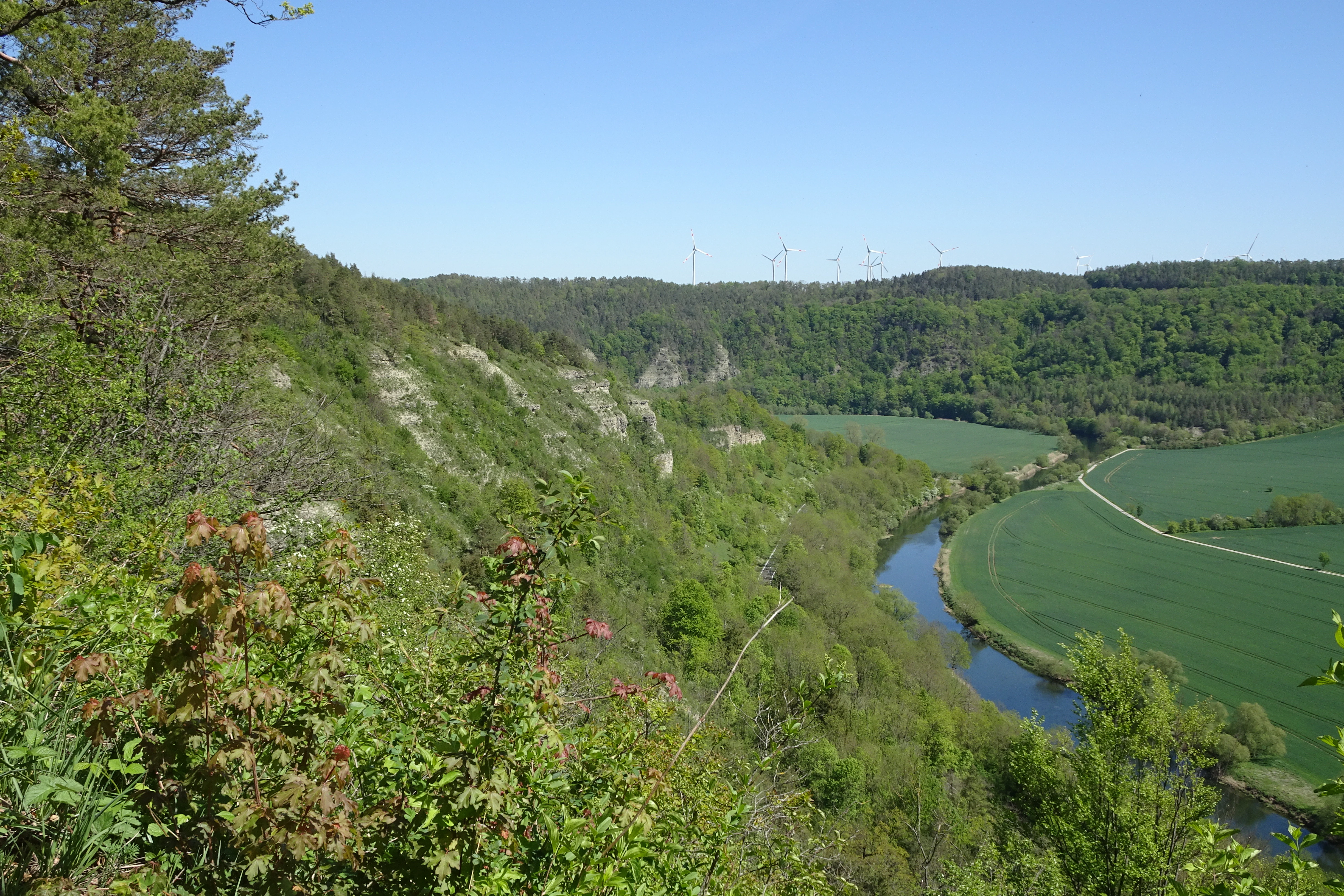
Downstream, the Werra flows through the southern foreland of the Thuringian Forest, where the landscape transitions into the Buntsandstein woodland and meadow mosaic of South Thuringia. Around Bad Salzungen and the Salzunger Werrabergland, the river widens into a floodplain containing inland salt sites, amphibia-rich meadows, and a complex of dissolution lakes, oxbows and wet forests. Near Heldra and Treffurt the river cuts between steep wooded slopes, the Ebenauer Köpfe and the Heldrastein, before reaching the national border.
The tributaries tracked by the site, including the Schleuse, Biber, Herpf, Katza, Rosabach and Schwarzbach, each add their own landscape character: deeply incised gorges near Schleusingen and Schwarzbach, the meadow floodplains near Vacha, the wooded slopes of the Hembachwald, and the karst-influenced valleys around Meiningen. The interplay of medium-mountain forest, lowland meadow and floodplain mosaics makes this one of the most landscape-diverse river-based Natura 2000 corridors in central Germany.
Werra bis Treffurt mit Zuflüssen ecosystems, habitats, and plant life
Ecologically, the site represents a transect through multiple Central European habitat zones within a single river system. Wetland and aquatic types are central: nutrient-poor standing waters with stonewort algae, nutrient-rich standing waters with pondweed, gypsum-karst lakes, flowing waters with rich aquatic vegetation, and rivers with mud banks. In the upper course, small flat mires occur in valley bottoms in a complex with upland hay meadows.
The grassland component is unusually rich for a river-based protected area. It includes tall-herb floodplain vegetation along banks and gravel bars, nutrient-rich meadows of the flatland variety distributed almost throughout the area, and upland hay meadows in the slate mountains and the Thuringian Forest. Inland salt sites, shaped by the natural leaching of salt-bearing strata and reinforced by centuries of potash mining discharges, are a rare ecological feature and support specifically adapted plant and insect communities.
The forest habitats span from lowland oak-hornbeam forests of the Labkraut type and slope-ravine mixed forests, to Hainsimsen beech forest, Waldmeister beech forest, orchid-rich beech forest on limestone, and high-altitude spruce forest in the slate mountains. Six habitat types in the area are classified as "priority" under the Habitats Directive: inland salt sites, orchid-rich calcareous dry grasslands, species-rich Nardus grasslands, calcareous scree slopes of the medium mountains, slope and ravine mixed forests, and alder-ash softwood floodplain forests. Beyond habitat type diversity, the inland salt sites, karst pools, and lowland salt meadows set the area apart as a habitat for halophilic species rarely found elsewhere in the region.
Werra bis Treffurt mit Zuflüssen wildlife and species highlights
The site's designated wildlife values are strongly shaped by freshwater species. The Werra and its tributaries within the FFH area host Thuringia's largest coherent population of the European bullhead, a small bottom-dwelling fish that demands clean, gravel-rich water. Equally important is the area's significance for the brook lamprey, a representative of the jawless fishes whose life cycle relies on clean gravelly stretches and free migration.
Amphibians are another focus. The yellow-bellied toad, classified in Thuringia as critically endangered, and the northern crested newt, considered threatened, find habitat in the area's ponds, oxbows and floodplain waters. The European otter, considered lost in Thuringia from the mid-1970s, has been steadily recolonizing and is documented for the Werra between Harras and Vacha, though it is currently stagnant in its lower distribution in this area.
Among bats, the area supports Bechstein's bat, the Barbastelle, the pond bat, the lesser horseshoe bat, and the greater mouse-eared bat, all strictly protected species on Germany's Red Lists. The dark large blue butterfly, dependent on the presence of great burnet meadows and specific host ants, occurs in scattered open-land sections, while the Spanish moth (Russischer Bär) is recorded regionally within the area. Since the management plan surveys, the European beaver, originating from reintroduction projects in Bavaria and Hesse, is now firmly established along the Werra in Thuringia and continues to spread, adding a large mammal to the area's resident fauna.
Werra bis Treffurt mit Zuflüssen conservation status and protection priorities
From a conservation perspective, the FFH area's main purpose is to secure the long-term ecological integrity of the Werra river system in Thuringia as part of the European Union's Natura 2000 network. The area aims to preserve the Werra's near-natural sections from the source regions with their flat mires all the way to the Thuringian-Hessian border, with emphasis on Thuringia's largest populations of the European bullhead, the brook lamprey, and the presence of the European otter.
Additional conservation targets include the inland salt sites, oxbows and standing waters inhabited by stonewort algae and amphibians such as the yellow-bellied toad and the northern crested newt; extensive hay meadows and inland salt sites that host the dark large blue butterfly; and the rich bat fauna of Bechstein's, Barbastelle, pond and lesser horseshoe bats. A second tier of priority habitats, including orchid-rich calcareous dry grasslands, scree slopes, slope and ravine forests, and alder-ash floodplain forests, reflects the European Union's particular responsibility for habitat types considered threatened across Europe.
The site overlaps with multiple other protection categories, which strengthen its conservation significance. It overlaps with parts of two nature parks, the Thuringian Forest and Eichsfeld-Hainich-Werratal; the UNESCO biosphere reserves of the Thuringian Forest and the Rhön; landscape protection areas covering around 20 percent of the FFH area; four Bird Protection Areas covering roughly 51 percent of the area; fourteen distinct nature reserves; and the Green Belt along the former inner-German border. The most pressing conservation challenge is the river's heavy salinity load from more than a century of potash mining in the Werra potash region: although buffer basins in the Hessian operations aim to align salt discharges with river flow, chloride and total salt concentrations remain far above the European Water Framework Directive targets, and the ecological state of the Werra is classified as poor. Restoring longitudinal connectivity is a parallel focus, with numerous hydromorphological barriers still in place and many hydropower sites lacking adequate fish protection.
Werra bis Treffurt mit Zuflüssen cultural meaning and human context
The Werra has long been a defining feature of the cultural and economic life of Thuringia and northern Hesse. The protected section captures a stretch of river that has shaped villages such as Fehrenbach, Sachsenbrunn, Schleusingen, Meiningen, Bad Salzungen, Vacha, Berka, Gerstungen, Creuzburg and Treffurt, many of which grew around mills, bridges, salt works and small-scale farming along the floodplain. The river's role as one of the two headwaters of the Weser, joining the Fulda to form Germany's longest river system flowing to the North Sea, gives it a deep cultural resonance beyond the immediate region.
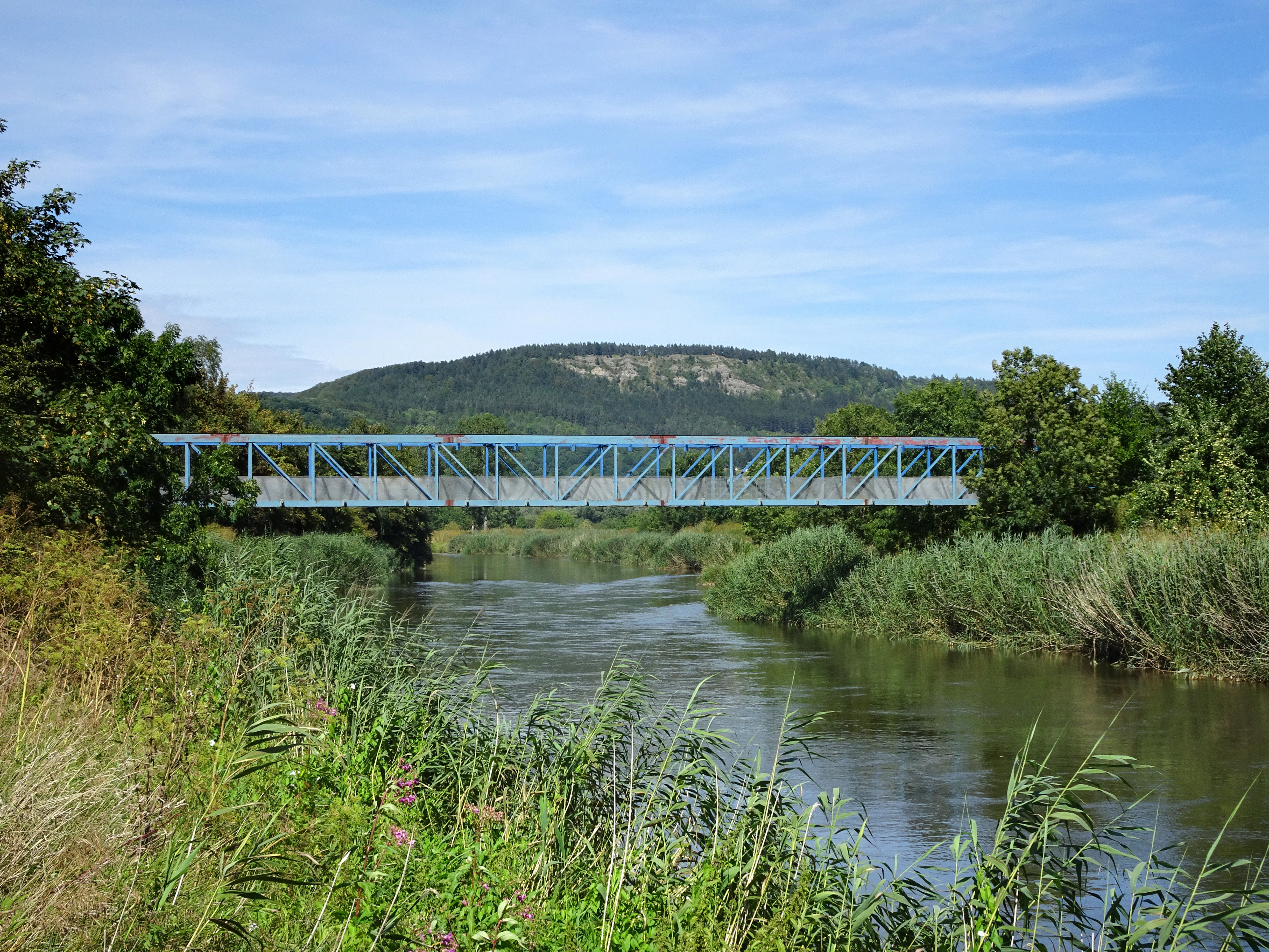
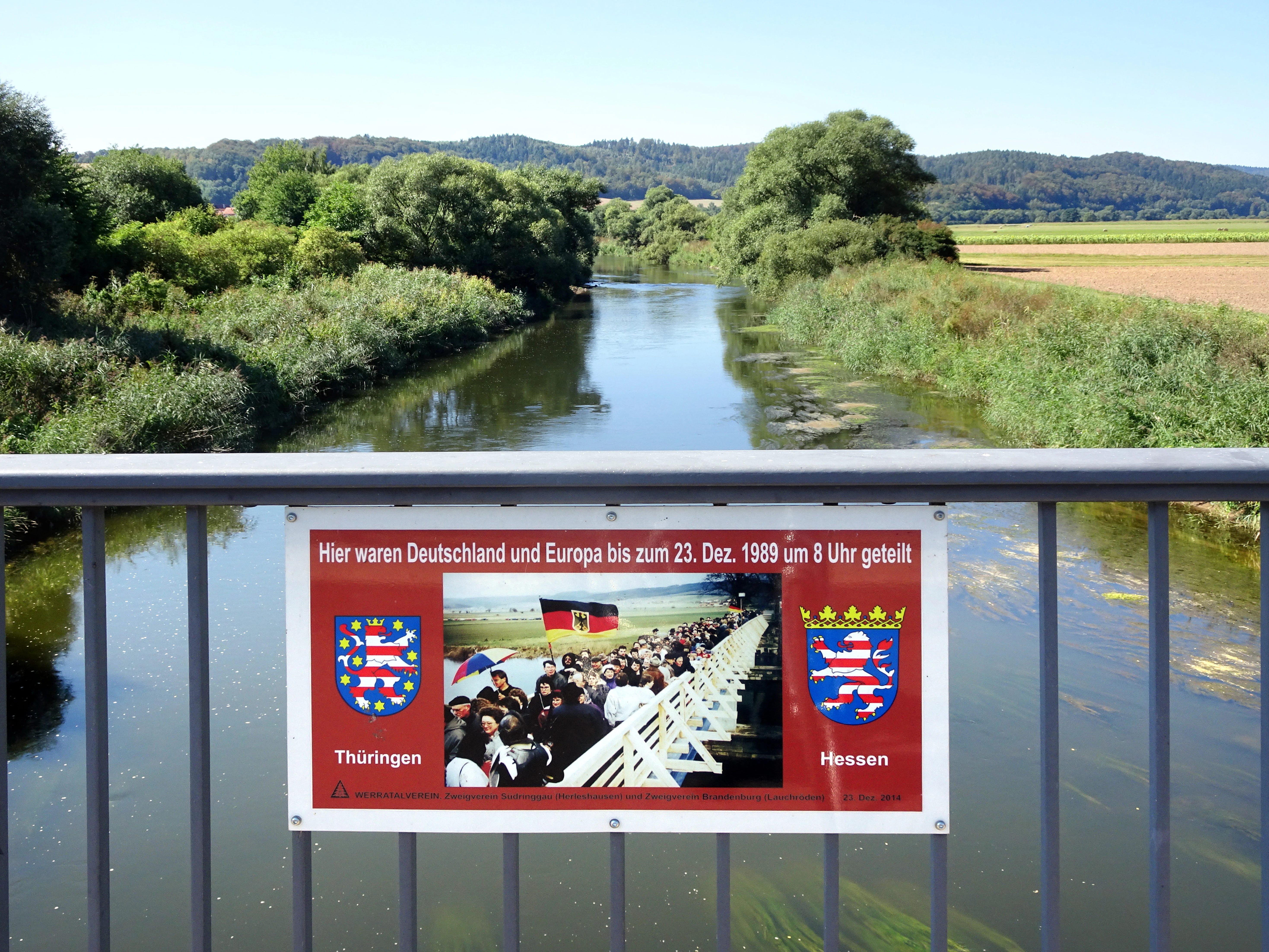
The cultural context is also shaped by recent history. Sections of the area in northern Thuringia run along the former inner-German border, and the eastern side of the Green Belt has been integrated into the core zone of the National Natural Monument known as the Green Belt Thuringia. Former border installations at Treffurt, for example, have been transformed into a bridge for walkers and cyclists, blending Cold War heritage with contemporary landscape experience. The long presence of the potash mining industry in the Werra potash region since the 19th century has shaped both the economy of the wider Werra valley and the river's ecological character, leaving an enduring mark on local identity and on the conservation challenges facing the river today.
Top sights and standout views in Werra bis Treffurt mit Zuflüssen
The site's strongest features include its exceptional length as a river-based Natura 2000 corridor, covering roughly 191 km of the Werra course within Thuringia, and its protection of multiple tributaries and connected floodplain complexes. It is the most important site in Thuringia for the European bullhead and a critical site for the brook lamprey, while also hosting a returning population of the European otter and a firmly established beaver population.
Its inland salt sites, gypsum-karst lakes, and halophilic meadows make it an unusual ecological island within central Germany. The combination of high-mountain source moors, mid-elevation beech and mixed forests, limestone cliffs, lowland meander floodplains and softly sloped softwood floodplain forests creates a striking landscape transect in a single protected area. Overlaps with nature parks, biosphere reserves, fourteen nature reserves, and the Green Belt along the former inner-German border give the site an unusually strong layered protection framework and a high degree of cultural-historical resonance.
Best time to visit Werra bis Treffurt mit Zuflüssen
The Werra valley and the protected landscape change character through the year, and the choice of season depends on what kind of experience is desired. Spring brings high water, fresh greens along the meadows and woodlands, and rising amphibian activity around the floodplain ponds. Late spring and early summer are typically the best time to see flowering hay meadows, including the great burnet stands that are linked to the dark large blue butterfly's life cycle, and to enjoy warm-weather cycling on the Werratal-Radweg, the well-developed long-distance cycling route that parallels the river.
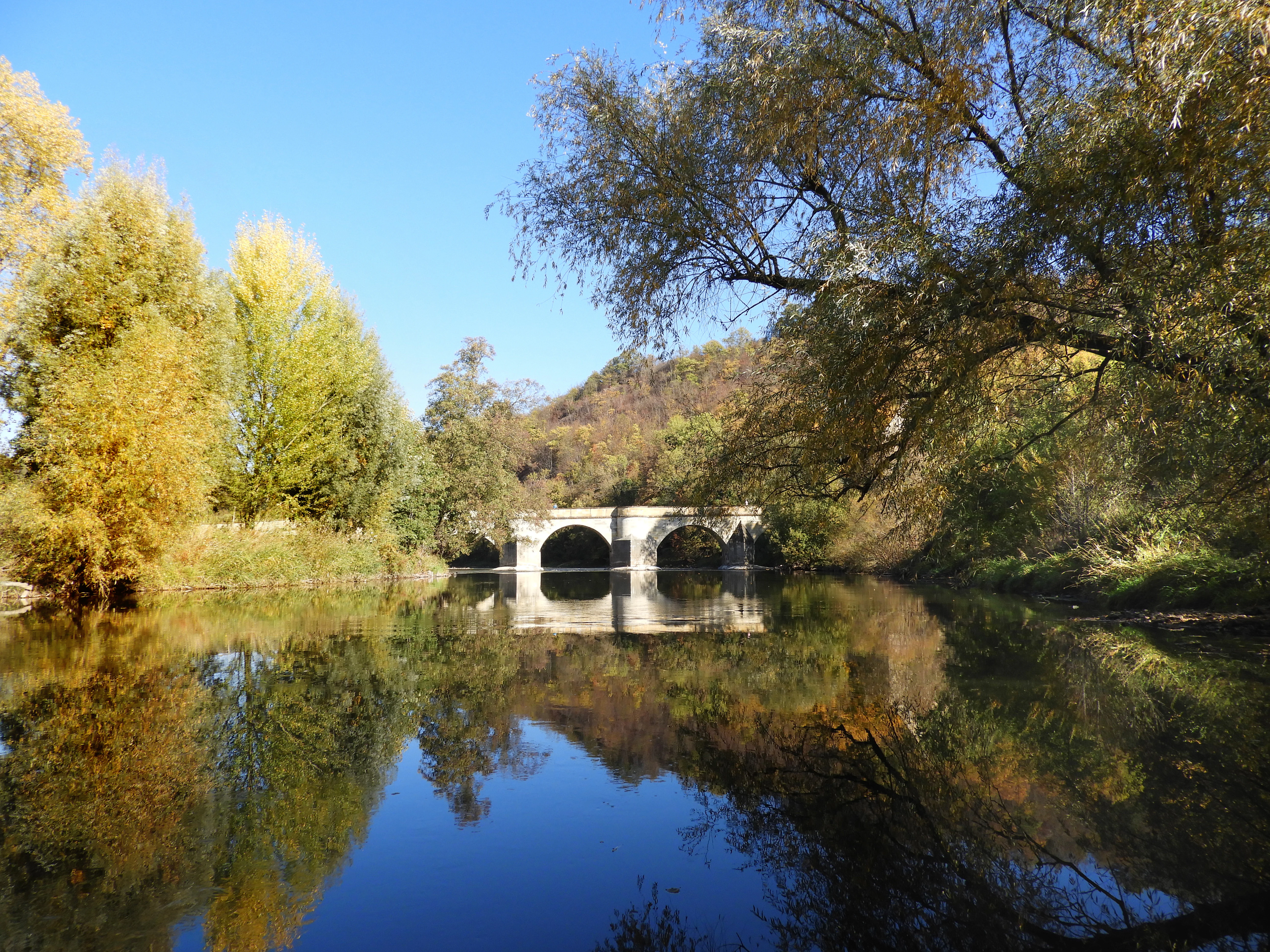
Summer offers the warmest conditions for walking the riverside trails, canoeing on slower sections of the Werra, and exploring the cliff sections and forested gorges. Autumn brings forest color in the beech and mixed mountain forests, lower water levels and good visibility for birdwatching along the oxbows, inland salt sites and meadows. Winter is generally quieter, with frost on the floodplain meadows and bare deciduous stands providing clearer views through the wooded gorges, though some hamlets along the Werratal-Radweg may have limited seasonal services, and weather along the slate highlands can be harsh. As the area is non-operational, planning visits is largely a matter of choosing seasons suited to landscape, wildlife, and outdoor activity preferences rather than park-specific opening hours.