
Mori Atlas logo
Nature reserveWerraaue Treffurt

A vital Green Belt wetland habitat shaped by river valley sediments and post-industrial ecological recovery

Werraaue Treffurt Nature Reserve: Mapped Protected Floodplain Landscapes and River Valley Geography

(Naturschutzgebiet Werraaue Treffurt)

Werraaue Treffurt serves as a protected floodplain landscape within the Wartburgkreis district, where the Werra river transitions between distinct geological zones. This nature reserve, established upon abandoned gravel pits, features a mosaic of reedbeds, riparian woodlands, and marshy zones that function as a critical stepping stone in the national Green Belt corridor. The site represents decades of undisturbed ecological succession along the former inner-German border, providing essential terrain for diverse waterbirds and amphibians within a compact valley basin.

floodplainriparian wetlandreedbedsgravel-pit lakesriver valleyGreen Belt corridor
A digital illustration of a scenic valley with a river, a waterfall in the distance between cliffs, and trees in the foreground.

Werraaue Treffurt

Nature reserve

Park overview

Structured park overview, official facts, and landscape profile for Werraaue Treffurt

Werraaue Treffurt park facts, protected area profile, and essential visitor context

Review the core facts for Werraaue Treffurt, including designation, size, terrain, visitor scale, habitats, and operating context in one park-focused overview.

About Werraaue Treffurt

Werraaue Treffurt is a small but ecologically rich nature reserve lying at the point where the Werra river exits the Thuringian Basin and enters the broader Buntsandstein lowlands of the eastern Hessian uplands. The widening of the Werra valley at this point, shaped by centuries of sediment deposition and the underground leaching of Zechstein salt layers, created a naturally broad floodplain that became attractive both for traditional gravel extraction and, after that extraction ceased, for wetland regeneration. Today, the area is recognized as one of the most valuable small floodplain refuges in the western Thuringian Werra region.

The floodplain's modern character is inseparable from its border history. From the 1950s through the late 1980s, the area was sealed off as part of the inter-German border zone, including a five-hundred-meter-wide protective strip running along the Werra itself. This extended period of restricted access spared the floodplain from agricultural intensification, recreational pressure, and extensive gravel winning, allowing reedbeds, marshy sedge communities, and natural riparian woodland to mature with minimal disturbance. The border regime also turned the old gravel pits into inaccessible, hidden waters that continued to evolve as quiet wetland habitats behind the Iron Curtain.

The reserve is embedded in a layered system of conservation designations. It is a Thuringian nature reserve, part of the Eichsfeld-Hainich-Werratal Nature Park, and a component of the Werra bis Treffurt mit Zuflüssen Natura 2000 site. It also forms an ecological unit with the neighbouring Frankenloch bei Heldra reserve on the Hessian side of the river, and is formally recognized as part of the Grünes Band, Germany's national nature monument along the former border. Together these designations underline the floodplain's importance both as habitat and as a connective landscape element linking protected areas along the Werra.

Quick facts and research context for Werraaue Treffurt

Werraaue Treffurt is a nature reserve of 68.5 hectares in the Wartburgkreis district of Thuringia, declared officially in June 1995 with the internal designation 208 and WDPA code 166254. The reserve occupies the floor of the Lower Werra valley where the river leaves the Thuringian Basin and enters the Buntsandstein lowlands, at elevations between roughly 171 and 180 meters. Its wetland character was preserved through decades of border-zone restrictions that kept the floodplain inaccessible to most human activity, allowing reedbeds, marshland, and gravel-pit lakes to develop naturally.

The reserve is also part of the Natura 2000 network through the Werra river corridor, lies within the larger Eichsfeld-Hainich-Werratal Nature Park, and forms a cross-border protected unit together with the Frankenloch bei Heldra nature reserve on the Hessian side. Its standing within Germany's national Green Belt nature monument reflects its role as a connective habitat node in a heavily fragmented cultural landscape.

Protection and recognition

Documented terrestrial protection scope and baseline conservation records

Werraaue Treffurt Protection Status and International Recognition Data

Werraaue Treffurt maintains a documented terrestrial protection status within official conservation databases. Structured records outline the baseline designation framework and management scope associated with the protected landscape.

Protection details

Protection scope
Terrestrial
Transboundary protection
No
WDPA ID
166254
Park context

Deeper park guide and search-rich context for Werraaue Treffurt

Werraaue Treffurt history, landscape, wildlife, and travel context

Explore Werraaue Treffurt through its history, landscape character, ecosystems, wildlife, conservation priorities, cultural context, and seasonal travel timing in a structured park guide built for atlas discovery and search intent.

Why Werraaue Treffurt stands out

The floodplain is best known as one of the restored wetland refuges along the former Iron Curtain, where decades of restricted access along the inner-German border produced an unusually intact river landscape. Quiet, shallow gravel-pit lakes bordered by reeds and willow-alder galleries now shelter breeding waterbirds, amphibians, and a rich invertebrate community that depends on transitional wet habitats. Equally defining is the floodplain's role as a stepping stone in Germany's Green Belt corridor, where it links protected stretches of the Werra valley across the Thuringia-Hessia border. The combination of restored gravel-pit waters, extensive reedbed, and undisturbed riparian woodland gives the area a distinctive profile that mixes industrial afterlife, border history, and ecological recovery into a single landscape.
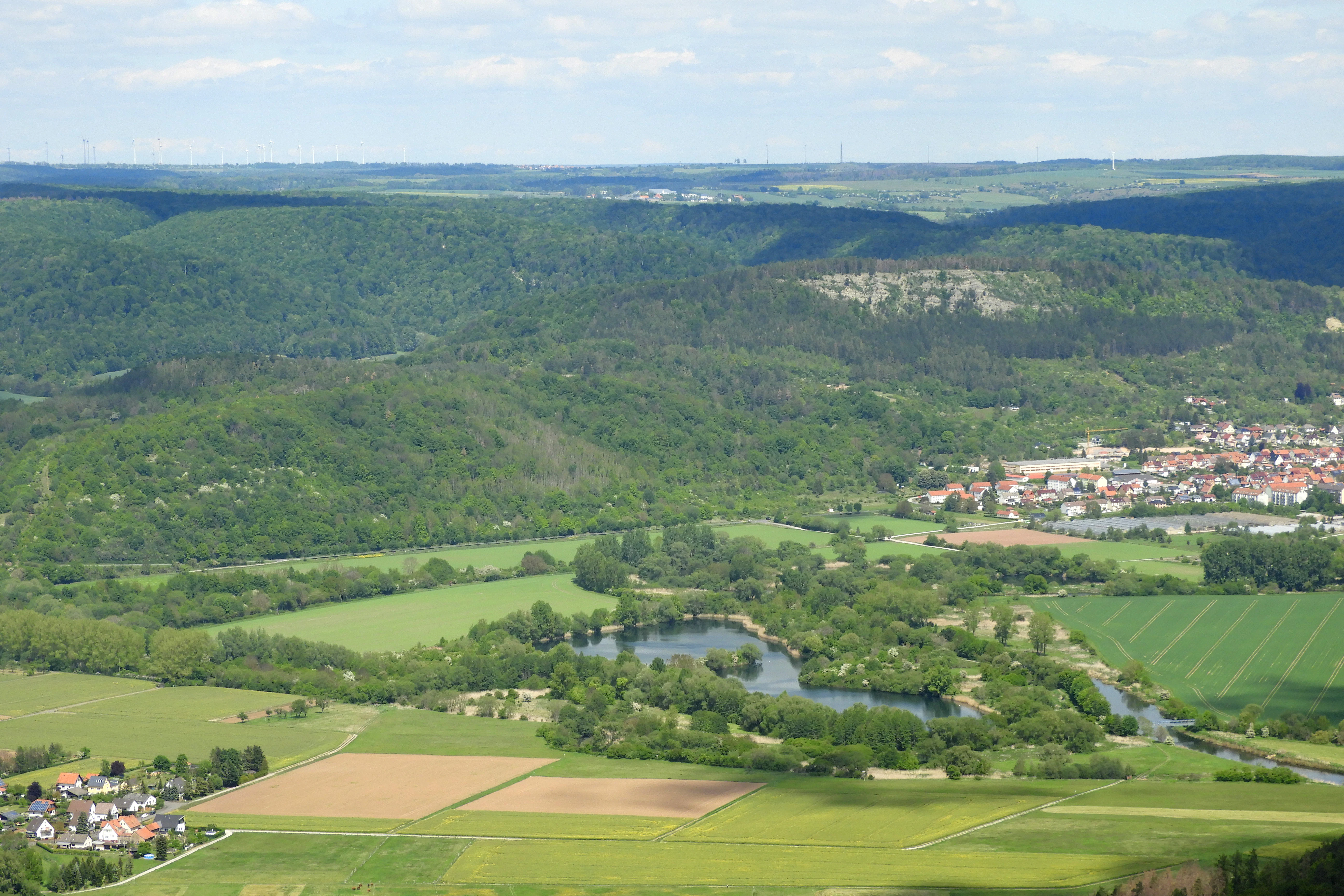
An expansive high-angle view of a river valley with a winding river, small lakes, agricultural fields, and a distant small town framed by rolling green forested hills.
A panoramic aerial view of the Werra river floodplain, showcasing the mosaic of wetlands, green fields, and surrounding forested hills.

Werraaue Treffurt history and protected-area timeline

The Werra floodplain at Treffurt was historically shaped by two parallel processes: gravel extraction that created new waters, and a long period of border protection that kept those waters undisturbed. Gravel winning in the area began at least six decades before protection, with the earliest pits in the northeastern part of the floodplain already abandoned by the mid-twentieth century. A further pit in the southern part of the area was worked through the 1980s, after which it also began to revert to a more natural state.

In the 1950s, the East German authorities established a five-kilometer-wide military exclusion zone along the inner-German border, including a five-hundred-meter protective strip, which cut off the Treffurt floodplain from most public use. The local gravel-pit lakes were known locally as the most important waters for Treffurt's anglers, yet during the border years they were inaccessible to the wider public. Restricted access preserved the incipient wetland character of the area and allowed plant succession to develop without the usual pressures from farming, fishing, or recreation.

Protection came officially on 1 June 1995, when the Thuringian state administrative office designated the area as a nature reserve under the internal code 208. The river channel itself, a roughly one-kilometer stretch of the Werra, was incorporated in its full width into the reserve. The floodplain was subsequently included in the Werra bis Treffurt mit Zuflüssen Fauna-Flora-Habitat area proposed in 2004, and in 2007 was confirmed and added to the Natura 2000 network in 2008. Alongside these designations, the floodplain became part of the Eichsfeld-Hainich-Werratal Nature Park, secured through the Thuringian Nature Park Ordinance of 7 December 2011. In November 2018, the Thuringian Landtag and, in January 2023, the Hessian Landtag declared the Green Belt a national nature monument, embedding Werraaue Treffurt more firmly into that corridor. The history of the site is therefore a rare example of a post-industrial floodplain whose ecological value owes much to nearly four decades of political isolation.

Werraaue Treffurt landscape and geographic character

The floodplain occupies a broad segment of the Werra valley where the river transitions between two very different geological regions. South of the floodplain, the Heldrastein rises as a prominent ridge of Triassic limestone, marking the edge of the Thuringian Basin's Muschelkalkrandplatten. North and east, the land rises into the Wanfrieder Werrahöhen and the Creuzburger Werradurchbruch, forming the textbook setting of a river cutting through concentric geological strata. Together these features give the floodplain a clearly framed character, sitting in a basin-like widening of the valley where the floor flattens out into wetland.

The floodplain floor itself is built from post-glacial alluvial deposits laid down by the Werra and its tributaries. These sediments, sourced from the Thuringian Forest and from Triassic landscapes further upstream, accumulated to thicknesses of up to six meters. Gravel extraction exploited these deposits over many decades, leaving behind a chain of small lakes in the northeastern part of the reserve and a further lake in the south. The water levels in these former gravel pits are tied directly to the groundwater of the Werra, with surface levels typically lying up to two meters below the level of the surrounding floodplain soils.

The transition from riverbank to higher ground creates layered vegetation zones that emphasize the wetland character of the floodplain. Along the Werra and around the older pits, multi-layered riparian woodlands dominated by willows and black alder line the water's edge. Shallow margins grade outward into extensive reedbeds and large-sedge marsh, while drier ground supports tall-herb communities and ruderal vegetation rich in flowering plants. To the south, the landscape closes in around the Heldrastein and the associated ridge scenery, while to the north the two surviving railway embankments act as visual and acoustic shields from the nearby B 250 road, preserving a sense of relative quiet across the floodplain.
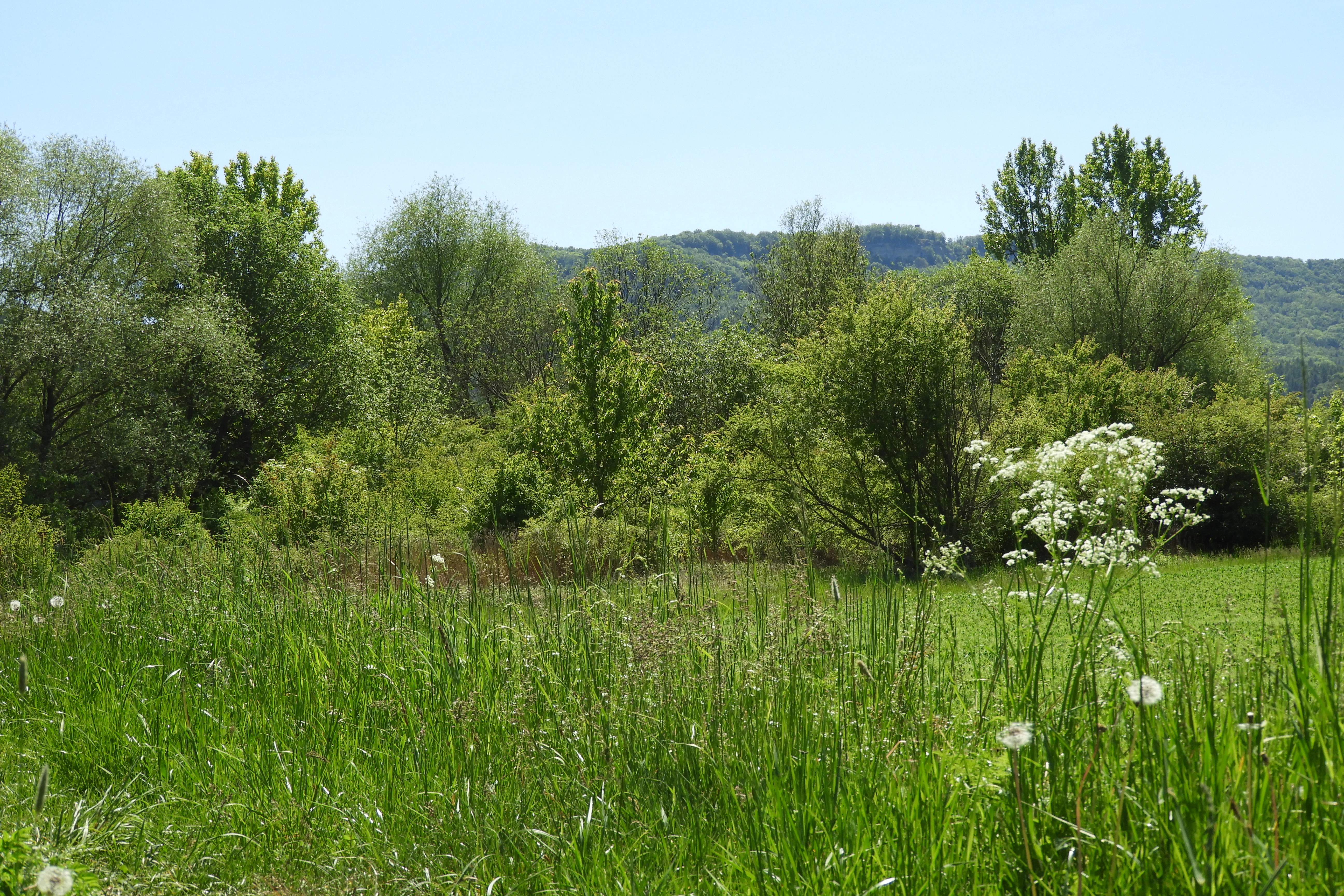
A wide view of a green meadow with wild grasses and white wildflowers in the foreground, with trees and a forested hillside in the background under a clear sky.
The Werraaue near Treffurt landscape, featuring lush riverside vegetation and meadow habitats.

Werraaue Treffurt ecosystems, habitats, and plant life

The floodplain combines several wetland habitat types in close proximity, producing an unusually rich transitional landscape for an inland area. The most visually dominant habitats are the large reedbeds and the great-sedge marsh communities that ring the former gravel-pit lakes and colonize the shallow shorelines. These reedbeds provide the structural backbone of the reserve and support many of its characteristic bird and insect species.

Riparian woodland fringes much of the water's edge, with willows and black alder forming the dominant woody layer along the Werra itself and around the older pits. Between these wooded strips and the reedbeds, wet meadows, tall-herb communities, and ruderal vegetation form a mosaic of open habitats rich in flowering plants and seeds. These open habitats are particularly important for pollinators and seed-eating birds, and they link the wet core of the floodplain with the broader Werra valley landscape.

The hydrology of the area is closely tied to the Werra itself. Water levels in the old gravel-pit lakes rise and fall with the regional groundwater, interlocking the still-water habitats with the running river. This close linkage supports a high diversity of dragonflies and other aquatic invertebrates, while the surrounding wet meadows and reeds provide breeding cover for amphibians. The combination of standing waters, flowing river, reedbeds, marshland, riparian woodland, and tall-herb vegetation gives the floodplain a layered structure that functions as a wetland complex rather than a single habitat.
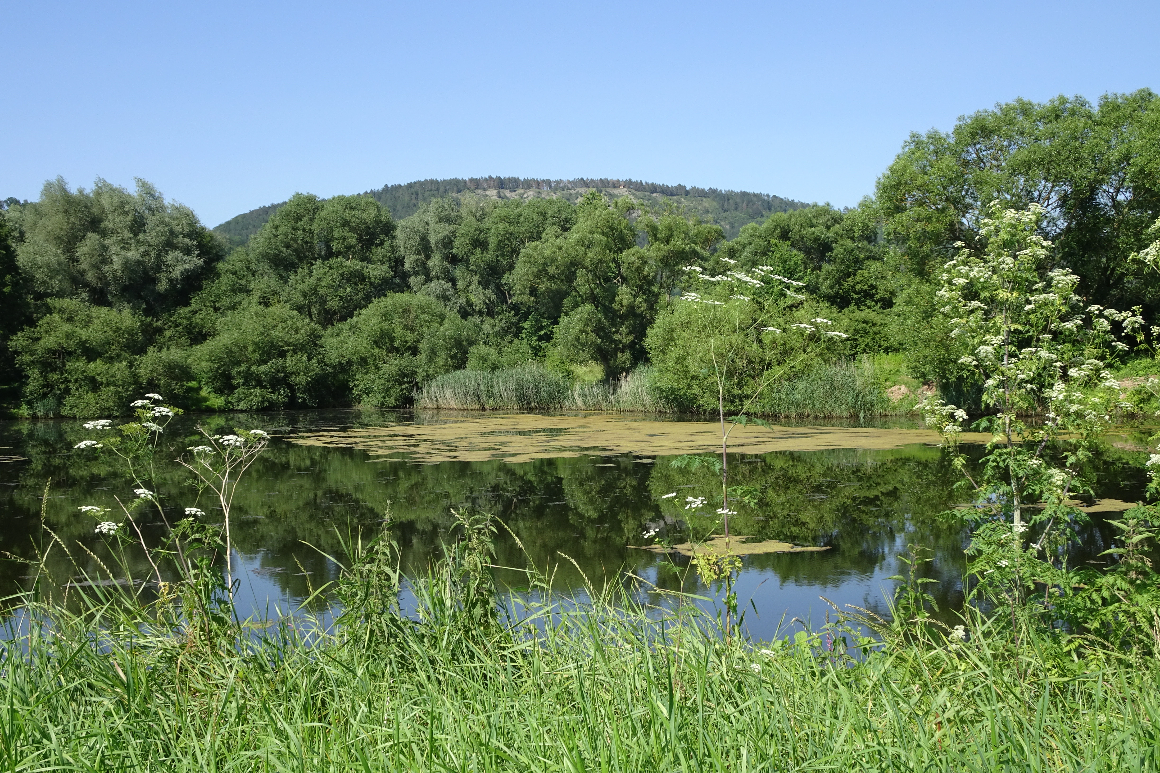
A calm, reflective pond in a nature reserve surrounded by dense green trees and reeds, with a hill rising in the background under a clear blue sky.
A view of the floodplain nature reserve along the Werra River, characterized by calm water, lush vegetation, and surrounding hills.

Werraaue Treffurt wildlife and species highlights

The floodplain supports an outstanding bird community for an area of its size. The most characteristic groups are the waterbirds and reedbed dwellers that use the lakes, the river margins, and the surrounding marshes. Notable breeding visitors recorded in surveys from 2000 and 2006 include several duck species such as garganey, shoveler, pochard, tufted duck, and common teal, alongside larger waterbirds like great crested grebe, mute swan, whooper swan, cormorant, and both grey and great egrets. The shallow margins and emerging vegetation provide attractive conditions for little grebe and coot, both of which appear regularly in the breeding bird records.

Reedbed specialists are also well represented. Common snipe and water rail make use of the dense reed edges, while passerines such as bluethroat and reed bunting are recorded in the area. Pendulous tits benefit from the network of former drainage ditches that intersect parts of the floodplain. The wooded edges of the reserve add further variety, with black, green, grey, and great spotted woodpeckers all noted there, while kingfisher uses the stretch of the Werra that flows through the protected area.

The amphibian and reptile fauna is similarly diverse. Northern crested newt, natterjack toad, European tree frog, and pool frog are all documented breeders, while grass snake and common lizard occur in drier transitions at the edges of the wet zones. Insects are a particular strength of the site: the flowering ruderal and tall-herb communities support rich butterfly and grasshopper populations, and the wetland margins are home to dragonflies including the large whiteface, the blue-eyed hawker, and the common winter damselfly. The ground beetles of the area, particularly those associated with gravelly riverbanks, have been assessed as regionally significant, with more than seventy species recorded in surveys carried out in the early 1990s.
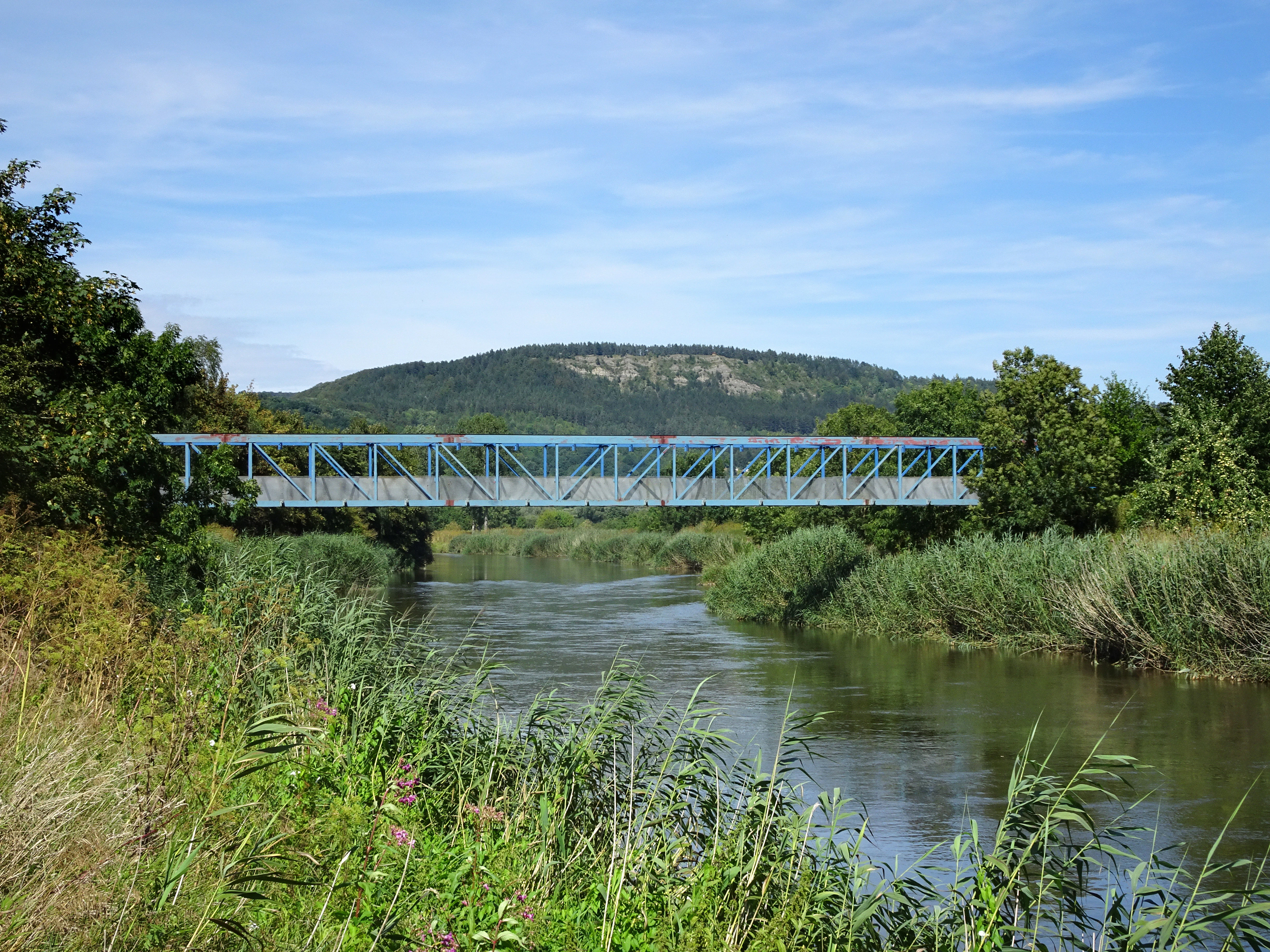
A blue steel truss bridge crosses over the calm Werra River, surrounded by green reeds and trees with a low forested hill in the background under a blue sky.
The blue bridge spanning the Werra River, a former border barrier now serving as a pedestrian crossing.

Werraaue Treffurt conservation status and protection priorities

Werraaue Treffurt is a textbook example of small-scale nature reserve design resting on layered protection regimes. At its core is the Thuringian nature reserve designation, under which any modification of the gravel-pit lakes, reedbeds, or riparian woodland is regulated to preserve the area's landscape character and its role as habitat for wetland-dependent birds, amphibians, and reptiles. The designation explicitly protects the two former railway embankments in the north, recognizing their role as effective noise and visual buffers shielding the reserve from the nearby B 250 road.

On a European scale, the reserve is integrated into the Werra bis Treffurt mit Zuflüssen Fauna-Flora-Habitat area, contributing to the Natura 2000 network whose aim is to safeguard biodiversity across the European Union. This wider designation emphasizes the floodplain's role within the river's ecological continuity, including roughly one kilometer of the Werra itself. At the national level, the floodplain's inclusion in the Green Belt national nature monument aligns it with Germany's broader strategy of using the former inner-German border as a backbone for connected habitat conservation, offering a route for species to move between otherwise isolated patches of habitat.

The neighboring Frankenloch bei Heldra area in Hesse extends the protected floodplain across the state border, jointly creating a cross-border wetland complex of ecological value that exceeds the sum of its parts. Both reserves are also embedded in the broader Werra floodplain conservation landscape, including the Auenverbund Werra landscape protection area on the Hessian side. Together these layers of protection convert a relatively small site into a stable core within an extensive, multi-jurisdiction conservation strategy, even if the local conflicts between recreational fishing and strict habitat protection have required careful negotiation.

Werraaue Treffurt cultural meaning and human context

The Werraaue at Treffurt carries a strong sense of border history, in addition to its ecological value. For nearly forty years, the floodplain was sealed inside the East German border zone, turning it into a forbidden strip of landscape along the Werra. That history is visible in subtle but tangible ways: the protective strip, the absence of intensive agriculture, and the visible boundary infrastructure that once followed the river. The conversion of an old border barrier over the Werra, the so-called Blue Bridge, into a pedestrian and cycling crossing is one of the most visible signs of that transition, and a place where the landscape's twentieth-century history remains part of how visitors experience it.

Local communities around the floodplain have a long-standing relationship with the landscape, particularly through angling on the gravel-pit lakes. The lakes were the most important waters for Treffurt's anglers before the border sealed them off, and their reopening after reunification gave rise to a long-running negotiation between conservation interests and recreational fishing, eventually resolved through a spatial compromise that protects the most sensitive waters while permitting fishing in designated strips. This history gives Werraaue Treffurt a distinctive local cultural character as a place where ecological recovery, frontier history, and recreational tradition meet.

Top sights and standout views in Werraaue Treffurt

A wetland refuge shaped by four decades of border-zone silence and revived on the foundations of abandoned gravel pits.

Positioned at the geological hinge where the Werra leaves the Thuringian Basin for the Buntsandstein lowlands, with the Heldrastein ridge rising just to the south.

Recognized as one of the stepping stones of Germany's Green Belt national nature monument, working alongside the Frankenloch reserve across the state border.

A small but exceptionally diverse site for waterbirds, amphibians, reedbed songbirds, dragonflies, and ground beetles within a compact 68.5-hectare area.

Best time to visit Werraaue Treffurt

Spring and early summer are particularly rewarding for visiting Werraaue Treffurt, as rising temperatures bring amphibians into the gravel-pit lakes and their margins, and the reedbeds fill with the songs of reedbed-nesting birds and early-season insects. The reserve's shallow waters and open vegetation also make this a productive period for observing dragonflies and damselflies along the marsh margins, while the flowering ruderal and tall-herb communities begin to provide rich nectar and seed resources.

Late spring and early summer overlap with the main breeding season for many of the waterbirds that use the floodplain, and the area's compact layout makes it possible to combine a visit with a walk along the lower Werra valley. Cool spring weather keeps insect activity manageable and gives clear views across the flat floodplain and its still waters, while the surrounding landscape of the lower Werra hills adds a scenic context to shorter circular walks linking Treffurt and Heldra.


Monthly climate preview

Long-term monthly temperature and precipitation rhythm for Werraaue Treffurt

Werraaue Treffurt Climate Normals and Measured Temperature Patterns

Representative coordinate records show measured monthly temperature variations and precipitation averages across the protected terrain of Werraaue Treffurt from 1991 to 2020. Reviewing the complete twelve-month climate profile provides detailed long-term averages for monthly temperature ranges and precipitation totals.
Annual mean8 °C
-1 °C18 °C
Jan-1°
Feb
Mar
Apr
May12°
Jun16°
Jul18°
Aug18°
Sep14°
Oct
Nov
Dec
Warmest month
July

18.3 °C

Coolest month
January

-1.1 °C

Wettest month
July

2.6 mm/day

Driest month
April

1.4 mm/day

Park location guide

Geography guide, regional context, and park location map for Werraaue Treffurt

Werraaue Treffurt park geography, regions, and map view in Germany

Understand where Werraaue Treffurt sits in Germany through a broader geographic reading of the surrounding landscape, nearby location context, and its mapped position within the national park landscape.

How Werraaue Treffurt fits into Germany

Germany is a federal republic in Western and Central Europe with a population of over 83 million across sixteen constituent states. It is Europe's largest economy by nominal GDP and a major global exporter and importer. The capital is Berlin, and the country borders Denmark, Poland, Czech Republic, Austria, Switzerland, France, Luxembourg, Belgium, and the Netherlands.

Wider geography shaping Werraaue Treffurt in Germany

Germany is located in Western and Central Europe, spanning 357,022 km². It borders Denmark to the north, Poland and the Czech Republic to the east, Austria and Switzerland to the south, and France, Luxembourg, Belgium, and the Netherlands to the west. The country has coastlines on the Baltic Sea and North Sea to the north, with the Alps located in the southern region.

Map view of Werraaue Treffurt

Use this park location map to pinpoint Werraaue Treffurt in Germany, understand its exact geographic position, and read its mapped placement within the surrounding landscape more clearly.

Pigeon | © OpenStreetMap contributors

Location context for Werraaue Treffurt

Wartburgkreis

Visual reference guide to floodplain habitats, riparian woodlands, and protected valley terrain.

Werraaue Treffurt Photos and Landscape Scenery Explorer

Examine detailed photographs of Werraaue Treffurt to understand the varied topography, quiet gravel pit lakes, and extensive reedbeds that define the river valley. Visual documentation reveals the ecological character of protected wetland habitats and the distinct physical boundaries shaped by surrounding limestone ridges.

An expansive high-angle view of a river valley with a winding river, small lakes, agricultural fields, and a distant small town framed by rolling green forested hills.

A calm pond surrounded by dense green trees and tall reeds under a clear blue sky, with a small castle visible on a distant hill.

A wide view of a green meadow with wild grasses and white wildflowers in the foreground, with trees and a forested hillside in the background under a clear sky.

A calm, reflective pond in a nature reserve surrounded by dense green trees and reeds, with a hill rising in the background under a clear blue sky.

A blue steel truss bridge crosses over the calm Werra River, surrounded by green reeds and trees with a low forested hill in the background under a blue sky.

A peaceful waterside scene in Werraaue Treffurt with mature willow-like trees growing along a grassy bank, overlooking a still, reflective river with distant hills.

Park atlas

Discover adjacent river valley protected areas and regional conservation corridors

Parks Near Werraaue Treffurt, Exploring Surrounding Valley Landscapes

Compare Werraaue Treffurt with other protected areas situated along the regional river valley and nearby border corridors. Evaluating adjacent wetland reserves provides broader context for understanding local floodplain habitats and geological transition zones.
Nature reserveThuringia
About 0.2 km away#1 closest

East

Werra bis Treffurt mit Zuflüssen: Protected River and Floodplain Network in Thuringia

Mapping an extensive 191 kilometer Natura 2000 river corridor.

The Werra bis Treffurt mit Zuflüssen protected area serves as a vital ecological corridor in Thuringia. This site encompasses a complex mosaic of fast-flowing highland brooks, expansive floodplain meadows, inland salt sites, and rare dissolution lakes. Its geography bridges high-altitude source regions with lower river valleys, creating a distinctive landscape transect that supports essential freshwater habitats and rare aquatic species across the state.

Area
22.6 km²
Established
2008
IUCN
IV
Relief
Mixed relief
Watercolor illustration showing a wide landscape with green rolling hills in the background, a line of trees in the midground, and a pinkish meadow with grasses in the foreground
Nature reserveHesse
About 0.3 km away#2 closest

South

Frankenloch bei Heldra Nature Reserve: Mapped Protected Landscapes in Hesse, Germany

A rare, near-natural Werra river oxbow and wetland floodplain sanctuary.

Discover the geographic layout of Frankenloch bei Heldra, a protected nature reserve located along the River Werra. This site offers insight into floodplain dynamics, reed-bed ecology, and the restoration of natural river channels within the Werra-Meissner-Kreis district of Hesse, Germany.

Area
0.089 km²
Established
1995
Relief
Lowland
Climate
Temperate
A horizontal watercolor painting depicting a soft-toned, layered landscape of rolling hills and forests in shades of green and pale yellow.
Nature reserveThuringia
About 0.7 km away#3 closest

East

Adolfsburg, Bornberg, Sülzenberg: A Protected Muschelkalk Landscape in Thuringia

Geographic map and protected-area atlas context

This nature reserve stands as a prominent geological feature in the Werrabergland region, where steep Muschelkalk hills and plateaus meet the Werra valley. The site protects a rare assembly of habitats including juniper heathland, scree slopes, and old-growth orchards, offering a dense case study for regional botanical diversity and limestone-terrain mapping in central Germany.

Watercolor painting of a rolling green landscape with a winding trail leading toward purple mountains under a soft light.
Nature reserveWartburgkreis
About 2.2 km away#4 closest

Southwest

Mertelstal - Heldrastein: Protected Nature Reserve and Forested Limestone Geography in Wartburgkreis

Mapping the natural relief and ecological boundaries of a central German nature reserve.

Mertelstal - Heldrastein stands as a protected natural landmark in the Wartburgkreis district, defined by its dramatic limestone cliffs and ancient beech forest canopy. The reserve features a unique vertical relief above the Werra river valley, housing rare orchid communities and specialized bryophytes. This entry maps the structural geography and conservation value of the site, highlighting its dual identity as both a Natura 2000 protected habitat and a place of deep historical resonance across the former inner-German border landscape.

Area
2.525 km²
Established
1997
IUCN
IV
Relief
Mountain
Nature reserveThuringia
About 3.9 km away#5 closest

East

Werrahänge von Frankenroda bis Falken: A Deep Dive into Thuringian Protected Landscapes

Mapping limestone river canyons and unique forest habitats in Wartburgkreis.

This protected area captures a distinct geomorphological intersection of river-cut canyons and plateau ridges in Thuringia. The site preserves an intense mosaic of juniper heath, dry grasslands, and ancient beech forests, functioning as a vital link for species conservation. Examine the mapped boundaries, karst features, and the sculptural topography formed by the Werra river as it winds through the Muschelkalk rim of the Thuringian Basin.

Area
5.69 km²
Established
1999
IUCN
IV
Relief
Upland
Watercolor painting of a green landscape featuring rolling hills and sparse trees.
Nature reserveWerra-Meißner-Kreis
About 5.2 km away#6 closest

Southwest

Dreiherrenstein-Eschenberg-Kreutzerberg Nature Reserve and Border Landscape Geography

Protected calcareous forests and limestone ridges in Werra-Meißner-Kreis

Spanning 206 hectares of the Ringgau escarpment, this reserve features ancient beech forests, steep limestone cliffs, and rare steppe-heath grasslands. It sits at a cultural and ecological intersection, preserving Cold War-era boundary markers alongside post-glacial biological relicts within the broader Hessian protected-area network.

Area
2.063 km²
Established
1998
IUCN
IV
Relief
Mountain
A wide watercolor painting depicting a landscape with green and purple trees and pale hills in the background.
Nature reserveGermany
About 6.6 km away#7 closest

East

Probsteizella Nature Reserve: A Geographical Overview of Limestone Cliffs and Forested Valleys in Germany

Mapping the Muschelkalk sequences and woodland habitats of the Werra valley.

Probsteizella is a distinctive nature reserve in Germany that showcases the dramatic geomorphology of the Werra valley. The site features the Falkener Klippen, an exposed limestone cliff face showing a full stratigraphic sequence, and the historic Bauernkanzel outcrop. This area supports a rich diversity of beech-woodland communities, providing a focused example of central German river valley protected terrain.

Area
0.269 km²
Established
1961
Relief
Upland
Climate
Temperate
Watercolor illustration showing a wide landscape with green trees, rolling hills, and distant mountains under a pale sky.
Nature reserveHessen
About 7 km away#8 closest

West

Graburg Nature Reserve and Protected Shell-Limestone Massif in Northern Hessen

Mapped protected areas and botanical landscape geography

Graburg is a compact shell-limestone plateau located in the Ringgau range of northern Hessen. This nature reserve is characterized by its high conservation value, featuring ancient calcareous beech forests, dramatic rock faces, and extensive historic landslide zones that support one of the most botanically diverse habitats in central Germany.

Area
3.41 km²
Established
1965
IUCN
IV

Common questions about visiting, size, designation, and location context for Werraaue Treffurt

Werraaue Treffurt FAQs for park facts, access, geography, and protected area context

Find quick answers about Werraaue Treffurt, including protected-area facts, park geography, trail and visitor context, and how the park fits into its surrounding country and regional landscape.
MoriAtlas Explorer

Continue Your Protected Areas Search Across the Global Atlas

Deepen your exploration by continuing the structured search for national parks and protected areas worldwide. Utilize the comprehensive filtering capabilities to compare different conservation landscapes and refine your understanding of global park geography. Discover more about the distribution and characteristics of protected natural areas.

Global natural geography