Mori Atlas logo
National parkWestern Area Peninsula National Park

Analyzing the protected boundaries and forest geography of a primary West African watershed

Western Area Peninsula National Park: Coastal Rainforests and Mountain Ridges in Sierra Leone

Western Area Peninsula National Park encompasses a significant coastal rainforest corridor that defines the rugged terrain of Sierra Leone. The park features dense vegetation that transitions from lowland to montane forest, covering steep hills and rocky headlands extending toward the Atlantic. This atlas entry provides a detailed look at the protected-area geography and environmental context of this essential ecosystem.

Coastal RainforestUpper Guinea ForestPrimate HabitatBirdwatchingWatershed ProtectionNational Park

Western Area Peninsula National Park

National park

Park overview

Structured park overview, official facts, and landscape profile for Western Area Peninsula National Park

Western Area Peninsula National Park park facts, protected area profile, and essential visitor context

Review the core facts for Western Area Peninsula National Park, including designation, size, terrain, visitor scale, habitats, and operating context in one park-focused overview.

About Western Area Peninsula National Park

Western Area Peninsula National Park occupies a distinctive position in Sierra Leone's protected area network as the principal coastal forest reserve on the Western Area Peninsula south of Freetown. The park encompasses a landscape of considerable topographic variation, with steep ridges and valleys that descend toward the Atlantic coastline. Its vegetation communities represent a transition from lowland rainforest at lower elevations through semi-evergreen forest to montane forest types at higher elevations. The protected area was established to safeguard the remaining contiguous forest cover in this region, which has faced substantial pressure from agricultural expansion, logging, and the growing urban footprint of Freetown and surrounding settlements. The park's ecological significance extends beyond its borders as a critical corridor and refuge for species adapted to the Upper Guinea forest ecosystem, a region renowned for its high levels of endemism despite widespread forest loss across West Africa.

Quick facts and research context for Western Area Peninsula National Park

Western Area Peninsula National Park is situated on the mainland peninsula south of Freetown, Sierra Leone's capital city, forming a natural extension of the coastal landscape that juts into the Atlantic Ocean. The park's terrain is dominated by steep forested slopes and rocky coastal outcrops, with elevations ranging from sea level to several hundred meters above sea level. It was established to protect the remaining tracts of coastal forest in the Western Area, which has experienced significant deforestation from agricultural expansion and urban development. The park is part of the Upper Guinea Forest ecosystem, a biodiversity hotspot that extends across West Africa and is recognized for its high concentration of endemic species.

Park context

Deeper park guide and search-rich context for Western Area Peninsula National Park

Western Area Peninsula National Park history, landscape, wildlife, and travel context

Explore Western Area Peninsula National Park through its history, landscape character, ecosystems, wildlife, conservation priorities, cultural context, and seasonal travel timing in a structured park guide built for atlas discovery and search intent.

Why Western Area Peninsula National Park stands out

Western Area Peninsula National Park is best known for its dense coastal rainforest ecosystem, which represents one of the last remaining extensive forest areas in the Western Area of Sierra Leone. The park is particularly recognized for its biodiversity significance within the Upper Guinea forest zone, supporting populations of primates including chimpanzees and various monkey species, as well as a diverse array of birdlife. The peninsula's location along the Atlantic coast provides dramatic scenery where forested slopes meet rocky shores and coastal viewpoints offer panoramic views. The park also serves as an important watershed, protecting water catchments that supply communities on the peninsula.

Western Area Peninsula National Park history and protected-area timeline

Western Area Peninsula National Park was established as a protected area to conserve the remaining tracts of coastal forest in Sierra Leone's Western Area, a region that has experienced significant ecological transformation due to human activity. The park's establishment reflected growing recognition of the need to protect the peninsula's forest cover, which had been diminished by decades of agricultural expansion, logging, and settlement. As one of Sierra Leone's designated national parks, it falls under the management framework of the country's protected area authority. The park's history is intertwined with the broader story of forest conservation in Sierra Leone, where extensive lowland forests once covered much of the coastal regions but have been reduced to scattered remnants by development pressures.

Western Area Peninsula National Park landscape and geographic character

The landscape of Western Area Peninsula National Park is characterized by a dramatic combination of forested hills descending sharply toward the Atlantic coast. The terrain features steep slopes and narrow valleys, with elevation changes that create diverse microhabitats within the forest. Rocky headlands and coastal cliffs mark where the land meets the sea, providing scenic vistas and coastal access points. The forest canopy is typically dense and multilayered, with emergent trees rising above the general canopy level. Streams and small watercourses flow down from the ridges, cutting through the forest and providing water resources for both wildlife and downstream communities. The peninsula's position at the interface between land and ocean creates a distinctive landscape where tropical forest meets coastal ecosystems.

Western Area Peninsula National Park ecosystems, habitats, and plant life

The nature of Western Area Peninsula National Park is defined by its coastal rainforest ecosystem, which belongs to the Upper Guinea Forest region of West Africa. This forest type is characterized by high species diversity and a high degree of endemism, with many species found nowhere else on Earth. The vegetation structure includes tall trees with buttressed roots, epiphytes, and a diverse understory of shrubs, seedlings, and ferns. The park's elevation range supports different forest communities, from lowland rainforest in the valleys to more montane-adapted species at higher elevations. The forest plays a critical role in watershed protection, regulating water flow and protecting soils on the steep slopes from erosion. Despite its relatively small size compared to other West African forests, the park maintains important ecological functions as a refuge for forest-dependent species.

Western Area Peninsula National Park wildlife and species highlights

Western Area Peninsula National Park supports populations of several primate species that are characteristic of West African rainforests, including various monkey species and populations of chimpanzees that persist in the forest remnants. The park's avifauna is diverse, with numerous bird species recorded including forest-dwelling birds and species that utilize the coastal environment. The diverse insect communities, particularly butterflies and other invertebrates, contribute to the park's ecological complexity. Small mammals including duikers and other forest antelopes inhabit the understory, while predators such as civets and genets occupy higher trophic levels. The combination of forest and coastal habitats supports species that utilize both environments, creating a mosaic of wildlife communities across the peninsula.

Western Area Peninsula National Park conservation status and protection priorities

Western Area Peninsula National Park represents an important conservation priority for Sierra Leone as one of the last remaining substantial forest areas in the Western Area region. The park is part of national efforts to preserve the country's biodiversity heritage, which has suffered significant losses due to deforestation and habitat fragmentation across the country. Conservation challenges include managing the pressure from surrounding populations who depend on forest resources, addressing illegal logging and agricultural encroachment, and maintaining connectivity for wildlife populations. The park's protected status provides a legal framework for conservation, though effective management requires resources and ongoing vigilance. The Upper Guinea Forest ecosystem is globally recognized as a biodiversity hotspot, making the park's conservation role significant beyond national boundaries.

Western Area Peninsula National Park cultural meaning and human context

The Western Area Peninsula is home to communities whose relationship with the landscape predates the establishment of the protected area. The peninsula has historically been an important area for settlement and resource use, with fishing communities along the coast and agricultural communities in the interior. The forest has provided various ecosystem services to local populations, including water, building materials, and non-timber forest products. The establishment of the park created a protected area that overlaps with traditional land use patterns, requiring ongoing efforts to balance conservation objectives with the needs of local communities. The peninsula's proximity to Freetown also means that the park serves as a recreational and educational resource for the capital's residents.

Top sights and standout views in Western Area Peninsula National Park

The defining highlight of Western Area Peninsula National Park is its role as a remnant of the once-extensive coastal forests that covered the Western Area of Sierra Leone, offering a glimpse of the original forest ecosystem that characterized this region. Visitors and researchers encounter a landscape where dense forest covers steep terrain, creating a green corridor that extends from the interior to the coast. The park provides habitat for species of conservation concern, particularly primates and forest birds, within a relatively accessible location relative to Freetown. The coastal portions of the park offer scenic landscapes where forest meets shore, with opportunities to experience the Atlantic coast from a forested peninsula. The park's function as a watershed protects water resources for communities across the peninsula, adding an ecosystem service dimension to its conservation value.

Best time to visit Western Area Peninsula National Park

The best time to visit Western Area Peninsula National Park falls during the dry season from November to April, when rainfall is reduced and trail conditions are more favorable for exploration. The dry months offer clearer views from elevated points within the park and more comfortable conditions for hiking through the forest. The wet season from May to October brings higher rainfall, which can make trails slippery and access more difficult, though the forest is at its lushest during this period. Wildlife viewing may be more productive during the dry season when animals concentrate around water sources. Visitors should be aware that the park's accessibility can be affected by seasonal weather patterns and that conditions may vary from year to year.
Monthly climate preview

Long-term monthly temperature averages and precipitation rhythm for Sierra Leone

Western Area Peninsula National Park Climate Normals and Annual Weather Patterns

Western Area Peninsula National Park exhibits recorded monthly mean temperatures spanning from 24.99 degrees Celsius to 27.74 degrees Celsius alongside shifting precipitation totals. Evaluating the complete twelve-month climatology dataset reveals distinct variations across the representative coordinate.
Annual mean26 °C
25 °C28 °C
Jan26°
Feb26°
Mar27°
Apr28°
May27°
Jun26°
Jul25°
Aug25°
Sep25°
Oct26°
Nov26°
Dec26°
Warmest month
April

27.7 °C

Coolest month
August

25 °C

Wettest month
August

21.5 mm/day

Driest month
January

0 mm/day

Park location guide

Geography guide, regional context, and park location map for Western Area Peninsula National Park

Western Area Peninsula National Park park geography, regions, and map view in Sierra Leone

Understand where Western Area Peninsula National Park sits in Sierra Leone through a broader geographic reading of the surrounding landscape, nearby location context, and its mapped position within the national park landscape.

How Western Area Peninsula National Park fits into Sierra Leone

Sierra Leone is a West African country located on the Atlantic coast, bordered by Liberia to the southeast and Guinea to the north and east. The country has a tropical climate and diverse terrain ranging from coastal plains to mountainous interior regions. It was a British colony that gained independence in 1961 and became a republic in 1971. Following a devastating civil war that ended in 2002, Sierra Leone has experienced political stability and economic recovery.

Wider geography shaping Western Area Peninsula National Park in Sierra Leone

Sierra Leone is situated on the West African Atlantic coast, occupying a rectangular territory stretching from the Atlantic ocean inland. The country borders Liberia to the southeast and Guinea to the north and east. Terrain includes a coastal plain, the Sierra Leone Peninsula, the mountainous interior around the Loma Mountains, and an eastern plateau region.

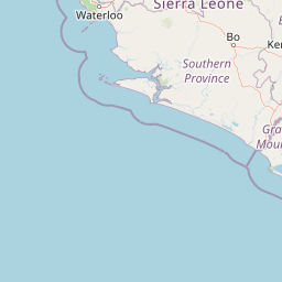
Map view of Western Area Peninsula National Park

Use this park location map to pinpoint Western Area Peninsula National Park in Sierra Leone, understand its exact geographic position, and read its mapped placement within the surrounding landscape more clearly.

Pigeon | © OpenStreetMap contributors
Park atlas

Compare regional biodiversity corridors and coastal forest reserves across adjacent terrain

Exploring Parks Near Western Area Peninsula National Park and Surrounding Protected Landscapes

Browse protected areas near Western Area Peninsula National Park to examine connected regional geography and adjacent conservation zones. Expanding the search helps investigators compare diverse forest ecosystems and regional habitat boundaries across the surrounding landscape.
National parkSierra Leone
Mapped park locations coincide#1 closest

Western Area Peninsula National Park: Mapped Forest Landscape and Geographic Context

Sierra Leone protected area and forest ecosystem map

Western Area Peninsula National Park encompasses 18,337 hectares of rolling terrain and semi-deciduous forest. This atlas entry examines the park boundaries and its role as a key conservation refuge in Sierra Leone, home to the Tacugama Chimpanzee Sanctuary and significant avian habitats within a coastal-influenced climate.

Area
183.37 km²
Established
2012
IUCN
II
Relief
Lowland
Protected areaConakry Region
About 149 km away#2 closest

North

Forêt classée de Kakimbo: Protected Forest Geography and Coastal Landscape Mapping

Analyzing peri-urban protected areas within Conakry Region

Forêt classée de Kakimbo represents a significant peri-urban forest and protected area characterized by its tall canopy trees and karst-like cave formations. This record details the reserve's strategic position in the Conakry coastal plain, emphasizing its dual role in urban groundwater supply and carbon storage within the Ratoma commune landscape.

Established
1945
Relief
Lowland
Water
Minor water
Protected areaGuinea
About 200 km away#3 closest

Northwest

Rio Pongo: A Protected Estuarine Wetland Landscape in Coastal Guinea

Mapping mangrove forests, tidal mudflats, and coastal ecology

Rio Pongo is a prominent protected area in Guinea, characterized by a complex network of brackish tidal channels and dense mangrove forests. The site serves as a crucial habitat for waterbirds and aquatic mammals, while its position at the edge of the Atlantic Ocean defines a dynamic, low-lying coastal terrain that remains vital for regional conservation and ecological research.

Area
300 km²
Established
1992
Water
Water-dominated
National parkKarene District
About 201 km away#4 closest

Northeast

Outamba-Kilimi National Park: Sierra Leone National Park and Protected Landscape Atlas

Mapped natural terrain within Karene District.

Investigate Outamba-Kilimi National Park as a protected area, examining its geographic footprint and significance within Sierra Leone's natural landscapes. This detailed entry provides context on the park's mapped boundaries and its contribution to regional geography, serving as a key point for atlas-based exploration of conservation lands in the Karene District.

Area
1,109 km²
Established
1986
IUCN
II
Relief
Lowland
Nature reserveIvory Coast
About 259 km away#5 closest

Northeast

Forêt classée de Pinselly: Protected Area Geography and Landscape Mapping

Nature reserve analysis and regional atlas context

Examine the formal boundaries and landscape character of Forêt classée de Pinselly. This atlas entry focuses on the geographic structure and environmental positioning of this nature reserve in Ivory Coast, offering a clear view of its role as a protected landscape.

Established
1945
Relief
Mountain
Climate
Tropical
Access
Moderate access
National parkEastern Province
About 264 km away#6 closest

East

Gola Rainforest National Park: Sierra Leone's Premier Rainforest Protected Area

Explore mapped boundaries and biodiversity in Eastern Province's vast tropical rainforest.

Gola Rainforest National Park is Sierra Leone's second national park and the largest intact rainforest landscape in the country, located in the Eastern Province. As part of the Upper Guinea Forest biodiversity hotspot, it is renowned for its exceptional wildlife, including western chimpanzees and pygmy hippopotamuses. This protected area's mapped extent covers over 71,000 hectares, contributing significantly to regional conservation and providing a vital natural resource for both wildlife and local communities.

Area
710.7 km²
Established
2010
IUCN
II
Relief
Lowland
Protected areaMamou Region
About 272 km away#7 closest

Northeast

Bafing-Source Protected Area: A Highland Wetland Landscape in the Mamou Region

Tracing the headwaters and plateau geography of the Bafing River basin

The Bafing-Source protected area serves as a significant hydrological anchor within the Fouta Djallon highlands of Guinea. This expansive site protects critical wetland catchments and plateau terrain that feed into the broader Senegal River system, demonstrating the vital link between highland ecosystems and downstream water security.

Area
3,172 km²
Established
2007
Relief
Highland
Climate
Tropical
Nature reserveGrand Cape Mount County
About 275 km away#8 closest

Southeast

Lake Piso Nature Reserve in Grand Cape Mount County: Protected Landscape Atlas

Coastal lagoon geography and wetland habitat mapping.

Lake Piso functions as a vital coastal nature reserve in Liberia, spanning roughly 103 square kilometers of brackish water, islands, and tidal forest. This protected area serves as an essential geographic anchor in Grand Cape Mount County, offering a complex terrain of mangrove ecosystems and river-fed channels that support significant biodiversity.

Area
103 km²
Established
1999
Relief
Lowland
Scope
Terrestrial

Common questions about visiting, size, designation, and location context for Western Area Peninsula National Park

Western Area Peninsula National Park FAQs for park facts, access, geography, and protected area context

Find quick answers about Western Area Peninsula National Park, including protected-area facts, park geography, trail and visitor context, and how the park fits into its surrounding country and regional landscape.
MoriAtlas Explorer

Continue Your Protected Areas Search Across the Global Atlas

Deepen your exploration by continuing the structured search for national parks and protected areas worldwide. Utilize the comprehensive filtering capabilities to compare different conservation landscapes and refine your understanding of global park geography. Discover more about the distribution and characteristics of protected natural areas.

Global natural geography