
Mori Atlas logo
Nature reserveWietzendorfer Moor

Mapping the protected raised bog, wet meadows, and industrial polder landscapes

Wietzendorfer Moor: A Comprehensive Geographic Atlas of a Northern German Nature Reserve

(Naturschutzgebiet Wietzendorfer Moor)

Wietzendorfer Moor represents a critical protected landscape within Niedersachsen, Germany. This nature reserve serves as an essential case study in peatland restoration, where rewetted cuttings, wet meadows, and a historical polder chain create a mosaic of wetland habitats. By analyzing the reserve boundaries and terrain, visitors can trace the intersection of historical agricultural land use and contemporary conservation efforts across the Lüneburg Heath.

raised bogpeatland restorationwet meadowspolderswaterbird habitatmeadow birds
An illustrative digital artwork showing a waterfall cascading into a pond surrounded by forests and hills, with ducks swimming in the foreground.

Wietzendorfer Moor

Nature reserve

Park overview

Structured park overview, official facts, and landscape profile for Wietzendorfer Moor

Wietzendorfer Moor park facts, protected area profile, and essential visitor context

Review the core facts for Wietzendorfer Moor, including designation, size, terrain, visitor scale, habitats, and operating context in one park-focused overview.

About Wietzendorfer Moor

Wietzendorfer Moor protects a representative fragment of the formerly much larger raised bog landscape of the southern Lüneburg Heath. The reserve consists of six separate parcels that together cover roughly 210 hectares, set in a region where centuries of drainage and peat extraction fundamentally reshaped the original wetland landscape. Rather than presenting a pristine bog, the protected area reflects a layered history of use, including peat cutting, agricultural drainage, and more recent conservation restoration, all of which are visible in its present mosaic of habitats.

The core ecological identity of the reserve lies in its blend of bog woodland, regenerating open bog, and intensively maintained wet grassland. On most of the drained and partially cut bog surface, moist and swamp woodland have developed, while cleared and rewetted peat cuttings now support recolonizing raised bog vegetation, including characteristic cottongrass, Sphagnum moss, floating mats, and heaths. In the northeastern part of the reserve, near Wietzendorf itself, more consolidated wet meadows and occasional spruce plantations create a different but complementary habitat pattern.

A particular feature of the reserve is the Radewiesen, a coherent complex of wet meadows covering around 55 hectares within the protected area and managed at least since the late 1700s. These meadows are now used extensively and host more than a hundred plant species alongside a community of meadow birds, some of which are of conservation concern. To the south, a series of five large and four small polders, originally built to receive surface and process water from a nearby potato starch factory, have matured into an important aquatic habitat. Since the factory installed its own treatment plant in 1996, the polders receive only surface runoff and rainwater, while continuing to function as a regionally significant breeding, resting, and wintering area for waterbirds.

Accessibility and interpretation are integral to the reserve's identity. A broad sand path runs through the bog, marked as a cycle route, and hosts a moor and wet meadow discovery trail, part of which is laid out as a loop. This path also forms a section of the Jacobusweg Lüneburger Heide pilgrimage trail, linking the site to the broader cultural landscape of the region. Surrounded largely by intensively used farmland and drained toward the Wietze and Suhrbach streams, the reserve offers a compact but ecologically rich window into the wetland heritage of Lower Saxony.

Quick facts and research context for Wietzendorfer Moor

Wietzendorfer Moor is a designated nature reserve in the German state of Lower Saxony, classified as an IUCN Category IV Habitat and Species Management Area. It lies in the Heidekreis district, southeast of Soltau, southwest of Wietzendorf, between the Celle–Soltau railway line and the B 3 federal road.

The reserve covers around 210 hectares, is identified as NSG LÜ 245, and has been protected since 16 July 1998. It is administered under the responsibility of the Heidekreis district as the lower nature conservation authority. The area borders the Großes Moor bei Becklingen nature reserve to the south and forms part of the historic raised bog complex that once linked Wietzendorf with Bergen.

Protection and recognition

Examine documented terrestrial conservation frameworks and administrative records for Wietzendorfer Moor.

Wietzendorfer Moor Protection Status and Designated Area Record

Wietzendorfer Moor maintains a documented terrestrial protection status within official conservation inventories. Structured records detail the registered designation scope and administrative parameters associated with the protected landscape.

Protection details

Protection scope
Terrestrial
Transboundary protection
No
WDPA ID
319332
Park context

Deeper park guide and search-rich context for Wietzendorfer Moor

Wietzendorfer Moor history, landscape, wildlife, and travel context

Explore Wietzendorfer Moor through its history, landscape character, ecosystems, wildlife, conservation priorities, cultural context, and seasonal travel timing in a structured park guide built for atlas discovery and search intent.

Why Wietzendorfer Moor stands out

Wietzendorfer Moor is best known for its combination of regenerated raised bog habitats, traditionally managed wet meadows, and a chain of polder ponds that together support a rich community of wetland, meadow, and water birds. Its Radewiesen wet meadow complex has been in agricultural use since at least the late eighteenth century and now provides breeding habitat for species such as lapwing, curlew, and snipe, while the polders host ducks, rails, and reedbed warblers. The reserve is also notable as a regional example of peatland restoration in the Lüneburg Heath area. Peat cuttings have been cleared of invading trees and rewetted, allowing Sphagnum moss, cottongrass, Schwingrasen floating mat vegetation, and Erica heaths to re-establish on the formerly drained and partially exploited bog surface.
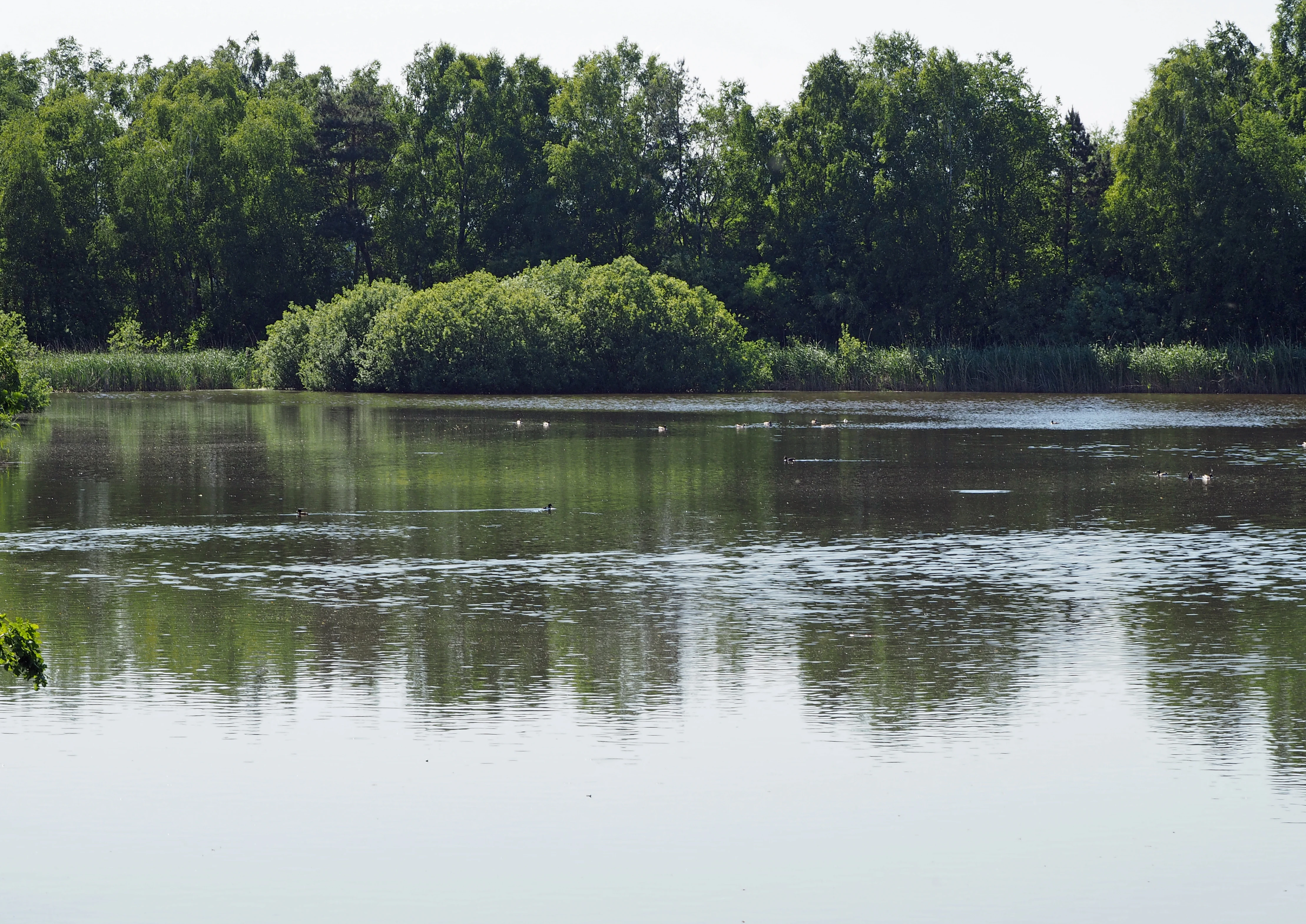
A calm, dark-surfaced pool of water surrounded by dense green trees and vegetation in a wetland environment.
A polder area within the Wietzendorfer Moor nature reserve, showing the wetland landscape and surrounding forest.

Wietzendorfer Moor history and protected-area timeline

The landscape of Wietzendorfer Moor reflects several centuries of human intervention in what was originally part of a vast raised bog stretching between Wietzendorf and Bergen. Peat was cut from the bog for fuel and horticultural use, and the surface was progressively drained by a network of ditches leading to the Wietze, a tributary of the Örtze, and to the Suhrbach, which joins the Wietze near Wietzendorf. The Radewiesen wet meadow complex in the northeast of the present reserve has been under agricultural management since at least the end of the eighteenth century, establishing a long continuity of extensive grassland use that continues today.

A more recent phase in the history of the area began in 1969 and 1970 with the construction of the Wietzendorf starch factory, now owned by the Emsland Group, in the Wietzendorf district of Klein Amerika. Polders were created to receive surface water from the factory site and, originally, washing water from potato processing. These polders, five large and four small, were later supplemented by rainfall inputs, and gradually developed into important habitat for waterbirds. In 1996, the factory commissioned its own wastewater treatment plant; since then, only surface runoff has entered the polders, preserving them as wetland habitat.

The area was formally designated as the Wietzendorfer Moor nature reserve on 16 July 1998 under the identifier NSG LÜ 245. Protection was followed by active conservation management, including the clearance of invading trees from peat cuttings and the rewetting of former extraction sites. The establishment of a wet meadow and bog discovery trail, integrated into both the local cycle network and the Jacobusweg Lüneburger Heide pilgrimage route, marked further recognition of the site's cultural and ecological significance.

Wietzendorfer Moor landscape and geographic character

The physical landscape of Wietzendorfer Moor is shaped by the remains of a once extensive raised bog set within the gently undulating terrain of the southern Lüneburg Heath. Elevations within the reserve sit roughly between 67 and 73 meters above sea level, and the area is bounded to the north by the Celle–Soltau railway line and to the south by the B 3 federal road. Six disjunct parcels of protected land make up the reserve; the largest and most contiguous lies in the northeast adjacent to Wietzendorf itself, while smaller bog fragments are scattered toward the south.

Drainage features are a defining visual and ecological element. Old drainage ditches cut into the peat, the legacy of long-term peat extraction and agricultural improvement, still channel water from the reserve toward the Wietze and Suhrbach streams. In former peat cuttings, the bog surface has been reshaped by rewetting, with shallow pools, floating peat mats, and recolonizing bog vegetation taking the place of dry, tree-covered cuttings. Sandy paths, including a broad sand route suitable for cyclists, cut through the bog interior and provide both practical access and a clearer view into the otherwise low-visibility landscape.

Around the bog proper, the reserve is framed by intensively used agricultural land, which emphasizes the contrast between the working wetland mosaic inside the protected boundary and the farmland beyond. The southern polders, with their embankments and open water, are the most visually distinctive constructed landscape element, reflecting both industrial heritage and the contemporary role of the site as managed wetland habitat.
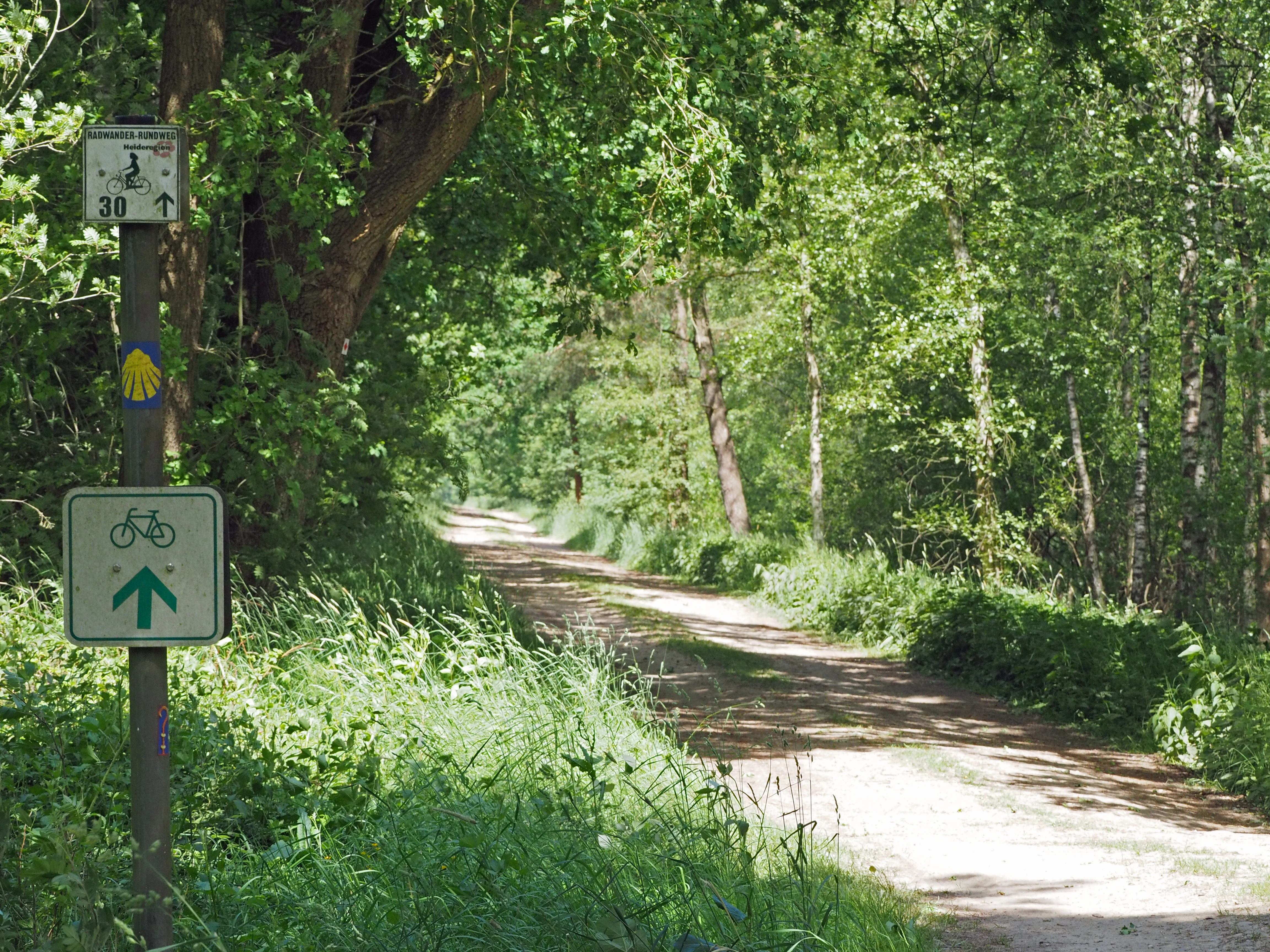
A sandy trail leads into a deciduous forest, with a wooden signpost in the foreground displaying bicycle route symbols and a shell icon.
A woodland trail marked for cycling and hiking at Wietzendorfer Moor.

Wietzendorfer Moor ecosystems, habitats, and plant life

The ecological character of Wietzendorfer Moor is defined by the interplay between remnant and regenerating raised bog vegetation, bog woodland communities, traditionally managed wet grassland, and open polder water. Although the original bog has been substantially altered by drainage and peat cutting, the combination of habitat types within the reserve supports a diverse and ecologically meaningful assemblage of plant and animal life.

On the drained and partially exploited bog surface, moist and swamp woodland communities dominate, with wet ground and shallow peat layers supporting tree species adapted to acidic, waterlogged conditions. Peat cuttings that have been cleared of invading trees and rewetted are now in active recovery, developing open raised bog vegetation. Cottongrass, Sphagnum mosses, and floating peat mat communities have reappeared, along with Erica heaths, signaling a slow return toward the structural and species composition typical of more intact raised bog.

The Radewiesen wet meadows provide a markedly different ecological setting. Continuously managed at least since the late eighteenth century and now used extensively, they support more than a hundred plant species and a meadow-bird community adapted to open, seasonally wet grassland. The southern polders, by contrast, are aquatic in character, with open water, embankments, and emergent vegetation that bridge wetland and open-water conditions. Together these habitats form a layered ecological system that, despite its fragmented and historically altered state, captures much of the ecological character of the larger bog landscape that once covered this part of Lower Saxony.
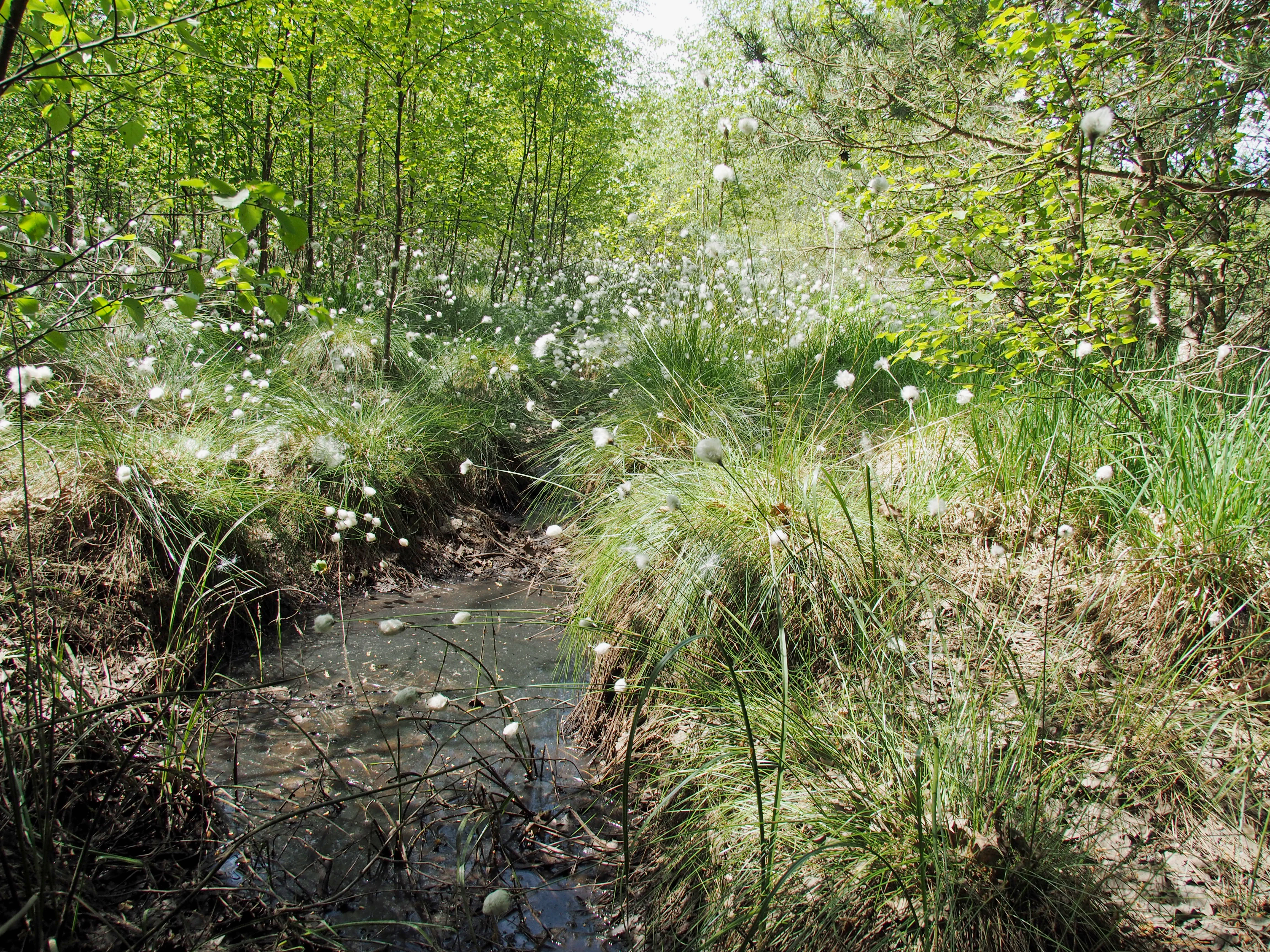
A small stream flowing through a wetland area filled with white, tufted cottongrass and surrounded by young birch trees.
Cottongrass blooming in the wetland environment of Wietzendorfer Moor.

Wietzendorfer Moor wildlife and species highlights

Wildlife is a central part of the reserve's identity, particularly its waterbirds, meadow birds, and breeding avifauna associated with wetland environments. The southern polders, evolved from former industrial settling basins, are now regionally significant for breeding, migrating, and wintering birdlife, with species drawn to open water, reedbeds, and embankment vegetation.

Among breeding birds associated with the polders are Eurasian teal, tufted duck, common goldeneye, water rail, moorhen, Eurasian coot, marsh warbler, Eurasian reed warbler, reed bunting, melodious warbler, common whitethroat, Eurasian blackcap, penduline tit, and willow warbler. Greylag geese also use the polders during the breeding season, and conflicts over territory between coots and mallards are a regular sight.

The Radewiesen wet meadows support a community of meadow birds typical of traditionally managed wet grassland, including lapwing, Eurasian curlew, and common snipe, alongside a broader range of wet-meadow fauna. The reserve as a whole is also important for migratory and opportunistic visitors such as gadwall, Eurasian wigeon, northern pintail, garganey, northern shoveler, common pochard, green sandpiper, common wood pigeon, Eurasian jay, common swift, sand martin, barn swallow, fieldfare, redwing, common chiffchaff, garden warbler, little ringed plover, Eurasian wren, Eurasian sparrowhawk, and Eurasian hobby. Several of the species recorded in the area are listed on Germany's Red List of threatened species.
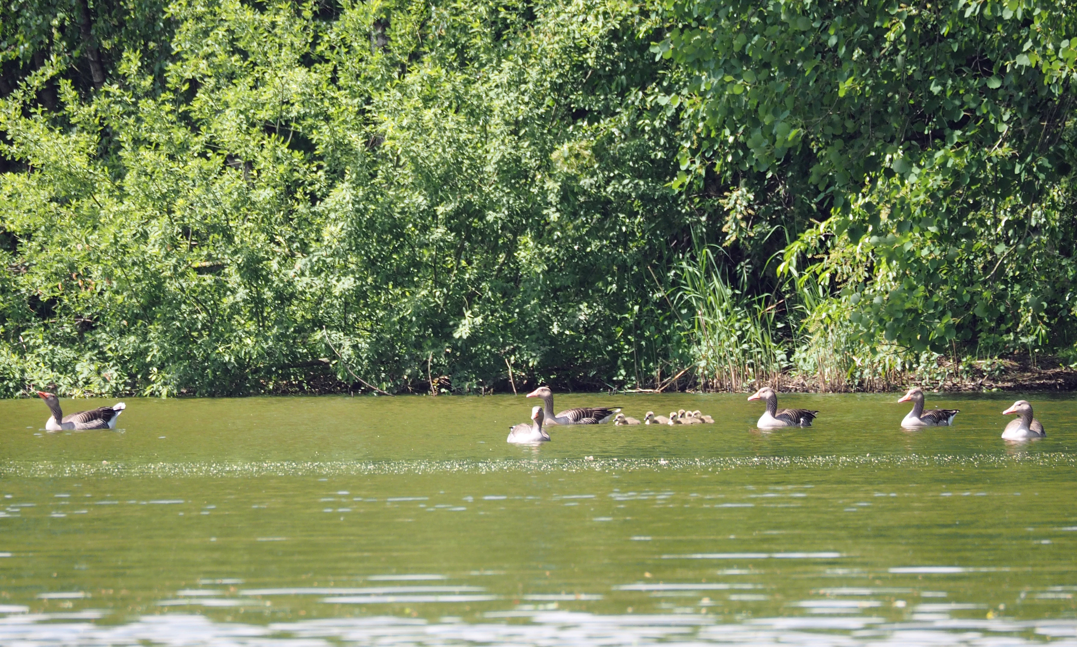
A group of greylag geese swimming in a green pond with a dense green tree line in the background.
Greylag geese swimming on a polder in Wietzendorfer Moor.

Wietzendorfer Moor conservation status and protection priorities

Wietzendorfer Moor is protected as a nature reserve under Lower Saxon law, with formal designation dating to 16 July 1998. Its profile in conservation terms combines long-term habitat preservation with active ecological restoration, particularly of formerly drained and exploited raised bog. Peat cuttings have been cleared of invading trees and rewetted to allow the recovery of open raised bog vegetation, while the continued extensive agricultural use of the Radewiesen meadows is itself treated as a conservation measure, preserving the open, wet grassland conditions on which meadow birds depend.

The transformation of the southern polder system from an industrial wastewater feature into a regionally important bird habitat illustrates the reserve's role as a place where industrial legacy and conservation outcomes have intersected in a largely positive way. With the commissioning of the factory's own wastewater treatment plant in 1996, pressure on the polders eased, allowing their ecological value to consolidate without further industrial discharge. The reserve's importance is recognized at multiple levels, from its inclusion among the protected sites of the Heidekreis district to its international registration in the World Database on Protected Areas.

Wietzendorfer Moor cultural meaning and human context

Wietzendorfer Moor sits within the broader cultural landscape of the Lüneburg Heath, a region long associated with heathland, raised bogs, and the gradual transformation of wetland into agricultural and industrial land. The Radewiesen meadows reflect a continuous practice of extensive grassland management stretching back to at least the late eighteenth century, embedding the reserve in a tradition of small-scale, water-adapted farming that has shaped both the flora and the birdlife of the site.

The industrial history of the southern polders links the reserve to the wider story of agricultural processing in the Lüneburg region. The construction of the Wietzendorf potato starch factory in the late 1960s and early 1970s, and the company's subsequent evolution under the Emsland Group, left an enduring mark on the landscape that, by accident and then by design, has become a defining ecological feature of the protected area.

Cultural layering is also visible in the route network that crosses the reserve. A broad sand path through the bog, marked both as a cycle route and as a section of the Jacobusweg Lüneburger Heide pilgrimage trail, ties the nature reserve into a long-distance cultural itinerary associated with the Way of St. James. The presence of a moor and wet meadow discovery trail along this same corridor reflects a deliberate effort to connect the region's ecological heritage with its broader historical and spiritual geography.
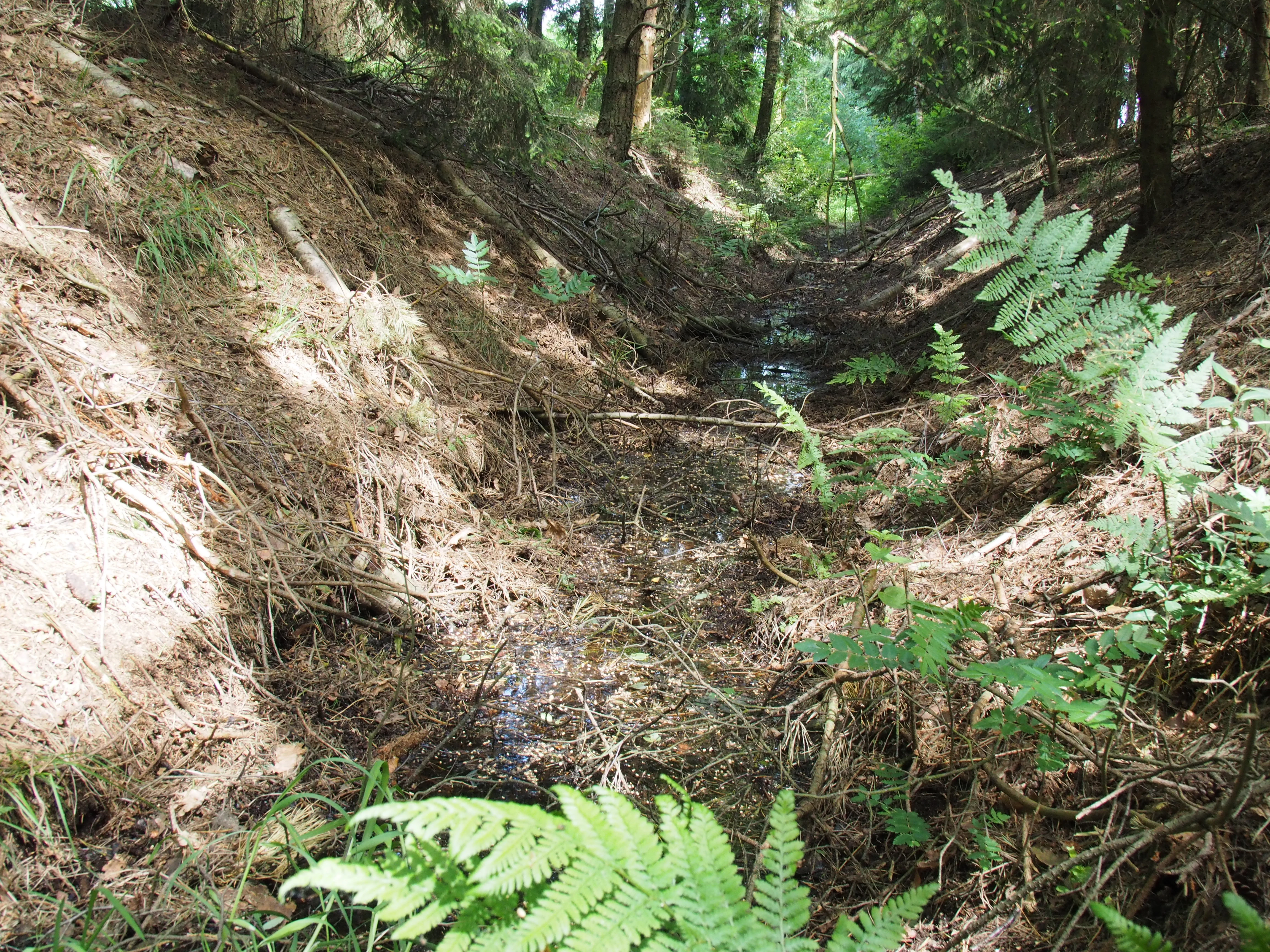
A narrow, shallow drainage ditch runs through a wooded area with earthen banks, ferns, and forest floor debris.
A narrow drainage ditch flowing through the forest terrain of Wietzendorfer Moor.

Top sights and standout views in Wietzendorfer Moor

Wietzendorfer Moor offers a compact but layered example of the interaction between raised bog, wet meadow, and constructed wetland ecosystems in northern Germany. Its combination of actively regenerating peat cuttings, long-managed Radewiesen meadows, and an industrial-era polder chain that has matured into prime waterbird habitat gives the reserve unusual ecological breadth within a relatively small area.

For visitors, the appeal lies as much in the interpretive infrastructure as in the wildlife. A bog and wet meadow discovery trail, a broad sand cycling route, and inclusion in the Jacobusweg Lüneburger Heide pilgrimage trail mean that the reserve is unusually accessible for a northern German bog landscape, where dense vegetation and waterlogged ground often limit on-site experience.

Best time to visit Wietzendorfer Moor

Wietzendorfer Moor is most rewarding during the warmer months, when breeding and migrant birds are active and the contrast between wet meadows, open bog, and polder water is at its most visible. Late spring and early summer bring meadow-bird activity on the Radewiesen and active breeding behavior on the polders, while late summer and early autumn support visible migration and the maturation of bog vegetation. Winter can be quieter but offers a clearer view of the open bog structure, the polders, and the channels used by overwintering waterfowl.

The trail and cycle infrastructure makes most of the reserve accessible outside the wettest winter periods, when standing water and softer peat surfaces can make the sand paths more demanding. As with any northern German bog, appropriate waterproof footwear and an awareness of changing ground conditions are advisable in cooler and wetter seasons.

Monthly climate preview

Examine long-term monthly temperature averages and precipitation patterns for Wietzendorfer Moor in Niedersachsen.

Wietzendorfer Moor Climate Normals and Annual Temperature Rhythm

Representative coordinate records show measured monthly mean temperatures ranging from 0.42 °C in January to 18.29 °C in July alongside consistent year-round precipitation rates. Detailed twelve-month climate tables provide deeper insight into long-term minimum and maximum temperature ranges across the protected area.
Annual mean9 °C
0 °C18 °C
Jan
Feb
Mar
Apr
May13°
Jun16°
Jul18°
Aug18°
Sep14°
Oct
Nov
Dec
Warmest month
July

18.3 °C

Coolest month
January

0.4 °C

Wettest month
July

2.6 mm/day

Driest month
April

1.4 mm/day

Park location guide

Geography guide, regional context, and park location map for Wietzendorfer Moor

Wietzendorfer Moor park geography, regions, and map view in Germany

Understand where Wietzendorfer Moor sits in Germany through a broader geographic reading of the surrounding landscape, nearby location context, and its mapped position within the national park landscape.

How Wietzendorfer Moor fits into Germany

Germany is a federal republic in Western and Central Europe with a population of over 83 million across sixteen constituent states. It is Europe's largest economy by nominal GDP and a major global exporter and importer. The capital is Berlin, and the country borders Denmark, Poland, Czech Republic, Austria, Switzerland, France, Luxembourg, Belgium, and the Netherlands.

Wider geography shaping Wietzendorfer Moor in Germany

Germany is located in Western and Central Europe, spanning 357,022 km². It borders Denmark to the north, Poland and the Czech Republic to the east, Austria and Switzerland to the south, and France, Luxembourg, Belgium, and the Netherlands to the west. The country has coastlines on the Baltic Sea and North Sea to the north, with the Alps located in the southern region.

Map view of Wietzendorfer Moor

Use this park location map to pinpoint Wietzendorfer Moor in Germany, understand its exact geographic position, and read its mapped placement within the surrounding landscape more clearly.

Pigeon | © OpenStreetMap contributors

Location context for Wietzendorfer Moor

Niedersachsen

Visualizing regenerated raised bogs, wet meadows, and wetland habitats

Wietzendorfer Moor Photos and Landscape Scenery

Photographs capture the quiet terrain, open polder waters, and regenerating peatlands defining the protected environment of Wietzendorfer Moor. Visual documentation reveals the intricate landscape character, wetland vegetation patterns, and conservation mosaic across the reserve.

A calm, dark-surfaced pool of water surrounded by dense green trees and vegetation in a wetland environment.

A small wooden observation tower with stairs sits in a grassy, partially overgrown field next to an information display and a red nature reserve sign with an owl logo.

A sandy trail leads into a deciduous forest, with a wooden signpost in the foreground displaying bicycle route symbols and a shell icon.

A small stream flowing through a wetland area filled with white, tufted cottongrass and surrounded by young birch trees.

A group of greylag geese swimming in a green pond with a dense green tree line in the background.

A mallard drake swims in the water while a common coot flaps its wings nearby, creating a splash.

A narrow, shallow drainage ditch runs through a wooded area with earthen banks, ferns, and forest floor debris.

Park atlas

Compare nearby regional nature reserves and surrounding northern German peatland geography.

Parks Near Wietzendorfer Moor and Related Protected Landscapes in Lower Saxony

Browse other parks near Wietzendorfer Moor to examine related wetland reserves, restored peatlands, and protected habitats across the surrounding region. Extending your geographic comparison reveals how similar lowland ecosystems and northern German conservation landscapes connect across the Lüneburg Heath.
Nature reserveLower Saxony
About 4.5 km away#1 closest

North

Wittenmoor Nature Reserve: Geographic Atlas of a Protected Raised Bog in Lower Saxony

Peatland conservation and wetland terrain in the Heidekreis district

Wittenmoor offers a focused view into the peatland dynamics of Lower Saxony. The protected area features two distinct sections characterized by hand-cut peat extraction pools, floating moss mats, and bog-adapted flora. This site provides a clear look at how small-scale reserve management restores hydrological health to marshy meadows and transition-zone moor heath environments within an agricultural landscape.

Area
0.28 km²
Established
1999
IUCN
IV
Relief
Lowland
Nature reserveLandkreis Heidekreis
About 16 km away#2 closest

East

Tal der Kleinen Örtze Nature Reserve: Geographic Atlas and Protected Area Context

Stream valley restoration in the Lüneburg Heath region

An essential look at the Tal der Kleinen Örtze nature reserve, which encompasses restored brook courses and floodplain woodland in Lower Saxony. This protected area serves as a significant example of hydrological recovery and habitat transition, ranging from alder forests to heathland remnants along the valley margins within the broader Heidekreis geography.

Area
4.5 km²
Established
1993
IUCN
IV
Relief
Lowland
Nature reserveLower Saxony
About 17 km away#3 closest

Southeast

Weesener Bach Nature Reserve: Protected Stream and Riparian Geography in the Celle District

Examining mapped boundaries and habitat preservation in Lower Saxony

Discover the geographic footprint of Weesener Bach, a dedicated nature reserve in the Celle district of Lower Saxony. This site focuses on the long term development of stream systems and associated riparian habitats, offering a clear look at specialized land management within the southern Lüneburg Heath region.

Area
2.58 km²
Established
1999
IUCN
IV
Scope
Terrestrial
A horizontal watercolor painting depicting a rolling heathland landscape with purple heather, evergreen trees, and a central water feature under a soft sky.
Protected landscapeLower Saxony
About 30 km away#4 closest

North

Naturpark Lüneburger Heide: Protected Landscape Map and Regional Geography

An expansive cultural landscape in northern Lower Saxony

Spanning over 1,000 square kilometers, Naturpark Lüneburger Heide preserves the largest contiguous inland heathlands in Central Europe. Use this atlas resource to understand the park's glacial terrain, including karst sinkholes and natural springs, as well as its status as a model region for sustainable conservation and traditional land management practices.

Area
1,097.85 km²
Established
1922
IUCN
V
Relief
Lowland
Nature reserveLandkreis Uelzen
About 31 km away#5 closest

Northeast

Wettenbosteler Moor Protected Area: Geographic Overview and Mapped Landscape Features

A resilient raised bog remnant in the Landkreis Uelzen heath forest

Spanning roughly thirteen hectares, Wettenbosteler Moor preserves a rare spring-fed bog habitat characterized by peat-forming vegetation and pine forest borders. This nature reserve offers deep insights into the drainage networks and lowland terrain of the Lüneburg Heath, mapping the transition between upland forest and valley mire.

Area
0.128 km²
Established
1977
IUCN
IV
Relief
Lowland
Nature reserveLandkreis Rotenburg (Wümme)
About 31 km away#6 closest

Northwest

Wümmeniederung mit Rodau, Wiedau und Trochelbach: Protected Wetland and Heath Landscape

Regional geography and floodplain connectivity in Landkreis Rotenburg

This nature reserve protects a sprawling lowland landscape characterized by the Wümme, Rodau, Wiedau, and Trochelbach rivers. The terrain features a mosaic of near-natural meandering streams, species-rich wet meadows, and rare raised bog remnants, providing a comprehensive overview of northern German lowland ecology.

Area
28.96 km²
Established
2020
IUCN
IV
Relief
Lowland
Nature reserveLower Saxony
About 35 km away#7 closest

West

Verdener Moor Nature Reserve: Geographic Atlas and Protected Area Context

Preserving raised bog ecosystems in Lower Saxony, Germany

Located in the municipality of Kirchlinteln, Verdener Moor functions as a protected nature reserve that demonstrates lowland peatland conservation. The landscape features a distinct mosaic of open water resulting from historical peat extraction, wet heath, and rewilded forest edges. This site offers valuable insight into the restoration of bog habitats through rewetting and bush removal within the broader geography of Lower Saxony.

Area
0.91 km²
Established
1989
IUCN
IV
Relief
Lowland
Nature reserveLower Saxony
About 42 km away#8 closest

West

Wedeholz Nature Reserve: Geographic Overview of Lower Saxony Protected Forest Landscapes

Ancient oak forests, Geest terrain, and protected wetland habitats

Wedeholz represents a dense forest conservation area in Lower Saxony, defined by its mature oak and beech communities. The reserve terrain transitions from dry sandy Geest soils to delicate pine swamp forests and floating bogs, supporting a high density of deadwood-dependent species and woodland biodiversity within a compact, protected boundary.

Area
1.83 km²
Established
2019
IUCN
IV
Relief
Upland

Common questions about visiting, size, designation, and location context for Wietzendorfer Moor

Wietzendorfer Moor FAQs for park facts, access, geography, and protected area context

Find quick answers about Wietzendorfer Moor, including protected-area facts, park geography, trail and visitor context, and how the park fits into its surrounding country and regional landscape.
MoriAtlas Explorer

Continue Your Protected Areas Search Across the Global Atlas

Deepen your exploration by continuing the structured search for national parks and protected areas worldwide. Utilize the comprehensive filtering capabilities to compare different conservation landscapes and refine your understanding of global park geography. Discover more about the distribution and characteristics of protected natural areas.

Global natural geography