

Mori Atlas logo
Nature reserve新疆塔里木胡杨国家级自然保护区

Analyzing the geographic boundaries, forest distribution, and hydrologic mosaic of China's largest Populus euphratica reserve.

新疆塔里木胡杨国家级自然保护区: Mapping the Protected Desert Riparian Ecosystems of the Tarim Basin

The Xinjiang Tarim Populus Diversifolia National Nature Reserve encompasses a vast protected landscape centered on the middle reaches of the Tarim River within the Xinjiang Uyghur Autonomous Region. This national-level reserve preserves one of the largest continuous Populus euphratica forest corridors in the world, tracing riverine boundaries where fertile riparian soils meet the hyperarid dunes of the Taklamakan Desert. Mapping these protected lands reveals a complex terrain of seasonal lakes, saline plains, and shifting river channels that sustain rare wildlife, including the wild Bactrian camel and the Tarim red deer.

desert riparian forestPopulus euphraticaPopulus diversifoliaTarim River wetlandsTaklamakan Desert marginwild Bactrian camel habitat
An illustration of a winding river in a desert canyon, featuring a prominent leafless dead tree in the foreground and layered mountains in the background.

新疆塔里木胡杨国家级自然保护区

Nature reserve

Park overview

Structured park overview, official facts, and landscape profile for Xinjiang Tarim Populus Diversifolia National Nature Reserve

Xinjiang Tarim Populus Diversifolia National Nature Reserve park facts, protected area profile, and essential visitor context

Review the core facts for Xinjiang Tarim Populus Diversifolia National Nature Reserve, including designation, size, terrain, visitor scale, habitats, and operating context in one park-focused overview.

About Xinjiang Tarim Populus Diversifolia National Nature Reserve

The Xinjiang Tarim Populus Diversifolia National Nature Reserve sits in a remarkable position at the crossroads of desert and river in northwestern China. It straddles the middle reaches of the Tarim River where the watercourse threads between Yuli and Luntai counties, hugging the northern rim of the Taklamakan Desert. The result is a long, ribbon-like protected area that captures one of the last remaining large stands of Populus euphratica and Populus pruinosa forest in the Tarim Basin.

The defining character of the reserve is the close relationship between water and vegetation. Along the active Tarim River floodplain, young poplar forests, usually 2 to 4 meters tall, thrive in moist soils, while older, taller stands of 10 to 14 meters occupy slightly elevated inter-river terraces with salinized soils. On still higher terraces and farther from water, the poplar canopy thins and becomes more open, grading into sparse desert vegetation. This gradient from dense riverine forest to open desert gives the park its layered ecological identity.

The reserve also contains extensive desert wetlands, including herbaceous marshes, shrub marshes, forested marshes, seasonally flooded depressions, and permanent and seasonal river channels. These wetlands support rich birdlife and provide crucial breeding and stopover habitat for migratory species, including waterbirds and shorebirds covered under bilateral agreements between China and other countries.

As the largest Populus euphratica forest reserve in China, the area carries national significance for the conservation of these ancient desert trees, the Tarim River ecosystem more broadly, and the wildlife that depends on both the river and the surrounding desert. Increasing aridity, groundwater decline, and historical land-use pressure have placed the reserve at the center of long-term restoration and water-management efforts in the Tarim Basin.

Quick facts and research context for Xinjiang Tarim Populus Diversifolia National Nature Reserve

The Xinjiang Tarim Populus Diversifolia National Nature Reserve covers roughly 3,954 square kilometers across Yuli and Luntai counties in the Bayingolin Mongol Autonomous Prefecture of Xinjiang. It was first established as an autonomous-region-level reserve in 1983 and was upgraded to national status in 2006, becoming the largest Populus euphratica forest reserve in China.

The reserve lies along the middle Tarim River on the northern fringe of the Taklamakan Desert, with terrain made up of alluvial plains, river floodplains, ancient river channels, seasonal lakes, and desert margins. Climate is temperate continental desert, with long sunshine hours, a frost-free period of around 218 days, very low annual precipitation, and high evaporation rates. Because of this extreme environment, the Populus euphratica forests here are considered the only true forest ecosystem able to survive in such arid conditions along the Tarim River.

Protection and recognition

Documented terrestrial protection scope, designation history, and official recognition sources

新疆塔里木胡杨国家级自然保护区 Protection Status and International Recognition Data

新疆塔里木胡杨国家级自然保护区 maintains a documented terrestrial protection status established in the year 2006. This structured overview compiles official designation history and management scope records for protected area analysis.

Protection details

Protection scope
Terrestrial
Designated year
2006
Transboundary protection
No
Core area
1,803.82 km²
Buffer area
330.41 km²
Park context

Deeper park guide and search-rich context for Xinjiang Tarim Populus Diversifolia National Nature Reserve

Xinjiang Tarim Populus Diversifolia National Nature Reserve history, landscape, wildlife, and travel context

Explore Xinjiang Tarim Populus Diversifolia National Nature Reserve through its history, landscape character, ecosystems, wildlife, conservation priorities, cultural context, and seasonal travel timing in a structured park guide built for atlas discovery and search intent.

Why Xinjiang Tarim Populus Diversifolia National Nature Reserve stands out

The reserve is best known for its vast Populus euphratica forests, often called the "living fossil" trees of Central Asia, which form the dominant vegetation along the Tarim River in one of the driest regions of China. These forests, together with adjoining tamarisk shrublands and desert wetlands, create a distinctive green corridor cutting across an otherwise barren sandy desert. It is also recognized as a refuge for desert-adapted wildlife, including the wild Bactrian camel, the Tarim red deer, the Tarim hare, and several raptor and waterbird species of conservation concern. The interplay between the river, the trees, and the surrounding Taklamakan sands has made this reserve one of the iconic examples of fragile desert riparian ecosystems in China.
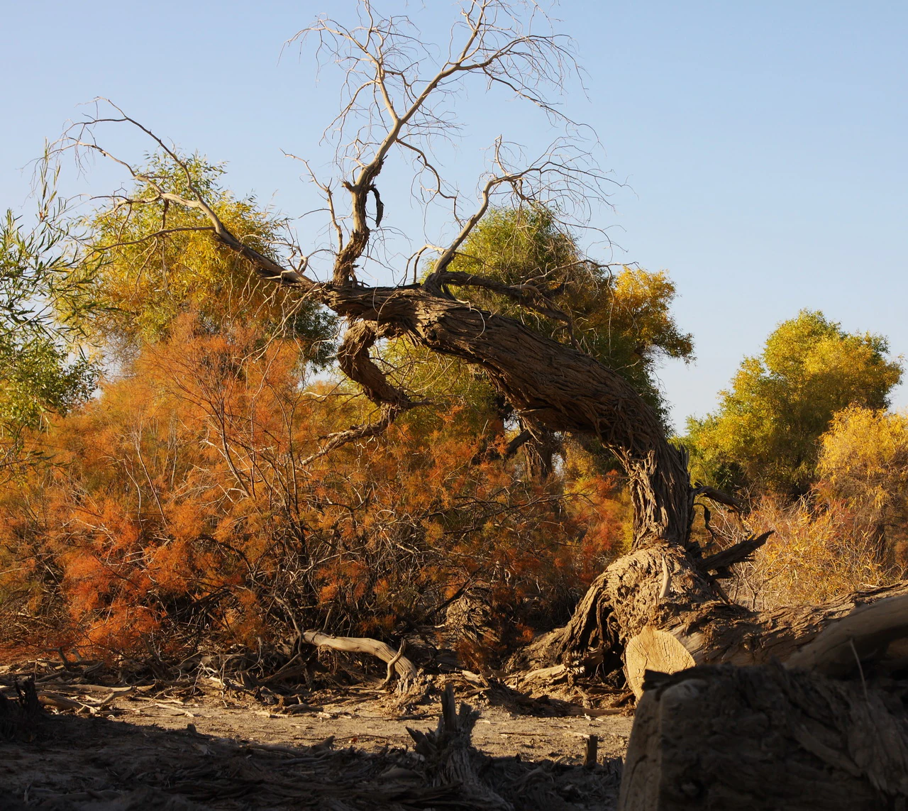
A gnarled and partially bare Populus euphratica tree with golden autumn leaves set against a dense, colorful forest backdrop in a dry desert environment.
A weathered Populus euphratica tree stands in the Tarim River basin, showcasing the characteristic golden foliage and arid landscape of the region.

Xinjiang Tarim Populus Diversifolia National Nature Reserve history and protected-area timeline

The reserve was first established in 1983 under the name Tarim Populus Diversifolia Nature Reserve, approved by the Xinjiang Uyghur Autonomous Region Government as a regional-level protected area. Its founding reflected growing concern about the rapid decline of Populus euphratica forests along the Tarim River during the late twentieth century, when upstream water use, agricultural expansion, and changing hydrology were visibly affecting both riverside forests and desert wetlands.

In 2006, the reserve was formally upgraded to a national nature reserve, expanding its administrative importance and tightening its conservation mandate. The management regulations for the Tarim Populus Diversifolia National Nature Reserve were first issued in 2007 and have since been revised multiple times to strengthen protection measures.

A major chapter in the reserve's history is tied to the broader Tarim River restoration effort. Beginning in 2000, large-scale ecological water transfer projects were launched, delivering water back into the lower and middle reaches of the river to revive degraded forests and wetlands within the reserve. In 2019, a dedicated Tarim Basin Populus euphratica rescue initiative was launched, building diversion channels and simple flood barriers to route floodwaters into the poplar forests. The same year, oil and gas operators began voluntarily relocating wells and infrastructure out of the reserve and its core zone to reduce industrial pressure on the forests.

Xinjiang Tarim Populus Diversifolia National Nature Reserve landscape and geographic character

The landscape of the reserve is defined by its stark contrast between fluid water and shifting sand. The Tarim River runs from west to east through the reserve for more than 162 kilometers and is fed by a network of permanent and seasonal channels that together extend for more than 310 kilometers. Around the river, floodplains, sandbanks, and dry riverbeds create a shifting mosaic of surfaces, punctuated by seasonal lakes, ancient oxbows, and shallow depressions that fill after floods.

Beyond the active river corridor, the terrain opens out into flat to gently undulating alluvial and diluvial plains between roughly 800 and 940 meters in elevation. Closer to the river, soils are relatively fresh and moist, supporting young and dense poplar stands. Slightly higher and farther from water, soils become increasingly saline, and the poplar canopy thins. At the desert edge, the land gives way to the Taklamakan, one of the most extensive sandy deserts in the world.

This gradient from riparian wetland to desert margin is the signature scenery of the reserve. The wide river bends lined with tall golden poplars, the reflective surfaces of seasonal lakes, and the abrupt transition into open sand make the landscape visually distinctive and ecologically layered.
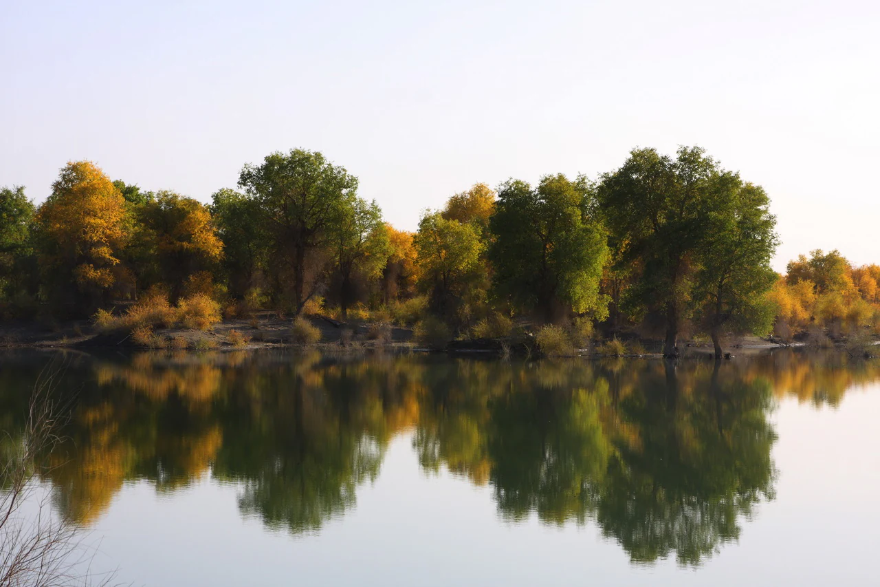
A calm river reflects a row of autumn-colored Populus euphratica trees under a soft sky.
Populus euphratica trees displaying autumn colors reflected in the Tarim River.

Xinjiang Tarim Populus Diversifolia National Nature Reserve ecosystems, habitats, and plant life

The reserve protects a desert riparian ecosystem that is unusual for both its scale and its composition. The principal vegetation is the Populus euphratica and Populus pruinosa forests, with associated tamarisk shrublands dominated by several tamarisk species, often referred to locally as red willow. These forests are accompanied by reeds, sedges, licorice, camel thorn, salt-tolerant shrubs such as desert saltbush and Haloxylon, and a range of herbaceous and shrubby species adapted to saline desert soils.

Wetland habitats form an important second layer of the reserve's ecological identity. The reserve includes more than 500 square kilometers of wetlands, ranging from herbaceous marshes and shrubby marshes to forested marshes and large areas of swampy meadow, alongside permanent rivers, seasonal rivers, and floodplain systems. These wetlands function as critical habitat for waterbirds and as natural water-storage and filtration zones in an otherwise dry landscape.

Because vegetation cover is relatively low and food chains are simple, the reserve's ecosystems are ecologically fragile and sensitive to hydrological change. Pedologists and ecologists have described the area as having limited self-repair capacity, making water availability the single most important ecological variable.
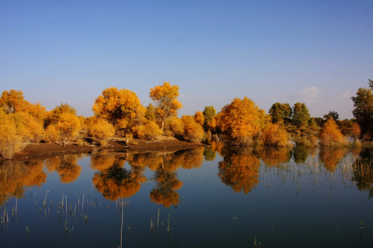
A calm body of water in the foreground reflects a row of golden-leaved desert poplar trees under a clear blue sky.
Autumn foliage of Populus euphratica reflected in the Tarim River basin.

Xinjiang Tarim Populus Diversifolia National Nature Reserve wildlife and species highlights

Wildlife in the reserve is shaped by the mix of desert and wetland habitats. Birdlife is the most visible component, with more than 140 recorded species across 17 orders and 40 families, including raptors, storks, cranes, and waterfowl. Species of particular note include the golden eagle, the white-shouldered eagle, the white-tailed sea eagle, the black stork, the great bustard, and the Eurasian eagle-owl, several of which are protected at the highest national level in China.

Mammals in the reserve include the wild Bactrian camel, the Tarim red deer, the Tarim hare, the goitered gazelle, and the steppe cat, along with other smaller desert mammals. The wild Bactrian camel in particular is one of the most significant species, as the Tarim Basin is one of the few remaining strongholds for this animal in the wild.

Reptiles, amphibians, and fish are also present, though less prominent in the landscape. Notable fish include the Xinjiang bighead fish and the Tarim schizothoracin, both endemic to the Tarim Basin and both considered vulnerable. Historically, the now-extinct Xinjiang tiger once inhabited the broader Tarim River region, including areas now within the reserve. Many migratory birds recorded here are also listed under bilateral agreements between China and Japan and between China and Australia on the protection of migratory birds and their habitats.
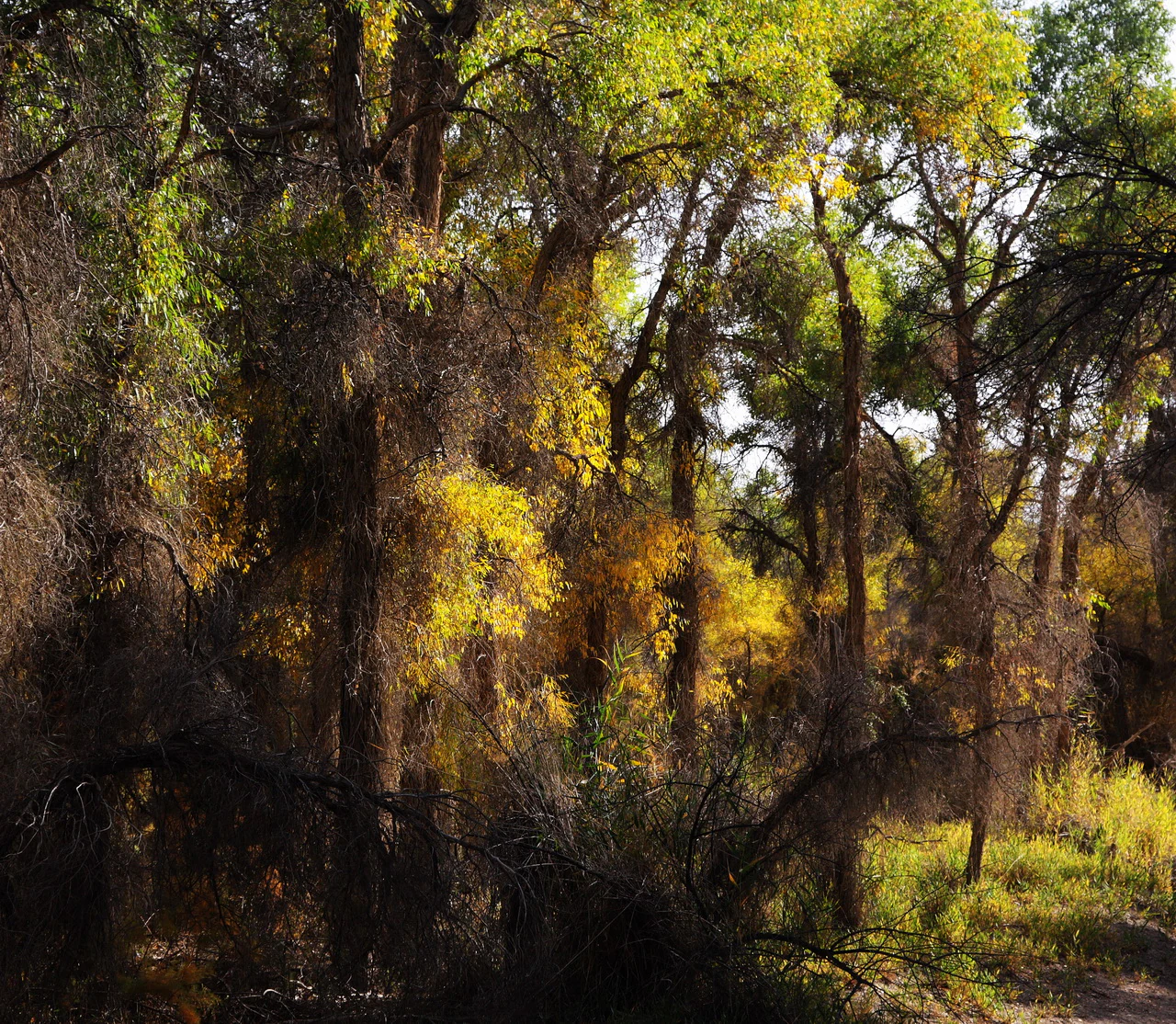
A close view of a dense forest of poplar trees with yellow and green leaves, showing intricate branch structures and sun-dappled foliage.
A dense grove of Populus euphratica trees in the Tarim River basin displaying vibrant golden autumn foliage.

Xinjiang Tarim Populus Diversifolia National Nature Reserve conservation status and protection priorities

Conservation significance in the reserve centers on protecting the largest remaining Populus euphratica forest stand in China and the wetland and desert ecosystems that depend on it. The reserve exists because Populus euphratica forests along the Tarim River have declined sharply since the mid-twentieth century, with documented losses of forest area, shrinkage of rivers and lakes, and expansion of saline land. The reserve is a focal point for national-level efforts to halt and reverse this trend.

Key conservation challenges include reduced river flow caused by upstream water use, falling groundwater tables, soil salinization, insect pests such as the spring cankerworm that periodically defoliate large tracts of forest, and pressure from grazing, agriculture, illegal herb harvesting, and oil and gas exploration. The reserve's relatively simple ecosystems and limited vegetation cover amplify these threats, since damage can cascade quickly through the food web.

Major conservation responses include the establishment of the reserve itself in 1983 and its 2006 upgrade to national status, multi-year ecological water transfers along the Tarim River beginning in 2000, the 2019 Populus euphratica rescue campaign, ecological resettlement of communities out of the most sensitive forest areas, the relocation of oil and gas infrastructure out of the core zone, and biological pest-control programs using agents such as Bacillus thuringiensis. These efforts have begun to slow the rate of forest and wetland loss, although recovery of mature poplar forests remains slow.

Xinjiang Tarim Populus Diversifolia National Nature Reserve cultural meaning and human context

The Populus euphratica tree, known in Chinese as "huyang," has long been a cultural emblem of the Tarim Basin and the broader Silk Road region. Local communities and travelers historically valued these trees for their resilience in extreme desert conditions, and the forests of the Tarim River are deeply tied to the identity of oasis towns such as Luntai and Yuli.

During the late twentieth and early twenty-first centuries, the reserve area was home to settled agricultural and pastoral communities, including cotton farming and livestock grazing by goat, horse, and cattle herds. Ecological resettlement projects have since moved several communities out of the reserve's most sensitive zones, a shift that reflects both conservation priorities and changes in the region's rural economy. The adjacent Tarim Populus Forest National Forest Park, established in the reserve's experimental zone in the 1990s, also plays a role in connecting local communities and visitors to the landscape.
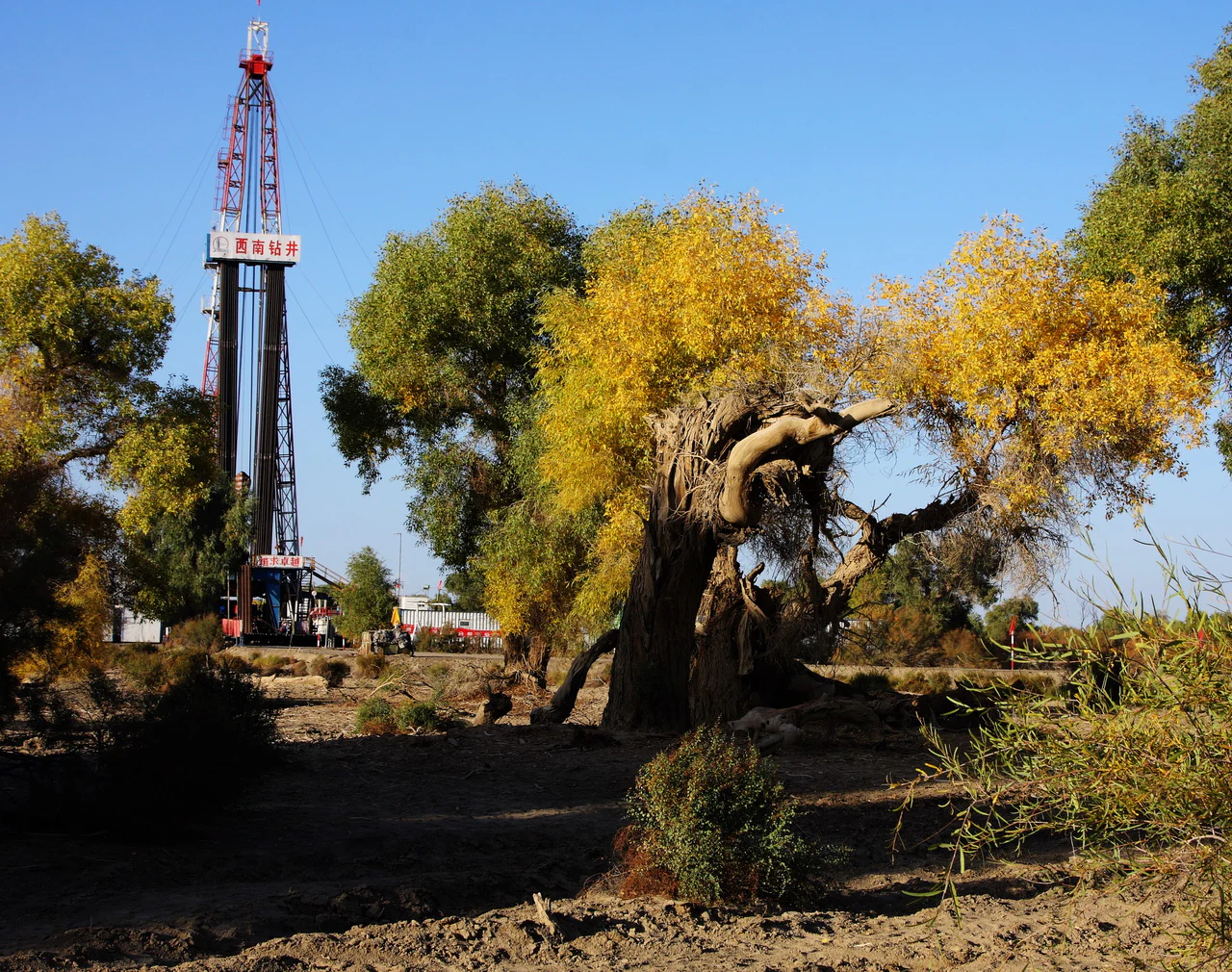
A large oil drilling rig stands in the background behind several yellowing Populus euphratica trees in a desert environment.
A view of the landscape featuring Populus euphratica trees and an oil drilling rig within the region.

Top sights and standout views in Xinjiang Tarim Populus Diversifolia National Nature Reserve

The reserve's strongest points of distinction are its scale, its unusual ecosystem, and its rich mosaic of habitats. As the largest Populus euphratica reserve in China, it anchors national efforts to conserve desert poplar forests and the Tarim River ecosystem, an effort with both ecological and cultural significance.

Its varied habitats, ranging from dense young poplar stands along the river to more open mature and degraded forests on higher terraces, together with extensive desert wetlands, give the area exceptional ecological breadth within a single protected landscape. The presence of flagship species such as the wild Bactrian camel, the Tarim red deer, the golden eagle, and the black stork adds further conservation weight.

For visitors and researchers, the reserve is also notable for its dramatic scenery, with golden-hued autumn poplar forests, meandering river bends, and the stark backdrop of the Taklamakan Desert forming an iconic desert-riparian landscape.

Best time to visit Xinjiang Tarim Populus Diversifolia National Nature Reserve

Seasonal character in the reserve is shaped mainly by temperature, river flow, and the autumn color of the poplar forests. Summers are extremely hot, with daytime highs above 40 degrees Celsius and frequent strong winds, while winters are cold with temperatures dropping well below minus 20 degrees Celsius. The frost-free period extends across much of the year, but late spring and autumn tend to offer more comfortable daytime conditions for being outdoors in the desert environment.

The most widely celebrated season for the landscape is autumn, when the leaves of Populus euphratica trees turn brilliant yellow and gold, transforming the riverbanks into a vivid corridor against the surrounding sand. Spring can also be rewarding for waterbirds and for wildflowers in wetland margins. Because rainfall is extremely low and unreliable, visitors and researchers should expect dry, sunny conditions and strong temperature swings between day and night throughout much of the year.

Monthly climate preview

Long-term representative measurements of monthly temperature and precipitation rhythm

新疆塔里木胡杨国家级自然保护区 Annual Climate Normals and Temperature Patterns

Historical climate data for 新疆塔里木胡杨国家级自然保护区 reveals wide annual temperature swings alongside consistently low precipitation levels across the representative coordinate. Detailed monthly normals provide a complete picture of long-term weather patterns and thermal variation.
Annual mean13 °C
-7 °C30 °C
Jan-7°
Feb-1°
Mar
Apr16°
May22°
Jun27°
Jul30°
Aug28°
Sep22°
Oct13°
Nov
Dec-5°
Warmest month
July

29.7 °C

Coolest month
January

-7.4 °C

Wettest month
June

0.5 mm/day

Driest month
March

0 mm/day

Park location guide

Geography guide, regional context, and park location map for Xinjiang Tarim Populus Diversifolia National Nature Reserve

Xinjiang Tarim Populus Diversifolia National Nature Reserve park geography, regions, and map view in China

Understand where Xinjiang Tarim Populus Diversifolia National Nature Reserve sits in China through a broader geographic reading of the surrounding landscape, nearby location context, and its mapped position within the national park landscape.

How Xinjiang Tarim Populus Diversifolia National Nature Reserve fits into China

China is a unitary communist state in East Asia, governed by the Chinese Communist Party. The country's capital is Beijing, while Shanghai is the largest city by urban population. China has 33 province-level divisions including provinces, autonomous regions, municipalities, and special administrative regions. The nation has a long history spanning thousands of years, with achievements including the invention of gunpowder, paper, printing, and the compass.

Wider geography shaping Xinjiang Tarim Populus Diversifolia National Nature Reserve in China

China is located in East Asia, bordering fourteen countries: Russia, North Korea, Vietnam, Laos, Myanmar, India, Bhutan, Nepal, Pakistan, Afghanistan, Tajikistan, Kyrgyzstan, Kazakhstan, and Mongolia. The country spans diverse terrain including deserts, mountains, plateaus, and river valleys. Major river systems include the Yellow River and Yangtze River. The coastline stretches along the East China Sea, South China Sea, and Yellow Sea.

Map view of Xinjiang Tarim Populus Diversifolia National Nature Reserve

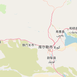
Use this park location map to pinpoint Xinjiang Tarim Populus Diversifolia National Nature Reserve in China, understand its exact geographic position, and read its mapped placement within the surrounding landscape more clearly.

Pigeon | © OpenStreetMap contributors

Location context for Xinjiang Tarim Populus Diversifolia National Nature Reserve

Xinjiang Uyghur Autonomous Region

Visual reference collection showcasing riparian forests, desert wetlands, and river corridors

新疆塔里木胡杨国家级自然保护区 Photos: Landscapes, Scenery, and Protected Area Views

Visual documentation captures the stark contrast between winding river channels and the surrounding sand dunes of the protected area. Examining these environmental photographs reveals the unique topography, riparian vegetation, and habitat conditions defining the regional ecosystem.

A gnarled and partially bare Populus euphratica tree with golden autumn leaves set against a dense, colorful forest backdrop in a dry desert environment.

A gnarled, weathered tree branch, showing signs of drought or age, extends across a clear blue sky, with a small crescent moon visible in the distance.

A calm river reflects a row of autumn-colored Populus euphratica trees under a soft sky.

A calm body of water in the foreground reflects a row of golden-leaved desert poplar trees under a clear blue sky.

A close view of a dense forest of poplar trees with yellow and green leaves, showing intricate branch structures and sun-dappled foliage.

A calm, narrow river winds through a dense forest of golden-yellow Populus euphratica trees in autumn, with reflections visible in the water.

A large oil drilling rig stands in the background behind several yellowing Populus euphratica trees in a desert environment.

Park atlas

Compare adjacent desert riparian reserves, river corridors, and arid basin ecosystems in northwestern China

Exploring Parks Near 新疆塔里木胡杨国家级自然保护区 and Surrounding Protected Landscapes

Browse nearby national parks and protected areas sharing the stark environmental gradient of the Tarim River basin and the Taklamakan Desert margin. Comparing related protected landscapes provides broader geographic context for the unique poplar forests and desert wetlands found within 新疆塔里木胡杨国家级自然保护区.
Nature reserveGongliu County
About 278 km away#1 closest

Northwest

Xinjiang West Tianshan National Nature Reserve: Protected Landscape and Mountain Terrain Map

A high-altitude forest and mountain nature reserve in Gongliu County.

This nature reserve encompasses a vast altitudinal range and complex river drainage systems in the western Tianshan. It is defined by its deep river gorges, glaciated peaks, and ancient spruce stands, functioning as a moist island for diverse Central Asian flora and fauna within an otherwise arid regional geography.

Area
312.17 km²
Established
1983
Relief
Mountain
Climate
Temperate
Nature reserveXinjiang
About 384 km away#2 closest

Northwest

新疆伊犁小叶白蜡国家级自然保护区: Regional Protected Landscape and Tianshan Mountain Geography

Conservation focus on rare riparian ash forest ecosystems in Xinjiang

Spanning the alluvial floodplains of the Kashi and Ili Rivers, this nature reserve is a scientific stronghold for the narrow-leaved ash. The protected area showcases multi-generational forest structures and diverse ancient plant lineages, shaped by a sheltered Tianshan valley microclimate that remains unusually humid for the arid landscapes of inland Xinjiang.

Area
91.03 km²
Established
1983
Relief
Mixed relief
Climate
Temperate
Nature reserveXinjiang
About 386 km away#3 closest

West

新疆托木尔峰国家级自然保护区: Protected Glacial Wilderness and Mountain Geography

Tian Shan mountain reserve featuring extensive valley glacier systems and vertical ecosystem transitions.

Centering on the Tomur and Hantengri peaks, this nature reserve forms the largest glacial concentration in the Tian Shan range. The landscape is defined by its extreme topographic relief, massive dendritic glaciers, and a complete altitudinal sequence of ecosystems. This overview provides a structured look at the reserve's unique mountain geography, from its glacial moraines and high-altitude wildlife habitats to the alluvial fans bordering the Tarim Basin.

Area
3,804.8 km²
Established
1980
Relief
Mountain
Climate
Temperate
State or regional parkKyrgyzstan
About 430 km away#4 closest

West

Khan-Tengri State Nature Park: Kyrgyzstan State or Regional Park Atlas Exploration

Explore protected landscapes and geographic context.

Khan-Tengri State Nature Park is a designated protected area in Kyrgyzstan, offering unique insights into the region's mountainous geography. This page serves as a detailed atlas entry, highlighting the park's protected landscape characteristics, its mapped boundaries, and its place within the broader natural terrain of Central Asia. Understand the geographic identity of this state or regional park and its contribution to conservation landscapes.

Area
2,758 km²
Established
2016
Relief
Mountain
Access
Remote access
Nature reserveXinjiang
About 433 km away#5 closest

North

新疆甘家湖梭梭林国家级自然保护区: Arid Ecosystems and Protected Haloxylon Woodland Mapping

Examining desert terrain and dune geomorphology in northwestern Xinjiang

Explore the structured geography of the Xinjiang Ganjiahu Haloxylon National Nature Reserve, which guards an expansive and ecologically critical saxaul woodland corridor. This protected area stands as a representative example of temperate desert systems in the Ebinur Basin, offering insight into wind-shaped dune landscapes, saline-alkali soil patterns, and the historic riverbeds that once connected Tien Shan meltwater to the regional basin floor.

Area
546.67 km²
Established
1983
Relief
Lowland
Climate
Arid
Nature reserveXinjiang Uyghur Autonomous Region
About 449 km away#6 closest

Northwest

新疆霍城四爪陆龟国家级自然保护区: Mapped Landscape and Tianshan Foothills Geography

Nature reserve boundaries within the Xinjiang Uyghur Autonomous Region

Located in the Xinjiang Uyghur Autonomous Region, the 新疆霍城四爪陆龟国家级自然保护区 represents a unique loess hill ecosystem. This atlas profile details the protected boundaries, erosion-carved terrain, and the semi-arid sagebrush steppe habitat essential for the four-clawed tortoise population, providing deep geographic context for this national nature reserve.

Area
350 km²
Established
1983
Relief
Upland
Climate
Arid
Watercolor painting of a river landscape with green mountains, grasses, and a stream
National parkAlmaty Region
About 525 km away#7 closest

Northwest

Charyn National Park: Protected Landscape Atlas and Mapped Terrain in Almaty Region

Explore its dramatic canyons and ancient Sogdian ash groves.

Charyn National Park offers a compelling exploration of Central Asia's dramatic natural heritage, centered around its spectacular canyon system. This protected area, situated in Kazakhstan's Almaty Region, features towering red rock walls and unique geological formations carved by the Charyn River. The park is also notable for preserving one of the world's northernmost stands of ancient Sogdian ash trees, a vital link to prehistoric ecosystems. Users can discover the park's mapped boundaries, diverse terrain, and distinct landscape features, making it a key destination for geographic and atlas-based discovery.

Area
1,250 km²
Established
2004
IUCN
II
Relief
Mountain
A horizontal watercolor illustration showing soft green grassy foregrounds, a midground of low vegetation, and distant purple and green mountain silhouettes on a white background.
Natural monumentAlmaty Region
About 535 km away#8 closest

Northwest

Charyn Ash Grove Natural Monument and Riparian Forest Landscape in Almaty Region

Protected botanical relic in the Kazakhstan steppe

Charyn Ash Grove preserves a rare population of river-loving Sogdian ash trees within the arid landscape of southeastern Kazakhstan. This protected natural monument traces the moisture-rich corridors of the Charyn and Temirlik rivers, creating a vivid riparian ribbon surrounded by rugged semi-desert terrain and ancient archaeological features that define the regional geography.

Area
48.55 km²
Established
1964
IUCN
III
Relief
Lowland

Common questions about visiting, size, designation, and location context for Xinjiang Tarim Populus Diversifolia National Nature Reserve

Xinjiang Tarim Populus Diversifolia National Nature Reserve FAQs for park facts, access, geography, and protected area context

Find quick answers about Xinjiang Tarim Populus Diversifolia National Nature Reserve, including protected-area facts, park geography, trail and visitor context, and how the park fits into its surrounding country and regional landscape.
MoriAtlas Explorer

Continue Your Protected Areas Search Across the Global Atlas

Deepen your exploration by continuing the structured search for national parks and protected areas worldwide. Utilize the comprehensive filtering capabilities to compare different conservation landscapes and refine your understanding of global park geography. Discover more about the distribution and characteristics of protected natural areas.

Global natural geography