Mori Atlas logo
Nature reserve新疆伊犁小叶白蜡国家级自然保护区

Analyzing the Tianshan mountain valley terrain and relict ash forest ecosystems in Xinjiang

新疆伊犁小叶白蜡国家级自然保护区: A Comprehensive Geographic Atlas and Protected Landscape Mapping

(Xinjiang Yili Xiaoye Baila National Nature Reserve)

The Xinjiang Yili Xiaoye Baila National Nature Reserve preserves a unique riparian ecosystem at the confluence of the Kashi and Ili Rivers within the Tianshan Mountains. This national-level protected area manages diverse plant communities, including rare Tertiary relict narrow-leaved ash forests that thrive in the moisture-retentive loess soils and sheltered microclimate of the valley floor. The geography features complex river floodplains and alluvial terraces that provide essential habitat for endemic flora, marking this region as a significant node for botanical conservation and inland Central Asian landscape study.

national nature reserverelict floranarrow-leaved ash forestTianshan mountainsIli Valleyriparian woodland

新疆伊犁小叶白蜡国家级自然保护区

Nature reserve

Park overview

Structured park overview, official facts, and landscape profile for Xinjiang Yili Xiaoye Baila National Nature Reserve

Xinjiang Yili Xiaoye Baila National Nature Reserve park facts, protected area profile, and essential visitor context

Review the core facts for Xinjiang Yili Xiaoye Baila National Nature Reserve, including designation, size, terrain, visitor scale, habitats, and operating context in one park-focused overview.

About Xinjiang Yili Xiaoye Baila National Nature Reserve

The Xinjiang Yili Xiaoye Baila National Nature Reserve is a botanically focused national protected area in the Ili Valley of northwestern Xinjiang. Although modest in size (about 91 square kilometers), it occupies an ecologically privileged niche where the cool moist influence of the western Tianshan meets the broad Ili River basin, producing conditions far more temperate than the surrounding arid steppes. This setting has allowed relict plant species that largely disappeared from much of Central Asia during later geological eras to persist into the present.

The reserve's defining feature is the narrow-leaved ash forest that dominates its floodplain and lower slopes. Trees of different ages form a layered, multi-strata canopy, with canopy closure varying from open savanna-like woodland to dense stands depending on soil Moisture and position within the floodplain. The ash trees coexist with associated species such as dense-leaved poplar (Populus densa), Tianshan birch, and a range of shrubs and grasses, creating one of the most intact examples of native broadleaf riparian forest remaining in the Ili region.

Beyond its flagship tree, the reserve protects a broader community of vascular plants (roughly 400 species in 64 families), a fauna typical of the Palearctic Central Asian faunal region, and several nationally protected wild plants and birds. Its importance for conservation science comes from the way it preserves, in one relatively compact area, both a relict tree species of considerable scientific interest and the ecological context, soils, microclimate, and plant community structure on which that species depends.

Quick facts and research context for Xinjiang Yili Xiaoye Baila National Nature Reserve

Located in Yining County, Ili Kazakh Autonomous Prefecture, Xinjiang Uygur Autonomous Region, China. Established as the Yining Xiaoye Baila Nature Reserve by the Xinjiang regional government in 1983 and upgraded to a national nature reserve in May 2016. Covers approximately 91 square kilometers in a westward-opening valley of the central Tianshan at the Kashi River's mouth into the Ili River. Primary management focus is in situ conservation of the narrow-leaved ash (Fraxinus sogdiana) and its associated riparian and foothill habitats.

Protection and recognition

Documented terrestrial protection scope and established designation timeline

新疆伊犁小叶白蜡国家级自然保护区 Protection Status and Designation History

Records for 新疆伊犁小叶白蜡国家级自然保护区 detail the established terrestrial protection status and designation history from 2016. Verified management scope and administrative data provide structured reference points for this protected area.

Protection details

Protection scope
Terrestrial
Designated year
2016
Transboundary protection
No
Park context

Deeper park guide and search-rich context for Xinjiang Yili Xiaoye Baila National Nature Reserve

Xinjiang Yili Xiaoye Baila National Nature Reserve history, landscape, wildlife, and travel context

Explore Xinjiang Yili Xiaoye Baila National Nature Reserve through its history, landscape character, ecosystems, wildlife, conservation priorities, cultural context, and seasonal travel timing in a structured park guide built for atlas discovery and search intent.

Why Xinjiang Yili Xiaoye Baila National Nature Reserve stands out

The reserve is best known for protecting one of the few remaining populations of narrow-leaved ash (xiaoye baila), a Tertiary relict species whose ancestors date back to the Neogene period and which today grows only in scattered localities of Central Asia. The reserve's forests are notable for their multi-generational structure, with trees of six or seven different age classes coexisting, including individuals over a century old and reaching roughly 20 meters in height. The protected area is also recognized for its unusual ecological setting in Xinjiang. A sheltered valley position, combined with alluvial soils and loess-covered hills, creates conditions that support a distinctive combination of steppe-forest vegetation and ancient plant lineages rarely found together elsewhere in the region. This combination of relict trees, diverse botanical communities, and protected wildlife gives the reserve a distinctive scientific and conservation profile.

Xinjiang Yili Xiaoye Baila National Nature Reserve history and protected-area timeline

The reserve traces its origins to the early 1980s, when scientists from Northwest University, the Chinese Academy of Sciences Xinjiang Branch, Xinjiang University, and the Xinjiang Academy of Agricultural Sciences carried out surveys of natural areas in the Ili region. In 1983, the Xinjiang Uygur Autonomous Region government approved the establishment of the Yining Xiaoye Baila Nature Reserve as a prefectural-level reserve, formalizing protection of the narrow-leaved ash stands along the Kashi and Ili river confluence.

For more than three decades the reserve operated as a regional protected area, while researchers continued to study its ash forest and associated flora. In May 2016, the State Council of China elevated its status, redesignating the area as the Xinjiang Yili Xiaoye Baila National Nature Reserve. Following this upgrade, the Ili Prefecture initiated construction and management reforms in 2017, replacing the older management station with a dedicated reserve administration bureau.

A long-term master plan covering 2018 to 2027 was put into effect in 2018, the same year the reserve's mining-related ecological rehabilitation was essentially completed. In 2021, a major conservation and monitoring infrastructure project was launched, adding fencing, a new management station, ranger outposts, a meteorological observation station, and an ecological monitoring station to strengthen on-site protection and scientific oversight.

Xinjiang Yili Xiaoye Baila National Nature Reserve landscape and geographic character

The reserve lies in a westward-opening wedge-shaped valley in the central Tianshan Mountains, precisely where the Kashi River joins the Ili River. The surrounding topography channels cold northern air masses away from the valley while also shielding it from hot, dry air masses advancing from the south, giving the area a noticeably cooler and more humid climate than the broader Ili Basin.

Within the valley, the terrain is shaped by Quaternary alluvial processes. The Kashi River has laid down broad floodplains and river terraces, while older loess deposits mantle the low hills and foothills flanking the valley. Soils on the river flats are predominantly silty and medium-sandy loam meadow-forest soils, providing a moisture-retentive substrate ideal for broadleaf tree growth. Annual precipitation is broadly 350 to 400 millimeters, paired with a mean annual temperature of around 8 degrees Celsius, conditions that support an unusually lush vegetation cover for inland Central Asia.

Xinjiang Yili Xiaoye Baila National Nature Reserve ecosystems, habitats, and plant life

Ecologically, the reserve sits at the meeting point of Central Asian steppe and relict broadleaf forest. The vegetation is dominated by north-temperate floristic elements, with strong biogeographic links to the Mediterranean, Central Asia, and West Asia, reflecting the region's position as a crossroads between major phytogeographic regions of Eurasia.

The flora carries clear signals of an ancient origin. Several families represented in the reserve, including Chenopodiaceae and Ephedraceae, date back to the early Tertiary, while others such as Zygophyllaceae and Tamaricaceae originated in the Oligocene. The narrow-leaved ash itself is a representative of the Tertiary relict flora that once covered much broader areas of Central Asia. Among the 64 plant families recorded, Asteraceae, Poaceae, Fabaceae, Rosaceae, Caryophyllaceae, Brassicaceae, and Polygonaceae are the dominant families, and the reserve supports plant species endemic to Xinjiang such as Xinjiang ferula, Junggar caragana, and Tianshan dolomiaea.

Xinjiang Yili Xiaoye Baila National Nature Reserve wildlife and species highlights

The reserve's fauna belongs primarily to the Palearctic Central Asian faunal region. Birds are the most conspicuous group and include species from passerine, falconiform, columbiform, cuculiform, and strigiform orders. Mammals are typical of Central Asian foothill and riparian habitats and are dominated by carnivores, lagomorphs, and rodents, reflecting the mosaic of woodland, shrub, and meadow habitats within the reserve.

Several species recorded here are of national conservation concern in China. Protected birds documented in the area include the long-eared owl, steppe eagle, and sparrowhawk, while a broader suite of nationally and regionally protected plants, such as Xinjiang wild apple, Xinjiang ferula, and Yibeimu (a Fritillaria species used in traditional medicine), also occur within the reserve. Wildlife observation value lies less in charismatic megafauna than in the integrity of the broader plant and bird community supported by these relict forests.

Xinjiang Yili Xiaoye Baila National Nature Reserve conservation status and protection priorities

Conservation significance centers on the narrow-leaved ash as a Tertiary relict species, making the reserve one of the few formally protected sites in China securing both the tree and the full habitat complex on which it depends. The reserve's elevation from a regional to a national designation in 2016 reflects recognition that this combination of relict flora, alluvial soils, and sheltered microclimate is a nationally important natural heritage.

Protection efforts have evolved from the basic management structure of the 1983 reserve to a more systematic framework. The 2018 to 2027 master plan and the 2021 infrastructure project introduced fencing, upgraded management stations, ranger outposts, and ecological monitoring facilities, while the completion of mine-site ecological rehabilitation in 2018 addressed legacy land-use impacts. Together with the reserve's role as living gene bank material for ancient ash populations, these management measures make the area a key site for in situ conservation and ecological research in Xinjiang.

Top sights and standout views in Xinjiang Yili Xiaoye Baila National Nature Reserve

A flagship site for conservation of the narrow-leaved ash, a Tertiary relict tree otherwise vanishingly rare across Central Asia. A multi-aged ash forest covering four distinct community types along the Kashi-Ili river confluence, from open savanna-like woodland to dense, layered stands with century-old trees. An unusually moist microclimate for inland Xinjiang, created by a sheltered Tianshan valley position and supported by Quaternary alluvial and loess soils. Diverse regional flora spanning about 64 plant families with ancient lineages, plus endemic species such as Xinjiang ferula, Junggar caragana, and Tianshan dolomiaea. A nationally designated reserve with a long-term management plan, dedicated reserve administration, and active ecological monitoring infrastructure.
Monthly climate preview

Long-term representative point measurements tracking monthly temperature and precipitation rhythms across Xinjiang

新疆伊犁小叶白蜡国家级自然保护区 Climate Normals and Annual Temperature Range

Historical monitoring records from 1991 to 2000 reveal the measured annual temperature and precipitation rhythm across the representative coordinate of Xinjiang Yili Xiaoye Baila National Nature Reserve. Examining the full twelve-month profile provides deeper analytical depth regarding long-term climatic patterns at this protected elevation.
Annual mean9 °C
-6 °C23 °C
Jan-6°
Feb-3°
Mar
Apr10°
May15°
Jun20°
Jul23°
Aug21°
Sep16°
Oct
Nov
Dec-4°
Warmest month
July

22.6 °C

Coolest month
January

-6.1 °C

Wettest month
June

1.3 mm/day

Driest month
January

0.4 mm/day

Park location guide

Geography guide, regional context, and park location map for Xinjiang Yili Xiaoye Baila National Nature Reserve

Xinjiang Yili Xiaoye Baila National Nature Reserve park geography, regions, and map view in China

Understand where Xinjiang Yili Xiaoye Baila National Nature Reserve sits in China through a broader geographic reading of the surrounding landscape, nearby location context, and its mapped position within the national park landscape.

How Xinjiang Yili Xiaoye Baila National Nature Reserve fits into China

China is a unitary communist state in East Asia, governed by the Chinese Communist Party. The country's capital is Beijing, while Shanghai is the largest city by urban population. China has 33 province-level divisions including provinces, autonomous regions, municipalities, and special administrative regions. The nation has a long history spanning thousands of years, with achievements including the invention of gunpowder, paper, printing, and the compass.

Wider geography shaping Xinjiang Yili Xiaoye Baila National Nature Reserve in China

China is located in East Asia, bordering fourteen countries: Russia, North Korea, Vietnam, Laos, Myanmar, India, Bhutan, Nepal, Pakistan, Afghanistan, Tajikistan, Kyrgyzstan, Kazakhstan, and Mongolia. The country spans diverse terrain including deserts, mountains, plateaus, and river valleys. Major river systems include the Yellow River and Yangtze River. The coastline stretches along the East China Sea, South China Sea, and Yellow Sea.

Map view of Xinjiang Yili Xiaoye Baila National Nature Reserve

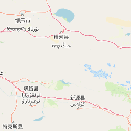
Use this park location map to pinpoint Xinjiang Yili Xiaoye Baila National Nature Reserve in China, understand its exact geographic position, and read its mapped placement within the surrounding landscape more clearly.

Pigeon | © OpenStreetMap contributors

Location context for Xinjiang Yili Xiaoye Baila National Nature Reserve

Xinjiang
Park atlas

Compare adjacent Tianshan mountain landscapes and regional valley reserves

Parks Near 新疆伊犁小叶白蜡国家级自然保护区 and Surrounding Protected Areas

Browse protected areas and river valley reserves adjacent to 新疆伊犁小叶白蜡国家级自然保护区 in the central Tianshan mountain region. Compare surrounding park geography and regional flora to understand connected conservation landscapes across the Ili Valley.
Nature reserveXinjiang Uyghur Autonomous Region
About 66 km away#1 closest

Northwest

新疆霍城四爪陆龟国家级自然保护区: Mapped Landscape and Tianshan Foothills Geography

Nature reserve boundaries within the Xinjiang Uyghur Autonomous Region

Located in the Xinjiang Uyghur Autonomous Region, the 新疆霍城四爪陆龟国家级自然保护区 represents a unique loess hill ecosystem. This atlas profile details the protected boundaries, erosion-carved terrain, and the semi-arid sagebrush steppe habitat essential for the four-clawed tortoise population, providing deep geographic context for this national nature reserve.

Area
350 km²
Established
1983
Relief
Upland
Climate
Arid
Nature reserveGongliu County
About 112 km away#2 closest

Southeast

Xinjiang West Tianshan National Nature Reserve: Protected Landscape and Mountain Terrain Map

A high-altitude forest and mountain nature reserve in Gongliu County.

This nature reserve encompasses a vast altitudinal range and complex river drainage systems in the western Tianshan. It is defined by its deep river gorges, glaciated peaks, and ancient spruce stands, functioning as a moist island for diverse Central Asian flora and fauna within an otherwise arid regional geography.

Area
312.17 km²
Established
1983
Relief
Mountain
Climate
Temperate
Nature reserveXinjiang
About 170 km away#3 closest

Northwest

Xinjiang Wenquan Xinjiang Salamander National Nature Reserve Protected Landscape and Atlas Geography

A vital montane spring and alpine grassland protected area in the Western Tianshan.

The Xinjiang Wenquan Xinjiang Salamander National Nature Reserve serves as a dedicated refuge for relict amphibian populations within the Tianshan mountain system. Its small footprint concentrates on preserving the integrity of cold-water spring brooks and snowmelt-driven seepage zones that form the backbone of this regional ecosystem. The reserve provides a clear example of targeted habitat management within the diverse topography of northwestern China.

Area
6.95 km²
Established
1997
Relief
Mountain
Climate
Arid
Watercolor illustration showing rolling hills, distant mountains, and sparse vegetation
National parkAlmaty Region
About 188 km away#4 closest

West

Altyn-Emel National Park: A Protected Landscape of Singing Dunes and Lunar Mountains

Explore unique geological wonders and ancient Saka history.

Discover Altyn-Emel National Park, a prominent national park located in Kazakhstan's Almaty Region. This protected area showcases an extraordinary diversity of landscapes, from the echoing Singing Dunes to the otherworldly Aktau mountains, often referred to as the 'lunar mountains' due to their vivid mineral hues. As a vital conservation zone, it safeguards Central Asian steppe ecosystems and significant Iron Age archaeological sites, offering a rich tapestry of natural beauty and historical depth for atlas exploration.

Area
4,600 km²
Established
1996
IUCN
II
Relief
Mixed relief
Nature reserveXinjiang
About 188 km away#5 closest

Northeast

新疆甘家湖梭梭林国家级自然保护区: Arid Ecosystems and Protected Haloxylon Woodland Mapping

Examining desert terrain and dune geomorphology in northwestern Xinjiang

Explore the structured geography of the Xinjiang Ganjiahu Haloxylon National Nature Reserve, which guards an expansive and ecologically critical saxaul woodland corridor. This protected area stands as a representative example of temperate desert systems in the Ebinur Basin, offering insight into wind-shaped dune landscapes, saline-alkali soil patterns, and the historic riverbeds that once connected Tien Shan meltwater to the regional basin floor.

Area
546.67 km²
Established
1983
Relief
Lowland
Climate
Arid
Watercolor painting of a river landscape with green mountains, grasses, and a stream
National parkAlmaty Region
About 194 km away#6 closest

West

Charyn National Park: Protected Landscape Atlas and Mapped Terrain in Almaty Region

Explore its dramatic canyons and ancient Sogdian ash groves.

Charyn National Park offers a compelling exploration of Central Asia's dramatic natural heritage, centered around its spectacular canyon system. This protected area, situated in Kazakhstan's Almaty Region, features towering red rock walls and unique geological formations carved by the Charyn River. The park is also notable for preserving one of the world's northernmost stands of ancient Sogdian ash trees, a vital link to prehistoric ecosystems. Users can discover the park's mapped boundaries, diverse terrain, and distinct landscape features, making it a key destination for geographic and atlas-based discovery.

Area
1,250 km²
Established
2004
IUCN
II
Relief
Mountain
A horizontal watercolor illustration showing soft green grassy foregrounds, a midground of low vegetation, and distant purple and green mountain silhouettes on a white background.
Natural monumentAlmaty Region
About 200 km away#7 closest

West

Charyn Ash Grove Natural Monument and Riparian Forest Landscape in Almaty Region

Protected botanical relic in the Kazakhstan steppe

Charyn Ash Grove preserves a rare population of river-loving Sogdian ash trees within the arid landscape of southeastern Kazakhstan. This protected natural monument traces the moisture-rich corridors of the Charyn and Temirlik rivers, creating a vivid riparian ribbon surrounded by rugged semi-desert terrain and ancient archaeological features that define the regional geography.

Area
48.55 km²
Established
1964
IUCN
III
Relief
Lowland
Watercolor painting depicting a mountain range, lake, and grassy foreground under a pale sky
National parkAlmaty Region
About 205 km away#8 closest

Northwest

Zhongar-Alatau National Park: Protected Mountain Landscape and Genetic Heritage Atlas

Almaty Region's critical wild apple forest and glaciated terrain.

Zhongar-Alatau National Park in Kazakhstan's Almaty Region is a significant protected landscape renowned for its role in conserving the genetic origins of cultivated apples. The park encompasses dramatic glaciated mountain ranges, deep canyons, and diverse ecosystems within the Dzungarian Alatau. Its mapped boundaries define an area vital for protecting unique wild fruit tree species, including the Sievers apple, and preserving the distinctive alpine terrain of southeastern Kazakhstan, offering rich context for geographic exploration.

Area
36 km²
Established
2010
IUCN
II
Relief
Mountain

Common questions about visiting, size, designation, and location context for Xinjiang Yili Xiaoye Baila National Nature Reserve

Xinjiang Yili Xiaoye Baila National Nature Reserve FAQs for park facts, access, geography, and protected area context

Find quick answers about Xinjiang Yili Xiaoye Baila National Nature Reserve, including protected-area facts, park geography, trail and visitor context, and how the park fits into its surrounding country and regional landscape.
MoriAtlas Explorer

Continue Your Protected Areas Search Across the Global Atlas

Deepen your exploration by continuing the structured search for national parks and protected areas worldwide. Utilize the comprehensive filtering capabilities to compare different conservation landscapes and refine your understanding of global park geography. Discover more about the distribution and characteristics of protected natural areas.

Global natural geography