

Mori Atlas logo
Nature reserveYammoune Nature Reserve

Examining the high altitude lake, juniper ecosystems, and unique geological fault line terrain

Yammoune Nature Reserve: An Atlas of Protected Landscapes and Geographic Boundaries in the Baalbek-Hermel Governorate

Yammoune Nature Reserve represents a critical protected area within the northern Beqaa Valley of Lebanon, characterized by its high altitude lake and historical temple ruins. This detailed geographic profile maps the intersection of spring-fed hydrology, endemic freshwater habitats, and the rugged slopes shaped by the Yammoune Fault. Users can investigate the distinct juniper woodlands and the ancient irrigation systems that define this culturally and ecologically significant mountain landscape.

nature reserveBeqaa Valleymountain lakejuniper forestfreshwater ecosystemendemic fish
A flat-style vector illustration depicting a tall waterfall flowing between rocky cliffs into a river, surrounded by pine forests.

Yammoune Nature Reserve

Nature reserve

Park overview

Structured park overview, official facts, and landscape profile for Yammoune Nature Reserve

Yammoune Nature Reserve park facts, protected area profile, and essential visitor context

Review the core facts for Yammoune Nature Reserve, including designation, size, terrain, visitor scale, habitats, and operating context in one park-focused overview.

About Yammoune Nature Reserve

Yammoune Nature Reserve lies in the high Beqaa Valley, roughly twenty-five to thirty kilometres northwest of Baalbek, in a region where mountain springs, fault-controlled geology, and Mediterranean upland vegetation come together. The reserve was formally established in 1998, and its designation explicitly combines scientific and cultural values: it protects a landscape that is ecologically distinctive and at the same time dense with archaeological and mythological significance.

At the heart of the reserve is Lake Yammoune, a seasonal freshwater body fed by a powerful karstic cavern west of the old temple site. The lake has a single major outflow into a rocky channel, and water levels vary through the year, sometimes dropping significantly in late summer. From the lake and its springs, an extensive system of rock-cut irrigation channels once carried water down into the broader Beqaa Valley, historically sustaining agriculture around Baalbek.

The reserve's terrain rises into the surrounding highlands, where slopes support juniper woodlands that are characteristic of this part of the Lebanese mountains. These juniper stands, combined with open rocky ground and spring wetlands, give the area a transitional character between high mountain and interior valley ecosystems. Walking trails cross the reserve, linking the lake, the springs, and the temple ruins, and the area has become a popular hiking destination for visitors who come for both the scenery and the history.

Culturally, the reserve overlays an ancient ritual landscape. The hill above the lake carries the remains of a temple whose origins may reach back to Phoenician and Greek periods before being expanded significantly under Rome. The site is traditionally linked to Venus and Astarte, and is woven into broader legends involving Adonis, Typhon, and the sacred waters of Afqa across the mountain. Together, the archaeological, ecological, and hydrological layers make Yammoune one of the most layered natural-cultural landscapes in Lebanon.

Quick facts and research context for Yammoune Nature Reserve

Yammoune Nature Reserve was established in 1998 as a scientific and cultural nature reserve in the Baalbek District of Lebanon's Baalbek-Hermel Governorate. The protected area covers the lake, its spring system, and the surrounding juniper-clad slopes in the upper Beqaa Valley.

The site combines a high-elevation freshwater ecosystem with major archaeological heritage, including temple ruins dedicated to Venus and possibly Astarte, and a network of rock-cut channels that historically irrigated parts of the Beqaa Valley. The reserve is also culturally important for its mythology, including legends linking the lake to Astarte's transformation into a fish.

Protection and recognition

Documented terrestrial protection metrics and official establishment records

Yammoune Nature Reserve Protection Status and Designation History

Yammoune Nature Reserve maintains a documented terrestrial protection status established in 1998 for conservation oversight. Official designation records detail the management scope and administrative framework governing the protected landscape.

Protection details

Protection scope
Terrestrial
Designated year
1998
Transboundary protection
No
Park context

Deeper park guide and search-rich context for Yammoune Nature Reserve

Yammoune Nature Reserve history, landscape, wildlife, and travel context

Explore Yammoune Nature Reserve through its history, landscape character, ecosystems, wildlife, conservation priorities, cultural context, and seasonal travel timing in a structured park guide built for atlas discovery and search intent.

Why Yammoune Nature Reserve stands out

Yammoune Nature Reserve is best known for two very different but intertwined reasons: its ancient heritage landscape and its distinctive juniper ecosystem. The reserve contains the remains of a Roman temple, likely rooted in earlier Phoenician-Greek worship, set against the dramatic backdrop of Lake Yammoune and the Naba al-Arbain spring. Ecologically, the area is recognized for its stands of juniper trees, which give the surrounding slopes a regionally distinctive character. The lake itself is biologically significant as the only known habitat of Lebanon's endemic freshwater fish, _Pseudophoxinus libani_, making the reserve a small but important refuge for aquatic biodiversity.
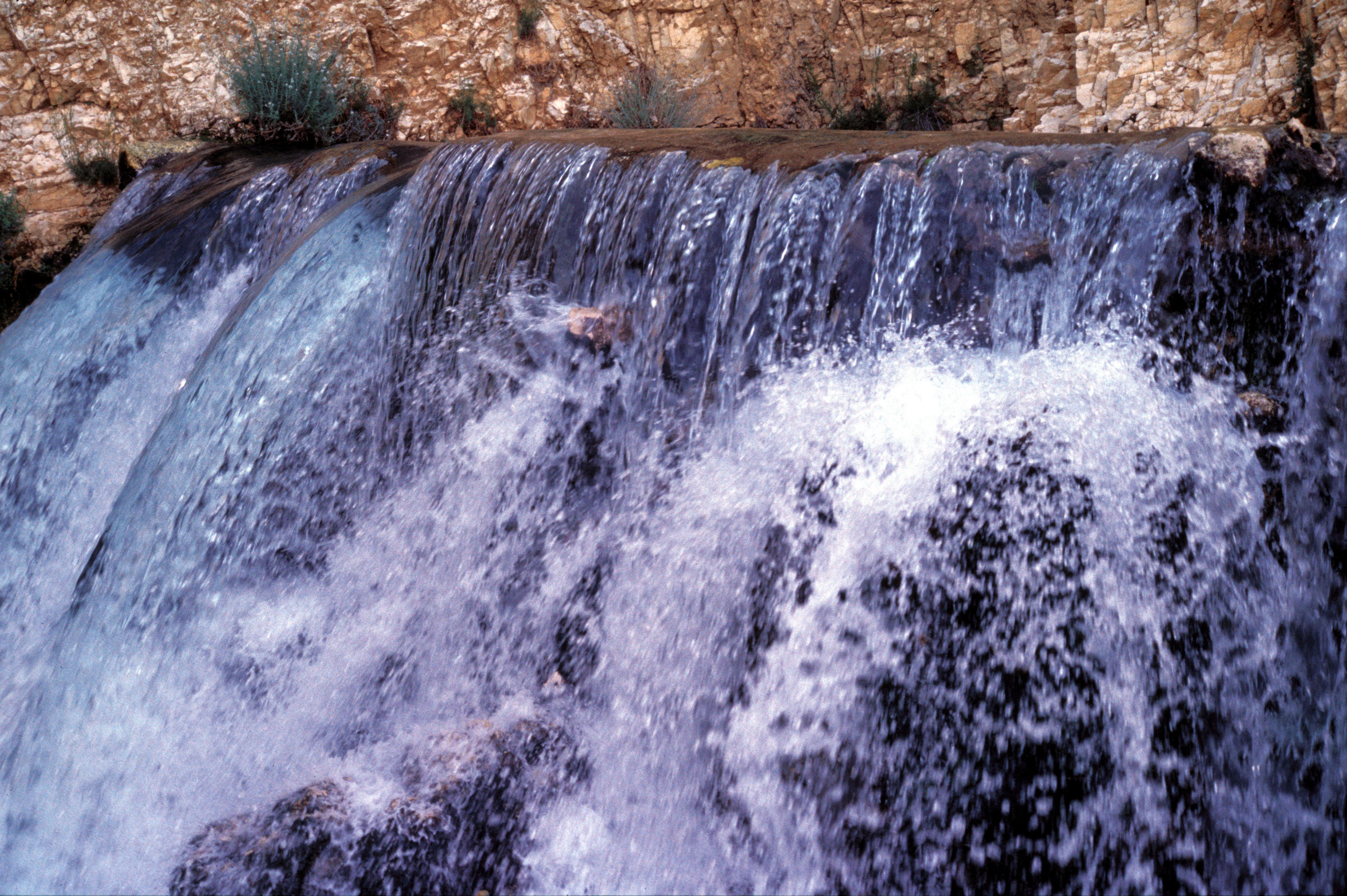
A close up view of a small, cascading waterfall flowing over rocks, with a stone wall visible in the background.
The flowing water at the Yammoune spring, a central feature of the nature reserve.

Yammoune Nature Reserve history and protected-area timeline

The cultural history of Yammoune stretches back at least to the Phoenician period, when the site is believed to have hosted an early sanctuary later expanded under Greek and Roman influence. The temple complex on the hill above the lake, traditionally associated with Venus and potentially with the older goddess Astarte, was likely small in its earliest form before being considerably enlarged and improved during the Roman era.

Latin inscriptions dominate the epigraphic record at the site, though a number of Ancient Greek inscriptions were also found. A retaining wall of limestone blocks descending toward the lake level is the most prominent surviving structural feature, and scholars have long believed that subterranean chambers lie beneath it. Nineteenth-century scholar Ernest Renan visited the site and recovered sections of a frieze and pediment belonging to the temple, while later investigators such as Michael Alouf added to the archaeological record with discoveries of statues, altars, votive objects, and a 200-metre Roman road southeast of the lake, along with what may have been a small guardhouse or watchtower.

The site's mythology is closely tied to water and ritual purity. Legends describe pilgrims traveling from the temple at Afqa to purify themselves in the waters of Yammoune, and stories connect the lake to Astarte's transformation into a fish to escape Typhon. Queen Zenobia of Palmyra is also linked to the site through traditions of offerings placed on the lake as a form of oracle. The early Christian historian Eusebius later records that Constantine destroyed a temple of Venus on Mount Lebanon, an event some scholars associate with the Yammoune sanctuary.

In the modern era, the area was classified as a scientific and cultural nature reserve in 1998 under Lebanese law. In the 1970s, the village also became briefly associated with regional political history when Ali Akbar Mohtashamipur, who later held senior positions in the Iranian government, lived there while receiving military training at a nearby camp.

Yammoune Nature Reserve landscape and geographic character

The landscape of Yammoune Nature Reserve is shaped by its position in the high northern Beqaa Valley, where the valley floor meets the foothills of Mount Lebanon. Elevation in the area reaches around 1,370 metres, and the terrain is a mix of valley basin, spring-fed plains, and rising rocky slopes. The reserve is dominated visually by the Lake Yammoune basin and the hills that frame it, with the Naba al-Arbain spring and an associated water cavern to the west supplying much of the hydrology.

Geologically, the reserve sits on the Yammoune Fault line, a structure responsible for several recorded historical earthquakes across the region. Research from the American University of Beirut in 2010 identified a new segment of this fault through trench studies near Marjahine, refining the dating of past events and informing seismic hazard understanding for the broader area.

The visual character of the reserve combines open stony ground near the lake, juniper-covered uplands, and the engineered water landscapes of rock-cut channels that once carried irrigation water toward the agricultural lands around Baalbek. From the lake, the valley of Ouyoun Ergush extends toward Marjhine, providing one of the regional corridors that link Yammoune into the larger Beqaa landscape.

Yammoune Nature Reserve ecosystems, habitats, and plant life

Ecologically, Yammoune Nature Reserve represents a transitional zone between high Mediterranean mountain environments and the drier interior character of the Beqaa Valley. Its most distinctive vegetative feature is the presence of juniper trees, which form recognizable stands on the rocky slopes around the lake and give the reserve a botanical signature unusual within Lebanon.

The wetland and spring systems around Lake Yammoune add a second ecological dimension. The lake and the Naba al-Arbain spring create locally humid conditions amid an otherwise semi-arid upland setting, supporting habitats that differ from the surrounding steppe-like terrain. The karstic hydrology of the area, including the large water cavern west of the old temple, controls seasonal water levels and shapes the vegetation around the lake margins.

Together, juniper slopes, spring wetlands, and the lake basin give the reserve a layered ecological profile: a small but ecologically rich mosaic where mountain vegetation, freshwater habitats, and Mediterranean upland species overlap within a relatively compact protected area.

Yammoune Nature Reserve wildlife and species highlights

Yammoune Nature Reserve is most notable in biological terms for its aquatic fauna. Lake Yammoune is the only known natural habitat of _Pseudophoxinus libani_, a small freshwater fish that is Lebanon's sole endemic fish species. This makes the lake a site of considerable conservation significance, as its survival is tied directly to the continued ecological health of the Yammoune water system.

Beyond the endemic fish, the reserve's mix of open rocky slopes, juniper woodlands, and spring-fed wetland margins supports typical upland Beqaa fauna, including birds adapted to Mediterranean mountain and semi-arid transition habitats. The combination of juniper cover, cliff and boulder terrain around the temple hill, and seasonal water at the lake creates varied microhabitats within a small geographic footprint, which contributes to the reserve's biodiversity value.

Yammoune Nature Reserve conservation status and protection priorities

Yammoune Nature Reserve has been protected since 1998, with its formal designation explicitly combining scientific and cultural values. The reserve's conservation importance rests on three pillars: the protection of Lebanon's only endemic freshwater fish in Lake Yammoune, the preservation of juniper-dominated upland vegetation, and the safeguarding of an archaeological and hydrological landscape that has shaped human use of the Beqaa Valley for millennia.

The hydrology of the reserve is itself a conservation subject. The lake is fed largely by a karstic cavern and has only one major outflow, which means water levels are sensitive to seasonal and longer-term climatic variation, and in some years the lake may drop significantly by the end of summer. Maintaining the quality and reliability of this water system is central both to protecting the endemic fish and to preserving the integrity of the ancient irrigation channels that link Yammoune to agricultural lands around Baalbek.

At the same time, the reserve sits on the active Yammoune Fault line. Research into this fault system, including a new segment identified near Marjahine in 2010, has improved the dating of historical earthquakes in the region and contributes to broader seismic hazard assessment. The reserve thus contains not only biological and cultural heritage but also a key piece of geological reference for understanding the region's natural hazards.

Yammoune Nature Reserve cultural meaning and human context

Yammoune sits within one of the most mythologically charged landscapes of the ancient Levant. The temple site is traditionally associated with the worship of Venus and, before the Roman period, with the Phoenician goddess Astarte. Local lore holds that it was at Yammoune that the goddess transformed herself into a fish to escape Typhon, a story that links the lake, the temple, and the wider cultic geography of Mount Lebanon.

The reserve is closely tied into a broader sacred circuit. Pilgrims are said to have traveled from the temple at Afqa, source of the river Adonis on the other side of the mountain, to purify themselves in the waters of Yammoune, suggesting ritual movement across the highland landscape. Some scholars have even proposed Yammoune and Afqa as a paired setting for the home of El described in the Ugaritic texts of around 1200 BCE, where El is placed at the sources of the rivers and the midst of the fountains of the two deeps.

In more recent centuries, the village of Yammoune has been a focal point for the surrounding Baalbek-Hermel region, where local social traditions and political events have occasionally intersected with broader Arab and international history. Today, the cultural context of the reserve is experienced primarily through visitors walking between the Naba al-Arbain spring, the lake, and the remains of the Roman temple, retracing routes that have been walked for thousands of years.

Top sights and standout views in Yammoune Nature Reserve

Yammoune Nature Reserve stands out for the unusual combination of a high-altitude lake, ancient temple ruins, juniper woodlands, and a culturally loaded spring system all within a relatively small protected footprint. Its most distinctive single features are the Naba al-Arbain spring, the Lake Yammoune basin fed by the western cavern, and the broken retaining wall of the Roman temple descending toward the water.

The reserve is also distinguished by being home to _Pseudophoxinus libani_, Lebanon's only endemic freshwater fish, giving its water ecosystem a unique place in the country's biodiversity. Layered onto this is the area's role within the wider sacred landscape of Venus, Astarte, Adonis, and Afqa, which has made Yammoune a site of interest for archaeologists, mythologists, and travelers alike.

Best time to visit Yammoune Nature Reserve

The character of Yammoune Nature Reserve shifts notably with the seasons. Spring and early summer are typically the most rewarding period for hiking, when the lake and the Naba al-Arbain spring are well supplied, the juniper slopes are vividly green, and temperatures on the high ground remain comfortable for walking between the lake, the springs, and the temple remains.

By late summer the lake can drop significantly due to the limited outflow and seasonal drying of feeder channels, which alters the visual impact of the basin and changes the atmosphere of the site. Winter visits are possible but can bring cold conditions at this elevation, snow on the higher slopes, and reduced accessibility around the lake margins. For visitors primarily interested in the combination of landscape, lake scenery, and outdoor walking, the late spring window generally offers the most balanced experience.
Monthly climate preview

Monthly temperature ranges and long-term precipitation averages across the protected terrain

Yammoune Nature Reserve Climate Normals, Annual Temperature and Precipitation Patterns

Yammoune Nature Reserve exhibits a measured annual climate rhythm ranging from winter minimum temperatures below freezing to summer maximums exceeding thirty degrees Celsius alongside distinct monthly precipitation variations. Examining the comprehensive twelve-month record reveals complete long-term temperature and precipitation averages for this protected location.
Annual mean13 °C
3 °C23 °C
Jan
Feb
Mar
Apr11°
May16°
Jun20°
Jul23°
Aug23°
Sep20°
Oct15°
Nov
Dec
Warmest month
August

23.2 °C

Coolest month
January

2.8 °C

Wettest month
January

2.2 mm/day

Driest month
July

0 mm/day

Park location guide

Geography guide, regional context, and park location map for Yammoune Nature Reserve

Yammoune Nature Reserve park geography, regions, and map view in Lebanon

Understand where Yammoune Nature Reserve sits in Lebanon through a broader geographic reading of the surrounding landscape, nearby location context, and its mapped position within the national park landscape.

How Yammoune Nature Reserve fits into Lebanon

Lebanon is a unitary parliamentary republic under confessionalism with a population of over 5 million. Located on the Mediterranean coast at the crossroads of ancient trade routes, it has a diverse religious composition with Islam and Christianity as the main faiths. The country has historical roots dating to Phoenicia and has been ruled by Romans, Byzantines, Ottoman Empire, and France.

Wider geography shaping Yammoune Nature Reserve in Lebanon

Lebanon is located in the Levant region of West Asia on the eastern Mediterranean coast. It is bordered by Syria to the north and east, Israel to the south, and the Mediterranean Sea to the west. The country has a small territory of 10,452 square kilometres, with a narrow coastal plain and mountainous interior including the Lebanon Mountains.

Map view of Yammoune Nature Reserve

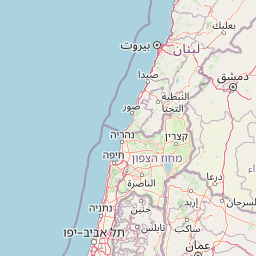
Use this park location map to pinpoint Yammoune Nature Reserve in Lebanon, understand its exact geographic position, and read its mapped placement within the surrounding landscape more clearly.

Pigeon | © OpenStreetMap contributors

Location context for Yammoune Nature Reserve

Baalbek-Hermel Governorate

Explore high-elevation terrain, juniper woodlands, and ancient lake basins through detailed protected-area imagery.

Yammoune Nature Reserve Photos and Landscapes: Visualizing the High Beqaa Valley

Visual documentation captures the high-altitude topography, spring-fed hydrology, and juniper-covered slopes defining Yammoune Nature Reserve. Examining these protected landscapes reveals the terrain features and ecological character shaping this unique Lebanese conservation area.

A close up view of a small, cascading waterfall flowing over rocks, with a stone wall visible in the background.

Park atlas

Compare regional geography, high-elevation valley terrain, and connected juniper ecosystems.

Exploring Parks Near Yammoune Nature Reserve and Surrounding Protected Areas

Browse nearby national parks and protected areas sharing similar highland terrain, spring-fed basins, and regional conservation significance. Compare adjacent protected landscapes to understand the broader ecological and geological corridors connecting the surrounding mountain valleys.
Nature reserveNorth Lebanon Governorate
About 12 km away#1 closest

Northwest

Tannourine Cedar Forest Nature Reserve: A Premier Protected Cedar Landscape in North Lebanon

Mapped geography of Lebanon's largest cedar forest.

Delve into the Tannourine Cedar Forest Nature Reserve, a protected area critically important for its extensive cedar groves within the North Lebanon Governorate. This nature reserve encompasses a complex mountain geography characterized by deep ravines, imposing cliffs, and secluded caves, providing a dramatic backdrop for its dominant cedar population. Users can explore the mapped boundaries and understand the regional landscape context of this ecologically significant coniferous forest, essential for Lebanon's natural atlas.

Area
1.955 km²
Established
1999
IUCN
IV
Relief
Mountain
Protected areaLebanon
About 14 km away#2 closest

Northwest

Ouadi Qadisha Protected Area: Explore Lebanon's Mapped Natural Landscapes and Geographic Boundaries

Discover the protected terrain and regional setting of Ouadi Qadisha.

Ouadi Qadisha stands as a key protected area, offering a focused lens on Lebanon's natural geography and protected landscapes. Through this entry, users can investigate the park's specific mapped boundaries, its regional terrain, and its importance within the atlas of natural areas. The structured data available here supports detailed exploration of the protected landscape's geographic context, distinguishing it within the Levant's diverse natural regions.

Relief
Mountain
Scope
Mixed
Water
Minor water
Nature reserveLebanon
About 20 km away#3 closest

North

Horsh Ehden Nature Reserve: Protected Nature Reserve within Lebanon's Regional Geography

Explore mapped protected land and natural terrain.

Horsh Ehden Nature Reserve is identified as a critical protected area within Lebanon. This page facilitates an atlas-style exploration of the reserve's specific geographic footprint, highlighting its mapped boundaries and the distinct natural terrain it preserves. Understanding Horsh Ehden Nature Reserve's role as a nature reserve contributes to a broader appreciation of protected landscapes and their regional context.

Area
17.4 km²
Established
1992
IUCN
Ib
Relief
Mountain
Nature reserveKeserwan District
About 24 km away#4 closest

West

Jabal Moussa Biosphere Reserve: Lebanon's Protected Nature Reserve with Distinct Geographic Identity

Mapped protected landscape within Keserwan District's regional geography.

Jabal Moussa Biosphere Reserve represents a crucial protected area in Lebanon, defined by its unique natural landscape and mapped boundaries. Positioned within the Keserwan District, this nature reserve offers valuable insights for geographic exploration and understanding protected land distribution. Its inclusion in the MoriAtlas platform highlights its significance for regional conservation and atlas-style discovery of Lebanon's natural terrain.

Area
65 km²
Established
2009
Relief
Mountain
Climate
Mediterranean
Watercolor painting of a calm coastal scene with soft green hills, forest edges, and water in the foreground, presented in a horizontal strip format.
Protected areaLebanon
About 36 km away#5 closest

Northwest

Ras ash-Shaq'a: Protected Area, Coastal Cliffs, and Geography of Northern Lebanon

A prominent Mediterranean headland and wetland refuge in Lebanese coastal terrain.

Ras ash-Shaq'a stands as a massive cliff-bound promontory on the coast of Lebanon. This protected area offers a look at the interplay between limestone formations and the Mediterranean Sea, housing critical wetland habitats and historic pilgrimage sites that have shaped regional land use for centuries.

Established
1999
Climate
Mediterranean
Scope
Terrestrial
Water
Major water bodies
Nature reserveLebanon
About 46 km away#6 closest

Northwest

Palm Islands Nature Reserve: A Protected Lebanese Nature Reserve with Critical Marine Habitats

Discover the island geography and mapped protected area.

Palm Islands Nature Reserve encompasses three flat, rocky limestone islands off the coast of northern Lebanon. This vital nature reserve, recognized internationally as a Ramsar site and Mediterranean Specially Protected Area, serves as a critical habitat for endangered green sea turtles and Mediterranean monk seals. Its unique coastal landscape and surrounding waters offer essential resting grounds for migratory birds, making it a significant point in the regional atlas of protected lands.

Area
4.2 km²
Established
1992
Relief
Lowland
Climate
Mediterranean
Biosphere reserveLebanon
About 49 km away#7 closest

Southwest

Aammiq Wetland Biosphere Reserve: Mapping Lebanon's Crucial Freshwater Protected Landscape

Discover its geography, mapped terrain, and role as a biodiversity hotspot.

Aammiq Wetland is Lebanon's most significant freshwater protected area, recognized as a UNESCO Biosphere Reserve and Ramsar site. Its unique geography, characterized by extensive reedbeds and open pools fed by mountain snowmelt, makes it a vital stopover for countless migratory bird species traversing the Middle East. This protected landscape offers rich opportunities for atlas-style exploration, revealing the ecological importance of its mapped terrain and its role as a critical biodiversity hotspot.

Area
2.53 km²
Established
1999
IUCN
IV
Relief
Lowland
Nature reserveLebanon
About 57 km away#8 closest

Southwest

Al Shouf Cedar Nature Reserve: A Protected Landscape in Lebanon's Geography

Explore its mapped natural terrain and protected boundaries.

Investigate Al Shouf Cedar Nature Reserve, a protected natural area situated within Lebanon. This page offers a detailed view of its protected landscape identity and geographic context, crucial for understanding its placement within the region's natural atlas. Examine the mapped terrain and park boundaries that distinguish this significant nature reserve.

Area
550 km²
Established
1996
Relief
Mountain
Climate
Temperate

Common questions about visiting, size, designation, and location context for Yammoune Nature Reserve

Yammoune Nature Reserve FAQs for park facts, access, geography, and protected area context

Find quick answers about Yammoune Nature Reserve, including protected-area facts, park geography, trail and visitor context, and how the park fits into its surrounding country and regional landscape.
MoriAtlas Explorer

Continue Your Protected Areas Search Across the Global Atlas

Deepen your exploration by continuing the structured search for national parks and protected areas worldwide. Utilize the comprehensive filtering capabilities to compare different conservation landscapes and refine your understanding of global park geography. Discover more about the distribution and characteristics of protected natural areas.

Global natural geography