Mori Atlas logo
Wildlife reserveZhaltyrkol Sanctuary

A detailed geographic atlas of this critical wildlife reserve and its interconnected lake systems.

Zhaltyrkol Sanctuary: Mapping the Protected Steppe Wetlands of West Kazakhstan Region

(Zhaltyrkol State Zoological Sanctuary (Zhaltyrkolsky Zakaznik))

Zhaltyrkol Sanctuary represents a significant wildlife reserve within the West Kazakhstan Region, characterized by its shallow, reed-fringed lake basins formed by the Kushum River. This protected landscape serves as a sanctuary for waterfowl, fish, and steppe mammal species, functioning as a vital link in the broader Ural River basin ecology. The region offers an essential look at the interplay between water, cattail margins, and open steppe terrain.

wetland sanctuarysteppe-wetland mosaicwaterfowl refugereed-fringed lakeUral River basinstate zoological sanctuary

Zhaltyrkol Sanctuary

Wildlife reserve

Park overview

Structured park overview, official facts, and landscape profile for Zhaltyrkol Sanctuary

Zhaltyrkol Sanctuary park facts, protected area profile, and essential visitor context

Review the core facts for Zhaltyrkol Sanctuary, including designation, size, terrain, visitor scale, habitats, and operating context in one park-focused overview.

About Zhaltyrkol Sanctuary

Zhaltyrkol Sanctuary lies in the Zhanğaly district of West Kazakhstan Oblast, in the far west of the country near the Russian border. The protected area sits in the basin of the Ural River, known locally as the Zhayyk, and incorporates the upper reaches of the Kushum River together with the lakes Zhaltyrkol and Itbatyr that the Kushum system has formed. The lake landscape is flat, open, and strongly seasonal, with shallow water margins that fluctuate with the rhythms of the steppe climate.

The sanctuary's defining ecological character is the close interaction between open steppe terrain and freshwater wetland habitat. Around Zhaltyrkol, dense growths of reeds and narrow-leaved cattail ring the lake and create the structural conditions that allow waterbirds to nest, shelter, and feed. Beyond the reed edges the landscape opens into the dry steppe typical of this part of the West Kazakhstan lowlands, providing contrasting habitat for ground-nesting birds and steppe mammals.

As a state zoological sanctuary (zakaznik), Zhaltyrkol is focused squarely on wildlife, rather than on landscape or recreation. Its protection is anchored in legal recognition under the Kazakh system of nature reserves, with management tied to the country's forestry and hunting oversight bodies. This institutional framing gives the reserve a primary role in safeguarding animal populations that depend on the lake system, including fish in the lakes, waterbirds both resident and migratory, and mammals ranging from wild boar to smaller mustelids and lagomorphs.

The scale of the reserve is modest by global protected-area standards, yet its position within the Ural basin and the documented richness of its breeding waterfowl community give it disproportionate conservation significance. Discussions about expanding the sanctuary to incorporate nearby lake complexes highlight how central Zhaltyrkol has become to wetland conservation planning in West Kazakhstan.

Quick facts and research context for Zhaltyrkol Sanctuary

Zhaltyrkol Sanctuary is a state zoological reserve (zakaznik) of republican significance in the Zhanğaly district of West Kazakhstan Oblast. It covers roughly 190 square kilometers and is centered on the shallow Zhaltyrkol and Itbatyr lakes in the upper Kushum River system, near the Ural (Zhayyk) River basin. The protected area is administered under IUCN Category IV as a habitat and species management territory, with management handled by Kazakhstan's Committee for Forestry and Hunting.

Protection and recognition

Documented terrestrial protection scope and historical designation data

Zhaltyrkol Sanctuary Protection Status and Designated History

Zhaltyrkol Sanctuary maintains a documented terrestrial protection scope established in nineteen eighty-six. Structured records compile available designation history and administrative recognition parameters for the protected area.

Protection details

Protection scope
Terrestrial
Designated year
1986
Transboundary protection
No
Park context

Deeper park guide and search-rich context for Zhaltyrkol Sanctuary

Zhaltyrkol Sanctuary history, landscape, wildlife, and travel context

Explore Zhaltyrkol Sanctuary through its history, landscape character, ecosystems, wildlife, conservation priorities, cultural context, and seasonal travel timing in a structured park guide built for atlas discovery and search intent.

Why Zhaltyrkol Sanctuary stands out

Zhaltyrkol is best known as a steppe-and-wetland refuge for waterfowl and game species in the Ural River basin. Its shallow reed-fringed lakes create breeding, feeding, and staging habitat for greylag geese, mallards, pintails, gadwalls, coots, and diving ducks, while the surrounding steppe supports mammals such as wild boar, red fox, corsac fox, and brown hare. The combination of lake, reedbed, and open steppe, all in close proximity to a major transboundary river system, gives the sanctuary a distinctive dual character.

Zhaltyrkol Sanctuary history and protected-area timeline

Zhaltyrkol was originally established in the late Soviet period as a temporary zoological sanctuary of limited duration. According to Kazakh-language documentation, it was created in 1967 on a 10-year basis, then dissolved in 1977 after that initial term elapsed. The site was then re-established in 1986 by resolution of the Council of Ministers of the Kazakh SSR as a zoological sanctuary of republican significance, giving it a more permanent and broader mandate.

The re-establishment in 1986 represented a renewed commitment to protecting the lake and steppe habitats around Zhaltyrkol and Itbatyr as a refuge for rare and declining animals in the Ural basin. Under the current Kazakh institutional framework, the sanctuary's management is the responsibility of the Committee for Forestry and Hunting, which oversees wildlife protection across such zakaznik territories.

More recent history has centered on whether to expand the sanctuary significantly. Conservation assessments have proposed enlarging the protected area to roughly 500,000 hectares and incorporating additional lake complexes, including the Kamysh-Samar lake group, Edilsor, Saltanat, and Saryaydyk, in order to strengthen protection for waterfowl and for the saiga antelope in the surrounding steppe.

Zhaltyrkol Sanctuary landscape and geographic character

The landscape of Zhaltyrkol Sanctuary is defined by flat steppe country broken by shallow lake basins and slow-moving river channels. The terrain reflects its position at the lower edge of the West Kazakhstan plain: low relief, open horizons, and very little topographic variation. Most of the reserve lies within the catchment of the Kushum River, a tributary system that feeds into the Ural (Zhayyk), one of the major rivers of the region.

Zhaltyrkol itself is a small, relatively closed lake. Depth in the lake is shallow on average and only modestly greater at its deepest points, with reported maximum depth around 2.5 meters. Its margins are gentle and fringed by thick emergent vegetation, mainly reeds and narrow-leaved cattail, which blur the line between water and land. The companion lake Itbatyr extends this wetland character further along the same river system, creating a connected mosaic of channels, pools, and flooded margins.

Beyond the lake edges, the landscape transitions quickly into the dry steppe that dominates the broader region. Soils are typically associated with the West Kazakhstan steppe zones, vegetation cover is sparse to moderate, and the climate is strongly continental. There is no high mountains, no forest interior, and no dramatic coastal scenery; instead the setting is a quiet, open mosaic of water, reeds, grass, and sky that defines much of the Ural basin's natural character.

Zhaltyrkol Sanctuary ecosystems, habitats, and plant life

Ecologically, Zhaltyrkol represents a transitional zone between freshwater wetland and dry steppe, and its protected value comes largely from this interface. The lakes and their reed and cattail margins provide the structural diversity that waterbirds need for nesting and feeding, while the surrounding steppe supplies foraging and dispersal habitat for ground-dwelling birds and mammals. The ecosystem is therefore not purely aquatic nor purely terrestrial, but a hybrid that supports a particularly broad range of species.

Wetland vegetation is centered on emergent reedbeds and stands of narrow-leaved cattail along the shoreline of Zhaltyrkol. These plant communities stabilize the lake margin, filter the shallow water, and create the dense cover that waterfowl require for nesting. Submerged and floating vegetation in the lake itself supports fish stocks and the broader aquatic food web, including the common species documented in local sources.

On the drier ground outside the reed belt, vegetation follows a steppe pattern typical of the West Kazakhstan region, with grasses and low herbaceous plants dominating. The combination of steppe and wetland, set within a river basin that connects to the Ural, gives the sanctuary a small but well-defined ecological niche. It functions as a local refuge within a much larger steppe matrix that has otherwise been heavily modified by agriculture and grazing.

Zhaltyrkol Sanctuary wildlife and species highlights

Zhaltyrkol is primarily valued for its animal communities, and the sanctuary's status as a zoological zakaznik reflects this focus. The lakes support fish populations that include common carp (sa Carp), crucian carp, bream, and pike, and the surrounding reedbeds and open water sustain a diverse community of waterbirds.

Waterfowl are the headline feature of the sanctuary. Nesting and visiting species documented include greylag geese, mallard, pintail, gadwall, and coot, along with a range of diving ducks collectively described as "nyrki" in Russian sources (diving ducks such as pochards and tufted ducks). The wetland margins are also occupied by raptors, with steppe eagle, eagle owl, and marsh harrier documented as present in the area.

Mammals in and around the sanctuary reflect the classic mix of West Kazakhstan steppe and wetland fauna. Wild boar utilize the reed margins, while red fox, corsac fox, and brown hare occupy the drier ground. Additional mustelids, including otter and other small carnivores, are noted in Kazakh-language documentation as present in the sanctuary. The presence of saiga antelope in the broader landscape is one reason conservation planners have long considered expanding the protected area to better support this iconic steppe species.

Zhaltyrkol Sanctuary conservation status and protection priorities

As a state zoological sanctuary, Zhaltyrkol exists first and foremost for conservation of rare and declining species in the Ural basin. IUCN classifies the site as Category IV, a habitat and species management territory, which means its management objective is the maintenance of particular species and habitats rather than ecosystem-wide wilderness preservation. This framing is consistent with the sanctuary's emphasis on waterfowl, game species, and the protection of specific taxa of concern.

Conservation work at the sanctuary combines passive protection with active management. Local sources describe biotechnical measures including wildlife population counts, the construction of artificial nests, sowing of wild plant seeds to maintain habitat, and the installation of structures to support perching and roosting birds. These interventions reflect a recognition that simply protecting habitat is not always sufficient to maintain populations in a heavily used steppe landscape.

The sanctuary's location in the Ural River basin, an important migratory route for waterbirds between Central Asia, the Caspian, and beyond, gives it broader than local conservation significance. Long-standing proposals to expand the reserve to incorporate additional nearby lake complexes and to better protect saiga routes indicate that Zhaltyrkol is viewed as a core of a much larger potential conservation landscape rather than an isolated refuge.

Zhaltyrkol Sanctuary cultural meaning and human context

Zhaltyrkol lies in a region with deep connections to Kazakh steppe culture and to the broader history of the Ural River corridor, which has long served as a boundary, a trade route, and a cultural link between Central Asia and the Caspian. The bilingual documentation of the sanctuary, with both Russian and Kazakh names used in formal contexts, reflects the region's multilingual administrative heritage. Beyond these general regional associations, the source material does not provide specific cultural, archaeological, or indigenous heritage content for the sanctuary itself, so this section remains limited in scope.

Top sights and standout views in Zhaltyrkol Sanctuary

The sanctuary's core highlights are its shallow reed-fringed lake Zhaltyrkol, the linked Itbatyr lake, and the upper Kushum River channel that ties them both to the broader Ural basin. These wetlands support a breeding community that includes greylag geese, mallards, pintails, gadwalls, coots, and various diving ducks, with raptors such as marsh harrier, steppe eagle, and eagle owl hunting over the margins. Steppe mammals including wild boar, red fox, corsac fox, and brown hare round out a fauna profile that is modest in size but meaningful for the region.

Best time to visit Zhaltyrkol Sanctuary

Seasonal character at Zhaltyrkol is dominated by the strongly continental climate of West Kazakhstan, with cold winters, short warm summers, and limited precipitation. For waterbirds and wetland scenery, late spring and early summer are typically the most active period, when breeding concentrations peak on the lake and reed margins are at their fullest extent. Early morning and evening tend to be the most rewarding times for observing waterfowl and raptor activity, particularly along the reed edges and shallow bays. Visitors should expect hot, dry summer conditions, cool shoulder seasons, and freezing temperatures in winter, when many wetland areas freeze and wildlife patterns shift dramatically.
Monthly climate preview

Long-term temperature and precipitation patterns across the West Kazakhstan Region representative point

Zhaltyrkol Sanctuary Climate Normals and Monthly Weather Records

Historical climate data for Zhaltyrkol Sanctuary records documented shifts in average monthly temperatures alongside recorded daily precipitation values from 1991 to 2020. Reviewing the comprehensive twelve-month profile provides deeper analytical context for long-term meteorological trends at this specific coordinate.
Annual mean9 °C
-10 °C27 °C
Jan-10°
Feb-9°
Mar
Apr10°
May18°
Jun24°
Jul27°
Aug25°
Sep17°
Oct
Nov-1°
Dec-7°
Warmest month
July

27 °C

Coolest month
January

-10.1 °C

Wettest month
October

0.8 mm/day

Driest month
August

0.5 mm/day

Park location guide

Geography guide, regional context, and park location map for Zhaltyrkol Sanctuary

Zhaltyrkol Sanctuary park geography, regions, and map view in Kazakhstan

Understand where Zhaltyrkol Sanctuary sits in Kazakhstan through a broader geographic reading of the surrounding landscape, nearby location context, and its mapped position within the national park landscape.

How Zhaltyrkol Sanctuary fits into Kazakhstan

Kazakhstan is a Central Asian country spanning vast steppes and plains, bordered by Russia, China, Kyrgyzstan, Uzbekistan, and Turkmenistan, with a coastline along the Caspian Sea. It gained independence from the Soviet Union in 1991 and has a population of approximately 20.5 million people. The country is officially secular but predominantly Muslim, with Kazakh and Russian as official languages.

Wider geography shaping Zhaltyrkol Sanctuary in Kazakhstan

Kazakhstan occupies a vast territory in Central Asia, extending into Eastern Europe. Its terrain consists largely of hilly plateaus and plains, with lowlands covering about a third of the area. The southern and eastern regions are mountainous. The country borders Russia to the north and west, China to the east, Kyrgyzstan to the southeast, Uzbekistan to the south, and Turkmenistan to the southwest. It has a coastline along the Caspian Sea.

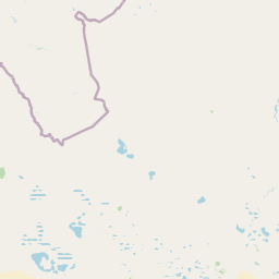
Map view of Zhaltyrkol Sanctuary

Use this park location map to pinpoint Zhaltyrkol Sanctuary in Kazakhstan, understand its exact geographic position, and read its mapped placement within the surrounding landscape more clearly.

Pigeon | © OpenStreetMap contributors

Location context for Zhaltyrkol Sanctuary

West Kazakhstan Region
Park atlas

Compare regional wetland reserves and protected steppe landscapes across West Kazakhstan.

Exploring Other Parks Near Zhaltyrkol Sanctuary and the Surrounding Ural River Basin

Browse other parks and protected areas near Zhaltyrkol Sanctuary to examine connected wetland habitats and steppe geography throughout the Ural River basin. Expanding regional comparison helps trace broader conservation networks and wildlife refuges across the surrounding Kazakh terrain.
A horizontal watercolor painting showing a pale, soft-focus landscape with rolling green plains, a few small trees, and layered distant hills in shades of light purple and pink.
Nature reserveWest Kazakhstan Region
About 187 km away#1 closest

West

Bokeyorda Nature Reserve: Mapping Protected Steppe Landscapes in West Kazakhstan

A regional stronghold for migratory saiga antelope populations

Bokeyorda Nature Reserve serves as a foundational protected area in the West Kazakhstan Region, established to preserve expansive dry steppe and semi-desert environments. The reserve provides essential habitat for migratory ungulates, forming a connected conservation corridor alongside the Ashchiozek Sanctuary that spans diverse lowland terrain and seasonal water features within the northwestern Kazakh plains.

Area
3,430.4 km²
Established
2022
IUCN
VI
Relief
Lowland
Nature reserveKazakhstan
About 268 km away#2 closest

South

Akzhayyk Reserve: Wetland and Coastal Nature Reserve in Western Kazakhstan

Dynamic deltaic landscapes and migratory bird habitats

Akzhayyk Reserve spans the confluence of the Ural River and the northern Caspian Sea, encompassing extensive reed marshes, aquatic plant communities, and arid steppe. This nature reserve provides essential conservation land for migratory waterbirds and rare regional aquatic species, functioning as a major ecological intersection in western Kazakhstan.

Area
1,115 km²
Established
2009
Relief
Lowland
Climate
Arid
A horizontal watercolor painting showing a stylized, layered landscape of rolling green hills, a calm river, and hints of forest, rendered in soft pastel tones against a white background.
Wildlife reserveWest Kazakhstan Region
About 286 km away#3 closest

Northeast

Kirsanov Sanctuary: Protected Floodplain Landscapes and Ural River Geography

Wildlife reserve and riverine corridor in West Kazakhstan

Spanning 50 kilometers along the Ural River, Kirsanov Sanctuary preserves a rich mix of floodplain meadows, gallery forests, and oxbow lakes. Originally established for beaver conservation, this wildlife reserve now functions as a complex ecosystem refuge, representing a key protected landscape within the West Kazakhstan regional geography.

Area
610 km²
Established
1967
IUCN
IV
Relief
Lowland
A horizontal watercolor painting showing a soft, stylized landscape with rolling hills, distant mountains, forested areas, and a meandering stream or marshy foreground.
National parkSaratov Oblast
About 317 km away#4 closest

Northwest

Dyakovsky Forest National Park: Protected Forest Landscapes and Steppe Geography in Saratov Oblast

A rare woodland island mapping project in the Russian Trans Volga region.

Dyakovsky Forest National Park stands as a significant natural monument in Saratov Oblast, preserving a rare mosaic of forest patches on sand-plain terraces. As the southernmost natural forest massif in Europe, it provides an essential study in ecological resilience, where woodland habitats thrive against the backdrop of the extensive Eurasian steppe. The territory features a complex interplay of riverine environments, oak groves, and psammophyte vegetation.

Area
185.32 km²
Established
2023
Relief
Lowland
Climate
Arid
Watercolor illustration of green hills, a body of water, and pink and yellow vegetation
National parkSaratov Oblast
About 399 km away#5 closest

Northwest

Khvalynsky National Park: Protected Landscape and Regional Geography Atlas

Discover mapped park boundaries in Saratov Oblast

Khvalynsky National Park is a significant protected area designated as a national park within the Saratov Oblast. This entry provides detailed atlas-based insights into its geographic scope, protected landscape features, and its context within the wider regional geography of Southeastern European Russia. Explore the mapped terrain and understand how this park contributes to the conservation landscape of the Volga region.

Area
255 km²
Established
1994
IUCN
II
Visitors
35K annual
National parkRussia
About 437 km away#6 closest

North

Buzuluksky Bor National Park: Mapping an Isolated Forest in the Russian Steppe

Examining the unique geomorphology and forest-steppe ecological boundaries.

Buzuluksky Bor National Park serves as an extraordinary natural laboratory in Russia, defined by its 106,000 hectares of pine forest set against a backdrop of open grasslands. This protected area features deep sandy substrates of marine origin, undulating dune landscapes, and the deeply incised Borovka River valley, providing a vital study site for forest-steppe dynamics and long-term conservation research.

Area
1,060 km²
Established
2007
IUCN
II
Relief
Lowland
A horizontal watercolor illustration depicting a line of evergreen trees along a shoreline with rolling hills in the background.
National parkSamara Oblast
About 438 km away#7 closest

North

Buzuluksky Bor National Park: A Mapped Analysis of Protected Pine Forest Landscapes

Regional Geography of the Samara and Orenburg Borderlands

Buzuluksky Bor National Park represents a significant conservation hub, safeguarding centuries-old pine stands within a pronounced riverine depression. This protected area offers deep insights into the transition between bore forest types and the broader steppe ecosystems of southeastern European Russia.

Area
1,067.88 km²
Established
2008
IUCN
II
Relief
Lowland
Watercolor illustration of a river flowing through a valley with green hills and scattered trees in the background
National parkSamara Oblast
About 441 km away#8 closest

North

Samarskaya Luka National Park: Mapped Geography and Protected Area Landscape Context

An atlas-focused overview of the Zhiguli Mountains and Volga River meander.

Samarskaya Luka National Park covers 134,000 hectares of diverse terrain in Samara Oblast. This overview examines the protected area's karst limestone uplands, dense forests, and river floodplains. Access map-integrated data on the Volga River bend and the unique geological formations defining this regional ecosystem.

Area
1,340 km²
Established
1984
IUCN
II
Relief
Mixed relief

Common questions about visiting, size, designation, and location context for Zhaltyrkol Sanctuary

Zhaltyrkol Sanctuary FAQs for park facts, access, geography, and protected area context

Find quick answers about Zhaltyrkol Sanctuary, including protected-area facts, park geography, trail and visitor context, and how the park fits into its surrounding country and regional landscape.
MoriAtlas Explorer

Continue Your Protected Areas Search Across the Global Atlas

Deepen your exploration by continuing the structured search for national parks and protected areas worldwide. Utilize the comprehensive filtering capabilities to compare different conservation landscapes and refine your understanding of global park geography. Discover more about the distribution and characteristics of protected natural areas.

Global natural geography