Mori Atlas logo
Nature reserveŻmudź

A study of xerothermic grassland boundaries, carbonate substrate terrain, and rare orchid-rich habitat mosaics

Żmudź Nature Reserve and Protected Calcareous Landscapes within the Lublin Upland of Eastern Poland

The Żmudź nature reserve sits upon the limestone-capped ridges of the Działy Grabowieckie in the Lublin Voivodeship. This protected area functions as a vital ecological reference site for Inula ensifolia grassland variants, characterized by its mosaic of south-facing xerothermic slopes, juniper scrub, and rare flora including populations of golden flax and lady's slipper orchid. Its physical structure illustrates the intersection of traditional low-intensity land use and specialized carbonate-soil biodiversity within the eastern Polish regional geography.

Natura 2000xerothermic grasslandcalcareous habitatsHabitats Directiverare plantsorchids

Żmudź

Nature reserve

Park overview

Structured park overview, official facts, and landscape profile for Żmudź

Żmudź park facts, protected area profile, and essential visitor context

Review the core facts for Żmudź, including designation, size, terrain, visitor scale, habitats, and operating context in one park-focused overview.

About Żmudź

Żmudź is one of the many small but ecologically focused protected areas that make up Poland's contribution to the Natura 2000 network. Although it covers just over 44 hectares, the site was designated because the dry grassland and scrub on its carbonate substrate combine unusually high concentrations of rare, protected, and phytogeographically interesting plant species within a compact spatial footprint.

The area lies in the Działy Grabowieckie, a series of low, loess-and-limestone ridges forming the southeastern portion of the Lublin Upland. This region supports calcareous rendzina soils and Mediterranean-influenced microclimate conditions that have allowed relict steppe-like vegetation to persist. At Żmudź, this has produced a mosaic landscape of open Festuco-Brometea grasslands, juniper thickets rooted on limestone and on patches of heathland, and open Scots pine woodland that has never been converted to dense commercial forest.

Within the roughly 45-hectare boundary, plant inventories have documented at least five orchid species alongside the site's signature taxa. The site serves both as a literal species refuge and as a living research object for Polish grassland ecologists, who study the Inula ensifolia community in its typical Lublin-Upland carbonate form and compare it with related assemblages further south or west.

Quick facts and research context for Żmudź

Żmudź carries the Natura 2000 site code PLH060075 and was formally confirmed as a Site of Community Importance in March 2011 under the EU Habitats Directive. The site occupies approximately 44.13 hectares in Chełm County (Chełmski), Lubelskie Voivodeship, in the Działy Grabowieckie mesoregion of the southern Lublin Upland. It overlaps with the Żmudź Nature Reserve, expanding its protection footprint onto adjacent semi-natural grasslands. The site lies near coordinates 51.007°N, 23.671°E.

Protection and recognition

Terrestrial conservation framework and official designation records for Żmudź

Żmudź Protection Status and Natura 2000 Recognition Details

Terrestrial protection status for Żmudź encompasses documented conservation frameworks and designated Natura 2000 recognition records. Official records outline the regulatory scope and administrative context established for this protected landscape area.

International recognition

Protection details

Protection scope
Terrestrial
Park context

Deeper park guide and search-rich context for Żmudź

Żmudź history, landscape, wildlife, and travel context

Explore Żmudź through its history, landscape character, ecosystems, wildlife, conservation priorities, cultural context, and seasonal travel timing in a structured park guide built for atlas discovery and search intent.

Why Żmudź stands out

Żmudź is best known among ecologists for hosting what is considered the largest national population of golden flax (Linum flavum) in Poland, a strictly protected species tied to calcareous xerothermic grassland in Central Europe. The site also supports a regionally significant population of lady's slipper orchid (Cypripedium calceolus) and one of the few Polish populations of Pannonian thistle (Cirsium canum / C. pannonicum). Beyond these headline species, the site is valued as a representative example of Inula ensifolia xerothermic grassland developed on carbonate substrate, a community that differs from the classic Inula grasslands of the Nida Basin by the absence of several diagnostic species. The combination of rare higher plants, juniper formations, and orchid-rich dry meadows makes Żmudź an important reference point for understanding the phytogeographic boundary between the Lublin Upland and more western dry-grassland regions.

Żmudź history and protected-area timeline

The Żmudź site entered formal European protection in March 2011, when it was confirmed as a Site of Community Importance, the designation step that translates a habitat directive proposal into a binding Natura 2000 commitment. This step effectively expanded the protection envelope around a pre-existing national-level reserve, the Żmudź Nature Reserve, by adding the surrounding dry grassland buffer to the same legal framework.

While the Natura 2000 designation is recent, the underlying habitat itself is old: the xerothermic and juniper-rich vegetation reflects centuries of low-intensity grazing, haymaking, and browsing pressure that prevented forest closure. The site's plant composition has therefore been shaped more by historical land use than by active ecological restoration.

By the time of standardized 2015 monitoring, the site's flagship species had been quantified: 238 shoots of lady's slipper orchid and 135 individuals of Pannonian thistle, providing baseline data for future conservation assessment under the EU Habitats Directive reporting cycle.

Żmudź landscape and geographic character

The landscape of Żmudź is shaped by the gentle, loess- and limestone-capped ridges of the Działy Grabowieckie, the southeastern tail of the Lublin Upland. Elevation generally sits in a low-hill range typical of this mesoregion, with shallow valleys separating broad interfluves whose carbonate substrate supports thin, well-drained rendzina soils.

Within the site itself, the topography forms warm, south- and west-facing micro-slopes where the substrate dries quickly and supports steppe-like vegetation rather than closed forest. Open rock- and soil-outcrops, thin juniper scrub, scattered Scots pines, and herb-rich dry grassland produce the patchwork structure typical of Polish calcareous xerothermic sites.

There are no dramatic cliffs, water bodies, or large-scale geomorphological features; the landscape's significance is microscale rather than panoramic. It is the texture of the ground, the alternation of bare calcareous patches, juniper hummocks, and flowering grassland, that defines the visual character of the area.

Żmudź ecosystems, habitats, and plant life

Żmudź is fundamentally a xerothermic-grassland ecosystem, with vegetation belonging to the broad Festuco-Brometea syntaxonomic class of dry, base-rich European grasslands. The dominant community is a form of Inula ensifolia grassland typical of the Lublin Upland's carbonate substrate, where characteristic xerothermic species make up roughly 35 to 50 percent of the phytocoenosis composition.

Habitats within the site include open calcareous grassland, juniper formations on both heathland and limestone substrates, open pine stands with a herb-rich understorey, and transition zones where juniper, Scots pine, and dry-grassland species mingle. The microhabitat heterogeneity, combined with calcareous soil chemistry, is what allows so many rare plants to coexist within such a small footprint.

Ecologically, Žmudź sits at an interesting biogeographic boundary: it shares many species with the more famous xerothermic sites of the Nida Basin further west, but lacks some of their diagnostic taxa, suggesting a somewhat distinct subregional variant worth conserving in its own right.

Żmudź wildlife and species highlights

Żmudź is a plant-focused rather than animal-focused site, and the available documentation centers on botanical rather than zoological records. Its most discussed 'wildlife' elements are in fact higher plants, particularly the orchids and other rare herbaceous species for which the site is designated.

Around the site's three flagship plant taxa: lady's slipper orchid (a charismatic woodland-margin orchid whose flowering biology is often studied as a marker of intact pollinator networks), golden flax (a yellow-flowered Linum of dry calcareous grasslands), and Pannonian thistle (a continental steppe relict), there is a wider community of insects associated with the dry-meadow habitat, including pollinators and grasshoppers of xerothermic swards. However, detailed faunal inventories are not the focus of the source material.

The site's value for bird or mammal conservation is incidental rather than primary; its designation logic rests on the Habitats Directive's plant and habitat features rather than on Annex I bird populations.

Żmudź conservation status and protection priorities

Żmudź was designated under the European Union Habitats Directive, meaning its conservation status must be periodically reported in the standard Natura 2000 monitoring framework. Its formal role is to bring a representative patch of Lublin-Upland xerothermic grassland and its associated rare plant populations into a transnational network of protected habitat sites.

The conservation logic is based partly on rarity (the species it holds are protected nationally and listed in EU directives), and partly on representativeness: the site functions as a reference for the local variant of Inula ensifolia grassland on carbonate substrate, complementing similar sites in adjacent mesoregions and providing comparative material for habitat assessments.

Management pressure is comparatively limited because the site is small and the threat regime is dominated by slow processes, succession toward forest, gradual changes in traditional land use, and the inherent vulnerability of small, isolated populations such as the 238-shoot lady's slipper stand. Conservation activity therefore typically emphasizes preventing woody encroachment, maintaining open ground conditions, and avoiding direct disturbance during sensitive flowering periods.

Top sights and standout views in Żmudź

Among the site's most distinctive highlights, three features stand out. First, the documented status as the locality holding Poland's largest known population of golden flax (Linum flavum), a nationally protected species of central-European dry grasslands. Second, the presence of a viable, monitored population of lady's slipper orchid integrated into a managed landscape rather than a closed forest, an unusual setting for this species. Third, the site's role as a reference example of the Lublin-Upland carbonate variant of Inula ensifolia grassland, valuable for comparative phytosociological study.

Supporting these are juniper-rich patches on both calcareous substrate and heathland, at least five orchid species documented within the boundary, and the structural contrast between open Scots pine stands, juniper thickets, and bright flowered dry meadows that gives the site much of its conservation interest.

Best time to visit Żmudź

The flowering rhythm follows the life cycles of the site's rare herbs. Late spring and early summer (roughly May to early July) is the most ecologically expressive period, when lady's slipper orchids, Inula ensifolia, and associated dry-grassland species bloom most visibly.

Late summer (July to August) into early autumn brings the golden flax's flowering peak and ripening of the xerothermic grassland, which is also the season when botanical monitoring has historically been conducted. Winter and early spring are quiet periods; the open structure of the landscape means the site is more visually exposed to weather and less attractive for casual visitors than in late spring.

For visitors with a research or biodiversity interest rather than a recreational one, calm, dry days between late May and mid-July maximize visibility of both the orchids and the structure of the juniper-grassland mosaic. Because this is a fragile habitat rather than a developed park, any on-site presence should be low-impact, and timing visits to the warmest, calmest conditions is more a matter of ecological observation than of comfort.
Monthly climate preview

Track measured monthly weather variations, average temperatures, and precipitation rhythms across the protected area.

Żmudź Climate Normals and Long-Term Temperature Patterns

Long-term representative coordinate data records monthly mean temperatures ranging from sub-zero winter lows to warm summer highs alongside steady precipitation normals. Examining the complete twelve-month climatology profile reveals comprehensive seasonal shifts and temperature spreads across the protected landscape.
Annual mean8 °C
-4 °C20 °C
Jan-4°
Feb-3°
Mar
Apr
May14°
Jun18°
Jul20°
Aug20°
Sep14°
Oct
Nov
Dec-3°
Warmest month
July

20.1 °C

Coolest month
January

-4.4 °C

Wettest month
July

2.7 mm/day

Driest month
January

1.2 mm/day

Park location guide

Geography guide, regional context, and park location map for Żmudź

Żmudź park geography, regions, and map view in Poland

Understand where Żmudź sits in Poland through a broader geographic reading of the surrounding landscape, nearby location context, and its mapped position within the national park landscape.

How Żmudź fits into Poland

Poland, officially the Republic of Poland, is a Central European country spanning from the Baltic Sea in the north to the Carpathian Mountains in the south. It borders Germany, Czech Republic, Slovakia, Ukraine, Belarus, Lithuania, and Kaliningrad Oblast. The country has a temperate climate, diverse landscapes, and is known for its rich history, cultural heritage, and strong economic position within the EU.

Wider geography shaping Żmudź in Poland

Poland occupies 312,696 km2 in Central Europe, extending from the Baltic Sea coast in the north to the Sudetes and Carpathian Mountains in the south. It borders Germany to the west, Czech Republic and Slovakia to the south, Ukraine and Belarus to the east, and Lithuania and Kaliningrad Oblast to the northeast. The landscape includes lowland plains, uplands, and mountain ranges.

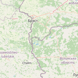
Map view of Żmudź

Use this park location map to pinpoint Żmudź in Poland, understand its exact geographic position, and read its mapped placement within the surrounding landscape more clearly.

Pigeon | © OpenStreetMap contributors

Location context for Żmudź

Lublin Voivodeship
Park atlas

Compare regional protected areas, dry grasslands, and connected conservation terrain.

Explore Other Parks Near Żmudź and Protected Landscapes Across Eastern Poland

Browsing parks near Żmudź reveals a broader network of protected calcareous grasslands and rare botanical reserves across the Lublin Upland. Comparing these surrounding natural areas provides essential regional context for understanding specialized lowland habitats.
Protected landscapeLublin Voivodeship
About 15 km away#1 closest

East

Strzelecki Park Krajobrazowy: Protected Landscape Geography and Mapped Natural Terrain

A forest-rich protected area along the Bug River in Poland.

Strzelecki Park Krajobrazowy is defined by its extensive pine forests and the expansive valley of the Bug River. This protected landscape contains a network of oxbow lakes, diverse wetland pockets, and vital bird habitats, mapping a distinct ecological corridor within the Lublin Voivodeship region of eastern Poland.

Area
120.26 km²
Established
1983
Relief
Lowland
Scope
Terrestrial
Protected areaLublin Voivodeship
15 km away#2 closest

North

Poleska Dolina Bugu Protected Landscape: Mapped Atlas and Geographic Overview

Key Natura 2000 river valley site in Lublin Voivodeship

Poleska Dolina Bugu is a regionally vital protected area comprising six connected enclaves along the Bug River. The site features a mosaic of oxbow lakes, alkaline fens, molinia meadows, and riparian woodlands that define the lowland geography of eastern Poland. Access structured data on this Habitats Directive site to understand its surface composition, floodplain connectivity, and specialized conservation habitats.

Area
81.732 km²
Relief
Lowland
Scope
Terrestrial
Water
Major water bodies
A horizontal watercolor illustration of a marshy landscape featuring a winding stream, soft green grasses, and clusters of wetland vegetation against a light background.
Nature reserveLubelskie Voivodeship
About 21 km away#3 closest

Northwest

Rezerwat przyrody Bagno Serebryskie: Protected Wetland and Calcareous Fen Geography in Lubelskie

Mapped terrain and ecological boundaries of a Polish nature reserve.

Investigate the environmental character of Rezerwat przyrody Bagno Serebryskie, an expansive protected wetland in eastern Poland. This site preserves rare alkaline-loving plant communities and vital avian habitats, showcasing the complex marshy terrain and geographic significance of the Lubelskie Voivodeship region.

Area
3.766 km²
Established
1991
Relief
Lowland
Scope
Terrestrial
A watercolor illustration showing a soft, stylized landscape of rolling green hills, distant mountains, and coniferous trees against a white background.
Protected landscapeLublin Voivodeship
About 25 km away#4 closest

Northwest

Chełmski Park Krajobrazowy: A Detailed Atlas of the Protected Landscape in Lublin Voivodeship

Exploring the calcareous peatlands and diverse wetland topography

Located in eastern Poland, Chełmski Park Krajobrazowy is a protected landscape shaped by unique geological features and rich botanical habitats. This overview explores the park's transition from upland hills to lowland depressions, its internal nature reserves, and its function as a critical biodiversity center within the Lublin Voivodeship landscape.

Area
164.57 km²
Established
1983
Relief
Upland
Climate
Temperate
Nature reservePoland
About 37 km away#5 closest

Northwest

Rezerwat przyrody Bachus: Protected Nature Reserve and Forest Atlas in Eastern Poland

Mapping sessile oak woodlands and protected landscape boundaries

Rezerwat przyrody Bachus is a notable nature reserve in Poland, recognized for its role in preserving sessile oak within the broader Chełmski Landscape Park. This atlas entry provides geographic context on the reserve, detailing its position within the lowland terrain of the Lubelskie region and its importance as an edge-of-range forest sanctuary.

Area
0.826 km²
Established
1958
Relief
Lowland
Climate
Temperate
Nature reserveLubelskie Voivodeship
About 40 km away#6 closest

North

Rezerwat przyrody Małoziemce: Nature Reserve Protected Areas and Geographic Map Context

A faunal reserve within the Łęczna-Włodawa Lake District

Rezerwat przyrody Małoziemce represents a specialized faunal protected area in Lubelskie Voivodeship. Established for the preservation of heron breeding colonies, the site is defined by its lowland, marshy terrain and its strategic inclusion within the larger Sobiborski Landscape Park. This entry provides detailed geographic perspective on how this forest and wetland complex fits into the regional network of protected landscapes near the Polish-Ukrainian border.

Area
0.38 km²
Established
1988
Scope
Terrestrial
A watercolor painting showing a panoramic view of a marshy landscape with green grasses, light-colored water, and distant trees on a white background.
National parkLublin Voivodeship
42 km away#7 closest

Northwest

Poleski Park Narodowy: Protected Wetlands and Glacial Geography in Lublin Voivodeship

Exploration of peatlands, kettle lakes, and boreal-style marshes

Poleski Park Narodowy encompasses a diverse mosaic of fens, transitional bogs, and dense marsh forests within the Lublin Voivodeship. This protected area serves as a primary reference for understanding the glacial-relict biodiversity and flat, water-defined terrain characteristic of the historic Polesie region in eastern Poland.

Area
97.6 km²
Established
1990
Visitors
41K annual
Relief
Lowland
Nature reserveLublin Voivodeship
About 50 km away#8 closest

Northwest

Jezioro Świerszczów Nature Reserve: A Detailed Geographic Atlas of Eastern Polish Protected Lands

Regional peatland and lake basin landscape context

Located in Lublin Voivodeship, Jezioro Świerszczów represents an essential study in lowland mire ecosystems. The reserve protects a small lake and surrounding transitional peatland, supporting a compact landscape mosaic that includes aquatic vegetation, alder carrs, and oak-hornbeam forest zones.

Area
0.461 km²
Established
1959
Relief
Lowland
Climate
Temperate

Common questions about visiting, size, designation, and location context for Żmudź

Żmudź FAQs for park facts, access, geography, and protected area context

Find quick answers about Żmudź, including protected-area facts, park geography, trail and visitor context, and how the park fits into its surrounding country and regional landscape.
MoriAtlas Explorer

Continue Your Protected Areas Search Across the Global Atlas

Deepen your exploration by continuing the structured search for national parks and protected areas worldwide. Utilize the comprehensive filtering capabilities to compare different conservation landscapes and refine your understanding of global park geography. Discover more about the distribution and characteristics of protected natural areas.

Global natural geography