

Mori Atlas logo
Wildlife reserveZugvogelschutzgebiet Indian Head

Mapping the geographic footprint of a historic bird sanctuary in southeastern Saskatchewan

Zugvogelschutzgebiet Indian Head Wildlife Reserve and Protected Prairie Landscape Context

(Indian Head Migratory Bird Sanctuary)

Zugvogelschutzgebiet Indian Head serves as a unique protected refuge within the Mixed Grassland ecoregion of Saskatchewan. This wildlife reserve incorporates artificial wetlands and long-standing agricultural research landscapes into its mapped boundaries, providing vital habitat for migratory waterfowl and shorebirds. The area reflects a specific intersection of conservation history and prairie land management that defines its current role in the regional geography.

migratory bird sanctuaryprairie wetlandsmixed grasslandwaterfowl habitatmigratory birdssaskatchewan

Zugvogelschutzgebiet Indian Head

Wildlife reserve

Park overview

Structured park overview, official facts, and landscape profile for Indian Head Migratory Bird Sanctuary

Indian Head Migratory Bird Sanctuary park facts, protected area profile, and essential visitor context

Review the core facts for Indian Head Migratory Bird Sanctuary, including designation, size, terrain, visitor scale, habitats, and operating context in one park-focused overview.

About Indian Head Migratory Bird Sanctuary

Indian Head Migratory Bird Sanctuary sits in the gently rolling Mixed Grassland ecoregion of southeastern Saskatchewan, a region where prairie ecosystems meet long-standing patterns of agricultural settlement. The protected area is small, covering about 32 hectares, but its ecological character is distinctive: rather than being a pure wilderness reserve, it is embedded within a working landscape that has been shaped by more than a century of agricultural science.

The site was designated on May 5, 1924 as part of Canada's Migratory Bird Sanctuary system. The sanctuary overlays two of three artificial wetlands that were created early in the twentieth century as part of the Agriculture Canada Experimental Farm and Tree Nursery, which was established in 1902. Dams on Indian Head Creek produced those wetlands, and they now form the most ecologically sensitive portion of the protected area, making up roughly 8 percent of its total extent.

As a migratory bird sanctuary, its primary purpose is to provide protected habitat where migrating birds can rest and feed during their seasonal movements without being exposed to unregulated hunting. The sanctuary hosts a modest assemblage of shorebirds, songbirds, and waterfowl, including Canada Geese. Human activity from the surrounding agricultural operations continues to influence the site, and observers have noted relatively low bird numbers in some seasons, a pattern attributed to ongoing disturbance degrading the habitat's attractiveness for waterfowl.

Quick facts and research context for Indian Head Migratory Bird Sanctuary

Indian Head Migratory Bird Sanctuary is located in southeastern Saskatchewan, Canada, within the Mixed Grassland ecoregion. It lies near the town of Indian Head along the Trans-Canada Highway, between Regina and the Manitoba border. The sanctuary protects about 32 hectares of land, of which roughly 8 percent consists of artificial wetlands created by dams on Indian Head Creek; the remainder is an historic tree nursery and experimental farm established in 1902.

Protection and recognition

Examine terrestrial protection scope and documented designation records.

Zugvogelschutzgebiet Indian Head Protection Status and Recognition

Zugvogelschutzgebiet Indian Head maintains a documented terrestrial protection scope within the global conservation database. Review the structured designation framework and international recognition facts associated with this protected area.

Protection details

Protection scope
Terrestrial
Transboundary protection
No
Park context

Deeper park guide and search-rich context for Indian Head Migratory Bird Sanctuary

Indian Head Migratory Bird Sanctuary history, landscape, wildlife, and travel context

Explore Indian Head Migratory Bird Sanctuary through its history, landscape character, ecosystems, wildlife, conservation priorities, cultural context, and seasonal travel timing in a structured park guide built for atlas discovery and search intent.

Why Indian Head Migratory Bird Sanctuary stands out

The sanctuary is best known as one of the older Migratory Bird Sanctuaries in the Canadian prairies, established in 1924 under the Migratory Birds Convention Act. It is unusual among prairie sanctuaries because most of its area is an agricultural tree nursery rather than intact native prairie, with a small share of its footprint consisting of constructed wetlands.

Indian Head Migratory Bird Sanctuary history and protected-area timeline

The site that would become the Indian Head Migratory Bird Sanctuary was developed as an agricultural experiment station in 1902, when the Agriculture Canada Experimental Farm and Tree Nursery was established near the town of Indian Head. Wetlands were created on Indian Head Creek through the construction of small dams intended to support research and tree cultivation under prairie conditions.

The protected sanctuary itself was established on May 5, 1924, at a time when Canada was formalizing protections for migratory birds under the Migratory Birds Convention Act. The earlier haphazard hunting of migratory birds had prompted federal action, and the Indian Head site was set aside as one of the prairie-region refuges within the national system of Migratory Bird Sanctuaries. Today it remains a small federal sanctuary managed as part of that long-standing network, with the Canadian Wildlife Service as the responsible authority.

Indian Head Migratory Bird Sanctuary landscape and geographic character

The sanctuary lies within the Mixed Grassland ecoregion of southeastern Saskatchewan, a transition zone characterized by grassland plains, scattered coulees, and a history of cultivation. The protected area itself is modest in scale, but its terrain combines open prairie surroundings with the unusual presence of a large tree nursery and three artificial wetlands formed by dams on Indian Head Creek.

Indian Head Migratory Bird Sanctuary ecosystems, habitats, and plant life

Ecologically, the sanctuary is shaped by its prairie setting and by its unusual combination of cultivated nursery land and constructed wetlands. Only about 8 percent of the protected footprint is wetland, but those basins, together with the surrounding tree nursery, create habitat diversity within an otherwise agricultural landscape. The Mixed Grassland ecoregion in which the site sits is naturally a mosaic of native grasses and seasonal wetlands, and the sanctuary's artificial waterbodies echo that broader pattern on a small scale.

Indian Head Migratory Bird Sanctuary wildlife and species highlights

The sanctuary was created specifically to protect migratory birds, and its wildlife values reflect that mandate. Small numbers of migrating shorebirds and songbirds pass through or use the site seasonally, while waterfowl visitors include Canada Geese. Bird numbers remain limited, in part because ongoing human activity from the surrounding agricultural operations continues to disturb the habitat and reduce its attractiveness for waterfowl.

Indian Head Migratory Bird Sanctuary conservation status and protection priorities

The sanctuary's conservation significance lies in its role within Canada's national network of Migratory Bird Sanctuaries, one of the older programs of its kind on the prairies. Established in 1924 to combat unregulated hunting of migratory birds, the site offers formal protection to migrating birds, including waterfowl such as Canada Geese, within a working agricultural landscape. Its continued value depends on balancing research and nursery functions at the surrounding experimental farm with protection of the small wetland area within the sanctuary.

Top sights and standout views in Indian Head Migratory Bird Sanctuary

Indian Head Migratory Bird Sanctuary stands out as a 1924 prairie refuge that overlays a historic federal tree nursery and three small artificial wetlands. Although limited in size, it illustrates how Canada's Migratory Bird Sanctuary system has integrated bird protection with long-running agricultural research landscapes, and it remains a modest but recognizable part of Saskatchewan's network of protected wetland and migration habitat.

Best time to visit Indian Head Migratory Bird Sanctuary

Migratory bird sanctuaries in the Canadian prairies are typically most active in spring and fall, when waterfowl, shorebirds, and songbirds move through the region. Visiting during these shoulder seasons offers the best chance of observing migrating flocks, while summer visits coincide with the breeding period for some species and winter visits reveal the quieter character of the tree nursery and dormant wetlands.

Monthly climate preview

Long term temperature and precipitation records measured across representative coordinate points

Zugvogelschutzgebiet Indian Head Climate Normals and Monthly Weather Patterns

Historical climate records for Zugvogelschutzgebiet Indian Head document wide temperature swings from severe winter minimums to warm summer maximums alongside measured monthly precipitation. Reviewing complete multiyear data profiles clarifies the full annual environmental rhythm governing regional protected landscapes.
Annual mean3 °C
-15 °C20 °C
Jan-15°
Feb-12°
Mar-4°
Apr
May11°
Jun17°
Jul20°
Aug19°
Sep12°
Oct
Nov-4°
Dec-11°
Warmest month
July

19.8 °C

Coolest month
January

-14.6 °C

Wettest month
June

2.9 mm/day

Driest month
February

0.5 mm/day

Park location guide

Geography guide, regional context, and park location map for Indian Head Migratory Bird Sanctuary

Indian Head Migratory Bird Sanctuary park geography, regions, and map view in Canada

Understand where Indian Head Migratory Bird Sanctuary sits in Canada through a broader geographic reading of the surrounding landscape, nearby location context, and its mapped position within the national park landscape.

How Indian Head Migratory Bird Sanctuary fits into Canada

Canada is a federal parliamentary constitutional monarchy spanning North America from the Atlantic to the Pacific and Arctic Oceans. With a population of over 41 million, it is officially bilingual in English and French at the federal level. The country gained independence from the United Kingdom through a gradual process culminating in 1982.

Wider geography shaping Indian Head Migratory Bird Sanctuary in Canada

Canada occupies the northern portion of North America, sharing its longest international border with the United States. The country extends from the Atlantic Ocean to the Pacific Ocean and northward into the Arctic Ocean, giving it the longest coastline of any nation.

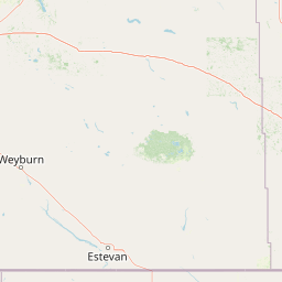
Map view of Indian Head Migratory Bird Sanctuary

Use this park location map to pinpoint Indian Head Migratory Bird Sanctuary in Canada, understand its exact geographic position, and read its mapped placement within the surrounding landscape more clearly.

Pigeon | © OpenStreetMap contributors

Location context for Indian Head Migratory Bird Sanctuary

Saskatchewan
Park atlas

Compare adjacent prairie habitats, regional wetlands, and connected conservation landscapes.

Explore Other Parks Near Zugvogelschutzgebiet Indian Head and Surrounding Protected Areas

Continue browsing other parks near Zugvogelschutzgebiet Indian Head to evaluate regional grassland ecosystems and wetland habitats. Comparing adjacent protected areas reveals the broader geographic spread of prairie migration reserves and working conservation terrain across the province.
Wildlife reserveSaskatchewan
About 63 km away#1 closest

West

Wascana Lake Migratory Bird Sanctuary: Geographic Overview and Protected Wetland Boundaries

A vital wildlife reserve located in Regina, Saskatchewan

Explore the unique geography of Wascana Lake Migratory Bird Sanctuary, where a managed reservoir creates a rich wetland habitat for migratory waterfowl. This protected area stands as a significant ecological site within the Saskatchewan prairie landscape, offering a rare look at riparian terrain integration inside a major urban center.

Area
1.04 km²
Established
1956
Relief
Lowland
Climate
Temperate
Wildlife reserveSaskatchewan
About 73 km away#2 closest

Southeast

Moose Mountain Creek National Wildlife Area Protected Habitat and Geographic Atlas

A preserved prairie wetland complex in southeastern Saskatchewan.

Moose Mountain Creek National Wildlife Area is a federal reserve in Saskatchewan that protects a rare assembly of four distinct habitat types. The land features a functional mix of freshwater marshes, native mixed-grass prairie, and trembling aspen groves. This structured protected area highlights the importance of preserving remnant prairie ecosystems within a broader agricultural region, providing a critical baseline for understanding local geography.

Area
1.63 km²
Established
2025
IUCN
IV
Relief
Lowland
Protected areaEstonia
About 109 km away#3 closest

Northeast

Zugvogelschutzgebiet Upper Rousay Lake Protected Area: Regional Map and Geography

Examining the protected landscapes and territorial extent in Estonia.

This resource provides a comprehensive view of the Zugvogelschutzgebiet Upper Rousay Lake protected area in Estonia. Focus on the defined boundaries, mapped terrain, and regional geographic context that identify this site. We provide a structured overview for researchers and geography enthusiasts to understand the spatial distribution and protected land status of this specific wetland environment.

Area
5.73 km²
Established
1948
Relief
Lowland
Climate
Temperate
National parkManitoba
About 189 km away#4 closest

East

Riding Mountain National Park: Manitoba National Park Protected Landscape and Geography

Discover mapped boundaries and regional context for this national park.

Delve into the geography of Riding Mountain National Park, a protected national park located in Manitoba. This page provides detailed insights into its mapped boundaries and its significance as a protected landscape within the region. Understand its place within the broader natural terrain and atlas context of Manitoba, offering a focused view for geographic exploration and conservation landscape study.

Area
2,969 km²
Established
1933
IUCN
II
Visitors
336.6K annual
Wildlife reserveNorth Dakota
About 225 km away#5 closest

Southeast

Lostwood Wilderness Wildlife Reserve and Prairie Pothole Landscape Geography

Protected northern mixed grass prairie in North Dakota

Lostwood Wilderness protects a unique mosaic of native grasslands and shallow wetlands in northwestern North Dakota. As an essential part of the National Wilderness Preservation System, it preserves a roadless, undeveloped window into the prairie pothole region, offering a clear view of the natural terrain and conservation character of the northern Great Plains.

Area
22.57 km²
Established
1975
IUCN
Ib
Relief
Lowland
Wildlife reserveSaskatchewan
About 234 km away#6 closest

North

Raven Island National Wildlife Area: Geographic Overview and Protected Island Landscape

Essential conservation geography within Saskatchewan

Located in the saline prairie basins of central Saskatchewan, Raven Island National Wildlife Area is a 112-hectare protected habitat. This site plays a strategic role in the Lenore Lake migratory bird complex, preserving crucial island breeding grounds within a gentle prairie landscape. Explore the physical boundaries and ecological context of this Canadian wildlife reserve.

Area
1.12 km²
Established
1982
IUCN
IV
Scope
Terrestrial
Wildlife reserveSaskatchewan
About 252 km away#7 closest

Northwest

St. Denis National Wildlife Area: Geographic Profile and Protected Prairie Landscape

A research-focused wildlife reserve in central Saskatchewan.

St. Denis National Wildlife Area represents a critical nexus for prairie ecology, defined by its dense network of shallow ponds and native grassland communities. As a dual-designated National Wildlife and Research Area, this site offers a clear window into the delicate balance of wetland habitats, saline soil conditions, and agricultural landscape integration across Saskatchewan.

Area
3.6 km²
Established
1967
IUCN
IV
Wildlife reserveSaskatchewan
About 252 km away#8 closest

North

Neely Lake Migratory Bird Sanctuary: Boreal Wetland Geography and Protected Landscapes

Essential protected area data for the eastern Saskatchewan boreal fringe

Neely Lake Migratory Bird Sanctuary encompasses a shallow freshwater environment defined by marshy shorelines, wet meadows, and small islands. Situated within the Mid-Boreal Upland, this protected landscape provides crucial stopover habitat for waterfowl moving through the Prairie and Boreal flyways. Gain insight into the terrain, water-body structure, and ecological role of this significant Canadian wildlife reserve.

Area
5.02 km²
Established
1952
IUCN
IV

Common questions about visiting, size, designation, and location context for Indian Head Migratory Bird Sanctuary

Indian Head Migratory Bird Sanctuary FAQs for park facts, access, geography, and protected area context

Find quick answers about Indian Head Migratory Bird Sanctuary, including protected-area facts, park geography, trail and visitor context, and how the park fits into its surrounding country and regional landscape.
MoriAtlas Explorer

Continue Your Protected Areas Search Across the Global Atlas

Deepen your exploration by continuing the structured search for national parks and protected areas worldwide. Utilize the comprehensive filtering capabilities to compare different conservation landscapes and refine your understanding of global park geography. Discover more about the distribution and characteristics of protected natural areas.

Global natural geography
