Mori Atlas logo
Countries

Browse the mapped distribution and geographic context of protected natural areas across Qatar.

Qatar: parks and protected areas

Explore maps and profiles of protected areas in Qatar, including Umm Tais and AWWP.

Qatar: parks and protected areas
Park system

Evaluating the Qatar Park System and Desert Protected Area Records

Comparing conservation designations, coastal habitats, and reserve scale across known boundaries

Geographic data from known records allows researchers to examine the distribution of coastal islands, mangrove ecosystems, and desert reserves throughout the Qatar peninsula. Evaluating conservation history, climate classifications, and reserve sizes offers a structured method to compare environmental priorities across the Gulf region.

Known protected area

2.5 km²

Area data available for 1 of 2 parks.

Median park size

2.5 km²

Median across 1 park with known area.

Oldest known park

Established in 2006.

Largest known park

Recorded area: 2.5 km².

Designation distribution

Climate distribution

About

Mapped Protected Regions and Geographic Distribution Across the Arabian Peninsula

Qatar's National Parks and Protected Areas: Discover Conservation Landscapes

Explore Qatar's national parks and designated protected areas, presenting a comprehensive atlas of the nation's key conservation landscapes and ecological zones. This country-level entry provides essential geographic context for understanding the distribution and significance of protected terrain across the Arabian Peninsula's unique environment.

Qatar is a sovereign nation on the Arabian Peninsula in West Asia, located on a peninsula extending into the Persian Gulf. The country gained independence from Britain in 1971 and is ruled by the House of Thani as an authoritarian monarchy under the current Emir Tamim bin Hamad Al Thani. It possesses the world's third-largest natural gas reserves and has one of the highest GDP per capita figures globally, driven by its hydrocarbon exports.

Qatar is a country in West Asia occupying the Qatar Peninsula on the northeastern coast of the Arabian Peninsula. It shares its only land border with Saudi Arabia to the south, while the rest of its territory is surrounded by the Persian Gulf, with the Gulf of Bahrain separating it from Bahrain to the east. The capital and largest city is Doha, home to over 80% of the population. The country has been ruled by the House of Thani since the 19th century, establishing itself as a British protectorate in 1916 before gaining full independence in 1971. Qatar operates as a unitary authoritarian semi-constitutional monarchy where the emir holds executive, legislative, and judicial authority. The nation has emerged as a significant regional power through its media presence via Al Jazeera and substantial financial resources from natural gas and oil exports.

Largest city:Doha
Currency code:QAR
ISO code:QA
Parks count
2
Capital
Doha
Area
11,581 km²
Population
3,214,609 (2,025)

Coastal
Island
Mountainous
Landlocked
Park atlas2 parks

Trace the mapped geography of Qatar's conservation landscapes and significant wildlife preserves across the Arabian Peninsula.

Explore National Parks and Protected Areas in Qatar: A Comprehensive Geographic Guide

Browse Qatar's significant national parks and protected areas, spanning key wildlife preservation sites and coastal ecosystems along the Arabian Peninsula. This country-level atlas view offers structured geographic context for understanding each conservation landscape and its distribution across the desert peninsula.
A digital illustration of a coastal landscape at sunset, featuring green mangrove patches, sandy tidal flats, and low mounds of vegetation under a soft pink and light blue sky.
National parkQatar

Umm Tais National Park: A Protected National Park in Qatar for Geographic Exploration

Discover its mapped boundaries and regional landscape context.

Umm Tais National Park represents a key protected landscape entity within Qatar, serving as a focal point for understanding the nation's conservation efforts and regional geography. As a designated national park, it offers valuable context for atlas exploration, allowing users to trace its protected boundaries and appreciate its place within the natural terrain of the Arabian Peninsula. This page provides structured information to support discovery of the park's unique environmental identity and its contribution to Qatar's mapped protected areas.

Established
2006
Relief
Lowland
Scope
Mixed
Water
Major water bodies
Wildlife reserveQatar

Al Wabra Wildlife Preservation Wildlife Reserve: Geographic Atlas and Landscape Context in Qatar

Mapped protected area for atlas discovery.

Delve into the specific geographic identity of Al Wabra Wildlife Preservation, a vital wildlife reserve located in Qatar. This dedicated page offers an atlas perspective on its mapped boundaries and its role within the broader landscape of the Arabian Peninsula. Understand the protected-area context and the unique natural geography that defines this significant Qatari conservation landscape, providing a foundation for structured geographic exploration.

Area
2.5 km²
Climate
Arid
Access
Highly restricted
Scope
Terrestrial
Landscape and environment

Understand how Qatar is shaped by terrain, ecosystems, and seasonal conditions

Qatar geography, nature, climate, and landscape context for park-focused travel research

Explore the physical geography, natural setting, and climate patterns of Qatar through a location-first overview built for travel research, national park discovery, and broader regional context. This section helps explain how landscapes, habitats, and environmental conditions shape what people search for, where they travel, and how they experience protected areas in Qatar.

Qatar geography and landscape

Qatar occupies the Qatar Peninsula, a flat, low-lying extension of the Arabian Peninsula jutting into the Persian Gulf. The country shares its sole land border with Saudi Arabia to the south and is otherwise surrounded by the Persian Gulf, with the Gulf of Bahrain separating it from nearby Bahrain to the east. The terrain consists predominantly of desert, with negligible water area.

Qatar nature and environment

Qatar's natural environment is characterized by flat desert terrain covering most of the land area. The coastal location along the Persian Gulf provides marine ecosystems, though the overall environment is arid with minimal vegetation. The country has minimal freshwater resources and relies on desalination for water needs.

Qatar climate and seasonal conditions

Qatar has a desert climate characterized by extremely hot summers and mild winters. Temperatures regularly exceed 40°C in summer months, while winters are typically warm with occasional cool spells. Rainfall is extremely scarce and sporadic throughout the year.

Explore this place

Related topics and popular queries

Ways to explore Qatar

Useful phrases, related topics, and discovery prompts connected to Qatar.
where is Qatar locatedQatar country informationQatar capital city DohaQatar geography and climateQatar economy natural gasQatar population demographicsQatar independence historyQatar government systemQatar countryQatar peninsulaWest AsiaArabian peninsulaPersian GulfDoha capitalQatar geographyQatar economyQatar populationQatar independentMiddle EastGulf cooperation council
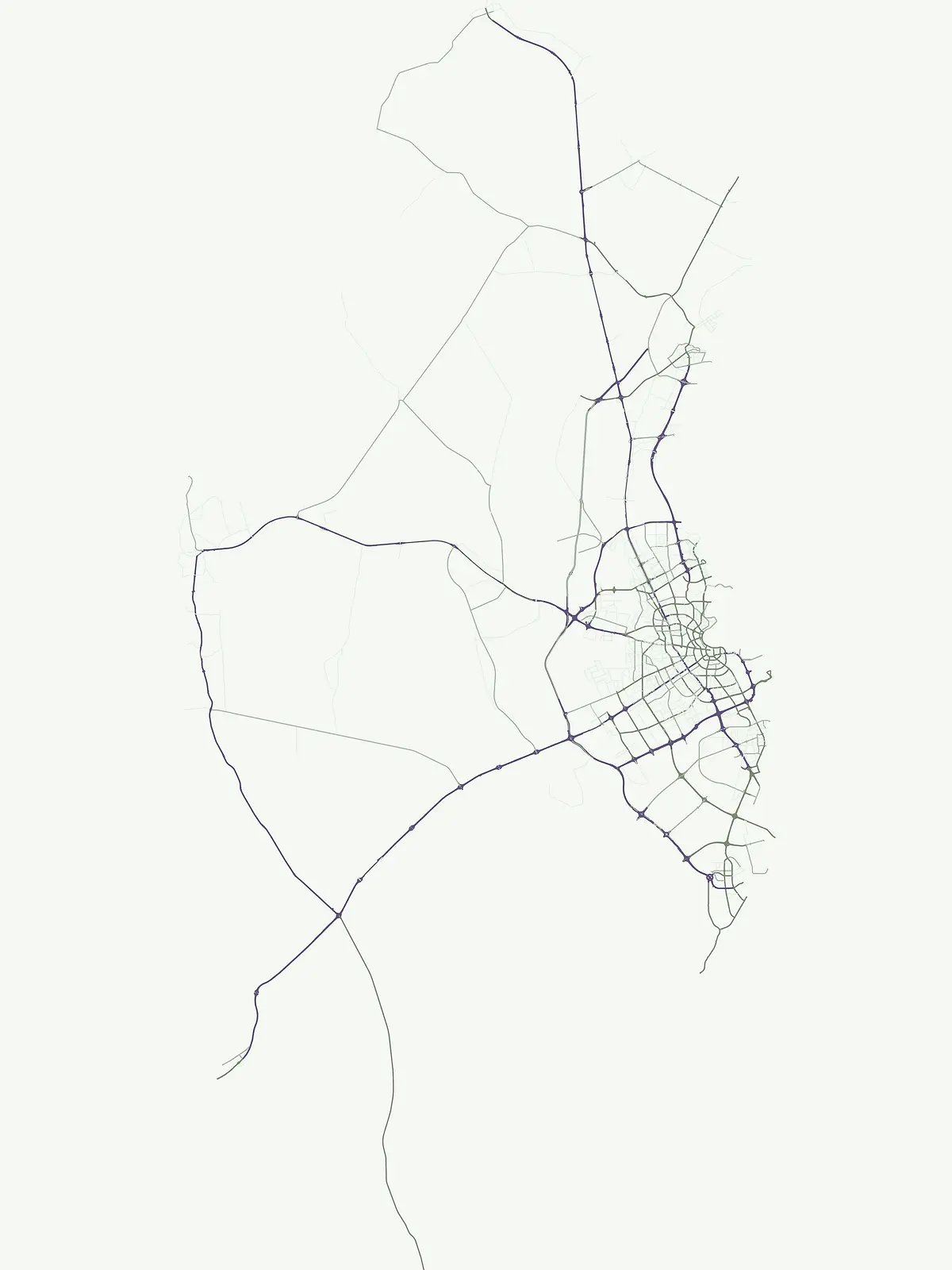
Park map

Trace the geographic spread of Qatar's conservation landscapes, mapping protected sites across the Arabian Peninsula.

Mapped Protected Areas in Qatar: Discover National Park Locations and Geographic Distribution

Browse the mapped locations of Qatar's national parks and protected areas, understanding their spatial positioning across the peninsula's unique desert and coastal terrain. Explore the full country map to examine the comprehensive atlas of protected landscapes, comparing their relative sizes and regional context in West Asia.

Explore common queries on Qatar's mapped park geography, conservation landscapes, and regional distribution

Frequently Asked Questions about Qatar's National Parks and Protected Areas

Understand Qatar's protected landscapes and national park geography through a curated set of common questions, covering key natural sites across the Arabian Peninsula nation. Delve into essential facts about conservation efforts, mapped park locations, and the distribution of protected areas within Qatar's desert and coastal environments.
Other countries

Broaden your atlas exploration from Qatar, comparing diverse national park geographies and protected landscapes across other sovereign countries

Discover National Parks in Other Countries Near Qatar and Across the Wider West Asia Region

From Qatar, browse national parks and protected areas in neighboring countries across the Arabian Peninsula and the broader Middle East, revealing diverse conservation landscapes. Compare the unique park geographies and environmental protection strategies of different sovereign nations as you continue your structured global atlas exploration.

Saudi Arabia: parks and protected areas

Parks and protected areas in Saudi Arabia, including 'Uruq Bani Ma'arid and Al-Khunfah.

13 parks

United Arab Emirates: parks and protected areas

Parks and protected areas in United Arab Emirates, including Ras Al Khor and Wadi Wurayah.

7 parks

Protected area types

Continue Exploring Qatar's Protected Area Classification and Geographic Context

Deepen your understanding of Qatar's protected natural areas by examining each designation category. This country-specific route allows for granular exploration of national parks and wildlife reserves, providing detailed geographic context and classification information. Move beyond a general overview to appreciate the mapped boundaries and unique features that shape Qatar's conservation landscape.

Qatar Protected Area Designations
MoriAtlas Explorer

National parks and protected areas worldwide

Find a park and explore its geography, habitats, and monthly climate.

Global natural geography