Mori Atlas logo
Nature reserveÅkersvika naturreservat

Discover the geographic boundaries, aquatic terrain, and conservation importance of Norway's premier Ramsar wetland site.

Åkersvika naturreservat: Mapping a Protected Wetland Landscape in Innlandet County, Norway

Åkersvika naturreservat represents a critical protected wetland ecosystem at the northern terminus of Lake Mjøsa. This nature reserve features a complex mosaic of shallow bays, reed beds, and mudflats that serve as a primary staging point for migratory waterbirds. Situated within Innlandet, the area offers a unique look at how lowland freshwater habitats function as essential nodes within the broader Norwegian geographic and conservation landscape.

wetlandRamsar sitenature reservebirdwatchingwaterfowlwaders

Åkersvika naturreservat

Nature reserve

Park overview

Structured park overview, official facts, and landscape profile for Åkersvika Nature Reserve

Åkersvika Nature Reserve park facts, protected area profile, and essential visitor context

Review the core facts for Åkersvika Nature Reserve, including designation, size, terrain, visitor scale, habitats, and operating context in one park-focused overview.

About Åkersvika Nature Reserve

Åkersvika Nature Reserve is a wetland protected area of considerable national and international significance, situated at the northern tip of Lake Mjøsa in southeastern Norway. The reserve occupies a shallow bay known as Åkersvika, which spans the boundary between the municipalities of Hamar and Stange in what is now Innlandet county. Because of its position at the lake's inflow zone, where rivers and streams deliver nutrient-rich freshwater into the Mjøsa basin, the area has naturally developed into a mosaic of duckweed-covered open water, lush reed beds, silt-laden mudflats, and shoreline meadows, each supporting distinct ecological communities.

While modest in physical size, covering roughly 3.25 square kilometers, Åkersvika punches well above its weight in ecological terms. It functions as both a breeding ground for resident wetland species and a critical stopover for migratory waterfowl moving along the inland flyways of Scandinavia. Bird counts conducted consistently over nearly four decades have shown the mallard to be the most common species recorded in both spring and autumn, but the reserve also supports substantial populations of coots, grebes, herons, and various wader species. The site's long-term monitoring data has made it a benchmark for understanding waterbird population dynamics in Norwegian lowland wetlands.

The reserve's protected status carries two layers of recognition. As a nature reserve under Norwegian law, it is shielded from activities that could damage its ecological character. As a Ramsar site, designated in 1974, it also falls under an international framework aimed at conserving wetlands of global importance. This dual designation reflects the site's value not only for its birdlife but also for its plant communities and associated invertebrate fauna, which together form a functioning freshwater wetland ecosystem under increasing pressure elsewhere in the region.

The reserve also illustrates the modern challenge of integrating infrastructure with conservation. The European route E6, Norway's main north-south highway, passes through the protected area, and as motorway standards required upgrades, a 2016 project removed 126 decares of land from the reserve and added 175.5 decares in compensation, accompanied by detailed environmental mitigation planning. This kind of boundary adjustment, while technical, underscores both the ecological value placed on the wetland and the practical pressures facing lowland protected areas in densely populated regions of southern Norway.

Quick facts and research context for Åkersvika Nature Reserve

Åkersvika Nature Reserve is located in Åkersvika, at the northern end of Lake Mjøsa, within the municipalities of Hamar and Stange in Norway's Innlandet county (formerly Hedmark). The reserve covers approximately 3.25 square kilometers of wetland habitat.

Designated as a nature reserve by royal resolution on 26 July 1974, Åkersvika simultaneously became Norway's first Ramsar site, recognizing it as a wetland of international importance. Subsequent expansions occurred in 1984 and 1992. The reserve is recognized particularly for its role as a staging and breeding area for wetland birds, and it has been the subject of systematic bird monitoring since its establishment. The European route E6 highway crosses the reserve, with compensatory habitat adjustments made during infrastructure upgrades.

Protection and recognition

Examine the documented protection background and official recognition records for Åkersvika naturreservat.

Åkersvika naturreservat Protection Status and Official Designation Facts

Review the documented protection status, management scope, and official designation history recorded for Åkersvika naturreservat. Official records outline the recognized conservation framework and international status assigned to the protected area.

Protection details

Transboundary protection
No
Park context

Deeper park guide and search-rich context for Åkersvika Nature Reserve

Åkersvika Nature Reserve history, landscape, wildlife, and travel context

Explore Åkersvika Nature Reserve through its history, landscape character, ecosystems, wildlife, conservation priorities, cultural context, and seasonal travel timing in a structured park guide built for atlas discovery and search intent.

Why Åkersvika Nature Reserve stands out

Åkersvika Nature Reserve is best known as Norway's first Ramsar-designated wetland and as one of the country's most important sites for waterbirds. Its shallow bays, reed-fringed shores, and nutrient-rich waters at the head of Lake Mjøsa attract large numbers of ducks, waders, and other wetland-dependent birds throughout the year, with peak concentrations during the spring and autumn migration seasons. The reserve is also notable in Norwegian conservation history for its pioneering role. Being the first Norwegian site recognized under the international Ramsar Convention gave Åkersvika an early and lasting place in the country's framework of wetland protection, and its long-running bird monitoring program, spanning from 1974 to 2013, has produced one of the more detailed datasets on waterbird population trends at any Norwegian protected wetland.
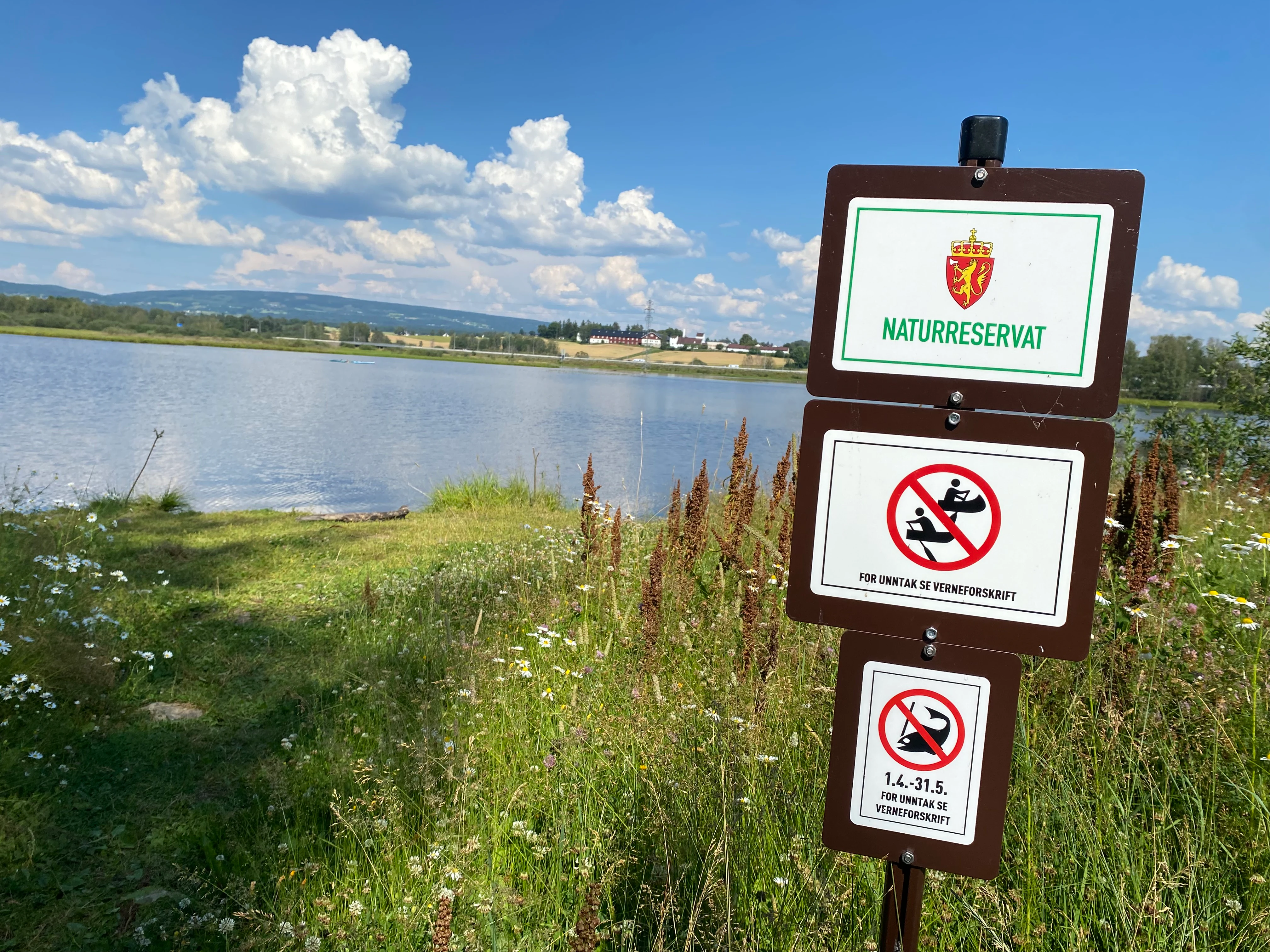
A brown regulatory sign in Norway identifying a nature reserve, featuring prohibited activities such as watercraft and specific fishing dates, set against a background of a lake and green meadows.
A nature reserve regulatory sign at Åkersvika naturreservat overlooking the wetland area.

Åkersvika Nature Reserve history and protected-area timeline

Åkersvika Nature Reserve was formally established by royal resolution on 26 July 1974, under Norwegian nature conservation legislation. From the outset, the reserve's stated purpose was to preserve an important wetland area together with its associated plant communities, birdlife, and other wildlife naturally connected to the site. The protection order specifically recognized Åkersvika's value as a staging and breeding area for wetland birds, acknowledging the site's role in supporting both resident and migratory species.

The year 1974 also carried international significance: Åkersvika became Norway's first area designated under the Ramsar Convention, the international treaty for the protection of wetlands. This made the reserve an early entry into Norway's formal engagement with global wetland conservation and gave it a special profile within the country's growing network of protected natural areas.

In the years that followed, the reserve's boundaries were adjusted to strengthen its conservation value. The area was expanded in 1984 and again in 1992, reflecting a growing understanding of the wetland's ecological importance and the need to include additional connected habitat. Throughout the late twentieth century, environmental management efforts in the broader Mjøsa basin, including the well-known Mjøsa clean-up campaign from the 1970s, contributed to improving water quality in Åkersvika; from 1977, untreated sewage no longer flowed into the bay, gradually reducing the nutrient load that had previously shaped local food webs.

The early twenty-first century brought a different kind of intervention. As part of upgrades to the European route E6, which crosses the reserve, a 2016 boundary revision removed 126 decares from the protected area and added 175.5 decares of compensatory habitat. This change was accompanied by detailed environmental assessments and mitigation plans coordinated by the Hedmark County Governor's office, reflecting a more contemporary approach to balancing infrastructure development with wetland conservation obligations.

Åkersvika Nature Reserve landscape and geographic character

The landscape of Åkersvika Nature Reserve is defined by water and the subtle forms that water creates. At the northern head of Lake Mjøsa, where smaller rivers and streams feed into the lake, Åkersvika forms a shallow, sheltered bay with gently sloping underwater contours. This setting encourages the accumulation of fine sediments and the growth of emergent vegetation, producing an extensive mosaic of soft mudflats, reed beds, and partially submerged plant communities that transition gradually into open water.

Around the bay's edges, the wetland gives way to adjacent agricultural lowlands and shoreline meadows, creating an ecological gradient between aquatic, semi-aquatic, and terrestrial habitats. This soft transition zone is ecologically important because it offers a range of conditions for different groups of birds and other wildlife, from deep-water feeders to those that prefer exposed mud or dense reed cover.

Topographically, the reserve is essentially flat and low-lying, with its elevation dominated by the level of Lake Mjøsa. The visual character is shaped more by vegetation patterns, water surfaces, and seasonal flooding than by dramatic landforms. During high-water periods, parts of the shoreline meadows can be inundated, expanding the effective area of open wetland, while in drier seasons the mudflats become more exposed, concentrating feeding opportunities for wading birds. The presence of the European route E6, which cuts across the reserve, is a distinctive modern feature of the landscape and a reminder of how human infrastructure intersects with this otherwise natural wetland setting.

Åkersvika Nature Reserve ecosystems, habitats, and plant life

Åkersvika Nature Reserve protects a lowland freshwater wetland ecosystem of a kind that has become increasingly rare in southern Norway. The reserve's habitats include open water, partially vegetated shallows, extensive reed beds, sedge-dominated marsh zones, and seasonally flooded shoreline meadows, all developed on the nutrient-rich sediments characteristic of a lake's inlet zone. This habitat diversity supports a correspondingly rich community of wetland-dependent plants and invertebrates, which in turn underpin the site's value for birds and other wildlife.

The plant communities of Åkersvika reflect the wetland's hydrological and nutrient conditions. Dense stands of reeds, sedges, and other emergent plants fringe the bay, while floating and submerged vegetation thrives in the calmer shallows. These plant communities provide both structural habitat and a food base for invertebrate animals, which form a critical link in the wetland's food web. Historically, the nutrient status of the bay was strongly influenced by untreated wastewater entering Åkersvika, but environmental improvements, particularly from 1977 onward through the broader Mjøsa clean-up effort, have altered nutrient loads and shifted the composition of the invertebrate community, with downstream effects on the birds that depend on it.

The ecological character of Åkersvika is closely tied to the seasonal dynamics of Lake Mjøsa. Water levels, ice cover, and vegetation growth all influence how the wetland functions through the year, creating shifting patterns of habitat availability. This dynamic quality is part of what makes the site attractive to a wide range of species, allowing it to support different ecological roles across the seasons, from breeding ground in summer to staging and refuge area during migration periods.

Åkersvika Nature Reserve wildlife and species highlights

The wildlife of Åkersvika Nature Reserve is dominated by birds, particularly those adapted to wetland living. Systematic bird counts carried out between 1974 and 2013 form the backbone of knowledge about the reserve's fauna, and they show a community shaped strongly by seasonal migration as well as local breeding.

The mallard is the most commonly recorded species in both spring and autumn, reflecting the importance of the bay's open and partially vegetated water for dabbling ducks. Beyond mallards, the reserve supports a diverse array of waterfowl, including coots and various diving ducks, as well as grebes that use the calmer waters for feeding and breeding. Herons and other wading species are also regular presences, exploiting the rich invertebrate life of the bay's shallows and reed edges.

Waders, or shorebirds, have historically been a significant component of Åkersvika's bird community, but counts indicate a long-term decline in their numbers since the 1970s. Species such as the ruff have shown particularly sharp decreases, while lapwings have experienced a more moderate decline. Researchers have linked these trends to changes in food availability, especially the gradual reduction in bottom-dwelling invertebrates following improvements in water quality through the Mjøsa clean-up campaign. The shift in invertebrate populations has rippled through the food web, affecting the birds that depend on them.

Beyond birds, the reserve's combination of open water, marsh vegetation, and adjacent meadows supports other wetland-associated wildlife, including small mammals, amphibians, and aquatic invertebrates that form the diet of many of the bird species present. The site's role as habitat extends beyond its resident fauna to the many migratory birds that rely on Åkersvika as a refueling stop, reinforcing its significance within the broader network of wetlands used by waterbirds moving through southeastern Norway.

Åkersvika Nature Reserve conservation status and protection priorities

Åkersvika Nature Reserve holds a distinctive place in Norwegian and international conservation. Its 1974 designation as Norway's first Ramsar site established the country within the global framework of wetland protection and gave the reserve an early, high-profile role in demonstrating how internationally important wetlands can be formally recognized and managed. As a Ramsar site, Åkersvika benefits from the standards and monitoring expectations that come with international wetland designation, reinforcing its long-term protection beyond purely national legal frameworks.

From a purely ecological perspective, the reserve's conservation value lies in its representation of a lowland freshwater wetland system that has been widely lost or degraded elsewhere in southern Norway through drainage, agricultural intensification, and development. Protecting Åkersvika preserves not only its bird populations but also its associated plant communities, invertebrate fauna, and the hydrological processes that sustain the wetland as a functioning ecosystem. The site's long-running bird monitoring program also gives it scientific conservation value, providing one of the more detailed datasets on waterbird population change at any Norwegian wetland and offering insight into how lowland wetland ecosystems respond to environmental change over decades.

Conservation management at Åkersvika has had to navigate the practical realities of siting a major transport corridor within its boundaries. The presence of the European route E6 motorway crossing the reserve has required balancing the interests of habitat protection with infrastructure development. The 2016 boundary adjustment, which removed some area from protection while compensating with additional habitat, was accompanied by detailed environmental assessments and mitigation planning led by county-level environmental authorities. This kind of careful, compensatory approach reflects modern practice in managing protected areas that lie within or adjacent to essential infrastructure, ensuring that transportation needs are met without undermining the broader integrity of the wetland.

Åkersvika Nature Reserve cultural meaning and human context

The Åkersvika area lies within a long-settled landscape on the shores of Lake Mjøsa, one of the historically most important inland water bodies in Norway. The region around Hamar and Stange has been farmed for centuries, and the wetland sits at the meeting point of productive agricultural lowlands and the lake itself, a relationship that has shaped both human land use and the ecological character of the bay. The shoreline communities of Åkersvika are tied to the lake's broader identity, with Mjøsa long playing a central role in the cultural and economic life of inland Norway.

The reserve's position near the town of Hamar also places it within a region recognized for its broader natural and cultural heritage, including the protected areas that surround the lake and the historical sites nearby. The interaction between long-standing human use of the landscape and modern conservation efforts, particularly the steps taken to protect water quality through the Mjøsa clean-up campaign from the 1970s, reflects a regional tradition of valuing the lake as both a resource and a natural heritage feature worthy of careful stewardship.

Top sights and standout views in Åkersvika Nature Reserve

Åkersvika Nature Reserve stands out as Norway's first Ramsar wetland and remains one of the country's most closely monitored bird sites, with waterbird counts spanning nearly four decades. The reserve's mosaic of open water, reed beds, and shoreline meadows at the head of Lake Mjøsa creates staging and breeding habitat for a wide range of ducks, waders, grebes, and other waterbirds, with peak activity during the spring and autumn migrations.

The reserve is also notable for the way it illustrates contemporary wetland conservation in practice. From water-quality improvements linked to the broader Mjøsa clean-up campaign to the careful boundary adjustments undertaken when upgrading the E6 highway, Åkersvika offers a working example of how a small but ecologically rich protected area can be managed alongside active human pressures while retaining its core conservation value.

Best time to visit Åkersvika Nature Reserve

Åkersvika Nature Reserve is strongly seasonal in character, and the time of year largely determines what kind of experience the wetland offers. Spring brings the return of migrating waterfowl and the start of the breeding season, with the highest diversity of species typically present as birds settle into the bay's reed beds and shallows. This period offers the richest birdwatching, with the wetland alive with calling ducks, waders, and other species establishing territories.

Autumn is the other peak season, as Åkersvika once again fills with waterfowl moving south. Large mixed flocks gather on the open water and along the mudflats, and the wetland takes on a different, more dynamic character as staging birds fuel up before continuing their journeys. Summer tends to be quieter in terms of visible bird numbers but offers the most lush vegetation and active insect life, while winter brings ice cover and a much-reduced fauna, transforming the reserve into a starkly calm, frozen landscape. Late spring and early autumn are generally the most rewarding periods for visitors interested in the reserve's defining birdlife.
Monthly climate preview

Examine long-term representative temperature ranges and precipitation trends across the year

Åkersvika naturreservat climate normals and average monthly temperature patterns

Representative coordinates record measured monthly temperature swings from deep subzero minimums to moderate summer maximums alongside consistent precipitation rates. Detailed monthly normals provide deeper analytical context for studying the long-term meteorological profile of this protected landscape.
Annual mean2 °C
-8 °C15 °C
Jan-8°
Feb-8°
Mar-4°
Apr
May
Jun12°
Jul15°
Aug13°
Sep
Oct
Nov-4°
Dec-8°
Warmest month
July

14.8 °C

Coolest month
January

-8.3 °C

Wettest month
August

3.9 mm/day

Driest month
February

1.7 mm/day

Park location guide

Geography guide, regional context, and park location map for Åkersvika Nature Reserve

Åkersvika Nature Reserve park geography, regions, and map view in Norway

Understand where Åkersvika Nature Reserve sits in Norway through a broader geographic reading of the surrounding landscape, nearby location context, and its mapped position within the national park landscape.

How Åkersvika Nature Reserve fits into Norway

Norway, officially the Kingdom of Norway, is a Nordic country in Northern Europe located on the Scandinavian Peninsula. It encompasses mainland Norway, the Arctic islands of Svalbard and Jan Mayen, and maintains dependencies including Bouvet Island and Antarctic claims. The country has a population of about 5.6 million and is bordered by Sweden, Finland, and Russia. Norway is a unitary parliamentary constitutional monarchy with Oslo as its capital and largest city.

Wider geography shaping Åkersvika Nature Reserve in Norway

Norway occupies the western and northern portions of the Scandinavian Peninsula in Northern Europe. The country shares a long eastern border with Sweden, and borders Finland and Russia to the northeast. Norway has an extensive coastline facing the Skagerrak, North Sea, Norwegian Sea, and Barents Sea. The terrain is predominantly mountainous with numerous fjords along the coastline.

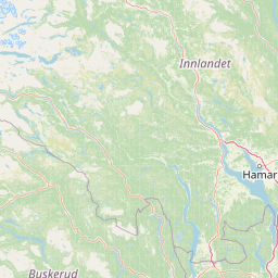
Map view of Åkersvika Nature Reserve

Use this park location map to pinpoint Åkersvika Nature Reserve in Norway, understand its exact geographic position, and read its mapped placement within the surrounding landscape more clearly.

Pigeon | © OpenStreetMap contributors

Location context for Åkersvika Nature Reserve

Innlandet

Explore protected wetland habitats, shallow bays, and shoreline environments across Norway's pioneering Ramsar reserve.

Åkersvika Naturreservat Photos and Landscape Scenery Visual Guide

Visual documentation captures the shallow bays, soft mudflats, and extensive reed beds defining the lowland freshwater ecosystem at the head of Lake Mjøsa. Examining these protected habitats clarifies the ecological character and seasonal waterbird environments preserved within the reserve.

A brown regulatory sign in Norway identifying a nature reserve, featuring prohibited activities such as watercraft and specific fishing dates, set against a background of a lake and green meadows.

Park atlas

Compare surrounding wetland habitats, lowlands, and neighboring nature reserves

Exploring Parks Near Åkersvika Naturreservat and Regional Protected Areas

Visitors exploring Åkersvika naturreservat can continue browsing adjacent protected areas and regional wetland ecosystems. Comparing nearby nature reserves reveals broader patterns in lowland freshwater conservation across the surrounding landscape.
Nature reserveRingerike
About 75 km away#1 closest

Southwest

Vikerfjell naturreservat: Geographic Atlas of Protected Forests in Ringerike, Norway

Mapped terrain of high-lying plateaus, ancient coniferous forests, and wetland mosaic.

Vikerfjell naturreservat serves as a vital protected area for old-growth coniferous forests and vulnerable lichen species. This atlas provides a detailed view of its mountain plateaus, forested slopes, and the expansive mire systems that characterize this key southern Norwegian conservation landscape within the Ringerike municipality.

Area
80.335 km²
Established
2016
Relief
Mountain
Climate
Boreal
National parkInnlandet
About 98 km away#2 closest

Northwest

Langsua National Park: Protected Mountain Forests and Inland Wilderness in Innlandet, Norway

Discover mapped boundaries and regional geographic context.

Langsua National Park, a designation expanded in 2011, is a prominent protected area in Norway's Innlandet county. This national park encompasses 537.1 square kilometers of diverse mountainous terrain, characterized by extensive mountain forests and inland wilderness habitats. Its creation consolidates fragmented nature reserves into a significant contiguous protected landscape, offering valuable insight into Norway's conservation strategies and the geographic context of its eastern mountain regions.

Area
537.1 km²
Established
2011
IUCN
II
Relief
Mixed relief
A watercolor landscape illustration showing a broad river delta with winding waterways, marshy banks, and distant hills.
Nature reserveAkershus
About 99 km away#3 closest

South

Nordre Øyeren naturreservat: Mapped Geography of Norway's Largest Inland Delta

Protected wetland landscapes and river delta terrain in Akershus

The protected land of Nordre Øyeren naturreservat comprises a vast mosaic of mudflats, islands, and river channels formed where three major rivers meet lake Øyeren. This detailed atlas entry explores the geographic significance of the bird's foot delta structure, providing context on its role as a critical inland wetland for migratory waterfowl within the Akershus region.

Area
62.568 km²
Established
1975
Relief
Lowland
Climate
Boreal
Watercolor illustration of a mountainous landscape with a lake, green fields, and pink flowers
National parkNorway
About 113 km away#4 closest

Northeast

Fulufjellet National Park: Protected Boreal Forest Landscape and Regional Geography

Explore mapped boundaries, rolling terrain, and transboundary conservation.

Fulufjellet National Park offers a detailed look at a protected boreal forest ecosystem in southeastern Norway. This page details the park's gently rolling hills, dominated by Norway spruce and Scots pine, interspersed with lakes and peat bogs. It highlights the park's designation as a national park, its establishment in 2012, and its contiguous protected status with Sweden's Fulufjället National Park, contributing to a significant transboundary conservation area. Users can explore its geographic features and protected landscape context within Scandinavia.

Area
82.5 km²
Established
2012
IUCN
II
Relief
Mountain
Watercolor illustration showing mountains, forests, and a river
National parkDalarna County
About 114 km away#5 closest

Northeast

Fulufjället National Park: Protected Plateau Landscape and Transboundary Conservation in Dalarna County

Sweden's southernmost alpine plateau, mapped geography, and natural wonders.

Fulufjället National Park in Dalarna County, Sweden, protects a significant high plateau landscape, notable for its ancient sandstone geology and unique lichen-heath environments. This national park is home to Njupeskär, Sweden's tallest waterfall, and is part of a transboundary protected area with Norway. Explore the mapped terrain and distinct natural features of this important conservation area within the Scandinavian Mountains.

Area
385 km²
Established
2002
IUCN
II
Visitors
53K annual
Watercolor painting of mountain peaks with green valleys and grassy foreground
National parkInnlandet
About 114 km away#6 closest

Northwest

Rondane National Park: Norway's Premier Alpine Protected Landscape and Historic National Park

Mapped glacial terrain, iconic peaks, and wild reindeer sanctuary.

As Norway's first national park, Rondane offers a profound exploration of a protected alpine environment. Situated in Innlandet county, its 963 square kilometers showcase a landscape sculpted by glaciers, featuring a striking array of ten peaks exceeding 2,000 meters. This page details Rondane National Park's distinct mapped boundaries, dramatic mountain geography, and its ecological significance as a refuge for wild reindeer, making it a cornerstone of Scandinavian natural heritage.

Area
963 km²
Established
1962
IUCN
II
Relief
Mountain
Watercolor illustration of a mountain range with green hills and a lake in the foreground
National parkNorway
About 146 km away#7 closest

Northwest

Jotunheimen National Park: Norway's Iconic Alpine Protected Landscape and Geographic Core

Explore mapped glacial terrain and alpine geography.

Jotunheimen National Park stands as a monument to Norway's alpine grandeur, protecting over 1,151 square kilometers of spectacular mountainous terrain. This protected area is defined by its dramatic glacial features, including sharp peaks exceeding 1,900 meters, U-shaped valleys, and pristine alpine lakes, making it a significant focus for geographic exploration and mapped landscape study. Delve into the core of Norway's mountain heartland, understanding the mapped boundaries and regional geological context that shape this iconic protected landscape.

Area
1,151 km²
Established
1980
IUCN
II
Relief
Mountain
Watercolor illustration showing green forests, a lake, and distant mountains under a light sky
National parkInnlandet
About 148 km away#8 closest

North

Gutulia National Park: Protected Southernmost Mountain Birch Forest Landscape Atlas

Explore Norway's unique subarctic forest geography and park boundaries.

Gutulia National Park stands as a key protected area within Norway's Innlandet region, distinguished by its role in preserving the country's southernmost mountain birch forest ecosystem. Covering approximately 23 square kilometers, this national park provides critical insights into subarctic forest ecology at the southern extent of its natural range. MoriAtlas enables detailed exploration of its mapped terrain and geographic context, offering a valuable resource for understanding this significant protected landscape.

Area
23 km²
Established
1968
IUCN
II
Scope
Terrestrial

Common questions about visiting, size, designation, and location context for Åkersvika Nature Reserve

Åkersvika Nature Reserve FAQs for park facts, access, geography, and protected area context

Find quick answers about Åkersvika Nature Reserve, including protected-area facts, park geography, trail and visitor context, and how the park fits into its surrounding country and regional landscape.
MoriAtlas Explorer

Continue Your Protected Areas Search Across the Global Atlas

Deepen your exploration by continuing the structured search for national parks and protected areas worldwide. Utilize the comprehensive filtering capabilities to compare different conservation landscapes and refine your understanding of global park geography. Discover more about the distribution and characteristics of protected natural areas.

Global natural geography