Mori Atlas logo
National parkFulufjället National Park

Explore mapped boundaries, waterfall wonders, and ancient geology within this unique Swedish national park.

Fulufjället National Park: Southernmost Alpine Plateau and Protected Landscape in Dalarna County

(Fulufjällets nationalpark)

Fulufjället National Park, situated in northwestern Dalarna County, Sweden, represents the southernmost extension of the Scandinavian Mountains. This protected national park covers a high plateau landscape centered around the Fulufjället mountain, characterized by extensive lichen-covered heaths, bare mountain plateaus, and valleys with old-growth forests. Its unique sandstone geology and the presence of Njupeskär waterfall, Sweden's tallest, offer a distinct geographic and natural heritage for atlas exploration.

mountain parksold-growth forestswaterfallslichen heathstransboundary protected areasplateau landscapes
Stylized illustration of a waterfall flowing from rocky cliffs into a river, surrounded by forest and hills

Fulufjället National Park

National park

Park overview

Structured park overview, official facts, and landscape profile for Fulufjället National Park

Fulufjället National Park park facts, protected area profile, and essential visitor context
Review the core facts for Fulufjället National Park, including designation, size, terrain, visitor scale, habitats, and operating context in one park-focused overview.

About Fulufjället National Park

Fulufjället National Park occupies a distinctive position in Sweden's protected area network as the southernmost of Sweden's mountain parks, making it the most accessible for the country's population while remaining relatively remote from major urban centers. The park was inaugurated in September 2002 by King Carl XVI Gustaf at a ceremony attended by several thousand visitors, representing the culmination of a decade of planning that initially faced local opposition regarding restrictions on snowmobile use, hunting, and fishing. The park was designed with a innovative zoning system dividing the area into four management zones: zone 1 (60% of area) comprises the completely protected heartland with minimal infrastructure, zone 2 (14%) allows limited elk hunting, zone 3 (25%) accommodates tourism infrastructure including trails and cabins, and zone 4 (1%) provides visitor facilities near major attractions. This zoning approach was pioneering for Swedish national parks, balancing conservation with sustainable tourism development. The park participates in the PAN Parks network, an international initiative combining nature preservation with tourism, and is part of the European Natura 2000 network. The park welcomes approximately 53,000 visitors annually, with about 80% arriving during the summer months and roughly one-third coming from abroad, predominantly Germany.

Quick facts and research context for Fulufjället National Park

Fulufjället National Park is located in Älvdalen Municipality in Dalarna County, approximately 25 kilometers southwest of Särna and 140 kilometers from Mora, the nearest town with railway and airport facilities. The park occupies most of the Fulufjället massif, a 35-kilometer-long plateau spanning the Sweden-Norway border and forming the southernmost part of the Scandes in Sweden. The geology is dominated by Dalecarlian sandstone, dating to approximately 900 million years ago, with diabase intrusions providing richer substrates for vegetation. The park experiences a continental climate due to its distance from the sea, with average temperatures around 1°C and annual precipitation of 835mm. Winter snow cover persists for 175 to 200 days annually. The park is managed by Dalarna County administrative council under the Swedish Environmental Protection Agency (Naturvårdsverket), and was the first Swedish mountain national park established since Padjelanta in 1962.

Park context

Deeper park guide and search-rich context for Fulufjället National Park

Fulufjället National Park history, landscape, wildlife, and travel context
Explore Fulufjället National Park through its history, landscape character, ecosystems, wildlife, conservation priorities, cultural context, and seasonal travel timing in a structured park guide built for atlas discovery and search intent.

Why Fulufjället National Park stands out

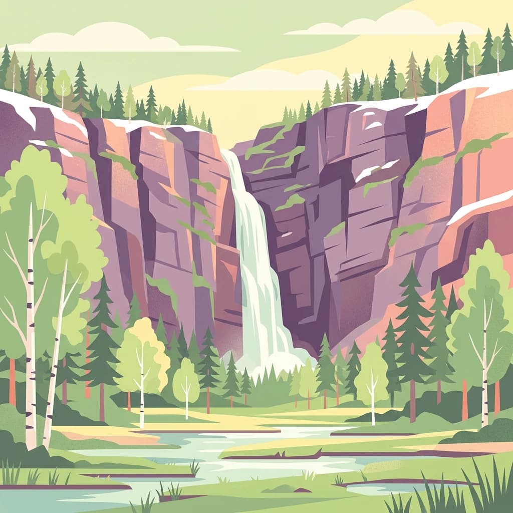
Fulufjället is best known for two extraordinary natural landmarks that define its identity: Njupeskär waterfall, the tallest in Sweden at 93 meters with a dramatic 70-meter free fall, and Old Tjikko, a Norway spruce clone recognized as one of the world's oldest trees at approximately 9,550 years. The park also protects Sweden's southernmost alpine heath environments with unique lichen carpets unaffected by reindeer grazing, a rare occurrence in Swedish mountain landscapes. The Siberian jay serves as the park's symbolic bird species. The plateau's combination of ancient geology, continental climate, and ecological isolation has created distinctive vegetation communities found nowhere else in Sweden's mountain range.

Mossy rocks line a flowing brook surrounded by green ferns and trees
A brook flows over moss-covered rocks in Fulufjället National Park's forested landscape

Fulufjället National Park history and protected-area timeline

The protection history of Fulufjället began incrementally, starting with the designation of 62.2 hectares around Njupeskär as a crown reserve in 1937, followed by additional forest protections along the Göljån river in 1946 and around Lövåsen. The Njupeskär area achieved natural park status in 1964 and was progressively expanded, while most of the Fulufjället massif received weaker reserve protections culminating in 38,060 hectares designated as a natural reserve in 1973. Reindeer grazing was prohibited throughout the area in 1990. Formal planning for national park status began in 1989, with negotiations starting the following year but facing significant local resistance from Älvdalen Municipality residents concerned about restrictions. The project shifted approach following consultation with local communities, and by 1999 local opinion had become favorable, viewing the park as an economic opportunity rather than merely a set of restrictions. The official motive for establishment was to preserve a central mountain area with distinctive vegetation and significant natural values in a relatively intact state. Norway subsequently established Fulufjellet National Park in 2012 on the Norwegian portion of the massif, creating coordinated transboundary protection driven in part by brown bear conservation concerns.

Fulufjället National Park landscape and geographic character

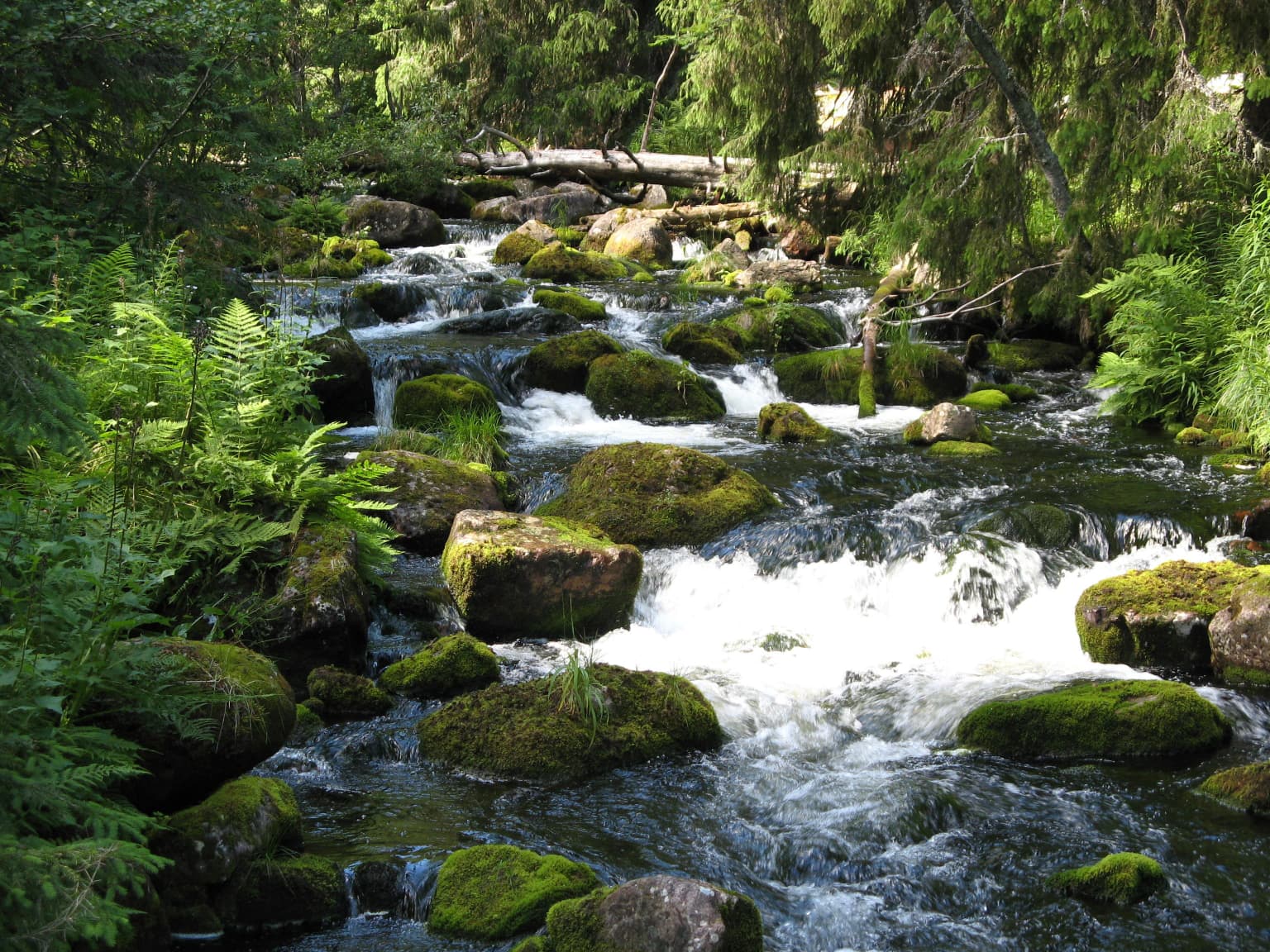
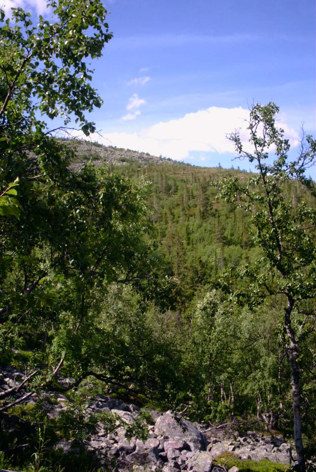
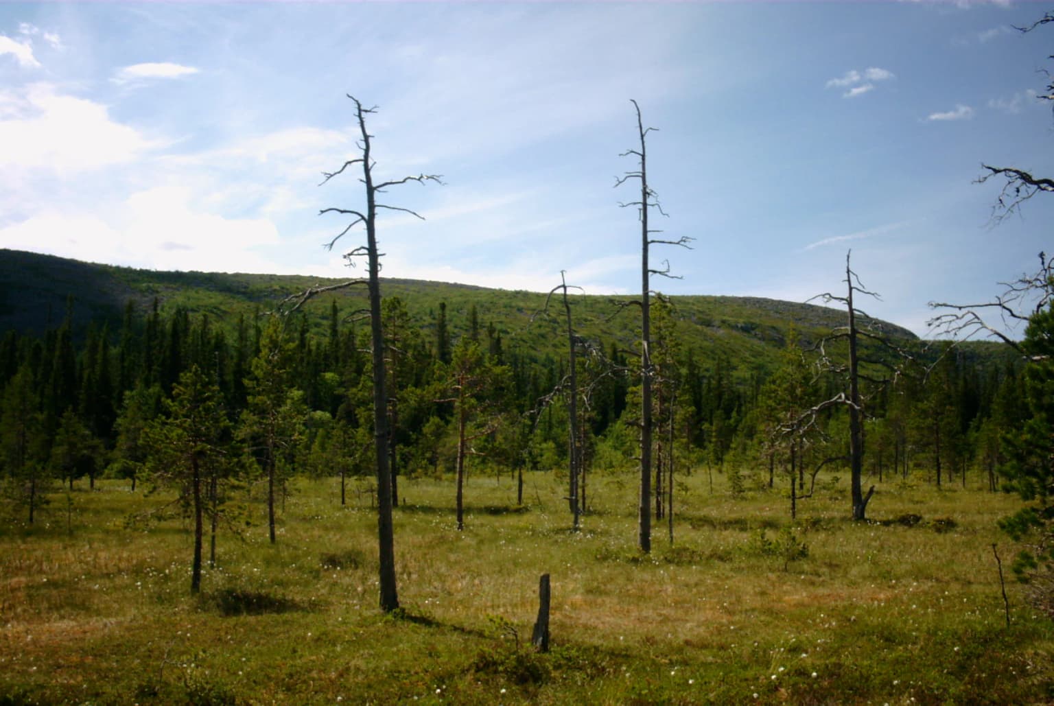
The Fulufjället landscape is defined by a high plateau ranging between 900 and 1,000 meters elevation, with round summits and deep valleys carved by rivers flowing toward the Dalälven system. The highest points on the Swedish side are Brattfjället at 1,042 meters and Storhön at 1,039 meters, while the massif's highest peak, Slottet at 1,047 meters, lies in Norway. The plateau descends sharply by approximately 600 meters at the southern and eastern extremities into the Fuluälven valley. The landscape has been shaped primarily by Tertiary-era erosion under tropical conditions rather than by Quaternary glacial activity, resulting in terrain less dramatically carved than other Scandes regions. The geology is exceptional for Sweden, consisting of Dalecarlian sandstone formed approximately 900 million years ago when this region lay near the equator, reaching thicknesses of 1,200 meters and typically displaying reddish coloration. This sandstone is veined with diabase intrusions less than 300 million years old, which form prominent ridges and provide nutrient-rich substrates supporting richer vegetation. The park contains several significant river systems including the Tangån, Girån, Bergån, and Stora Göljån, all feeding either the Görälven to the west or the Fulan to the east, which together form the Västerdal River and ultimately Dalälven.

Wooden boardwalk leading through a grassy field with scattered trees under a partly cloudy sky
Wooden boardwalk extending through grassy terrain in Fulufjället National Park

Fulufjället National Park ecosystems, habitats, and plant life

The park spans two major WWF terrestrial ecoregions: the Scandinavian and Russian taiga in the lower valleys and the Scandinavian Montane Birch Forest and Grasslands above the treeline. The plateau environments support heath vegetation dominated by common juniper and moor birch, with vascular plants including snowbed willow, alpine bearberry, alpine hawkweed, crowberry, cowberry, blue whortleberry, and alpine azalea. The vegetation's distinctiveness derives from extensive lichen carpets, particularly reindeer lichen and fönsterlav (Cladonia stellaris), which remain ungrazed due to the park's exclusion from reindeer pasture zones—a rarity in Swedish mountains. The valleys and mountainsides support diverse forest communities: moor birch covers 4,100 hectares, Scots pine covers 3,500 hectares, and Norway spruce covers 5,000 hectares. The diabase-rich areas support more demanding plant species including alpine blue-sow-thistle, wood cranesbill, and northern wolfsbane. The park harbors remarkable bryophyte diversity, containing more than one-third of all moss species found in Sweden, with 394 species documented, alongside over 500 lichen species.

Green forested hills with scattered rocks and trees under a blue sky with clouds
Panoramic view of Fulufjället National Park's forested hills under a clear blue sky

Fulufjället National Park wildlife and species highlights

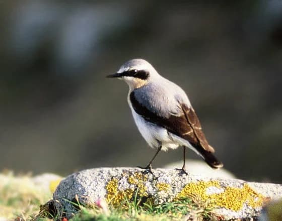
Fulufjället supports significant populations of large predators including brown bears, which den along the mountain slopes and descend to lower elevations in spring when berries ripen, and Eurasian lynx, which roam the forested terrain. Both species receive protected status in Sweden. The park provides important habitat for moose, which summer on the mountain but prefer lower elevations during winter. The mammal community also includes red fox, wolverine, gray wolf, Arctic fox (all rarer), red squirrel, European pine marten, and mountain hare. Norway lemming populations fluctuate dramatically in cyclical patterns not yet fully understood. The bird community is diverse, with the Siberian jay serving as the park's symbolic species. The plateau hosts willow warbler, meadow pipit, northern wheatear, and specialist mountain species including European golden plover, Eurasian dotterel, snow bunting, and Lapland longspur. Willow ptarmigan are common while rock ptarmigan inhabit only the highest peaks. The forested slopes support ring ouzel, common raven, golden eagle, Eurasian three-toed woodpecker, parrot crossbill, red crossbill, common redstart, brambling, and other species. The wetlands constitute the southernmost Swedish nesting range for greater scaup, oldsquaw, common scoter, and support important populations of red-necked phalarope, ruff, common greenshank, and wood sandpiper.

Grassy field with scattered leafless and coniferous trees, forested hills under a partly cloudy sky
Grassy meadow with scattered trees and forested hills in Fulufjället National Park

Fulufjället National Park conservation status and protection priorities

Fulufjället represents a conservation priority for multiple reasons: it protects the southernmost extent of Scandinavian mountain ecosystems in Sweden, preserving ecological communities that reach their range limits here; it safeguards exceptional geological heritage including the largest sandstone formation in Sweden with ancient Precambrian origins; and it maintains old-growth forest communities in a relatively unmodified state. The park's exclusion from reindeer pasture zones has permitted the development of unique lichen communities that have been eliminated from most other Swedish mountain areas through grazing pressure. The protection of brown bear and Eurasian lynx populations addresses species of conservation concern at the national level. The transboundary coordination with Norway's Fulufjellet National Park ensures coherent management of the entire Fulufjället massif, particularly important for mobile species like brown bears that require large territories. The park's inclusion in Natura 2000 since 1995 and designation as a Special Protection Area for birds since 1996 provides additional European-level conservation framework. The innovative zoning system demonstrates how protection objectives can be balanced with sustainable tourism, serving as a model for subsequent Swedish park management.

Fulufjället National Park cultural meaning and human context

The Fulufjället region bears traces of human activity dating to the Stone Age, with the mountain becoming ice-free approximately 8,000 to 10,000 years ago. Archaeological evidence includes stone axes and four Iron Age funerary cairns—the only such monuments discovered in Dalarna—located northeast of the plateau near Njupeskär, containing arrowheads and spears. The Altarringen, an oval stone wall with a central altar, represents another notable archaeological feature, though its dating is complicated by multiple restorations. The area's location on the Sweden-Norway frontier, demarcated since 1273, resulted in the massif being entirely Norwegian historically before Sweden captured Särna in 1644 during the Torstenson War, with the current border established through negotiation in 1751. Villages including Särna, Heden, and Idre developed in connection with wild reindeer hunting, and transhumance practices left lasting marks on the landscape with cabins and virtual villages established during the 18th and 19th centuries. The children's song "Mors lilla Olle" by Alice Tegnér, inspired by an 1850-1851 bear encounter in the forests, is set in Fulufjället. The park also participates in Swedish cultural identity through naming of a KLM Boeing 777-300 aircraft after the park.

Group of people seated at a circular wooden bench in a gravel rest area with a signpost, small cabin, and forested landscape in the background
Rest area with a group of people at a wooden bench, signpost, and cabin overlooking forested mountains in Fulufjället National Park

Top sights and standout views in Fulufjället National Park

Fulufjället National Park offers a remarkable combination of superlatives and unique features within Sweden's protected area system. The park contains Njupeskär, Sweden's tallest waterfall at 93 meters with a 70-meter free fall, which forms a dramatic backdrop for visitors and serves as the primary attraction drawing the majority of tourists. Old Tjikko, the world's oldest known living tree at approximately 9,550 years, represents an extraordinary biological landmark visible to visitors on the plateau. The park protects the southernmost alpine environments in Sweden, with lichen-heath communities that are unique in the Scandinavian Mountains due to the absence of reindeer grazing. The innovative four-zone management system pioneered in Sweden balances strict conservation with visitor access, with 60% of the area designated as wilderness zone. The park's sandstone geology, formed nearly a billion years ago, contrasts dramatically with typical Swedish bedrock and provides educational value. The transboundary coordination with Norway's Fulufjellet National Park ensures coherent protection of the entire massif, creating one of Scandinavia's more comprehensive mountain protection initiatives.

A Northern Wheatear bird standing on a rock with yellow lichen, set against a blurred green background
Northern Wheatear perched on a moss-covered rock

Best time to visit Fulufjället National Park

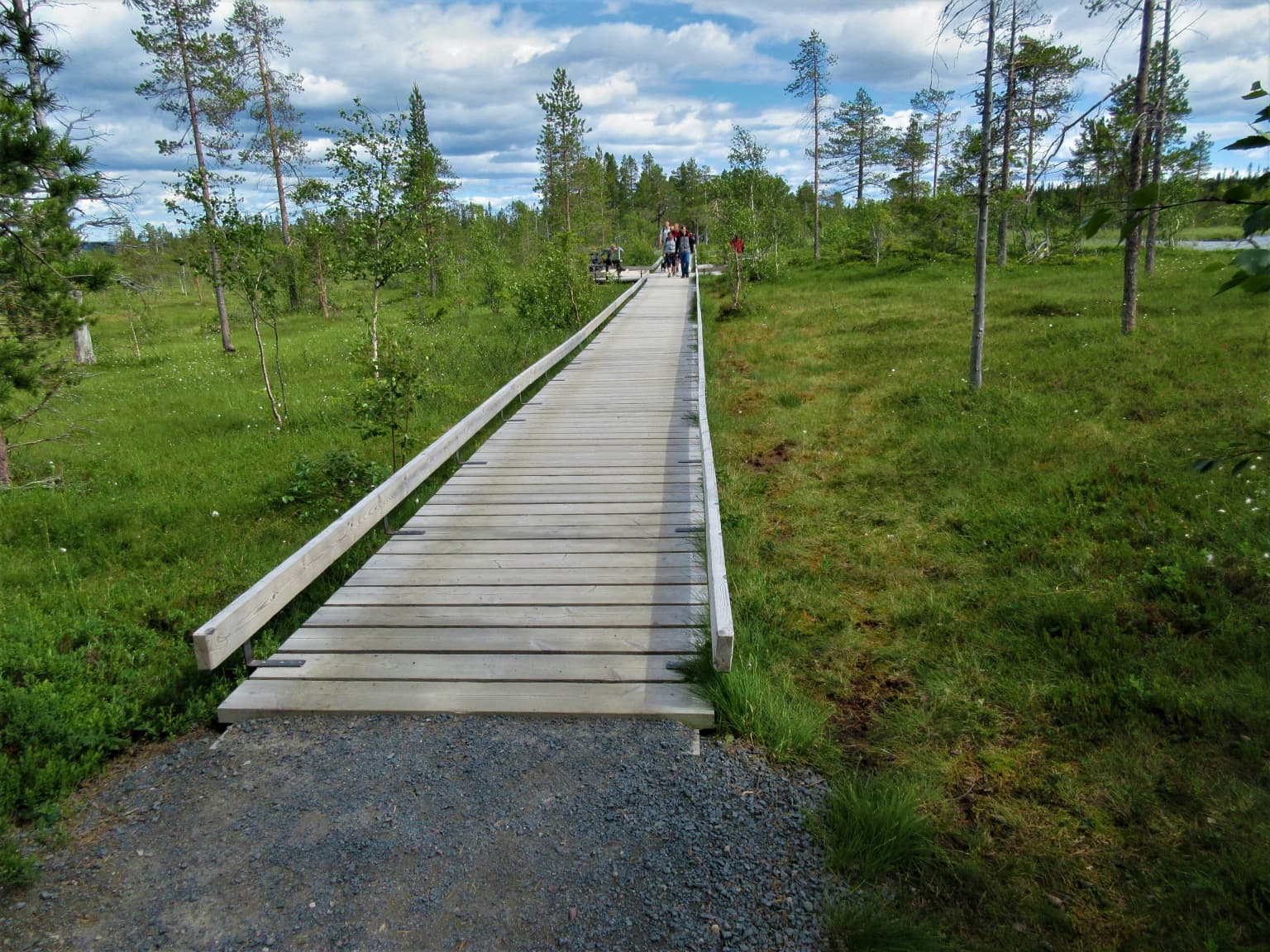
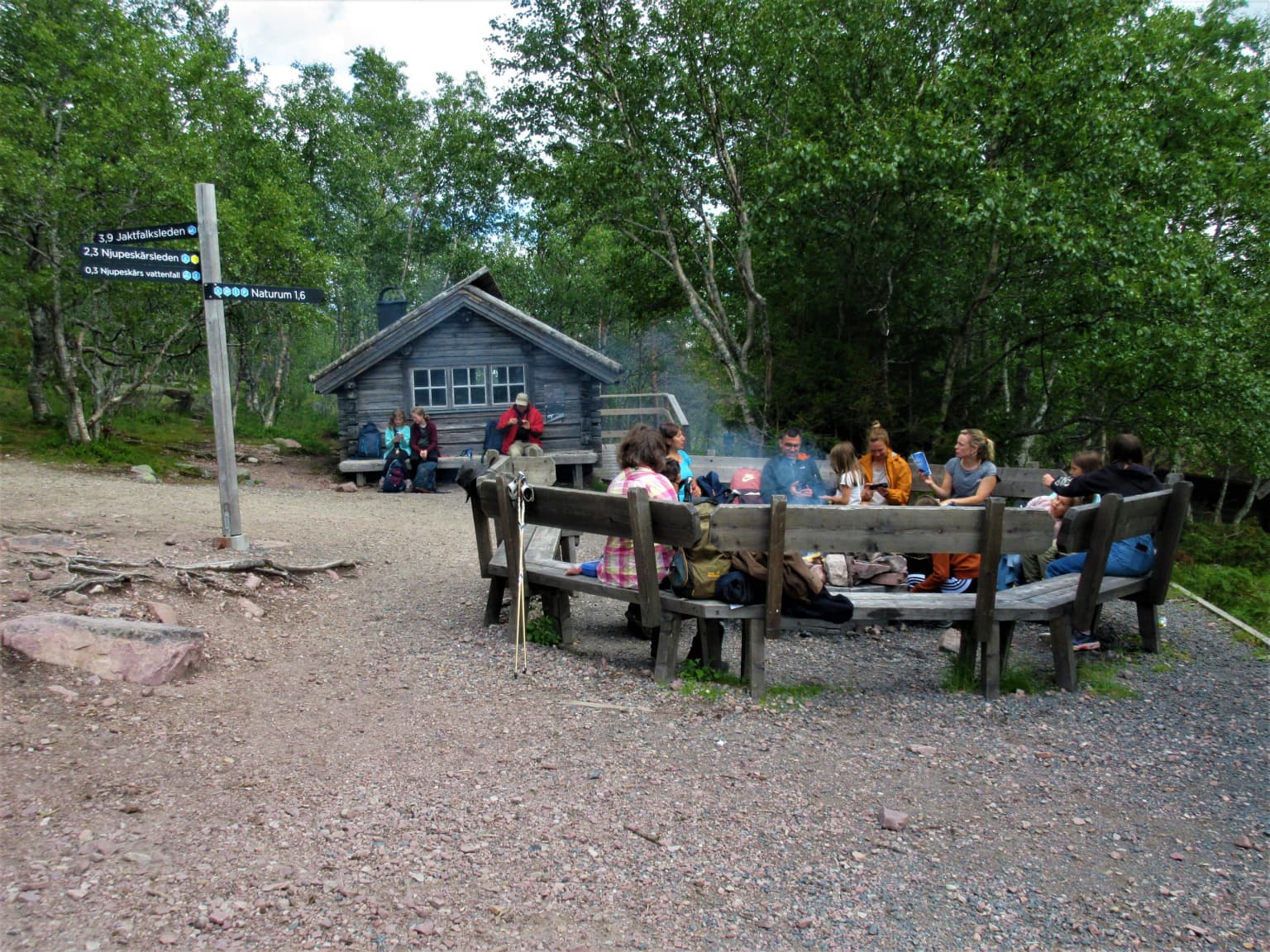
The optimal time to experience Fulufjället National Park depends on preferred activities and tolerance for conditions. Summer months from June through September offer the most accessible period, when approximately 80% of annual visitors arrive, with the park's 140 kilometers of hiking trails fully accessible and the visitor center (Naturum Fulufjället) operational. July and August provide the warmest conditions for exploring the plateau and valleys, though the continental climate means temperatures remain modest. The Njupeskär waterfall is most impressive during snowmelt and after autumn rains. Autumn offers fewer visitors and the possibility of witnessing the landscape transformed by fall colors in the birch and willow communities. Winter brings opportunities for cross-country skiing and ice climbing on the frozen Njupeskär waterfall, though dedicated ski trails are limited. The park remains open year-round, and winter visits offer solitude and the experience of the mountain landscape under snow cover, though infrastructure is minimal and conditions require appropriate preparation. Spring transitions are brief, with snow typically clearing from lower elevations by May.

Park location guide

Geography guide, regional context, and park location map for Fulufjället National Park

Fulufjället National Park park geography, regions, and map view in Sweden
Understand where Fulufjället National Park sits in Sweden through a broader geographic reading of the surrounding landscape, nearby location context, and its mapped position within the national park landscape.

How Fulufjället National Park fits into Sweden

Sweden, formally the Kingdom of Sweden, is a highly developed Nordic country on the Scandinavian Peninsula in Northern Europe. With a population of 10.6 million and an area of 450,295 km², it is the largest Nordic country by both area and population. Sweden is a constitutional monarchy with Stockholm as its capital and largest city, known for its advanced economy, social welfare system, and membership in the European Union and NATO.

Wider geography shaping Fulufjället National Park in Sweden

Sweden occupies the eastern portion of the Scandinavian Peninsula in Northern Europe. It borders Norway to the west and north, Finland to the east, and shares a maritime border with Denmark to the southwest across the Øresund. The country has an extensive coastline along the Baltic Sea and Gulf of Bothnia, dotted with thousands of islands. The terrain varies from mountainous regions in the northwest to low-lying coastal areas and inland lakes in the south and central parts.

Map view of Fulufjället National Park

Use this park location map to pinpoint Fulufjället National Park in Sweden, understand its exact geographic position, and read its mapped placement within the surrounding landscape more clearly.

Pigeon | © OpenStreetMap contributors

Location context for Fulufjället National Park

Dalarna County

Visual guide to Fulufjället's unique plateau terrain, Njupeskär waterfall, ancient spruces, and protected lichen heaths.

Fulufjället National Park Photos: Explore Landscapes, Waterfalls, and Ancient Forests
View compelling imagery of Fulufjället National Park to understand its distinctive high plateau terrain, dramatic Njupeskär waterfall, and ancient old-growth forests that define Sweden's southernmost alpine environments. These protected area visuals offer essential context for appreciating the park's unique lichen-covered heaths and the geological character of its nearly billion-year-old sandstone formations.

Mossy rocks line a flowing brook surrounded by green ferns and trees

Wooden interior of Naturum Fulufjället visitor center showing large windows with a view of grassy fields and mountains outside. Two people are seated in the foreground with silhouettes visible against the bright exterior.

Wooden boardwalk leading through a grassy field with scattered trees under a partly cloudy sky

Green forested hills with scattered rocks and trees under a blue sky with clouds

Grassy field with scattered leafless and coniferous trees, forested hills under a partly cloudy sky

Wide landscape view of Fulufjället National Park showing a high-plain with wetland patches, grassy vegetation, and a partly cloudy sky

Group of people seated at a circular wooden bench in a gravel rest area with a signpost, small cabin, and forested landscape in the background

A Northern Wheatear bird standing on a rock with yellow lichen, set against a blurred green background

Tall Norway spruce tree on rocky terrain with low vegetation and distant mountains under a partly cloudy sky

Snow-covered mountains and pine trees in a winter landscape

Panoramic view of a waterfall cascading between rocky cliffs with green vegetation on slopes

Landscape with rainbow over rocky terrain, green vegetation, and cloudy sky

Swamp with standing water, scattered trees, and green vegetation under a partly cloudy sky.

Modern glass building with wooden deck and tall pine trees at Fulufjället National Park entrance

A tall waterfall flowing down rocky cliffs with a river surrounded by green vegetation and rocks

Frozen waterfall with ice formations on rocky cliffs and snow-covered ground

Park atlas

Explore the regional spread of protected landscapes and mountain terrain surrounding Fulufjället National Park, comparing features and geography.

Discover Other National Parks and Protected Areas Near Fulufjället
Continue exploring national parks and protected areas near Fulufjället National Park, tracing the distinct mountain plateaus, old-growth forests, and water features across Dalarna County. Compare these unique conservation landscapes and regional park geography to deepen your understanding of Sweden's protected wilderness atlas.
Watercolor illustration of a mountainous landscape with a lake, green fields, and pink flowers
National park

Fulufjellet National Park: Protected Boreal Forest Landscape and Regional Geography

Explore mapped boundaries, rolling terrain, and transboundary conservation.

Fulufjellet National Park offers a detailed look at a protected boreal forest ecosystem in southeastern Norway. This page details the park's gently rolling hills, dominated by Norway spruce and Scots pine, interspersed with lakes and peat bogs. It highlights the park's designation as a national park, its establishment in 2012, and its contiguous protected status with Sweden's Fulufjället National Park, contributing to a significant transboundary conservation area. Users can explore its geographic features and protected landscape context within Scandinavia.

Area
82.5 km²
Established
2012
IUCN
II
Relief
Mountain
National parkInnlandet

Gutulia National Park: Protected Southernmost Mountain Birch Forest Landscape Atlas

Explore Norway's unique subarctic forest geography and park boundaries.

Gutulia National Park stands as a key protected area within Norway's Innlandet region, distinguished by its role in preserving the country's southernmost mountain birch forest ecosystem. Covering approximately 23 square kilometers, this national park provides critical insights into subarctic forest ecology at the southern extent of its natural range. MoriAtlas enables detailed exploration of its mapped terrain and geographic context, offering a valuable resource for understanding this significant protected landscape.

Area
23 km²
Established
1968
IUCN
II
Scope
Terrestrial
National parkDalarna County

Töfsingdalen National Park: Ancient Old-Growth Forest in Rugged Terrain

Remote protected landscape within Dalarna County, Sweden.

Töfsingdalen National Park showcases a rare example of an ancient, up-to-500-year-old pine forest thriving in extremely rugged, boulder-strewn valley terrain. This protected area, located in Sweden's Dalarna County, offers a glimpse into a near-wilderness landscape shaped by glacial forces and defined by its remoteness and ecological integrity. Discover the mapped park boundaries and the unique geographic context of this remarkably untouched natural reserve.

Area
16.15 km²
Established
1930
IUCN
II
Relief
Lowland
National parkInnlandet

Femundsmarka National Park: Exploring Norway's Distinctive Wetland and Boreal Protected Landscape

Mapped boundaries and regional geography in Innlandet.

Femundsmarka National Park in Innlandet, Norway, offers a profound look into a preserved wetland wilderness characterized by vast marshlands, numerous lakes, and scattered boreal forests. As a designated national park, its ecological significance is tied to the surrounding water systems and the unique landscape stretching towards the Swedish border. This entry provides detailed geographic context, mapping information, and an understanding of its protected area status, inviting exploration of its remote boreal terrain and notable wildlife habitats.

Area
573 km²
Established
1971
IUCN
II
Relief
Mixed relief
National park

Sonfjället National Park: Mapped Alpine Terrain and Protected Landscape in Sweden

Explore the glacial geography and subalpine transition zones.

Sonfjället National Park is a key protected area in central Sweden, offering a unique glimpse into an alpine environment shaped by glacial forces. The park's landscape is characterized by the prominent Sånfjället mountain, steep glacial valleys, mires, and small lakes, showcasing raw, natural terrain. As a southern outpost for subalpine ecosystems, it presents a distinct ecological transition zone valuable for geographic discovery and understanding protected nature.

Watercolor illustration of a lake surrounded by trees and distant hills with a soft sky
National parkGävleborg County

Hamra National Park: Ancient Forests, Mires, and Protected Landscape in Gävleborg County

Discover pristine Swedish nature and mapped park boundaries.

Hamra National Park in Gävleborg County, Sweden, protects an extraordinary natural landscape. At its heart lies a distinct moraine hill adorned with some of central Sweden's oldest coniferous trees, some reaching 400 years. Surrounding this ancient forest is a vast, unbroken expanse of mire and wetland, a landscape preserved from drainage and modification. This park offers a profound insight into pristine ecosystems and geographic context, making it a key destination for atlas exploration of protected natural areas.

Area
13.83 km²
Established
1909
IUCN
II
Relief
Lowland
National park

Forollhogna National Park: Norway's Gently Rolling Alpine Protected Landscape Atlas

Explore unique terrain and vital wild reindeer habitat in Central Norway.

MoriAtlas provides structured geographic context for Forollhogna National Park, Norway's nineteenth national park. This area is best known for its distinctively gentle, rolling alpine terrain, a contrast to other Norwegian mountain ranges, and as a critical habitat for wild reindeer. Discover the park's unique landscape character, its role as a protected area, and the ongoing cultural traditions tied to its mountain pastures, all visualized within a comprehensive atlas framework.

Area
1,062 km²
Established
2001
IUCN
II
Watercolor painting of mountain peaks with green valleys and grassy foreground
National parkInnlandet

Rondane National Park: Norway's Premier Alpine Protected Landscape and Historic National Park

Mapped glacial terrain, iconic peaks, and wild reindeer sanctuary.

As Norway's first national park, Rondane offers a profound exploration of a protected alpine environment. Situated in Innlandet county, its 963 square kilometers showcase a landscape sculpted by glaciers, featuring a striking array of ten peaks exceeding 2,000 meters. This page details Rondane National Park's distinct mapped boundaries, dramatic mountain geography, and its ecological significance as a refuge for wild reindeer, making it a cornerstone of Scandinavian natural heritage.

Area
963 km²
Established
1962
IUCN
II
Relief
Mountain

Common questions about visiting, size, designation, and location context for Fulufjället National Park

Fulufjället National Park FAQs for park facts, access, geography, and protected area context
Find quick answers about Fulufjället National Park, including protected-area facts, park geography, trail and visitor context, and how the park fits into its surrounding country and regional landscape.
MoriAtlas Explorer

Continue Your Protected Areas Search Across the Global Atlas

Deepen your exploration by continuing the structured search for national parks and protected areas worldwide. Utilize the comprehensive filtering capabilities to compare different conservation landscapes and refine your understanding of global park geography. Discover more about the distribution and characteristics of protected natural areas.

Global natural geography