Mori Atlas logo
National parkSonfjället National Park

Discover the mapped terrain, glacial valleys, and subalpine transition zones of this key Swedish national park.

Sonfjället National Park: Explore Sweden's Distinctive Alpine Protected Landscape

Sonfjället National Park represents a significant protected alpine environment in central Sweden, distinguished by its namesake mountain and glacial topography. This national park preserves a unique landscape shaped by geological processes, featuring exposed bedrock, moraines, small lakes, and mires. It serves as a crucial southern outpost for alpine and subalpine ecosystems, marking a transition zone between boreal forests and higher mountain flora, offering a clear example of ecological zonation within a mapped natural area.

Alpine EnvironmentsBoreal ForestsGlacial LandscapeMountain ParksNorthern SwedenProtected Nature

Sonfjället National Park

National park

Park overview

Structured park overview, official facts, and landscape profile for Sonfjället National Park

Sonfjället National Park park facts, protected area profile, and essential visitor context
Review the core facts for Sonfjället National Park, including designation, size, terrain, visitor scale, habitats, and operating context in one park-focused overview.

About Sonfjället National Park

Sonfjället National Park occupies a mountainous area in the central part of Sweden, within the administrative boundaries of Gävleborg County and the historical province of Hälsingland. The park's landscape is dominated by the mass of Sånfjället mountain, which provides the distinctive backdrop for the protected area. The terrain exhibits classic glacial morphology with steep-sided valleys, exposed rock surfaces, and accumulations of glacial debris including terminal and lateral moraines. Several small lakes dot the park, occupying depressions carved by past glacial activity. The underlying geology consists primarily of ancient granitic and metamorphic rocks, typical of the geological foundation throughout this region of Scandinavia. The park was established to ensure the long-term preservation of this relatively unmodified alpine landscape, recognizing that mountainous environments in southern and central Sweden have experienced significant human modification over centuries of settlement and resource extraction. The protected area serves as a reference site for understanding natural processes in subalpine environments and provides a habitat refuge for species adapted to cold, exposed conditions.

Quick facts and research context for Sonfjället National Park

Sonfjället National Park is located in central Sweden's Hälsingland region within Gävleborg County. The park centers on Sånfjället mountain and protects a landscape of exposed alpine terrain, glacial valleys, and boreal forest transitions. The area lies at the southern edge of Sweden's mountainous zone, representing one of the more northerly landscape types accessible in this part of the country. The protected area was established to preserve relatively untouched subalpine and alpine environments in a region where such habitats have become increasingly fragmented. The park features several small lakes surrounded by heath and mire landscapes, with underlying granitic and metamorphic bedrock typical of the geological foundation of this part of Scandinavia.

Park context

Deeper park guide and search-rich context for Sonfjället National Park

Sonfjället National Park history, landscape, wildlife, and travel context
Explore Sonfjället National Park through its history, landscape character, ecosystems, wildlife, conservation priorities, cultural context, and seasonal travel timing in a structured park guide built for atlas discovery and search intent.

Why Sonfjället National Park stands out

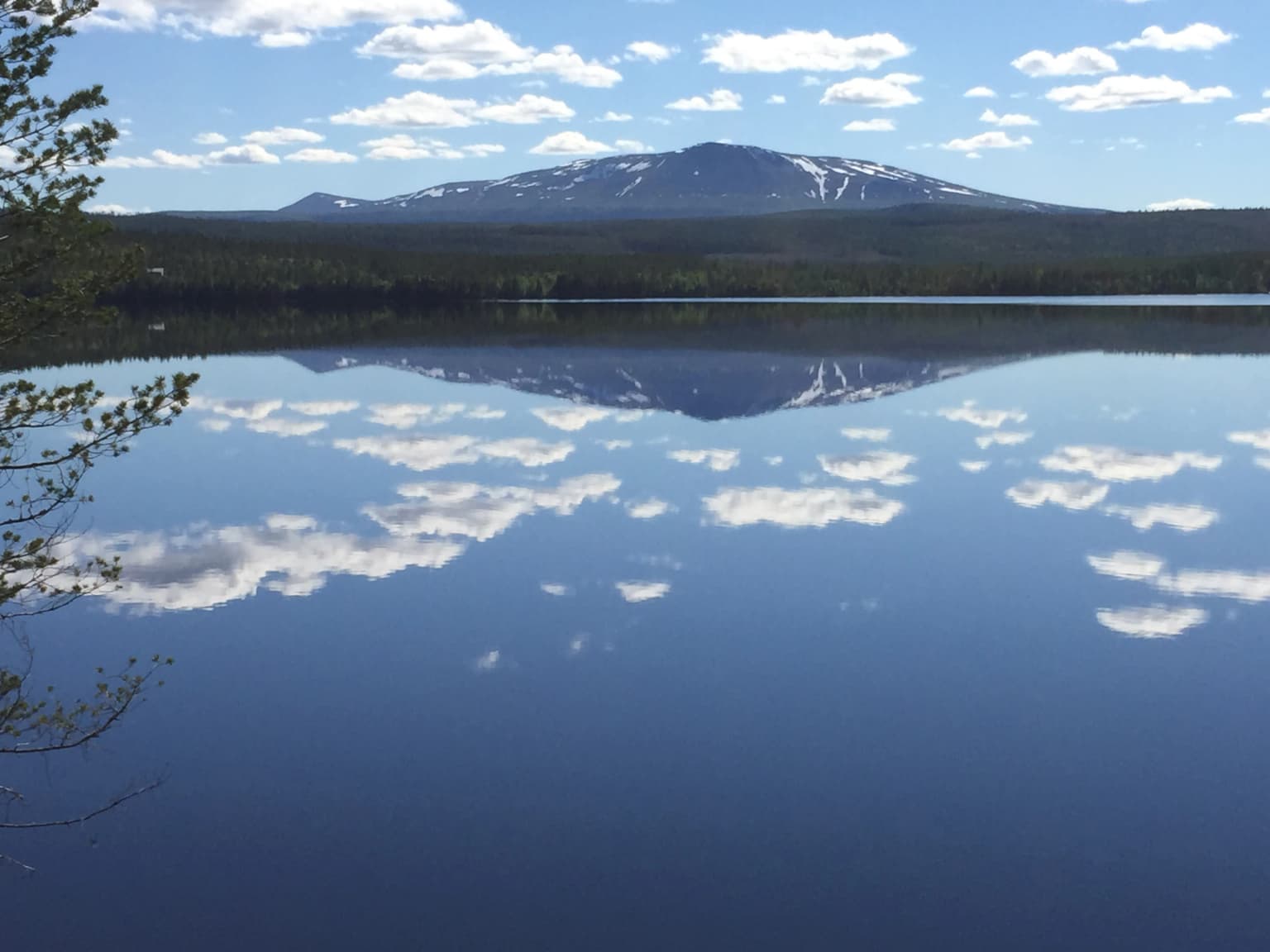
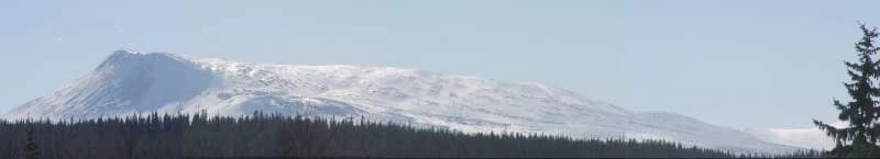
Sonfjället National Park is distinguished by its role as a southern outpost for alpine and subalpine ecosystems within Sweden. The mountain Sånfjället rises above the surrounding terrain as a prominent landscape feature, providing exposed rocky summit areas and steep glacial valleys. The park protects a transition zone where northern boreal spruce forests meet the subalpine birch zone, creating an ecological boundary of particular interest. The relatively unmodified nature of the landscape, with its mires, small lakes, and exposed bedrock, represents a conservation value in a region where extensive forest modification has occurred in surrounding areas.

Sonfjället National Park history and protected-area timeline

Sonfjället National Park was established as part of Sweden's program to create a comprehensive network of protected areas preserving representative samples of the country's diverse natural landscapes. The designation recognized the ecological significance of maintaining the transition between boreal and alpine zones in this part of Sweden. The establishment of the park reflected growing post-war recognition in Sweden of the need to protect remaining natural areas from expanding forestry operations and infrastructure development that had increasingly fragmented wilderness landscapes in lower elevations. The park remains under the management of Swedish environmental authorities, who maintain the protected area status while allowing limited public access for nature appreciation and recreation.

Sonfjället National Park landscape and geographic character

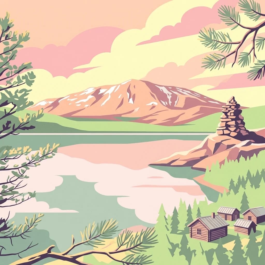
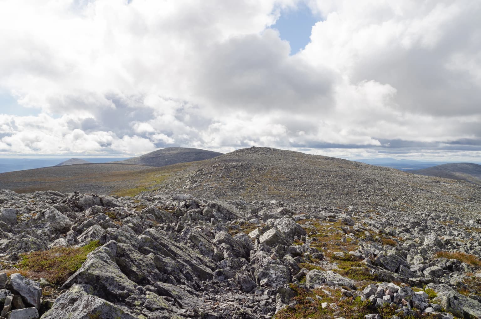
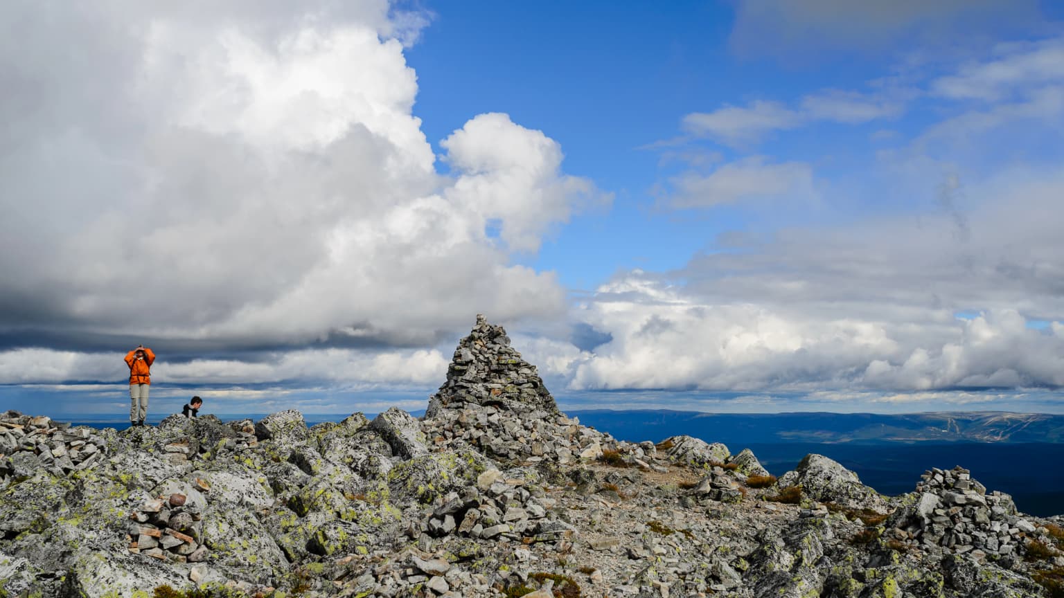
The physical landscape of Sonfjället National Park is characterized by mountainous terrain centered on the prominent peak of Sånfjället. The terrain rises dramatically from the surrounding lower-lying forested areas, with exposed rock faces, steep glacial valleys, and rocky ridges defining the park's most striking topographical features. The valleys and lower areas contain sequences of small lakes, their shorelines fringed with mires and wetland vegetation. The bedrock is predominantly granitic, with weathering creating the distinctive blocky tors and exposed surfaces visible on the mountain slopes. Areas of glacial deposition have created uneven terrain with moraine ridges and hummocky ground, particularly in valley bottoms. The overall character is one of raw, natural alpine landscape that retains the imprint of glacial processes without extensive modification from human activity.

Sonfjället National Park ecosystems, habitats, and plant life

The ecological character of Sonfjället National Park is defined by the transition between northern boreal forest and subalpine environments. Spruce-dominated forest occurs in the lower valleys and slopes, representing the southern edge of the continuous boreal forest zone. As elevation increases, the forest transitions through a subalpine birch zone before giving way to alpine heath and exposed rock at the highest elevations. This elevational gradient creates a compressed sequence of vegetation zones within a relatively small area. The mires and lake edges support specialized wetland plant communities adapted to acidic, nutrient-poor conditions. The overall biodiversity reflects the position of the park at a biogeographic crossroads, where species with different geographical affinities meet. The park provides habitat for species characteristic of both boreal and alpine environments, creating an ecological assemblage that is representative of mountain landscapes in this part of Sweden.

Sonfjället National Park wildlife and species highlights

The wildlife of Sonfjället National Park reflects the blend of boreal and alpine habitats within the protected area. The forests support species typical of Sweden's northern woodlands, including various small mammals and bird species adapted to coniferous forest environments. The alpine and subalpine zones provide habitat for species characteristic of more northerly and exposed environments. The mires and lake edges attract waterfowl and wetland birds during the breeding season. The overall wildlife community represents a composite of species adapted to the ecological gradient from forest to alpine conditions, making the park significant for maintaining populations of species that require the mosaic of habitats found in mountainous terrain.

Sonfjället National Park conservation status and protection priorities

Sonfjället National Park contributes to Sweden's national strategy for conserving representative examples of the country's natural diversity. The protected area preserves a landscape that has retained relatively high naturalness in a region where lowland environments have been extensively modified by forestry and agriculture. The park serves as a reference area for studying natural ecological processes in subalpine environments and provides a protected habitat corridor connecting higher elevation terrain with surrounding forested landscapes. The preservation of the transition zone between boreal and alpine ecosystems is of particular conservation significance, as these ecotonal areas support distinctive species assemblages and ecological processes that cannot be replicated in modified landscapes.

Sonfjället National Park cultural meaning and human context

The landscape surrounding Sonfjället has been part of the cultural landscape of Hälsingland for centuries, with evidence of human activity in the broader region extending back to prehistoric times. The mountainous areas were historically used for seasonal grazing and resource gathering by local communities. The name Sånfjället reflects the Swedish language naming tradition for significant landscape features. While the park itself is designated as wilderness protection, the surrounding region maintains cultural connections to the land through traditional land use patterns that have shaped the broader landscape outside the protected area boundaries.

Top sights and standout views in Sonfjället National Park

Sonfjället National Park offers visitors the opportunity to experience a relatively unmodified alpine landscape in central Sweden, with the distinctive mountain peak providing a prominent focus for exploration. The park preserves a significant transition zone between boreal and subalpine ecosystems, creating a compact demonstration of ecological zonation within a manageable area. The combination of exposed mountain terrain, glacial valleys, small lakes, and mire landscapes provides a diversity of scenery within a relatively contained area. The park serves as one of the more accessible mountainous protected areas for visitors from the more populated regions of southern and central Sweden.

Best time to visit Sonfjället National Park

The most favorable conditions for visiting Sonfjället National Park occur during the summer months when snow has melted from the trails and the mountain terrain is fully accessible. Late summer typically offers stable weather and the opportunity to observe the park's full range of habitats in bloom. Autumn brings the characteristic colors of northern forests and may offer reduced visitor numbers, though conditions become increasingly variable. Winter access is limited to cross-country skiing on maintained trails, with the mountain terrain requiring appropriate winter mountaineering skills for any off-trail travel. Spring conditions are variable, with snow cover remaining on higher ground well into May in typical years.

Park location guide

Geography guide, regional context, and park location map for Sonfjället National Park

Sonfjället National Park park geography, regions, and map view in Sweden
Understand where Sonfjället National Park sits in Sweden through a broader geographic reading of the surrounding landscape, nearby location context, and its mapped position within the national park landscape.

How Sonfjället National Park fits into Sweden

Sweden, formally the Kingdom of Sweden, is a highly developed Nordic country on the Scandinavian Peninsula in Northern Europe. With a population of 10.6 million and an area of 450,295 km², it is the largest Nordic country by both area and population. Sweden is a constitutional monarchy with Stockholm as its capital and largest city, known for its advanced economy, social welfare system, and membership in the European Union and NATO.

Wider geography shaping Sonfjället National Park in Sweden

Sweden occupies the eastern portion of the Scandinavian Peninsula in Northern Europe. It borders Norway to the west and north, Finland to the east, and shares a maritime border with Denmark to the southwest across the Øresund. The country has an extensive coastline along the Baltic Sea and Gulf of Bothnia, dotted with thousands of islands. The terrain varies from mountainous regions in the northwest to low-lying coastal areas and inland lakes in the south and central parts.

Map view of Sonfjället National Park

Use this park location map to pinpoint Sonfjället National Park in Sweden, understand its exact geographic position, and read its mapped placement within the surrounding landscape more clearly.

Pigeon | © OpenStreetMap contributors
Park atlas

Expand your atlas view, compare diverse protected landscapes, and explore other national parks geographically connected to Sonfjället National Park.

Explore Other National Parks and Protected Areas Across the Sonfjället Region of Sweden
Browse other national parks and protected areas near Sonfjället National Park, exploring alpine environments, boreal forests, and glacial landscapes in central Sweden. Compare these distinct conservation areas for geographic context, understanding regional park distribution and the diverse protected nature across Sweden.
National parkDalarna County

Töfsingdalen National Park: Ancient Old-Growth Forest in Rugged Terrain

Remote protected landscape within Dalarna County, Sweden.

Töfsingdalen National Park showcases a rare example of an ancient, up-to-500-year-old pine forest thriving in extremely rugged, boulder-strewn valley terrain. This protected area, located in Sweden's Dalarna County, offers a glimpse into a near-wilderness landscape shaped by glacial forces and defined by its remoteness and ecological integrity. Discover the mapped park boundaries and the unique geographic context of this remarkably untouched natural reserve.

Area
16.15 km²
Established
1930
IUCN
II
Relief
Lowland
National parkInnlandet

Femundsmarka National Park: Exploring Norway's Distinctive Wetland and Boreal Protected Landscape

Mapped boundaries and regional geography in Innlandet.

Femundsmarka National Park in Innlandet, Norway, offers a profound look into a preserved wetland wilderness characterized by vast marshlands, numerous lakes, and scattered boreal forests. As a designated national park, its ecological significance is tied to the surrounding water systems and the unique landscape stretching towards the Swedish border. This entry provides detailed geographic context, mapping information, and an understanding of its protected area status, inviting exploration of its remote boreal terrain and notable wildlife habitats.

Area
573 km²
Established
1971
IUCN
II
Relief
Mixed relief
National parkInnlandet

Gutulia National Park: Protected Southernmost Mountain Birch Forest Landscape Atlas

Explore Norway's unique subarctic forest geography and park boundaries.

Gutulia National Park stands as a key protected area within Norway's Innlandet region, distinguished by its role in preserving the country's southernmost mountain birch forest ecosystem. Covering approximately 23 square kilometers, this national park provides critical insights into subarctic forest ecology at the southern extent of its natural range. MoriAtlas enables detailed exploration of its mapped terrain and geographic context, offering a valuable resource for understanding this significant protected landscape.

Area
23 km²
Established
1968
IUCN
II
Scope
Terrestrial
Watercolor illustration of a lake surrounded by trees and distant hills with a soft sky
National parkGävleborg County

Hamra National Park: Ancient Forests, Mires, and Protected Landscape in Gävleborg County

Discover pristine Swedish nature and mapped park boundaries.

Hamra National Park in Gävleborg County, Sweden, protects an extraordinary natural landscape. At its heart lies a distinct moraine hill adorned with some of central Sweden's oldest coniferous trees, some reaching 400 years. Surrounding this ancient forest is a vast, unbroken expanse of mire and wetland, a landscape preserved from drainage and modification. This park offers a profound insight into pristine ecosystems and geographic context, making it a key destination for atlas exploration of protected natural areas.

Area
13.83 km²
Established
1909
IUCN
II
Relief
Lowland
Watercolor illustration showing mountains, forests, and a river
National parkDalarna County

Fulufjället National Park: Protected Plateau Landscape and Transboundary Conservation in Dalarna County

Sweden's southernmost alpine plateau, mapped geography, and natural wonders.

Fulufjället National Park in Dalarna County, Sweden, protects a significant high plateau landscape, notable for its ancient sandstone geology and unique lichen-heath environments. This national park is home to Njupeskär, Sweden's tallest waterfall, and is part of a transboundary protected area with Norway. Explore the mapped terrain and distinct natural features of this important conservation area within the Scandinavian Mountains.

Area
385 km²
Established
2002
IUCN
II
Visitors
53K annual
Watercolor illustration of a mountainous landscape with a lake, green fields, and pink flowers
National park

Fulufjellet National Park: Protected Boreal Forest Landscape and Regional Geography

Explore mapped boundaries, rolling terrain, and transboundary conservation.

Fulufjellet National Park offers a detailed look at a protected boreal forest ecosystem in southeastern Norway. This page details the park's gently rolling hills, dominated by Norway spruce and Scots pine, interspersed with lakes and peat bogs. It highlights the park's designation as a national park, its establishment in 2012, and its contiguous protected status with Sweden's Fulufjället National Park, contributing to a significant transboundary conservation area. Users can explore its geographic features and protected landscape context within Scandinavia.

Area
82.5 km²
Established
2012
IUCN
II
Relief
Mountain
Watercolor illustration of mountains and valleys with green and purple terrain and pink-hued peaks
National parkTrøndelag

Skarvan and Roltdalen National Park: Protected Wilderness and Trøndelag Landscape Atlas

Explore extensive peatlands, alpine terrain, and regional geography.

The Skarvan and Roltdalen National Park detail page offers an atlas-driven exploration of this protected landscape in Norway's Trøndelag region. Discover its vast peatland systems, the intact Roltdalen valley, and its alpine environments. This page provides detailed geographic context and mapped features, highlighting the park's significance within the regional natural heritage.

Area
441.5 km²
Established
2004
IUCN
II
Relief
Mountain
National park

Forollhogna National Park: Norway's Gently Rolling Alpine Protected Landscape Atlas

Explore unique terrain and vital wild reindeer habitat in Central Norway.

MoriAtlas provides structured geographic context for Forollhogna National Park, Norway's nineteenth national park. This area is best known for its distinctively gentle, rolling alpine terrain, a contrast to other Norwegian mountain ranges, and as a critical habitat for wild reindeer. Discover the park's unique landscape character, its role as a protected area, and the ongoing cultural traditions tied to its mountain pastures, all visualized within a comprehensive atlas framework.

Area
1,062 km²
Established
2001
IUCN
II

Common questions about visiting, size, designation, and location context for Sonfjället National Park

Sonfjället National Park FAQs for park facts, access, geography, and protected area context
Find quick answers about Sonfjället National Park, including protected-area facts, park geography, trail and visitor context, and how the park fits into its surrounding country and regional landscape.
MoriAtlas Explorer

Continue Your Protected Areas Search Across the Global Atlas

Deepen your exploration by continuing the structured search for national parks and protected areas worldwide. Utilize the comprehensive filtering capabilities to compare different conservation landscapes and refine your understanding of global park geography. Discover more about the distribution and characteristics of protected natural areas.

Global natural geography