Mori Atlas logo
National parkFulufjellet National Park

Explore the gently rolling terrain, lakes, and wetlands of Norway's easternmost national park.

Fulufjellet National Park: Mapped Protected Landscape and Boreal Forest Ecology

(Fulufjellet nasjonalpark)

Fulufjellet National Park, established in 2012, represents a significant protected area of intact boreal forest in southeastern Norway. This page provides an atlas-style overview of its mapped boundaries and characteristic landscape, featuring rolling hills, dense conifer forests dominated by spruce and pine, and numerous small lakes and peat bogs. As one of Norway's newer national parks, Fulufjellet showcases a relatively untouched natural environment and its role in a transboundary protected area with neighboring Sweden, highlighting its ecological significance within the Scandinavian context.

National ParksBoreal ForestsNorwayProtected AreasTransboundary ParksLakes and Wetlands
Stylized illustration of a lake with a small boat, green hills, patches of snow on mountains, and clouds in the sky.

Fulufjellet National Park

National park

Park overview

Structured park overview, official facts, and landscape profile for Fulufjellet National Park

Fulufjellet National Park park facts, protected area profile, and essential visitor context
Review the core facts for Fulufjellet National Park, including designation, size, terrain, visitor scale, habitats, and operating context in one park-focused overview.

About Fulufjellet National Park

Fulufjellet National Park occupies a distinctive position in Norway's system of protected areas as a relatively recent addition (established 2012) that protects important boreal forest ecosystems in the country's southeast. The park's location in Trysil Municipality places it in a region that has historically been dominated by forestry and outdoor recreation, making the national park designation a significant commitment to long-term conservation of this landscape.

The terrain within the park is characterized by hills that rise to moderate elevations, with the landscape shaped by glacial processes during the last ice age. The area features numerous small to medium-sized lakes scattered throughout the forest, along with wetlands and peat bogs that add ecological diversity to the otherwise uniform forest cover. These water bodies and wet areas are important for biodiversity, providing habitat for waterfowl, amphibians, and insects that depend on wetland environments.

The forest ecosystems within Fulufjellet represent typical boreal vegetation for this part of Scandinavia. Norway spruce dominates the moister valley bottoms and slopes, while Scots pine occurs on drier ridge tops and shallower soils. The forest has significant age diversity, with old-growth areas coexisting with younger regeneration, creating a mosaic of forest structures that supports various wildlife species. The establishment of the park ensures that these forest ecosystems can develop naturally without intensive forestry intervention.

The transboundary relationship with Sweden's Fulufjället National Park is a defining characteristic of this protected area complex. The two parks together form a larger ecological unit that allows for wildlife movement across the international border and protects ecological processes at a landscape scale. This cross-border cooperation represents modern conservation thinking that recognizes political boundaries do not constrain ecological systems.

Quick facts and research context for Fulufjellet National Park

Fulufjellet National Park spans 82.5 km² in Trysil Municipality, southeastern Norway, near the Sweden border. Established April 24, 2012, it is one of Norway's newer national parks. The terrain consists of rolling boreal forest hills with numerous small lakes and wetland areas. The park forms a contiguous protected area with Sweden's Fulufjället National Park across the border. The area falls within the boreal forest zone, dominated by Norway spruce and Scots pine. The park is classified as IUCN Category II (national park).

Park context

Deeper park guide and search-rich context for Fulufjellet National Park

Fulufjellet National Park history, landscape, wildlife, and travel context
Explore Fulufjellet National Park through its history, landscape character, ecosystems, wildlife, conservation priorities, cultural context, and seasonal travel timing in a structured park guide built for atlas discovery and search intent.

Why Fulufjellet National Park stands out

Fulufjellet National Park is known for its relatively untouched boreal forest landscapes and its role as a cross-border protected area with Sweden. The park protects one of the more intact forest regions in eastern Norway, with clean water bodies, peat bogs, and diverse forest types representing the boreal ecosystem. Its proximity to and connection with the Swedish Fulufjället National Park creates a larger transboundary conservation unit that helps protect migrating wildlife and ecological processes that cross the international boundary.

A panoramic view of a turquoise lake surrounded by rugged mountains with patches of snow under a partly cloudy sky
Panoramic mountain view of turquoise lakes and snow-capped peaks in Fulufjellet National Park

Fulufjellet National Park history and protected-area timeline

Fulufjellet National Park was established on April 24, 2012, making it one of the more recent additions to Norway's national park system. The park's creation followed a lengthy process of evaluation and advocacy by conservation organizations and local stakeholders who recognized the ecological value of this forest landscape. The establishment represented a continuation of Norway's approach of creating national parks in areas that represent the country's diverse natural environments.

Prior to national park designation, the area had been subject to varying degrees of protection and management through other designations. The process of creating the park involved coordination between Norwegian authorities and consideration of the existing Swedish protected area across the border. The formal establishment brought the area under the management framework of the Norwegian Directorate for Nature Management, which oversees Norway's national parks.

The establishment of Fulufjellet National Park contributed to Norway's international conservation commitments and helped complete the network of protected areas in the boreal forest zone of southern Norway. The park's creation was part of broader efforts to protect old-growth forests and intact natural landscapes that had become increasingly scarce in the face of historical forestry expansion in the region.

Fulufjellet National Park landscape and geographic character

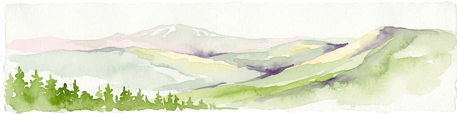
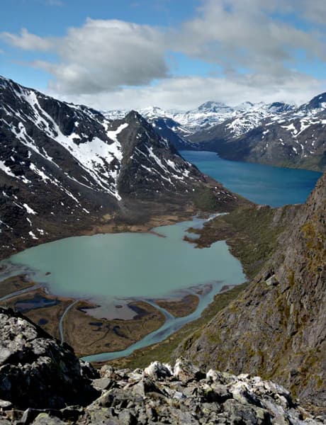
The landscape of Fulufjellet National Park is characterized by gently rolling hills typical of the boreal forest region in southeastern Norway. The terrain rises to moderate elevations without reaching the dramatic alpine peaks found in higher mountain areas of Norway. This softened topography reflects the region's position at the edge of the Scandinavian mountain range and the erosional effects of glacial activity during the last ice age.

Forested hills dominate the visual character of the park, with dense conifer forest covering the majority of the terrain. The forest canopy is predominantly composed of Norway spruce in the lower and wetter areas, with Scots pine dominating ridge tops and drier sites. Between the forest stands, numerous small lakes and ponds dot the landscape, many of which formed in depressions left by glacial retreat. These water bodies range from tiny ponds to more substantial lakes of several hectares.

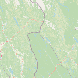
Peat bogs and wetlands are significant landscape features throughout the park, adding diversity to the otherwise continuous forest cover. These wetland areas often occupy the flatter terrain between hills and are characterized by sphagnum mosses, cotton grass, and stunted pine vegetation. The combination of forest, lakes, and wetlands creates a varied landscape that provides different habitats for wildlife and visual interest for visitors. The eastern parts of the park follow the international border with Sweden, maintaining the rolling forest character across the boundary.

Fulufjellet National Park ecosystems, habitats, and plant life

Fulufjellet National Park protects representative boreal forest ecosystems that are characteristic of southeastern Norway's interior landscapes. The park's vegetation reflects the southern boreal forest zone, where Norway spruce and Scots pine form the primary forest types. These conifer forests are adapted to the continental climate with cold winters and relatively warm summers that characterize this part of Scandinavia.

The forest within the park exhibits varying ages and structures, including areas of old-growth forest where trees have reached significant ages and sizes. These older forest areas are particularly valuable for biodiversity, providing dead wood habitats for fungi, invertebrates, and cavity-nesting birds. The mixture of forest age classes creates a diverse habitat structure that supports a range of species dependent on different forest conditions.

The numerous lakes and wetlands within the park add significant ecological diversity to the forested landscape. These water bodies support aquatic plants, amphibians, waterfowl, and insects. The peat bogs represent unique wetland ecosystems with specialized flora adapted to acidic, nutrient-poor conditions. The combination of forest and wetland habitats within a relatively compact protected area creates ecological richness that distinguishes Fulufjellet from more uniform forest landscapes.

Fulufjellet National Park wildlife and species highlights

The wildlife of Fulufjellet National Park reflects the boreal forest ecosystem typical of this region of Scandinavia. The mature conifer forests provide habitat for a range of bird species associated with old-growth forest, including various woodpeckers, owls, and thrushes. The dead and dying trees found in less disturbed forest areas are particularly important for cavity-nesting species that require tree hollows for breeding.

The wetland areas within the park attract waterfowl including various duck species and common snipe. These areas also support populations of amphibians such as frogs and newts that breed in the shallow, still waters of lakes and ponds. The diverse habitat structure, combining forest, wetlands, and water bodies, supports a broader range of species than would be found in more uniform terrain.

Larger mammals present in the region include moose (elk), roe deer, and occasionally red deer, which use the forest for cover and browse on vegetation. The transboundary connection with Sweden's protected area facilitates wildlife movement across the international border, allowing species to migrate and maintain genetic connectivity between populations. The forest and wetland habitats also support small mammals including various rodents and shrews that form the base of the food web for predators.

Fulufjellet National Park conservation status and protection priorities

Fulufjellet National Park was established to protect intact boreal forest ecosystems in southeastern Norway, representing a recognition that this landscape had significant ecological value warranting the highest level of national protection. The park protects clean water systems, diverse forest habitats, and the natural biodiversity that exists in this relatively unmodified landscape. The designation ensures that these ecological values will be maintained into the future.

The park's connection to Sweden's Fulufjället National Park creates a transboundary conservation unit that protects ecological processes at a landscape scale. This cross-border approach recognizes that wildlife populations and ecological systems do not respect international boundaries, and protecting connected areas together provides greater conservation benefit than isolated protected areas. The Norwegian park contributes to the broader network of protected areas in the boreal forest biome across Scandinavia.

The protection of old-growth forest elements within the park is particularly significant, as such forests have been extensively reduced by historical forestry across Norway. The park preserves ecological processes that cannot function in actively managed forest, including natural disturbance dynamics, dead wood accumulation, and the development of complex forest structures over time. This protection contributes to biodiversity conservation in a region where most forest land has been subject to commercial forestry.

Fulufjellet National Park cultural meaning and human context

Fulufjellet National Park is situated in Trysil Municipality, a region with a long history of forestry and outdoor recreation. The local landscape has been shaped by centuries of human activity, including traditional forest management and seasonal land use. Trysil is also known as a winter sports destination, with ski facilities drawing visitors to the region during the snow season.

The area's location along the Norway-Sweden border has given it historical significance as a border region, with connections to trade routes and regional interactions between the two countries. The proximity to the Swedish park creates a modern transboundary relationship focused on conservation cooperation. The park's name reflects the Norwegian spelling of the landscape feature that extends across the border, with the Swedish side using the variant "Fulufjället."

While the park itself does not contain significant cultural heritage sites, the surrounding region maintains connections to traditional outdoor life and forest culture that are part of local identity. The establishment of the national park coexists with ongoing forestry and recreation in the broader region, representing a balance between conservation and sustainable use of natural resources.

Top sights and standout views in Fulufjellet National Park

Fulufjellet National Park offers protected boreal forest landscapes in a transboundary setting with Sweden, creating one of the larger connected forest protected areas in Scandinavia. The park's network of lakes, peat bogs, and wetlands adds ecological diversity to the forest-covered terrain. Visitors to the park experience relatively pristine nature with minimal development, wandering through forests that have been protected from intensive forestry. The cross-border connection with the Swedish park demonstrates international conservation cooperation protecting shared ecological heritage.

Best time to visit Fulufjellet National Park

Fulufjellet National Park can be visited throughout the year, with each season offering a different experience of the boreal forest landscape. Summer months bring long days, green forest canopy, and active wildlife around the lakes and wetlands. The warm season is ideal for hiking and exploring the trail network within the park. Autumn brings color to the forest as the understory vegetation turns gold and red, and this season can be excellent for mushroom gathering and experiencing the changing landscape.

Winter transforms the park into a snow-covered wilderness, with the conifer forest heavy with snow and ice. This season appeals to those interested in cross-country skiing and winter trekking, though the cold temperatures require appropriate preparation. The park'snorthern latitude means winter days are short, while summer days are long, affecting the available time for outdoor activities. The shoulder seasons of spring and fall offer fewer visitors and the opportunity to experience the park in quieter conditions, though weather can be changeable.

Park location guide

Geography guide, regional context, and park location map for Fulufjellet National Park

Fulufjellet National Park park geography, regions, and map view in Norway
Understand where Fulufjellet National Park sits in Norway through a broader geographic reading of the surrounding landscape, nearby location context, and its mapped position within the national park landscape.

How Fulufjellet National Park fits into Norway

Norway, officially the Kingdom of Norway, is a Nordic country in Northern Europe located on the Scandinavian Peninsula. It encompasses mainland Norway, the Arctic islands of Svalbard and Jan Mayen, and maintains dependencies including Bouvet Island and Antarctic claims. The country has a population of about 5.6 million and is bordered by Sweden, Finland, and Russia. Norway is a unitary parliamentary constitutional monarchy with Oslo as its capital and largest city.

Wider geography shaping Fulufjellet National Park in Norway

Norway occupies the western and northern portions of the Scandinavian Peninsula in Northern Europe. The country shares a long eastern border with Sweden, and borders Finland and Russia to the northeast. Norway has an extensive coastline facing the Skagerrak, North Sea, Norwegian Sea, and Barents Sea. The terrain is predominantly mountainous with numerous fjords along the coastline.

Map view of Fulufjellet National Park

Use this park location map to pinpoint Fulufjellet National Park in Norway, understand its exact geographic position, and read its mapped placement within the surrounding landscape more clearly.

Pigeon | © OpenStreetMap contributors

Location context for Fulufjellet National Park

Trysil Municipality

Visualize Fulufjellet National Park's Rolling Boreal Forest Hills, Lakes, and Wetland Habitats

Fulufjellet National Park Scenery: Explore Landscape Photos of Norway's Boreal Forests
Browse an extensive gallery of Fulufjellet National Park photos to visually understand its distinctive boreal forest landscapes, gently rolling hills, and expansive wetland areas. These images provide essential context for exploring the park's protected ecosystems, revealing its unique scenery and environmental character in southeastern Norway.

A panoramic view of a turquoise lake surrounded by rugged mountains with patches of snow under a partly cloudy sky

Snowmelt lake with grassy terrain, snow patches on a hill, and a yellow boat on the shore under a blue sky with scattered clouds

Park atlas

Compare diverse protected areas, mapping their geographic spread across the Scandinavian boreal forest region

Find Nearby National Parks and Protected Areas Surrounding Fulufjellet National Park in Eastern Norway
Browse national parks and protected areas geographically close to Fulufjellet, tracing similar boreal forest ecosystems and transboundary landscapes near the Norway-Sweden border. Compare these protected areas to understand regional biodiversity, explore diverse forest and wetland terrain, and gain geographic context for conservation efforts in Scandinavia.
Watercolor illustration showing mountains, forests, and a river
National parkDalarna County

Fulufjället National Park: Protected Plateau Landscape and Transboundary Conservation in Dalarna County

Sweden's southernmost alpine plateau, mapped geography, and natural wonders.

Fulufjället National Park in Dalarna County, Sweden, protects a significant high plateau landscape, notable for its ancient sandstone geology and unique lichen-heath environments. This national park is home to Njupeskär, Sweden's tallest waterfall, and is part of a transboundary protected area with Norway. Explore the mapped terrain and distinct natural features of this important conservation area within the Scandinavian Mountains.

Area
385 km²
Established
2002
IUCN
II
Visitors
53K annual
National parkInnlandet

Gutulia National Park: Protected Southernmost Mountain Birch Forest Landscape Atlas

Explore Norway's unique subarctic forest geography and park boundaries.

Gutulia National Park stands as a key protected area within Norway's Innlandet region, distinguished by its role in preserving the country's southernmost mountain birch forest ecosystem. Covering approximately 23 square kilometers, this national park provides critical insights into subarctic forest ecology at the southern extent of its natural range. MoriAtlas enables detailed exploration of its mapped terrain and geographic context, offering a valuable resource for understanding this significant protected landscape.

Area
23 km²
Established
1968
IUCN
II
Scope
Terrestrial
National parkDalarna County

Töfsingdalen National Park: Ancient Old-Growth Forest in Rugged Terrain

Remote protected landscape within Dalarna County, Sweden.

Töfsingdalen National Park showcases a rare example of an ancient, up-to-500-year-old pine forest thriving in extremely rugged, boulder-strewn valley terrain. This protected area, located in Sweden's Dalarna County, offers a glimpse into a near-wilderness landscape shaped by glacial forces and defined by its remoteness and ecological integrity. Discover the mapped park boundaries and the unique geographic context of this remarkably untouched natural reserve.

Area
16.15 km²
Established
1930
IUCN
II
Relief
Lowland
National parkInnlandet

Femundsmarka National Park: Exploring Norway's Distinctive Wetland and Boreal Protected Landscape

Mapped boundaries and regional geography in Innlandet.

Femundsmarka National Park in Innlandet, Norway, offers a profound look into a preserved wetland wilderness characterized by vast marshlands, numerous lakes, and scattered boreal forests. As a designated national park, its ecological significance is tied to the surrounding water systems and the unique landscape stretching towards the Swedish border. This entry provides detailed geographic context, mapping information, and an understanding of its protected area status, inviting exploration of its remote boreal terrain and notable wildlife habitats.

Area
573 km²
Established
1971
IUCN
II
Relief
Mixed relief
National park

Sonfjället National Park: Mapped Alpine Terrain and Protected Landscape in Sweden

Explore the glacial geography and subalpine transition zones.

Sonfjället National Park is a key protected area in central Sweden, offering a unique glimpse into an alpine environment shaped by glacial forces. The park's landscape is characterized by the prominent Sånfjället mountain, steep glacial valleys, mires, and small lakes, showcasing raw, natural terrain. As a southern outpost for subalpine ecosystems, it presents a distinct ecological transition zone valuable for geographic discovery and understanding protected nature.

Watercolor illustration of a lake surrounded by trees and distant hills with a soft sky
National parkGävleborg County

Hamra National Park: Ancient Forests, Mires, and Protected Landscape in Gävleborg County

Discover pristine Swedish nature and mapped park boundaries.

Hamra National Park in Gävleborg County, Sweden, protects an extraordinary natural landscape. At its heart lies a distinct moraine hill adorned with some of central Sweden's oldest coniferous trees, some reaching 400 years. Surrounding this ancient forest is a vast, unbroken expanse of mire and wetland, a landscape preserved from drainage and modification. This park offers a profound insight into pristine ecosystems and geographic context, making it a key destination for atlas exploration of protected natural areas.

Area
13.83 km²
Established
1909
IUCN
II
Relief
Lowland
National park

Forollhogna National Park: Norway's Gently Rolling Alpine Protected Landscape Atlas

Explore unique terrain and vital wild reindeer habitat in Central Norway.

MoriAtlas provides structured geographic context for Forollhogna National Park, Norway's nineteenth national park. This area is best known for its distinctively gentle, rolling alpine terrain, a contrast to other Norwegian mountain ranges, and as a critical habitat for wild reindeer. Discover the park's unique landscape character, its role as a protected area, and the ongoing cultural traditions tied to its mountain pastures, all visualized within a comprehensive atlas framework.

Area
1,062 km²
Established
2001
IUCN
II
National parkInnlandet

Langsua National Park: Protected Mountain Forests and Inland Wilderness in Innlandet, Norway

Discover mapped boundaries and regional geographic context.

Langsua National Park, a designation expanded in 2011, is a prominent protected area in Norway's Innlandet county. This national park encompasses 537.1 square kilometers of diverse mountainous terrain, characterized by extensive mountain forests and inland wilderness habitats. Its creation consolidates fragmented nature reserves into a significant contiguous protected landscape, offering valuable insight into Norway's conservation strategies and the geographic context of its eastern mountain regions.

Area
537.1 km²
Established
2011
IUCN
II
Relief
Mixed relief

Common questions about visiting, size, designation, and location context for Fulufjellet National Park

Fulufjellet National Park FAQs for park facts, access, geography, and protected area context
Find quick answers about Fulufjellet National Park, including protected-area facts, park geography, trail and visitor context, and how the park fits into its surrounding country and regional landscape.
MoriAtlas Explorer

Continue Your Protected Areas Search Across the Global Atlas

Deepen your exploration by continuing the structured search for national parks and protected areas worldwide. Utilize the comprehensive filtering capabilities to compare different conservation landscapes and refine your understanding of global park geography. Discover more about the distribution and characteristics of protected natural areas.

Global natural geography