
Streams
Park geography
Detailed analysis of land and marine spatial data for this Mediterranean island landscape
Comprehensive Geographic Profile and Mapped Boundaries of Arcipelago Toscano National Park
Examine the technical geography of Arcipelago Toscano National Park through its precise boundary coverage and environmental composition. This profile maps the protected area across its 746.63 square kilometer domain, detailing the distinct intersection of mountain peaks, coastal cliffs, and marine habitats found within the Tuscan region.
Related tags
Mediterranean islandsMarine protected areaEndemic speciesBirdwatchingMediterranean maquis
Mediterranean island archipelago protecting marine and terrestrial ecosystems in Tuscany
Arcipelago Toscano National Park
Arcipelago Toscano National Park is a large protected area encompassing the Tuscan Archipelago, a chain of islands located in the Mediterranean Sea between the Ligurian Sea to the north and the Tyrrhenian Sea to the south, off the western coast of Tuscany, Italy. Established in 1996 and expanded in 1997, the park uniquely combines terrestrial and marine protection, covering approximately 56,776 hectares of sea and 17,887 hectares of island habitats across seven main islands and numerous smaller islets and rock outcrops. The park protects a remarkable Mediterranean island ecosystem characterized by rugged coastlines, forested hills, and rich biodiversity, with the highest point being Mount Capanne at 1,019 meters on Elba Island. As both a national park and marine protected area with Special Protection Zone status, Arcipelago Toscano represents one of Italy's most significant conservation landscapes, preserving endemic species found nowhere else on Earth and critical habitats for migratory birds and marine life.
- Location
- Italy
- Park type
- National park
- Established
- 1996
- Area
- 746.6 km²
- Highest point
- 1,019 m
Location overview
Island and coastal geography within the Tuscany region of Italy
Geographic Setting of Arcipelago Toscano National Park in Italy
Arcipelago Toscano National Park lies in Italy, spanning Tuscany and the provinces of Livorno and Grosseto. Official data confirms its status as a coastal, marine, and island territory under national jurisdiction.
- Countries
- Italy
- Regions
- Province of Grosseto, Province of Livorno, Tuscany
- Primary location
- Tuscany
- Geographic setting
- Coastal · Island · Marine
Boundary and coordinates
Explore geographic coordinates and total protected area across land and sea.
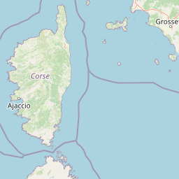
Geographic Boundary Map of Arcipelago Toscano National Park
Interactive mapped geometry provides clear spatial context for the protected archipelago outline. Accompanying database records detail the land and marine area calculations, coordinates, and geographic center.
- Boundary area
- 772.5 km²
- Boundary perimeter
- 565.6 km
- Northernmost point
- 43.4774° N
- Southernmost point
- 42.1856° N
- Easternmost point
- 11.1824° E
- Westernmost point
- 9.7207° E
- Geographic centre
- 42.7688° N, 10.2153° E
- North–south span
- 143.5 km
- East–west span
- 119.5 km
Elevation and terrain
Mixed relief topography featuring recorded peaks, capes, and coastal features
Arcipelago Toscano National Park Terrain and Elevation Summary
Recorded elevation data establishes a highest point of 1019 meters across mixed mountain terrain. Associated feature records detail named streams, peaks, and bays located within park boundaries.
- Highest point
- 1,019 m
Selected named natural features
Viewpoints
Il Trattoio
Beaches
Spiaggia delle Fornacelle
Capes
Punta Forata
Capes
Punta della Tacca
Capes
Punta del Corvo
Environmental setting
Mediterranean climate zones, mixed relief, and dominant marine water presence
Arcipelago Toscano National Park Environmental Classifications and Physical Setting
Stored landscape features and habitat types frame the physical setting across islands, coastal beaches, and mountains. Recorded categories connect directly to relevant protected area classifications within the atlas.
- Relief
- Mixed relief
- Climate
- Mediterranean
- Water
- Water-dominated
Landscape features
Mountains · Cliffs · Islands · Coast · Beach
Habitat types
Mediterranean forest · Coastal habitat · Marine habitat
Park atlas
Explore the Mapped Geography and Protected Landscapes Across Tuscany and the Mediterranean Coast
Discover More National Parks and Protected Areas Near Arcipelago Toscano National Park
Browse additional national parks and marine protected areas situated within or adjacent to the Tuscan region, encompassing diverse coastal and island ecosystems. This comprehensive geographic overview allows for direct comparison of varied conservation landscapes, expanding your protected area exploration beyond Arcipelago Toscano National Park.
Marine protected areaFrance
Park boundaries overlap#1 closest
West

Sanctuaire Pelagos Marine Protected Area: Mediterranean Geography and Seascape
A transboundary conservation zone spanning 87,500 square kilometers.
Sanctuaire Pelagos represents a unique collaborative effort in marine conservation across the Mediterranean. Spanning the waters between France, Italy, and Monaco, this protected maritime area is defined by its deep-sea canyons and nutrient-rich currents that sustain diverse cetacean populations. Its immense scale and international governance make it a focal point for understanding Mediterranean marine biodiversity and environmental policy.
- Area
- 87,500 km²
- Established
- 1999
- IUCN
- IV
- Relief
- Lowland

National parkLiguria
About 77 km away#2 closest
North

Cinque Terre National Park: Protected Area Geography and Mapped Landscape
Explore its regional context in Liguria, Italy.
Examine Cinque Terre National Park as a key protected area within the rugged geography of Italy's Liguria region. This dedicated atlas entry provides essential geographic context, detailing the park's mapped boundaries and its significance as a national park. Understand how this protected landscape fits within the broader regional terrain, offering a structured view for geographic discovery and map-based exploration of Italy's protected areas.
- Area
- 22 km²
- Established
- 1999
- IUCN
- V
- Relief
- Mountain

National parkEmilia-Romagna
87 km away#3 closest
North
Appennino Tosco-Emiliano National Park: Explore Its National Park Boundaries and Geography
Discover the mapped landscape and regional context of this protected area.
Appennino Tosco-Emiliano National Park is a designated national park offering a rich area for geographic exploration. This MoriAtlas entry details the park's protected landscape, providing insights into its mapped boundaries and its contribution to the natural terrain of the Emilia-Romagna region. Understand its significance within the broader atlas of Italian protected areas, focusing on its unique geographic identity and landscape context.
- Area
- 227.92 km²
- Established
- 2001
- IUCN
- II
- Relief
- Mountain

Nature reserveUmbria
About 97 km away#4 closest
East
Oasi naturalistica Lago di Alviano: Protected Wetland Landscapes and River Geography
A vital nature reserve in the Tiber Valley region of Umbria
Discover the unique wetland geography of Oasi naturalistica Lago di Alviano, where marshy river basins meet extensive hygrophilous forest corridors. This reserve serves as a critical node in central Italy for migratory waterbird habitats, showcasing the natural transition between riparian woodland and shallow aquatic ecosystems within the broader Tiber Valley protected network.
- Area
- 9 km²
- Established
- 1990
- Scope
- Terrestrial
- Water
- Major water bodies
Biosphere reserveCorse
About 105 km away#5 closest
West
Vallée du Fango Biosphere Reserve: Geography and Protected Landscape Analysis
Mapping the natural features of the Corse watershed.
Vallée du Fango encompasses a significant protected watershed in western Corse. This reserve features a complete altitudinal gradient, ranging from Laricio pine-forested summits to a thriving coastal estuary. The site is characterized by exceptionally clear water, centuries-old holm oak woodland, and complex riparian systems that define the natural geography of this Mediterranean drainage basin.
- Area
- 251.1 km²
- Established
- 1977
- Relief
- Mountain
- Climate
- Mediterranean

Biosphere reserveEmilia-Romagna
About 107 km away#6 closest
North
Carsismo e grotte evaporitiche dell'Appennino settentrionale Protected Geological Reserve
Evaporite karst landscapes within the Emilia-Romagna region.
Spanning across northern Italy, this site features a dense concentration of gypsum caves and sculpted karst terrain. It stands as a premier example of evaporite geomorphology, with record-breaking cave depths and diverse formations that offer a deep look into the geological history of the northern Apennines.
- Established
- 2023
- Relief
- Mountain
- Scope
- Terrestrial
- Water
- Minor water
National parkItaly
128 km away#7 closest
Southwest
Arcipelago di La Maddalena National Park: An Italian National Park Defined by Archipelago Geography
Discover mapped protected boundaries and regional landscape context.
Arcipelago di La Maddalena National Park stands as a vital protected area within Italy, characterized by its distinctive archipelago geography. This national park offers a unique lens through which to explore mapped natural landscapes, understand protected land distribution, and contextualize its regional geographic significance. Dive into the detailed mapping of its protected territories to appreciate the full scope of this significant natural asset for structured atlas discovery.
- Area
- 201.46 km²
- Established
- 1994
- IUCN
- II
- Relief
- Lowland

Nature reserveEmilia-Romagna
129 km away#8 closest
North
Monte Prinzera Nature Reserve: Emilia-Romagna Protected Ophiolite and Geological Atlas
Ancient oceanic crust and rare ecological habitats
Monte Prinzera represents a singular geological anomaly in the Apennine foothills, characterized by its deep rust-red color and specialized dry Mediterranean vegetation. As the only protected ophiolite site in Emilia-Romagna, the reserve offers essential insight into ultramafic ecology, hosting a mosaic of mixed deciduous woodlands and xerophilous grasslands that support unique populations of birds, bats, and mammals.
- Established
- 1990
- Relief
- Mountain
- Scope
- Terrestrial
- Water
- Minor water
MoriAtlas Explorer
Continue Exploring Arcipelago Toscano National Park's Mapped Geography and Landscapes
MoriAtlas provides a structured atlas view to understand Arcipelago Toscano National Park's unique position within the Tuscan Archipelago. Delve deeper into its specific geographic features, protected island boundaries, and the regional landscape context that distinguishes this important Mediterranean conservation area. Explore its terrain and ecological significance through detailed mapping and geographic data.
Browse next
Global natural geography
Explore related park routes
Explore MoriAtlas Global ParksBrowse All MoriAtlas ParksGlobal Park Map DiscoveryMoriAtlas: Browse All CountriesBrowse All MoriAtlas ContinentsNational Park Environment AtlasGrand Canyon National Park AtlasYellowstone National Park AtlasYosemite National Park Atlas and GeographySerengeti National Park AtlasGalápagos National Park Protected LandscapeBanff National Park Geography and AtlasKruger National Park Atlas EntryUluṟu-Kata Tjuṯa National Park AtlasExplore Uluru-Kata Tjuta National Park GeographyPlitvice Lakes National Park AtlasFiordland National Park Protected LandscapeGreat Smoky Mountains National Park AtlasAfghanistan National Parks and Protected AreasAlbania National Parks and Protected AreasAlgeria National Parks and Protected AreasAmerican Samoa National Parks and Protected AreasAndorra National Parks and Protected AreasAngola National Parks and Protected AreasAntarctica National Parks and Protected AreasAntigua and Barbuda Park List