Why Bicuari National Park stands out
Bicuari National Park is best known for its position within the Angolan mopane woodlands ecoregion, one of Africa's distinctive woodland ecosystems characterized by the iconic mopane tree. The park was historically renowned for populations of large mammals including black buffalo, elephants, and various antelope species. Its location on the Huíla Plateau places it within a climate zone that differs from the coastal lowlands, supporting a unique combination of woodland and wetland habitats. The park also stands out for its recovery narrative following severe depletion during the Angolan Civil War, with evidence of wildlife returning to former habitat areas.
Bicuari National Park history and protected-area timeline
The history of Bicuari National Park reflects the broader trajectory of wildlife protection in colonial and post-independence Angola. The area was first protected in 1938 when it was established as a hunting reserve, one of several game reserves created during the Portuguese colonial period to manage wildlife populations in the territory. In 1964, the reserve was elevated to national park status, becoming part of Angola's inaugural national park system alongside other protected areas established during this period. The park's modern history was profoundly shaped by the Angolan Civil War, which began following independence in 1975 and continued until 2002. During this conflict, Bicuari suffered extensive damage as the park reportedly served as an artillery range and experienced severe poaching and human encroachment. Large mammal populations were nearly or entirely exterminated during this period. Following the end of hostilities, the Angolan Government through the Huíla provincial administration initiated efforts to rebuild park infrastructure and restore wildlife populations. As of the early 2010s, reports indicated encouraging signs of elephant herds returning to areas within and adjacent to the park, with animals recognizing former habitat and beginning to reproduce within protected boundaries.
Bicuari National Park landscape and geographic character
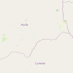
The physical landscape of Bicuari National Park is defined by its position on the Huíla Plateau, a elevated region in southwestern Angola that rises above the coastal plain. The terrain consists primarily of sandy hills interspersed with areas of shrub thicket, creating a characteristic woodland savanna appearance. The park's eastern boundary follows the course of the Cunene River, one of the few permanent rivers in this semi-arid region, which provides an important ecological corridor and water source. Portions of the park contain seasonally wet areas that form wetland swamps and dambo grasslands, adding habitat diversity to the predominantly woodland landscape. The underlying geology supports the sandy soils that characterize much of the plateau, while the vegetation transitions between different woodland types depending on local conditions and elevation.
Bicuari National Park ecosystems, habitats, and plant life
The ecological character of Bicuari National Park is shaped by its position within the Angolan mopane woodlands ecoregion, a distinct biogeographic region that extends across parts of southern Angola and into neighboring countries. The dominant vegetation consists of Angolan miombo woodlands and Angolan mopane woodlands, characterized by the presence of Colophospermum mopane trees that form the backbone of the ecosystem. These woodland formations support a variable rainfall regime and are known for relatively high species richness compared to surrounding arid regions. The park's natural value is enhanced by the presence of wetland areas, including seasonal swamps and dambo grasslands that provide habitat diversity and support different ecological communities. The climate classification as a temperate highland tropical climate with dry winters influences the seasonal patterns of vegetation growth and wildlife activity throughout the protected area.
Bicuari National Park wildlife and species highlights
Bicuari National Park was historically renowned for its populations of large mammals, particularly black buffalo, which gave the park its distinctive reputation among Angola's protected areas. The park supported significant herds of common antelopes and African elephants, along with other notable species including spotted hyenas, lions, common elands, gnus, and zebras. These species populations were severely depleted during the Angolan Civil War, with the park reportedly used as a military artillery range and subjected to intensive poaching and habitat encroachment. Post-conflict surveys and reports from the early 2010s indicated encouraging signs of recovery, with elephant herds observed returning to municipal areas surrounding the park and beginning to reproduce within protected boundaries. The park administrator noted the return of elephant herds to the Quipungo, Matala, and Gambos municipalities, suggesting that remnant populations were reoccupying historical habitat within and adjacent to the park.
Bicuari National Park conservation status and protection priorities
Bicuari National Park represents a significant conservation area in Angola's protected area network, designated under IUCN Category II as a national park. The park's conservation importance stems from its position within the Angolan mopane woodlands ecoregion, a region recognized for its biodiversity value and the ecological role of mopane trees in supporting wildlife and local communities. The park's history illustrates both the challenges facing African protected areas during periods of conflict and the potential for recovery when conservation efforts are renewed. The severe depletion of wildlife during the Angolan Civil War demonstrated the vulnerability of protected areas to armed conflict, while subsequent recovery efforts demonstrate the resilience of ecosystems when given protection. Current conservation work focuses on rebuilding infrastructure and supporting the natural return of wildlife populations to their historical ranges within the park.
Bicuari National Park cultural meaning and human context
The cultural context of Bicuari National Park is closely tied to the rural communities of Huíla Province in southern Angola. The park's location on the Huíla Plateau places it within a region inhabited by indigenous communities whose traditional land use practices have interacted with the woodland ecosystem. The mopane woodlands surrounding the park have historically provided resources for local populations, with the mopane tree holding particular cultural and economic importance. The region's history includes colonial-era settlement patterns centered on Lubango, and post-independence development has been shaped by the civil war that displaced communities and disrupted traditional land management practices.
Top sights and standout views in Bicuari National Park
Bicuari National Park offers visitors an opportunity to experience one of Angola's major woodland protected areas on the Huíla Plateau. The park's mopane and miombo woodlands represent a distinctive African landscape type, while the presence of the Cunene River along its eastern boundary provides scenic variety and wildlife viewing opportunities. The park's recovery story following the civil war adds a dimension of ecological resilience, with elephant herds and other large mammals gradually returning to former habitat areas. The combination of woodland, savanna, and wetland habitats creates diverse ecological communities within a single protected area. The park's relative remoteness and limited infrastructure offer a wilderness character that distinguishes it from more heavily developed African parks.
Best time to visit Bicuari National Park
The best time to visit Bicuari National Park aligns with the dry winter season typical of its highland tropical climate. The period from May to October generally offers more comfortable conditions for wildlife viewing, as vegetation becomes less dense and animals concentrate around remaining water sources. The wet season from November through April brings rainfall that can affect road accessibility within the park and may reduce wildlife visibility as animals disperse across the landscape. Temperature patterns follow typical highland conditions, with warmer conditions in the wet season and cooler, drier weather during the winter months. Visitors interested in witnessing the returning wildlife populations should consult with park authorities regarding current conditions and access arrangements, as infrastructure development continues following the post-war recovery period.