

Mori Atlas logo
National parkBosques Petrificados de Jaramillo National Park

Discover the unparalleled mapped landscape of ancient stone trees in Argentina's Patagonian steppe.

Bosques Petrificados de Jaramillo National Park: Jurassic Petrified Forests of Patagonia

(Parque Nacional Bosques Petrificados de Jaramillo)

Bosques Petrificados de Jaramillo National Park, a significant national park in Argentina, protects an expansive area of the Patagonian steppe renowned for its extensive Jurassic period petrified forests. This protected landscape showcases remarkably preserved fossilized tree trunks, some over 2 meters in diameter, offering a unique glimpse into prehistoric ecosystems and the geological forces that shaped South America millions of years ago. Explore the mapped boundaries and discover the stark beauty of this ancient forest preserved in stone.

Petrified ForestJurassic FossilsPatagoniaScientific SignificanceNational ParkIUCN Category II

Bosques Petrificados de Jaramillo National Park

National park

Park overview

Structured park overview, official facts, and landscape profile for Bosques Petrificados de Jaramillo National Park

Bosques Petrificados de Jaramillo National Park park facts, protected area profile, and essential visitor context
Review the core facts for Bosques Petrificados de Jaramillo National Park, including designation, size, terrain, visitor scale, habitats, and operating context in one park-focused overview.

About Bosques Petrificados de Jaramillo National Park

Bosques Petrificados de Jaramillo National Park represents one of Patagonia's most important paleontological treasures, protecting a landscape where an ancient Jurassic forest has been preserved in stone. The petrification process occurred when volcanic activity associated with the early stages of Andean uplift buried forests under layers of ash and lava, creating oxygen-free conditions that allowed mineral-rich water to gradually replace the organic wood structure with silica and other minerals. The resulting fossils provide exceptional detail, preserving not only the overall form of the trees but also cellular structures and growth rings. The park's expansion in 2012 from a smaller natural monument to a full national park reflected recognition of the site's broader ecological and scientific significance, incorporating additional Patagonian steppe habitat beyond the core fossil zone. The landscape surrounding the petrified forest consists of the characteristic arid, windswept plains of southern Patagonia, where sparse vegetation adapted to dry conditions creates a stark contrast with the ancient forested environment that once existed here. Scientific research at the site has continued since the fossils were first discovered in 1925, advancing understanding of Jurassic ecosystems and the geological history of southern South America.

Quick facts and research context for Bosques Petrificados de Jaramillo National Park

Located in northeastern Santa Cruz Province, Argentina, within the Deseado Department. The protected area was originally established as the Petrified Forest Natural Monument in 1954 covering 13,700 hectares, then expanded and reclassified as a national park in 2012 to encompass 78,543 hectares. The fossilized trees, some reaching 100 meters in height and 3.5 meters in diameter, date from the Jurassic period. The park lies in the Patagonian steppe ecoregion characterized by cold, arid, and windy conditions with annual precipitation around 200 millimeters.

Park context

Deeper park guide and search-rich context for Bosques Petrificados de Jaramillo National Park

Bosques Petrificados de Jaramillo National Park history, landscape, wildlife, and travel context
Explore Bosques Petrificados de Jaramillo National Park through its history, landscape character, ecosystems, wildlife, conservation priorities, cultural context, and seasonal travel timing in a structured park guide built for atlas discovery and search intent.

Why Bosques Petrificados de Jaramillo National Park stands out

The park is renowned for its extensive petrified forest, containing remarkably well-preserved fossilized tree trunks and cones from the Jurassic period. The specimens of Araucaria mirabilis, an ancient relative of modern araucaria conifers, are particularly significant. Some fossilized trunks measure up to 2 meters in diameter and 30 meters in length, lying exposed on the surface of the ground. The site provides crucial evidence of the region's prehistoric climate, demonstrating that this part of Patagonia once supported dense forests in a much wetter environment before the Andes mountains intercepted humid airflow from the west.

Bosques Petrificados de Jaramillo National Park history and protected-area timeline

The Bosques Petrificados de Jaramillo area was originally protected as the Petrified Forest Natural Monument in 1954, establishing the first formal conservation designation for this remarkable fossil site. Fossilized trees were first discovered at the location in 1925, and the site subsequently attracted scientific attention for its exceptional preservation of Jurassic period flora. In December 2012, the National Parks Administration of Argentina acquired two adjacent areas of land and incorporated them into the protected area, reclassifying the status from natural monument to national park and expanding the total area from approximately 13,700 hectares to 78,543 hectares. This expansion reflected both the scientific importance of the core fossil site and recognition of the broader Patagonian steppe ecosystem's conservation value. The historical significance of the area extends to its representation of the dramatic environmental transformation that Patagonia has undergone, from the lush, wet forests of the Jurassic period to the cold, arid steppe environment visible today.

Bosques Petrificados de Jaramillo National Park landscape and geographic character

The park encompasses the Patagonian steppe ecoregion, characterized by vast, gently rolling plains punctuated by isolated hills and mesas. The terrain is generally flat to undulating, with sparse vegetation covering the arid ground. The most striking landscape features are the exposed fossilized tree trunks scattered across the terrain, some lying horizontally on the surface while others stand as partial remnants. The surrounding steppe displays the muted earth tones typical of Patagonia's southern plateau, with grasses and low shrubs adapted to the harsh, dry climate. The visual contrast between the ancient stone trees and the contemporary semi-desert environment creates a surreal landscape that emphasizes the vast time scale represented by the fossils. Wind is a dominant environmental force in this region, shaping both the vegetation and the surface features of the terrain.

Bosques Petrificados de Jaramillo National Park ecosystems, habitats, and plant life

The Patagonian steppe environment within the park supports sparse but distinctive vegetation adapted to arid conditions and strong winds. The flora consists primarily of low spiny shrubs and cushion plants that have evolved to survive in the region's dry climate. Plant species recorded in the park include Caesalpinia gilliesii, Berberis microphylla, Chiliotrichum diffusum, Mulinum spinosum, and Fragaria chiloensis, representing the characteristic shrub communities of southern Patagonian deserts. The park sits at the boundary between the more humid western portions of Patagonia and the extremely arid central plateau, resulting in a transition-zone vegetation character. The fossil forest itself represents a completely different ecological community that existed during the Jurassic period, when the climate was far wetter and supported dense forests of giant conifers.

Bosques Petrificados de Jaramillo National Park wildlife and species highlights

The fauna of Bosques Petrificados de Jaramillo National Park reflects the arid Patagonian steppe environment. Mammals present in the park include the guanaco, a camelid species characteristic of Patagonian landscapes, the dwarf armadillo (also known as pichi), the culpeo fox, and the South American gray fox. The park is also home to the lesser rhea, also called Darwin's rhea, a flightless bird species endemic to southern South America. These species represent the relatively limited but distinctive fauna adapted to the harsh, dry conditions of the Patagonian plateau. The wildlife community is typical of open, arid terrain rather than forested environments, reflecting the sparse vegetation cover and the absence of significant water bodies within the protected area.

Bosques Petrificados de Jaramillo National Park conservation status and protection priorities

The park holds IUCN Category II status as a national park, reflecting its primary function of protecting both the outstanding fossil forest resource and the broader Patagonian steppe ecosystem. The site is significant for scientific research into Jurassic period ecosystems and the geological processes of petrification. The preservation of the fossilized trees in situ provides irreplaceable scientific value, as the specimens cannot be moved without destroying their contextual information. The 2012 expansion of the protected area added substantial additional habitat to the conservation unit, recognizing that the fossil forest exists within a broader ecological landscape that warrants protection. The site serves as a natural laboratory for understanding past climate change and the role of tectonic activity in transforming regional environments.

Bosques Petrificados de Jaramillo National Park cultural meaning and human context

The park is located in the Deseado Department of Santa Cruz Province, an area of southern Patagonia with a history of human habitation extending back to indigenous peoples who lived in the region before European colonization. The name Jaramillo refers to the local area and settlement pattern in this portion of the Patagonian plateau. The region's cultural history is tied to the broader story of Patagonia's development from indigenous territories through Spanish colonial claims to the modern Argentine province. The fossil forest itself has scientific and educational significance that extends beyond Argentina, attracting researchers and visitors interested in paleontology and geological history.

Top sights and standout views in Bosques Petrificados de Jaramillo National Park

The park's primary highlight is the exceptional preservation of Jurassic period fossil trees, with specimens including trunks up to 2 meters in diameter and 30 meters in length, as well as fossilized cones from the ancient araucaria trees. The expansion in 2012 created one of Argentina's larger national parks, encompassing nearly 80,000 hectares of Patagonian steppe. The visual impact of stone trees lying scattered across an arid landscape creates a unique and memorable environment not found elsewhere. The scientific importance of the site for understanding Jurassic ecosystems and the paleoclimatic history of Patagonia represents a form of heritage value distinct from typical biodiversity conservation.

Best time to visit Bosques Petrificados de Jaramillo National Park

The park can be visited throughout the year, though the Patagonian climate presents distinct seasonal conditions. Summer months (December to February in the Southern Hemisphere) bring warmer temperatures, with mean temperatures around 19°C and occasional highs reaching 40°C, making this the most popular time for visitors. The summer season also coincides with the period when most of the limited annual rainfall occurs. Winter (June to August) features mean temperatures around 7°C with possible lows to -15°C, and snowfall can occur, creating a dramatically different landscape. The strong westerly winds that characterize the region can occur in any season, and visitors should be prepared for rapid temperature changes and variable conditions regardless of when they visit.
Park location guide

Geography guide, regional context, and park location map for Bosques Petrificados de Jaramillo National Park

Bosques Petrificados de Jaramillo National Park park geography, regions, and map view in Argentina
Understand where Bosques Petrificados de Jaramillo National Park sits in Argentina through a broader geographic reading of the surrounding landscape, nearby location context, and its mapped position within the national park landscape.

How Bosques Petrificados de Jaramillo National Park fits into Argentina

Argentina is a federal republic located in the southern cone of South America, bordering Chile, Bolivia, Paraguay, Brazil, Uruguay, and the Atlantic Ocean. With an area of 2,780,085 km², it is the second-largest country in South America and the eighth-largest globally. The capital and largest city is Buenos Aires, and the official language is Spanish. The country claims sovereignty over the Falkland Islands, South Georgia and the South Sandwich Islands, and a portion of Antarctica.

Wider geography shaping Bosques Petrificados de Jaramillo National Park in Argentina

Argentina occupies the southern portion of South America, sharing the Southern Cone region with Chile to the west. The country borders Bolivia and Paraguay to the north, Brazil to the northeast, Uruguay and the South Atlantic Ocean to the east, and the Drake Passage to the south. The Andes mountain range runs along the western border, while the Pampas plains dominate the central region. Argentina also claims territories in Antarctica.

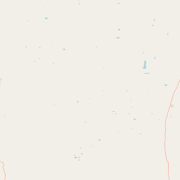
Map view of Bosques Petrificados de Jaramillo National Park

Use this park location map to pinpoint Bosques Petrificados de Jaramillo National Park in Argentina, understand its exact geographic position, and read its mapped placement within the surrounding landscape more clearly.

Pigeon | © OpenStreetMap contributors
Park atlas

Compare the unique fossil forest with adjacent Patagonian protected landscapes and regional park geography

Discover More Protected Areas Near Bosques Petrificados de Jaramillo National Park in Patagonian Steppe
Explore other national parks and protected areas near Bosques Petrificados de Jaramillo National Park, tracing the distinct landscapes of the Patagonian steppe. This regional context allows for deeper atlas-style comparison, revealing how conservation efforts protect diverse natural and geological heritage across southern Argentina.
National park

Patagonia National Park: A National Park Protecting the Argentine Patagonian Steppe Landscape

Explore the mapped boundaries of this semi-arid grassland ecosystem.

Patagonia National Park is a protected national park in Argentina established to preserve the representative Patagonian steppe ecosystem. Covering 528.11 square kilometers, it offers a deep dive into the unique semi-arid grassland environment, known for its rolling plains and wind-shaped terrain. This park provides crucial context for understanding the broader geography of southern Argentina and the conservation of its distinctive natural landscapes.

Area
528.11 km²
Established
2015
IUCN
II
Climate
Arid
National park

Monte León National Park: Patagonia's First Continental Marine Protected Area and Coastal Atlas

Explore its unique sandstone formations and rich marine geography.

Monte León National Park stands as a significant federal protected area along Argentina's Patagonian coast. Known for its dramatic sandstone cliffs, including the iconic Monte Cabeza de León, and extensive Magellanic penguin colonies, this park offers a unique glimpse into coastal ecosystems. Its designation as Argentina's first continental marine park highlights its importance for biodiversity and landscape conservation along the southern Argentine Sea shoreline, providing rich context for atlas exploration.

Area
621.68 km²
Established
2004
IUCN
II
Relief
Upland
National park

Perito Moreno National Park: Argentina's Expansive Patagonian Protected Landscape

Explore its mapped terrain and significant protected area geography.

Perito Moreno National Park stands as a cornerstone of Argentinian conservation, safeguarding over 126,000 hectares of striking Patagonian mountain wilderness. This national park protects a rare ecological transition zone, blending wet Andean forests with dry steppe environments across its dramatic amphitheater-like terrain and dual-watershed hydrography. Its mapped boundaries encompass significant natural geography, offering a clear atlas view of protected Patagonian landscapes.

Area
1,268.3 km²
Established
1937
IUCN
II
Relief
Mountain
National parkAysén Region

Patagonia National Park, Chile: Exploring Protected Landscape and Regional Geography

Mapped boundaries and natural terrain in Aysén Region.

Patagonia National Park, situated within the Aysén Region of Chile, serves as a significant protected area offering rich opportunities for atlas-based geographic exploration. This national park's specific landscape identity and mapped boundaries provide a clear focal point for understanding regional conservation and natural terrain. Discover the geographic context of this protected land and its place within the broader landscape of southern Chile through structured data and map exploration.

Area
3,045.28 km²
Established
2018
IUCN
II
Relief
Mountain
National parkAysén del General Carlos Ibáñez del Campo Region

Cerro Castillo National Park: Dramatic Granite Peaks and Patagonian Protected Landscape

Mapped geography and huemul conservation in Chile's Aysén Region.

Cerro Castillo National Park is a premier protected area in southern Chile, celebrated for its iconic Cerro Castillo granite mountain that dominates the landscape. This national park, spanning over 1,700 square kilometers in the Aysén del General Carlos Ibáñez del Campo Region, showcases a dynamic Patagonian terrain shaped by glaciers and rivers. Its significance extends to being a vital corridor for endangered huemul, offering critical habitat within a broader regional conservation strategy and the famous Route of Parks.

Area
1,795.5 km²
Established
1970
IUCN
II
Relief
Mountain
National parkAysén del General Carlos Ibáñez del Campo Region

Laguna San Rafael National Park: Explore its Mapped Boundaries and Patagonian Landscape

A National Park within Aysén del General Carlos Ibáñez del Campo Region.

Laguna San Rafael National Park stands as a key protected area within the vast geography of the Aysén del General Carlos Ibáñez del Campo Region. This entry provides an atlas-focused perspective, detailing the park's geographic significance, mapped natural landscapes, and its role as a vital conservation territory. Understand how this national park fits into the broader context of Patagonia's unique terrain and protected areas.

Area
17,420 km²
Established
1959
IUCN
II
Relief
Mountain
Watercolor illustration of rolling hills, a river flowing through a valley, and forested areas
National parkAysén del General Carlos Ibáñez del Campo Region

Queulat National Park: Patagonian Andes Glacier and Rainforest Discovery

Mapped protected area in Aysén del General Carlos Ibáñez del Campo Region.

Queulat National Park is a vast protected wilderness in southern Chile, renowned for its dramatic glacial alpine terrain and lush temperate rainforests. The park's geography is defined by steep glacial valleys, ice fields, and the iconic Queulat Hanging Glacier cascading from sheer cliffs. Discover the mapped boundaries of this significant Patagonian national park, offering unparalleled insight into its unique ecosystems and dramatic landscapes shaped by ice and forest.

Area
1,541 km²
Established
1983
IUCN
II
Relief
Mountain
National park

Los Glaciares National Park: Argentinian National Park with Patagonian Ice Fields

Explore glacial terrain and iconic Andes peaks.

Los Glaciares National Park is a vast protected area in Argentina, dominated by a massive Patagonian ice cap and numerous descending glaciers, including the renowned Perito Moreno Glacier. Its dramatic landscape of ice fields, glacial lakes, and towering granite spires like Mount Fitz Roy provides critical context for understanding regional geography and the formation of glacial terrain. This park exemplifies the unique protected ecosystems of the southern Andes, offering rich detail for atlas-based discovery.

Area
7,269.27 km²
Established
1937
IUCN
II
Visitors
688.8K annual

Common questions about visiting, size, designation, and location context for Bosques Petrificados de Jaramillo National Park

Bosques Petrificados de Jaramillo National Park FAQs for park facts, access, geography, and protected area context
Find quick answers about Bosques Petrificados de Jaramillo National Park, including protected-area facts, park geography, trail and visitor context, and how the park fits into its surrounding country and regional landscape.
MoriAtlas Explorer

Continue Your Protected Areas Search Across the Global Atlas

Deepen your exploration by continuing the structured search for national parks and protected areas worldwide. Utilize the comprehensive filtering capabilities to compare different conservation landscapes and refine your understanding of global park geography. Discover more about the distribution and characteristics of protected natural areas.

Global natural geography
