
Mori Atlas logo
Nature reserveČepkeliai

A vast, protected mire complex of raised bogs, inland dunes, and forested islands.

Čepkeliai Nature Reserve: Exploring the Geography of Lithuania’s Premier Wetland Landscape

(Čepkelių valstybinis gamtinis rezervatas)

Čepkeliai Nature Reserve represents one of the most ecologically significant wetland complexes in Lithuania, situated within the Varėna District Municipality along the border with Belarus. This protected landscape is defined by an expansive, near-primeval raised bog known as Čepkelių raistas, which is surrounded by stabilized continental dunes, forested peatlands, and the valley of the Katra River. These distinct geological features create a unique mosaic of habitats, including over eighty wooded islands and numerous shallow bog lakes that provide refuge for diverse wetland flora and fauna.

raised bogmire complexinland duneswetland reserveRamsar siteNatura 2000
A flat vector-style illustration of a natural scene featuring a waterfall cascading from a rocky cliff, a pine forest, and a calm lake with reeds in the foreground.

Čepkeliai

Nature reserve

Park overview

Structured park overview, official facts, and landscape profile for Čepkeliai State Nature Reserve

Čepkeliai State Nature Reserve park facts, protected area profile, and essential visitor context

Review the core facts for Čepkeliai State Nature Reserve, including designation, size, terrain, visitor scale, habitats, and operating context in one park-focused overview.

About Čepkeliai State Nature Reserve

Čepkeliai State Nature Reserve lies in the southernmost part of Lithuania, in the Varėna district, right along the country's border with Belarus. The border itself, traced by the Katra River, also forms much of the reserve's southern edge, while the Dzūkija National Park borders Čepkeliai to the north and west, and a protective buffer zone lies to the east. The reserve's administrative center is in the town of Merkinė, where exhibitions and visitor information about Čepkeliai are also offered.

The reserve was established in 1975 on the site of a botanical-zoological sanctuary that had been in place since 1960. Its founding purpose was to protect one of the oldest and most unusual forest-mire complexes in Lithuania, including forested inland dunes, relict bog lakes, the natural hydrological regime of the mire, and the rare plants and animals that depend on these conditions. Over time, the reserve has gained additional international recognition: since 1993, it has been a Ramsar wetland of international importance, it contributes to the European Natura 2000 ecological network, and in 2019 it was awarded the European Wilderness Certificate.

Today, Čepkeliai is regarded as one of the wildest and least human-disturbed landscapes in Lithuania. Much of the territory is closed to unrestricted access and can only be visited under guided supervision, a policy that has helped keep its natural processes remarkably intact. The reserve is a living archive of post-glacial landscape development, with peat deposits reaching several meters thick, bog lakes that have survived since the ice age, and dune ridges that still record the wind patterns of a vanished climate.

Quick facts and research context for Čepkeliai State Nature Reserve

Čepkeliai is a strictly protected nature reserve, classified by UICN as Category Ia (a strict nature reserve) and managed by the State Service for Protected Areas. It was formally established in 1975, replacing an earlier botanical-zoological sanctuary from 1960, and covers a territory of roughly 11,200 hectares in Lithuania's southernmost Varėna district. About half of this area consists of raised bog, with the remainder comprising forested dunes, transitional mires, and the valley of the Katra River.

The reserve holds several internationally recognized statuses: it was designated a Ramsar wetland of international importance in 1993, forms part of the Natura 2000 ecological network, and was awarded the European Wilderness Certificate in 2019. Its location directly on the Lithuanian-Belarusian border, combined with its status as habitat for species such as the capercaillie and the largest common crane breeding grounds in Lithuania, makes it one of the most significant mosaic-protected landscapes in the country.

Protection and recognition

Documented terrestrial protection scope and transboundary designation records for Čepkeliai.

Čepkeliai Protection Status and International Designation History

Čepkeliai maintains a documented terrestrial protection scope established in 1993 alongside a verified transboundary status. Structured records outline the official designation history and management framework associated with the protected area.

Protection details

Protection scope
Terrestrial
Designated year
1993
Transboundary protection
Yes
Park context

Deeper park guide and search-rich context for Čepkeliai State Nature Reserve

Čepkeliai State Nature Reserve history, landscape, wildlife, and travel context

Explore Čepkeliai State Nature Reserve through its history, landscape character, ecosystems, wildlife, conservation priorities, cultural context, and seasonal travel timing in a structured park guide built for atlas discovery and search intent.

Why Čepkeliai State Nature Reserve stands out

Čepkeliai is best known for its enormous, still largely undisturbed raised bog (Čepkelių raistas), which is one of the oldest and most unique forest-mire complexes in Lithuania. The bog itself is studded with more than twenty small lakes, over eighty islands, and vast stretches of sparse pine woodland, while the surrounding inland continental dunes give the area a distinctively varied relief. The reserve is also known for its exceptionally rich birdlife, hosting some of the largest populations of capercaillie, common crane, and black stork in Lithuania, along with rare species such as the short-toed snake eagle and the Eurasian eagle-owl. The combination of sphagnum bogs, forested dunes, transitional mires, and old-growth oak-bearing islands gives Čepkeliai a reputation among conservationists as one of the country's most authentic wilderness landscapes.
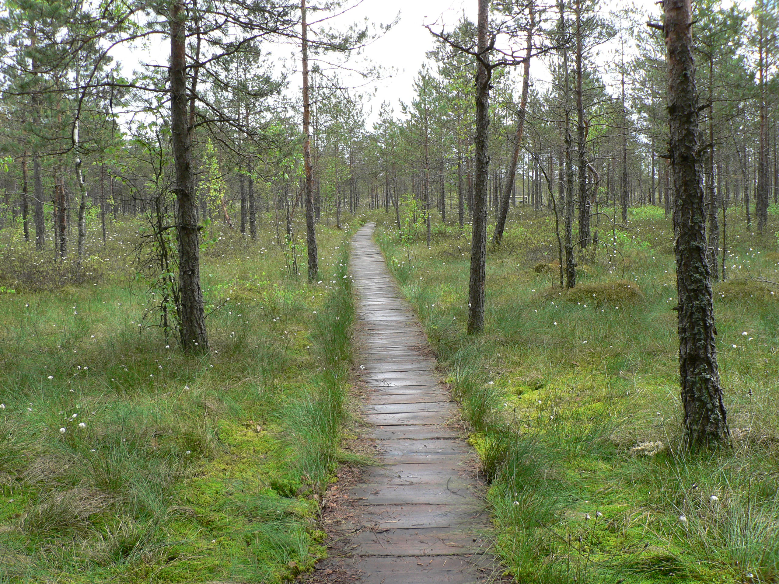
A narrow wooden boardwalk stretches through a flat, mossy wetland area scattered with thin pine trees under an overcast sky.
A wooden boardwalk path winds through the Čepkeliai marshland, highlighting the unique raised bog ecosystem of the reserve.

Čepkeliai State Nature Reserve history and protected-area timeline

The area now protected as Čepkeliai was first given formal conservation status in 1960, when a botanical-zoological sanctuary was established to safeguard the unique combination of forest, mire, dune, and river valley habitats in southern Lithuania. In 1975, this sanctuary was reorganized into a much larger strict nature reserve, the Čepkeliai State Nature Reserve, with the explicit goal of preserving one of the country's oldest and most valuable wetland complexes along with its dependent wildlife.

Following Lithuania's restoration of independence, the reserve's significance continued to grow. In 1993 it was recognized as a wetland of international importance under the Ramsar Convention, making it part of a global network of protected wetlands. Later, as part of Lithuania's accession to European environmental frameworks, Čepkeliai became a key component of the Natura 2000 ecological network, linking its protection with broader continental conservation goals. In 2019 the reserve received the European Wilderness Certificate, formally acknowledging its character as one of Europe's most intact wild areas.

The name "Čepkeliai" itself has older roots. According to the earliest twentieth-century maps, only the edge of the mire near the Musteika stream was known by this name, while the larger area that now forms the reserve was called Gudų giria, or Gudo Šalimi, reflecting the strong historical and cultural ties of this borderland region to the broader Slavic-speaking forest world to the southeast.

Čepkeliai State Nature Reserve landscape and geographic character

The landscape of Čepkeliai is dominated by an exceptionally large raised bog surrounded by forested continental dunes, with a sand plain, a steep river valley, and dozens of bog islands that together create an unusually varied terrain for this part of Lithuania. The bog itself, known as Čepkelių raistas, stretches roughly twelve kilometers east-west and floods during snowmelt, while drying out partially in late summer. Inland sand dunes, now long since stabilized by forest and pine heaths, ring the bog to the west and northwest, acting as a natural wall.

In the south, the Katra River has carved a distinct valley that doubles as the international border between Lithuania and Belarus, while the western edge of the reserve is shaped by wet black-alder wetlands and mires along the Musteika stream. The bog's many small islands, more than eighty in total, often carry unusually rich vegetation, including ancient oaks and birches, and stand out above the open peat surface like miniature wooded ridges. The entire relief is gentle but visually diverse, with the highest dunes rising around the level of Jogailos-Jėgalos Hill and the bog surface itself lying only a few dozen meters above sea level.
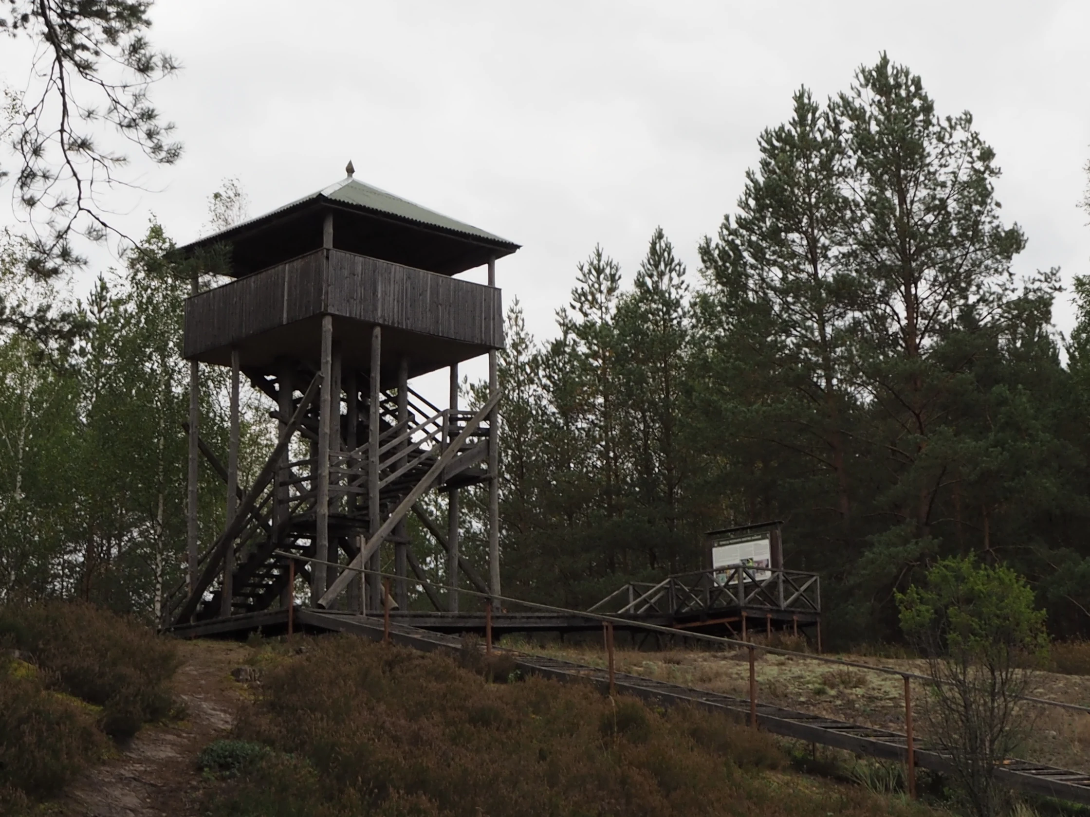
A tall, wooden observation tower stands among pine trees and marshy ground on an overcast day.
A wooden observation tower situated within the Čepkeliai marshland environment.

Čepkeliai State Nature Reserve ecosystems, habitats, and plant life

Čepkeliai's ecological identity is defined by its mosaic of raised bog, transitional mires, forested dunes, and river-side wetlands, all of which have been preserved under strict protection since the 1970s. About half of the reserve consists of sphagnum-dominated raised bog, where peat continues to accumulate from atmospheric precipitation alone. Around this core, the landscape shifts through mires, sedge and reed communities, willow thickets, wet black-alder forests, spruce and mixed forests, and dry pine heaths on the surrounding sandy dunes.

This combination of habitats gives the reserve an unusually wide ecological range. Older oak stands survive on the bog's islands, juniper-rich woodlands occupy drier sandy patches, and wet black-alder mires with royal fern, marsh marigold, and marsh iris flourish along the Katra and Musteika valleys. The bog's many small lakes, both old glacial remnants and newer peat-encroached waters, are especially important for hydrology, and they continue to support unique communities of aquatic plants. The whole system is recognized internationally as a Ramsar wetland and as a core Natura 2000 site, a status that reflects the rarity of such a complete and intact mire complex in the Baltic lowlands.
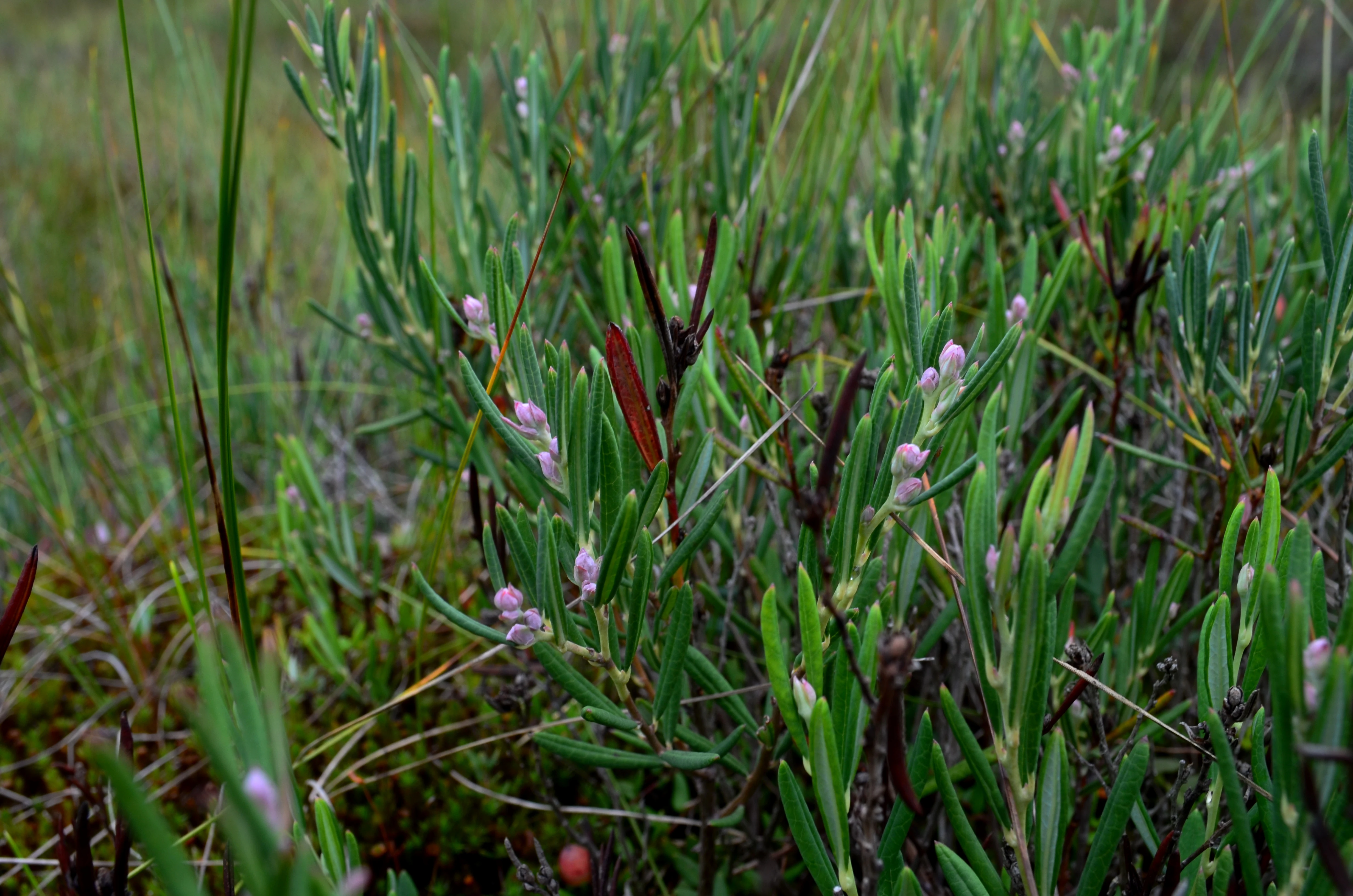
Close-up of small green bog rosemary plants with light purple buds and narrow leaves, growing in a marshy habitat.
Bog rosemary, Andromeda polifolia, growing in the peatlands of Čepkeliai Nature Reserve.

Čepkeliai State Nature Reserve wildlife and species highlights

Čepkeliai supports one of the richest and most varied faunas of any protected area in Lithuania, with several hundred invertebrate species and around 150 recorded bird species. Insects alone number 874 beetle species, 353 hymenopteran species, and more than 1,000 moth and butterfly species, including a significant share that are rare or endangered. Amphibians and reptiles are well represented too, with ten amphibian species (including the common adder as the only venomous snake in the country) and six reptile species, including one of only two known localities in Lithuania for the smooth snake.

The reserve is especially important for its birdlife. It hosts some of the largest breeding populations in Lithuania of the western capercaillie, the common crane, and the black stork, and supports rare raptors such as the short-toed snake eagle and the Eurasian eagle-owl. Black grouse, corncrakes, three-toed and white-backed woodpeckers, and all three typical European woodpeckers find habitat here, while old oak islands provide nesting places for the black stork. Larger mammals are also present: the reserve is one of the country's main wintering grounds for moose, and rarer species such as the mountain hare and pine marten also occur within its lightly disturbed forests.
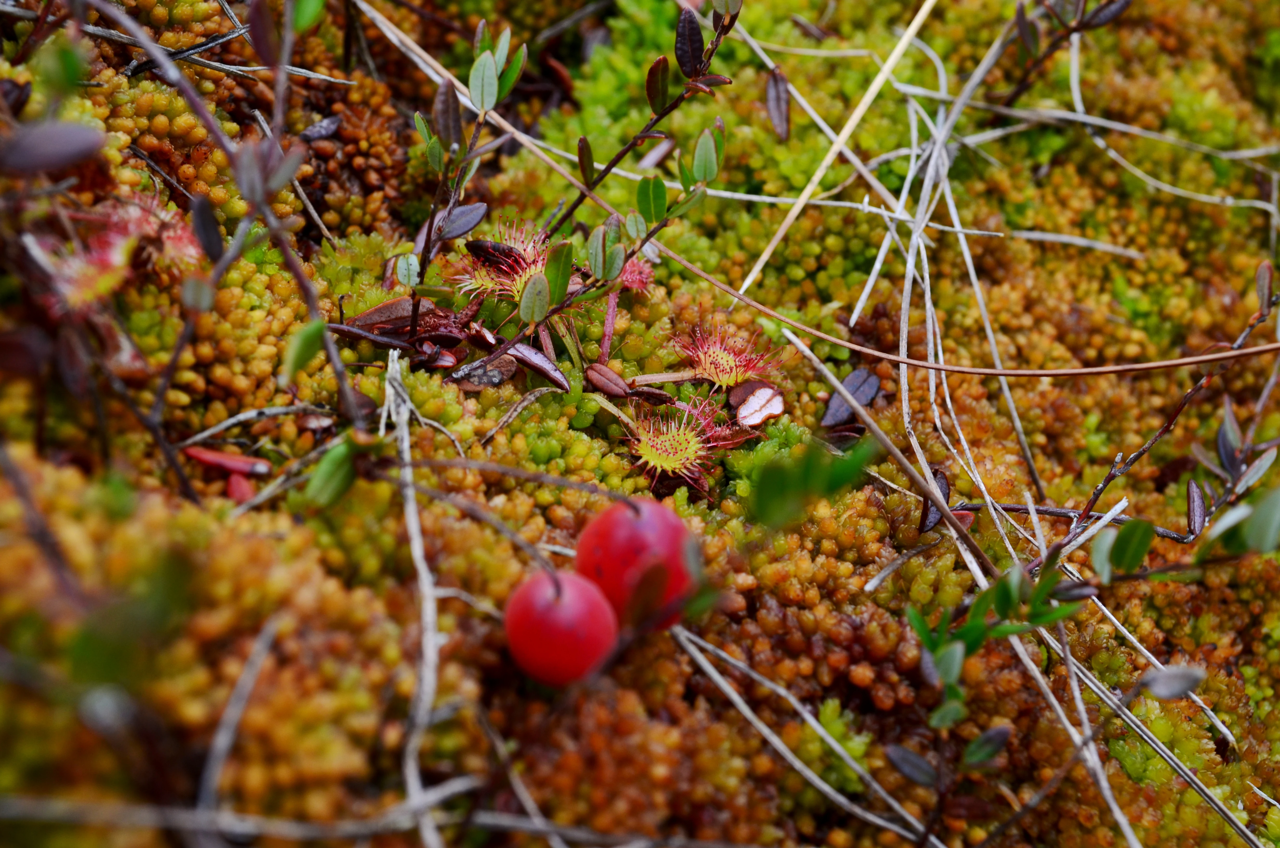
A close up view of small, red, round cranberries nestled among green and orange sphagnum moss and small, reddish, circular sundew plants in a marshy habitat.
A close up view of wild cranberries and sundew plants growing in the marshy environment of Čepkeliai Nature Reserve.

Čepkeliai State Nature Reserve conservation status and protection priorities

Čepkeliai is a cornerstone site for wetland and forest conservation in Lithuania. As a strict nature reserve (UICN Category Ia), it has been managed for decades with the primary goal of preserving its natural processes, including the intact hydrology of its raised bog, the undisturbed development of peat, and the protection of rare and threatened species and habitats. It was one of the first reserves in Lithuania to be recognized internationally, gaining Ramsar status in 1993 and later being integrated into the European Natura 2000 network.

The reserve's conservation value lies in both its ecological completeness and its near-pristine character. Because most human activity is restricted and the area is only visited under guided supervision, Čepkeliai has retained large continuous tracts of old-growth forest, peat-forming mires, and forest-dune transitions. In 2019, it became one of the few areas in Europe to receive the European Wilderness Certificate, a formal acknowledgement of its high level of naturalness. This makes Čepkeliai an important reference site for conservation strategies that aim to restore connected wetland and forest landscapes across the Baltic region.

Čepkeliai State Nature Reserve cultural meaning and human context

Čepkeliai sits in the historical borderland between Lithuania, Belarus, and the broader Slavic-speaking forest region traditionally known as the "Wild Forest" (Ruska Puszcza). The older local toponyms for much of the area, Gudų giria and Gudo Šalimi, reflect this mixed cultural geography, while the modern name "Čepkeliai" likely derives from a personal name of probable Stephan origin. The reserve itself is administered from Merkinė, a historic town linked to the region's multicultural past.

The traditional landscape also includes cultural and natural monuments such as hollow, centuries-old pines, which are valued both as ecological features and as silent witnesses to centuries of forest use in the area. Local Dzūkija dialects occasionally surface in place names, such as the small lake Lygucis near the village of Lynežeris. While human activity within the reserve is now strictly limited, the surrounding villages, the interpretive center in Merkinė, and the traditional region of Dzūkija continue to provide a cultural frame for understanding Čepkeliai as both a natural and a historical landscape.
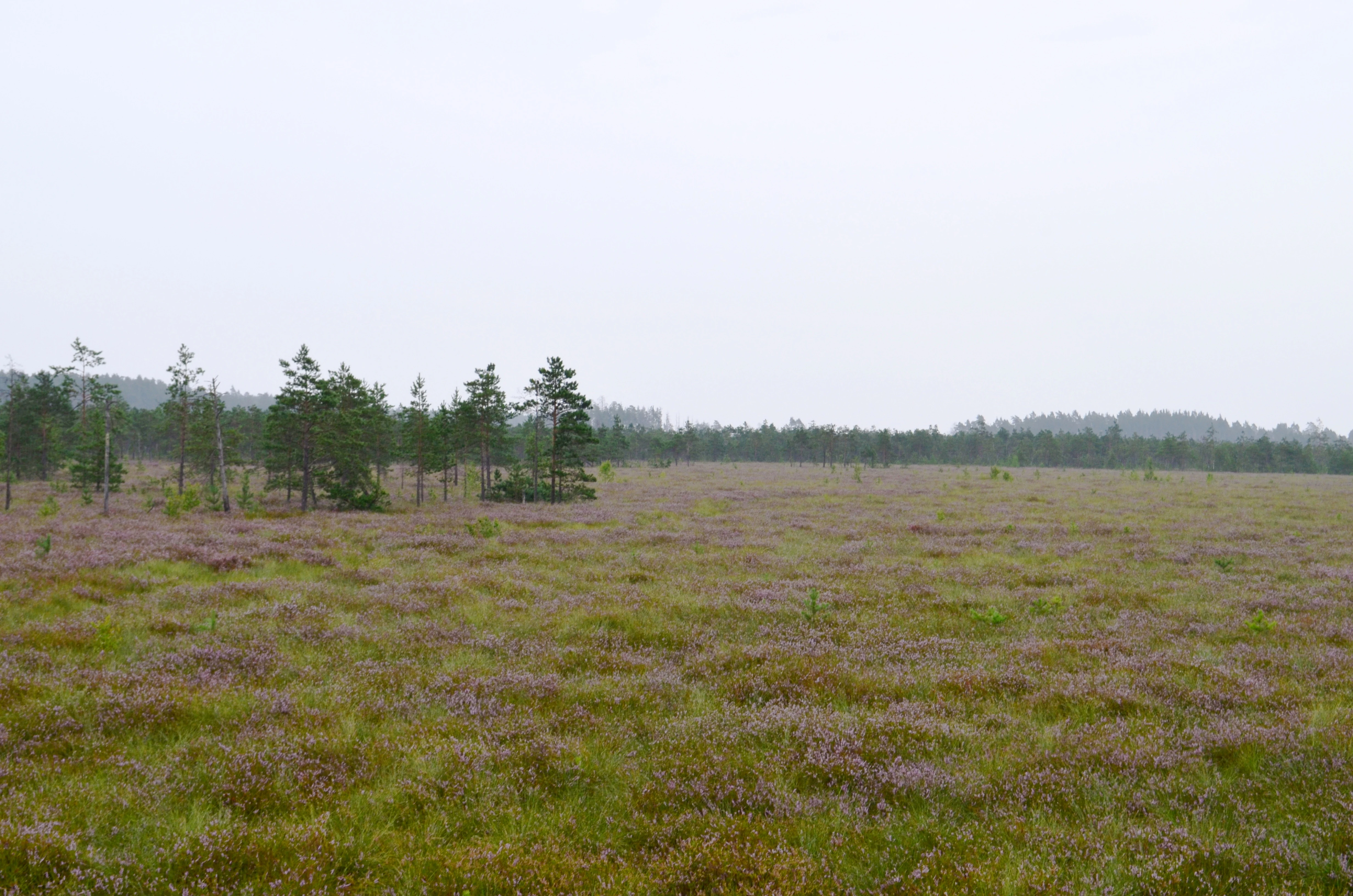
A wide, eye-level shot of a flat bog landscape with purple-flowering heather in the foreground and a line of sparse pine trees and distant forest under an overcast sky.
A wide view of a raised bog landscape at Čepkeliai Nature Reserve, featuring blooming heather and scattered coniferous trees.

Top sights and standout views in Čepkeliai State Nature Reserve

Čepkeliai's highlights include its vast raised bog, one of the largest and most ecologically intact of its kind in Lithuania, and the surrounding forested dunes that form a unique inland dune landscape. The bog's more than twenty small lakes and over eighty forested islands give visitors a sense of stepping between water, peat, and woodland, while the deep peat deposits record the area's full post-glacial history.

Equally important are the reserve's rare wildlife concentrations: some of the largest breeding populations of capercaillie and common crane in Lithuania, rarer raptors like the short-toed snake eagle, and old oak islands that host black storks. The combination of Ramsar recognition, Natura 2000 status, and the 2019 European Wilderness Certificate marks Čepkeliai as a flagship site for both wetland and wilderness conservation in the Baltic region.
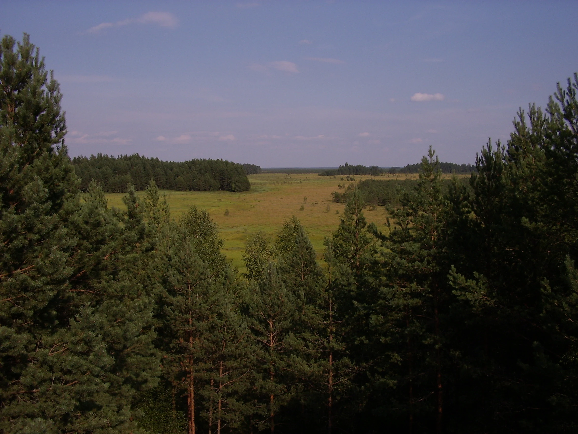
A high-angle view looking over a sprawling green marsh or bog area, framed by pine trees on the left and right sides under a clear sky.
A view overlooking the expansive marshlands of the Čepkeliai Nature Reserve.

Best time to visit Čepkeliai State Nature Reserve

The character of Čepkeliai changes strongly with the seasons, and visitors typically experience the reserve most comfortably in late spring and early summer. Spring is when the water level in the bog reaches its peak after snowmelt, flooding the open peat surface, and the surrounding forests and mires come alive with bird activity, including cranes, woodpeckers, and grouse. Summer brings the warmest temperatures of the year in this part of Lithuania and the richest insect activity, though peatlands can dry out significantly during dry spells.

Autumn brings cooling weather and the first frosts, along with the bog beginning to refill again after the dry period, while winter often means thinner or even absent snow cover in the sandy dune areas compared with much of Lithuania. Whatever the season, the reserve's strict protection means that any visit is best experienced as part of a guided program, and certain sensitive periods, particularly the main bird breeding season, are excluded from public access.
Monthly climate preview

Review measured monthly averages and representative coordinates for the protected landscape

Čepkeliai Climate Normals, Long Term Temperature and Precipitation Patterns

Representative coordinate records show average monthly temperatures ranging from sub-zero winter minimums to warm summer maximums alongside steady daily precipitation rates. Examining the full twelve-month profile provides complete historical climate data for the protected area.
Annual mean7 °C
-6 °C19 °C
Jan-6°
Feb-5°
Mar
Apr
May13°
Jun16°
Jul19°
Aug18°
Sep13°
Oct
Nov
Dec-4°
Warmest month
July

18.6 °C

Coolest month
January

-5.7 °C

Wettest month
July

2.9 mm/day

Driest month
March

1.5 mm/day

Park location guide

Geography guide, regional context, and park location map for Čepkeliai State Nature Reserve

Čepkeliai State Nature Reserve park geography, regions, and map view in Lithuania

Understand where Čepkeliai State Nature Reserve sits in Lithuania through a broader geographic reading of the surrounding landscape, nearby location context, and its mapped position within the national park landscape.

How Čepkeliai State Nature Reserve fits into Lithuania

Lithuania is a unitary semi-presidential republic and one of three Baltic states in Northern Europe. It lies on the eastern coast of the Baltic Sea, with Vilnius as its capital and largest city. The country regained independence in 1990 after Soviet occupation and joined the European Union in 2004. Lithuania has a population of about 2.9 million and covers an area of 65,300 km².

Wider geography shaping Čepkeliai State Nature Reserve in Lithuania

Lithuania is situated on the eastern shore of the Baltic Sea in Northern Europe. It borders Latvia to the north, Belarus to the east and south, Poland to the south, and Russia's Kaliningrad Oblast to the southwest. The country also has a maritime border with Sweden to the west. The terrain is largely flat with rolling hills, numerous lakes, and rivers. The Nemunas River is the longest river in the country.

Map view of Čepkeliai State Nature Reserve

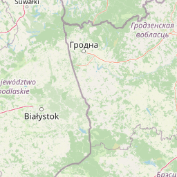
Use this park location map to pinpoint Čepkeliai State Nature Reserve in Lithuania, understand its exact geographic position, and read its mapped placement within the surrounding landscape more clearly.

Pigeon | © OpenStreetMap contributors

Location context for Čepkeliai State Nature Reserve

Varėna District Municipality

Explore photographic records of raised bogs, forested dunes, and wetland habitats across Čepkeliai.

Čepkeliai Photos and Landscape Scenery: Visualizing the Protected Mire Complex

Visual documentation captures the remote sphagnum raised bogs, forested continental dunes, and tranquil bog lakes that define the protected landscape of Čepkeliai. Examining field imagery reveals the complex interplay between open peatlands, ancient island woodlands, and rare wetland habitats across the reserve.

A narrow wooden boardwalk stretches through a flat, mossy wetland area scattered with thin pine trees under an overcast sky.

A narrow wooden boardwalk path cuts through a marshy landscape with low scrub, grasses, and scattered pine trees leading toward a denser pine forest in the background.

A tall, wooden observation tower stands among pine trees and marshy ground on an overcast day.

Close-up of small green bog rosemary plants with light purple buds and narrow leaves, growing in a marshy habitat.

A close up view of small, red, round cranberries nestled among green and orange sphagnum moss and small, reddish, circular sundew plants in a marshy habitat.

A close-up view of a cluster of wild rosemary plants with slender green leaves and rusty-colored stems growing in a forest-adjacent marshy area.

A wide, eye-level shot of a flat bog landscape with purple-flowering heather in the foreground and a line of sparse pine trees and distant forest under an overcast sky.

A high-angle view looking over a sprawling green marsh or bog area, framed by pine trees on the left and right sides under a clear sky.

A wide, low-angle shot of a sprawling marshy landscape with patches of standing water, grasses, and scattered low vegetation, leading to a line of dense forest in the distance under an overcast sky.

A vast, flat marshland landscape covered in tall green and yellowish grasses, dotted with small, sparse pine trees under a cloudy sky.

A wide, still lake reflects a clear blue sky, surrounded by marshy wetlands and low-lying pine forest in the distance.

A dense forest of tall birch and pine trees emerging from a wetland floor covered in thick green marsh reeds.

Park atlas

Compare regional wetlands, forested dunes, and adjacent borderland reserves.

Explore Parks Near Čepkeliai and Surrounding Protected Landscapes in Lithuania

Browse national parks and protected areas located near Čepkeliai to examine connected wetland ecosystems and regional terrain. Extending exploration across the surrounding borderland reveals diverse mire complexes and forested habitats throughout southern Lithuania.
Watercolor illustration showing a landscape with forests, a river, and distant hills
National parkLithuania
About 4.7 km away#1 closest

Northwest

Dzūkija National Park: Explore Lithuania's Largest Protected Forest and Inland Dune Landscapes

Mapped protected area geography and natural terrain of the Dainava region.

Delve into the protected landscape of Dzūkija National Park, Lithuania's expansive national park renowned for its vast primeval pine forests and extraordinary inland dune formations. This page provides a detailed atlas-style view of the park's mapped boundaries, diverse terrain, and significant natural features, offering insight into its protected territory and regional geographic importance. Examine the unique wetland systems and forest ecosystems that make this a crucial area for protected land discovery.

Area
584.53 km²
Established
1991
IUCN
II
Visitors
30K annual
A horizontal watercolor painting showing a soft, impressionistic landscape with trees on both sides and a gentle rolling hill in the background.
Nature reserveVarėna District Municipality
About 10 km away#2 closest

North

Povilnio Rezervatas: Protected Nature Reserve and Glacial Valley Geography in Varėna District

Glacial landscape study within the Dainava Forest massif

Located in the Varėna District, Povilnio Rezervatas is a protected nature reserve defined by its striking glacial spillway valley and diverse forest communities. This area encompasses a complex mosaic of lichen-rich pine heaths, spruce forests, and alder mires, making it a critical site for botanical conservation and regional geomorphology studies.

Area
1.832 km²
Established
1997
IUCN
Ia
Relief
Lowland
Watercolor illustration of a serene river landscape with green trees, grassy banks, and rolling hills in the background.
Nature reserveVarėna District Municipality
About 19 km away#3 closest

Northwest

Skroblaus rezervatas: Protected Nature Reserve and Baltic Upland Geographic Reference Site

Natural hydrological basin and inland dune landscapes in Varėna District Municipality

Skroblaus rezervatas functions as a strict nature reserve protecting the natural hydrological regime of the Baltic uplands. Located in the Varėna District Municipality, the terrain features deep stream valleys, thermokarst depressions, and inland dune massifs. This mapped area offers a deep look into the geomorphology and forest ecology of southern Lithuania, providing essential context for understanding undisturbed upland water systems.

Area
8.107 km²
Established
1983
IUCN
Ia
Relief
Upland
Watercolor painting of a tranquil marshland scene with reeds in the foreground, rolling green hills, and a pale sky.
Nature reservePodlaskie Voivodeship
About 66 km away#4 closest

West

Ostoja Augustowska Nature Reserve: Protected Forest and Wetland Atlas of Podlaskie

Mapped wilderness corridors in the Polish lowlands

Ostoja Augustowska serves as a major ecological hub in Podlaskie Voivodeship, comprising extensive pine and spruce woodlands linked with diverse peatland systems. The site provides a critical corridor for rare forest wildlife while preserving ancient stands of old-growth timber. Gain insights into the complex geography of this Natura 2000 protected territory through its documented terrain, hydrological networks, and mosaic of rare boreal habitat types.

Area
1,070.69 km²
Established
2009
Relief
Lowland
Climate
Temperate
Nature reserveTrakai District Municipality
About 67 km away#5 closest

North

Mergiškių gamtinis rezervatas Protected Nature Reserve in Trakai District Municipality

Strictly protected hornbeam woodland and hilly glacial terrain

Mergiškių gamtinis rezervatas is a protected area in Lithuania dedicated to conserving mature hornbeam-dominated hill forest. Located within the Trakai District Municipality, the reserve provides a critical habitat for threatened species and maintains the natural integrity of hilly glacial landscapes typical of the Aukštadvaris region.

Area
1.57 km²
Established
1996
IUCN
Ia
Relief
Upland
Watercolor painting showing green hills, trees, a body of water, and grassy vegetation
National parkLithuania
About 72 km away#6 closest

North

Trakai National Historic Park: Medieval Heritage and Lake District Protected Landscape

Explore Lithuania's historic park and its mapped geographic context.

Trakai National Historic Park offers a rich tapestry of medieval history intertwined with a captivating lake district landscape. As a protected area in southeastern Lithuania, it preserves significant architectural monuments, including the iconic Trakai Castle, set against a backdrop of interconnected lakes, forests, and wetlands. MoriAtlas provides a structured overview of its geographic boundaries and regional setting, facilitating atlas-style exploration of this historically significant protected landscape.

IUCN
V
Access
Moderate access
Scope
Mixed
Watercolor painting showing a wetland scene with reeds, patches of water, and trees under a light sky
National parkPodlaskie Voivodeship
About 75 km away#7 closest

Southwest

Biebrza National Park: Protected Fenlands and River Basin Geography in Northeastern Poland

Tracing the largest lowland peat bog complex in the European landscape

Biebrza National Park serves as the premier protected wetland area in Poland, characterized by its vast, intact marshlands and the meandering Biebrza River valley. This geographic profile details the park's critical fen ecosystems, floodplain dynamics, and distinctive habitats that support diverse avian and mammalian populations within the Podlaskie region.

Area
592.23 km²
Established
1993
IUCN
II
Relief
Lowland
A watercolor painting of a flat wetland landscape with a winding river in the foreground, small clusters of trees, and rolling hills in the soft, distant background.
National parkPodlaskie Voivodeship
About 75 km away#8 closest

West

Biebrzański Park Narodowy: A Protected Wetland Landscape in Podlaskie Voivodeship, Poland

Mapped river valley and peatland geography.

Located in the northeast of Poland, Biebrzański Park Narodowy protects a sprawling, flat basin defined by the slow-meandering Biebrza River. This critical protected area encompasses rare peat bogs, floodplain meadows, and alder carrs, functioning as a vital refuge for wetland species within the broader Podlaskie Voivodeship landscape.

Area
592.23 km²
Established
1993
Visitors
23.2K annual
Relief
Lowland

Common questions about visiting, size, designation, and location context for Čepkeliai State Nature Reserve

Čepkeliai State Nature Reserve FAQs for park facts, access, geography, and protected area context

Find quick answers about Čepkeliai State Nature Reserve, including protected-area facts, park geography, trail and visitor context, and how the park fits into its surrounding country and regional landscape.
MoriAtlas Explorer

Continue Your Protected Areas Search Across the Global Atlas

Deepen your exploration by continuing the structured search for national parks and protected areas worldwide. Utilize the comprehensive filtering capabilities to compare different conservation landscapes and refine your understanding of global park geography. Discover more about the distribution and characteristics of protected natural areas.

Global natural geography