
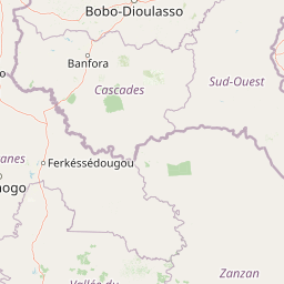
Lakes
Park geography
Detailed survey of regional terrain, inland water features, and protected ecological zones.
Comprehensive Geographic Profile and Landscape Boundaries of Comoé National Park, Ivory Coast
Comoé National Park spans 11,500 square kilometers across the Zanzan and Savanes Districts of Ivory Coast. This geographic profile details the park topography, including lowlands and ridges reaching 600 meters, alongside a network of rivers, streams, and wetlands such as the Mare aux Crocodiles.
West Africa's largest protected area with extraordinary savanna biodiversity
Comoé National Park
Comoé National Park is the largest protected area in West Africa, spanning approximately 11,500 square kilometers across the Zanzan and Savanes districts of north-eastern Ivory Coast. The park sits at a remarkable ecological crossroads, encompassing a steep north-south climatic gradient that transitions from the humid Guinea savanna in the south to the dry Sudanian zone in the north. This environmental gradient supports a multitude of habitats, including various savanna types, gallery forests, forest islands, and riparian grasslands, creating one of the most biodiverse savanna ecosystems on Earth. The Comoé River, which flows through the park for over 230 kilometers, creates conditions that allow plant species typically found further south to thrive here, including patches of dense tropical rainforest in the gallery forests along its banks. Designated as a UNESCO World Heritage Site and a Biosphere Reserve, the park represents an exceptional example of transitional habitats across climatic zones and serves as a critical sanctuary for numerous species at the northern limits of their ranges.
- Location
- Ivory Coast
- Park type
- National park
- Established
- 1983
- Area
- 11,500 km²
Location overview
Recorded country memberships and district relationships across Ivory Coast
Comoé National Park Geographic Overview and Regional Location Data
Comoé National Park sits entirely within Ivory Coast, spanning the administrative territories of Zanzan District and Savanes District. Regional records confirm inland protected status without transboundary or marine overlap.
- Countries
- Ivory Coast
- Regions
- Savanes District, Zanzan District
- Primary location
- Ivory Coast
- Geographic setting
- Inland
Boundary and coordinates
Mapped protected perimeter and recorded area metrics
Comoé National Park Boundary Map and Spatial Geography
Spatial context emerges directly from the interactive boundary geometry outlining the protected area. Derived measurements provide baseline dimensional facts including total recorded surface area.
- Boundary area
- 11,530.3 km²
- Boundary perimeter
- 513.8 km
- Northernmost point
- 9.6159° N
- Southernmost point
- 8.5048° N
- Easternmost point
- 3.1155° W
- Westernmost point
- 4.4419° W
- Geographic centre
- 9.1171° N, 3.7244° W
- North–south span
- 122.9 km
- East–west span
- 145.8 km
Elevation and terrain
Lowland topography and recorded natural water bodies
Comoé National Park Terrain and Elevation Profile
Comoé National Park features a recorded maximum elevation of 600 meters across its lowland landscape. The linked feature cards detail specific named peaks, streams, and lakes located within the protected area.
- Maximum elevation
- 600 m
Selected named natural features
Streams
Hanha
Streams
Lougbélo
Streams
Pidi
Streams
Kolosson
Streams
Hahiu
Environmental setting
Tropical lowland relief, savanna habitats, and major water systems
Comoé National Park Environmental Classifications and Physical Setting
Recorded habitat types, landscape features, and climate classifications provide complementary ways to read the physical setting of Comoé National Park. Stored environmental categories connect directly to relevant atlas destinations across the protected area.
- Relief
- Lowland
- Climate
- Tropical
- Water
- Major water bodies
- Forest cover
- Partial forest
- Seasonality
- Year-round
Landscape features
Valleys · Rivers · Wetland · Grassland · Forest · Woodland
Habitat types
Savanna · Temperate broadleaf forest · Riverine habitat · Wetland · Grassland
Park atlas
Compare adjacent West African savanna reserves and regional conservation landscapes
Exploring Other Parks Near Comoé National Park and Surrounding Protected Areas
Visitors exploring Comoé National Park can browse nearby protected areas to examine broader ecological gradients and regional wildlife corridors. Comparing adjacent conservation landscapes reveals shared habitat patterns across West African savanna ecosystems and riverine gallery forests.
National parkIvory Coast
Park boundaries overlap#1 closest
Southeast

Comoé National Park: Geographic Overview and Protected Landscape Analysis
Mapping the savanna and river corridors of Ivory Coast
Comoé National Park spans the northeastern reaches of Ivory Coast, providing a crucial protected space for West Sudanian savanna and gallery forests. This large-scale reserve is characterized by the hydrological influence of the Comoé River, which carves through the undulating plains to create seasonal floodplains and dense riverine corridors that serve as essential habitat for regional wildlife populations.
- Area
- 11,491.5 km²
- Established
- 1968
- IUCN
- II
- Relief
- Upland
Wildlife reserveUpper West Region
About 66 km away#2 closest
Northeast

Wechiau Community Hippo Sanctuary: Protected River Landscapes and Savanna Wildlife Reserve
Upper West Region, Ghana: Riverine ecology and community-managed boundaries
Wechiau Community Hippo Sanctuary encompasses a protected stretch of the Black Volta, providing essential habitat for hippopotamuses in northwestern Ghana. This wildlife reserve features a diverse landscape of riverine forests, sandbanks, and savanna trails. The sanctuary demonstrates how local traditional governance maintains critical natural terrain while fostering an integrated cultural and ecological landscape.
- Established
- 1999
- Relief
- Lowland
- Scope
- Terrestrial
- Water
- Major water bodies
National parkSavannah Region
90 km away#3 closest
East
Mole National Park: A Premier Protected Landscape in Ghana's Savannah Region
Explore mapped boundaries and Guinea savannah ecosystems.
Mole National Park represents a significant protected landscape within Ghana's Savannah Region, serving as the country's largest national park and a crucial conservation area for West African wildlife. The park's geography is defined by extensive Guinea savannah, characterized by grasslands with scattered woodlands and a prominent escarpment along its southern edge. Its vast expanse offers a unique opportunity to study mapped park boundaries and understand the ecosystem's role in regional conservation efforts. Discover the unique landscape context and protected area identity of this major West African wildlife refuge.
- Area
- 4,840 km²
- Established
- 1958
- IUCN
- II
- Visitors
- 17.8K annual
National parkGhana
About 100 km away#4 closest
Southeast
Bui National Park: Protected Savanna Landscape and Black Volta River Geography in Ghana
Explore the mapped boundaries and unique ecosystems of this national park.
Bui National Park, a protected national park in Ghana, offers a rich geographic discovery of savanna ecosystems bisected by the Black Volta River. Its vast mapped area provides a unique setting for understanding riparian corridors, woodland savanna, and mountainous terrain. The park is critically important for its significant hippopotamus population and its designation as an Important Bird Area, showcasing its ecological value. Exploration of Bui National Park provides insight into Ghana's protected landscapes and their strategic position within West African geography, serving as a key entity for any natural atlas.
- Area
- 1,820 km²
- Established
- 1971
- IUCN
- II
- Relief
- Mixed relief
Protected areaCascades
About 131 km away#5 closest
Northwest

Lac de Tengréla Protected Area: Mapping Wetland Landscapes in the Cascades Region
Freshwater geography and regional catchment in southwestern Burkina Faso
Located near Banfora, Lac de Tengréla functions as a protected Ramsar wetland within the Comoé River system. This freshwater lake provides essential ecological value, with its elongated basin and outflow connectivity offering a distinct window into the hydrology and natural terrain of southwestern Burkina Faso.
- Area
- 5.8 km²
- Established
- 2009
- Scope
- Terrestrial
- Water
- Water-dominated
Wildlife reserveUpper West Region
About 171 km away#6 closest
Northeast
Gbele Resource Centre Wildlife Reserve: A Regional Atlas of Protected Savanna Landscapes
Mapped geography and protected woodland in Ghana
Gbele Resource Centre represents one of the most substantial protected savanna landscapes in northwestern Ghana, spanning over 500 square kilometres of Sudano-Sahelian woodland. The terrain is defined by the seasonal Kulpawn River and a distinct composition of African baobab and sycamore fig trees, which together anchor an important ecological corridor. This reserve provides a vital opportunity to map and understand the conservation geography and avian diversity that distinguish the Upper West Region from other parts of the country.
- Area
- 565 km²
- Relief
- Lowland
- Scope
- Terrestrial
- Water
- Minor water
Protected areaBurkina Faso
About 175 km away#7 closest
North
Forêt classée de Kou: Protected Gallery Forest and Riverine Geography in Burkina Faso
A compact biodiversity refuge near Bobo-Dioulasso
Forêt classée de Kou stands as a vital example of Guinean-type forest preservation in Burkina Faso. This protected area features a complex mosaic of dense gallery woodland along the Kou and Guinguette rivers, transitioning into arborescent savanna. With its layered canopy, riverine corridors, and documented avian richness, it serves as a critical geographic marker of humid woodland in the broader Sudano-Sahelian terrain.
- Area
- 1.15 km²
- Established
- 1951
- Climate
- Tropical
- Access
- Easy access
Wildlife reserveBono East Region
About 192 km away#8 closest
Southeast
Boabeng-Fiema Monkey Sanctuary: Geographic Boundaries and Wildlife Reserve Context
Community-protected forest landscapes in Ghana
Boabeng-Fiema Monkey Sanctuary represents a rare community-based wildlife reserve located in central Ghana. Spanning 4.4 square kilometers between the villages of Boabeng and Fiema, the forest provides essential habitat for primate populations protected by generations of cultural tradition. This detail page offers geographic context, map exploration of the forest reserve, and insight into the unique intersection of woodland ecosystems and community-enforced conservation in the Bono East Region.
- Area
- 4.4 km²
- Established
- 1970
- Relief
- Lowland
- Climate
- Tropical
MoriAtlas Explorer
Trace the Ecological Boundaries of Comoé National Park in Northern Ivory Coast
Continue exploring the intricate landscape patterns and protected status of Comoé National Park through our structured atlas data. MoriAtlas provides deep insights into the geographic connectivity, river drainage systems, and habitat transitions that define this vital West African wilderness, helping you visualize the scale and importance of this protected region beyond the surface.
Browse next
Global natural geography
Explore related park routes
Explore MoriAtlas Global ParksBrowse All MoriAtlas ParksGlobal Park Map DiscoveryMoriAtlas: Browse All CountriesBrowse All MoriAtlas ContinentsNational Park Environment AtlasGrand Canyon National Park AtlasYellowstone National Park AtlasYosemite National Park Atlas and GeographySerengeti National Park AtlasGalápagos National Park Protected LandscapeBanff National Park Geography and AtlasKruger National Park Atlas EntryUluṟu-Kata Tjuṯa National Park AtlasExplore Uluru-Kata Tjuta National Park GeographyPlitvice Lakes National Park AtlasFiordland National Park Protected LandscapeGreat Smoky Mountains National Park AtlasAfghanistan National Parks and Protected AreasAlbania National Parks and Protected AreasAlgeria National Parks and Protected AreasAmerican Samoa National Parks and Protected AreasAndorra National Parks and Protected AreasAngola National Parks and Protected AreasAntarctica National Parks and Protected AreasAntigua and Barbuda Park List