

Mori Atlas logo
National parkCoopracambra National Park

Discover the mapped boundaries and geographic setting of this significant transboundary conservation area.

Coopracambra National Park: Victoria's Remote Protected Landscape and Wilderness Corridor

Coopracambra National Park, a vast protected area in Victoria, Australia, offers a deep dive into a remote mountainous landscape defined by tall eucalypt forests and the Genoa River. As the Victorian anchor of a major transboundary wilderness corridor, it connects with New South Wales's protected lands, forming one of south-eastern Australia's largest contiguous wilderness zones. This park detail page provides atlas-level insight into its geographic context, mapped boundaries, and the ecological significance of its preserved terrain.

wilderness protectiontall eucalypt forestmountain landscapetransboundary conservationriver ecosystemsVictoria protected areas

Coopracambra National Park

National park

Park overview

Structured park overview, official facts, and landscape profile for Coopracambra National Park

Coopracambra National Park park facts, protected area profile, and essential visitor context
Review the core facts for Coopracambra National Park, including designation, size, terrain, visitor scale, habitats, and operating context in one park-focused overview.

About Coopracambra National Park

Coopracambra National Park occupies a distinctive position in Victoria's protected area network as a remote, mountainous wilderness on the state's eastern frontier. The park's location near the New South Wales border places it at the crossroads of two Australian states and creates ecological connections that extend well beyond its official boundaries. The Black-Allan Line, which forms the park's northern boundary, represents a significant historical survey feature that has shaped regional administration and land management for generations. This boundary follows a straight survey line rather than natural geographic features, giving the park an unusual geometric northern edge that contrasts with the more organic shapes of most protected areas. The western boundary follows the Monaro Highway, a major regional road that provides the primary access route to the park from the Victorian interior. Within the park, the Genoa River system provides important aquatic habitat and creates a natural drainage corridor that connects the highland interior to the coast. The combination of elevation changes, forest cover, and watershed systems creates a complex and diverse landscape that supports multiple ecological communities. The park's relative remoteness from major population centres has helped maintain its wilderness character, though this same isolation presents challenges for visitor access and park management.

Quick facts and research context for Coopracambra National Park

Coopracambra National Park spans 388 square kilometres in eastern Victoria, established in 1988 and managed by Parks Victoria. The park sits at the northern edge of the Gippsland region, with its boundary defined by the Black-Allan Line where it meets New South Wales. Three prominent peaks rise within the park: Mount Coopracambra reaches 1,103 metres above sea level, Mount Kaye stands between 998 and 1,000 metres, and Mount Denmarsh reaches 917 metres. The Genoa River flows eastward through the park, eventually reaching the Tasman Sea. The Monaro Highway forms the western boundary of the protected area, providing access to the Cann River township nearby.

Park context

Deeper park guide and search-rich context for Coopracambra National Park

Coopracambra National Park history, landscape, wildlife, and travel context
Explore Coopracambra National Park through its history, landscape character, ecosystems, wildlife, conservation priorities, cultural context, and seasonal travel timing in a structured park guide built for atlas discovery and search intent.

Why Coopracambra National Park stands out

Coopracambra National Park is best known for its role as the Victorian anchor of a major transboundary wilderness corridor in south-eastern Australia. The park protects extensive tall eucalypt forest ecosystems and serves as a critical link in one of the region's largest contiguous wilderness areas. Its mountain peaks, particularly Mount Coopracambra, offer prominent elevated terrain within the park, while the Black-Allan Line boundary creates a distinctive geographic setting that combines historical survey significance with contemporary conservation value. The park's remoteness and relatively limited development have helped preserve its wilderness character.

Coopracambra National Park history and protected-area timeline

Coopracambra National Park was established in 1988, making it a relatively recent addition to Victoria's national park system. The creation of the park reflected growing recognition of the ecological significance of Victoria's eastern high country and the need to protect large, contiguous wilderness areas. The establishment came during a period of increased attention to wilderness conservation in Australia, with federal and state agencies working to identify and protect representative examples of the nation's natural landscapes. The park's boundary with New South Wales created opportunities for cross-border cooperation in conservation management, a theme that would become increasingly important as the significance of the larger wilderness corridor became better understood. Parks Victoria assumed management responsibility for the park, integrating it into the state's system of national parks and reserves managed for conservation and sustainable visitor enjoyment. The history of European settlement in the region predates the park's establishment by more than a century, with pastoral activity and timber harvesting occurring in the surrounding areas before protection was granted.

Coopracambra National Park landscape and geographic character

The landscape of Coopracambra National Park is defined by its mountainous terrain and forested ridges that form part of the eastern highlands of Victoria. Mount Coopracambra rises to 1,103 metres above sea level as the highest point in the park, providing panoramic views across the surrounding wilderness and into New South Wales. Mount Kaye, with elevations between 998 and 1,000 metres, and Mount Denmarsh at 917 metres, form additional prominent peaks that contribute to the park's mountainous character. The terrain shows the influence of ancient geological processes, with ridgelines and valleys creating a complex topography that varies in aspect and microclimate. The Genoa River flows eastward through the park, carving valleys that provide lower-elevation corridors through the mountainous terrain. Tall eucalypt forests dominate the lower and mid-slope areas, with the trees reaching impressive heights in the productive environments. The forest canopy creates a distinctive visual character that is typical of Victorian high country landscapes. The combination of steep slopes, forest cover, and the river system creates a landscape of considerable visual and ecological complexity.

Coopracambra National Park ecosystems, habitats, and plant life

The nature of Coopracambra National Park centers on its tall eucalypt forest ecosystems, which represent some of the most productive and diverse forest types in eastern Australia. The forests vary in composition and density across the park, responding to differences in elevation, aspect, soil type, and moisture availability. The park's position in the Gippsland region places it within a climate zone that receives sufficient rainfall to support dense forest cover while experiencing seasonal variation that creates distinct growing conditions. The forest structure includes tall emergent eucalypts, a mid-story of smaller trees and shrubs, and a ground layer of grasses, ferns, and other understory plants. This vertical complexity creates diverse microhabitats that support a range of ecological relationships. The waterways, particularly the Genoa River system, add aquatic and riparian environments to the park's ecological diversity. The combination of forest and riverine habitats creates a mosaic of environments that supports biodiversity across taxonomic groups.

Coopracambra National Park wildlife and species highlights

While the source material provides limited specific detail about wildlife species, the tall eucalypt forests and riverine environments of Coopracambra National Park would be expected to support diverse fauna populations typical of eastern Victorian high country. The forest structure provides habitat for arboreal mammals, birds, and invertebrates, while the riparian corridors along the Genoa River offer different environmental conditions that support aquatic and waterside species. The park's connection to the larger South East Forests National Park creates a contiguous habitat that facilitates wildlife movement across a broad landscape, which is particularly important for species that require large territories or seasonal migration routes. The variety of elevations and aspects within the park creates microclimatic conditions that support diverse species assemblages. The wilderness character of the area, with limited development and low visitor pressure, provides relatively undisturbed habitat for sensitive species.

Coopracambra National Park conservation status and protection priorities

Coopracambra National Park plays a critical role in the conservation network of south-eastern Australia through its position as part of a major transboundary protected area complex. When combined with the adjoining South East Forests National Park in New South Wales, the two parks form one of the largest contiguous wilderness areas in the region, stretching from Bombala in New South Wales to Cann River in Victoria. This large, intact landscape is significant for conservation because it allows natural ecological processes to operate across boundaries without the fragmentation that typically occurs in more developed landscapes. The protection of this corridor supports biodiversity by maintaining connectivity between populations, facilitating gene flow, and providing refuge for species that require large areas of intact habitat. The park's inclusion in the IUCN Category II protected area classification reflects its designation as a national park where conservation of natural values is the primary management objective. The management by Parks Victoria integrates protection of natural values with opportunities for appropriate visitor experiences, balancing conservation with community access.

Coopracambra National Park cultural meaning and human context

The cultural context of Coopracambra National Park reflects the broader history of the Gippsland region and its interactions between Indigenous communities and European settlers. The land itself has been part of the traditional country of Aboriginal peoples whose connections to the landscape predate the colonial period by many thousands of years, though the source material does not provide specific detail about Indigenous heritage within the park itself. The Black-Allan Line, which forms the park's northern boundary, represents a particular historical feature of the region, being a survey line that was established to define the border between Victoria and New South Wales. This boundary has administrative significance that continues to shape how the park is managed and how it relates to neighboring protected areas across the state border. The Monaro Highway, which defines the western boundary, follows routes that have been used for regional movement and transport since European settlement of the area.

Top sights and standout views in Coopracambra National Park

The standout features of Coopracambra National Park include its role as the Victorian component of one of south-eastern Australia's largest wilderness corridors, its tall eucalypt forests rising from the Genoa River valley, and the prominent peaks of Mount Coopracambra, Mount Kaye, and Mount Denmarsh. The Black-Allan Line boundary creates a unique geometric edge to the park that distinguishes it from most other protected areas. The park's location near Cann River provides access to a remote wilderness experience relatively close to major population centres of eastern Victoria. The transboundary connection to South East Forests National Park in New South Wales creates a conservation complex of substantial regional significance, protecting ecological processes across a large, intact landscape.

Best time to visit Coopracambra National Park

The best time to visit Coopracambra National Park would typically be during the warmer months of spring and summer in Victoria, from roughly October through March, when weather conditions are more favorable for outdoor activity and the longer days allow more time for exploration. The park's elevated terrain means that conditions can be cooler and more variable than in lower-lying areas, and visitors should be prepared for changeable weather regardless of season. Winter months may bring snow to the higher peaks and conditions that make some areas difficult to access, though this can also create distinctive mountain scenery for those prepared for colder conditions. The remote character of the park means that visitors should be self-sufficient and prepared for limited services within the protected area itself.
Park location guide

Geography guide, regional context, and park location map for Coopracambra National Park

Coopracambra National Park park geography, regions, and map view in Australia
Understand where Coopracambra National Park sits in Australia through a broader geographic reading of the surrounding landscape, nearby location context, and its mapped position within the national park landscape.

How Coopracambra National Park fits into Australia

Australia is a constitutional monarchy and federal parliamentary democracy comprising six states and ten territories. With a population of nearly 28 million, it is one of the world's most urbanised countries, with most people concentrated on the eastern seaboard. The country has a high Human Development Index and is known for its cultural diversity, ancient Aboriginal heritage, and unique wildlife.

Wider geography shaping Coopracambra National Park in Australia

Australia occupies the entire Australian continent, the island of Tasmania, and numerous smaller islands. It is the world's flattest and driest inhabited continent, featuring vast deserts in the interior (the Outback), tropical rainforests along the eastern coast, and a coastline bordering the Indian and Pacific Oceans.

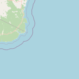
Map view of Coopracambra National Park

Use this park location map to pinpoint Coopracambra National Park in Australia, understand its exact geographic position, and read its mapped placement within the surrounding landscape more clearly.

Pigeon | © OpenStreetMap contributors
Park atlas

Trace interconnected protected landscapes, mapping wilderness corridors across Victoria and New South Wales.

Explore Other National Parks and Protected Areas Near Coopracambra National Park
Browse a curated list of national parks and protected areas geographically close to Coopracambra National Park, including major wilderness corridors spanning Victoria and New South Wales. This curated view allows for comparing diverse protected landscapes, tracing mountain terrain and forest ecosystems across a significant cross-border conservation region.
National parkAustralia

Errinundra National Park: Australia's National Park Geographic Identity and Mapped Boundaries

Explore the protected landscape and natural terrain of this Australian national park.

Errinundra National Park offers a unique window into Australia's protected natural areas. This detailed view focuses on its role as a national park, providing structured information on its geographic footprint, mapped terrain, and position within the broader Australian landscape. Understand Errinundra National Park as a distinct entity for atlas-based discovery, focusing on its protected land characteristics and geographic context without visitor logistics.

Area
268.75 km²
Established
1988
IUCN
II
Relief
Upland
National park

Alfred National Park: Southernmost Warm Temperate Rainforest Atlas and Protected Landscape

Explore a unique biogeographic boundary and diverse rainforest ecosystem.

Alfred National Park stands as a vital protected area, renowned for harboring Australia's southernmost warm temperate rainforest. Located in Victoria's East Gippsland region, this national park is a significant ecological meeting point, where plant communities from subtropical, temperate, and arid zones converge. The park's mapped landscape features a dense, jungle-like environment dominated by Lilly Pilly, tree ferns, and epiphytes, offering a distinct contrast to the typical eucalyptus woodlands of the area and highlighting its unique floristic character.

Area
30.5 km²
Established
1925
IUCN
II
Climate
Temperate
National park

Lind National Park: Historic Protected Landscape in East Gippsland, Victoria

Explore mapped boundaries and forested terrain within this early national park.

Lind National Park, established in 1925, is a key protected area in Victoria, Australia, preserving the characteristic forested landscapes of East Gippsland. Spanning 1,370 hectares, it offers a tangible connection to the state's early conservation efforts. The park's terrain is defined by temperate forest, characteristic of eastern Victoria's undulating geography, providing a clear example of protected woodland adjacent to the Princes Highway corridor. Its historical designation underscores its importance in the region's network of natural reserves and mapped landscapes.

Area
13.7 km²
Established
1925
IUCN
II
Visitors
3.5K annual
National parkNew South Wales

South East Forests National Park: New South Wales National Park Atlas Entry

Mapped landscape and protected area geography.

This canonical MoriAtlas entry for South East Forests National Park provides essential geographic context and details about its status as a national park. Understand the mapped boundaries of this protected landscape within New South Wales, supporting discovery through its regional setting and natural terrain. The focus remains on atlas-style exploration of its geographic identity and conservation significance, devoid of visitor logistics or travel advice.

Area
1,151.77 km²
Established
1997
IUCN
II
Relief
Highland
National parkNew South Wales

Mount Imlay National Park: Protected Land Geography and Mapped Boundaries in New South Wales

Explore the geographic context of this Australian national park.

Mount Imlay National Park serves as a significant protected area within New South Wales, providing a focal point for understanding regional geography and mapped natural landscapes. As a national park, its boundaries and terrain offer valuable insights for atlas-based discovery, highlighting Australia's commitment to conserving diverse geographic entities and showcasing its role in the broader national landscape context.

Area
48 km²
Established
1972
IUCN
II
Relief
Mountain
Marine protected area

Point Hicks Marine National Park: Protected Marine Landscape and Geographic Context

Explore Victoria's unique transitional marine ecosystems and mapped underwater geography.

Point Hicks Marine National Park represents a crucial marine protected area within Victoria, Australia, safeguarding a unique ecological transition zone. The park's underwater geography features a dynamic interplay of rocky reefs and sandy bottoms, supporting a rich diversity of marine life where species from distinct biogeographic regions overlap. Understanding Point Hicks Marine National Park means exploring its protected marine identity, its mapped underwater landscapes, and its critical role in conserving Australia's warmer eastern marine environments.

Area
40 km²
Established
2002
IUCN
II
Relief
Lowland
National park

Snowy River National Park: A Deep Gorge Protected Landscape in Victoria, AU

Explore mapped terrain and vital alpine wilderness boundaries.

Snowy River National Park showcases Victoria's rugged natural geography with its dramatic mountain terrain and the spectacular Little River Gorge, the state's deepest. This national park, classified as a wilderness area for much of its expanse, protects critical habitats and diverse ecosystems across its mapped boundaries. Its significance as a protected landscape within the Australian Alps National Parks makes it a key destination for understanding regional geography and conservation efforts.

Area
987 km²
Established
1979
IUCN
II
Relief
Mountain
Marine protected area

Cape Howe Marine National Park: Victoria's Southeastern Marine Protected Landscape

Rugged coast, Southern Ocean influence, and marine conservation.

Cape Howe Marine National Park offers a protected marine environment at the remote eastern edge of Victoria, Australia. Defined by its dramatic coastal geography, the park features rocky headlands, exposed cliffs, and waters influenced by the powerful Southern Ocean. Established in 2002, this marine protected area contributes to a significant continuum of protected lands, adjacent to terrestrial national parks. Its landscape is shaped by powerful surf and coastal wilderness, providing a unique example of marine conservation where the Australian continent meets the open ocean.

Area
40.5 km²
Established
2002
IUCN
II
Climate
Temperate

Common questions about visiting, size, designation, and location context for Coopracambra National Park

Coopracambra National Park FAQs for park facts, access, geography, and protected area context
Find quick answers about Coopracambra National Park, including protected-area facts, park geography, trail and visitor context, and how the park fits into its surrounding country and regional landscape.
MoriAtlas Explorer

Continue Your Protected Areas Search Across the Global Atlas

Deepen your exploration by continuing the structured search for national parks and protected areas worldwide. Utilize the comprehensive filtering capabilities to compare different conservation landscapes and refine your understanding of global park geography. Discover more about the distribution and characteristics of protected natural areas.

Global natural geography