

Mori Atlas logo
National parkCulgoa Floodplain National Park

Understand the mapped boundaries and regional context of this protected area in northeastern Australia.

Culgoa Floodplain National Park: Queensland National Park and Protected Landscape Geography

Culgoa Floodplain National Park represents a significant protected area within Queensland, offering users a dedicated space to explore its geographic identity. As a designated national park, its mapped boundaries and the surrounding natural landscape provide crucial context for understanding regional conservation efforts in northeastern Australia. This park is a key entity for atlas-based discovery, allowing for detailed examination of its terrain and its placement within the broader Queensland geography.

Floodplain EcosystemsBirdwatchingQueenslandSemi-Arid LandscapesAboriginal HeritageWoodland Environments

Culgoa Floodplain National Park

National park

Park overview

Structured park overview, official facts, and landscape profile for Culgoa Floodplain National Park

Culgoa Floodplain National Park park facts, protected area profile, and essential visitor context
Review the core facts for Culgoa Floodplain National Park, including designation, size, terrain, visitor scale, habitats, and operating context in one park-focused overview.

About Culgoa Floodplain National Park

Culgoa Floodplain National Park protects a distinctive floodplain ecosystem in Queensland's South West region, representing one of the state's significant conservation reserves in a semi-arid landscape. The park's location at the western extent of Hebel in the Shire of Balonne places it within an area of Queensland characterized by low rainfall and extensive pastoral activity, making protected floodplain habitats particularly valuable for biodiversity conservation.

The park's hydrological character is defined by the Culgoa River, which flows through the eastern tip of the reserve and can cause seasonal flooding that transforms the landscape and creates vital wetland habitats. In contrast, the western portions of the park fall within the Nebine Creek catchment, and certain areas feature unique natural springs where water from the Great Artesian Basin rises to the surface, forming muddy pools that provide permanent water sources in an otherwise dry environment.

Diverse woodland vegetation covers the park, providing habitat structure for the remarkable bird communities that have been documented here. The former pastoral use of the land as Byra Station ended with the park's establishment in 1994, allowing natural processes to recover in areas previously subjected to grazing pressure. The park offers limited infrastructure, with access restricted to four-wheel-drive vehicles reflecting the remote nature of the location and the conditions of the access routes. Visitors seeking to experience this floodplain wilderness must be prepared for self-sufficient camping with no provided facilities and no marked walking tracks, emphasizing the park's undeveloped character and the importance of leaving no trace principles.

Quick facts and research context for Culgoa Floodplain National Park

Culgoa Floodplain National Park covers 428.59 square kilometres of floodplain and woodland in South West Queensland. Established in 1994, the park is governed by the Queensland Parks and Wildlife Service and is located near Hebel, close to the Queensland-New South Wales border. The terrain averages 142 metres in elevation, with the Culgoa River causing seasonal flooding in the eastern sections while the western areas drain into Nebine Creek. The Great Artesian Basin contributes to surface water features through natural spring outlets. The park preserves Aboriginal archaeological sites including stone tool scatters and cooking remnants.

Park context

Deeper park guide and search-rich context for Culgoa Floodplain National Park

Culgoa Floodplain National Park history, landscape, wildlife, and travel context
Explore Culgoa Floodplain National Park through its history, landscape character, ecosystems, wildlife, conservation priorities, cultural context, and seasonal travel timing in a structured park guide built for atlas discovery and search intent.

Why Culgoa Floodplain National Park stands out

Culgoa Floodplain is particularly notable for its exceptional birdlife diversity, supporting 150 recorded species including all six Australian woodswallow species and ten honeyeater varieties. The floodplain ecosystem itself is distinctive in Queensland's protected area network, representing a semi-arid floodplain environment with unique hydrological characteristics driven by the Culgoa River and Great Artesian Basin springs. The combination of seasonal wetland habitats, diverse woodland vegetation, and relative isolation creates conditions favorable for significant bird populations and makes the park a destination for dedicated birdwatchers and wildlife observers.

Culgoa Floodplain National Park history and protected-area timeline

Culgoa Floodplain National Park was established in 1994 through the protection of the former Byra Station pastoral property, transitioning from grazing land to a national park within Queensland's protected area system. The conversion of this pastoral lease to conservation tenure reflects a broader pattern in Queensland of identifying significant ecological and heritage sites within former pastoral landscapes for formal protection.

The area's human history extends far beyond its relatively recent national park designation, with Aboriginal heritage sites scattered throughout the park including stone tool scatters and cooking sites that attest to millennia of indigenous occupation and use of this floodplain landscape. The establishment of the park under the Queensland Parks and Wildlife Service brought formal recognition of both the ecological values of the floodplain system and the cultural significance of the Aboriginal archaeological sites within its boundaries.

Culgoa Floodplain National Park landscape and geographic character

The landscape of Culgoa Floodplain National Park is characterized by flat to gently undulating terrain averaging 142 metres in elevation, with the floodplain itself forming the dominant landform element. The eastern portion of the park features the Culgoa River channel, which creates seasonal flood conditions that transform the surrounding landscape into temporary wetland environments. The western areas exist within the Nebine Creek catchment system, representing a different hydrological character within the same protected area.

Unique landscape features include the muddy pools formed where water from the Great Artesian Basin naturally reaches the surface, creating perennial wetland spots amid the generally drier woodland environment. These spring-fed pools provide permanent water features that contrast with the seasonal nature of the river flooding and contribute to the habitat diversity of the park. The woodland vegetation covers the majority of the park, with diverse tree and shrub species adapted to the semi-arid climate and the occasional flood conditions.

Culgoa Floodplain National Park ecosystems, habitats, and plant life

The nature of Culgoa Floodplain National Park centers on a floodplain ecosystem that is relatively uncommon in Queensland's protected area network. The combination of seasonal river flooding, spring-fed permanent wetlands from the Great Artesian Basin, and diverse woodland vegetation creates a complex of habitat types supporting various ecological communities. The floodplain nature of the reserve means that the landscape undergoes periodic transformation as floodwaters inundate areas, recede, and create varying conditions across seasons and years.

The woodland vegetation communities present reflect adaptation to the semi-arid climate, with species capable of withstanding periods of drought while exploiting the moisture available during flood periods. The diverse structure of these woodlands, from taller trees to lower shrub layers, provides diverse niche environments for wildlife and contributes to the overall biodiversity value of the reserve. The Great Artesian Basin spring features add a unique dimension to the park's ecological character, creating reliable water sources that support wildlife populations during dry periods and contribute to the overall ecological significance of the area.

Culgoa Floodplain National Park wildlife and species highlights

Culgoa Floodplain National Park is distinguished by exceptional birdlife, with 150 species documented within its boundaries. The honeyeater family is particularly well represented, with ten species recorded including the painted honeyeater, a species of particular note. All six of Australia's woodswallow species have been identified in the park, making this a remarkable location for observing this group of birds. Various parrot species also inhabit the woodland environments, adding to the avifaunal diversity.

The combination of floodplain wetlands, spring-fed pools, and diverse woodland creates a mosaic of habitats that supports this rich bird community. Seasonal flooding creates feeding and foraging opportunities for waterbirds and other species, while the permanent spring pools provide refuges during dry periods. The woodland environments provide nesting habitat, foraging resources, and shelter for a range of species. Beyond birds, the park supports various other wildlife adapted to the floodplain and woodland environments, though detailed species records are less extensively documented in available sources.

Culgoa Floodplain National Park conservation status and protection priorities

Culgoa Floodplain National Park represents protection of a floodplain ecosystem that is underrepresented in Queensland's national park system. The semi-arid floodplain environment, fed by the Culgoa River and Great Artesian Basin springs, supports ecological communities adapted to both seasonal flooding and drought conditions. The protection of this landscape preserves habitat for the exceptional bird diversity recorded, including species of conservation concern such as the painted honeyeater.

The conversion of Byra Station from pastoral use to national park status in 1994 allowed natural ecological processes to recover without the pressures of grazing, enabling vegetation communities and wildlife populations to respond to protection. The preservation of Aboriginal heritage sites within the park adds cultural conservation values to the ecological protection provided by the national park designation.

Culgoa Floodplain National Park cultural meaning and human context

Culgoa Floodplain National Park contains significant Aboriginal heritage sites that demonstrate the long human history of this floodplain landscape. Stone tool scatters and cooking sites found throughout the park represent tangible evidence of Aboriginal occupation and use extending back thousands of years. These archaeological features indicate that the floodplain provided resources and held significance for Aboriginal communities well before European settlement and pastoral development of the region.

The cultural context of the park thus extends beyond its recent national park history to encompass indigenous heritage that is embedded in the landscape itself. The preservation of these sites within the protected area ensures that both ecological and cultural values are maintained, recognizing the dual significance of the land in both environmental and heritage terms.

Top sights and standout views in Culgoa Floodplain National Park

Culgoa Floodplain National Park offers exceptional birdwatching opportunities in a remote floodplain setting, with all six Australian woodswallow species and ten honeyeater species documented. The floodplain landscape, with its seasonal river flooding and Great Artesian Basin spring-fed pools, creates a dynamic environment distinctive among Queensland's protected areas. Aboriginal heritage sites including stone tool scatters and cooking areas provide cultural interest, while the undeveloped character of the park, accessible only by four-wheel-drive and with no facilities, offers a wilderness experience for self-sufficient visitors.

Best time to visit Culgoa Floodplain National Park

The best time to visit Culgoa Floodplain National Park depends on seasonal conditions and desired experiences. The floodplain environment means that conditions vary significantly between wet and dry periods, with the Culgoa River capable of causing flooding that may affect access and landscape character. Wildlife viewing, particularly birdwatching, may be most productive during drier periods when birds concentrate around permanent water sources such as the Great Artesian Basin spring pools. Visitors should be aware that the park's remote location and four-wheel-drive access requirements mean that conditions can change rapidly, and self-sufficiency is essential regardless of when visiting.
Park location guide

Geography guide, regional context, and park location map for Culgoa Floodplain National Park

Culgoa Floodplain National Park park geography, regions, and map view in Australia
Understand where Culgoa Floodplain National Park sits in Australia through a broader geographic reading of the surrounding landscape, nearby location context, and its mapped position within the national park landscape.

How Culgoa Floodplain National Park fits into Australia

Australia is a constitutional monarchy and federal parliamentary democracy comprising six states and ten territories. With a population of nearly 28 million, it is one of the world's most urbanised countries, with most people concentrated on the eastern seaboard. The country has a high Human Development Index and is known for its cultural diversity, ancient Aboriginal heritage, and unique wildlife.

Wider geography shaping Culgoa Floodplain National Park in Australia

Australia occupies the entire Australian continent, the island of Tasmania, and numerous smaller islands. It is the world's flattest and driest inhabited continent, featuring vast deserts in the interior (the Outback), tropical rainforests along the eastern coast, and a coastline bordering the Indian and Pacific Oceans.

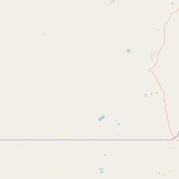
Map view of Culgoa Floodplain National Park

Use this park location map to pinpoint Culgoa Floodplain National Park in Australia, understand its exact geographic position, and read its mapped placement within the surrounding landscape more clearly.

Pigeon | © OpenStreetMap contributors

Location context for Culgoa Floodplain National Park

Queensland
Park atlas

Trace the regional spread of protected landscapes and compare adjacent floodplain ecosystems or semi-arid reserves in Queensland.

Explore Nearby National Parks and Protected Areas Beyond Culgoa Floodplain National Park
Continue your park discovery by mapping other protected areas and national parks located near Culgoa Floodplain National Park, exploring the diverse semi-arid landscapes of Queensland and its border regions. Browse the regional context to compare different floodplain ecosystems, woodland environments, and wetland conservation efforts, providing a richer atlas view of Australia's interior protected areas.
National parkAustralia

Culgoa National Park: Iconic Coolabah Woodlands and River Floodplain Landscapes of Australia

Explore mapped boundaries and regional geography in this New South Wales protected area.

Culgoa National Park is a premier example of a preserved semi-arid outback landscape in Australia, celebrated for its extensive and intact coolabah woodlands. This national park protects vital river floodplains and a chain of permanent waterholes along the Culgoa River, contributing significantly to the biodiversity of the Darling River catchment. Understanding its geographic setting and the mapped distribution of its unique vegetation communities offers deep insight into Australia's natural heritage.

Area
352.39 km²
Established
1996
IUCN
II
Relief
Lowland
National parkQueensland

Thrushton National Park: Queensland's Mulga Lands National Park and Protected Landscape

Explore the semi-arid terrain and mapped conservation boundaries.

Thrushton National Park represents a crucial protected landscape within Queensland's Mulga Lands, preserving vast expanses of dense mulga scrub, spinifex sandplains, and dry woodlands. As a National Park, it offers a unique window into the semi-arid ecology of inland Australia, characterized by its subtly undulating terrain and sandy soils. This atlas-focused exploration highlights the park's distinctive vegetation communities and its regional geographic significance, providing a factual base for understanding this vital conservation area.

Area
256.52 km²
Established
1990
IUCN
II
Scope
Terrestrial
National parkNew South Wales

Toorale National Park: Inland Floodplain and Wetland Protected Area in New South Wales

Discover its unique geography at the Darling and Warrego River confluence.

Toorale National Park is a critical protected area in the arid interior of New South Wales, Australia, recognized for its expansive inland floodplain and a significant wetland system formed by historic water management. Situated at the convergence of the Darling and Warrego Rivers, the park's terrain is predominantly flat, characterized by riparian floodplains and occasional low ridges. This landscape supports diverse vegetation communities, including river red gum forests and extensive chenopod shrublands, offering a unique insight into inland Australian geography and conservation values. Explore the mapped boundaries and natural context of this important national park.

Area
308.66 km²
Established
2010
IUCN
II
Relief
Lowland
National parkNew South Wales

Gundabooka National Park: Australian Protected Landscape Geography

Mapped boundaries and regional context within New South Wales.

Gundabooka National Park serves as a vital national park entity within the Australian protected areas system. This entry focuses on its specific geographic footprint and landscape character, offering a foundation for understanding its role and distribution within New South Wales. Explore the mapped context and regional geography that define Gundabooka National Park as a protected natural landscape.

Area
639.02 km²
Established
1996
IUCN
II
Relief
Mountain
National parkQueensland

Currawinya National Park: Queensland's Ramsar Wetland and Mulga Lands National Park

Discover its arid landscape and protected area identity.

Currawinya National Park is a major protected area in Queensland, Australia, recognized for its significant Ramsar-listed wetland system, including Lakes Numalla and Wyara. These ephemeral lakes are vital drought refuges for waterbirds across inland Australia and represent a unique ecological feature within the park's expansive mulga lands landscape. The park also champions conservation initiatives, notably a large predator-exclusion enclosure for the greater bilby, showcasing its commitment to arid-zone biodiversity and landscape preservation.

Area
1,513 km²
Established
1991
IUCN
II
Relief
Lowland
National parkQueensland

Alton National Park: Discover Protected Landscape and Geographic Setting in Queensland

Explore the mapped boundaries and regional context of this national park.

Alton National Park is a key protected natural landscape within Queensland, Australia. This dedicated page focuses on its identity as a national park, providing clear geographic context and mapped outlines. Explore how Alton National Park contributes to the protected areas of northeastern Australia, offering valuable insights for atlas-based discovery of diverse terrains and conservation landscapes.

Area
5.58 km²
Established
1973
IUCN
II
Relief
Lowland
Watercolor illustration showing rolling hills, scattered trees, and distant mountains in a natural landscape.
National parkQueensland

Tregole National Park: Queensland National Park with Significant Ooline Woodlands

Explore unique semi-arid protected landscape and Ooline tree stands.

Tregole National Park in Queensland, Australia, is a protected natural area celebrated for its remarkable Ooline tree concentrations. This park offers a rare look at pure Ooline stands within a hot, dry inland climate, showcasing a significant example of semi-arid ecosystems. Its landscape represents the meeting point of brigalow and mulga biospheres, providing valuable context for understanding Australia's diverse protected areas and geographic regions within the MoriAtlas framework.

Area
75.79 km²
Established
1995
IUCN
II
Relief
Lowland
National parkQueensland

Lake Bindegolly National Park: A Mapped Protected Wetland Sanctuary in Queensland

Discover its rare flora and vital bird habitat in the Mulga Lands.

Lake Bindegolly National Park is a significant protected natural area situated in the Mulga Lands of Queensland, Australia. This national park preserves a unique three-lake system, essential for rare plant conservation and recognized internationally as an Important Bird Area. The transient wetlands within the park attract a remarkable diversity of bird species, especially waterfowl, making it a key destination for understanding inland Australian geography and the importance of protected landscapes.

Area
140 km²
Established
1991
IUCN
II
Relief
Lowland

Common questions about visiting, size, designation, and location context for Culgoa Floodplain National Park

Culgoa Floodplain National Park FAQs for park facts, access, geography, and protected area context
Find quick answers about Culgoa Floodplain National Park, including protected-area facts, park geography, trail and visitor context, and how the park fits into its surrounding country and regional landscape.
MoriAtlas Explorer

Continue Your Protected Areas Search Across the Global Atlas

Deepen your exploration by continuing the structured search for national parks and protected areas worldwide. Utilize the comprehensive filtering capabilities to compare different conservation landscapes and refine your understanding of global park geography. Discover more about the distribution and characteristics of protected natural areas.

Global natural geography