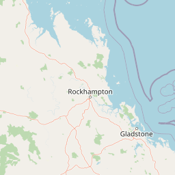
Why Curtis Island National Park stands out
Curtis Island is best known for its distinctive coastal landscapes that combine littoral rainforest with sand dunes, salt flats, and beach ridges along an island shoreline. The Cape Capricorn headland provides a dramatic coastal landmark, while the island's coastal heaths support diverse birdlife in a relatively compact protected area. The park represents a rare example of intact coastal ecosystems on a Queensland island, with the littoral rainforest being a particularly notable feature that thrives in the island's maritime climate. Visitors seeking a remote, undeveloped coastal experience come for the opportunity to camp in this wild island setting with its distinctive combination of dune, forest, and wetland environments.
Curtis Island National Park history and protected-area timeline
Curtis Island National Park was established in 1909, making it one of the earliest national parks in Queensland and reflecting an early recognition of the island's natural significance. The creation of the park coincided with a broader movement in Queensland during the early twentieth century to protect outstanding natural areas, with Curtis Island being recognised for its distinctive coastal landscapes and ecological values. The park's establishment predates modern conservation frameworks and reflects an early appreciation for the island's combination of littoral rainforest, sand dunes, and coastal heath environments. Over the decades, the park has maintained its protected status and relatively undeveloped character, surviving various pressures for more intensive use of the island's resources. The Queensland Parks and Wildlife Service has managed the park throughout its history, maintaining its focus on preserving the island's natural values while providing limited opportunities for public enjoyment through bush camping. The park's long history of protection has allowed its coastal ecosystems to remain largely intact, preserving a window into Queensland's coastal environments as they existed before more intensive development of the coast.
Curtis Island National Park landscape and geographic character
The landscape of Curtis Island National Park is defined by its coastal island setting and the interplay between maritime influences and terrestrial environments. The island features a relatively flat terrain with an average elevation of approximately 16 metres above sea level, creating a low-lying coastal landscape shaped by wind, tide, and historic sea level changes. Sand dunes fringe portions of the island's coastline, sculpted by coastal winds and representing dynamic coastal landforms that continue to evolve. Beach ridges along parts of the island's coast record past sea levels and shoreline positions, creating a series of subtle ridges that traverse the island. Inland, salt flats occupy lower-lying areas where evaporation exceeds rainfall during dry periods, creating distinctive white salt-crusted surfaces that contrast with the surrounding green coastal heaths. The Cape Capricorn headland provides the island's most dramatic topographic feature, a rocky promontory that extends into the Coral Sea and marks a significant geographic landmark on the Queensland coast. The coastal heaths that cover much of the island's interior create a relatively uniform backdrop across which the more specialised habitats of the dunes, salt flats, and littoral rainforest stand out distinctly.
Curtis Island National Park ecosystems, habitats, and plant life
The nature of Curtis Island is characterised by a diversity of coastal habitats compressed into a relatively small island area, creating a mosaic of interconnected ecosystems. The littoral rainforest represents one of the most distinctive habitats, forming a narrow but dense vegetation band along sections of the island's coastline where maritime moisture supports rainforest species that would not survive in the drier inland areas. This coastal forest type creates a dramatic contrast with the surrounding coastal heaths, with species adapted to the salty spray and high humidity of the coastal margin. The coastal heaths that dominate the island's interior support their own distinct plant communities, adapted to the sandy, nutrient-poor soils and the island's climatic conditions. The sand dunes host specialised dune vegetation capable of surviving the challenging conditions of shifting sand, salt spray, and intense sunlight. Salt flats support halophytic plants adapted to high soil salinity, creating a vegetation type quite different from the surrounding areas. This combination of habitats within a small area supports a variety of ecological processes and provides important habitat for numerous species.
Curtis Island National Park wildlife and species highlights
Curtis Island National Park is home to a variety of bird species that inhabit the island's diverse coastal environments. The combination of littoral rainforest, coastal heaths, sand dunes, and salt flats creates a range of bird habitats, with different species favouring different parts of the island. The coastal heath provides foraging and nesting habitat for ground-dwelling bird species, while the rainforest corridor along the coast offers shelter and feeding opportunities for forest-dwelling species. Shorebirds utilise the island's beaches and tidal areas, while the salt flats and dune areas support their own specialised bird communities. The island's position off the Queensland coast places it within migratory bird pathways, and the protected status of the park helps ensure that these bird populations have access to important coastal habitats. While the Wikipedia source notes the presence of a variety of bird species without detailed enumeration, the diverse habitat mosaic of the island clearly supports meaningful bird diversity.
Curtis Island National Park conservation status and protection priorities
Curtis Island National Park represents an important conservation outcome on the Queensland coast, protecting a coastal island environment that includes rare littoral rainforest communities and diverse coastal habitats within a relatively compact protected area. The park's long history since 1909 has allowed these ecosystems to remain largely intact, preserving biological diversity and ecological processes that might otherwise have been degraded by more intensive use. The protection of the island's littoral rainforest is particularly significant, as this habitat type is naturally limited in extent and vulnerable to disturbance. The park also conserves the island's sand dune systems, salt flats, and coastal heaths, representing a holistic approach to protecting an entire coastal island ecosystem rather than individual species or features. The IUCN category II designation reflects the park's primary objective of protecting natural ecosystems while allowing compatible visitor use. The park contributes to Queensland's protected area network, representing coastal and island conservation values that complement the state's terrestrial and marine protected areas.
Curtis Island National Park cultural meaning and human context
Curtis Island sits within the traditional territory of the Gladstone Region, though detailed information about indigenous associations with the island is not prominently featured in the available source material. The broader Gladstone Region on the Queensland coast has a long history of indigenous occupation, with various Aboriginal groups having connections to coastal and island environments throughout the area. The island's name references Captain Curtis, an early European navigator, and the heritage listings on the island including structures such as Sea Hill Light reflect more recent European maritime history. The park's cultural dimension appears to centre primarily on its natural values rather than detailed indigenous heritage documentation, though the island's coastal location would almost certainly have provided resources for traditional owners over thousands of years.
Top sights and standout views in Curtis Island National Park
Curtis Island National Park offers visitors a rare combination of coastal environments protected within a compact island park. The littoral rainforest along the shoreline provides an unusual opportunity to experience this coastal forest type in a relatively accessible location. The Cape Capricorn headland offers a dramatic coastal vantage point with historical significance. The park's three bush camping areas allow visitors to experience the island's wild character firsthand, with no built facilities to interrupt the natural setting. The diversity of coastal environments from sand dunes to salt flats to coastal heaths creates a landscape that rewards exploration and demonstrates how different habitats coexist on a small island. The birdlife supported by these varied habitats adds another dimension to the park's natural appeal.
Best time to visit Curtis Island National Park
The best time to visit Curtis Island National Park is during the cooler, drier months from autumn through early spring, when temperatures are more comfortable for outdoor activities and the likelihood of rain is reduced. The Queensland coast experiences a subtropical climate, and summer months can bring both high temperatures and increased rainfall that may affect visitor comfort and access. The winter months from June to August typically offer the most stable weather conditions, with mild daytime temperatures and lower humidity making camping and exploring more pleasant. Wildlife viewing may also be more productive during these drier months when animals are more active during cooler parts of the day. Visitors should be aware that the island's remote location requires independent planning for supplies and transport, and the lack of facilities means bringing all necessary equipment for a self-sufficient camping experience.