Why Wild Cattle Island National Park stands out
Wild Cattle Island National Park is best known as a coastal island protected area in Queensland's southern coastal region. While smaller than many Australian national parks, it represents an important island conservation example within the state's protected area network. The park's island setting distinguishes it from mainland protected areas, offering a distinct coastal and potentially marine-focused conservation context within the Gladstone region.
Wild Cattle Island National Park history and protected-area timeline
Wild Cattle Island National Park was established in 1992, designated as a national park under Queensland's protected area framework. The creation of this protected area reflected a commitment to preserving the island's natural values within the state's conservation estate. Management responsibility was assigned to the Queensland Parks and Wildlife Service, which continues to oversee the park's protection and administration. The establishment of the park added a small but meaningful island component to Queensland's national park system, particularly within the coastal region near Gladstone.
Wild Cattle Island National Park landscape and geographic character
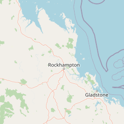
Wild Cattle Island presents a coastal island landscape characterized by its island terrain and proximity to the Queensland mainland. The island's relatively compact 5.8-square-kilometer area encompasses typical coastal island topography including shoreline features, coastal vegetation zones, and potentially interior habitats depending on the island's specific geography. The park's location approximately 25 kilometers southeast of Gladstone places it within a coastal region influenced by subtropical marine conditions. The surrounding marine environment connects to the broader Great Barrier Reef ecosystem region, though the island itself sits within more nearshore waters near Tannum Sands.
Wild Cattle Island National Park ecosystems, habitats, and plant life
As a coastal island protected area in subtropical Queensland, Wild Cattle Island National Park encompasses island-based natural systems including coastal vegetation communities, shoreline habitats, and potentially interior forest or shrubland depending on the island's specific ecological character. The park's island setting creates distinct ecological conditions influenced by marine proximity, salt exposure, and the limited area typical of island environments. Queensland's coastal islands often support specialized plant communities adapted to island conditions, including coastal dune vegetation, beach communities, and inland forest or woodland types. The surrounding marine environment adds another dimension to the park's natural values.
Wild Cattle Island National Park wildlife and species highlights
Wild Cattle Island National Park likely supports coastal and island-adapted wildlife species typical of Queensland's nearshore islands. Coastal islands in this region commonly provide habitat for seabirds, shorebirds, and marine-influenced faunal communities. The island's protected status helps preserve these wildlife values within a conservation context. While specific species details are limited in available sources, the park's coastal island position suggests it serves as important habitat for bird species utilizing coastal and marine environments, as well as any island-dwelling fauna present on the landmass.
Wild Cattle Island National Park conservation status and protection priorities
Wild Cattle Island National Park holds IUCN Category II designation as a national park, reflecting its status as a protected area managed primarily for ecosystem conservation and protection. The park's establishment in 1992 contributed to Queensland's protected area network by preserving a coastal island within the state's conservation estate. The island's relatively small size makes it a focused conservation unit, targeting the preservation of island-specific natural values within the Gladstone coastal region. This protected area contributes to the broader Queensland strategy of maintaining representative examples of diverse landscape types, including coastal island environments.
Wild Cattle Island National Park cultural meaning and human context
No specific cultural heritage information is available for Wild Cattle Island in the source material. The park's cultural context therefore remains unsupported by available documentation, and this field is left null to avoid speculation.
Top sights and standout views in Wild Cattle Island National Park
Wild Cattle Island National Park stands as a small but distinctive coastal island protected area in Queensland's southern coastal region. Its establishment in 1992 added an island conservation component to the state's national park system near Gladstone. The park protects approximately 5.8 square kilometers of island terrain within a coastal marine context. As an IUCN Category II protected area, it represents formal recognition of the island's natural values and contributes to Queensland's protected area coverage across diverse landscape types including coastal island environments.
Best time to visit Wild Cattle Island National Park
Visitors to Wild Cattle Island National Park would typically consider Queensland's subtropical climate when planning trips. The region's warm temperatures and seasonal rainfall patterns influence visitor conditions throughout the year. Generally, the cooler winter months from May to September offer more comfortable conditions for outdoor activities in Queensland's coastal areas, while summer months from November to March bring warmer temperatures and higher rainfall. The park's island setting and coastal position mean that weather conditions can include coastal breezes and typical Queensland weather patterns. Visitors seeking to explore the island should consider seasonal factors appropriate to the Gladstone region's subtropical coastal environment.