Mori Atlas logo
National parkCapricorn Coast National Park

Understanding the geographic context and park boundaries within Shire of Livingstone.

Capricorn Coast National Park: Detailed Map and Protected Landscape Geography

Capricorn Coast National Park represents a significant protected area within Australia's national park system, situated within the Shire of Livingstone. This page serves as an atlas entry, offering detailed geographic information, mapped boundaries, and an understanding of its landscape context. Discover the regional geography that defines this protected natural landscape, providing essential context for map-based exploration and conservation understanding.

Coastal Protected AreasQueensland National ParksVolcanic LandscapesHeadlands and CliffsAustralian BiodiversityIUCN Category II

Capricorn Coast National Park

National park

Park overview

Structured park overview, official facts, and landscape profile for Capricorn Coast National Park

Capricorn Coast National Park park facts, protected area profile, and essential visitor context
Review the core facts for Capricorn Coast National Park, including designation, size, terrain, visitor scale, habitats, and operating context in one park-focused overview.

About Capricorn Coast National Park

Capricorn Coast National Park protects a ecologically important stretch of Queensland's central coastline, preserving the rugged headland landscape that defines this portion of the Capricorn Coast. The park's territory extends across multiple discrete sections that collectively form a discontinuous but cohesive protected corridor along the shoreline, with each section characterized by distinctive geological features, vegetation communities, and coastal configurations. The volcanic origin of the landscape is evident in the rocky headlands, exposed cliff faces, and resistant rock formations that punctuate the coastline. These geological features create a range of microhabitats that support diverse plant and animal communities, from coastal scrub vegetation on the cliff tops to specialized species adapted to the harsh coastal environment. The park's location within the Shire of Livingstone places it in a region where coastal development has accelerated in recent decades, making the protected status of these lands increasingly significant for maintaining ecological connectivity and preserving natural coastal character. Management by Queensland Parks and Wildlife Service ensures ongoing protection of the park's natural values while providing limited public access to appreciate this distinctive coastal landscape.

Quick facts and research context for Capricorn Coast National Park

Capricorn Coast National Park occupies a narrow coastal strip along the Capricorn Coast in central Queensland, Australia, approximately 535 kilometers north of Brisbane. The park was formally established in 1992 and consolidated in 1994 when five separate coastal sections were amalgamated into a single protected area spanning 114 hectares. The terrain is dominated by low but rugged headlands and volcanic-derived landforms, with an average elevation of around 34 meters above sea level. The park is managed by the Queensland Parks and Wildlife Service and is classified as an IUCN Category II protected area, reflecting its national park status. Its biodiversity is notably concentrated for its size, with over 400 animal species recorded including 24 rare or endangered species, making it ecologically significant within the central Queensland coastal zone.

Park context

Deeper park guide and search-rich context for Capricorn Coast National Park

Capricorn Coast National Park history, landscape, wildlife, and travel context
Explore Capricorn Coast National Park through its history, landscape character, ecosystems, wildlife, conservation priorities, cultural context, and seasonal travel timing in a structured park guide built for atlas discovery and search intent.

Why Capricorn Coast National Park stands out

Capricorn Coast National Park is distinguished primarily by its dramatic coastal landscape of weathered headlands, exposed volcanic rock formations, and steep cliffs that define the Capricorn Coastline. The Double Head section exemplifies the park's geological character, featuring prominent trachyte plugs and rocky promontories that rise abruptly from the Coral Sea. These volcanic remnants represent ancient igneous intrusions that have been carved by millions of years of erosion into the distinctive formations visible today. Beyond its geological significance, the park is recognized for the surprising density of biodiversity it supports within its relatively modest 114-hectare boundary, including numerous rare and endangered species that inhabit the coastal scrub, cliff faces, and adjacent marine environments. The park also serves as an important coastal green corridor within a region increasingly affected by development pressure.

Capricorn Coast National Park history and protected-area timeline

Capricorn Coast National Park was officially established in 1992 as a protected area under Queensland's national park system. The creation of the park represented the culmination of conservation efforts to preserve the distinctive coastal landscape and ecological values of the Capricorn Coast region. In 1994, the park was expanded through the amalgamation of five previously separate sections into a single unified national park entity. These sections, including Vallis Park, Rosslyn Head, Double Head, Bluff Point, Cocoanut Point, and Pinnacle Point, had previously existed as smaller protected reserves or unprotected coastal areas. The consolidation into a single national park enhanced administrative efficiency and strengthened the coherent management of the coastal corridor as an integrated conservation unit. The park was assigned IUCN Category II status, reflecting its classification as a national park with the primary objectives of protecting natural ecosystems while allowing for limited public enjoyment and environmental education. Management responsibility was delegated to the Queensland Parks and Wildlife Service, which continues to oversee conservation activities, visitor management, and ecological monitoring within the park boundaries.

Capricorn Coast National Park landscape and geographic character

The landscape of Capricorn Coast National Park is defined by a series of dramatic coastal headlands that project into the Coral Sea, creating a rugged and visually striking shoreline characteristic of central Queensland's Capricorn Coast. The terrain consists of low but steep-sided volcanic ridges and rocky promontories that average approximately 34 meters in elevation, with the highest points offering sweeping views along the coast and out to sea. The park's five sections each display slightly different landscape expressions, from the Double Head area with its prominent trachyte rock formations to the more gradual slopes of Vallis Park. Rocky cliffs and steep-sided valleys dissect the headlands, while the interface between land and sea features small coves, rocky platforms, and exposed shore sections. The underlying volcanic geology, primarily composed of resistant igneous rocks, has produced a landscape of considerable topographic variation despite its limited total area. Vegetation cover varies across the park, with coastal scrub and woodland communities occupying the cliff tops and slopes, creating a green backdrop that contrasts with the grey-brown of exposed rock faces and the blue of adjacent waters.

Capricorn Coast National Park ecosystems, habitats, and plant life

The nature of Capricorn Coast National Park centers on its role as a coastal conservation area protecting representative examples of central Queensland's coastal ecosystems. The park's vegetation communities reflect the subtropical climate and coastal environment, with species adapted to salt-laden winds, periodic drought, and the nutrient-poor soils typical of ancient volcanic substrates. The various headland sections support different vegetation associations depending on aspect, slope, and microclimate, creating a mosaic of coastal habitats within the relatively small park boundary. The park's biodiversity is particularly notable given its limited size, with 402 animal species documented within its boundaries. This species count includes representatives from multiple taxonomic groups and trophic levels, reflecting the diverse microhabitats created by the park's complex terrain of cliffs, slopes, rock outcrops, and coastal scrub. The presence of 24 rare or endangered species within the park underscores its conservation significance, as these species depend on the protected coastal habitats for their continued survival. The marine environment adjacent to the park also contributes to its ecological value, with coastal waters supporting additional species and ecological processes that interact with the terrestrial ecosystem.

Capricorn Coast National Park wildlife and species highlights

The wildlife of Capricorn Coast National Park reflects the park's position at the interface between terrestrial and marine environments along Queensland's central coast. Over 400 animal species have been recorded within the park, a remarkable diversity for a protected area of only 114 hectares. This richness is attributable to the variety of habitats provided by the complex terrain, including cliff faces, rocky outcrops, coastal scrub, and the过渡 zone between land and sea. Of particular conservation significance is the presence of 24 species classified as rare or endangered, indicating the park's important role in protecting threatened wildlife populations. These may include bird species that utilize the coastal cliffs for nesting, reptiles adapted to the rocky headland environment, and invertebrate species with highly restricted distributions. The coastal location also positions the park along migratory flyways for seabirds and shorebirds, adding seasonal dimensions to the wildlife assemblage. While the Wikipedia source provides species counts rather than detailed species lists, the figures indicate that the park supports a biologically significant community that benefits from protection within the national park boundary.

Capricorn Coast National Park conservation status and protection priorities

Capricorn Coast National Park represents an important conservation outcome for Queensland's coastal zone, protecting a representative sample of the Capricorn Coast's natural values within a formal national park framework. The park's designation as an IUCN Category II protected area reflects its primary conservation purpose of preserving natural ecosystems while allowing for compatible public use. The aggregation of multiple coastal sections into a single unified protected area in 1994 enhanced the ecological coherence of the reserve, creating a more effective conservation corridor along the coastline. The remarkable concentration of biodiversity within the park's boundaries, with over 400 species including 24 rare or endangered species, demonstrates the conservation significance of this relatively small coastal reserve. In a region experiencing ongoing development pressure from coastal urbanization and associated infrastructure, protected areas like Capricorn Coast National Park play a critical role in maintaining ecological connectivity and preserving natural coastal character. The park also contributes to the broader network of protected areas along Queensland's coast, supporting regional biodiversity conservation objectives and representing a commitment to preserving natural heritage for future generations.

Capricorn Coast National Park cultural meaning and human context

Capricorn Coast National Park occupies a section of the Queensland coastline that falls within the traditional lands of Aboriginal peoples with ongoing cultural connections to the region. The park's coastal headlands, rocky outcrops, and associated marine environments would have held significance for Indigenous communities historically, with the landscape providing resources, cultural values, and spiritual connections. While the Wikipedia source does not detail specific Indigenous heritage values for this park, the broader Capricorn Coast region contains areas of Aboriginal cultural significance, and many Queensland coastal national parks incorporate Indigenous heritage considerations into their management frameworks. The park's location within the Shire of Livingstone places it in a region of central Queensland that has experienced European settlement since the nineteenth century, with coastal development accelerating more recently. The establishment of the national park in 1992 represented a recognition of the natural values of this coastline and a commitment to preserving them within a protected area framework, providing an alternative to continued private development of the headland sections.

Top sights and standout views in Capricorn Coast National Park

Capricorn Coast National Park offers visitors the opportunity to experience the dramatic coastal landscape of central Queensland, with its distinctive volcanic headlands, exposed rock formations, and panoramic ocean views. The Double Head section exemplifies the park's geological character, featuring prominent rock formations that rise from the sea and provide visual landmarks along this section of coastline. The park's biodiversity, though not always visible at first glance, represents one of its most significant values, with over 400 species including 24 rare or endangered animals supported within the 114-hectare boundary. The series of five separate sections along the coast provides different visual experiences and vegetation communities, while collectively forming a coherent protected corridor. The park's proximity to the town of Yeppoon and the broader Capricorn region makes it accessible for day visitors interested in experiencing Queensland's coastal natural heritage without extensive travel. The relatively modest scale of the park encourages exploration of multiple sections, each offering distinctive perspectives on the Capricorn Coast landscape.

Best time to visit Capricorn Coast National Park

The best time to visit Capricorn Coast National Park aligns with Queensland's subtropical climate patterns, with the cooler winter months from May through September typically offering more comfortable conditions for outdoor exploration. During these months, temperatures are moderate and rainfall is reduced compared to the summer wet season, making this period generally favorable for walking and landscape appreciation. Summer months from December to February bring higher temperatures and increased rainfall, though the coastal location benefits from sea breezes that can moderate conditions. The park can be visited year-round, though visitors should be aware that summer storms and associated closures may occur. Wildlife viewing opportunities may vary seasonally, with migratory bird species potentially present during different times of year. The park's relatively compact size allows for flexible visiting, though early morning visits offer the best light for photography and increased likelihood of wildlife activity. Visitors should check current conditions with Queensland Parks and Wildlife Service before traveling, as park status and access may change.

Park location guide

Geography guide, regional context, and park location map for Capricorn Coast National Park

Capricorn Coast National Park park geography, regions, and map view in Australia
Understand where Capricorn Coast National Park sits in Australia through a broader geographic reading of the surrounding landscape, nearby location context, and its mapped position within the national park landscape.

How Capricorn Coast National Park fits into Australia

Australia is a constitutional monarchy and federal parliamentary democracy comprising six states and ten territories. With a population of nearly 28 million, it is one of the world's most urbanised countries, with most people concentrated on the eastern seaboard. The country has a high Human Development Index and is known for its cultural diversity, ancient Aboriginal heritage, and unique wildlife.

Wider geography shaping Capricorn Coast National Park in Australia

Australia occupies the entire Australian continent, the island of Tasmania, and numerous smaller islands. It is the world's flattest and driest inhabited continent, featuring vast deserts in the interior (the Outback), tropical rainforests along the eastern coast, and a coastline bordering the Indian and Pacific Oceans.

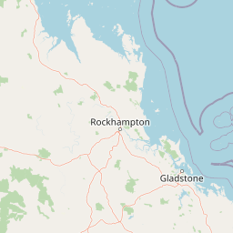
Map view of Capricorn Coast National Park

Use this park location map to pinpoint Capricorn Coast National Park in Australia, understand its exact geographic position, and read its mapped placement within the surrounding landscape more clearly.

Pigeon | © OpenStreetMap contributors

Location context for Capricorn Coast National Park

QueenslandShire of Livingstone
Park atlas

Explore the surrounding protected areas and coastal landscapes, comparing the geology and biodiversity near Capricorn Coast National Park in central Queensland.

Discover Other National Parks and Coastal Protected Areas Near Capricorn Coast National Park
Browse national parks and other protected areas situated near Capricorn Coast National Park, focusing on Queensland's distinctive coastal geography and inland conservation landscapes. Comparing these regional parks offers valuable geographic context, revealing how diverse protected landscapes contribute to the ecological richness of central Queensland.
National parkQueensland

Baga National Park: Unique Volcanic Geography and Protected Landscape in Queensland

Mapped terrain and protected area identity for a distinctive national park.

Baga National Park stands as a notable protected area in central Queensland, Australia, centered around the striking Mount Baga, a trachyte volcanic plug. This geological marvel offers a unique landscape context, showcasing the remnants of ancient volcanic activity within the regional geography. As a national park, it serves to preserve this distinctive natural feature and its associated habitats, providing a compact yet significant destination for atlas-based discovery of Queensland's diverse protected lands.

Area
1.44 km²
Established
1977
IUCN
II
Relief
Mountain
National parkQueensland

Keppel Bay Islands National Park: Queensland's Coastal National Park and Archipelago Discovery

Explore protected islands, mapped coral reefs, and marine ecosystems.

Delve into the geographic identity of Keppel Bay Islands National Park, a significant protected area comprising thirteen islands off the coast of Queensland. This national park showcases a dynamic coastal landscape, featuring distinct island terrains, diverse marine life, and essential coral reef systems. Through its mapped boundaries and conservation focus, the park offers a unique lens for understanding island geography and the importance of marine protected areas within the broader Australian atlas.

Area
7.2 km²
Established
1994
IUCN
II
Relief
Lowland
Watercolor illustration showing a landscape with hills, trees, and distant mountains under a light sky
National parkQueensland

Mount Etna Caves National Park: Queensland National Park Protected Landscape and Map

Explore the geographic boundaries and natural terrain of this Australian park.

Mount Etna Caves National Park is a protected national park located in Queensland, Australia. This page facilitates an atlas-style discovery of its geographic features and mapped boundaries. Understand how this protected landscape contributes to the regional geography of northeastern Australia, providing essential context for cartographic and geographic exploration.

Area
4.78 km²
Established
1994
IUCN
II
Relief
Lowland
National parkQueensland

Mount Archer National Park: Queensland National Park Geography and Protected Landscape

Mapped boundaries and regional terrain discovery in northeastern Australia.

Mount Archer National Park is a designated national park contributing to the protected landscape mosaic of Queensland, Australia. This entry provides a focused look at its geographic attributes, mapped outlines, and its significance within the state's natural geography. Users exploring this protected area can gain insight into its specific landform characteristics and its role within the structured discovery offered by MoriAtlas for understanding Australia's conservation network.

Area
36.1 km²
Established
1994
IUCN
II
Relief
Mountain
National parkQueensland

Byfield National Park: Protected National Park with Coastal Dune Ecosystems in Queensland

Explore its mapped landscape and unique pandanus forests.

Byfield National Park presents a compelling case study in coastal protected-area geography, showcasing a diverse landscape where dune systems meet extensive pandanus forests across 12 kilometers of Queensland coastline. This national park, established in 1988, provides a unique glimpse into the ecological transition zone between tropical savanna and subtropical climates, offering a richly detailed environment for map-based exploration. Its relatively undeveloped terrain and distinct ecosystems make it a valuable entity for understanding regional Australian natural landscapes and conservation efforts.

Area
87 km²
Established
1988
IUCN
II
Relief
Lowland
National parkQueensland

Rundle Range National Park: Queensland's National Park Protected Landscape Exploration

Explore its mapped boundaries and regional geographic context.

Delve into the protected landscape of Rundle Range National Park, a designated national park situated within Queensland, Australia. This entry provides focused insights into its geographic setting, mapped park boundaries, and its significance as a protected area. It is designed to aid in understanding the park's specific natural context and its place within the broader Queensland regional geography for detailed atlas discovery.

Area
21.7 km²
Established
1993
IUCN
II
Scope
Terrestrial
National parkQueensland

Curtis Island National Park: National Park Protected Area in Queensland, Australia

Explore its mapped landscape and regional geography.

Curtis Island National Park is a designated national park offering a distinct protected landscape within Queensland, Australia. This atlas-focused entry details its geographic setting and mapped boundaries, providing essential context for understanding its place within the natural terrain of northeastern Australia. It serves as a key reference for exploring the park's specific regional geography and protected-area identity.

Area
15.5 km²
Established
1909
IUCN
II
Relief
Lowland
National parkQueensland

Mount O'Connell National Park: Queensland National Park, Protected Landscape, and Geographic Context

Discover the mapped terrain and regional boundaries within Queensland's natural geography.

Delve into Mount O'Connell National Park, a protected area offering critical insights into Queensland's regional geography and natural landscapes. This national park serves as a vital point for understanding mapped boundaries and the specific protected-area characteristics that define its identity. Users can explore its geographic context within Queensland, providing a solid foundation for atlas-driven discovery and detailed landscape analysis.

Area
7.57 km²
Established
1989
IUCN
II
Relief
Mixed relief

Common questions about visiting, size, designation, and location context for Capricorn Coast National Park

Capricorn Coast National Park FAQs for park facts, access, geography, and protected area context
Find quick answers about Capricorn Coast National Park, including protected-area facts, park geography, trail and visitor context, and how the park fits into its surrounding country and regional landscape.
MoriAtlas Explorer

Continue Your Protected Areas Search Across the Global Atlas

Deepen your exploration by continuing the structured search for national parks and protected areas worldwide. Utilize the comprehensive filtering capabilities to compare different conservation landscapes and refine your understanding of global park geography. Discover more about the distribution and characteristics of protected natural areas.

Global natural geography