Mori Atlas logo
National parkMount Archer National Park

Discover the mapped boundaries and natural terrain of this key Australian national park.

Mount Archer National Park: Explore Protected Landscape and Regional Geography in Queensland

Mount Archer National Park stands as a distinct protected area within Queensland, Australia, offering a valuable point of reference for geographic discovery. This page focuses on detailing the park's specific protected landscape identity, its mapped boundaries, and its integration into the broader regional geography of northeastern Australia. Engage with the atlas-style context that reveals Mount Archer National Park's place within Queensland's diverse natural terrain and conservation network.

Eucalypt WoodlandVolcanic PeaksCentral QueenslandBirdwatchingBushwalkingRock Climbing

Mount Archer National Park

National park

Park overview

Structured park overview, official facts, and landscape profile for Mount Archer National Park

Mount Archer National Park park facts, protected area profile, and essential visitor context
Review the core facts for Mount Archer National Park, including designation, size, terrain, visitor scale, habitats, and operating context in one park-focused overview.

About Mount Archer National Park

Mount Archer National Park occupies a significant position in Central Queensland's protected area network, serving both ecological and recreational functions for the Rockhampton region. The park's landscape is dominated by open eucalypt woodland, a characteristic vegetation type of eastern Australia, with patches of vine scrub adding ecological complexity and diversity to the plant communities. The volcanic origin of Mount Archer has shaped the terrain, creating ridges, rocky outcrops and slopes that contribute to the park's scenic character. Being relatively close to Rockhampton, the park provides residents and visitors with accessible wilderness experiences, including bushwalking along trails that lead to the summit and rock climbing opportunities on the mountain's granite formations. The park's establishment in 1994 represented the culmination of decades of changing land use, transitioning from a water and timber reserve through to a protected environmental park before achieving full national park status.

Quick facts and research context for Mount Archer National Park

Mount Archer National Park encompasses 4,250 hectares of protected land in Central Queensland, Australia. The park's defining feature is Mount Archer, a 604-metre volcanic peak that provides panoramic views over Rockhampton and the surrounding region. The area was first explored by the Archer brothers in 1853 and subsequently named after them. Following a history as a water reserve (1898) and timber reserve (1940), with grazing activities continuing until 1985, the land was transferred to environmental park status in 1987 before achieving national park designation in 1994. The Queensland Parks and Wildlife Service manages the park, which supports significant biodiversity within its eucalypt woodland and vine scrub habitats.

Park context

Deeper park guide and search-rich context for Mount Archer National Park

Mount Archer National Park history, landscape, wildlife, and travel context
Explore Mount Archer National Park through its history, landscape character, ecosystems, wildlife, conservation priorities, cultural context, and seasonal travel timing in a structured park guide built for atlas discovery and search intent.

Why Mount Archer National Park stands out

Mount Archer National Park is best known for its distinctive eucalypt woodland landscapes and the dramatic volcanic peak that gives the park its name. The park offers visitors the opportunity to climb to the summit of Mount Archer, where sweeping views over Rockhampton and the Capricorn Coast reveal themselves. The protected area serves as an important habitat for several notable bird species, including the powerful owl and the glossy black cockatoo, both of which inhabit the woodland and forest environments. The combination of accessible summit trails, rock climbing opportunities, and the park's role as a green recreational space adjacent to a major regional city makes it a distinctive Queensland protected area.

Mount Archer National Park history and protected-area timeline

The European history of Mount Archer National Park began in 1853 when the area was explored by the Archer brothers, after whom the prominent peak was subsequently named. The land's practical importance was recognized early, leading to its formal reservation as a water reserve in 1898, reflecting the significance of the mountain's water-catchment function for the developing Rockhampton region. In 1940, the area received additional protection as a timber reserve, recognizing its forest resources. Grazing activities continued on the land until 1985, marking a significant transition point in the area's management trajectory. The following years saw the Queensland Parks and Wildlife Service assume supervisory responsibility, and in 1987 the land was reclassified as an environmental park. This progressive upgrade in protection status culminated in 1994 when Mount Archer was formally declared a national park, providing the highest level of conservation protection under Queensland's protected area framework.

Mount Archer National Park landscape and geographic character

The landscape of Mount Archer National Park is defined by its central volcanic peak, Mount Archer, which rises dramatically from the surrounding terrain to an elevation of 604 metres above sea level. The mountain's volcanic origins are evident in its rocky granite outcrops, ridges and boulder-strewn slopes that create varied topography throughout the park. The surrounding lower slopes and valleys support open forests and woodlands that extend across the 36.1-square-kilometre park area. The eucalypt woodland, characterized by tall trees with open canopy, allows sunlight to reach the forest floor, supporting a diverse understorey of shrubs, grasses and groundcovers. Patches of vine scrub add to the landscape diversity, occurring in more sheltered locations and providing denser vegetation cover. The combination of the prominent peak, the woodland-covered slopes and the rocky exposures creates a landscape of considerable scenic value, particularly when viewed from Rockhampton below.

Mount Archer National Park ecosystems, habitats, and plant life

The natural environment of Mount Archer National Park centres on its eucalypt woodland ecosystem, which represents a widespread but ecologically important habitat type across eastern Australia. The open woodland canopy, dominated by various eucalypt species, creates conditions suitable for a range of wildlife species, from ground-dwelling mammals and reptiles to numerous bird species. The patches of vine scrub within the park add ecological diversity, providing more dense vegetation cover that benefits species requiring sheltered habitats. These vine thickets often contain different plant species composition compared to the surrounding woodland, adding to the overall biodiversity of the protected area. The park's position in Central Queensland places it within a transition zone between tropical and temperate ecological influences, contributing to its distinctive character.

Mount Archer National Park wildlife and species highlights

Mount Archer National Park supports a diversity of bird species within its eucalypt woodland habitats. The powerful owl, a large and impressive raptor, inhabits the forest canopy and represents a significant species for birdwatchers visiting the park. The glossy black cockatoo, a distinctive Australian parrot species, can be found foraging through the woodlands, feeding on seeds of various trees and shrubs. The rufous shrikethrush and white-browed scrubwren are common woodland bird species that inhabit the understorey and forest edges. These bird species represent just a portion of the avifauna that depends on the park's protected woodland habitats. The combination of mature trees for nesting, diverse foraging resources and protected status makes the park an important refuge for woodland birds in the Rockhampton region.

Mount Archer National Park conservation status and protection priorities

Mount Archer National Park represents an important conservation outcome in Central Queensland, protecting a representative sample of eucalypt woodland and volcanic peak landscape that would otherwise face development pressure. The park's declaration in 1994 followed decades of evolving land use that gradually shifted from resource extraction towards conservation. The protection of Mount Archer and its surrounding woodlands ensures the preservation of habitat for species including the powerful owl and glossy black cockatoo, both of which face population pressures in many parts of their range. The park also protects important water catchment values that were recognized as early as 1898 when the area was first set aside as a water reserve. The transition from timber reserve and grazing land to full national park protection demonstrates the conservation value that the area holds.

Mount Archer National Park cultural meaning and human context

Mount Archer National Park holds deep significance for the Darumbal people, specifically the Raki-warra clan, whose traditional country encompasses this landscape. The mountain and surrounding terrain has been part of Indigenous cultural landscape for thousands of years, with the Darumbal people maintaining connection to Country through ongoing cultural practices and knowledge. This Indigenous heritage adds an important cultural dimension to the park's values, complementing its natural and recreational significance. European settlement history also contributed to the area's identity, with the exploration by the Archer brothers in 1853 and subsequent naming of the mountain creating the enduring association with this pioneering family that remains in the park's name today.

Top sights and standout views in Mount Archer National Park

Mount Archer National Park offers visitors the chance to ascend to the summit of Mount Archer via walking trails, reaching elevated vantage points with sweeping views over Rockhampton and the broader Capricorn region. The park provides accessible bushwalking experiences suitable for various fitness levels, with trails winding through eucalypt woodland and past interesting rock formations. Rock climbing opportunities exist on the mountain's granite surfaces, attracting climbers seeking to explore the vertical terrain. The birdlife, particularly sightings of the powerful owl and glossy black cockatoo, draw nature enthusiasts to the park. The proximity to Rockhampton makes this protected area a convenient escape into nature for residents of the regional city.

Best time to visit Mount Archer National Park

Mount Archer National Park can be visited throughout the year, though the cooler months from April to September typically offer more comfortable conditions for hiking and outdoor activities. Summer months in Central Queensland can bring high temperatures and humidity, making midday activities less pleasant. The winter dry season generally provides clearer skies and more stable weather, suitable for summit walks and rock climbing. Visitors should be aware that the park's popularity can increase on weekends and public holidays, particularly during favourable weather conditions. Regardless of season, visitors should carry adequate water and sun protection when exploring the park's trails and summit areas.

Park location guide

Geography guide, regional context, and park location map for Mount Archer National Park

Mount Archer National Park park geography, regions, and map view in Australia
Understand where Mount Archer National Park sits in Australia through a broader geographic reading of the surrounding landscape, nearby location context, and its mapped position within the national park landscape.

How Mount Archer National Park fits into Australia

Australia is a constitutional monarchy and federal parliamentary democracy comprising six states and ten territories. With a population of nearly 28 million, it is one of the world's most urbanised countries, with most people concentrated on the eastern seaboard. The country has a high Human Development Index and is known for its cultural diversity, ancient Aboriginal heritage, and unique wildlife.

Wider geography shaping Mount Archer National Park in Australia

Australia occupies the entire Australian continent, the island of Tasmania, and numerous smaller islands. It is the world's flattest and driest inhabited continent, featuring vast deserts in the interior (the Outback), tropical rainforests along the eastern coast, and a coastline bordering the Indian and Pacific Oceans.

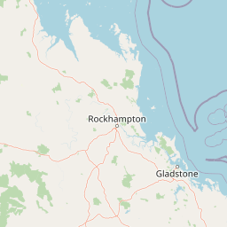
Map view of Mount Archer National Park

Use this park location map to pinpoint Mount Archer National Park in Australia, understand its exact geographic position, and read its mapped placement within the surrounding landscape more clearly.

Pigeon | © OpenStreetMap contributors

Location context for Mount Archer National Park

Queensland
Park atlas

Explore diverse Central Queensland protected landscapes, comparing mountain parks, woodlands, and regional conservation areas.

Discover More National Parks and Protected Areas Near Mount Archer National Park
After exploring Mount Archer National Park, browse other protected areas within Central Queensland, tracing their geographic spread and landscape features from volcanic peaks to eucalypt woodlands. Compare adjacent national parks and conservation reserves to understand the broader regional context of protected landscapes and the unique ecological patterns across this Australian territory.
National parkQueensland

Baga National Park: Unique Volcanic Geography and Protected Landscape in Queensland

Mapped terrain and protected area identity for a distinctive national park.

Baga National Park stands as a notable protected area in central Queensland, Australia, centered around the striking Mount Baga, a trachyte volcanic plug. This geological marvel offers a unique landscape context, showcasing the remnants of ancient volcanic activity within the regional geography. As a national park, it serves to preserve this distinctive natural feature and its associated habitats, providing a compact yet significant destination for atlas-based discovery of Queensland's diverse protected lands.

Area
1.44 km²
Established
1977
IUCN
II
Relief
Mountain
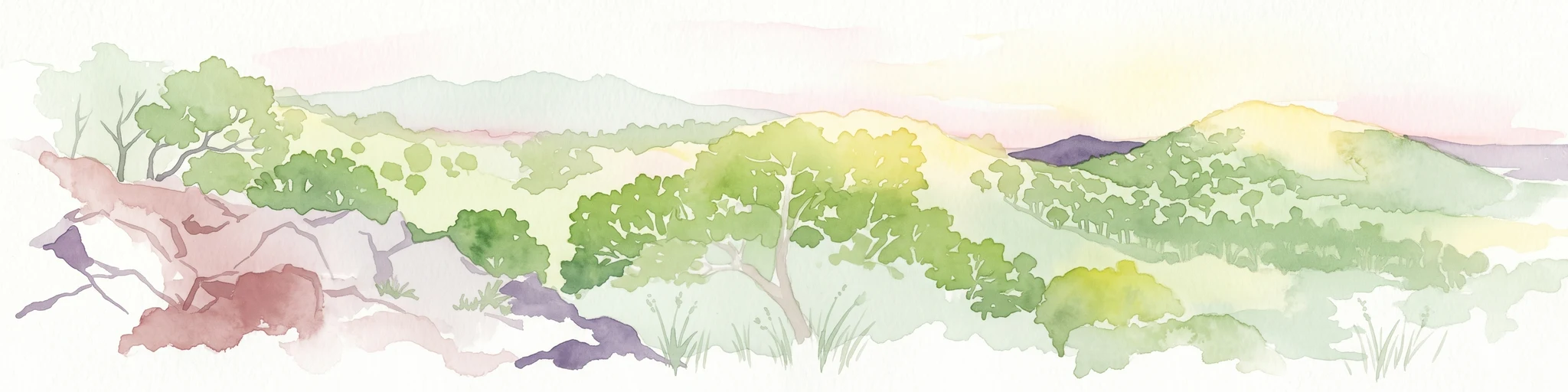
Watercolor illustration showing a landscape with hills, trees, and distant mountains under a light sky
National parkQueensland

Mount Etna Caves National Park: Queensland National Park Protected Landscape and Map

Explore the geographic boundaries and natural terrain of this Australian park.

Mount Etna Caves National Park is a protected national park located in Queensland, Australia. This page facilitates an atlas-style discovery of its geographic features and mapped boundaries. Understand how this protected landscape contributes to the regional geography of northeastern Australia, providing essential context for cartographic and geographic exploration.

Area
4.78 km²
Established
1994
IUCN
II
Relief
Lowland
National parkShire of Livingstone

Capricorn Coast National Park: Mapped Protected Area and Regional Geography

Explore its geographic setting within Shire of Livingstone.

Capricorn Coast National Park is a key protected landscape offering significant geographic detail for atlas exploration. Situated within the Shire of Livingstone, this national park's mapped boundaries and regional context are crucial for understanding its role as a protected natural area. Delve into the specific geography that shapes this Australian park and its contribution to conservation landscapes.

Area
1.14 km²
Established
1992
IUCN
II
Relief
Lowland
National parkQueensland

Keppel Bay Islands National Park: Queensland's Coastal National Park and Archipelago Discovery

Explore protected islands, mapped coral reefs, and marine ecosystems.

Delve into the geographic identity of Keppel Bay Islands National Park, a significant protected area comprising thirteen islands off the coast of Queensland. This national park showcases a dynamic coastal landscape, featuring distinct island terrains, diverse marine life, and essential coral reef systems. Through its mapped boundaries and conservation focus, the park offers a unique lens for understanding island geography and the importance of marine protected areas within the broader Australian atlas.

Area
7.2 km²
Established
1994
IUCN
II
Relief
Lowland
National parkQueensland

Rundle Range National Park: Queensland's National Park Protected Landscape Exploration

Explore its mapped boundaries and regional geographic context.

Delve into the protected landscape of Rundle Range National Park, a designated national park situated within Queensland, Australia. This entry provides focused insights into its geographic setting, mapped park boundaries, and its significance as a protected area. It is designed to aid in understanding the park's specific natural context and its place within the broader Queensland regional geography for detailed atlas discovery.

Area
21.7 km²
Established
1993
IUCN
II
Scope
Terrestrial
National parkQueensland

Byfield National Park: Protected National Park with Coastal Dune Ecosystems in Queensland

Explore its mapped landscape and unique pandanus forests.

Byfield National Park presents a compelling case study in coastal protected-area geography, showcasing a diverse landscape where dune systems meet extensive pandanus forests across 12 kilometers of Queensland coastline. This national park, established in 1988, provides a unique glimpse into the ecological transition zone between tropical savanna and subtropical climates, offering a richly detailed environment for map-based exploration. Its relatively undeveloped terrain and distinct ecosystems make it a valuable entity for understanding regional Australian natural landscapes and conservation efforts.

Area
87 km²
Established
1988
IUCN
II
Relief
Lowland
National parkQueensland

Curtis Island National Park: National Park Protected Area in Queensland, Australia

Explore its mapped landscape and regional geography.

Curtis Island National Park is a designated national park offering a distinct protected landscape within Queensland, Australia. This atlas-focused entry details its geographic setting and mapped boundaries, providing essential context for understanding its place within the natural terrain of northeastern Australia. It serves as a key reference for exploring the park's specific regional geography and protected-area identity.

Area
15.5 km²
Established
1909
IUCN
II
Relief
Lowland
National parkQueensland

Goodedulla National Park: Queensland National Park Atlas and Geographic Exploration

Discover its mapped protected area and landscape context.

Goodedulla National Park is a designated national park in Queensland, Australia, offering a focused entry point for atlas exploration of protected landscapes. Understand its specific geographic scope, mapped boundaries, and how it fits within the natural and regional context of Queensland. This resource is tailored for users interested in the detailed geography and protected-area data of Australia's natural landscapes.

Area
255 km²
Established
1994
IUCN
II
Relief
Lowland

Common questions about visiting, size, designation, and location context for Mount Archer National Park

Mount Archer National Park FAQs for park facts, access, geography, and protected area context
Find quick answers about Mount Archer National Park, including protected-area facts, park geography, trail and visitor context, and how the park fits into its surrounding country and regional landscape.
MoriAtlas Explorer

Continue Your Protected Areas Search Across the Global Atlas

Deepen your exploration by continuing the structured search for national parks and protected areas worldwide. Utilize the comprehensive filtering capabilities to compare different conservation landscapes and refine your understanding of global park geography. Discover more about the distribution and characteristics of protected natural areas.

Global natural geography