Mori Atlas logo
Park earthquake history

Examine a curated collection of seismic events documented in the proximity of this protected river gorge.

Historical Earthquake Records and Seismic Data for Defileul Jiului National Park in Romania

This historical catalogue provides a structured overview of seismic activity documented within the geographic surroundings of Defileul Jiului National Park. Each record includes specific details such as magnitude, depth, and epicentre distance from the park boundaries, sourced from established geological datasets. By mapping these events, observers gain insight into the regional seismic history of the Jiu Valley without implying causation or future hazard.

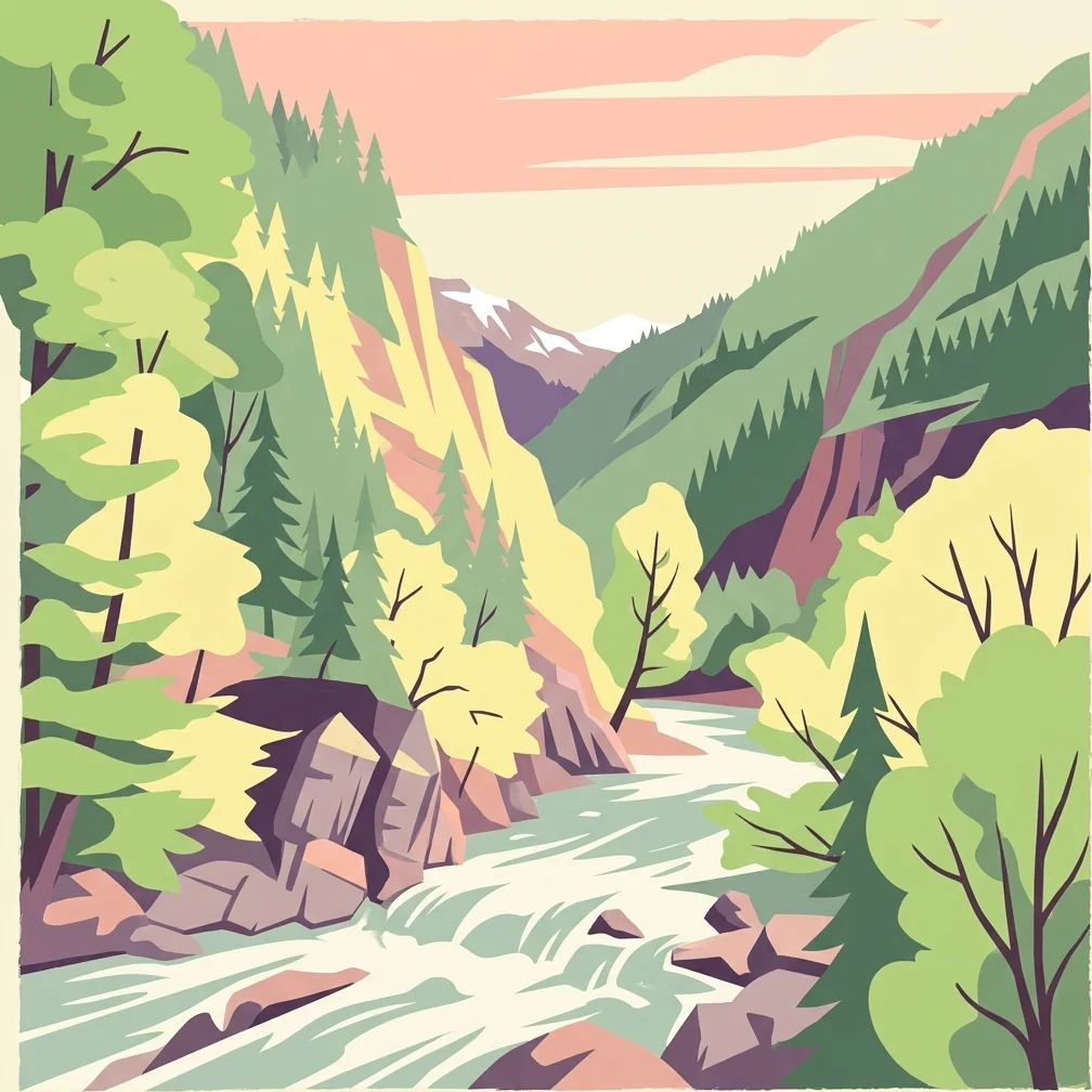
Illustration of a river flowing through rocky mountains with dense forests

Carpathian river gorge preserving mountain ecosystems in southern Romania

Defileul Jiului National Park

Defileul Jiului National Park is a protected natural area in southern Romania, established in 2005 through Government Decision Number 1581. The park occupies a dramatic river gorge carved by the Jiu River as it winds between the Vâlcan Mountains and the Parâng Mountains, both subrange formations within the broader Southern Carpathians. The national park spans approximately 11,127 hectares across the northern part of Gorj County, with a small portion extending into Hunedoara County. This protected landscape represents a significant ecological corridor within Romania's mountain park network, sheltering diverse flora and fauna within its steep-sided valley and adjacent forested slopes. The park's setting along the historic Jiu Valley places it in a region of both natural and industrial heritage, with the former mining city of Petroșani serving as the nearest urban center.

Location
Romania
Park type
National park
Established
2005
Area
111.3 km²
Defileul Jiului National Park Protected Landscape

Relate epicentres to the Jiu gorge and Southern Carpathians

Defileul Jiului National Park earthquake history records

The Defileul Jiului National Park collection positions earthquake reports around the Jiu River gorge through epicentre geography and calculated distance, without describing the park as their cause or location. Users can compare dates, magnitudes, depths, reported places, park separation, and source evidence while keeping the historical catalogue distinct from a present-day risk assessment.

Sort by
Magnitude
Location

This page describes catalogued earthquakes associated with the park by epicentre location and distance. It does not establish causation, assess current danger, or predict future earthquakes.

No earthquake records match the current filters

Park atlas

Move from Defileul Jiului National Park earthquake history into wider discovery

Find additional parks beyond Defileul Jiului National Park

After the earthquake data for Parcul Național Defileul Jiului, browse protected destinations selected apart from the source; the Romanian park covers 111.27 km² of terrestrial mountain terrain with minor waters, mountains, valleys, and rivers, while habitat labels are unpopulated. The onward cards are not terrain twins or seismic matches and do not imply equivalent designation, nearness, evidence, or danger.
Watercolor illustration of a mountain range with forests, a lake, and distant hills under a light sky
National parkHunedoara County
25 km away#1 closest

West

Retezat National Park National Park: Protected Landscape and Regional Geography

Mapped boundaries and landscape context in Hunedoara County.

Retezat National Park is a key protected area featured within MoriAtlas, offering structured geographic data and map-based insights. This national park's protected landscape is situated in Hunedoara County, Romania, contributing significantly to the regional topography and natural context of the Southern Carpathians. Explore its mapped boundaries and understand its role as a distinct natural entity.

Area
380.47 km²
Established
1935
IUCN
II
Relief
Mountain
Protected landscapeHunedoara County
About 25 km away#2 closest

North

Grădiștea Muncelului-Cioclovina Natural Park: Protected Landscape in Hunedoara County Atlas

Explore protected area geography and mapped boundaries.

Gain a structured understanding of Grădiștea Muncelului-Cioclovina Natural Park, a significant protected landscape located in Romania's Hunedoara County. This resource details its geographic position and mapped protected area extent, providing essential context for atlas exploration and regional landscape analysis. It serves as a focused entry point for understanding the park's unique geographic identity within its natural setting.

Area
381.84 km²
Established
2000
IUCN
V
Relief
Mountain
Watercolor illustration of a river flowing through a valley with mountains and forests in the background
National parkRomania
34 km away#3 closest

West

Domogled-Valea Cernei National Park: National Park with Mapped Protected Landscape

Explore its protected boundaries and regional geography.

Domogled-Valea Cernei National Park is recognized as a National Park, offering a distinct protected landscape for atlas-based discovery. This page provides focused insights into its mapped geographic extent and the character of its natural terrain. Understand the park's role within Romania's protected areas network and its unique geographic identity. Utilize this structured view to navigate the park's features and its surrounding landscape context for informed exploration.

Area
612.11 km²
Established
2000
IUCN
II
Relief
Mountain
Watercolor illustration of a landscape with mountains, trees, and a river
Protected landscapeSibiu County
About 38 km away#4 closest

Northeast

Cindrel Natural Park: Protected Landscape within Sibiu County's Regional Geography

Mapped natural landscapes and protected area context.

Delve into the protected landscape of Cindrel Natural Park, situated in Sibiu County, Romania. This page offers a detailed geographic perspective, highlighting the park's mapped boundaries and its role within the broader natural terrain of the Southern Carpathians. Understand the structured atlas data that defines Cindrel Natural Park and its regional significance for protected land discovery.

Area
98.73 km²
Established
2000
IUCN
V
Relief
Mountain
Watercolor painting of green rolling hills, a river, and distant mountains under a light sky.
Protected areaRomania
About 43 km away#5 closest

Northwest

Hațeg Country Dinosaur Geopark: Mapped Protected Area within Romania's Geography

Explore the protected landscape and regional atlas context.

Discover the Hațeg Country Dinosaur Geopark, a distinct protected area situated within the rich geography of Romania. This entry provides detailed information on its mapped boundaries and landscape characteristics, serving as a crucial anchor for understanding its place in the Southeast European region. Explore the structured geographic data and atlas context that define this significant protected landscape.

IUCN
V
Scope
Terrestrial
Watercolor illustration of a mountainous landscape with green forests, valleys, and distant mountains under a soft pink and green sky
National parkVâlcea County
47 km away#6 closest

East

Buila-Vânturarița National Park: Romania's National Park in Vâlcea County Geography

Mapped protected landscape within Vâlcea County.

Delve into the specifics of Buila-Vânturarița National Park, a designated national park in Vâlcea County, Romania. This detailed entry focuses on its protected landscape identity and geographic placement, offering precise mapped boundary information relevant for atlas exploration. Understand how this national park contributes to the regional geography and protected area network, providing a foundational element for structured discovery of Romania's natural environments.

Area
41.86 km²
Established
2005
IUCN
II
Relief
Mountain
Watercolor painting showing green hills, trees, and a river
National parkVâlcea County
58 km away#7 closest

East

Cozia National Park: Protected Landscape and Regional Geography in Vâlcea County

Discover the mapped protected area in Romania's landscape.

Cozia National Park is a key national park situated within Vâlcea County, Romania. This page facilitates the exploration of its protected landscape, offering detailed insights into its geographic context and mapped features. Understand how Cozia National Park contributes to the regional geography and atlas of Romania's protected areas, providing a foundation for structured landscape discovery.

Area
171 km²
Established
2000
IUCN
II
Relief
Mountain
Watercolor illustration showing rolling hills, scattered trees, and a soft pink sky
Protected landscapeMehedinți County
About 64 km away#8 closest

Southwest

Mehedinți Plateau Geopark Protected Landscape: Karst Geography and Regional Context

Explore Romania's unique limestone formations and karst landscapes.

The Mehedinți Plateau Geopark in Mehedinți County, Romania, is a significant protected landscape celebrated for its extensive karst features. This page offers detailed insights into the park's mapped boundaries, including its famous natural bridges like Podul lui Dumnezeu, vast limestone pavements, and cave systems. Understand its position within the broader regional geography of southwestern Romania, providing a solid foundation for atlas-driven exploration of this geologically rich area.

Area
1,065 km²
Established
2005
IUCN
V
Relief
Upland
MoriAtlas Explorer

Continue Exploring Defileul Jiului National Park's Geographic and Protected Area Context

Dive deeper into the structured data for Defileul Jiului National Park to understand its precise mapped boundaries and its role within the regional geography of Gorj County. Our platform offers detailed geographic context, allowing for robust atlas-based discovery of Romania's protected areas and their natural landscapes.