
Rivers
Park geography
Detailed mapping of elevation ranges, protected landscape areas, and mountain peaks.
Geographic Profile of Eravikulam National Park; Boundaries and Natural Terrain
This geographic profile details the 97 square kilometer boundary of Eravikulam National Park in Kerala, India. The data covers the mountain relief and Alpine climate zones of the region, including the Anamudi peak and the Western Ghats range. Users can review structured measurements regarding the park perimeter and recorded natural terrain features within this protected area.
Related tags
National ParkWestern GhatsMontane GrasslandShola ForestEndangered Species
Highland sanctuary protecting South India's highest peak and the endangered Nilgiri tahr
Eravikulam National Park
Eravikulam National Park is a 97 square kilometer protected area located along the Western Ghats in the Idukki and Ernakulam districts of Kerala, India. Established in 1978, it holds the distinction of being the first national park in Kerala. The park centers on a high rolling hill plateau with a base elevation of approximately 2,000 meters, featuring a distinctive landscape of montane grasslands interspersed with shola forest patches. The park is globally significant as it contains Anamudi, which rises to 2,695 meters and stands as the highest peak in South India.
- Location
- India
- Park type
- National park
- Established
- 1978
- Area
- 97 km²
- Highest point
- 2,695 m
Location overview
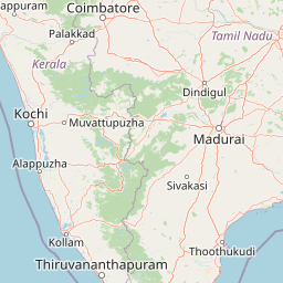
Mapping administrative regional memberships in India and Kerala
Geographic Location of Eravikulam National Park in India
Eravikulam National Park sits within the recorded national territories of India and American Samoa. Regional records place the park within Kerala, Ernakulam, and Idukki to outline its geographic position.
- Countries
- India
- Regions
- Ernakulam, Idukki, Kerala
- Primary location
- Kerala
Boundary and coordinates
Geographic extent and coordinate limits of the 97 square kilometer park
Mapping the Geographic Boundaries of Eravikulam National Park
Mapped boundary geometry outlines the spatial footprint of Eravikulam National Park. Structured facts clarify the registered area of 97 square kilometers alongside geographic span details.
- Boundary area
- 110.7 km²
- Boundary perimeter
- 94.3 km
- Northernmost point
- 10.3143° N
- Southernmost point
- 10.1432° N
- Easternmost point
- 77.1317° E
- Westernmost point
- 76.9999° E
- Geographic centre
- 10.2313° N, 77.0778° E
- North–south span
- 18.9 km
- East–west span
- 14.4 km
Elevation and terrain
Mountain relief metrics and recorded natural features within the landscape
Eravikulam National Park Terrain and Elevation Profile
Recorded mountain relief facts establish a high point of 2695 meters across the protected terrain. Detailed feature cards document individual peaks, rivers, and ranges located within the park boundary.
- Maximum elevation
- 2,695 m
- Highest point
- 2,695 m
Selected named natural features
Peaks
Kumarikal Mala
2,522 m
Peaks
Undakkal Mala
Peaks
Naikolli Mala
2,401 m
Peaks
Podu Mala
2,252 m
Peaks
Perattu Mala
2,156 m
Environmental setting
Interpreting alpine climate zones, montane forests, and mountain relief
Eravikulam National Park Environmental Classifications and Physical Setting
Recorded landscape features and habitat types provide complementary perspectives on the physical setting of Eravikulam National Park. Associated classifications connect stored regional characteristics directly to relevant atlas destinations.
- Relief
- Mountain
- Climate
- Alpine
- Water
- Major water bodies
- Forest cover
- Mostly forested
Landscape features
Mountains · Plateau · Grassland · Forest · Rivers · Waterfalls · Cliffs
Habitat types
Alpine meadow · Grassland · Montane forest
Park atlas
Compare montane landscapes and conservation efforts of protected areas within the Western Ghats region surrounding Eravikulam National Park.
Discover Other National Parks and Protected Areas Near Eravikulam National Park
Continue your exploration from Eravikulam National Park by browsing other national parks and protected areas within the contiguous Western Ghats. This extended view allows you to compare diverse montane grassland ecosystems, shola forest patches, and endemic wildlife conservation efforts across a wider geographic spread.
National parkKerala
3.4 km away#1 closest
East

Anamudi Shola National Park: Protected Montane Forest and Wildlife Corridor in Kerala
Explore unique high-altitude ecosystems and regional landscape context.
Anamudi Shola National Park is a compact yet ecologically significant protected area situated in the Western Ghats of Kerala, India. Covering around 7.5 square kilometers, the park preserves rare montane shola forests at elevations exceeding 2,100 meters. Its identity as a critical wildlife corridor, connecting contiguous protected zones, is fundamental to its conservation value. The park's landscape, defined by its unique ecosystems and regional geographic position, offers valuable insights for atlas-driven exploration of protected natural areas.
- Area
- 7.5 km²
- Established
- 2003
- IUCN
- II
- Relief
- Mountain
Wildlife reserveIndia
About 12 km away#2 closest
North
Anaimalai Tiger Reserve: Wildlife Reserve Park Atlas and Geographic Context in India
Mapping protected landscapes and natural terrain of this Indian wildlife reserve.
Anaimalai Tiger Reserve is a significant wildlife reserve located in India, offering rich opportunities for geographic and atlas-based discovery. This page provides detailed information on its protected area status, mapped boundaries, and the surrounding natural landscape context. Delve into the park's specific geography to understand its role as a conservation area within the broader Indian subcontinent.
National parkIdukki
About 15 km away#3 closest
South
Mathikettan Shola National Park: National Park Exploration and Geographic Mapping
Discover its protected landscape and regional context.
Mathikettan Shola National Park, a designated national park in the Idukki region, offers a focal point for understanding protected landscapes and their geographic distribution. This entry details the park's mapped boundaries and its specific setting within the regional geography, providing an atlas-level view of its conservation value. Users can explore the structured geographic identity of this protected natural area, enriching their understanding of India's park network.
- Area
- 12.82 km²
- Established
- 2003
- IUCN
- II
- Relief
- Mountain
National parkIndia
About 17 km away#4 closest
East
Pampadum Shola National Park: India's Protected Area Landscape Details
Explore mapped terrain and geographic context for this national park.
Gain insight into Pampadum Shola National Park, a key protected area within India's geography. This park detail provides essential information on its designation as a national park, its mapped boundaries, and its contribution to the regional landscape. It serves as a vital point for understanding the distribution and character of protected lands across India, offering a foundation for structured geographic research and atlas-based discovery of natural environments.
National parkKerala
About 64 km away#5 closest
South
Periyar National Park: National Park Protected Area Atlas and Geographic Context
Mapped protected lands and regional landscape exploration in Kerala.
Discover Periyar National Park as a distinct protected landscape offering rich geographic context for atlas exploration. This entry details its mapped boundaries and its significance within the broader regional geography of Kerala. Understand the natural terrain and protected-area distribution that makes Periyar National Park a key element in India's conservation mapping.
- Area
- 350.54 km²
- Established
- 1982
- IUCN
- II
- Visitors
- 754.3K annual
Protected areaIndia
About 79 km away#6 closest
Southwest
Vembanad Protected Area: Mapping India's Iconic Kerala Backwaters and Wetland Landscape
An extensive inland lake system featuring tidal lagoons, islets, and below-sea-level agricultural plains.
Spanning over 96 kilometers, Vembanad forms a sprawling wetland environment that acts as the primary drainage basin for much of Kerala. Analyze the geography of its intricate shorelines, mangrove patches, and historic islets like Pathiramanal. This protected zone provides a critical habitat for thousands of waterbirds while illustrating the complex relationship between coastal estuaries and human-managed landscapes.
- Area
- 2,033.02 km²
- Relief
- Lowland
- Climate
- Tropical
- Access
- Easy access

National parkKerala
About 113 km away#7 closest
Northwest
Silent Valley National Park: Kerala's Protected Landscape and Geographic Atlas
Explore mapped boundaries and regional terrain in South India.
Silent Valley National Park stands as a key protected area within Kerala, India, offering rich insights into its geographic setting. This destination provides an atlas-driven view of the park's mapped boundaries, its integration with the surrounding regional geography, and the character of its natural landscapes. Users can engage with detailed information designed for structured exploration of protected natural areas and their mapped contexts.
- Area
- 89.52 km²
- Established
- 1984
- IUCN
- II
- Relief
- Mountain
National parkNilgiri District
About 125 km away#8 closest
Northwest
Mukurthi National Park: Nilgiri District's Protected Montane Grassland and Shola Ecosystem
Explore a vital refuge for the endangered Nilgiri tahr.
Mukurthi National Park, situated in the Nilgiri District of India, is an essential protected area celebrated for its distinctive montane landscape. This national park plays a critical role in the survival of the endangered Nilgiri tahr, protecting the rare shola-grassland ecosystem where they thrive. Its dramatic terrain, high elevations, and unique ecological associations make it a focal point for understanding conservation geography and the mapped boundaries of protected lands within the Western Ghats.
- Area
- 78.46 km²
- Established
- 1990
- IUCN
- II
- Relief
- Mountain
MoriAtlas Explorer
Continue Exploring Eravikulam National Park's Protected Landscape and Geography
Further your understanding of Eravikulam National Park by exploring its specific protected land boundaries and its positioning within the diverse geography of Kerala. This exploration is essential for appreciating the park's unique contribution to regional conservation and its place in a global atlas of natural landscapes. Discover the detailed geographic context that defines this important national park.
Browse next
Global natural geography
Explore related park routes
Explore MoriAtlas Global ParksBrowse All MoriAtlas ParksGlobal Park Map DiscoveryMoriAtlas: Browse All CountriesBrowse All MoriAtlas ContinentsNational Park Environment AtlasGrand Canyon National Park AtlasYellowstone National Park AtlasYosemite National Park Atlas and GeographySerengeti National Park AtlasGalápagos National Park Protected LandscapeBanff National Park Geography and AtlasKruger National Park Atlas EntryUluṟu-Kata Tjuṯa National Park AtlasExplore Uluru-Kata Tjuta National Park GeographyPlitvice Lakes National Park AtlasFiordland National Park Protected LandscapeGreat Smoky Mountains National Park AtlasAfghanistan National Parks and Protected AreasAlbania National Parks and Protected AreasAlgeria National Parks and Protected AreasAmerican Samoa National Parks and Protected AreasAndorra National Parks and Protected AreasAngola National Parks and Protected AreasAntarctica National Parks and Protected AreasAntigua and Barbuda Park List