

Mori Atlas logo
Nature reserveEurardy Reserve

Understanding the landscape character and protected habitat boundaries of this Mid West conservation area

Eurardy Reserve Nature Reserve: Exploring the Sandplain Geography of Western Australia

Eurardy Reserve is a critical nature reserve located in the Mid West region of Western Australia, defined by its flat sandplain topography and expansive eucalypt woodlands. This protected area serves as an essential ecological link by sitting adjacent to Kalbarri National Park, creating a larger corridor of habitat within the South West Botanical Province. The terrain is characterized by ancient soils and seasonal wildflower displays, representing a key example of privately managed conservation land within the broader Australian landscape.

nature reserveprivately protected areasandplainmallalie scrubYork gum woodlandeucalypt woodland

Eurardy Reserve

Nature reserve

Park overview

Structured park overview, official facts, and landscape profile for Eurardy Reserve

Eurardy Reserve park facts, protected area profile, and essential visitor context

Review the core facts for Eurardy Reserve, including designation, size, terrain, visitor scale, habitats, and operating context in one park-focused overview.

About Eurardy Reserve

Eurardy Reserve is a substantial privately owned nature reserve in Western Australia's Mid West, situated on the coastal inland side of the state's mid-west coast and positioned at the transitional edge of the internationally significant South West Botanical Province. Covering about 30,000 hectares, the reserve was acquired by Bush Heritage Australia in 2005 with the explicit aim of preserving a high-conservation-value sandplain landscape that would otherwise have been vulnerable to clearing or degradation. Its location directly beside Kalbarri National Park gives Eurardy a regional conservation weight that exceeds what its image as a quiet block of scrub might initially suggest.

Ecologically, the reserve sits in one of the most botanically distinctive corners of Australia, where the Southwest floristic province meets the more arid country further north. This position is reflected in the mix of eucalypt, acacia, and heath species found across the property. Eurardy protects vegetation associations that have been heavily cleared elsewhere on the southern sandplains, making the reserve a kind of refuge for ecological communities that were once much more widespread. The flat, sandy terrain hosts mallalie scrub, bowgada and jam acacia communities, and open York gum and red mallee woodlands, layered with seasonal herb and wildflower species during the spring months.

In the wider conservation landscape, Eurardy functions not as a standalone reserve but as part of a connected protected network. Its boundary with Kalbarri National Park effectively extends the area of contiguous habitat available for native mammals, reptiles, and ground-dwelling fauna in the region. The reserve is also part of Bush Heritage Australia's broader portfolio, placing it within a national framework of strategic private land conservation. For visitors, scientists, and conservation planners alike, Eurardy is significant less for dramatic scenery than for the botanical and ecological integrity of the landscape it safeguards.

Quick facts and research context for Eurardy Reserve

Eurardy Reserve is a 30,050-hectare private nature reserve located about 145 kilometres north of Geraldton in Western Australia, on the northern edge of the South West Botanical Province. It adjoins Kalbarri National Park and sits between Geraldton to the south and Carnarvon to the north, well off the heavily populated southwest corner of the state. The reserve has been owned and managed by Bush Heritage Australia since 2005, when the conservation organization purchased the property to secure its ecological values.

Its terrain is flat and dominated by sandplain, supporting vegetation associations flagged as high conservation priorities in the region. Wildlife history on the reserve includes a number of mammal species that disappeared locally but may return through ongoing reintroductions linked to nearby Kalbarri National Park.

Protection and recognition

Terrestrial conservation scope and documented protected area framework

Eurardy Reserve Protection Status and International Recognition Details

Eurardy Reserve maintains a defined terrestrial protection scope within its regional conservation landscape. Documented records outline the established conservation status and management framework governing the natural area.

Protection details

Protection scope
Terrestrial
Transboundary protection
No
Park context

Deeper park guide and search-rich context for Eurardy Reserve

Eurardy Reserve history, landscape, wildlife, and travel context

Explore Eurardy Reserve through its history, landscape character, ecosystems, wildlife, conservation priorities, cultural context, and seasonal travel timing in a structured park guide built for atlas discovery and search intent.

Why Eurardy Reserve stands out

Eurardy Reserve is best known for the intact condition of its sandplain vegetation, especially the rare Mallalie (Eucalyptus eudesmoides) scrub association combined with York gum and red mallee woodlands. The reserve also stands out for its dramatic spring wildflower displays, which are a signature feature of the broader Mid West botanical region, and for its position adjoining Kalbarri National Park, which gives it a role as a complementary private conservation area rather than an isolated patch of protected bushland.

Eurardy Reserve history and protected-area timeline

Eurardy Reserve was purchased by Bush Heritage Australia in 2005, becoming part of the organization's strategy to acquire and manage private land of high conservation importance across Australia. The purchase was driven by the desire to protect a large, intact sandplain landscape in the Mid West at a moment when broadscale land clearing was continuing to fragment regional habitat. By securing the property outright, Bush Heritage Australia ensured long-term protection independent of shifting agricultural or development pressures.

Since 2005, the reserve has been managed as part of a regional conservation complex that includes neighbouring Kalbarri National Park. A particular focus of management history has been the eventual return of several native mammal species lost from the property during the twentieth century, an effort linked to broader reintroduction programs underway in the surrounding parks and reserves.

Eurardy Reserve landscape and geographic character

The landscape of Eurardy Reserve is defined by its remarkable flatness, sitting on a broad sandplain that stretches across the Mid West of Western Australia. There are no major mountain systems, dramatic gorges, or coastal cliffs within the reserve itself; instead, the scenery is characterised by gently undulating sand country with subtle rises, dry drainage lines, and expansive views across a low, open horizon. This understated topography is typical of the southern sandplain systems that fringe Western Australia's agricultural heartland.

The soils and landforms of Eurardy support a mosaic of plant communities that respond strongly to seasonal rainfall. After winter rains, the sandplain is transformed by dense growth of herbs, lilies, and small shrubs, while in drier seasons the landscape appears as an open expanse of scrub and low woodland. The reserve's elevation is low throughout, and the visual character of the landscape therefore comes from vegetation patterning and seasonal change rather than topographic relief.

Eurardy Reserve ecosystems, habitats, and plant life

Eurardy Reserve protects a piece of Mid West sandplain ecology at the transitional northern edge of the South West Botanical Province. The reserve's vegetation includes several associations that conservation biologists consider to be of high priority for protection, particularly mallalie scrub dominated by Eucalyptus eudesmoides combined with bowgada and jam acacias, alongside patches of York gum and red mallee woodland. These communities historically extended across vast areas of the southwest but have since been reduced by clearing for agriculture, leaving Eurardy and similar intact blocks as increasingly important refuges.

Spring is the most ecologically expressive period on the reserve, when the sandplain erupts into seasonal wildflower displays. Annual and perennial herb species bloom in dense drifts between the woody shrubs and overstorey trees, producing the kind of wildflower mass that the Mid West region is famous for. The reserve's flat, open sandplain structure also helps these seasonal displays read across wide distances, with stretches of colour visible between stands of mature eucalypts and acacias. The ecological value of Eurardy is largely tied to this combination of intact structure, diverse plant associations, and minimal habitat fragmentation.

Eurardy Reserve wildlife and species highlights

Eurardy's wildlife profile reflects both its past and its prospects. The reserve historically supported a suite of small to medium-sized native mammals that were once widespread across the Australian arid and semi-arid zone, including the numbat, bilby, burrowing bettong, western barred bandicoot, and chuditch. These species were lost from Eurardy during the twentieth century, in line with catastrophic declines across much of the Australian mainland, but their habitat remains in place and recent reintroductions into neighbouring Kalbarri National Park offer the possibility that some may eventually find their way back to the reserve.

Species that continue to occupy Eurardy include the spinifex hopping mouse and several species of dunnarts, small marsupials well adapted to sandy country and long dry periods. Reptiles such as the thorny devil are also present, taking advantage of the warm sandplain environment. Larger native fauna includes the eastern grey kangaroo, the euro (or eastern wallaroo), and the emu, all of which range across the open woodland and sandplain mosaic. Birdlife on the reserve reflects the broader Mid West avifauna, with woodland and sandplain species making regular use of the habitat during both breeding and non-breeding seasons.

Eurardy Reserve conservation status and protection priorities

Eurardy Reserve's conservation significance lies in its role as a privately protected block of high-value sandplain habitat at a critical biogeographical boundary. By acquiring the property in 2005, Bush Heritage Australia secured an area of 30,050 hectares that would otherwise have been part of the broader pattern of land clearing across the south-west agricultural zone. The reserve's location directly adjoining Kalbarri National Park effectively extends the functional footprint of the national park by providing a buffer of similar habitat under complementary management.

Ecologically, Eurardy is important because it retains vegetation associations, particularly the mallalie and York gum-mallee communities, that have been reduced elsewhere and are considered priorities for conservation. The reserve also contributes to landscape-scale connectivity, allowing fauna expected to be reintroduced into Kalbarri to expand into additional suitable habitat. Within Bush Heritage Australia's portfolio, Eurardy represents a flagship example of strategic private conservation acquisition in one of Australia's most botanically distinctive regions.

Eurardy Reserve cultural meaning and human context

Eurardy Reserve sits on traditional Aboriginal country in the Mid West of Western Australia, in a region long associated with Aboriginal land use and seasonal movement. Like much of the surrounding sandplain, the area has a history of human presence and use that predates European pastoral expansion. The reserve's modern conservation history also reflects a broader shift in Australian land management, in which private conservation organisations play an increasing role in protecting landscapes alongside state-managed national parks.

Top sights and standout views in Eurardy Reserve

The standout features of Eurardy Reserve include the rare and largely intact mallalie scrub vegetation, the adjoining position with Kalbarri National Park, and a strong reputation for Mid West spring wildflower displays. The reserve also offers the unusual combination of a low-profile, privately managed conservation area with clear regional importance, safeguarding habitat for small mammals that may eventually return through linked reintroduction programs with neighbouring protected lands.

Best time to visit Eurardy Reserve

The most interesting time for a visit to the broader Eurardy region is during the cooler months of late winter and spring, when seasonal wildflowers bloom across the sandplain and the landscape becomes more biologically active. Temperatures are milder than during the hot summer months, and the contrast between dry-season and flowering-season conditions on the same reserve is dramatic. Outside of this window, the landscape takes on a drier, more subdued character, though the woodland and sandplain mosaic remains visually distinctive year-round.
Monthly climate preview

Long term average temperature and monthly precipitation patterns across Western Australia

Eurardy Reserve Climate Normals and Annual Temperature Rhythm

Historical measurements from a representative coordinate detail the annual rhythm of average temperatures and monthly precipitation at Eurardy Reserve. Analyzing the complete twelve month dataset provides deeper insight into long term climate normals across the protected area.
Annual mean21 °C
15 °C28 °C
Jan27°
Feb28°
Mar26°
Apr23°
May20°
Jun17°
Jul15°
Aug16°
Sep17°
Oct20°
Nov23°
Dec25°
Warmest month
February

28 °C

Coolest month
July

15.4 °C

Wettest month
June

2 mm/day

Driest month
November

0.3 mm/day

Park location guide

Geography guide, regional context, and park location map for Eurardy Reserve

Eurardy Reserve park geography, regions, and map view in Australia

Understand where Eurardy Reserve sits in Australia through a broader geographic reading of the surrounding landscape, nearby location context, and its mapped position within the national park landscape.

How Eurardy Reserve fits into Australia

Australia is a constitutional monarchy and federal parliamentary democracy comprising six states and ten territories. With a population of nearly 28 million, it is one of the world's most urbanised countries, with most people concentrated on the eastern seaboard. The country has a high Human Development Index and is known for its cultural diversity, ancient Aboriginal heritage, and unique wildlife.

Wider geography shaping Eurardy Reserve in Australia

Australia occupies the entire Australian continent, the island of Tasmania, and numerous smaller islands. It is the world's flattest and driest inhabited continent, featuring vast deserts in the interior (the Outback), tropical rainforests along the eastern coast, and a coastline bordering the Indian and Pacific Oceans.

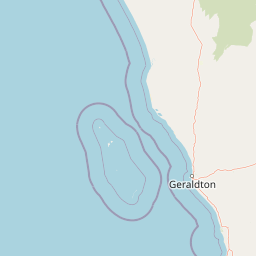
Map view of Eurardy Reserve

Use this park location map to pinpoint Eurardy Reserve in Australia, understand its exact geographic position, and read its mapped placement within the surrounding landscape more clearly.

Pigeon | © OpenStreetMap contributors

Location context for Eurardy Reserve

Western Australia
Recorded earthquake history

Explore the Historical Earthquake Records Associated with Eurardy Reserve

Examine the seismic catalogue for Eurardy Reserve to understand documented activity in this part of the Mid West. MoriAtlas provides a clear, data-driven view of historical epicentres and magnitudes to support geographic and geological exploration.

Eurardy Reserve Earthquake History

Catalogued events

1 event

Strongest magnitude

Magnitude 3.4

Most recent event

Sep 4, 2001

This history includes earthquakes recorded inside the park or within 50 km of its borders

Park atlas

Compare regional sandplain reserves and connected conservation areas in Western Australia

Explore Parks Near Eurardy Reserve and Surrounding Protected Landscapes

Discover other national parks and protected areas near Eurardy Reserve to analyze regional sandplain vegetation corridors and coastal woodland ecosystems. Comparing adjacent habitats reveals the broader botanical continuity of the Mid West landscape across public and private reserves.
National parkWestern Australia
Park boundaries overlap#1 closest

Southwest

Kalbarri National Park: Discover Its Mapped Geography and Protected Landscape Identity

Western Australia's protected national park terrain.

Kalbarri National Park is a vital protected area within the vast geography of Western Australia. This detail entry provides essential context for understanding the park's specific protected landscape, its geographic features, and how it integrates into the broader regional atlas. Explore the mapped boundaries and natural terrain that define Kalbarri National Park, offering a foundation for deeper geographic study and protected-area discovery.

Area
1,830.05 km²
Established
1963
IUCN
II
Relief
Mixed relief
National parkAustralia
122 km away#2 closest

Southwest

Houtman Abrolhos Islands National Park: Australia's Mapped Protected Landscape

Essential geography and park boundary details for this protected area.

Investigate Houtman Abrolhos Islands National Park, a significant protected area offering a unique lens into Australia's diverse geography. This national park's mapped boundaries and specific landscape features provide valuable context for understanding protected lands and regional terrain. Explore the distinct geographic character of this protected region, contributing to a richer comprehension of Australia's atlas of natural landscapes.

Area
15.64 km²
Established
2019
Relief
Lowland
Access
Moderate access
Nature reserveWestern Australia
About 186 km away#3 closest

North

Faure Island Nature Reserve: Mapped Geography and Protected Landscapes in Western Australia

Coastal arid-zone sanctuary and bird conservation landscape

Located east of the Peron Peninsula, Faure Island serves as a critical nature reserve within the Shark Bay World Heritage setting. The island offers a study in coastal geography, featuring a mosaic of sandy dunes, tidal flats, and acacia shrublands that support unique bird breeding colonies and restored marsupial populations.

Area
58 km²
Established
1999
Relief
Lowland
Climate
Arid
National parkWestern Australia
197 km away#4 closest

Northwest

Francois Peron National Park: National Park Protected Landscape & Geographic Exploration

Mapped boundaries and regional landscape context in Western Australia.

Delve into the geography of Francois Peron National Park, a designated national park located in Western Australia. This resource provides structured information on its protected landscape, mapped boundaries, and regional setting, offering a clear point of reference for atlas-based geographic discovery. Understand the natural terrain and conservation context of this significant Australian protected area.

Area
525.87 km²
Established
1993
IUCN
II
Relief
Lowland
National parkGascoyne
About 214 km away#5 closest

North

Pimbee National Park: Australian National Park with Gascoyne Regional Geography

Mapped protected boundaries and natural landscape context.

Pimbee National Park represents a key protected area within Australia's vast Gascoyne region. This national park provides a specific geographic focus, allowing for detailed exploration of its mapped boundaries and the surrounding natural landscape. Understanding Pimbee National Park's place within the regional geography of Western Australia is crucial for a comprehensive atlas-driven discovery of the continent's protected lands and their unique terrain.

Established
2023
Climate
Arid
Scope
Terrestrial
National parkAustralia
About 234 km away#6 closest

Northwest

Dirk Hartog Island National Park: Australia's Protected Island Geography and National Park Atlas Entry

Mapped boundaries and regional landscape context for Dirk Hartog Island National Park.

This entry provides detailed geographic context for Dirk Hartog Island National Park, a designated national park in Australia. Understand its mapped protected area status, its place within the Australian continent's geography, and its unique landscape identity. Ideal for atlas exploration, this content offers a structured view of the park's terrain and conservation significance.

National parkWestern Australia
245 km away#7 closest

South

Tathra National Park: Protected Landscape Identity and Mapped Geographic Boundaries

Western Australia national park exploration and regional context.

Delve into the protected landscape of Tathra National Park, a significant entity within Western Australia's network of natural areas. This detail provides a structured overview of its geographic position, mapped outlines, and ecological context, serving as a vital entry point for understanding Australia's diverse protected lands and regional geography.

Area
43.22 km²
Established
1970
IUCN
II
Relief
Upland
National parkWestern Australia
263 km away#8 closest

South

Lesueur National Park: Detailed National Park Atlas and Geographic Context

Explore the mapped protected landscape in Western Australia.

Lesueur National Park is a key protected area within the expansive geography of Western Australia. This resource provides detailed information on its national park status, mapped boundaries, and its significance within the regional atlas. Engage with the specific landscape identity of this protected territory and understand its role in the broader geographic context of Australia.

Area
272.35 km²
Established
1992
IUCN
II
Relief
Upland

Common questions about visiting, size, designation, and location context for Eurardy Reserve

Eurardy Reserve FAQs for park facts, access, geography, and protected area context

Find quick answers about Eurardy Reserve, including protected-area facts, park geography, trail and visitor context, and how the park fits into its surrounding country and regional landscape.
MoriAtlas Explorer

Continue Your Protected Areas Search Across the Global Atlas

Deepen your exploration by continuing the structured search for national parks and protected areas worldwide. Utilize the comprehensive filtering capabilities to compare different conservation landscapes and refine your understanding of global park geography. Discover more about the distribution and characteristics of protected natural areas.

Global natural geography