

Mori Atlas logo
National parkKalbarri National Park

Understand the geographic context and natural terrain of this significant protected national park.

Kalbarri National Park: Explore Its Mapped Boundaries and Protected Landscape in Western Australia

Kalbarri National Park stands as a key protected landscape within Western Australia, offering a unique geographic entry point for atlas-based discovery. This page details the park's protected area identity, its surrounding natural terrain, and how its boundaries contribute to the regional geography of Australia. Explore the mapped context of Kalbarri National Park to understand its distinct place within the nation's network of conservation lands and natural features.

River gorgeCoastal cliffsWildflower displaysEndemic floraSemi-arid landscapeWestern Australia

Kalbarri National Park

National park

Park overview

Structured park overview, official facts, and landscape profile for Kalbarri National Park

Kalbarri National Park park facts, protected area profile, and essential visitor context
Review the core facts for Kalbarri National Park, including designation, size, terrain, visitor scale, habitats, and operating context in one park-focused overview.

About Kalbarri National Park

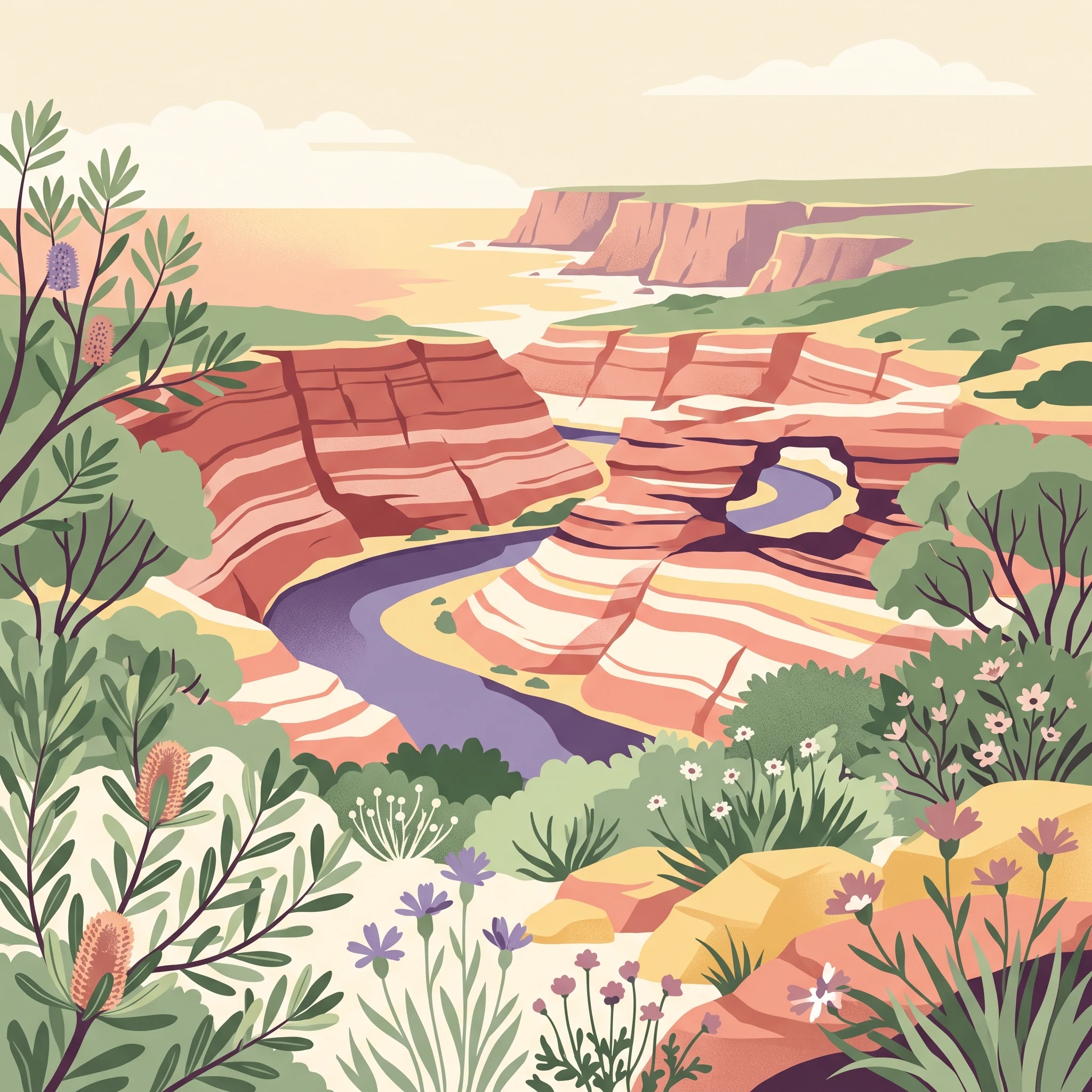
Kalbarri National Park occupies a remarkable position along the western coast of Australia, protecting a landscape of extraordinary geological and ecological diversity. The park's inland section centres on the lower reaches of the Murchison River, where millions of years of erosion have carved a spectacular gorge system through layers of Tumblagooda sandstone, creating a landscape of towering cliffs, dramatic meanders, and isolated rock formations. The river, one of Western Australia's few permanent watercourses in this arid region, sustains a ribbon of greenery through the otherwise semi-desert landscape, providing critical habitat for wildlife and creating one of the state's most iconic natural environments. The coastal section of the park extends south from the town of Kalbarri along a rugged shoreline where massive cliffs have been sculpted by the relentless action of the Indian Ocean. These cliffs, exceeding 100 metres in height, showcase a sequence of rock formations including the Natural Bridge, a large sea stack, and numerous smaller features with evocative names like Eagle Gorge and Shellhouse and Grandstand. The contrast between the red sandstone of the interior and the dark coastal rock creates a visually striking landscape that has drawn visitors to this remote corner of Western Australia for decades. The park's establishment in 1963 reflected growing recognition of the region's unique natural values, and it has since become a cornerstone of conservation in the Mid West while also serving as a major draw for visitors seeking to experience one of Australia's most distinctive protected landscapes.

Quick facts and research context for Kalbarri National Park

Kalbarri National Park covers 1,830 square kilometres in Western Australia's Mid West region, established in 1963 and managed by the Department of Parks and Wildlife. The park encompasses nearly 80 kilometres of the Murchison River gorge carved through Tumblagooda sandstone, as well as over 100-metre high coastal cliffs south of the town of Kalbarri. The region sits at the northern edge of the transition between Mediterranean and semi-arid climates, with summer temperatures regularly exceeding 40 degrees Celsius inland. The park supports more than 800 wildflower species, with peak blooming in August and September, and contains 21 plant species found nowhere else on Earth. Notable geological features include Nature's Window, a natural rock arch, and the Z Bend, a dramatic river meander.

Park context

Deeper park guide and search-rich context for Kalbarri National Park

Kalbarri National Park history, landscape, wildlife, and travel context
Explore Kalbarri National Park through its history, landscape character, ecosystems, wildlife, conservation priorities, cultural context, and seasonal travel timing in a structured park guide built for atlas discovery and search intent.

Why Kalbarri National Park stands out

Kalbarri National Park is best known for its spectacular Murchison River gorge, where the river has carved a nearly 80-kilometre canyon through ancient Tumblagooda sandstone, creating one of Western Australia's most impressive inland geological wonders. The park's coastal section is equally renowned for its dramatic cliffs exceeding 100 metres in height, punctuated by wind and water-carved formations including sea stacks and the famous Natural Bridge rock arch. The iconic Nature's Window, a naturally formed rock arch through which the Murchison River can be viewed, has become one of the most photographed features in Western Australia. The park's floral significance is exceptional, with over 800 wildflower species documented and 21 endemic plant species found exclusively within its boundaries, including the rare Kalbarri catspaw and several orchid species found nowhere else on Earth.

Kalbarri National Park history and protected-area timeline

Kalbarri National Park was established in 1963, formalising protection for a landscape that had long been recognised for its outstanding natural values. The region's significance extends far beyond its modern park boundaries, with the Murchison River and its gorge system having shaped the development of the surrounding region and the small town of Kalbarri that now serves as the gateway to the park. The area's indigenous heritage is significant, with the local Nanda people having lived in this region for thousands of years, their connection to the land reflected in various cultural sites throughout the park. Development of visitor facilities and infrastructure has occurred gradually over the decades, with the construction of walking tracks, viewing platforms, and more recently the Kalbarri Skywalk, which now offers visitors dramatic elevated views over the Murchison River gorge. The park's management has evolved alongside changing approaches to conservation, with the Department of Parks and Wildlife now overseeing protection of both the geological formations and the remarkable biodiversity that the landscape supports.

Kalbarri National Park landscape and geographic character

The landscape of Kalbarri National Park is defined by a dramatic contrast between two spectacular geological environments. The inland portion of the park showcases the results of the Murchison River cutting through ancient Tumblagooda sandstone, creating a gorge system that extends for nearly 80 kilometres with cliff faces rising dozens of metres above the river below. The sandstone itself displays distinctive red and white banding that creates a visually striking palette, particularly during sunrise and sunset when the colours seem to glow. Notable features along the gorge include the famous Nature's Window, a natural arch that frames views of the river, the sharp meander known as the Z Bend, and viewpoints like Ross Graham Lookout that offer sweeping perspectives of the canyon. The coastal section presents a completely different character, where the same ancient rock formations meet the Indian Ocean in cliffs that soar more than 100 metres above sea level. Wave action and wind erosion have carved the cliffs into a succession of shapes including sea stacks, natural arches, and narrow passages, with features like Red Bluff, Mushroom Rock, and Rainbow Valley providing memorable landmarks along the coast. Meanarra Hill dominates the view at the mouth of the river, marking the transition from the inland gorge to the open ocean.

Kalbarri National Park ecosystems, habitats, and plant life

The ecological character of Kalbarri National Park reflects its position at the intersection of several different environmental zones, creating a surprising diversity of habitats within what might appear to be a relatively uniform semi-desert landscape. The park is renowned for its extraordinary wildflower displays, with more than 800 species recorded across the region. The bloom begins in late winter and continues through early summer, reaching peak intensity in August and September when the landscape transforms into a tapestry of colour. Twenty-one plant species are found exclusively within the park's boundaries, making it a significant site for botanical endemism. Among the most notable is the Kalbarri catspaw, a small yellow or red plant that appears prominently on recently burnt areas, and several orchid species including the Kalbarri spider orchid and the Murchison hammer orchid. The re-discovery of the small-petalled Beyeria in 1994 was particularly significant, as it had previously been thought extinct and is now known from only three populations worldwide, with the Kalbarri population being one of the most important. The Murchison River corridor acts as a linear oasis through the arid landscape, supporting vegetation communities quite different from the surrounding country and providing crucial water and habitat in an otherwise dry environment.

Kalbarri National Park wildlife and species highlights

The wildlife of Kalbarri National Park demonstrates the park's role as a refuge in a generally arid landscape, with the Murchison River corridor and the coastal zone supporting notably different assemblages of species. Approximately 200 animal species have been recorded in the inland areas along the river, while the coastal region and surrounding areas host more than 400 species, reflecting the additional habitat diversity provided by the ocean environment. Birdlife is particularly diverse, with around 150 species observed including emu, osprey, wedge-tailed eagle, and Australian pelican. Mammals of the inland areas include western grey kangaroo, short-beaked echidna, and the tiny spinifex hopping mouse, while the only bat species recorded is Finlayson's cave bat. The park's reptile population includes several species characteristic of arid Australia, such as the thorny devil, western bearded dragon, and central netted dragon. The threatened tammar wallaby was historically present in the area, though recent observations have been lacking. Amphibians are represented primarily by Günther's toadlet, while approximately 30 arthropod species have been documented, including the Pilbara tiger dragonfly.

Kalbarri National Park conservation status and protection priorities

Kalbarri National Park represents a significant conservation outcome in Western Australia's Mid West, protecting a landscape of exceptional geological and ecological value. The park safeguards one of the most impressive river gorge systems in the state's arid interior, preserving not only the dramatic landforms but also the ecological processes that sustain the river and its riparian corridor. The protection of 21 endemic plant species underscores the park's botanical significance, with several species facing considerable conservation pressure outside protected areas. The discovery and ongoing monitoring of the Beyeria population highlights the importance of the park for species of conservation concern, with this species known from only three locations globally. The coastal cliffs and offshore islands provide important habitat for seabirds and marine species, adding another dimension to the park's conservation values. Management focuses on maintaining the natural values while providing sustainable visitor access, with particular attention to managing fire regimes that are important for many of the park's plant species, including the fire-dependent Kalbarri catspaw.

Kalbarri National Park cultural meaning and human context

The landscape of Kalbarri National Park holds significance for the Nanda people, the traditional owners of the land on which the park is situated. The Murchison River and its gorge would have held spiritual and practical importance for indigenous communities over thousands of years, with the landscape providing resources, travel routes, and cultural connections. While the specific details of indigenous heritage sites are not extensively documented in available sources, the broader region has evidence of Aboriginal occupation extending deep into prehistory. The modern town of Kalbarri, which serves as the primary access point for the park, developed as a small coastal settlement in the mid-twentieth century, with its economy historically based on fishing and mining in the surrounding region. The relationship between the town and the national park is close, with tourism related to the park forming a significant part of the local economy and community identity.

Top sights and standout views in Kalbarri National Park

Kalbarri National Park offers two distinct but complementary landscapes within a single protected area. The inland section features the spectacular Murchison River gorge, where the iconic Nature's Window arch provides one of Western Australia's most recognisable natural views, and the dramatic Z Bend showcases the power of water to shape the landscape. The Loop and Hawks Head represent other notable viewpoints along the gorge, each offering different perspectives of the river and its canyon. The coastal section presents equally impressive scenery, with the towering cliffs at Red Bluff, the wave-carved formations of Pot Alley, and the Natural Bridge demonstrating the ongoing interaction between land and sea. The recent addition of the Kalbarri Skywalk platforms has created new opportunities for visitors to experience the scale of the gorge from elevated viewing structures. The wildflower displays from late winter through spring provide an additional highlight, transforming the often-seen arid landscape into a garden of colour.

Best time to visit Kalbarri National Park

The optimal time to visit Kalbarri National Park depends on what visitors hope to experience, with the park offering different attractions across the seasons. Autumn and winter, from May through September, bring more moderate temperatures that make outdoor activities comfortable, with daytime temperatures typically ranging from the high teens to mid-twenties Celsius. This period coincides with the peak wildflower season, when the park's famous floral displays are at their most impressive, particularly in August and September when the greatest variety of species can be observed. Summer months from December through April can bring extreme heat, especially inland where temperatures frequently exceed 40 degrees Celsius, making midday activities dangerous and limiting the appeal of hiking in the gorge. However, the coastal section remains more moderate due to sea breezes. Visitors should be aware that summer thunderstorms can cause rapid and significant rainfall, potentially closing roads to the gorge areas. Spring offers a good compromise between comfortable temperatures and the tail end of the wildflower season, while still avoiding the extreme summer heat.
Park location guide

Geography guide, regional context, and park location map for Kalbarri National Park

Kalbarri National Park park geography, regions, and map view in Australia
Understand where Kalbarri National Park sits in Australia through a broader geographic reading of the surrounding landscape, nearby location context, and its mapped position within the national park landscape.

How Kalbarri National Park fits into Australia

Australia is a constitutional monarchy and federal parliamentary democracy comprising six states and ten territories. With a population of nearly 28 million, it is one of the world's most urbanised countries, with most people concentrated on the eastern seaboard. The country has a high Human Development Index and is known for its cultural diversity, ancient Aboriginal heritage, and unique wildlife.

Wider geography shaping Kalbarri National Park in Australia

Australia occupies the entire Australian continent, the island of Tasmania, and numerous smaller islands. It is the world's flattest and driest inhabited continent, featuring vast deserts in the interior (the Outback), tropical rainforests along the eastern coast, and a coastline bordering the Indian and Pacific Oceans.

Map view of Kalbarri National Park

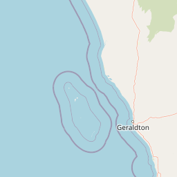
Use this park location map to pinpoint Kalbarri National Park in Australia, understand its exact geographic position, and read its mapped placement within the surrounding landscape more clearly.

Pigeon | © OpenStreetMap contributors

Location context for Kalbarri National Park

Western Australia
Park atlas

Discover the diverse mapped geography and connected protected landscapes surrounding Western Australia's dramatic coastal cliffs and river gorge.

Explore Nearby National Parks and Protected Areas Around Kalbarri National Park
Continue your geographic exploration beyond Kalbarri National Park by comparing other protected areas within Western Australia's Mid West region. Trace the regional spread of national parks and discover varied terrains, from additional river gorges to expansive coastal reserves, for a deeper atlas understanding.
National parkAustralia

Houtman Abrolhos Islands National Park: Australia's Mapped Protected Landscape

Essential geography and park boundary details for this protected area.

Investigate Houtman Abrolhos Islands National Park, a significant protected area offering a unique lens into Australia's diverse geography. This national park's mapped boundaries and specific landscape features provide valuable context for understanding protected lands and regional terrain. Explore the distinct geographic character of this protected region, contributing to a richer comprehension of Australia's atlas of natural landscapes.

Area
15.64 km²
Established
2019
Relief
Lowland
Access
Moderate access
National parkWestern Australia

Tathra National Park: Protected Landscape Identity and Mapped Geographic Boundaries

Western Australia national park exploration and regional context.

Delve into the protected landscape of Tathra National Park, a significant entity within Western Australia's network of natural areas. This detail provides a structured overview of its geographic position, mapped outlines, and ecological context, serving as a vital entry point for understanding Australia's diverse protected lands and regional geography.

Area
43.22 km²
Established
1970
IUCN
II
Relief
Upland
National parkGascoyne

Pimbee National Park: Australian National Park with Gascoyne Regional Geography

Mapped protected boundaries and natural landscape context.

Pimbee National Park represents a key protected area within Australia's vast Gascoyne region. This national park provides a specific geographic focus, allowing for detailed exploration of its mapped boundaries and the surrounding natural landscape. Understanding Pimbee National Park's place within the regional geography of Western Australia is crucial for a comprehensive atlas-driven discovery of the continent's protected lands and their unique terrain.

Established
2023
Climate
Arid
Scope
Terrestrial
National parkWestern Australia

Lesueur National Park: Detailed National Park Atlas and Geographic Context

Explore the mapped protected landscape in Western Australia.

Lesueur National Park is a key protected area within the expansive geography of Western Australia. This resource provides detailed information on its national park status, mapped boundaries, and its significance within the regional atlas. Engage with the specific landscape identity of this protected territory and understand its role in the broader geographic context of Australia.

Area
272.35 km²
Established
1992
IUCN
II
Relief
Upland
National parkWestern Australia

Alexander Morrison National Park: Discover Its Protected Landscape and Regional Geography

Mapped protected area boundaries and landscape context in Western Australia.

Alexander Morrison National Park represents a core protected natural landscape within Western Australia. As a national park, its identity is deeply tied to its mapped geographic extent and its role in the regional atlas. This destination provides a focused lens on a specific protected area, enabling users to understand its unique landscape features and its contribution to the conservation estate of Western Australia. Delve into its protected status and geographic orientation within Australia's largest state.

Area
85 km²
Established
1970
IUCN
II
Relief
Upland
National parkWestern Australia

Drovers Cave National Park: Protected National Park Landscape in Western Australia

Discover the mapped geography and natural context of this park.

Drovers Cave National Park stands as a key protected area within the expansive Western Australian region. This national park offers a focused lens through which to explore its specific geographic identity and landscape characteristics. As a designated national park, it is mapped within the larger atlas of Australia's protected lands, providing users with structured insights into its regional setting and natural terrain.

Area
26.81 km²
Established
1972
IUCN
II
Relief
Lowland
National parkMid West

Mungada Ridge National Park: National Park Geography and Protected Landscape Details

Mapped boundaries and regional landscape context.

Delve into the protected landscape identity of Mungada Ridge National Park, a significant national park located in Australia's Mid West. This resource provides detailed information on its geographic positioning, mapped boundaries, and the natural terrain it encompasses, contributing to a structured understanding of protected areas within the region and the broader national atlas.

Area
10.31 km²
Established
2022
Relief
Upland
Climate
Arid
National parkWestern Australia

Watheroo National Park National Park: Mapping Protected Landscapes in Western Australia

Explore regional geography and mapped park boundaries.

Watheroo National Park represents a key protected landscape within the vast state of Western Australia. This detail page offers focused insight into the park's specific geographic character, its mapped boundaries, and its role within the regional atlas of protected areas. Understand the natural terrain and landscape context that defines this Australian national park.

Area
444.81 km²
Established
1969
IUCN
II
Relief
Upland

Common questions about visiting, size, designation, and location context for Kalbarri National Park

Kalbarri National Park FAQs for park facts, access, geography, and protected area context
Find quick answers about Kalbarri National Park, including protected-area facts, park geography, trail and visitor context, and how the park fits into its surrounding country and regional landscape.
MoriAtlas Explorer

Continue Your Protected Areas Search Across the Global Atlas

Deepen your exploration by continuing the structured search for national parks and protected areas worldwide. Utilize the comprehensive filtering capabilities to compare different conservation landscapes and refine your understanding of global park geography. Discover more about the distribution and characteristics of protected natural areas.

Global natural geography