
Why Färnebofjärden National Park stands out
Färnebofjärden is best known for its exceptional concentrations of woodpeckers and owls, representing one of Sweden's most important areas for forest birds. The park supports critical populations of white-backed woodpecker, black woodpecker, Ural owl, and other raptors, with the Ural owl serving as the park's emblematic species. The river landscape itself is distinctive, a succession of fjärdar (wide river bays), rapids, and islands creating a mosaic of aquatic and terrestrial habitats unique in Sweden. The park's position at the ecological frontier between northern and southern Scandinavia means both boreal and temperate species coexist here, including osprey, white-tailed eagle, beaver, lynx, and brown bear. The extensive wetlands, old-growth forests, and the near-natural hydrology of the Dalälven make this one of Sweden's most significant riverine conservation areas.
Färnebofjärden National Park history and protected-area timeline
Human presence in the Färnebofjärden area extends back to the Stone Age, when the region's eskers provided ideal settlement sites above the waters of the Littorina Sea, the ancestor of the Baltic Sea that covered much of the area after the last ice age. These elevated ridges offered defense, access to fishing, and convenient crossing points across the expanding river. Prehistoric sites dot the landscape, including Stone Age settlements at Trångnäs and Sandön, and burial cairns on Hemön and Utön.
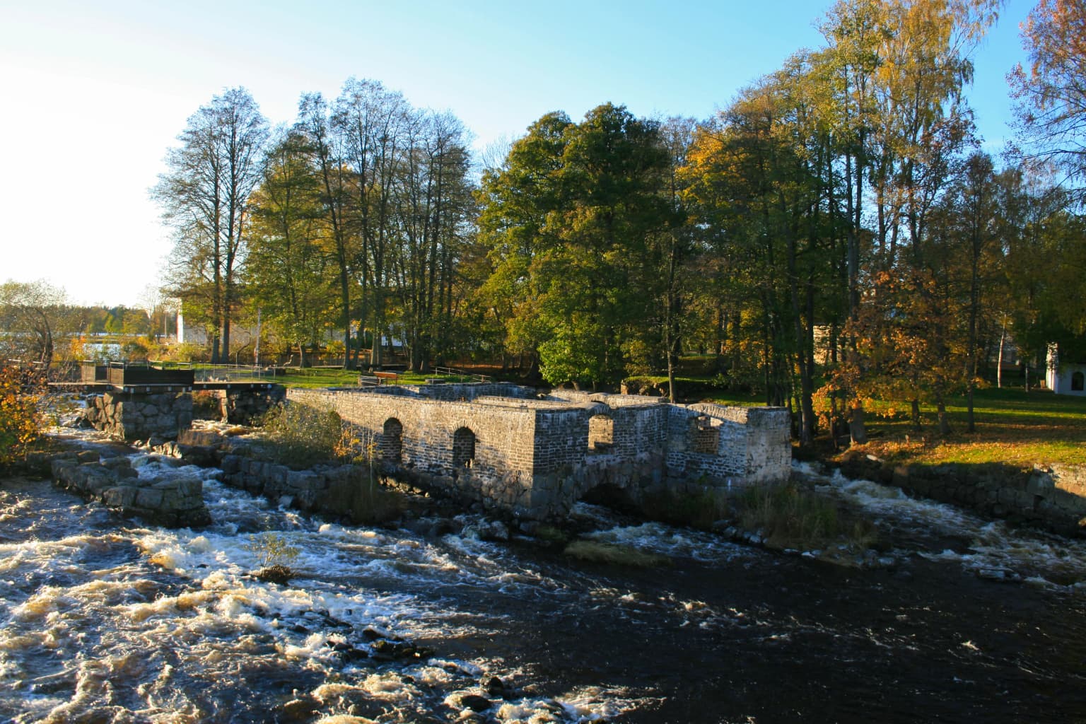
The region's rich iron deposits shaped human activity for centuries. The forests were heavily exploited to fuel water-powered forges that grew along the river, with the Gysinge forge, established in 1668, becoming one of the largest in the country during the 18th century. The forge was notably the first in the world to use an induction furnace, known as the Kjellin oven. Logging for timber rafting and mining operations left lasting impacts on the landscape, though the wettest forests and most inaccessible areas largely escaped commercial exploitation, preserving biological diversity that would later prove crucial.
Conservation efforts accelerated in the 1960s and 1970s as the Swedish Society for Nature Conservation documented the area's ecological importance. A critical moment came in the early 1970s when Stora AB attempted to clear forests in the Tinäset area, sparking the formation of a movement that proposed a national park in 1975. The municipality of Sandviken established the Gysinge nature reserve in the same year. After systematic inventories of the region's geomorphology, fauna, and flora, Färnebofjärden was proposed for national park status in 1989. The park was officially established by royal decree on September 10, 1998, with the stated purpose of preserving a unique river landscape together with rich forests and surrounding wetlands in a relatively intact state. It was added to the Ramsar list in November 2001 and included in the Natura 2000 network.
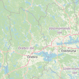
Färnebofjärden National Park landscape and geographic character
The landscape of Färnebofjärden is fundamentally shaped by the Dalälven River and the glacial deposits that underlie the region. The terrain is predominantly flat, lying between 56 and 75 meters above sea level, though certain areas feature more relief, including the valleys of the Tiån and Storån streams and the hilly zones around Torrösundet and Långvindsjön. The most distinctive topographic feature is the esker Enköpingsåsen, a ridge of glacial gravel reaching up to 18 meters in height that crisscrosses the region for over 300 kilometers, creating islands such as Sandön and shaping the river's course.
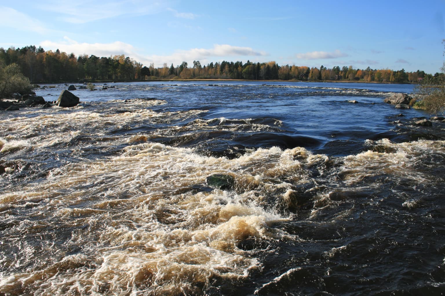
The Dalälven itself is the second-longest river in Sweden, flowing 541 kilometers from its origins at the confluence of the Västerdal and Österdal rivers. By the time it reaches Färnebofjärden, the river has gathered a watershed of 28,000 square kilometers and flows with an average rate of 350 cubic meters per second, though this varies dramatically between low winter flows of 50 cubic meters per second and spring floods exceeding 2,000 cubic meters per second. The river's character changes markedly as it passes through the park—alternating between broad fjärdar where it spreads across the floodplain and narrower channels around the eskers where rapids create faster flows.
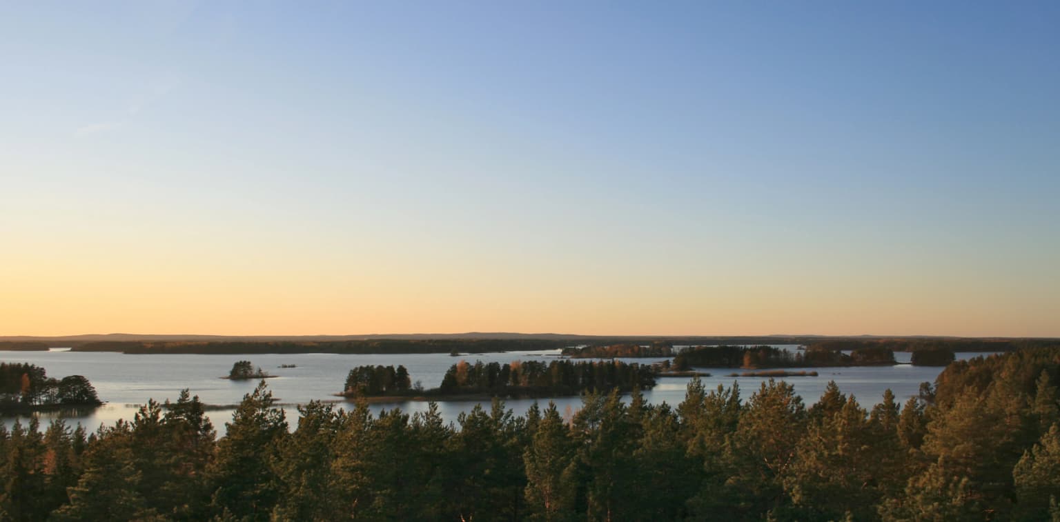
The park contains approximately 200 islands and skerries, with the largest being Mattön, Torrön, Ängsön, Vedön, Rosön, and Västerön. Extensive wetlands covering about 2,150 hectares—more than 20 percent of the park's total area—include marshes, bogs, and the flood-prone zones that border the river channels. These wetlands, particularly around Tinäset, are among the most ecologically important habitats in the park, supporting specialized plant communities and serving as critical breeding grounds for waterfowl.
Färnebofjärden National Park ecosystems, habitats, and plant life
Färnebofjärden's ecological richness stems from its position at the boundary between two major biomes and the diversity of habitats within its boundaries. The park lies within the Sarmatic mixed forests ecoregion, close to the transition with Scandinavian and Russian taiga. This biological crossroads means the park supports species characteristic of both northern and southern Sweden, creating assemblages found nowhere else in the country.
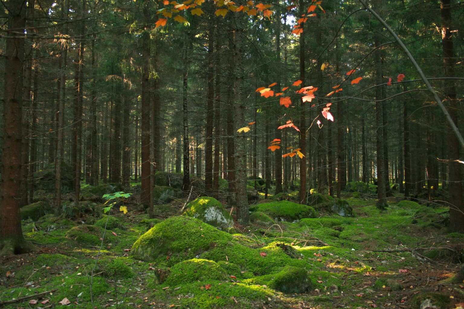
The forests of the park represent nearly all central Swedish forest types. Coniferous forests dominated by Norway spruce cover approximately 1,000 hectares, particularly around Tinäset, on Torrön, and the Öbyhalvön peninsula. These forests, some of which have not been logged since the 1950s and contain trees over 120 years old, provide critical habitat for species dependent on old-growth conditions. Mixed forests cover 1,460 hectares and include broadleaf species such as aspen—common in the Lower Dalälven but rare elsewhere in Sweden—English oak, and small-leaved linden. Wetlands and open bogs occupy substantial areas, with bogs covering 1,650 hectares and other wetlands an additional 750 hectares.
The park supports significant biodiversity including two endangered vascular plant species, 25 species of mosses, 34 species of lichens, and 22 species of fungi considered endangered in Sweden. The extensive dead wood found in the old forests supports thousands of invertebrate species, with over 70 insect species listed as endangered in Sweden. The rivers and lakes contain diverse fish communities including northern pike, European perch, zander, grayling, and the rare asp, while the noble crayfish, though nearly extinct in the broader region, still appears occasionally within the park.
Färnebofjärden National Park wildlife and species highlights
Färnebofjärden supports an exceptional diversity of wildlife, with birds being the most notable group. More than 200 bird species have been recorded in the park, of which at least 107 nest regularly. The combination of shallow, fish-rich waters, extensive wetlands, and old forests with abundant dead wood creates ideal conditions for both aquatic and forest bird species. The park is particularly renowned for its woodpecker populations, supporting all three Swedish species of grouse—capercaillie, black grouse, and hazel grouse—along with great spotted woodpecker, black woodpecker, European green woodpecker, and lesser spotted woodpecker. The white-backed woodpecker, one of Sweden's most endangered birds with only about 16 individuals in the entire country in 2004, historically nested here, though populations have declined dramatically.
The owl diversity is equally impressive, with the Ural owl serving as the park's symbolic species and representing one of the highest densities in Sweden. The Eurasian pygmy owl is also common, while the white-tailed eagle, classified as endangered in Sweden, has returned to the park after disappearing in the 1970s. The osprey population of about 30 breeding pairs is among the most significant in the country. Aquatic birds including common gull, common tern, black-throated loon, mute swan, grey heron, and common crane are widespread throughout the wetlands and river channels.
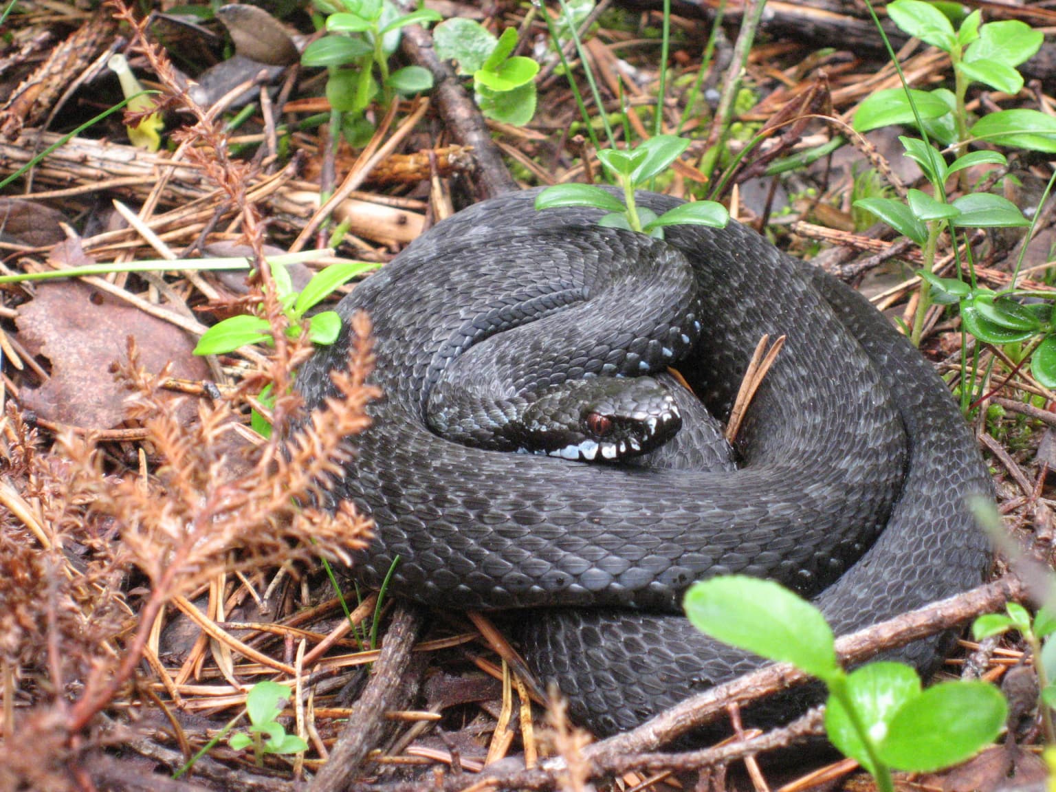
Mammals are well represented, with moose, roe deer, mountain hare, red fox, and European pine marten being the most common species. Eurasian beaver, reintroduced in the 1980s, now populations around Torrön, Ängsön, and Gysinge. Four mammal species are considered endangered in Sweden: Eurasian lynx, brown bear, gray wolf, and European otter, all of which occur in the park. The fish community is exceptionally rich, with the waters supporting northern pike that can weigh up to 20 kilograms, European perch, zander, grayling, brown trout, and the rare asp. The park also contains all major Swedish amphibian species and common reptiles including adders and grass snakes.
Färnebofjärden National Park conservation status and protection priorities
Färnebofjärden holds significant conservation status at both national and international levels. The park was designated a Ramsar Wetland of International Importance in November 2001, recognizing its significance as a wetland ecosystem. It is also included in the European Union's Natura 2000 network, which protects habitats and species of European importance under the Habitats Directive. In 2011, the broader Lower Dalälven region was designated as a UNESCO biosphere reserve under the name "Nedre Dalälven," acknowledging the area's exceptional combination of biodiversity, cultural heritage, and sustainable development.
The conservation rationale for the park centers on preserving a near-natural river system that has largely escaped the regulation affecting other Swedish rivers. Färnebofjärden is the only major fjärd of the Lower Dalälven with an unregulated mouth, maintaining natural hydrological processes including the dramatic spring floods that sustain wetland ecosystems. The old-growth forests, though reduced from historical extent, contain some of the largest remaining populations of dead-wood-dependent species in central Sweden. The park's position at a biological crossroads means it serves as a refuge for species adapted to both northern and southern conditions, making it particularly valuable as climate change alters species distributions.
Management challenges include balancing visitor access with wildlife protection, particularly during bird nesting season when certain zones are closed. The beaver population requires active management to prevent excessive forest damage, while invasive species and changing hydrological conditions due to upstream regulation continue to pose threats. The park's multi-county administration requires coordination among different regional authorities, though Västmanland County maintains primary management responsibility.
Färnebofjärden National Park cultural meaning and human context
The Färnebofjärden region has been inhabited since the Stone Age, with the eskers serving as preferred settlement sites above the waters of the post-glacial Littorina Sea. These elevated ridges provided strategic advantages for early settlers—defensible positions, access to the river's fish resources, and convenient crossing points. Many modern roads and settlements still follow the routes established along these ancient esker ridges, and prehistoric sites including Stone Age settlements and burial cairns dot the landscape.
Agriculture and iron extraction shaped the region's character for centuries. The wetlands were historically used for haymaking, with barns constructed on the esker ridges to store fodder for winter livestock feed. Remains of these barns can still be seen around Torrösundet and on Västerön. The forests served as summer grazing lands for transhumance, with shepherd cabins (fäbod) scattered throughout the area—15 of these cabins remain in and around the park, particularly near Tinäset and south of Gysinge. This practice ceased at the beginning of the 20th century.
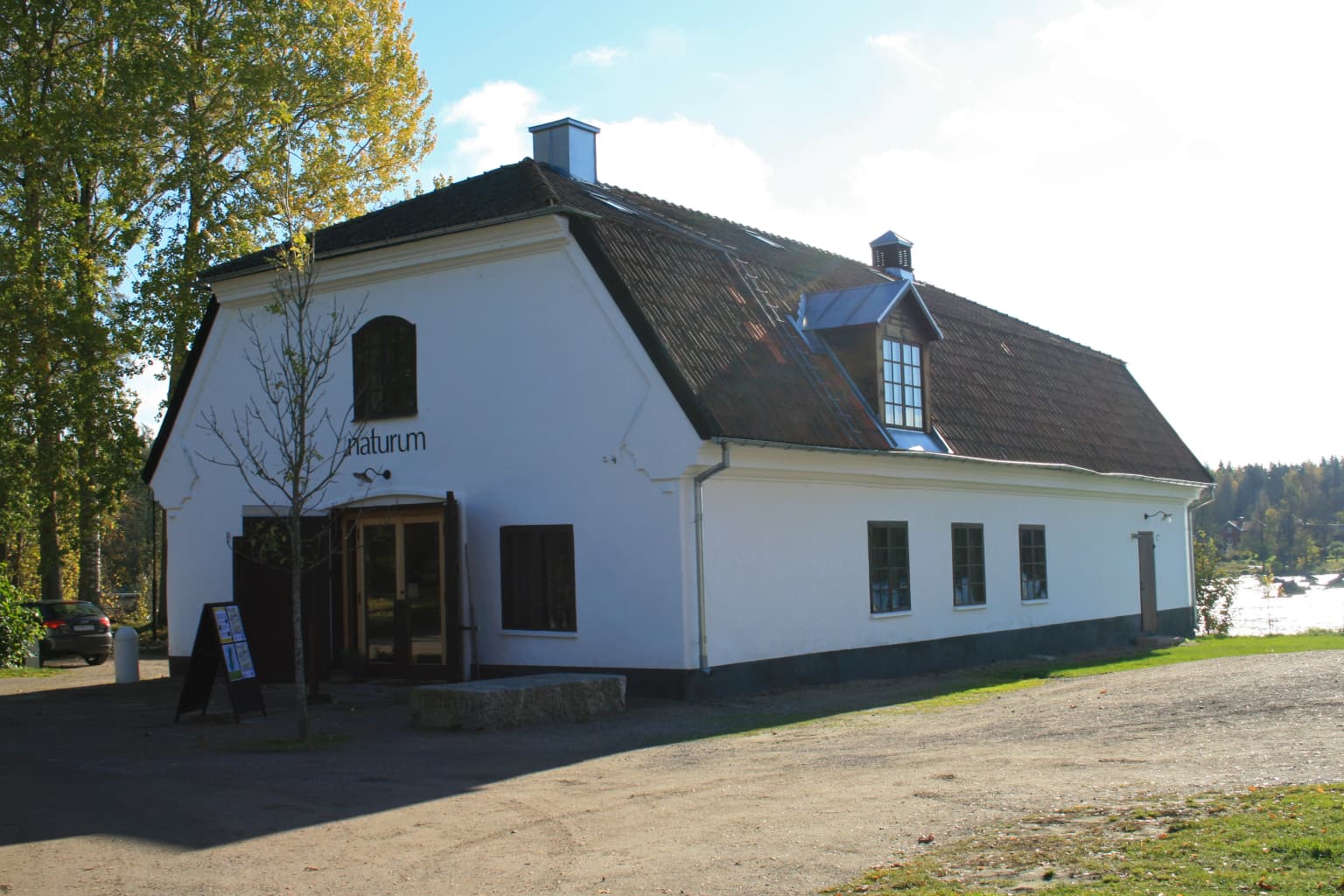
The iron industry left the most visible cultural imprint, particularly through the Gysinge forge, established in 1668. At its peak in the 18th century, the forge employed 50 workers directly and supported another 3,000 people in related occupations. The forge was notable for pioneering the Kjellin induction furnace, the first such oven in the world. The forge's location at Gysinge, with its powerful rapids providing energy, created a small industrial community that included homes, mills, stables, a manor, and eventually a hotel. Today, the Gysinge area receives approximately 250,000 visitors annually, making it one of the region's most visited cultural sites.
Top sights and standout views in Färnebofjärden National Park
Färnebofjärden offers several exceptional experiences that distinguish it among Swedish national parks. The Dalälven River itself is the central attraction—exploring by boat or canoe provides the most immersive way to experience the park's mosaic of channels, islands, and wetlands. The observation tower at Skekarsbo reaches 20 meters height and offers panoramic views across much of the park, particularly spectacular during spring flooding or autumn colors. The birdlife is extraordinary: the concentration of woodpeckers and owls, including the park symbol Ural owl, makes Färnebofjärden a destination for ornithologists and nature enthusiasts throughout the year.
The old-growth forests around Tinäset represent some of the most biodiverse woodland in central Sweden, with Norway spruce over 120 years old and abundant dead wood supporting thousands of species. The wetlands, particularly during spring floods, transform the landscape into an expansive water world that attracts migratory birds in great numbers. The Gysinge forge area provides cultural-historical context, with its 17th-century industrial ruins and the nature center housed in a historic barn from 1814. Fishing for northern pike, grayling, and other species draws enthusiasts to the river's productive waters.
Best time to visit Färnebofjärden National Park
The best time to visit Färnebofjärden depends on interests, but each season offers distinct experiences. Spring brings the spectacular flooding that defines the park's character, with water levels rising dramatically as snow melts in the upper Dalälven catchment. This is a prime time for birdwatching as migratory waterfowl return and the wetlands fill with life, though mosquitoes are also at their peak and can be overwhelming. The summer months of June through August offer the warmest conditions for hiking, boating, and fishing, with long Scandinavian daylight allowing extended exploration. July and August are particularly popular for canoeing and camping at the established sites.
Autumn brings another excellent birdwatching season and spectacular forest colors as the deciduous species turn gold and red. The water levels recede, exposing islands and sandbanks that provide access to areas flooded in spring. Winter offers a completely different experience as the river and wetlands freeze, creating opportunities for winter birdwatching, particularly at Tinäset where the birdlife remains most concentrated. The cold months see fewer visitors but require appropriate equipment for the frozen conditions. The river itself remains partly open at the rapids even when surrounding waters are frozen, a characteristic of this free-flowing section. The park's nature center at Gysinge operates year-round, though opening hours vary seasonally.