Mori Atlas logo
National parkTiveden National Park

Mapping the unique fracture valleys and geological heritage of this protected Swedish wilderness.

Tiveden National Park: Ancient Forest and Granite Landscape in Swedish Protected Area

Tiveden National Park represents a significant protected wilderness area within southern Sweden's Västra Götaland and Örebro Counties. This national park showcases a dramatic landscape shaped by ancient granite bedrock, deep fracture valleys, and extensive old-growth forests, a testament to geological forces that occurred nearly a billion years ago. As one of the remaining large tracts of older forest in the Tiveden region, it offers a unique window into Sweden's natural history and serves as a vital biological crossroads.

Old-growth forestGranite landscapeNational parkFracture valleysSwedenVästergötland
Colorful illustration of a forest scene featuring a large rock formation, pine trees, and scattered deciduous trees under a light sky

Tiveden National Park

National park

Park overview

Structured park overview, official facts, and landscape profile for Tiveden National Park

Tiveden National Park park facts, protected area profile, and essential visitor context
Review the core facts for Tiveden National Park, including designation, size, terrain, visitor scale, habitats, and operating context in one park-focused overview.

About Tiveden National Park

Tiveden National Park protects a distinctive landscape of wild forest, deep valleys, and granite formations in the heart of the Tiveden forest region of southern Sweden. The park straddles the administrative border between Västra Götaland County and Örebro County, centered in the historical province of Västergötland. Unlike much of Sweden's productive forest land, which has been heavily managed for timber production, Tiveden preserves one of the few remaining large areas of older forest in this part of the country. The terrain is characterized by rugged granite bedrock that formed during Precambrian tectonic events approximately 900 to 1,400 million years ago, when the formation of Lake Vättern fractured the ancient rock in a distinctive rectangular pattern. Subsequent glacial activity during the retreat of the inland ice roughly 11,000 years ago further shaped the landscape, leaving behind massive boulder fields concentrated in the fracture valleys and creating the characteristic narrow, 25 to 50 meter deep valleys that define much of the park's topography. The park's vegetation reflects the challenging conditions imposed by thin soils and nutrient-poor granite substrate. Pine dominates the rocky exposed surfaces where only this species can survive the harsh conditions, while spruce occupies areas with slightly deeper soil accumulation. Deciduous trees remain scarce throughout most of the park due to the limited nutrient availability. The forest has been allowed to develop toward old-growth conditions with minimal human intervention, representing a rare example of near-natural forest dynamics in this part of Sweden.

Quick facts and research context for Tiveden National Park

Tiveden National Park covers 2,030 hectares along the border between Västra Götaland and Örebro counties in southern-central Sweden. The park was established in 1983 and expanded by roughly 50% in 2017, now protecting one of the largest remaining contiguous old-growth forest areas in the Tiveden region. The terrain consists of wild forest growing over ancient granite bedrock with characteristic deep, narrow valleys created by geological faulting and cave formation. The park lies within the historical province of Västergötland and is administered jointly by Naturvårdsverket and Örebro County. The area holds particular ecological significance as a transitional zone between northern and southern Scandinavian species.

Park context

Deeper park guide and search-rich context for Tiveden National Park

Tiveden National Park history, landscape, wildlife, and travel context
Explore Tiveden National Park through its history, landscape character, ecosystems, wildlife, conservation priorities, cultural context, and seasonal travel timing in a structured park guide built for atlas discovery and search intent.

Why Tiveden National Park stands out

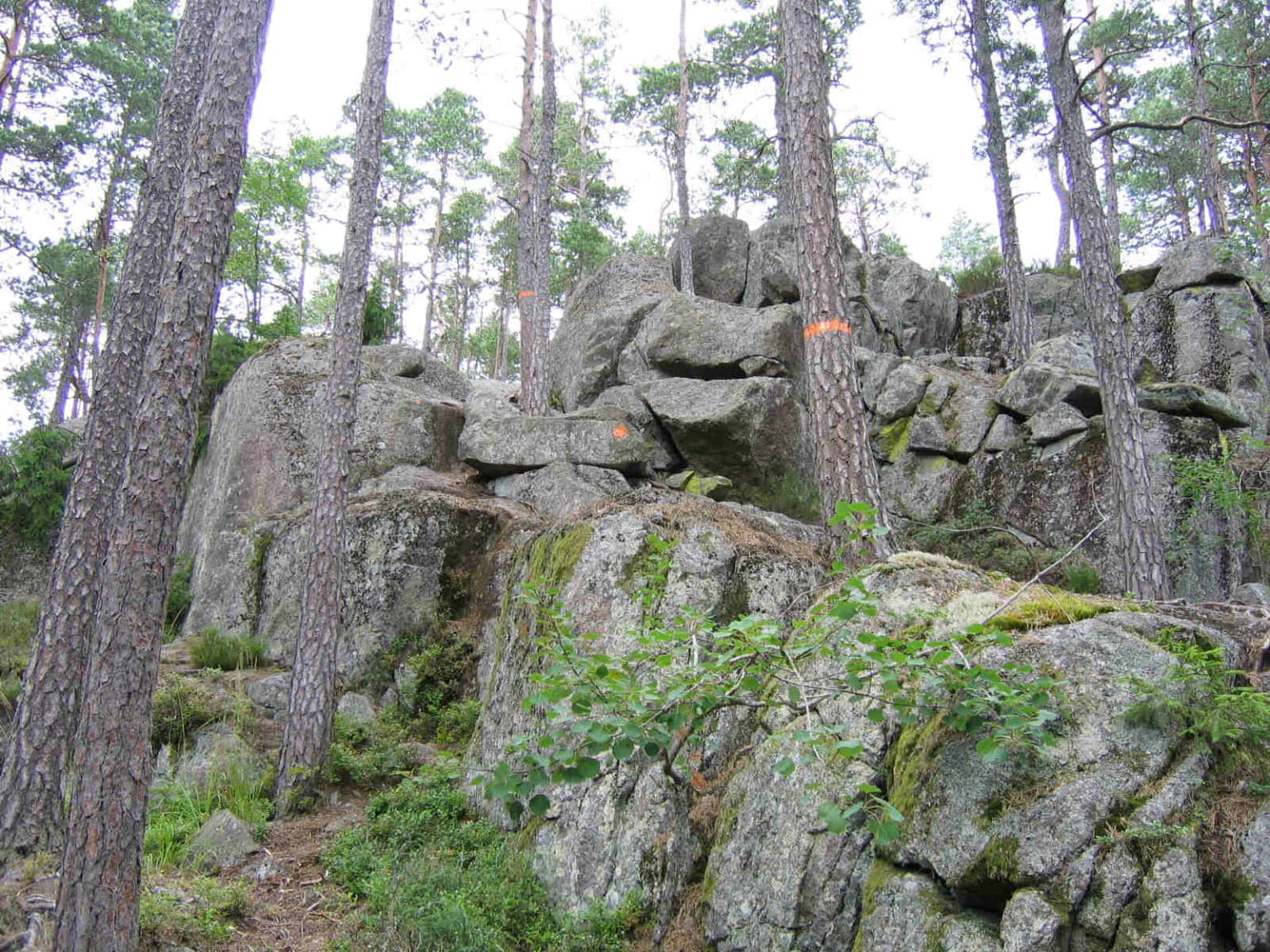
Tiveden National Park is best known for its pristine old-growth forest ecosystems and dramatic granite landscape of fracture valleys, caves, and boulder fields. The park contains the most significant remaining tract of older forest in the Tiveden region, with some forests containing trees up to 200 years old. The distinctive Trollkyrka rock formation exemplifies the park's rugged character, while the network of deep valleys and granite cliffs creates a terrain strikingly different from the more typical Swedish forest landscape. The park also serves as a biological boundary zone where northern and southern Scandinavian species overlap in their distributions, providing habitat for species at the edge of their range including the three-toed woodpecker near its southern limit.

Tall pine trees and large boulders on a forest trail with an orange marker
Trollkyrka trail winding through rocky terrain in Tiveden National Park

Tiveden National Park history and protected-area timeline

The history of human activity in the Tiveden region extends back to the Middle Ages when the dense forest served as a refuge for outlaws and those seeking to escape authority. The remote and difficult terrain made the forest an ideal place for those wishing to avoid detection, establishing a historical association with lawlessness and isolation that persists in local cultural memory. The establishment of Tiveden as a national park in 1983 reflected growing recognition of the region's ecological significance and the need to preserve its remaining old-growth forest characteristics. The initial protected area covered 1,350 hectares, but the park was significantly expanded in 2017 when approximately 50 percent additional land was incorporated, bringing the total area to roughly 2,030 hectares. The 2017 expansion added the area surrounding Lake Stora Trehörningen along with valuable forest land in the eastern portion of the park. This expansion was accompanied by infrastructure improvements including new trail markings with dedicated color-coded routes, a new circular trail around Stora Trehörningen, and two additional access points at Vitsand beach and Ösjönäs in the southwest. The park is administered jointly by Sweden's environmental protection agency Naturvårdsverket and Örebro County, with the cooperation of Västra Götaland County for the portion of the park extending into that administrative area.

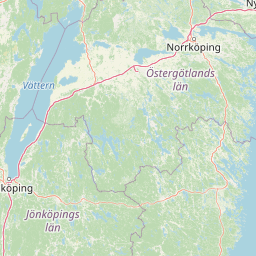
Tiveden National Park landscape and geographic character

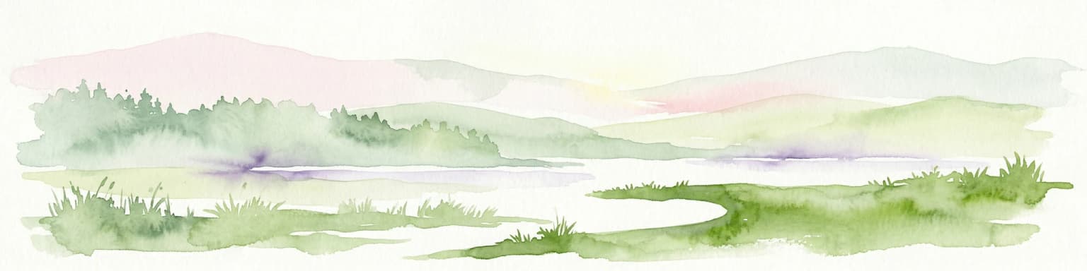
The landscape of Tiveden National Park is defined by its ancient granite bedrock and the distinctive geological features created by tectonic and glacial processes over hundreds of millions of years. The underlying granite dates to the Precambrian era when massive forces associated with the formation of the proto-North Atlantic and the creation of Lake Vättern fractured the continental crust in a rectangular pattern that remains clearly visible in the contemporary topography. The fracture zones, where the bedrock was crushed and broken, became the pathways for water flow and locations where lakes and marshes formed as the softer material eroded. Between these fracture valleys, blocks of intact granite remained as elevated plateaus and ridges, creating the characteristic alternating pattern of steep-sided valleys and rounded hilltops that dominates the park's scenery. Glacial processes during the final glaciation further modified this foundation, with the retreating inland ice approximately 11,000 years ago leaving behind massive boulder fields. Most boulders accumulated in the fracture valleys where they formed extensive block fields, while scattered erratics also rest on the exposed rock surfaces across the plateau areas. The resulting landscape features narrow valleys typically 25 to 50 meters deep, granite cliffs and rock formations including the notable Trollkyrka, caves such as Stenkällas grotta, and numerous small lakes and marsh areas scattered throughout the forest.

Tiveden National Park ecosystems, habitats, and plant life

The ecological character of Tiveden National Park reflects the challenging conditions created by nutrient-poor granite substrate and thin soils that limit plant growth and habitat complexity. The forest ecosystem consists primarily of pine and spruce, with pine dominating the exposed rock surfaces and shallower soils while spruce occupies areas with slightly greater soil accumulation. Deciduous trees remain uncommon throughout most of the park due to the limited nutrient availability. The park contains the largest remaining area of older forest in the Tiveden region, with some forest stands reaching 200 years of age. The vegetation on exposed rock surfaces consists largely of reindeer lichens and heather, while areas with minimal soil development support blueberry bushes as the primary ground cover. Species requiring richer soil conditions such as liverwort and hazel occur only rarely in isolated locations with local soil accumulation. The park's position in southern-central Sweden places it at a biogeographic crossroads where northern and southern species distributions meet, creating a transitional ecological character distinct from both the boreal north and the deciduous forest zone to the south.

Tiveden National Park wildlife and species highlights

The wildlife population in Tiveden National Park reflects the park's position as a transitional zone between northern and southern Scandinavian faunal provinces. Large mammals present include elk and roe deer, though population densities remain relatively low due to the limited productivity of the forest ecosystem. Smaller mammals include red fox, badger, marten, and squirrel, with beaver also present and occasionally creating management challenges by damming streams and drainage ditches adjacent to roads within the park. The old-growth forest characteristics support a diverse bird community associated with mature woodland, including capercaillie, pygmy owl, and several woodpecker species. The three-toed woodpecker reaches near its southern range limit in Tiveden, making the park significant for monitoring the southern edge of this species' distribution. The marshes and wetland areas support species typical of these habitats, including dwarf birch, a shrub species more common in the northern Norrland region that reaches its southern boundary in the Tiveden marshes.

Tiveden National Park conservation status and protection priorities

Tiveden National Park was established with the explicit purpose of preserving a contiguous forest, lake, and fracture valley landscape in essentially unmodified condition while allowing natural forest dynamics to proceed toward old-growth development. The management philosophy permits natural processes to operate with minimal human intervention, with the approach described as allowing land, water, plants, and animal life to develop essentially freely. This represents a significant departure from the intensive forest management that characterizes most of Sweden's productive forest land, where timber extraction has dramatically altered forest composition and structure. The park protects what remains of a once-extensive forest landscape that covered much of the Tiveden region, now reduced to this single significant protected area of older forest. The expansion in 2017 added valuable mature forest habitat and the lake ecosystem of Stora Trehörningen, strengthening the ecological coherence of the protected area. The park also provides public access for recreation along marked trails while protecting core natural values from damage.

Tiveden National Park cultural meaning and human context

The Tiveden forest holds a significant place in Swedish cultural history and folklore, with the landscape traditionally associated with supernatural beings including trolls, dwarves, and other figures from Scandinavian mythology. The dramatic granite formations, deep shadowed valleys, and isolated character of the forest contributed to these associations, and the park's name itself derives from this cultural heritage. Historical records indicate that during the Middle Ages the forest served as a refuge for outlaws and those escaping authority, its rugged and remote character providing natural concealment. The region formed part of the historical province of Västergötland, one of Sweden's traditional landskap, and the park now lies at the administrative intersection of two modern counties. The cultural connections to the landscape remain evident in place names and local traditions, providing a human context that enriches the purely ecological interpretation of the protected area.

Top sights and standout views in Tiveden National Park

Tiveden National Park offers distinctive experiences centered on its rugged old-growth forest landscape and unique geological formations. The Trollkyrka rock formation stands as the park's most recognizable landmark, a dramatic pile of granite blocks rising above the forest canopy. Visitors can explore a network of long hiking trails passing through diverse terrain including mature forest, deep valleys, rocky ridges, and lake shores. The 2017 expansion created new access points and a complete circuit around Lake Stora Trehörningen, providing opportunities to experience the lake landscape that was previously less accessible. The Stenkällas grotta cave offers another geological highlight, while the Vitsand beach area provides swimming access in the northwestern part of the park. The visitor center with its exhibition provides orientation and educational context for understanding the park's natural and cultural history. Portions of the longer Bergslagsleden trail pass through the park, connecting it to Sweden's broader network of long-distance hiking routes.

Best time to visit Tiveden National Park

The park can be visited throughout the year, with each season offering a distinct character. Summer months bring the most accessible trail conditions and opportunity to experience the full forest canopy, while the long Swedish winter transforms the landscape into a snowy wilderness with different appeal for those seeking solitude. The shoulder seasons of spring and autumn offer intermediate conditions and the opportunity to observe seasonal changes in the forest. Summer provides the warmest conditions for swimming at Vitsand beach and the longest days for extended hiking, though this is also the peak visitor season. Autumn brings the changing colors of the forest and may offer improved wildlife viewing opportunities as animals become more active during the cooler days. Winter access requires appropriate preparation for cold conditions and variable snow cover, but rewards visitors with a particularly peaceful experience of the forest in its quiet season.

Park location guide

Geography guide, regional context, and park location map for Tiveden National Park

Tiveden National Park park geography, regions, and map view in Sweden
Understand where Tiveden National Park sits in Sweden through a broader geographic reading of the surrounding landscape, nearby location context, and its mapped position within the national park landscape.

How Tiveden National Park fits into Sweden

Sweden, formally the Kingdom of Sweden, is a highly developed Nordic country on the Scandinavian Peninsula in Northern Europe. With a population of 10.6 million and an area of 450,295 km², it is the largest Nordic country by both area and population. Sweden is a constitutional monarchy with Stockholm as its capital and largest city, known for its advanced economy, social welfare system, and membership in the European Union and NATO.

Wider geography shaping Tiveden National Park in Sweden

Sweden occupies the eastern portion of the Scandinavian Peninsula in Northern Europe. It borders Norway to the west and north, Finland to the east, and shares a maritime border with Denmark to the southwest across the Øresund. The country has an extensive coastline along the Baltic Sea and Gulf of Bothnia, dotted with thousands of islands. The terrain varies from mountainous regions in the northwest to low-lying coastal areas and inland lakes in the south and central parts.

Map view of Tiveden National Park

Use this park location map to pinpoint Tiveden National Park in Sweden, understand its exact geographic position, and read its mapped placement within the surrounding landscape more clearly.

Pigeon | © OpenStreetMap contributors

Location context for Tiveden National Park

Örebro CountyVästra Götaland County

Visually explore Tiveden National Park's rugged granite landscapes, pristine old-growth forests, and diverse protected habitats.

Tiveden National Park Photos: Visual Guide to Sweden's Ancient Forests and Granite Landscapes
Browse a curated collection of Tiveden National Park imagery, showcasing its pristine old-growth forests, dramatic granite terrain, and distinctive fracture valleys. These visual resources help you understand the park's unique geological heritage and its role as a crucial protected landscape in Sweden's interior.

Tall pine trees and large boulders on a forest trail with an orange marker

Large gray rock formation standing upright in a lush green forest surrounded by trees and undergrowth

Park atlas

Trace the regional spread of Sweden's protected landscapes and compare diverse forest ecosystems and granite formations surrounding Tiveden.

Explore Nearby National Parks and Protected Areas Beyond Tiveden National Park's Ancient Forests
Explore additional national parks and protected areas geographically linked to Tiveden National Park, encompassing similar old-growth forest ecosystems and rugged granite landscapes within Sweden's interior. Comparing these adjacent protected areas offers essential geographic context for understanding regional conservation efforts and the distinct variations within Sweden's boreal forest environments.
National parkÖrebro County

Garphyttan National Park: Pioneer Protected Landscape and Historic Swedish Terrain

Explore meadows, forests, and historic geography in Örebro County.

Garphyttan National Park, established in 1909, is a testament to early Swedish nature conservation efforts. This protected landscape features rolling forested terrain and distinctive flower-rich meadows, maintained through traditional practices that highlight Sweden's cultural heritage. Located within Örebro County, the park offers valuable insights into regional geography and the formation of mapped protected areas, making it a key destination for understanding historical landscape preservation.

Area
1.11 km²
Established
1909
IUCN
II
Relief
Lowland
National parkVästra Götaland County

Djurö National Park: Sweden's Lake Archipelago National Park in Västra Götaland County

Mapped island geography and protected aquatic landscapes.

Djurö National Park stands as a singular example of Sweden's protected natural areas, characterized by its unique position as a national park comprising a complete archipelago within Lake Vänern. This page focuses on the geographic identity of Djurö National Park, detailing its island distribution, protected land status, and the distinct landscape it preserves. Users will find context for its place within Västra Götaland County, facilitating an atlas-based understanding of this exceptional aquatic environment and its mapped boundaries.

Area
24 km²
Established
1991
IUCN
II
Relief
Mixed relief
Watercolor illustration of a lake surrounded by trees and hills
National parkKalmar County

Norra Kvill National Park: Ancient Coniferous Forest Protected Landscape in Kalmar County

Discover its unique mapped terrain and natural forest heritage.

Norra Kvill National Park safeguards a remarkable old-growth coniferous forest ecosystem, a rarity in southern Sweden. This park is characterized by ancient pines, some dating back over 350 years, thriving on steep fault-formed terrain and amid boulder fields. Its protected status ensures the preservation of this unique natural landscape, providing invaluable insight into forest ecology and regional geography within Kalmar County. MoriAtlas offers a structured approach to understanding its mapped boundaries and ecological significance.

Area
1.14 km²
Established
1927
IUCN
II
Relief
Highland
Watercolor painting of a landscape featuring mountains, wetland, and forest
National parkJönköping County

Store Mosse National Park: Explore Sweden's Largest Bog Landscape & Protected Area

Detailed park map, geography, and peatland ecosystem context.

Delve into Store Mosse National Park, a significant protected landscape in Jönköping County, Sweden, celebrated for its vast peat bog, the largest south of Lapland. This page provides detailed geographic context, mapping its unique wetland terrain, interspersed lakes like Kävsjön, and surrounding pine forests. Understand the park's ecological importance as a Ramsar site and its place within the South Småland peneplain for structured natural area discovery.

Area
78.5 km²
Established
1982
IUCN
II
Relief
Lowland
National parkVästra Götaland County

Tresticklan National Park: Preserved Old-Growth Forest on Rocky Heathland

Explore the geographic context and mapped boundaries of this vital protected area.

Tresticklan National Park is a vital protected landscape in Västra Götaland County, Sweden, safeguarding one of southern Scandinavia's most significant old-growth forest ecosystems. The park's terrain is defined by exposed granite bedrock, sparse heath pine forests, and a wild, remote character. MoriAtlas provides a structured overview of Tresticklan National Park, detailing its geographic setting and protected area status for explorers and cartographers.

Area
28.97 km²
Established
1996
IUCN
II
Relief
Upland
National parkVästmanland County

Färnebofjärden National Park: Protected River Landscape and Birdlife Atlas

Explore Västmanland County's unique riverine protected area and mapped terrain.

Färnebofjärden National Park offers a unique geographic perspective as a protected national park situated in Sweden's Västmanland County. This page details the park's distinct riverine landscape, characterized by the Dalälven River's intricate network of channels, wetlands, and islands, and its position at a critical ecological frontier. Discover the mapped boundaries and regional context of this important protected area, renowned for its exceptional bird populations and diverse natural habitats.

Area
101 km²
Established
1998
IUCN
II
Relief
Lowland
National parkVästra Götaland County

Kosterhavet National Park: A Marine National Park Exploring Unique Archipelago Geography

Discover its mapped underwater terrain and rich marine biodiversity.

Kosterhavet National Park, located in Västra Götaland County, is Sweden's first marine national park, dedicated to protecting the unique aquatic environment of the Koster Islands. This protected area is renowned for its exceptional marine biodiversity, including rare cold-water coral reefs and the country's largest seal colony, all situated within a dramatic underwater geography characterized by deep fjords. Use MoriAtlas to explore the mapped extent of this vital marine protected landscape and understand its significant place in regional and national conservation efforts.

Area
388.78 km²
Established
2009
IUCN
II
Visitors
90K annual
National park

Blå Jungfrun National Park: Baltic Sea Island National Park with Blue Granite Cliffs

Explore its mapped boundaries and distinct coastal terrain.

Blå Jungfrun National Park is a distinctive Swedish national park situated on a Baltic Sea island, immediately recognizable by its prominent blue-hued granite cliffs. As a protected landscape, it offers a unique glimpse into island ecosystems and rugged coastal geography. MoriAtlas provides detailed context for its mapped boundaries, showcasing the natural and geological significance of this solitary protected area within the regional atlas.

Relief
Mixed relief
Access
Moderate access
Scope
Mixed
Water
Major water bodies

Common questions about visiting, size, designation, and location context for Tiveden National Park

Tiveden National Park FAQs for park facts, access, geography, and protected area context
Find quick answers about Tiveden National Park, including protected-area facts, park geography, trail and visitor context, and how the park fits into its surrounding country and regional landscape.
MoriAtlas Explorer

Continue Your Protected Areas Search Across the Global Atlas

Deepen your exploration by continuing the structured search for national parks and protected areas worldwide. Utilize the comprehensive filtering capabilities to compare different conservation landscapes and refine your understanding of global park geography. Discover more about the distribution and characteristics of protected natural areas.

Global natural geography