
Why Kosterhavet National Park stands out
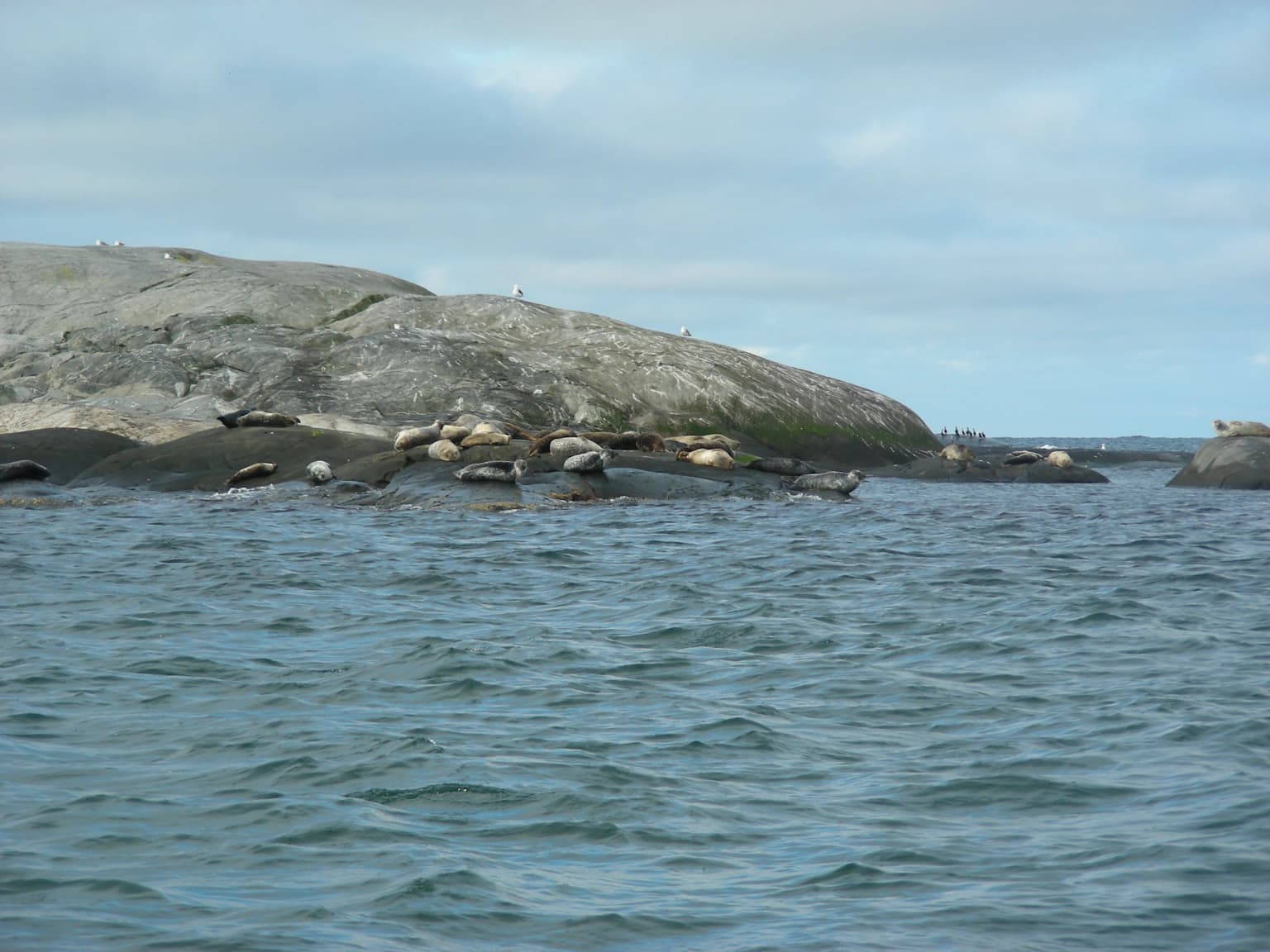
Kosterhavet is best known for its extraordinary marine biodiversity and its status as Sweden's pioneering marine national park. The park contains the country's largest seal colony, home to harbor seals that comprise roughly one-sixth of Sweden's entire west coast population. The underwater landscape features the Kosterfjord, a 200-meter deep fjord with cold, high-salinity conditions that support Atlantic species at the northern edge of their range. The coral reef in the Säcken basin represents one of only two living coral reefs in Swedish waters, hosting species found nowhere else in the country. The park also serves as an Important Bird Area for species including the European shag and the purple sandpiper, with over 100 seabird species recorded within its boundaries.
Kosterhavet National Park history and protected-area timeline
The protected area movement around Kosterhavet began in the late 1970s when regional authorities recognized the ecological importance of the Kosterfjord. In 1984, the Koster Islands themselves were protected as a nature reserve, though the surrounding waters remained unprotected. The Swedish Environmental Protection Agency included the area in its first national park proposal in 1988, but local opposition from island communities concerned about restrictions on fishing and development delayed the project for nearly two decades.
The situation changed as the islands transitioned from a fishing-based economy to tourism, with residents eventually viewing national park status as a way to sustainably manage increasing visitor numbers while preserving the marine environment. Detailed biological surveys conducted in 1997 by the Tjärnö Marine Biological Laboratory documented the extraordinary biodiversity, including the coral reef in the Säcken. Following extensive consultations with fishermen, researchers, and local communities, the proposal advanced. In 2008, Swedish and Norwegian authorities coordinated their efforts, leading to the simultaneous inauguration of both Kosterhavet and Ytre Hvaler National Parks on September 9, 2009, with King Carl XVI Gustaf of Sweden and Crown Prince Haakon of Norway presiding.
Human settlement in the Koster Islands dates to the late Stone Age or early Bronze Age, with archaeological evidence on Nordkoster showing occupation beginning around 1500 BCE. The islands' prosperity historically depended on fishing, particularly during the great herring periods of the 18th century when the population grew substantially. The islands became Swedish territory in 1658 following the Treaty of Roskilde. By the mid-20th century, economic changes led to population decline, with residents decreasing from approximately 600 in 1930 to around 320 today, though summer tourism has brought new economic activity.
Kosterhavet National Park landscape and geographic character
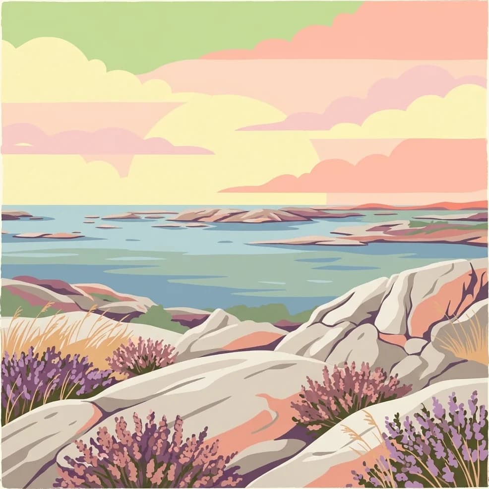
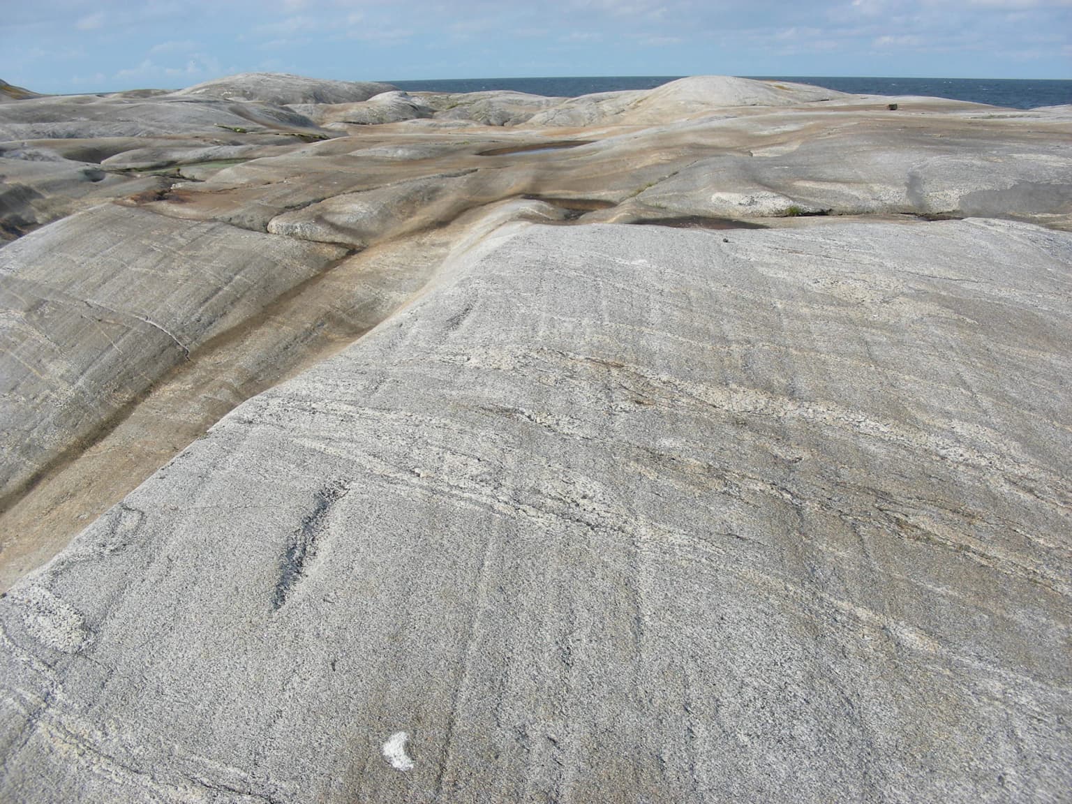
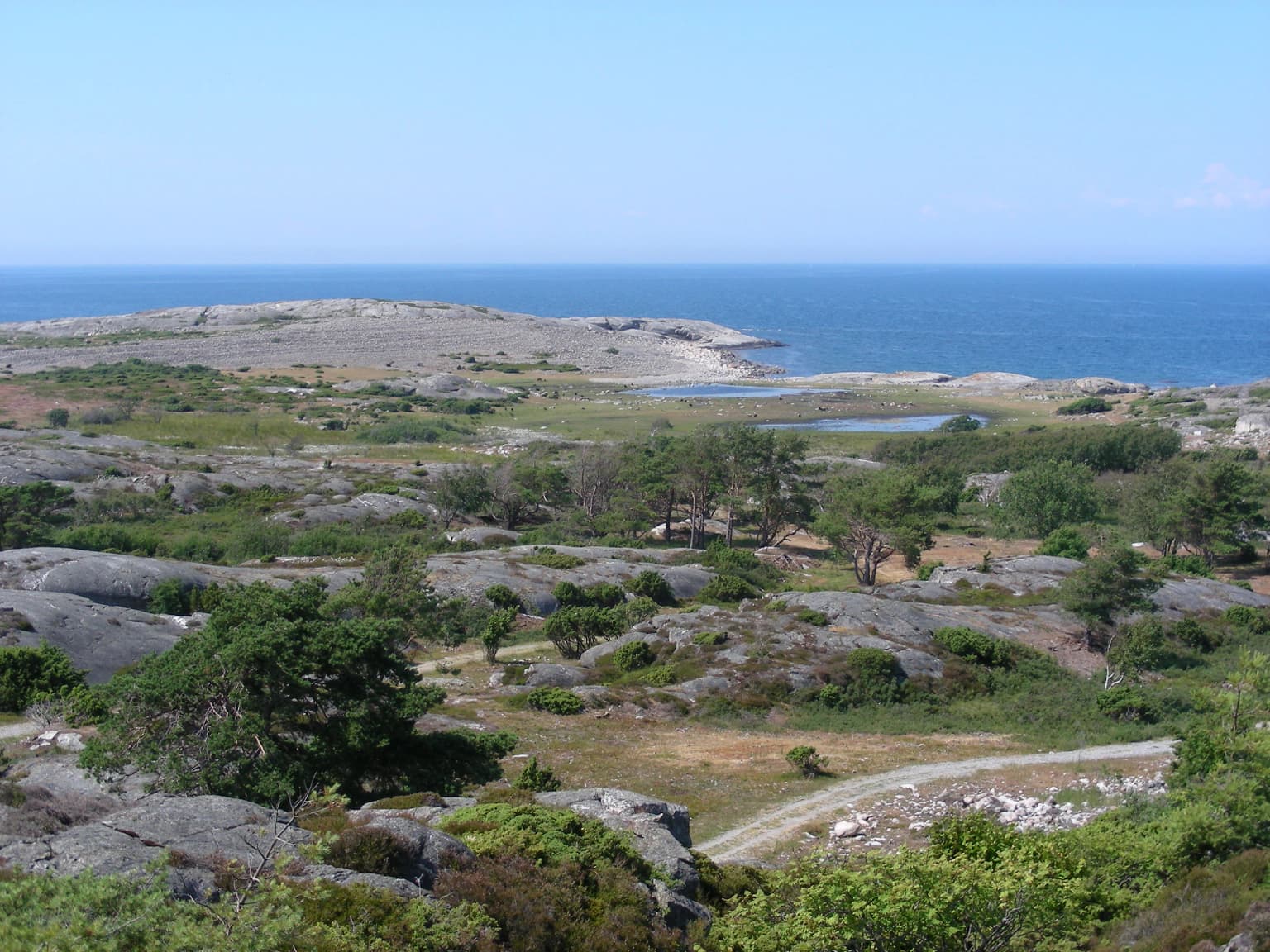
The landscape of Kosterhavet is fundamentally maritime, with the overwhelming majority of the protected area consisting of marine waters rather than land. The Koster Islands archipelago comprises nearly 400 islands, islets, and skerries, with the largest being Sydkoster at 8 square kilometers and Nordkoster at 4 square kilometers. These islands feature the characteristic granite geology of Bohuslän, a cracked valley landscape with steep rocky cliffs descending into productive fishing waters.
Below the water surface, the underwater topography is equally dramatic. The Kosterfjord cuts through the archipelago as a deep channel, reaching 247 meters southeast of Ramsö—extraordinary depth compared to the North Sea's average of 94 meters. This deep channel, known as the Koster Channel or Kosterrännan, connects to the Norwegian Channel and allows Atlantic waters to flow into Swedish waters. The fjord floor transitions between rocky substrates and sandy sediments, with the deepest areas hosting the cold-water coral formations.
The terrestrial elements within the park are limited to small islands and rocky outcrops, though the larger islands excluded from the park boundary contain the archipelago's highest points—Kosterbonden on Nordkoster rises to 58.8 meters, while Valfjället on Sydkoster reaches 45 meters. Between the rocky ridges, sandy areas have developed in sheltered coves, supporting the limited terrestrial vegetation that survives on these exposed coastal islands.
Kosterhavet National Park ecosystems, habitats, and plant life
The nature of Kosterhavet is defined by the convergence of Atlantic and Baltic Sea conditions, creating a marine environment of exceptional ecological richness. The park lies at the boundary where low-salinity Baltic Sea surface waters meet the salty Atlantic inflow from the North Sea, creating a complex layered system where different species occupy different depth zones. The stable cold temperatures of 5-7°C in the deep waters and the high salinity of 34-35 parts per thousand support species typical of more northerly Atlantic conditions.
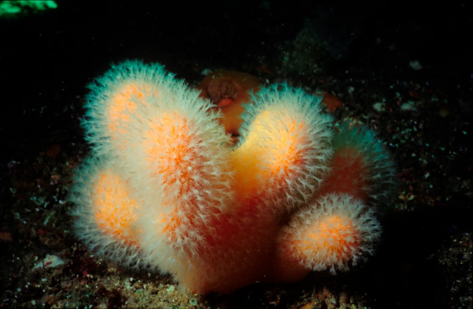
The marine habitats range from shallow seagrass beds dominated by eelgrass to deep muddy substrates and the iconic coral reef formations. The shallow hard and soft bottoms support extensive kelp forests and blue mussel beds, while deeper areas harbor diverse communities of sponges, brachiopods, and sea pens. The coral reef in the Säcken, composed of the cold-water coral Lophelia pertusa, represents the northernmost extent of this species' range and supports a unique assemblage of associated species. Over 200 species documented in the park are not found anywhere else in Sweden, reflecting the ecological uniqueness of these waters.
On land, the limited terrestrial portions feature heathland vegetation with heather and mosses, with juniper and other conifers in sheltered areas. The larger islands outside the park boundary contain deciduous woodlands, but these are protected separately as nature reserves. The combination of mild coastal climate, exposed bedrock, and calcareous soils where sediments have accumulated supports plant communities distinct from mainland areas.
Kosterhavet National Park wildlife and species highlights
Kosterhavet supports an extraordinary diversity of marine wildlife, with over 6,000 species identified from the park's waters—the highest marine biodiversity in Sweden. The park is particularly famous for its seal population, hosting Sweden's largest colony of harbor seals, estimated at roughly one-sixth of the entire Swedish west coast population. Gray seals are also present, and both species have recovered from population crashes caused by phocine distemper virus epidemics in 1988, 2002, and 2007.
The seabird fauna is equally impressive, with over 100 species recorded. The park functions as an Important Bird Area for European shag and purple sandpiper, supporting more than 1% of the European wintering population of these species. The islands provide critical nesting habitat for Arctic terns and skuas, while winter brings large populations of common scoter, velvet scoter, and red-breasted merganser. The eider is particularly common year-round, with populations swelling to around 10,000 individuals during spring and autumn migrations.
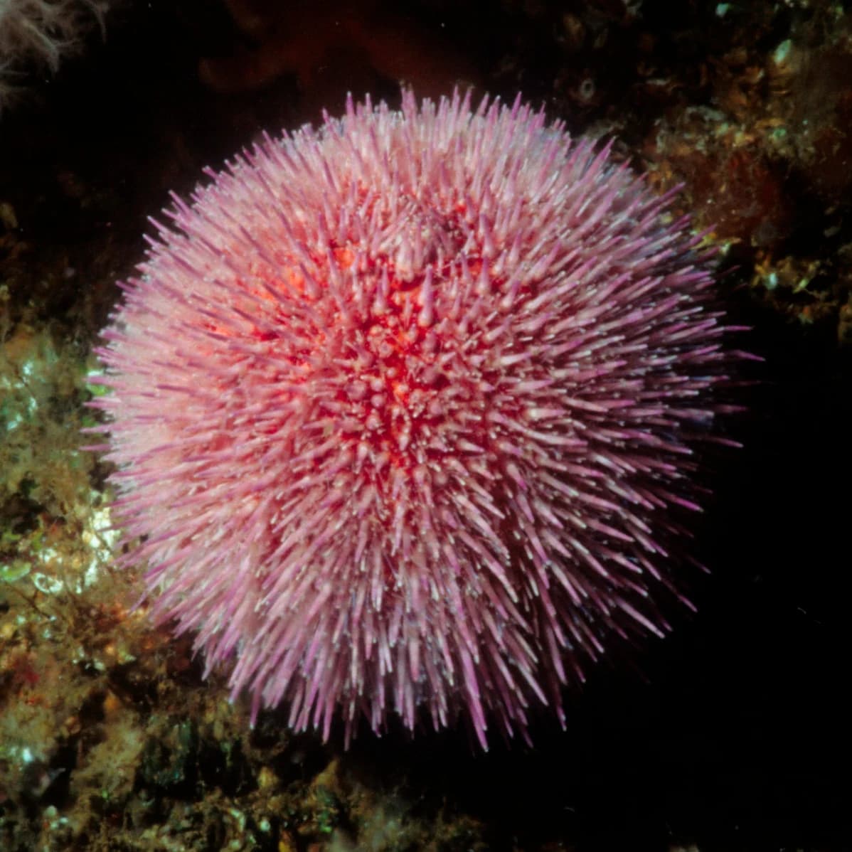
The fish community historically included abundant cod, haddock, plaice, and sole, though species composition has shifted since the 1970s with mackerel and herring now more common. The park still supports 19 red-listed fish species, including the spiny dogfish and critically endangered European eel. Marine invertebrates are exceptionally diverse, with 11 crustacean and 51 mollusk species on Sweden's red list, including the Norwegian lobster and edible crab. Whale and dolphin species including common porpoise, orca, long-finned pilot whale, and minke whale have been observed in the park's waters.
Kosterhavet National Park conservation status and protection priorities
Kosterhavet represents a critical conservation priority due to the exceptional biological richness of its marine waters and the multiple threats facing these ecosystems. The park protects one of only two living coral reefs in Swedish waters—the reef in the Säcken covers approximately 5,000 square meters with about 300 square meters of living coral. This reef has been damaged by bottom trawling, and genetic studies have shown it cannot naturally recover due to limited coral larvae dispersal, prompting restoration efforts by researchers from the University of Gothenburg who have begun transplanting corals from Norwegian reefs.
The conservation framework acknowledges that fishing remains important to the local economy while implementing protections for the most sensitive habitats. Trawling is restricted to shrimp fishing only and prohibited near sensitive areas. The park is zoned with different levels of protection: zone A limits boat speeds during summer, zone B restricts motorized traffic near certain islands, zone C protects bird and seal colonies with landing prohibitions April through August, zone D protects coral reefs with anchoring restrictions, and zone E prohibits hunting. Of Sweden's 218 red-listed marine species, 196 (86%) occur within the park, demonstrating its irreplaceable conservation value. Thirteen species and eleven habitats are also listed as threatened under the OSPAR convention for protecting the marine environment of the North Atlantic.
Kosterhavet National Park cultural meaning and human context
The Koster Islands have been inhabited since the late Stone Age or early Bronze Age, approximately 1500 BCE, with the oldest settlement traces found on Nordkoster. The name "Koster" may derive from the Old Norse word "kostir" meaning "food places," likely referring to the abundant fishing grounds that historically sustained the island communities. Medieval records from 1388 mention seven farms distributed between Nordkoster and Sydkoster, with inhabitants engaged in fishing, sealing, and bird hunting alongside agriculture.
The islands experienced economic prosperity during the great herring periods of the 18th and early 19th centuries, when fishing became more important than agriculture and the population grew substantially. The lobster fishery developed in the late 17th century, with Dutch traders transporting lobsters in specialized boats—a heritage reflected in Strömstad's municipal coat of arms. The Treaty of Roskilde in 1658 brought the islands under Swedish control, allowing residents to purchase land from the crown rather than paying rent to previous ecclesiastical and noble owners.
Traditional island life declined dramatically in the mid-20th century as industrialization drew people to cities, and the population fell from around 600 in 1930 to approximately 320 permanent residents today. The transition to tourism-based economy created tensions between permanent residents and affluent summer property owners, with rising real estate prices reshaping island communities. The UNESCO World Heritage Site of Tanum Rock Carvings, located on the adjacent mainland, testifies to the ancient significance of this coastal region, with numerous petroglyphs depicting boats reflecting the maritime focus of prehistoric inhabitants.
Top sights and standout views in Kosterhavet National Park
Kosterhavet National Park stands as Sweden's premier marine protected area, offering visitors access to underwater environments unique in Swedish waters. The coral reef in the Säcken provides extraordinary diving opportunities to observe cold-water corals and their associated species in their natural habitat. The harbor seal colony represents the largest in Sweden, with viewing opportunities from several protected islets. The park's status as an Important Bird Area makes it a significant destination for birdwatchers, particularly during migration seasons when thousands of eiders and other seabirds pass through.
The combination of deep fjord waters, high biodiversity, and accessible islands creates a distinctive visitor experience that blends archipelago exploration with marine nature observation. The nearby Tjärnö Marine Biological Laboratory offers educational programs and aquarium facilities where visitors can learn about the park's marine life. The annual visitor count of approximately 90,000 reflects the popularity of this destination, with ferry connections from Strömstad making the islands accessible to those without private boats. The park's creation story demonstrates how scientific research, community engagement, and international cooperation can establish lasting environmental protection.
Best time to visit Kosterhavet National Park
The optimal time to visit Kosterhavet National Park is during the summer months from June through August, when daily visitor numbers can reach 3,000 and may double during favorable weather conditions. This period offers the warmest air temperatures, extended daylight hours, and calm seas ideal for boating, swimming, and diving activities. The marine environment is most accessible for water-based recreation during these months, though this is also the peak tourist season with the greatest crowds.
For wildlife observation, different seasons offer distinct advantages. Spring and autumn migrations bring large concentrations of seabirds, particularly eiders, with approximately 10,000 individuals present during these periods. Seal pupping occurs in June, making early summer a good time to observe harbor seals with their pups on the protected islets. Winter visits offer a more tranquil experience with fewer visitors and the opportunity to observe wintering species including the purple sandpiper, which is the only place in Sweden where this species overwinters. The shoulder seasons of May and September offer a balance between favorable weather conditions and reduced crowds, though boat services may be less frequent than during peak summer.