Mori Atlas logo
National parkYtre Hvaler National Park

Discover the unique skerry archipelago and vital cold water coral reefs of the Oslofjord coast.

Ytre Hvaler National Park: Norway's Premier Marine Protected Landscape and Atlas Entry

MoriAtlas presents Ytre Hvaler National Park, Norway's pioneering marine national park located off the Østfold coast. This page offers a detailed geographic perspective on a landscape defined by a vast archipelago of islands and islets, interwoven with significant marine environments. Explore the mapped boundaries of this protected area, understand its critical role as a marine ecosystem, and uncover the unique context of the Tisler cold water coral reef, all contributing to Norway's distinctive coastal geography.

marine national parkNorwegian archipelagocold water coral reefcoastal wildernessskerry landscapeOslofjord

Ytre Hvaler National Park

National park

Park overview

Structured park overview, official facts, and landscape profile for Ytre Hvaler National Park

Ytre Hvaler National Park park facts, protected area profile, and essential visitor context
Review the core facts for Ytre Hvaler National Park, including designation, size, terrain, visitor scale, habitats, and operating context in one park-focused overview.

About Ytre Hvaler National Park

Ytre Hvaler National Park occupies a unique position in Norway's protected area network as the country's first national marine park. Unlike Norway's other national parks, which typically emphasize mountain ranges, forests, or arctic tundra, Ytre Hvaler is defined by its marine environment—the sheltered yet productive waters of the outer Oslofjord. The park encompasses the outer reaches of the extensive skerry archipelago that lines the eastern shore of Oslofjord, creating a landscape where land and sea intermingle in countless configurations of islands, islets, rocks, and open water.

The establishment of Ytre Hvaler in 2009 marked a significant evolution in Norway's approach to conservation. While the country had long protected its mountainous and forested wilderness, the creation of this marine park acknowledged that coastal and marine ecosystems required equivalent protection. The park's boundaries were drawn to encompass not just the islands themselves but the critical marine waters that surround them, recognizing that the health of the terrestrial islands is inseparable from the condition of the surrounding sea.

The park's location at the mouth of Oslofjord places it at a biogeographic crossroads where Atlantic and Baltic sea influences mix, creating unusual environmental conditions. This mixing zone supports distinctive marine communities that differ from both fully Atlantic and fully Baltic ecosystems. The complexity of the coastline—with its countless islands, coves, and exposed points—creates tremendous habitat diversity within a relatively compact area, supporting everything from intertidal communities to deep-water coral reefs.

Quick facts and research context for Ytre Hvaler National Park

Ytre Hvaler National Park is Norway's pioneering marine protected area, established in 2009 to safeguard the coastal skerry ecosystems of the eastern Oslofjord. The park spans 354 km², with 340 km² being marine waters and only 14 km² land, making it overwhelmingly a marine park rather than a terrestrial one. It shares its southern border with Sweden and connects to Kosterhavet National Park across the Norway-Sweden boundary. The park is managed from Skjærhalden, a settlement within the archipelago. The Tisler Reef near Tisler island represents Europe's largest cold water coral reef in sheltered waters, supporting a unique deep-sea ecosystem. The islands have been inhabited since the Bronze Age, with Akerøya settled between 1682 and 1807, reflecting centuries of continuous coastal human presence.

Park context

Deeper park guide and search-rich context for Ytre Hvaler National Park

Ytre Hvaler National Park history, landscape, wildlife, and travel context
Explore Ytre Hvaler National Park through its history, landscape character, ecosystems, wildlife, conservation priorities, cultural context, and seasonal travel timing in a structured park guide built for atlas discovery and search intent.

Why Ytre Hvaler National Park stands out

Ytre Hvaler is best known as Norway's first national marine park, a designation that reflects its extraordinary focus on protecting marine ecosystems rather than terrestrial landscapes. The park's defining natural feature is the Tisler Reef, a cold water coral formation that stands as the largest known coral reef in sheltered European waters. This reef, composed primarily of Lophelia coral, supports a diverse community of marine organisms in what would otherwise be cold, dark Norwegian coastal waters. The park is also renowned for its extensive network of skerries and islands, rocky, wave-battered landforms that create a quintessential Norwegian coastal landscape. Maritime heritage is another distinguishing element, with over fifty shipwrecks documented within park waters, including historically significant vessels from the 17th and 18th centuries.

Ytre Hvaler National Park history and protected-area timeline

Ytre Hvaler National Park was established on 26 June 2009, representing a milestone in Norwegian conservation history as the nation's first national marine park. The creation of the park reflected growing recognition that Norway's extensive coastlines and marine environments required formal protection comparable to that already afforded to terrestrial wilderness areas. The park was carved from existing protections that had been gradually strengthened over preceding decades.

Human presence in the Ytre Hvaler archipelago stretches back to the Bronze Age, making this one of the longest-continuously inhabited coastal areas in Norway. Archaeological evidence suggests that the sheltered waters and rich fishing grounds attracted settlement very early in Norwegian prehistory. The islands served as important bases for fishing, maritime trade, and coastal navigation throughout the historical period. Akerøya, one of the larger islands, was formally settled between 1682 and 1807, though the surrounding waters had been used by fishermen and sailors for centuries before this.

The park contains significant maritime heritage beyond ancient settlement. Over fifty shipwrecks lie within park waters, representing vessels lost over multiple centuries of intense maritime activity in the Oslofjord. The most notable is the Danish frigate HDMS Lossen, lost during the catastrophic Christmas Flood of 1717—a storm surge that devastated coastlines throughout the region and claimed numerous vessels. These wrecks represent both a cultural resource and underwater archaeological heritage requiring careful management within the park's framework.

Ytre Hvaler National Park landscape and geographic character

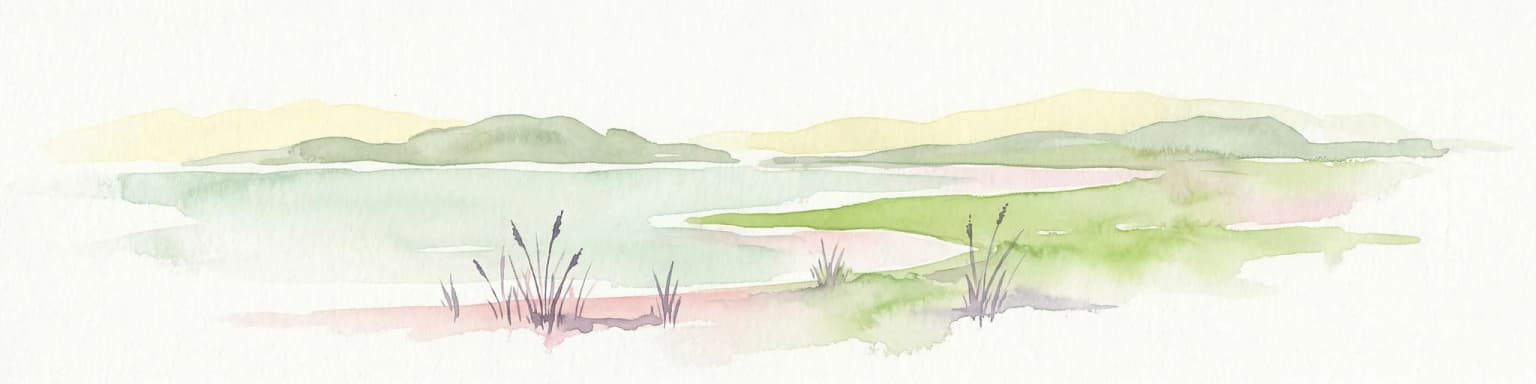
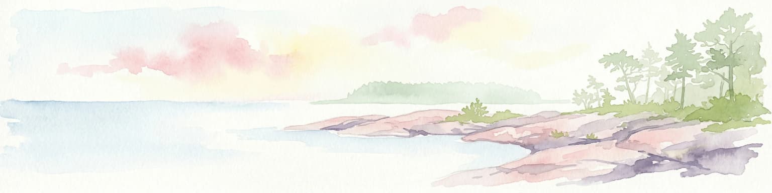
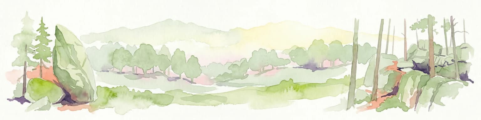
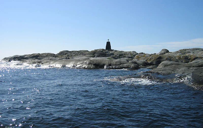
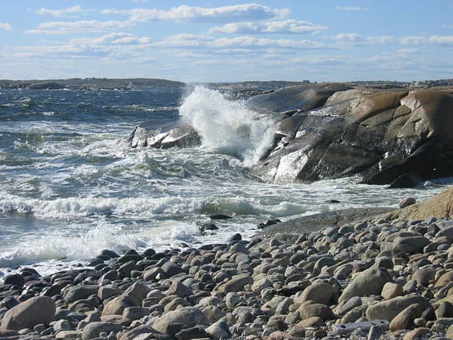
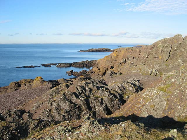
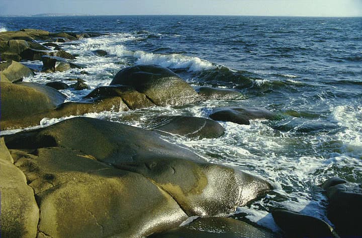
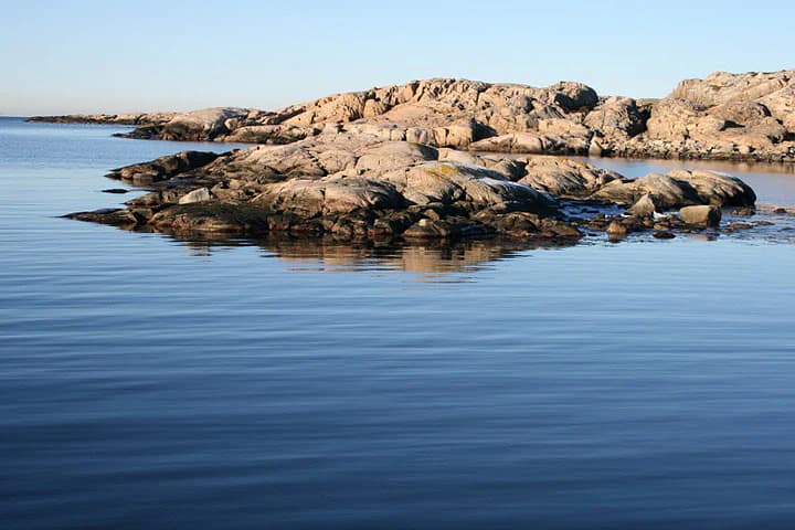
The landscape of Ytre Hvaler National Park is fundamentally defined by the interplay between sea and land in the outer Oslofjord. The park encompasses a vast archipelago of skerries—small, rocky islands and islets that have been shaped by wave action and glacial processes into characteristic formations. These skerries range from tiny exposed rocks barely above water level to larger islands with significant terrain.

The islands display the classic boreal coastal landscape: bare granite surfaces with thin soils supporting sparse vegetation, interspersed with more sheltered areas where soil accumulation allows for heath and grass communities. The exposed coastlines bear witness to the relentless action of waves, with characteristic erosion features and beaches of boulder and cobble. Between the islands, sheltered coves and sound provide calmer waters where sedimentation creates softer shorelines.

The marine landscape is equally distinctive. The waters of outer Oslofjord are relatively sheltered from the open North Atlantic, yet still subject to significant wave action during storms. The sea floor in shallower areas typically consists of rocky substrate with areas of sand and mud in deeper basins. The Tisler Reef represents a particularly dramatic submarine feature—a coral mound rising from the sea floor in waters where such formations were not previously expected.

Ytre Hvaler National Park ecosystems, habitats, and plant life

The nature of Ytre Hvaler reflects its position as a marine-focused protected area. The park's marine ecosystems encompass a remarkable diversity of habitats, from shallow coastal waters to deeper basins supporting unique communities. The Tisler Reef near Tisler island represents the crown jewel of the park's natural values—a cold water coral reef that is the largest of its kind in sheltered European waters. This reef, dominated by the colonial coral Lophelia, forms a complex three-dimensional structure that supports hundreds of associated species, creating an underwater ecosystem more reminiscent of tropical reefs than typical Norwegian waters.

The island landscapes, while less extensive than the marine areas, support distinctive coastal vegetation communities adapted to salty winds, thin soils, and exposure. Heath communities dominated by heather and crowberry are common on more exposed areas, while sheltered hollows support grass-dominated vegetation. The islands remain in use for grazing, a traditional land use that has shaped the vegetation for centuries and maintains open habitats important for certain species.

The marine waters support productive ecosystems driven by the mixing of Atlantic and Baltic Sea influences. These productive waters sustain important fish populations, marine mammals, and seabirds that depend on the coastal food web. The complexity of the coastline creates numerous microhabitats, supporting species adapted to everything from exposed wave-battered shores to calm, sheltered coves.

Ytre Hvaler National Park wildlife and species highlights

The wildlife of Ytre Hvaler National Park reflects the park's dual marine-terrestrial character and its position at a biogeographic transition zone. The marine waters support diverse fish communities, including species important for both commercial and recreational fishing. The complex underwater terrain and the presence of the Tisler Reef create habitat for numerous species that would not otherwise occur this far north in such densities.

Seabirds are particularly prominent, with the islands providing important nesting habitat for species adapted to coastal cliff environments. The mix of exposed and sheltered coastlines supports diverse bird communities, from species specializing in wave-exposed cliff nesting to those preferring calmer island shores. The surrounding waters are important feeding areas for seabirds throughout the year.

The cold water coral reef system supports a distinctive community of marine organisms. Beyond the Lophelia corals themselves, the reef provides habitat for fish, crustaceans, and invertebrates that are often associated with more southerly waters. This makes the reef a scientific priority for understanding how marine species distributions are shifting in response to changing ocean conditions.

Ytre Hvaler National Park conservation status and protection priorities

Ytre Hvaler National Park represents Norway's commitment to marine conservation at the highest level of protection. As the country's first national marine park, it established a precedent for protecting coastal and marine ecosystems with the same institutional framework used for terrestrial wilderness areas. The park's designation as IUCN Category II reflects its management approach combining habitat protection with sustainable use where compatible.

The Tisler Reef has been a particular focus of conservation attention. This cold water coral reef represents an ecosystem of European significance, and its inclusion within the national park provides formal protection against activities that could damage the reef structure. The reef's status as the largest known coral reef in sheltered European waters gives it international significance beyond Norwegian borders.

The park's marine waters require different management approaches than terrestrial protected areas. The continuing traditional uses of the islands—including grazing and small-scale fishing—must be balanced against conservation objectives. The maritime heritage elements, including the shipwrecks, represent another conservation dimension requiring careful management. The dual focus on marine ecosystem protection and cultural heritage makes Ytre Hvaler a complex conservation model that continues to evolve as management experience accumulates.

Ytre Hvaler National Park cultural meaning and human context

The cultural context of Ytre Hvaler National Park is deeply rooted in centuries of coastal human presence. The archipelago has been inhabited since at least the Bronze Age, making it one of Norway's longest-continuously occupied coastal areas. This long history of human presence has left an indelible mark on the landscape, with traditional land uses like grazing maintaining open habitats that have become part of the cultural landscape.

The coastal culture that characterizes the region is embodied in the numerous boathouses scattered across the islands—structures that reflect the historic importance of fishing and maritime activities to local communities. These simple buildings, often positioned to provide easy access to fishing grounds, represent a architectural tradition specific to Norwegian coastal landscapes.

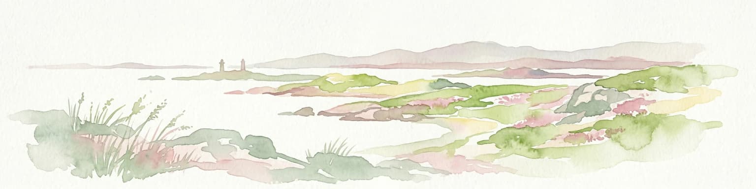
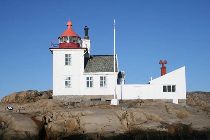
The two lighthouses within the park—Torbjørnskjær and Homlungen—represent another layer of cultural heritage. These navigational aids have guided vessels through the challenging waters of outer Oslofjord for generations, and their continued operation by the Norwegian Coastal Administration maintains an ongoing connection between the park and maritime tradition. The shipwrecks within park waters, including the notable HDMS Lossen, add maritime archaeological dimensions to the park's cultural significance.

Top sights and standout views in Ytre Hvaler National Park

Ytre Hvaler National Park stands as Norway's premier marine protected area, offering a distinctive coastal wilderness experience centered on extensive marine environments rather than terrestrial landscapes. The park's skerry archipelago represents one of Norway's most visually striking coastal landscapes, with countless islands creating a complex maze of channels, coves, and exposed shores. The Tisler Reef, as Europe's largest cold water coral reef in sheltered waters, provides extraordinary underwater探索 opportunities and represents a unique biological treasure. The park's rich maritime heritage, including over fifty documented shipwrecks and two historic lighthouses, adds cultural depth to the natural experience. The area's human heritage spans from Bronze Age settlements through centuries of fishing and maritime activity to the establishment of Norway's first marine national park in 2009.

Best time to visit Ytre Hvaler National Park

The character of Ytre Hvaler changes significantly with the seasons, offering different experiences throughout the year. The summer months bring long daylight hours and relatively calm seas, making this the most popular time for visitor activities. The islands display their lushest vegetation during these months, and the marine environment is most accessible for kayaking and other water-based activities. However, summer is also the busiest period, and the full range of services available.

The shoulder seasons of spring and autumn offer different advantages, with fewer visitors and dramatic atmospheric conditions. Spring brings migratory birds and the renewal of coastal vegetation, while autumn often produces the dramatic storm conditions that shaped the landscape and created the shipwrecks that now rest on the sea floor. These seasons provide more solitary experiences of the park's wild character.

Winter transforms the park into a different landscape entirely. The short days and harsh conditions limit access but offer opportunities to experience the raw power of the Norwegian coast in its most elemental form. The lighthouses take on added significance during the dark months, their lights more visible against the long nights. The marine environment remains active even in winter, with cold water species remaining in the waters beneath the surface.

Park location guide

Geography guide, regional context, and park location map for Ytre Hvaler National Park

Ytre Hvaler National Park park geography, regions, and map view in Norway
Understand where Ytre Hvaler National Park sits in Norway through a broader geographic reading of the surrounding landscape, nearby location context, and its mapped position within the national park landscape.

How Ytre Hvaler National Park fits into Norway

Norway, officially the Kingdom of Norway, is a Nordic country in Northern Europe located on the Scandinavian Peninsula. It encompasses mainland Norway, the Arctic islands of Svalbard and Jan Mayen, and maintains dependencies including Bouvet Island and Antarctic claims. The country has a population of about 5.6 million and is bordered by Sweden, Finland, and Russia. Norway is a unitary parliamentary constitutional monarchy with Oslo as its capital and largest city.

Wider geography shaping Ytre Hvaler National Park in Norway

Norway occupies the western and northern portions of the Scandinavian Peninsula in Northern Europe. The country shares a long eastern border with Sweden, and borders Finland and Russia to the northeast. Norway has an extensive coastline facing the Skagerrak, North Sea, Norwegian Sea, and Barents Sea. The terrain is predominantly mountainous with numerous fjords along the coastline.

Map view of Ytre Hvaler National Park

Use this park location map to pinpoint Ytre Hvaler National Park in Norway, understand its exact geographic position, and read its mapped placement within the surrounding landscape more clearly.

Pigeon | © OpenStreetMap contributors

Location context for Ytre Hvaler National Park

Hvaler MunicipalityØstfold
Park atlas

Explore the geographic context and diverse protected landscapes surrounding Ytre Hvaler National Park, spanning coastal and marine environments.

Explore Nearby National Parks and Protected Areas Beyond Ytre Hvaler National Park
From Ytre Hvaler National Park, browse other national parks and protected areas to trace the geographic distribution of coastal and marine conservation landscapes. This comparison offers valuable insights into regional protected area strategies and highlights diverse natural heritage across the Oslofjord and surrounding Norwegian geography.
National parkVästra Götaland County

Kosterhavet National Park: A Marine National Park Exploring Unique Archipelago Geography

Discover its mapped underwater terrain and rich marine biodiversity.

Kosterhavet National Park, located in Västra Götaland County, is Sweden's first marine national park, dedicated to protecting the unique aquatic environment of the Koster Islands. This protected area is renowned for its exceptional marine biodiversity, including rare cold-water coral reefs and the country's largest seal colony, all situated within a dramatic underwater geography characterized by deep fjords. Use MoriAtlas to explore the mapped extent of this vital marine protected landscape and understand its significant place in regional and national conservation efforts.

Area
388.78 km²
Established
2009
IUCN
II
Visitors
90K annual
Watercolor illustration of a coastal landscape with reeds in shallow water and distant green hills under a pale yellow sky
National parkFærder Municipality

Færder National Park: Norway's Coastal Archipelago & Marine Protected Area Atlas

Explore mapped landscapes and regional geography.

Færder National Park represents a significant protected landscape in Norway, characterized by its extensive marine environment and scattered archipelago. Situated east of Færder Municipality, the park's geography is defined by a mosaic of granite islands, coastal waters, and the iconic Færder Lighthouse. This entry provides atlas-level insight into the park's mapped boundaries, its role as a protected coastal ecosystem, and its contribution to the broader regional geography of Norway's southern coast.

Area
340 km²
Established
2013
IUCN
II
Relief
Lowland
National parkVästra Götaland County

Tresticklan National Park: Preserved Old-Growth Forest on Rocky Heathland

Explore the geographic context and mapped boundaries of this vital protected area.

Tresticklan National Park is a vital protected landscape in Västra Götaland County, Sweden, safeguarding one of southern Scandinavia's most significant old-growth forest ecosystems. The park's terrain is defined by exposed granite bedrock, sparse heath pine forests, and a wild, remote character. MoriAtlas provides a structured overview of Tresticklan National Park, detailing its geographic setting and protected area status for explorers and cartographers.

Area
28.97 km²
Established
1996
IUCN
II
Relief
Upland
National parkTelemark

Jomfruland National Park: Coastal Archipelago and Skagerrak Marine Atlas

Norway's unique marine-focused national park landscape.

Jomfruland National Park is a significant protected landscape in Telemark, Norway, renowned for its coastal island geography and a landscape predominantly composed of marine waters. Covering 117 square kilometers, this national park emphasizes the conservation of both terrestrial island habitats and the surrounding Skagerrak coastal ecosystem. Explore the park's mapped boundaries and discover its regional geographic context, offering a unique perspective on Norway's protected areas and maritime natural heritage through MoriAtlas.

Area
117 km²
Established
2016
IUCN
II
Scope
Mixed
Watercolor painting of coastal waters, islands, rocky shore, and distant hills
National parkAgder

Raet National Park: A Coastal National Park Defined by Glacial Moraine Landscape in Agder

Explore Norway's southern coast geography and protected marine area.

Raet National Park offers a profound exploration of Norway's post-glacial landscape, anchored by its namesake 12,000-year-old glacial moraine. This unique protected area, predominantly marine, reveals a striking combination of terrestrial moraine features, extensive pebble beaches, and submerged geological formations. Understanding its mapped boundaries within Agder provides critical context for appreciating this significant coastal protected landscape, its marine ecosystems, and its role in the regional geography.

Area
607 km²
Established
2016
IUCN
II
Relief
Lowland
National parkVästra Götaland County

Djurö National Park: Sweden's Lake Archipelago National Park in Västra Götaland County

Mapped island geography and protected aquatic landscapes.

Djurö National Park stands as a singular example of Sweden's protected natural areas, characterized by its unique position as a national park comprising a complete archipelago within Lake Vänern. This page focuses on the geographic identity of Djurö National Park, detailing its island distribution, protected land status, and the distinct landscape it preserves. Users will find context for its place within Västra Götaland County, facilitating an atlas-based understanding of this exceptional aquatic environment and its mapped boundaries.

Area
24 km²
Established
1991
IUCN
II
Relief
Mixed relief
Watercolor illustration of a forest landscape with rocks, trees, and distant hills
National park

Tiveden National Park: Sweden's Protected Granite Landscape and Ancient Forest

Explore protected wilderness, fracture valleys, and geological heritage.

Tiveden National Park is a protected area in southern Sweden renowned for its ancient forests and rugged granite landscape. The park's terrain features deep fracture valleys, formed by ancient geological events, and stands as one of the last large remnants of older forest in the region. Discover the park's unique topography, mapped boundaries, and its significance as a protected natural landscape for atlas-based exploration.

Area
20.3 km²
Established
1983
IUCN
II
Relief
Mixed relief
National parkÖrebro County

Garphyttan National Park: Pioneer Protected Landscape and Historic Swedish Terrain

Explore meadows, forests, and historic geography in Örebro County.

Garphyttan National Park, established in 1909, is a testament to early Swedish nature conservation efforts. This protected landscape features rolling forested terrain and distinctive flower-rich meadows, maintained through traditional practices that highlight Sweden's cultural heritage. Located within Örebro County, the park offers valuable insights into regional geography and the formation of mapped protected areas, making it a key destination for understanding historical landscape preservation.

Area
1.11 km²
Established
1909
IUCN
II
Relief
Lowland

Common questions about visiting, size, designation, and location context for Ytre Hvaler National Park

Ytre Hvaler National Park FAQs for park facts, access, geography, and protected area context
Find quick answers about Ytre Hvaler National Park, including protected-area facts, park geography, trail and visitor context, and how the park fits into its surrounding country and regional landscape.
MoriAtlas Explorer

Continue Your Protected Areas Search Across the Global Atlas

Deepen your exploration by continuing the structured search for national parks and protected areas worldwide. Utilize the comprehensive filtering capabilities to compare different conservation landscapes and refine your understanding of global park geography. Discover more about the distribution and characteristics of protected natural areas.

Global natural geography