Mori Atlas logo
National parkDjurö National Park

Explore the mapped islands and protected landscape within Västra Götaland County's vast waters.

Djurö National Park: Discover Sweden's Distinct Lake Archipelago National Park

Djurö National Park offers a unique glimpse into Sweden's aquatic geography, presenting a complete archipelago of approximately 35 islands within the immense Lake Vänern. This protected national park, located in Västra Götaland County, showcases a rare lake-based ecosystem distinct from coastal counterparts. Users can explore the mapped boundaries of these islands, understand their relationship to the surrounding waters, and appreciate the specialized natural landscapes that have developed in this isolated island environment. Discover the geography of this unparalleled aquatic wilderness.

Lake archipelagoIsland nature reserveBirdwatching in SwedenSwedish national parksVänern lake islandsCoastal wetlands alternative

Djurö National Park

National park

Park overview

Structured park overview, official facts, and landscape profile for Djurö National Park

Djurö National Park park facts, protected area profile, and essential visitor context
Review the core facts for Djurö National Park, including designation, size, terrain, visitor scale, habitats, and operating context in one park-focused overview.

About Djurö National Park

Djurö National Park represents a distinctive category within Sweden's protected area network as one of the few national parks centered on a lake archipelago rather than a coastal or mountainous landscape. The park encompasses all islands of the archipelago rising from Lake Vänern, creating a protected area where the boundary between land and water is perpetually blurred. The islands vary considerably in character, with none of the 22 largest islands being alike in their topography, vegetation, or ecological characteristics. This diversity within a relatively compact area creates a mosaic of habitats that supports the park's ecological richness. The establishment of the park in 1991 reflected Sweden's commitment to protecting representative examples of the country's diverse landscapes, with the lake archipelago ecosystem being particularly underrepresented in the national park system. The park remains under the administration of Naturvårdsverket, which manages it as a wilderness area where natural processes are allowed to proceed with minimal human intervention.

Quick facts and research context for Djurö National Park

Djurö National Park protects a lake archipelago of approximately 35 islands in Lake Vänern, Sweden's largest freshwater body. The park spans 24 square kilometers and was established in 1991 under the management of Naturvårdsverket (Swedish Environmental Protection Agency). Located in Västra Götaland County, the park is situated between the cities of Mariestad and Karlstad. The islands feature a hunting lodge and an automated lighthouse, though no permanent residents remain today. The surrounding waters of Vänern form a natural boundary, with only the prominent hill of Kinnekulle visible on the southern horizon, reinforcing the park's sense of isolation and wilderness within a lake environment.

Park context

Deeper park guide and search-rich context for Djurö National Park

Djurö National Park history, landscape, wildlife, and travel context
Explore Djurö National Park through its history, landscape character, ecosystems, wildlife, conservation priorities, cultural context, and seasonal travel timing in a structured park guide built for atlas discovery and search intent.

Why Djurö National Park stands out

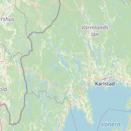
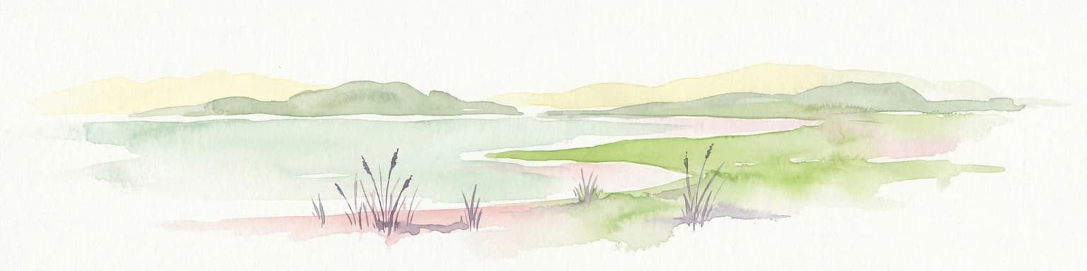
Djurö National Park is especially known for its unique status as Sweden's only significant lake-based archipelago national park, protecting a complete island system within the country's largest lake. The park is renowned for its birdlife, particularly nesting populations of ospreys, hobbies, oystercatchers, and great black-backed gulls. The presence of fallow deer on the islands adds mammalian interest to this aquatic sanctuary. The park's defining characteristic is the dramatic horizon of open water that surrounds every island except to the south, where Kinnekulle mountain provides a distant landmark, creating an immersive island wilderness experience unlike typical coastal archipelagos.

Djurö National Park history and protected-area timeline

The islands of the Djuro archipelago have a history of human habitation dating back to the 1500s, though the population never exceeded three families at any point, reflecting the challenging nature of lake island life. Over time, the islands were gradually abandoned as residents left for mainland communities, and today the archipelago is entirely uninhabited except for a hunting lodge and an automated lighthouse. The national park was officially established in 1991 through Swedish Government Proposition 1990/91:31, which identified the archipelago as worthy of national protection for its unique ecological and landscape values. This designation transformed the archipelago from a peripheral peripheral area within Vänern into a formally protected wilderness area, with management priorities focused on conservation rather than human habitation or commercial exploitation.

Djurö National Park landscape and geographic character

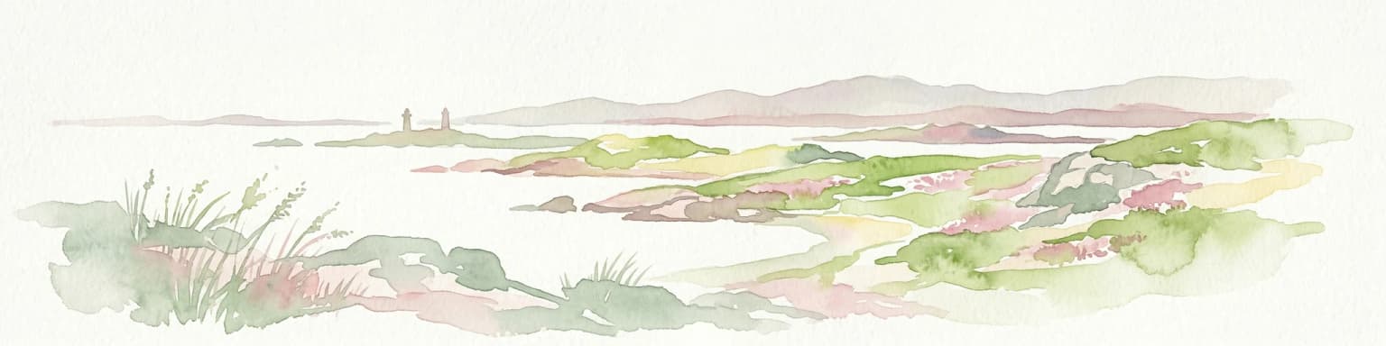
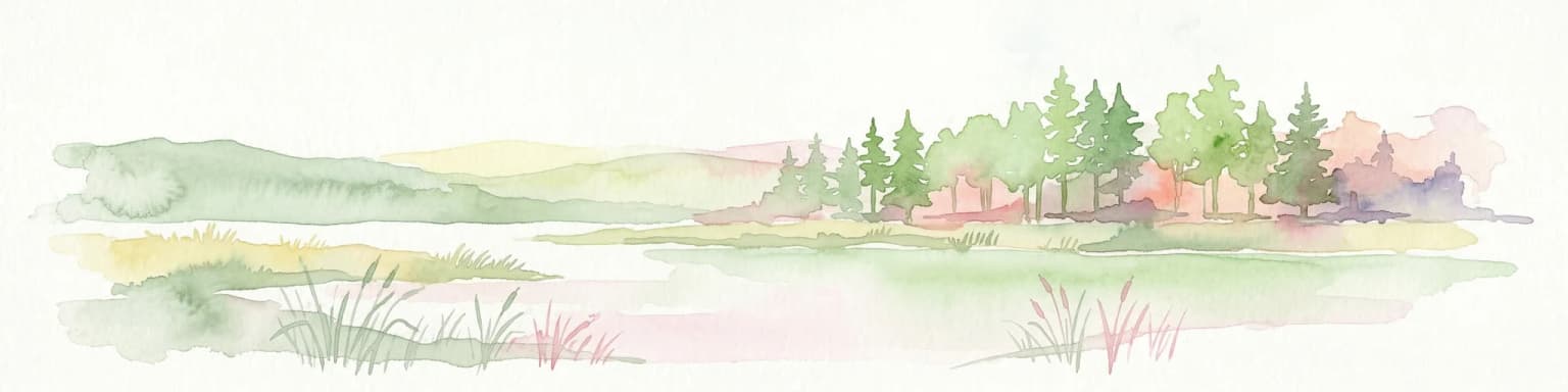
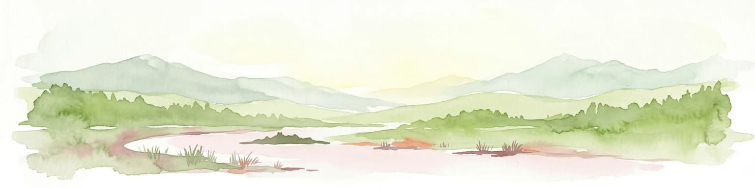
The landscape of Djuro National Park is defined by the relationship between land and water that characterizes a lake archipelago. The islands rise from the relatively shallow waters of Lake Vänern, with varied topography ranging from low-lying islets to more substantial landforms with gentle elevation. The surrounding waters dominate the visual experience from any island, with the horizon consisting almost entirely of water in most directions. Only to the south does the landscape open toward the mainland, where the distinctive profile of Kinnekulle, a table mountain, provides a familiar landmark connecting the isolated island group to the broader Swedish landscape. The islands themselves feature combinations of rocky shores, forested areas, and open ground, with each island possessing its own distinct character despite their relatively close proximity.

Djurö National Park ecosystems, habitats, and plant life

The nature of Djuro National Park reflects the specialized conditions of a lake archipelago environment. The isolation created by surrounding waters has shaped distinctive ecological communities adapted to island conditions and the lake environment. The forests that cover many islands consist of typical Swedish lake-shore vegetation, while the varied island sizes and configurations create a range of microhabitats. The open waters of Vänern that surround the islands are themselves ecologically significant, supporting fish populations and serving as a migration corridor for waterfowl. The combination of terrestrial islands and extensive aquatic habitat creates a coherent ecosystem unit where the boundary between protected terrestrial areas and the surrounding lake waters is inherently connected.

Djurö National Park wildlife and species highlights

The wildlife of Djuro National Park is characterized by species adapted to island and lake environments. Fallow deer are present on the islands, representing one of the larger mammalian species in the park. The birdlife is particularly significant, with the park supporting populations of several notable species. Ospreys nest in the archipelago, utilizing the isolated islands as secure breeding sites away from mainland disturbances. Hobbies, a species of falcon, also breed in the area, taking advantage of the abundant prey opportunities in the lake environment. Oystercatchers favor the shoreline habitats around the islands, while great black-backed gulls nest on appropriate island sites. The waters of Vänern support additional bird species throughout the year, particularly during migration periods when the lake serves as an important stopover for waterfowl moving between northern and southern European areas.

Djurö National Park conservation status and protection priorities

Djurö National Park serves an important conservation function as the primary protected example of lake archipelago ecosystems in Sweden. The park protects not only the terrestrial islands but also the surrounding waters of Vänern, creating a comprehensive protected area that maintains ecological connectivity between land and water. The designation of this archipelago as a national park ensures the preservation of biological diversity across the island system, protecting the varied habitats that each distinct island provides. The isolation of the islands from significant human activity has allowed natural processes to continue relatively unimpeded, providing reference ecosystems for understanding how lake archipelago environments function without major human disturbance. The park contributes to Sweden's commitments to protecting representative examples of the country's natural landscapes.

Djurö National Park cultural meaning and human context

The cultural context of Djuro National Park is defined by a history of sparse human habitation that has left minimal permanent mark on the landscape. The islands were occupied intermittently from the 1500s onward, but the challenging conditions of lake island life never supported significant population growth. The three families that represented the archipelago's peak population gradually departed, leaving behind only a hunting lodge and lighthouse as evidence of human presence. This relatively light historical use has meant that the park's cultural landscape is essentially a natural landscape with minimal archaeological or architectural heritage, allowing visitors to experience the islands as they appeared before modern protection efforts. The lighthouse, now automated, represents the only structure of note and serves as a reminder of the archipelago's historical role in navigation on Lake Vänern.

Top sights and standout views in Djurö National Park

The highlights of Djuro National Park center on its unique identity as Sweden's lake archipelago national park. The experience of island-hopping through diverse islands, each with its own distinct character, offers a distinctive wilderness experience unlike coastal archipelagos. The birdwatching opportunities, particularly for ospreys and other raptors, draw nature enthusiasts interested in observing breeding birds of prey in a secure island sanctuary. The sense of isolation created by the surrounding waters of Vänern, with only the distant landmark of Kinnekulle breaking the horizon, provides a tranquil atmosphere that emphasizes the park's wilderness character. The hunting lodge and lighthouse structures add historical interest to the natural landscape.

Best time to visit Djurö National Park

The best time to visit Djuro National Park is during the warmer months from late spring through early autumn, when the full range of park experiences is available and access is most straightforward. Summer months offer the warmest conditions for exploring the islands and observing nesting bird species at their most active. The birdlife is particularly notable during the breeding season in spring and early summer, when ospreys and other species are actively raising young. Autumn migration brings additional bird activity as waterfowl move through the lake corridor. Winter visits are possible but limited by weather conditions and reduced services, with the stark beauty of snow-covered islands offering a different but challenging experience.

Park location guide

Geography guide, regional context, and park location map for Djurö National Park

Djurö National Park park geography, regions, and map view in Sweden
Understand where Djurö National Park sits in Sweden through a broader geographic reading of the surrounding landscape, nearby location context, and its mapped position within the national park landscape.

How Djurö National Park fits into Sweden

Sweden, formally the Kingdom of Sweden, is a highly developed Nordic country on the Scandinavian Peninsula in Northern Europe. With a population of 10.6 million and an area of 450,295 km², it is the largest Nordic country by both area and population. Sweden is a constitutional monarchy with Stockholm as its capital and largest city, known for its advanced economy, social welfare system, and membership in the European Union and NATO.

Wider geography shaping Djurö National Park in Sweden

Sweden occupies the eastern portion of the Scandinavian Peninsula in Northern Europe. It borders Norway to the west and north, Finland to the east, and shares a maritime border with Denmark to the southwest across the Øresund. The country has an extensive coastline along the Baltic Sea and Gulf of Bothnia, dotted with thousands of islands. The terrain varies from mountainous regions in the northwest to low-lying coastal areas and inland lakes in the south and central parts.

Map view of Djurö National Park

Use this park location map to pinpoint Djurö National Park in Sweden, understand its exact geographic position, and read its mapped placement within the surrounding landscape more clearly.

Pigeon | © OpenStreetMap contributors

Location context for Djurö National Park

Västra Götaland County
Park atlas

Examine the geographic context and protected-area spread across Västra Götaland County, expanding from Djurö National Park.

Compare National Parks and Protected Areas Surrounding Djurö National Park in Västra Götaland County
After delving into Djurö National Park's lake archipelago, explore a curated list of other national parks and protected areas within Västra Götaland County and surrounding Swedish geography. Expand your understanding of regional conservation landscapes, comparing diverse ecosystems and mapped terrain beyond this unique island sanctuary.
Watercolor illustration of a forest landscape with rocks, trees, and distant hills
National park

Tiveden National Park: Sweden's Protected Granite Landscape and Ancient Forest

Explore protected wilderness, fracture valleys, and geological heritage.

Tiveden National Park is a protected area in southern Sweden renowned for its ancient forests and rugged granite landscape. The park's terrain features deep fracture valleys, formed by ancient geological events, and stands as one of the last large remnants of older forest in the region. Discover the park's unique topography, mapped boundaries, and its significance as a protected natural landscape for atlas-based exploration.

Area
20.3 km²
Established
1983
IUCN
II
Relief
Mixed relief
National parkÖrebro County

Garphyttan National Park: Pioneer Protected Landscape and Historic Swedish Terrain

Explore meadows, forests, and historic geography in Örebro County.

Garphyttan National Park, established in 1909, is a testament to early Swedish nature conservation efforts. This protected landscape features rolling forested terrain and distinctive flower-rich meadows, maintained through traditional practices that highlight Sweden's cultural heritage. Located within Örebro County, the park offers valuable insights into regional geography and the formation of mapped protected areas, making it a key destination for understanding historical landscape preservation.

Area
1.11 km²
Established
1909
IUCN
II
Relief
Lowland
National parkVästra Götaland County

Tresticklan National Park: Preserved Old-Growth Forest on Rocky Heathland

Explore the geographic context and mapped boundaries of this vital protected area.

Tresticklan National Park is a vital protected landscape in Västra Götaland County, Sweden, safeguarding one of southern Scandinavia's most significant old-growth forest ecosystems. The park's terrain is defined by exposed granite bedrock, sparse heath pine forests, and a wild, remote character. MoriAtlas provides a structured overview of Tresticklan National Park, detailing its geographic setting and protected area status for explorers and cartographers.

Area
28.97 km²
Established
1996
IUCN
II
Relief
Upland
National parkVästra Götaland County

Kosterhavet National Park: A Marine National Park Exploring Unique Archipelago Geography

Discover its mapped underwater terrain and rich marine biodiversity.

Kosterhavet National Park, located in Västra Götaland County, is Sweden's first marine national park, dedicated to protecting the unique aquatic environment of the Koster Islands. This protected area is renowned for its exceptional marine biodiversity, including rare cold-water coral reefs and the country's largest seal colony, all situated within a dramatic underwater geography characterized by deep fjords. Use MoriAtlas to explore the mapped extent of this vital marine protected landscape and understand its significant place in regional and national conservation efforts.

Area
388.78 km²
Established
2009
IUCN
II
Visitors
90K annual
National parkØstfold

Ytre Hvaler National Park: Norway's Coastal Marine Protected Landscape Atlas

Explore protected archipelago geography and unique cold water coral reefs.

Discover Ytre Hvaler National Park, a pivotal marine protected area on Norway's Østfold coast. This atlas entry provides detailed insight into its defining skerry landscape, the significant Tisler cold water coral reef, and its role as a protected marine ecosystem. Understand the mapped boundaries and geographic context of this unique Norwegian coastal wilderness, crucial for understanding the region's natural and maritime heritage.

Area
354 km²
Established
2009
IUCN
II
Watercolor illustration of a coastal landscape with reeds in shallow water and distant green hills under a pale yellow sky
National parkFærder Municipality

Færder National Park: Norway's Coastal Archipelago & Marine Protected Area Atlas

Explore mapped landscapes and regional geography.

Færder National Park represents a significant protected landscape in Norway, characterized by its extensive marine environment and scattered archipelago. Situated east of Færder Municipality, the park's geography is defined by a mosaic of granite islands, coastal waters, and the iconic Færder Lighthouse. This entry provides atlas-level insight into the park's mapped boundaries, its role as a protected coastal ecosystem, and its contribution to the broader regional geography of Norway's southern coast.

Area
340 km²
Established
2013
IUCN
II
Relief
Lowland
Watercolor illustration of a lake surrounded by trees and hills
National parkKalmar County

Norra Kvill National Park: Ancient Coniferous Forest Protected Landscape in Kalmar County

Discover its unique mapped terrain and natural forest heritage.

Norra Kvill National Park safeguards a remarkable old-growth coniferous forest ecosystem, a rarity in southern Sweden. This park is characterized by ancient pines, some dating back over 350 years, thriving on steep fault-formed terrain and amid boulder fields. Its protected status ensures the preservation of this unique natural landscape, providing invaluable insight into forest ecology and regional geography within Kalmar County. MoriAtlas offers a structured approach to understanding its mapped boundaries and ecological significance.

Area
1.14 km²
Established
1927
IUCN
II
Relief
Highland
Watercolor painting of a landscape featuring mountains, wetland, and forest
National parkJönköping County

Store Mosse National Park: Explore Sweden's Largest Bog Landscape & Protected Area

Detailed park map, geography, and peatland ecosystem context.

Delve into Store Mosse National Park, a significant protected landscape in Jönköping County, Sweden, celebrated for its vast peat bog, the largest south of Lapland. This page provides detailed geographic context, mapping its unique wetland terrain, interspersed lakes like Kävsjön, and surrounding pine forests. Understand the park's ecological importance as a Ramsar site and its place within the South Småland peneplain for structured natural area discovery.

Area
78.5 km²
Established
1982
IUCN
II
Relief
Lowland

Common questions about visiting, size, designation, and location context for Djurö National Park

Djurö National Park FAQs for park facts, access, geography, and protected area context
Find quick answers about Djurö National Park, including protected-area facts, park geography, trail and visitor context, and how the park fits into its surrounding country and regional landscape.
MoriAtlas Explorer

Continue Your Protected Areas Search Across the Global Atlas

Deepen your exploration by continuing the structured search for national parks and protected areas worldwide. Utilize the comprehensive filtering capabilities to compare different conservation landscapes and refine your understanding of global park geography. Discover more about the distribution and characteristics of protected natural areas.

Global natural geography