Mori Atlas logo
National parkBlå Jungfrun National Park

Discover the island's distinctive granite cliffs, mapped boundaries, and rich coastal ecosystem.

Blå Jungfrun National Park: Unique Baltic Sea Island Protected Landscape and Coastal Geography

Blå Jungfrun National Park represents a solitary island sanctuary in the Baltic Sea, recognized for its striking blue-tinted granite cliffs and dramatic coastal terrain. This designated national park, encompassing the island and its surrounding waters, offers a unique opportunity to explore an isolated Baltic landscape defined by its unusual geology and rich biodiversity. Through MoriAtlas, users can navigate its protected area boundaries and understand its place within the broader regional geography.

Baltic Sea islandsGranite landscapesBird sanctuariesCoastal nature reservesSwedish national parksIsland ecosystems

Blå Jungfrun National Park

National park

Park overview

Structured park overview, official facts, and landscape profile for Blå Jungfrun National Park

Blå Jungfrun National Park park facts, protected area profile, and essential visitor context
Review the core facts for Blå Jungfrun National Park, including designation, size, terrain, visitor scale, habitats, and operating context in one park-focused overview.

About Blå Jungfrun National Park

Blå Jungfrun National Park is situated on an island in the Baltic Sea approximately 6 kilometers off the coast of Oskarshamn in Kalmar County, southeastern Sweden. The island itself is relatively small but represents a significant geological and ecological asset within Sweden's coastal protected area network. The park was established to protect both the island's unique natural features and its surrounding marine environment, creating a comprehensive coastal conservation unit.

The island's defining characteristic is its blue-tinted granite, a feature that has given rise to its name and contributes to its visual identity. The granite contains the mineral glauconite, which produces the distinctive blue-gray coloration visible from the mainland, particularly during certain lighting conditions. The island features steep cliffs along its western and northern shores, with more gentle rocky slopes on the eastern side. Sea caves and rock formations add to the geological interest of the coastline.

Beyond its geological significance, Blå Jungfrun supports coastal heath and grassland vegetation adapted to the island's exposed conditions. The combination of rocky substrate, thin soils, and salt-laden winds creates a challenging environment that has shaped distinctive plant communities. The surrounding marine waters contain important fish spawning areas and support fishing traditions in the region.

Quick facts and research context for Blå Jungfrun National Park

Blå Jungfrun National Park protects a small Baltic Sea island known for its characteristic blue-tinted granite formations. The island rises dramatically from the sea with steep cliffs and rocky shores. The surrounding waters and coastal habitats support significant bird populations, particularly seabirds and migratory species. The island contains the remains of a medieval church and graveyard, adding historical dimension to its natural values. The park represents a rare example of Baltic coastal island ecosystems in the Swedish protected area network.

Park context

Deeper park guide and search-rich context for Blå Jungfrun National Park

Blå Jungfrun National Park history, landscape, wildlife, and travel context
Explore Blå Jungfrun National Park through its history, landscape character, ecosystems, wildlife, conservation priorities, cultural context, and seasonal travel timing in a structured park guide built for atlas discovery and search intent.

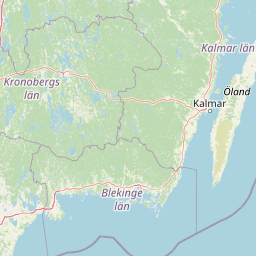
Why Blå Jungfrun National Park stands out

Blå Jungfrun is especially known for its unique blue-hued granite cliffs that give the island its characteristic appearance and name. The island's steep rocky shores, sea caves, and distinctive coastal geology make it visually striking among Baltic Sea islands. The park is also notable as an important bird sanctuary, with the island and surrounding waters supporting diverse seabird populations. The combination of unusual geological features, coastal ecosystems, and cultural heritage ruins creates a distinctive protected area that stands apart from Sweden's mainland national parks.

Blå Jungfrun National Park history and protected-area timeline

The island of Blå Jungfrun has a long human presence in Swedish history. The most notable cultural feature is the ruins of a medieval church that once served the island's small community. The church and its accompanying graveyard represent the spiritual and communal life of past inhabitants who lived on or utilized the island. Historical records indicate that the island was inhabited during various periods, with fishing and maritime activities forming the basis of local economy.

The establishment of the area as a nature reserve reflected growing recognition of the island's scientific and conservation value. The unique geological features, combined with the island's ecological significance as a bird habitat and the cultural heritage elements, made it a candidate for formal protection. The national park designation ensures ongoing preservation of these combined natural and cultural values for future generations.

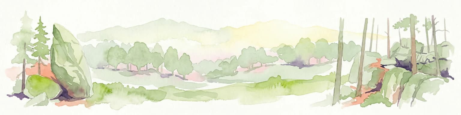
Blå Jungfrun National Park landscape and geographic character

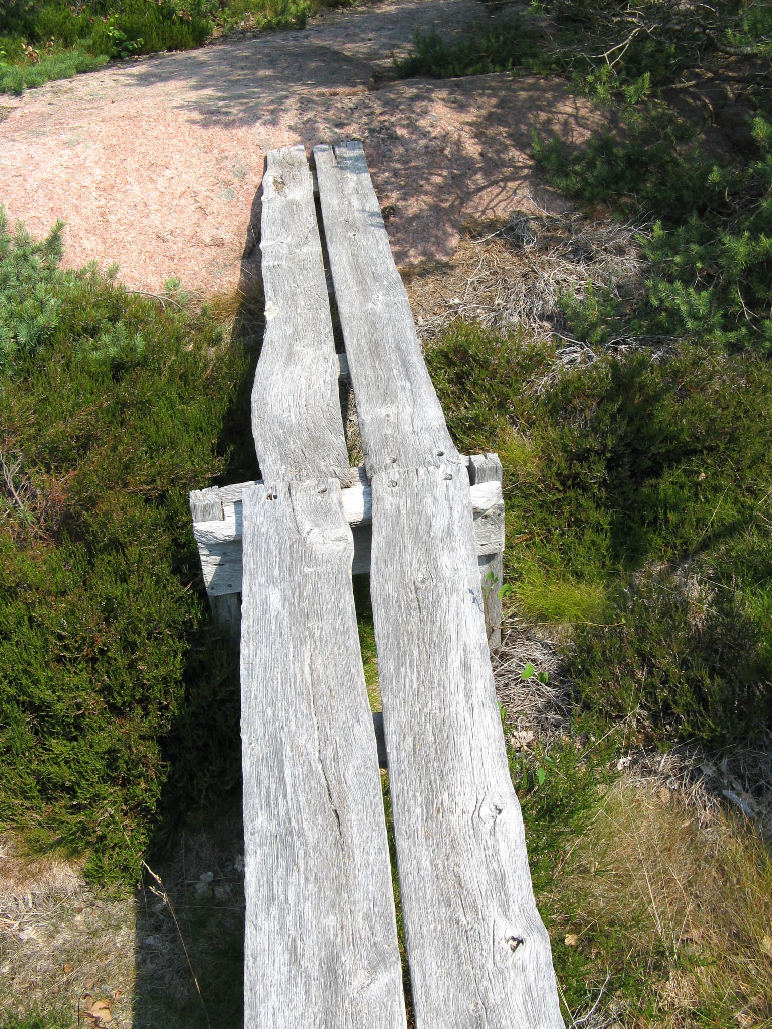
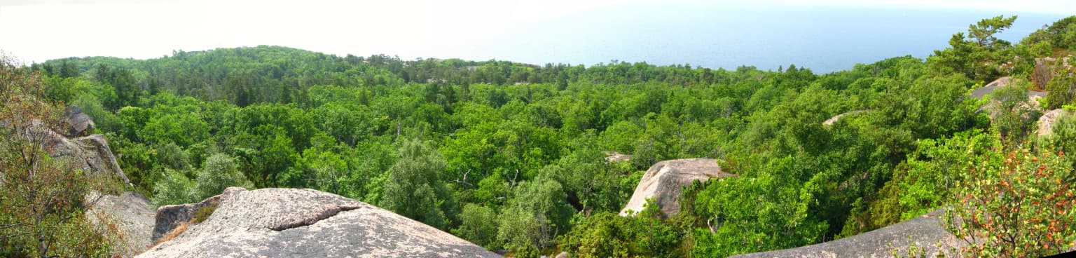
The landscape of Blå Jungfrun National Park is dominated by the island's distinctive granite bedrock, which creates a rugged and visually striking coastal environment. The island rises sharply from the Baltic Sea, with the most dramatic topography along its western and northern coasts where steep cliffs drop directly into the water. These cliffs feature the characteristic blue-gray coloration that gives the island its name.

The coastal landscape includes sea caves, rock arches, and weathered granite formations that showcase the ongoing interaction between the sea and the island's geology. The shoreline alternates between rocky headlands and small cobble beaches. Inland, the terrain is characterized by exposed bedrock with thin soils supporting sparse vegetation. The overall impression is one of stark, beautiful isolation, with the island standing as a solitary landform in the Baltic Sea.

Blå Jungfrun National Park ecosystems, habitats, and plant life

The ecological character of Blå Jungfrun is shaped by its island location in the Baltic Sea and the associated maritime influences. The vegetation reflects coastal conditions, with heath communities and hardy grasses dominating the thin soils over granite substrate. Salt-tolerant plants occur in areas most exposed to sea spray, while more sheltered areas support a different suite of species adapted to the island's conditions.

The marine environment surrounding the island is an integral part of the ecosystem. The waters support fish populations and contribute to the broader Baltic Sea ecological system. The combination of island and marine habitats creates a coastal ecosystem that is relatively rare in the Swedish protected area network, making the park ecologically significant beyond its modest size.

Blå Jungfrun National Park wildlife and species highlights

Blå Jungfrun is recognized as an important bird habitat, with the island and surrounding waters supporting diverse bird species. Seabirds nest on the island's cliffs and rocky shores, while the surrounding marine environment provides feeding areas for various species. The island's isolated location and diverse coastal habitats create favorable conditions for bird life.

The bird populations using the area include both resident species and migratory visitors that utilize the island as a stopover or breeding site. The coastal cliffs provide nesting opportunities for species that require the rocky island environment, while the surrounding waters support fish-eating birds. The importance of the area for bird conservation has contributed to its protected status.

Blå Jungfrun National Park conservation status and protection priorities

Blå Jungfrun National Park represents an important conservation unit within Sweden's coastal protected area network. The park protects both the island's unique geological features, including the distinctive blue granite formations, and the surrounding marine environment. This dual protection approach recognizes the interconnected nature of terrestrial and marine coastal ecosystems.

The conservation significance extends to the island's role as a bird sanctuary, with the protected status helping to maintain important nesting and feeding habitats. The combination of geological, ecological, and cultural values within a single protected area exemplifies the integrated approach to landscape conservation that characterizes Swedish natural heritage management. The park serves as a living example of Baltic coastal island ecosystems that face various pressures in the contemporary environment.

Blå Jungfrun National Park cultural meaning and human context

The island of Blå Jungfrun carries human history within its landscape. The ruins of a medieval church represent the spiritual and communal traditions of people who lived on or visited the island historically. The church graveyard contains historic burials, linking the island to broader patterns of coastal settlement and maritime life in the Baltic Sea region.

This cultural dimension adds depth to the island's identity, connecting the natural landscape to human stories and traditions spanning centuries. The presence of these heritage elements within a national park setting illustrates how natural and cultural values can be protected together, creating holistic conservation that honors both the environment and human history.

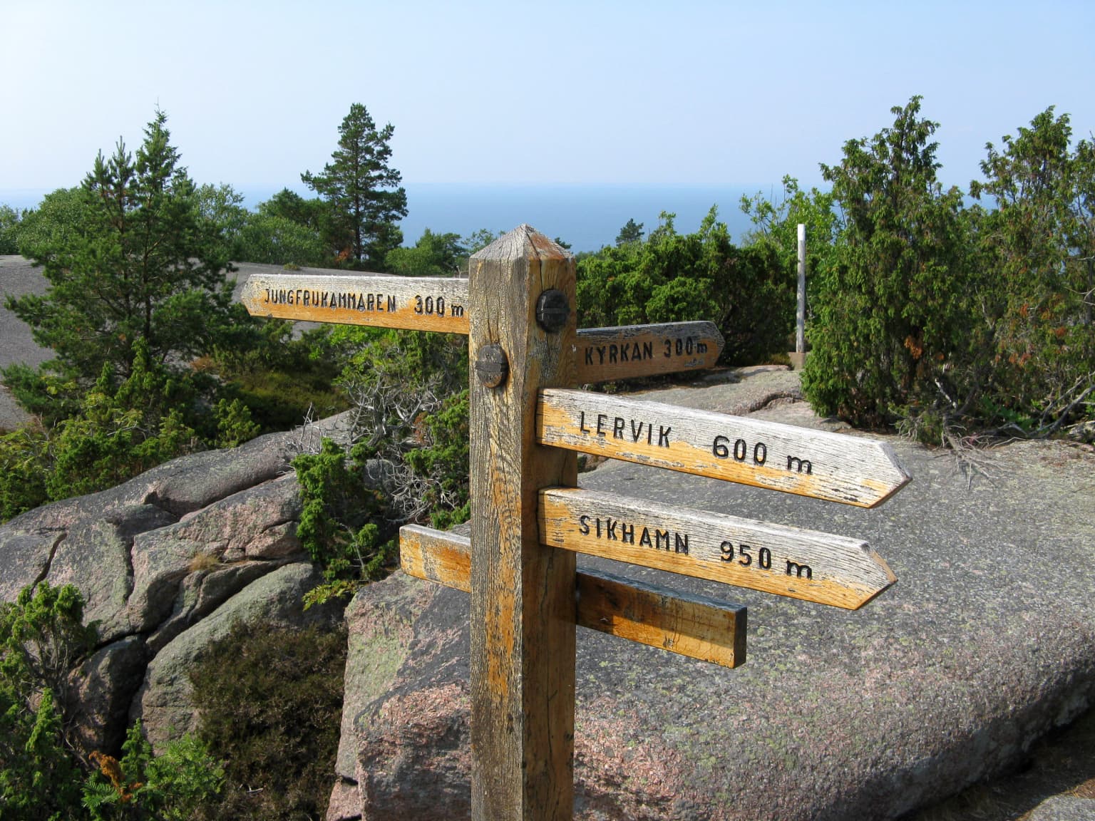
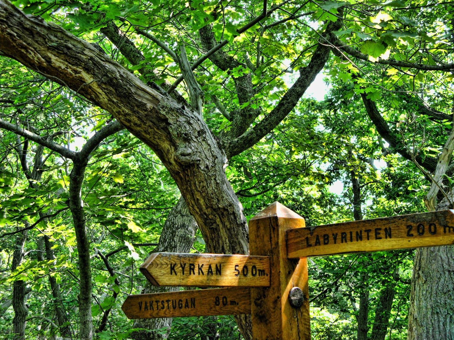
Top sights and standout views in Blå Jungfrun National Park

Blå Jungfrun National Park offers a rare combination of geological uniqueness, coastal ecology, and cultural heritage within a Baltic Sea island setting. The island's signature blue-hued granite cliffs create a visually distinctive landscape not found elsewhere in Sweden. The protected area encompasses both the island and its surrounding waters, providing comprehensive coastal ecosystem protection. Bird populations and marine life add biological richness to the park's values. The medieval church ruins provide a tangible connection to human history on this isolated island.

Best time to visit Blå Jungfrun National Park

The character of Blå Jungfrun changes with the seasons, with each period offering different experiences. The summer months bring the most accessible conditions for island visitation, with longer daylight hours and warmer temperatures. The blue coloration of the granite is most visible during calm summer days when the sea is still and lighting conditions favor the mineral's characteristic hue. Autumn and spring offer different atmospheric qualities, with the possibility of witnessing migratory bird movements. Winter visits provide a stark, dramatic experience of the island in its most challenging season, though access may be more limited. The choice of when to visit depends on what aspects of the park experience are most valued.

Park location guide

Geography guide, regional context, and park location map for Blå Jungfrun National Park

Blå Jungfrun National Park park geography, regions, and map view in Sweden
Understand where Blå Jungfrun National Park sits in Sweden through a broader geographic reading of the surrounding landscape, nearby location context, and its mapped position within the national park landscape.

How Blå Jungfrun National Park fits into Sweden

Sweden, formally the Kingdom of Sweden, is a highly developed Nordic country on the Scandinavian Peninsula in Northern Europe. With a population of 10.6 million and an area of 450,295 km², it is the largest Nordic country by both area and population. Sweden is a constitutional monarchy with Stockholm as its capital and largest city, known for its advanced economy, social welfare system, and membership in the European Union and NATO.

Wider geography shaping Blå Jungfrun National Park in Sweden

Sweden occupies the eastern portion of the Scandinavian Peninsula in Northern Europe. It borders Norway to the west and north, Finland to the east, and shares a maritime border with Denmark to the southwest across the Øresund. The country has an extensive coastline along the Baltic Sea and Gulf of Bothnia, dotted with thousands of islands. The terrain varies from mountainous regions in the northwest to low-lying coastal areas and inland lakes in the south and central parts.

Map view of Blå Jungfrun National Park

Use this park location map to pinpoint Blå Jungfrun National Park in Sweden, understand its exact geographic position, and read its mapped placement within the surrounding landscape more clearly.

Pigeon | © OpenStreetMap contributors
Park atlas

Explore surrounding Baltic Sea island ecosystems and coastal protected areas, tracing their unique geography and conservation values.

Discover Other Protected Areas and National Parks Near Blå Jungfrun National Park, Sweden
Continue your park exploration from Blå Jungfrun National Park by browsing other protected areas, national parks, and coastal reserves within Sweden's Baltic Sea region. Compare their unique island ecosystems, granite landscapes, and bird sanctuary habitats to understand the broader conservation geography of Nordic protected areas.
Watercolor illustration of a lake surrounded by trees and hills
National parkKalmar County

Norra Kvill National Park: Ancient Coniferous Forest Protected Landscape in Kalmar County

Discover its unique mapped terrain and natural forest heritage.

Norra Kvill National Park safeguards a remarkable old-growth coniferous forest ecosystem, a rarity in southern Sweden. This park is characterized by ancient pines, some dating back over 350 years, thriving on steep fault-formed terrain and amid boulder fields. Its protected status ensures the preservation of this unique natural landscape, providing invaluable insight into forest ecology and regional geography within Kalmar County. MoriAtlas offers a structured approach to understanding its mapped boundaries and ecological significance.

Area
1.14 km²
Established
1927
IUCN
II
Relief
Highland
Watercolor painting of a landscape featuring mountains, wetland, and forest
National parkJönköping County

Store Mosse National Park: Explore Sweden's Largest Bog Landscape & Protected Area

Detailed park map, geography, and peatland ecosystem context.

Delve into Store Mosse National Park, a significant protected landscape in Jönköping County, Sweden, celebrated for its vast peat bog, the largest south of Lapland. This page provides detailed geographic context, mapping its unique wetland terrain, interspersed lakes like Kävsjön, and surrounding pine forests. Understand the park's ecological importance as a Ramsar site and its place within the South Småland peneplain for structured natural area discovery.

Area
78.5 km²
Established
1982
IUCN
II
Relief
Lowland
Watercolor illustration of a forest landscape with rocks, trees, and distant hills
National park

Tiveden National Park: Sweden's Protected Granite Landscape and Ancient Forest

Explore protected wilderness, fracture valleys, and geological heritage.

Tiveden National Park is a protected area in southern Sweden renowned for its ancient forests and rugged granite landscape. The park's terrain features deep fracture valleys, formed by ancient geological events, and stands as one of the last large remnants of older forest in the region. Discover the park's unique topography, mapped boundaries, and its significance as a protected natural landscape for atlas-based exploration.

Area
20.3 km²
Established
1983
IUCN
II
Relief
Mixed relief
National parkStockholm County

Tyresta National Park: Explore Protected Old-Growth Forest and Rift Valley Landscape

Stockholm County National Park, Sweden

Tyresta National Park stands as a crucial protected area, showcasing one of southern Sweden's largest expanses of old-growth coniferous forest, featuring trees up to 400 years old. Its distinctive rift valley terrain, lakes, and post-fire recovery zones offer a rich geographic profile for atlas exploration. Within Stockholm County, this national park provides essential context for understanding the preservation of ancient forest ecosystems and unique geological formations.

Area
20 km²
Established
1993
IUCN
II
Relief
Mixed relief
National parkSkåne County

Stenshuvud National Park: Discover Skåne County's Distinctive Baltic Headland National Park

Explore broadleaf forests, heathlands, and panoramic coastal geography.

Stenshuvud National Park is a notable national park in Sweden's Skåne County, characterized by a prominent hill that rises 97 meters above the Baltic Sea. This protected landscape offers a rich diversity of habitats within a small area, including dense broadleaf forests, open heathlands, and coastal terrains. Its unique geographic position and varied ecosystems make it a key destination for exploring protected natural areas, mapped terrain, and regional landscape context within the MoriAtlas platform.

Area
3.9 km²
Established
1986
IUCN
II
Relief
Lowland
National parkÖrebro County

Garphyttan National Park: Pioneer Protected Landscape and Historic Swedish Terrain

Explore meadows, forests, and historic geography in Örebro County.

Garphyttan National Park, established in 1909, is a testament to early Swedish nature conservation efforts. This protected landscape features rolling forested terrain and distinctive flower-rich meadows, maintained through traditional practices that highlight Sweden's cultural heritage. Located within Örebro County, the park offers valuable insights into regional geography and the formation of mapped protected areas, making it a key destination for understanding historical landscape preservation.

Area
1.11 km²
Established
1909
IUCN
II
Relief
Lowland
National parkVästra Götaland County

Djurö National Park: Sweden's Lake Archipelago National Park in Västra Götaland County

Mapped island geography and protected aquatic landscapes.

Djurö National Park stands as a singular example of Sweden's protected natural areas, characterized by its unique position as a national park comprising a complete archipelago within Lake Vänern. This page focuses on the geographic identity of Djurö National Park, detailing its island distribution, protected land status, and the distinct landscape it preserves. Users will find context for its place within Västra Götaland County, facilitating an atlas-based understanding of this exceptional aquatic environment and its mapped boundaries.

Area
24 km²
Established
1991
IUCN
II
Relief
Mixed relief
Watercolor painting of green trees on rolling hills under a pink and orange sunset
National park

Dalby Söderskog National Park: Explore Southern Sweden's Smallest Protected Deciduous Forest

Unique limestone geology, spring flowers, and mapped terrain.

Dalby Söderskog National Park, though only 36 hectares, offers exceptional botanical discovery rooted in its fertile limestone soils. This protected area in Scania, Sweden, showcases a dense deciduous forest ecosystem with remarkable diversity, particularly evident in its vibrant spring wildflower displays. Use MoriAtlas to explore the park's mapped boundaries and understand its significant role within the regional geography and broader protected landscape atlas.

Area
0.36 km²
Established
1918
IUCN
II
Relief
Lowland

Common questions about visiting, size, designation, and location context for Blå Jungfrun National Park

Blå Jungfrun National Park FAQs for park facts, access, geography, and protected area context
Find quick answers about Blå Jungfrun National Park, including protected-area facts, park geography, trail and visitor context, and how the park fits into its surrounding country and regional landscape.
MoriAtlas Explorer

Continue Your Protected Areas Search Across the Global Atlas

Deepen your exploration by continuing the structured search for national parks and protected areas worldwide. Utilize the comprehensive filtering capabilities to compare different conservation landscapes and refine your understanding of global park geography. Discover more about the distribution and characteristics of protected natural areas.

Global natural geography