
Bays
Park geography
A detailed look at the island terrain, coastal landscape, and environmental features.
French Island National Park: Comprehensive Geographic Profile and Mapped Boundaries
Examine the physical characteristics of French Island National Park through a structured geographic lens. This profile includes mapped boundaries covering 111 square kilometers, temperate coastal terrain, and various protected natural features such as wetlands, peaks, and salt marshes situated within Western Port.
Related tags
Island parkWetland habitatsMangrove ecosystemsCoastal conservationVictoria national parks
Island wilderness on Melbourne's doorstep
French Island National Park
French Island National Park is a protected wilderness area located on French Island in Western Port, Victoria, Australia. The 11,100-hectare park was established in 1998 and sits approximately 61 kilometres southeast of Melbourne, making it one of the most accessible island national parks in Australia. The park is uniquely accessible only by water, adding to its wilderness character and isolation. It encompasses a remarkable diversity of habitats including mangrove forests, salt marshes, and open woodland ecosystems. The park forms part of a larger conservation network that includes the adjacent French Island Marine National Park, which protects extensive seagrass beds, mangroves, and mud flats in the surrounding waters of Western Port.
- Location
- Australia
- Park type
- National park
- Established
- 1998
- Area
- 111 km²
Location overview
Coastal and island national park status within the Australian landmass
Geographic Profile of French Island National Park in Australia
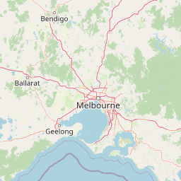
French Island National Park is positioned within Australia as a designated national conservation zone. Map data confirms the protected area maintains distinct coastal and island geography.
- Countries
- Australia
- Primary location
- Australia
- Geographic setting
- Coastal · Island
Boundary and coordinates
Analyzing the 111 square kilometers of mapped island terrain and spatial limits
French Island National Park Geographic Boundaries and Spatial Mapping
The interactive boundary outline clarifies the physical footprint of French Island National Park. Companion data points record the total area, coordinate limits, and geographic span of the protected landscape.
- Boundary area
- 103.3 km²
- Boundary perimeter
- 198 km
- Northernmost point
- 38.2761° S
- Southernmost point
- 38.4217° S
- Easternmost point
- 145.5036° E
- Westernmost point
- 145.2656° E
- Geographic centre
- 38.3397° S, 145.3805° E
- North–south span
- 16.2 km
- East–west span
- 20.8 km
Terrain and natural features
Explore recorded coastal zones, wetlands, and lowland terrain units.
French Island National Park Terrain and Named Natural Features
Stored lowland terrain classifications encompass multiple named natural features located within French Island National Park. Linked feature cards supply official feature types, measurements, and spatial relationships where recorded.
Selected named natural features
Wetlands
Red Bluff Rock Shelf
Islands
Rams Island
Beaches
Micks Beach
Wetlands
Tortoise Head Salt Marsh
Bays
Western Port
Environmental setting
Temperate lowland terrain featuring coastal wetlands, partial forests, and island habitats
French Island National Park Environmental Setting and Protected Landscape Classifications
Recorded habitat types and landscape features serve as complementary indicators for reading the physical setting of French Island National Park. Linked categories connect individual classifications to related geographic destinations across the protected area database.
- Relief
- Lowland
- Climate
- Temperate
- Water
- Major water bodies
- Forest cover
- Partial forest
Landscape features
Woodland · Wetland · Coast · Islands · Beach
Habitat types
Wetland · Shrubland · Coastal habitat
Park atlas
Explore adjacent marine protected areas and regional conservation landscapes across Victoria, Australia.
Discover Other National Parks and Protected Areas Near French Island National Park
Continue exploring protected areas beyond French Island National Park by mapping nearby marine conservation zones and terrestrial parks within Victoria, Australia. Compare diverse coastal habitats, island ecosystems, and wetland environments to understand the regional spread of protected landscapes.
Biosphere reserveVictoria
Mapped location lies within the park boundary#1 closest
West

Mornington Peninsula and Western Port Biosphere Reserve: A Geographic Atlas and Protected Area Map
Coastal wetland and biosphere landscape in Victoria, Australia
Analyze the diverse topography of the Mornington Peninsula and Western Port Biosphere Reserve through its coastal indentations, tidal mudflats, and island chains. This record details the reserve as a working landscape, balancing internationally significant migratory bird habitats with the varied terrestrial terrain of the Mornington Peninsula, Phillip Island, and French Island across southeastern Victoria.
- Area
- 2,142 km²
- Established
- 2002
- Visitors
- 400K annual
- Relief
- Lowland
Marine protected areaAustralia
7.9 km away#2 closest
South
Churchill Island Marine National Park: Coastal Marine Protected Area and Migratory Bird Sanctuary
Mapped seagrass meadows and vital habitat within Western Port.
Churchill Island Marine National Park is a protected marine area recognized for its ecological significance within Victoria, Australia. Occupying 670 hectares of coastal waters in Western Port, the park features extensive seagrass meadows that are essential for black swans and a variety of fish species. It also provides critical roosting and feeding grounds for migratory shorebirds, underscoring its importance within the East Asian-Australasian Flyway and Victoria's broader protected marine area network.
- Area
- 6.7 km²
- Established
- 2002
- IUCN
- II
- Climate
- Temperate
National parkAustralia
23 km away#3 closest
Southwest
Mornington Peninsula National Park: Victoria's Coastal Protected Landscape and Map Atlas
Explore dramatic cliff-top terrain, sandy beaches, and native bushland.
Mornington Peninsula National Park is a protected natural area defined by its spectacular coastal geography in Victoria, Australia. The park features striking cliff-top vistas, extensive sandy beaches, and sculpted dunes that showcase the dynamic forces shaping Australia's coastline. Its mapped boundaries protect a vital landscape including areas like Greens Bush, offering a glimpse into the region's native vegetation and geological formations for those interested in detailed geographic context and protected area exploration.
- Area
- 26.86 km²
- Established
- 1995
- IUCN
- II
- Relief
- Mixed relief
National parkAustralia
36 km away#4 closest
North
Churchill National Park: Remnant Woodland and Industrial Heritage in Victoria, Australia
Mapped protected area with notable bird diversity and historical quarry sites.
Churchill National Park offers a unique glimpse into Victoria's remnant woodland ecosystems and early twentieth-century industrial history. As a national park, it protects critical habitats for a variety of bird species and preserves the landscape features of historical quarrying operations, including the Scoresby Tramway ruins. The park's mapped geography and accessible walking tracks, like the Channel Track, provide opportunities for exploration and understanding its role as a protected natural and historical asset near Melbourne.
- Area
- 2.71 km²
- Established
- 1941
- IUCN
- II
- Relief
- Upland
National parkAustralia
36 km away#5 closest
Southeast
Bunurong Marine National Park: Protected Marine Area with Diverse Reefs and Coastal Landscapes
Explore unique rock formations and rich marine biodiversity off Victoria's coast.
Bunurong Marine National Park in Victoria, Australia, is a designated national park safeguarding remarkable marine ecosystems. Its protected geography features striking coastal features like Eagles Nest and a wealth of subtidal and intertidal rocky reefs teeming with life. This area is renowned for its high marine invertebrate diversity, significant fossil sites such as the Cape Paterson Claw discovery, and provides exceptional opportunities for mapped landscape exploration of its underwater terrains.
- Area
- 21 km²
- Established
- 2002
- IUCN
- II
- Visitors
- 250K annual
National parkAustralia
41 km away#6 closest
North
Dandenong Ranges National Park: A Protected National Park Landscape
Explore its mapped terrain and regional geographic context.
Dandenong Ranges National Park represents a significant protected area near Melbourne, Australia, characterized by its steep, undulating ridges and deep gullies supporting tall, wet forests. As a national park, it safeguards a vital natural landscape, providing context for regional geography and offering insights into its terrain. This entry facilitates detailed exploration of the park's protected boundaries and its place within the Australian protected-area atlas.
- Area
- 35.4 km²
- Established
- 1987
- IUCN
- II
- Visitors
- 1M annual
National parkAustralia
About 55 km away#7 closest
West
Point Nepean National Park: Protected Coastal Landscape & Geographic Context
Discover the mapped boundaries of this Australian national park.
Point Nepean National Park represents a vital protected landscape situated at the southern extremity of the Mornington Peninsula, Australia. This national park encompasses a rugged headland that forms the critical entrance to Port Phillip Bay, characterized by striking limestone cliff formations and coastal ecosystems. As a site of historical military importance, Point Nepean National Park offers a distinct geographic identity and a unique protected area for atlas-based exploration and understanding its regional context.
- IUCN
- II
National parkAustralia
63 km away#8 closest
Northeast
Yarra Ranges National Park: Victoria's Towering Mountain Ash Forests and Protected Landscape Geography
Explore mapped boundaries and vital water catchment landscapes.
Yarra Ranges National Park in Victoria, Australia, represents a significant protected landscape within the Great Dividing Range. It is renowned for its exceptionally tall mountain ash forests, which are vital carbon stores and habitats, and its critical function as a water catchment area for Melbourne. This park offers a deep dive into a unique geographic setting defined by diverse mountain terrain, temperate rainforests, and subalpine environments, all preserved for their ecological and water security importance.
- Area
- 760 km²
- Established
- 1995
- IUCN
- II
- Visitors
- 800K annual
MoriAtlas Explorer
Continue Exploring French Island National Park's Island and Wetland Geography
Delve deeper into the protected landscape of French Island National Park, understanding its unique role as an island national park. Examining its mapped terrain and coastal wetland features provides valuable context for its regional geographic significance. This exploration helps to map the distribution of such protected natural areas and understand their ecological frameworks within the broader atlas.
Browse next
Global natural geography
Explore related park routes
Explore MoriAtlas Global ParksBrowse All MoriAtlas ParksGlobal Park Map DiscoveryMoriAtlas: Browse All CountriesBrowse All MoriAtlas ContinentsNational Park Environment AtlasGrand Canyon National Park AtlasYellowstone National Park AtlasYosemite National Park Atlas and GeographySerengeti National Park AtlasGalápagos National Park Protected LandscapeBanff National Park Geography and AtlasKruger National Park Atlas EntryUluṟu-Kata Tjuṯa National Park AtlasExplore Uluru-Kata Tjuta National Park GeographyPlitvice Lakes National Park AtlasFiordland National Park Protected LandscapeGreat Smoky Mountains National Park AtlasAfghanistan National Parks and Protected AreasAlbania National Parks and Protected AreasAlgeria National Parks and Protected AreasAmerican Samoa National Parks and Protected AreasAndorra National Parks and Protected AreasAngola National Parks and Protected AreasAntarctica National Parks and Protected AreasAntigua and Barbuda Park List