

Mori Atlas logo
National parkFrench Island National Park

Explore the mapped boundaries and diverse terrain of this Victorian island national park.

French Island National Park: Protected Island National Park with Coastal Wetland Landscapes

French Island National Park is a significant protected landscape situated in Western Port, Victoria, Australia, approximately 61 kilometers southeast of Melbourne. This 11,100-hectare national park offers a unique island wilderness experience, accessible primarily by water, preserving diverse habitats such as extensive mangrove forests, salt marshes, and open woodlands. Its proximity and water-based access make it a distinctive destination for exploring coastal ecosystems and understanding island geography within a broader regional context.

Island parkWetland habitatsMangrove ecosystemsCoastal conservationVictoria national parksMarine protected area nearby

French Island National Park

National park

Park overview

Structured park overview, official facts, and landscape profile for French Island National Park

French Island National Park park facts, protected area profile, and essential visitor context

Review the core facts for French Island National Park, including designation, size, terrain, visitor scale, habitats, and operating context in one park-focused overview.

About French Island National Park

French Island National Park occupies the entire landmass of French Island, a large island in Western Port Bay approximately 61 kilometres southeast of Melbourne. The park was formally established in 1998, making it one of Victoria's younger national parks, though the island had long been recognized for its environmental values. Its establishment reflected growing recognition of the need to protect the island's unique combination of terrestrial and coastal ecosystems. The park's location within Western Port, a Ramsar-listed wetland of international significance, underscores its ecological importance at a broader regional scale. Visitors to the park experience a landscape characterized by low-lying terrain, extensive wetland areas, and pockets of woodland, all set within a maritime environment that shapes the island's ecology and character.

Quick facts and research context for French Island National Park

French Island National Park covers 11,100 hectares (27,000 acres) of terrestrial landscape on French Island in Western Port, Victoria. Established on 28 June 1998, it is managed by Parks Victoria and classified as IUCN Category II (National Park). The park is situated within the Greater Melbourne region but requires boat access to reach, as it lies in Western Port Bay approximately 61 kilometres southeast of Melbourne. Adjacent marine waters are protected by the French Island Marine National Park, creating a comprehensive terrestrial and marine conservation area spanning nearly 14,000 hectares total.

Protection and recognition

Tracing the terrestrial boundaries, 1998 designation history, and regional conservation status.

French Island National Park Protection Status and Official Designation Details

Geographic records outline the terrestrial protection status and environmental framework established for French Island National Park since its designation in 1998. Reviewing verified boundaries and historical records helps researchers map the factual conservation footprint of the region.

Protection details

Protection scope
Terrestrial
Designated year
1998
Transboundary protection
No
Park context

Deeper park guide and search-rich context for French Island National Park

French Island National Park history, landscape, wildlife, and travel context

Explore French Island National Park through its history, landscape character, ecosystems, wildlife, conservation priorities, cultural context, and seasonal travel timing in a structured park guide built for atlas discovery and search intent.

Why French Island National Park stands out

French Island National Park is best known for its diverse coastal and wetland habitats that include extensive mangrove systems, salt marshes, and open woodland environments. The island's isolation, accessible only by water, has helped preserve relatively intact ecosystems and a sense of wilderness within reach of a major city. The park's significance is amplified by the adjacent marine protected area, which together creates one of Victoria's most comprehensive island conservation landscapes, protecting both terrestrial and marine environments in a single ecological framework.

French Island National Park history and protected-area timeline

French Island was named by early European explorers, though the island's human history extends much further back through the presence of Aboriginal communities whose connection to the land predates European settlement. The island remained relatively undeveloped compared to the surrounding mainland, in part due to its isolation and the challenging nature of Western Port's waters. Conservation recognition grew through the late 20th century as the significance of the island's wetlands, mangroves, and wildlife habitats became better understood. The formal establishment of the national park in 1998 represented the culmination of decades of advocacy and scientific assessment, bringing the island's terrestrial environments under national park protection. The creation of the adjacent French Island Marine National Park further solidified conservation commitments for the broader island ecosystem.

French Island National Park landscape and geographic character

French Island presents a low-lying island landscape dominated by coastal wetland features and woodland habitats. The island's terrain is generally flat or gently undulating, with elevation remaining modest throughout the park. Extensive mangrove forests line the island's waterways and shoreline, creating a distinctive coastal vegetation pattern adapted to tidal influence. Salt marshes occupy areas between mangrove zones and higher ground, supporting specialized plant communities tolerant of saline conditions. Open woodland areas occur on better-drained soils, providing habitat contrast to the extensive wetland systems. The island's position within Western Port exposes it to marine influences, with tidal waters penetrating far inland through creeks and channels that cross the island.

French Island National Park ecosystems, habitats, and plant life

The ecological character of French Island National Park is defined by its complex of wetland habitats that form a interconnected system across the island. Mangrove forests dominate the coastal fringes and tidal creek systems, providing critical habitat for marine and terrestrial species. These mangrove communities grade into salt marsh zones where tidal influence creates alternating periods of inundation and exposure. The open woodland areas support a different suite of species adapted to drier conditions. Together, these habitats create a mosaic of environments that supports diverse plant and animal communities. The adjacent marine national park extends protection into the subtidal waters, protecting seagrass beds, mud flats, and additional mangrove communities that support fish, invertebrates, and waterbirds.

French Island National Park wildlife and species highlights

French Island National Park supports significant populations of waterbirds that utilize the wetland habitats throughout the year. The mangroves, salt marshes, and mud flats provide crucial feeding and breeding grounds for many bird species, while the marine environment offers additional foraging opportunities. Fish and invertebrate communities inhabit the mangrove-lined waters and seagrass beds, supported by the productive coastal ecosystems. The combination of protected terrestrial and marine areas creates a conservation landscape that supports species throughout their life cycles, from coastal spawning in the marine park to feeding and nesting in the terrestrial park's wetland areas.

French Island National Park conservation status and protection priorities

The protection of French Island reflects its significance as a representative example of island wetland ecosystems in Victoria. The park forms part of Western Port, which has been recognized as a Ramsar site of international importance for its wetland values. The establishment of both terrestrial and marine protected areas on and around French Island demonstrates an integrated approach to conservation that recognizes the connections between land and sea. These protected areas work together to protect water quality, habitat continuity, and the ecological processes that sustain the region's biodiversity.

French Island National Park cultural meaning and human context

French Island has historical significance extending beyond its European naming, with Aboriginal connection to the island and surrounding waters of Western Port. The island's relative isolation limited intensive development, preserving environmental values that might otherwise have been lost to agriculture or settlement. The island's name reflects its early European charting, though the broader Western Port region has been an area of human occupation and use for thousands of years.

Top sights and standout views in French Island National Park

French Island National Park offers a rare combination of island wilderness and accessible natural landscapes within reach of Melbourne. The park's extensive mangrove forests, salt marshes, and wetland areas provide outstanding opportunities to experience coastal ecosystems relatively undisturbed by development. The requirement for water-based access reinforces the park's wild character and limits the intensity of visitor impact on sensitive habitats. The integration with the adjacent marine protected area creates a comprehensive conservation landscape that showcases the connections between terrestrial and marine environments in a temperate coastal setting.

Best time to visit French Island National Park

French Island National Park can be visited throughout the year, though the cooler months offer comfortable conditions for exploring the island's trails and landscapes. The island's wetland habitats are particularly active during autumn and winter when waterbird populations increase and migration brings additional species to the area. Summer months can bring warmer temperatures that make outdoor activity more challenging, though the coastal breezes provide some relief. Visitors should plan for boat access to the island, which requires consideration of ferry schedules and weather conditions on Western Port.
Monthly climate preview

Long term temperature averages and daily precipitation trends over a thirty year climatology period

French Island National Park Climate Profile and Monthly Weather Normals

Long term measurements at a representative coordinate of forty-six meters elevation reveal mild average temperatures peaking at nineteen degrees Celsius alongside daily precipitation ranging from under two to over three millimeters. Accessing the complete monthly climate normals provides a structured view of seasonal transitions, temperature variances, and historical weather patterns across the year.
Annual mean14 °C
10 °C19 °C
Jan19°
Feb19°
Mar18°
Apr15°
May13°
Jun11°
Jul10°
Aug10°
Sep12°
Oct13°
Nov15°
Dec17°
Warmest month
February

19 °C

Coolest month
July

10.2 °C

Wettest month
August

3 mm/day

Driest month
March

1.7 mm/day

Park location guide

Geography guide, regional context, and park location map for French Island National Park

French Island National Park park geography, regions, and map view in Australia

Understand where French Island National Park sits in Australia through a broader geographic reading of the surrounding landscape, nearby location context, and its mapped position within the national park landscape.

How French Island National Park fits into Australia

Australia is a constitutional monarchy and federal parliamentary democracy comprising six states and ten territories. With a population of nearly 28 million, it is one of the world's most urbanised countries, with most people concentrated on the eastern seaboard. The country has a high Human Development Index and is known for its cultural diversity, ancient Aboriginal heritage, and unique wildlife.

Wider geography shaping French Island National Park in Australia

Australia occupies the entire Australian continent, the island of Tasmania, and numerous smaller islands. It is the world's flattest and driest inhabited continent, featuring vast deserts in the interior (the Outback), tropical rainforests along the eastern coast, and a coastline bordering the Indian and Pacific Oceans.

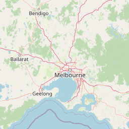
Map view of French Island National Park

Use this park location map to pinpoint French Island National Park in Australia, understand its exact geographic position, and read its mapped placement within the surrounding landscape more clearly.

Pigeon | © OpenStreetMap contributors
Natural feature types

Examine the Natural Landscapes and Named Features of French Island National Park

Investigate the geographic makeup of French Island National Park by browsing its full collection of natural features. MoriAtlas provides a structured path to understand the complex interplay between coastal wetland systems and woodland habitats within this unique Victorian protected area.
Recorded earthquake history

Review the Historical Earthquake Catalogue for French Island National Park

Consult the MoriAtlas collection of recorded seismic activity associated with French Island National Park. This resource allows for the inspection of historical event data, including magnitude and proximity metrics, to support geographic understanding of seismic patterns in the region.

French Island National Park Earthquakes

Catalogued events

13 events

Strongest magnitude

Magnitude 4.5

Most recent event

Feb 8, 2024

This history includes earthquakes recorded inside the park or within 50 km of its borders

Park atlas

Explore adjacent marine protected areas and regional conservation landscapes across Victoria, Australia.

Discover Other National Parks and Protected Areas Near French Island National Park

Continue exploring protected areas beyond French Island National Park by mapping nearby marine conservation zones and terrestrial parks within Victoria, Australia. Compare diverse coastal habitats, island ecosystems, and wetland environments to understand the regional spread of protected landscapes.
Biosphere reserveVictoria
Mapped location lies within the park boundary#1 closest

West

Mornington Peninsula and Western Port Biosphere Reserve: A Geographic Atlas and Protected Area Map

Coastal wetland and biosphere landscape in Victoria, Australia

Analyze the diverse topography of the Mornington Peninsula and Western Port Biosphere Reserve through its coastal indentations, tidal mudflats, and island chains. This record details the reserve as a working landscape, balancing internationally significant migratory bird habitats with the varied terrestrial terrain of the Mornington Peninsula, Phillip Island, and French Island across southeastern Victoria.

Area
2,142 km²
Established
2002
Visitors
400K annual
Relief
Lowland
Marine protected areaAustralia
7.9 km away#2 closest

South

Churchill Island Marine National Park: Coastal Marine Protected Area and Migratory Bird Sanctuary

Mapped seagrass meadows and vital habitat within Western Port.

Churchill Island Marine National Park is a protected marine area recognized for its ecological significance within Victoria, Australia. Occupying 670 hectares of coastal waters in Western Port, the park features extensive seagrass meadows that are essential for black swans and a variety of fish species. It also provides critical roosting and feeding grounds for migratory shorebirds, underscoring its importance within the East Asian-Australasian Flyway and Victoria's broader protected marine area network.

Area
6.7 km²
Established
2002
IUCN
II
Climate
Temperate
National parkAustralia
23 km away#3 closest

Southwest

Mornington Peninsula National Park: Victoria's Coastal Protected Landscape and Map Atlas

Explore dramatic cliff-top terrain, sandy beaches, and native bushland.

Mornington Peninsula National Park is a protected natural area defined by its spectacular coastal geography in Victoria, Australia. The park features striking cliff-top vistas, extensive sandy beaches, and sculpted dunes that showcase the dynamic forces shaping Australia's coastline. Its mapped boundaries protect a vital landscape including areas like Greens Bush, offering a glimpse into the region's native vegetation and geological formations for those interested in detailed geographic context and protected area exploration.

Area
26.86 km²
Established
1995
IUCN
II
Relief
Mixed relief
National parkAustralia
36 km away#4 closest

North

Churchill National Park: Remnant Woodland and Industrial Heritage in Victoria, Australia

Mapped protected area with notable bird diversity and historical quarry sites.

Churchill National Park offers a unique glimpse into Victoria's remnant woodland ecosystems and early twentieth-century industrial history. As a national park, it protects critical habitats for a variety of bird species and preserves the landscape features of historical quarrying operations, including the Scoresby Tramway ruins. The park's mapped geography and accessible walking tracks, like the Channel Track, provide opportunities for exploration and understanding its role as a protected natural and historical asset near Melbourne.

Area
2.71 km²
Established
1941
IUCN
II
Relief
Upland
National parkAustralia
36 km away#5 closest

Southeast

Bunurong Marine National Park: Protected Marine Area with Diverse Reefs and Coastal Landscapes

Explore unique rock formations and rich marine biodiversity off Victoria's coast.

Bunurong Marine National Park in Victoria, Australia, is a designated national park safeguarding remarkable marine ecosystems. Its protected geography features striking coastal features like Eagles Nest and a wealth of subtidal and intertidal rocky reefs teeming with life. This area is renowned for its high marine invertebrate diversity, significant fossil sites such as the Cape Paterson Claw discovery, and provides exceptional opportunities for mapped landscape exploration of its underwater terrains.

Area
21 km²
Established
2002
IUCN
II
Visitors
250K annual
National parkAustralia
41 km away#6 closest

North

Dandenong Ranges National Park: A Protected National Park Landscape

Explore its mapped terrain and regional geographic context.

Dandenong Ranges National Park represents a significant protected area near Melbourne, Australia, characterized by its steep, undulating ridges and deep gullies supporting tall, wet forests. As a national park, it safeguards a vital natural landscape, providing context for regional geography and offering insights into its terrain. This entry facilitates detailed exploration of the park's protected boundaries and its place within the Australian protected-area atlas.

Area
35.4 km²
Established
1987
IUCN
II
Visitors
1M annual
National parkAustralia
About 55 km away#7 closest

West

Point Nepean National Park: Protected Coastal Landscape & Geographic Context

Discover the mapped boundaries of this Australian national park.

Point Nepean National Park represents a vital protected landscape situated at the southern extremity of the Mornington Peninsula, Australia. This national park encompasses a rugged headland that forms the critical entrance to Port Phillip Bay, characterized by striking limestone cliff formations and coastal ecosystems. As a site of historical military importance, Point Nepean National Park offers a distinct geographic identity and a unique protected area for atlas-based exploration and understanding its regional context.

IUCN
II
National parkAustralia
63 km away#8 closest

Northeast

Yarra Ranges National Park: Victoria's Towering Mountain Ash Forests and Protected Landscape Geography

Explore mapped boundaries and vital water catchment landscapes.

Yarra Ranges National Park in Victoria, Australia, represents a significant protected landscape within the Great Dividing Range. It is renowned for its exceptionally tall mountain ash forests, which are vital carbon stores and habitats, and its critical function as a water catchment area for Melbourne. This park offers a deep dive into a unique geographic setting defined by diverse mountain terrain, temperate rainforests, and subalpine environments, all preserved for their ecological and water security importance.

Area
760 km²
Established
1995
IUCN
II
Visitors
800K annual

Common questions about visiting, size, designation, and location context for French Island National Park

French Island National Park FAQs for park facts, access, geography, and protected area context

Find quick answers about French Island National Park, including protected-area facts, park geography, trail and visitor context, and how the park fits into its surrounding country and regional landscape.
MoriAtlas Explorer

Continue Your Protected Areas Search Across the Global Atlas

Deepen your exploration by continuing the structured search for national parks and protected areas worldwide. Utilize the comprehensive filtering capabilities to compare different conservation landscapes and refine your understanding of global park geography. Discover more about the distribution and characteristics of protected natural areas.

Global natural geography