

Mori Atlas logo
National parkGir National Park

Mapped boundaries and regional geography of this vital Indian national park

Gir National Park: Gujarat's Premier National Park and Protected Landscape

(Gir National Park and Wildlife Sanctuary)

Gir National Park stands as a significant protected area and national park situated in the Gujarat region of western India. This page offers an atlas-oriented perspective, focusing on the park's distinct geographic identity, its position within the regional landscape, and the mapped context of its protected boundaries. Understand Gir National Park as a vital component of India's conservation geography, essential for anyone exploring protected lands and natural terrain.

Dry Deciduous ForestBig Cat HabitatLion ConservationWildlife SanctuaryProtected AreaAsiatic Lion

Gir National Park

National park

Park overview

Structured park overview, official facts, and landscape profile for Gir National Park

Gir National Park park facts, protected area profile, and essential visitor context
Review the core facts for Gir National Park, including designation, size, terrain, visitor scale, habitats, and operating context in one park-focused overview.

About Gir National Park

Gir National Park stands as India's most significant lion conservation landscape and one of Asia's most important protected areas. Located in the southwestern region of Gujarat state, the park occupies a semi-arid landscape characterized by undulating terrain, dense forest cover, and an intricate network of rivers and reservoirs that form the ecological backbone of the region. The park's establishment in 1965 marked a critical turning point in protecting what remained of the Gir Forest, which had served as the private hunting grounds of the Nawab of Junagarh. The ecosystem's ecological importance extends far beyond its flagship species, encompassing a complex web of dry deciduous forest habitats, grassland patches, and riparian zones that support extraordinary biodiversity. The park's management focuses on maintaining the delicate balance between species conservation and ecosystem preservation, with particular emphasis on the Asiatic lion whose population dynamics require careful monitoring and habitat protection. Visitor access is carefully regulated through seasonal closures that allow the ecosystem to regenerate during the monsoon months.

Quick facts and research context for Gir National Park

Gir National Park is located in Junagadh, Gir Somnath, and Amreli districts of Gujarat, India, with the nearest towns being Talala and Veraval. The park was formally established in 1965 and operates under the governance of Gujarat's Forests and Environment Department. The ecosystem falls within the Khathiar-Gir dry deciduous forests ecoregion, classified as very dry teak forest with scrub and savanna variations. The region features seven major perennial rivers including the Hiran, Shetrunji, Machhundri, and Raval, with the Kamleshwar Dam serving as the primary water reservoir. The park closes annually from June 16 to October 15 during the monsoon season.

Park context

Deeper park guide and search-rich context for Gir National Park

Gir National Park history, landscape, wildlife, and travel context
Explore Gir National Park through its history, landscape character, ecosystems, wildlife, conservation priorities, cultural context, and seasonal travel timing in a structured park guide built for atlas discovery and search intent.

Why Gir National Park stands out

Gir National Park is world-renowned as the exclusive habitat of the Asiatic lion, the last surviving population of this subspecies outside African conservation contexts. The park's successful lion conservation story represents one of wildlife protection's most remarkable achievements, with the population growing from as few as about a dozen individuals in the late 1800s to over 670 by 2020. The park also preserves one of India's largest dry deciduous forest ecosystems and serves as a refuge for significant populations of Indian leopards, mugger crocodiles, and diverse herbivore species within its protected boundaries.

Gir National Park history and protected-area timeline

The history of Gir National Park is inextricably linked to the dramatic decline and subsequent recovery of the Asiatic lion in India. During the 19th century, the rulers of various Indian princely states, including the British colonial administrators, conducted extensive hunting expeditions throughout the region, pushing the Asiatic lion to the brink of extinction. By the end of the 1800s, fewer than a dozen lions remained in all of India, all confined to the Gir Forest within the territory of the Nawab of Junagarh. The British viceroys brought this critical situation to the Nawab's attention, prompting the establishment of the wildlife sanctuary to protect the remaining lion population. The formal designation of Gir as a national park and wildlife sanctuary in 1965 institutionalized conservation efforts, creating a protected framework that has enabled the lion population to recover substantially. The conservation program has included scientific breeding initiatives, population monitoring through regular censuses conducted every five years, and community engagement programs that involve local tribal women in population counting efforts. Despite challenges including occasional poaching, human-wildlife conflict, and ecological threats like drought and disease, Gir remains the most promising long-term preserve for the Asiatic lion.

Gir National Park landscape and geographic character

The Gir landscape is characterized by a diverse topography of rolling hills, plateaus, and valleys within the broader Kathiawar peninsula region of Gujarat. The terrain generally slopes from east to west, with elevations varying across the park's extent. The forest landscape is dominated by dry deciduous vegetation, with teak trees forming a significant component of the tree cover, particularly in the eastern portions of the park. The region supports several distinct habitat types including dense forest areas, open savanna grasslands locally known as vidis, and scrubland zones that result from forest degradation. Seven major perennial rivers traverse the park: Hiran, Shetrunji, Dhatarvadi, Shingoda, Machhundri, Ambajal, and Raval, fed by the monsoon rains and sustained by groundwater resources. Four major reservoirs created by dams on these rivers provide critical water resources, with the Kamleshwar Dam forming the largest water body in the area and serving as the lifeline of the Gir ecosystem. These water bodies support both wildlife and agricultural activities in the surrounding region.

Gir National Park ecosystems, habitats, and plant life

Gir National Park represents a unique dry deciduous forest ecosystem that constitutes the largest such forest in western India. The vegetation falls under the classification of very dry teak forest according to the Champion and Sheth forest type system, with teak occurring in mixture with various dry deciduous species. The forest supports over 500 plant species, including important trees such as acacia species, ber, jamun, babul, flame of the forest, tendu, and dhak, along with occasional banyan trees that provide distinctive landmarks in the landscape. The park's ecological significance extends to its role in providing substantial resources, including approximately 5 million kilograms of grass harvested annually and significant fuel wood production. The ecosystem supports complex ecological interactions between forest, grassland, and aquatic habitats, with the riparian zones along the perennial rivers providing critical biodiversity corridors. The afforestation program has introduced species such as casuarina and prosopis along the forest boundaries, while the overall ecosystem provides important scientific, educational, and recreational values.

Gir National Park wildlife and species highlights

Gir National Park supports an exceptional diversity of wildlife, with approximately 2,375 documented fauna species including around 38 mammal species, 300 bird species, 37 reptile species, and over 2,000 insect species. The park's mammal community is dominated by its famous carnivores: the Asiatic lion remains the flagship species, while Indian leopards, jungle cats, striped hyenas, golden jackals, Bengal foxes, and various mongoose species including Indian gray mongoose and ruddy mongoose also inhabit the area. Herbivore species include chital, nilgai, sambar deer, four-horned antelope, chinkara, and wild boar, with blackbuck occasionally venturing into the sanctuary from surrounding areas. The reptile population features the mugger crocodile, Indian cobra, Indian star tortoise, and Bengal monitor, with the crocodile conservation program having released nearly 1,000 individuals into the park's water bodies since 1977. Birdlife is exceptionally rich with over 300 species, including resident populations of crested serpent eagle, Bonelli's eagle, changeable hawk-eagle, Indian peafowl, and several species of vultures as part of the scavenger community.

Gir National Park conservation status and protection priorities

Gir National Park holds extraordinary conservation significance as the world's only habitat for the Asiatic lion, making it one of the most critical protected areas in Asia. The lion population has recovered from near extinction in the early 1900s, growing from approximately 100 individuals in 1900 to 674 by 2020, representing a remarkable conservation success story. The park's conservation program operates through the Gujarat State Forest Department and includes the Lion Breeding Programme, which maintains breeding centers and has successfully bred approximately 180 lions at the Sakkarbaug Zoo facility. Population monitoring occurs through quinquennial censuses using direct counting methods, with the involvement of local communities including tribal women from neighboring villages. The park faces ongoing conservation challenges including natural threats like drought, cyclones, and fires, as well as anthropogenic pressures from over-grazing, encroachment, and peripheral mining activities. Genetic diversity concerns within the large mammal populations represent an emerging issue requiring continued management attention.

Gir National Park cultural meaning and human context

The Gir region has historical connections to the princely state of Junagarh, whose Nawab maintained the forest as private hunting grounds before its transformation into a protected area. The local communities surrounding the park include traditional tribal populations who have been engaged in conservation activities, with women from these communities playing important roles in the lion census operations. The ecosystem has historically supported local livelihoods through grazing, fuel wood collection, and agricultural activities in the surrounding areas, creating a complex relationship between human communities and the protected landscape.

Top sights and standout views in Gir National Park

Gir National Park's primary highlight remains its status as the last home of the Asiatic lion, offering visitors one of the world's few opportunities to observe this magnificent big cat in its natural habitat. The park's successful conservation narrative represents a landmark achievement in global wildlife protection. The landscape itself, spanning the largest dry deciduous forest in western India, provides a distinctive setting of teak woodlands, savanna grasslands, and riparian corridors. The opportunity to observe Indian leopards, mugger crocodiles, and diverse birdlife adds to the park's ecological appeal. The Kamleshwar Reservoir and other water bodies create scenic focal points within the park while supporting abundant wildlife viewing opportunities.

Best time to visit Gir National Park

The optimal period to visit Gir National Park runs from November through mid-June, with the park remaining closed from June 16 to October 15 during the monsoon season. The winter months from November through February offer pleasant temperatures and excellent wildlife viewing opportunities, as vegetation is less dense and animals frequent water sources more regularly. Summer months from March to June provide optimal conditions for lion sightings, as the dry conditions concentrate wildlife around the remaining water bodies. The post-monsoon period in October and early November offers green landscapes following the rains, though the park may be approaching its closure date. Visitors should plan accordingly to experience the park's seasonal variations in wildlife behavior and landscape appearance.
Park location guide

Geography guide, regional context, and park location map for Gir National Park

Gir National Park park geography, regions, and map view in India
Understand where Gir National Park sits in India through a broader geographic reading of the surrounding landscape, nearby location context, and its mapped position within the national park landscape.

How Gir National Park fits into India

India is a South Asian country bordered by the Indian Ocean, Arabian Sea, and Bay of Bengal. It shares land borders with Pakistan, China, Nepal, Bhutan, Bangladesh, and Myanmar. The country has a population of over 1.4 billion people and operates as a federal parliamentary republic with its capital in New Delhi.

Wider geography shaping Gir National Park in India

India occupies the Indian subcontinent in South Asia, bordered by the Arabian Sea to the southwest, the Bay of Bengal to the southeast, and the Indian Ocean to the south. It shares land borders with Pakistan to the west, China, Nepal, and Bhutan to the north, and Bangladesh and Myanmar to the east. The territory also includes the Andaman and Nicobar Islands in the Indian Ocean.

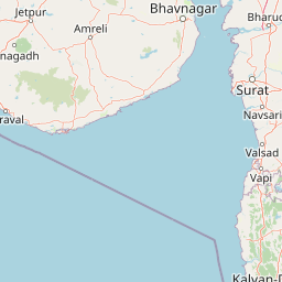
Map view of Gir National Park

Use this park location map to pinpoint Gir National Park in India, understand its exact geographic position, and read its mapped placement within the surrounding landscape more clearly.

Pigeon | © OpenStreetMap contributors

Location context for Gir National Park

Gujarat
Park atlas

Trace the Protected Landscape Spread and Regional Geography Surrounding Gir National Park

Discover Other National Parks and Protected Areas Near Gir National Park
Explore a curated selection of national parks and protected areas geographically adjacent to Gir National Park, expanding your understanding of conservation landscapes within Gujarat, India. This comparative view helps trace the distribution of dry deciduous forests and diverse wildlife habitats, offering regional context for protected area mapping and structured discovery.
National parkBhavnagar District

Blackbuck National Park: Gujarat's Grassland Protected Landscape and Wildlife Atlas

Mapped semi-arid terrain and endangered species habitat.

Blackbuck National Park in Bhavnagar District, India, presents a unique focus on semi-arid grassland ecosystems and their protection. This national park showcases a flat, expansive landscape that borders coastal tidal zones, offering a distinct geographic context for its rich biodiversity. As a critical habitat for the blackbuck antelope and the endangered lesser florican, its protected area status is paramount. Exploring this park through its mapped boundaries and regional geography reveals its importance within India's network of conservation landscapes.

Area
34.08 km²
Established
1976
IUCN
II
Relief
Lowland
National parkGujarat

Marine National Park, Gulf of Kutch: A Protected Coastal Landscape in Gujarat, India

Explore its mapped boundaries and regional geography.

Marine National Park, Gulf of Kutch is a designated national park located in the Gujarat region of India. This page serves as an atlas-centric resource for understanding the park's protected landscape, its position within the broader geography of Western India, and its mapped natural features. Discover the distinct protected-area characteristics and regional context that define this important Indian national park.

Area
162.89 km²
Established
1982
IUCN
II
Relief
Lowland
National parkNavsari District

Vansda National Park: Protected Deciduous Forest Landscape within the Western Ghats

Explore the mapped geography and biodiversity of this Navsari District national park.

Vansda National Park stands as a crucial protected area in Navsari District, Gujarat, preserving the characteristic dense deciduous forests and extensive bamboo groves of the Western Ghats. The park's geography is shaped by its location along the Ambika River, presenting a landscape of rolling hills and forested valleys within this significant biodiversity hotspot. Users can delve into its protected land status, mapped terrain, and the unique ecological attributes that make it a noteworthy national park for geographic and conservation exploration.

Area
23.99 km²
Established
1979
IUCN
II
Relief
Highland
National parkMaharashtra

Sanjay Gandhi National Park: Protected Forest Landscape and Ancient Buddhist Archaeology

Explore the mapped terrain and natural geography within Maharashtra.

Sanjay Gandhi National Park offers a unique blend of natural and historical discovery. This national park preserves vital tropical forest ecosystems characteristic of the Western Ghats region, providing a crucial urban wilderness habitat. Its most prominent feature is the Kanheri Caves, an extensive network of ancient rock-cut Buddhist structures showcasing over 2,400 years of continuous religious and cultural history. The park's protected boundaries encompass diverse terrain, supporting leopard populations and a rich variety of bird and insect life, all within the metropolitan limits of Mumbai, making it a significant site for geographic and conservation exploration.

Area
87 km²
Established
1996
IUCN
II
Visitors
2M annual
National parkRajasthan

Desert National Park: A Sprawling National Park in Rajasthan's Thar Desert

Explore unique desert geography, mapped terrain, and fossil discoveries.

Desert National Park offers an expansive atlas view of the Thar Desert's unique aeolian sand deposits and arid terrain. Covering over 3,100 square kilometers across Rajasthan's Jaisalmer and Barmer districts, this national park is a critical landscape for desert conservation. Its features include iconic sand dunes, rocky formations, and ancient fossil beds, providing a profound geographic context for understanding desert ecosystems and prehistoric life.

Area
3,162 km²
Established
1981
IUCN
II
Relief
Lowland
National parkRajasthan

Mukundara Hills National Park: Rajasthan's Protected Landscape for Tigers and Diverse Habitats

Explore its dry deciduous forests, rocky hills, and riverine ecosystems.

Mukundara Hills National Park is a significant national park and tiger conservation landscape situated in eastern Rajasthan, India. This protected area features a varied terrain encompassing rocky hills, dry deciduous forests, and crucial grassland patches, all intersected by major rivers like the Chambal. Its ecological importance lies in providing vital habitat for Bengal tigers and a mosaic of landscapes that support a wide array of wildlife. Understanding its mapped boundaries and geographic context reveals its critical role in regional conservation efforts and provides a rich atlas-level view of protected lands in western India.

Area
759.99 km²
Established
2004
IUCN
II
Relief
Mountain
National parkMadhya Pradesh

Van Vihar National Park: National Park Protected Landscape and Regional Geography

Mapped boundaries within Madhya Pradesh's natural context.

Van Vihar National Park is a designated national park offering a unique perspective on protected landscapes within Madhya Pradesh. This detail entry provides essential geographic context, focusing on the park's mapped boundaries and its role within the region's natural terrain. It serves as a vital point for understanding the distribution and identity of protected areas for atlas exploration.

Area
4.48 km²
Established
1979
IUCN
II
Visitors
250K annual
National parkBalochistan

Hingol National Park: Pakistan's Unique Protected Landscape and Geological Atlas

Discover dramatic rock formations and coastal geography.

Hingol National Park stands as a monumental protected landscape within Balochistan, Pakistan, offering an unparalleled atlas view of geological diversity. Renowned for its hoodoos like the Princess of Hope and the Balochistan Sphinx, the park also features active mud volcanoes and striking coastal semi-desert terrain. The confluence of the Hingol River with the Arabian Sea creates important wetland habitats. This national park provides a rich context for exploring unique natural formations and regional geography, making it a significant point of discovery within Pakistan's protected areas.

Area
6,100 km²
Established
1988
IUCN
II
Relief
Mixed relief

Common questions about visiting, size, designation, and location context for Gir National Park

Gir National Park FAQs for park facts, access, geography, and protected area context
Find quick answers about Gir National Park, including protected-area facts, park geography, trail and visitor context, and how the park fits into its surrounding country and regional landscape.
MoriAtlas Explorer

Continue Your Protected Areas Search Across the Global Atlas

Deepen your exploration by continuing the structured search for national parks and protected areas worldwide. Utilize the comprehensive filtering capabilities to compare different conservation landscapes and refine your understanding of global park geography. Discover more about the distribution and characteristics of protected natural areas.

Global natural geography