Mori Atlas logo
National parkGrampians National Park

Discover the mapped boundaries and regional context of this significant national park in Victoria.

Grampians National Park: Protected Landscape, Aboriginal Heritage, and Sandstone Geography

Grampians National Park in Victoria, Australia, presents a dramatic protected landscape characterized by ancient sandstone mountain ranges that rise abruptly from the Wimmera plains. This extensive national park, covering over 167,000 hectares, offers a unique opportunity to explore its rugged terrain, significant Aboriginal rock art sites, and distinctive geological formations. Understanding Grampians National Park through its mapped geography and protected status reveals its profound natural beauty and deep cultural significance.

Mountain parksAboriginal heritage sitesRock art locationsSandstone landscapesVictoria national parksNature conservation areas

Grampians National Park

National park

Park overview

Structured park overview, official facts, and landscape profile for Grampians National Park

Grampians National Park park facts, protected area profile, and essential visitor context
Review the core facts for Grampians National Park, including designation, size, terrain, visitor scale, habitats, and operating context in one park-focused overview.

About Grampians National Park

Grampians National Park protects a distinctive sandstone mountain landscape in western Victoria that rises from the flat Wimmera plains to form a series of rugged, north-south trending ranges. The park's terrain is characterized by steep eastern faces where sedimentary layers have faulted, creating near-vertical cliffs and dramatic rock formations such as The Fortress. The landscape supports a network of well-developed walking tracks, with the 164-kilometre Grampians Peaks Trail crossing the length of the park on a 13-day hiking route opened in 2021. The park is bordered by the Western Highway to the north and the Glenelg Highway to the south, with the town of Halls Gap serving as the main visitor accommodation hub on the eastern side of the ranges. The Brambuk National Park and Cultural Centre in Halls Gap is owned and managed by Jardwadjali and Djab Wurrung peoples from five Aboriginal communities with historic links to the Gariwerd-Grampians ranges.

Quick facts and research context for Grampians National Park

Grampians National Park spans 1,672 square kilometres in western Victoria, Australia, established on 1 July 1984 and managed by Parks Victoria. The park features Devonian sandstone mountain ranges formed 425 to 415 million years ago, with the highest peak at Mount William reaching 1,167 metres. The region experiences a cool Mediterranean climate with high precipitation, recording rain on approximately 215 days annually and frequent winter snowfalls. The park contains 90 percent of Victoria's Aboriginal rock art and is home to 975 native plant species, including more than 75 orchid species, representing one-third of Victoria's total flora.

Park context

Deeper park guide and search-rich context for Grampians National Park

Grampians National Park history, landscape, wildlife, and travel context
Explore Grampians National Park through its history, landscape character, ecosystems, wildlife, conservation priorities, cultural context, and seasonal travel timing in a structured park guide built for atlas discovery and search intent.

Why Grampians National Park stands out

Grampians National Park is best known for its extraordinary concentration of Aboriginal rock art, featuring depictions of humans, hands, animal tracks, and birds in caves throughout the park's sandstone ranges. The park's dramatic sandstone cliff formations and peaks attract world-class rock climbers, with notable routes including The Wheel of Life and Groove Train. The area is also celebrated for its seasonal wildflower displays, with the Grampians often called the 'garden of Victoria' due to its exceptional plant diversity and many endemic species. The Grampians Wave meteorological phenomenon makes Mount William a renowned gliding location where pilots can reach extreme altitudes.

Grampians National Park history and protected-area timeline

The Grampians region has been home to Aboriginal peoples for thousands of years, with the Jardwadjali and Djab Wurrung peoples maintaining deep cultural connections to the landscape long before European colonization. The name Gariwerd was first recorded in 1841 by Chief Protector of Aborigines George Augustus Robinson, taken from a Jardwadjali speaker. In 1836, explorer and Surveyor General Thomas Mitchell named the range after the Grampian Mountains in Scotland, initially calling them the Coast Mountains, then the Gulielmian Mountains after William IV, before settling on Grampians. The area became a popular recreation destination in the mid-nineteenth century, with railway expansion to nearby Stawell, Ararat, and Dunkeld driving tourism growth in the early twentieth century. After a two-year consultation process, the park was renamed Grampians (Gariwerd) National Park in 1991, though this proved controversial and was reversed in 1992 following the election of the Kennett government. The 1998 Geographic Place Names Act reinstated dual naming conventions, and the park is now officially referred to as Grampians National Park (Gariwerd) on the National Heritage List.

Grampians National Park landscape and geographic character

The Grampians landscape consists of a striking series of sandstone mountain ranges running roughly north-south, with the rock material laid down from rivers during the Devonian period 425 to 415 million years ago. The sediment accumulated to a depth of approximately seven kilometres before being raised and tilted into its present form. The western parts of the park feature lower-angled sandstone ridges, while the eastern sides feature steep to near-vertical cliff faces, notably at Hollow Mountain near Dadswells Bridge at the northern end. The highest peak, Mount William, reaches 1,167 metres above sea level. Numerous waterfalls punctuate the landscape, with Mackenzie Falls being among the most accessible via the park's road network. The Silverband Formation contains significant geological features, including sandstone paving slabs used in nearby construction in 1873 that contained fossilized track impressions of a four-legged vertebrate animal, considered among the oldest traces of land vertebrate life in Australia.

Grampians National Park ecosystems, habitats, and plant life

The Grampians ecosystem supports exceptional plant diversity, with the park containing 975 native plant species including more than 75 orchid species, representing approximately one-third of Victoria's total flora. Many species are endemic to the Grampians, including the Grampians pincushion lily (Borya mirabilis), one of the rarest native lilies in Australia. The park's elevation gradient from the Wimmera plains to the alpine heights of Mount William creates diverse habitats ranging from dry sclerophyll forests on lower slopes to damp ferny gullies and exposed heathland on high peaks. The seasonal wildflower display in spring is a major attraction, with the colloquial nickname 'garden of Victoria' reflecting the area's botanical significance. The ranges act as a biodiversity corridor connecting isolated remnant vegetation communities across western Victoria.

Grampians National Park wildlife and species highlights

The Grampians provides habitat for diverse native wildlife adapted to the mountain and forest environments of western Victoria. The park's forests shelter numerous bird species, mammals, and reptiles, though specific species details are limited in the source material. The rocky outcrops and cliff faces provide nesting habitat for raptors and other birds that thrive in the sandstone environment. The park's water sources, including streams and waterfalls, support aquatic species and provide drinking points for wildlife in the drier months. The vegetation communities, ranging from open forests to heathland and rocky ridges, create varied microhabitats supporting different wildlife assemblages across the elevational gradient.

Grampians National Park conservation status and protection priorities

Grampians National Park is listed on the National Heritage List for its outstanding natural beauty and exceptional Aboriginal cultural significance, being one of the richest Indigenous rock art sites in southeastern Australia. The park protects 90 percent of Victoria's rock art heritage, with significant sites containing motifs painted by Jardwadjali and Djab Wurrung peoples over thousands of years. The 2006 National Heritage List inscription recognized both the natural values and the continuing Aboriginal cultural associations with the landscape. Conservation efforts face challenges from periodic bushfires, with a major fire in January 2006 burning approximately 127,000 hectares (47 percent of the park), and subsequent fires impacting roughly 85 percent of the total area. The 164-kilometre Grampians Peaks Trail was designed with inspiration from Tasmanian walking tracks to provide sustainable visitor access while minimizing ecological impact.

Grampians National Park cultural meaning and human context

The Grampians holds profound cultural significance for the Jardwadjali and Djab Wurrung peoples, for whom the landscape of Gariwerd was central to Aboriginal dreaming and the creation narrative of Bunjil, the creator being, and the two brothers Bram responsible for shaping and naming many landscape features across western Victoria. The park contains numerous rock art sites with motifs including human figures, handprints, animal tracks, and birds, created by Aboriginal communities that have maintained cultural connections to the land despite historical disruption since European settlement from 1840. Dual naming of features has been adopted in the park based on Jardwadjali and Djab Wurrung names, including Grampians/Gariwerd for the mountain range, Halls Gap/Budja Budja, Mount Zero/Mura Mura, and Mount Difficult/Gar. The Brambuk National Park and Cultural Centre represents Indigenous management and ownership, operated by Aboriginal communities with historic links to the region.

Top sights and standout views in Grampians National Park

The Grampians offers exceptional experiences including the dramatic sandstone peaks and cliff formations perfect for rock climbing at world-class venues, the remarkable concentration of Aboriginal rock art sites showcasing thousands of years of Indigenous heritage, the seasonal wildflower displays that blanket the ranges in spring, and the panoramic views from lookouts like Boroka Peak and The Balconies overlooking Victoria Valley. The 13-day Grampians Peaks Trail provides an immersive wilderness hiking experience through the park's most scenic terrain, while the Grampians Wave enables extraordinary gliding opportunities from Mount William. The annual Grampians Grape Escape food and wine festival in Halls Gap each May celebrates local produce and culture. The Mackenzie Falls and other waterfall walks showcase the park's water features tumbling over sandstone cliffs.

Best time to visit Grampians National Park

The Grampians is best visited in winter and spring when cooler temperatures make hiking comfortable and the wildflower season creates spectacular displays across the ranges. Summer can bring extreme heat and fire closures, while winter offers dramatic scenery but cold conditions with frequent snow at higher elevations. The most popular time for day visitors is during spring when wildflowers bloom and weather is pleasant for bushwalking. Rock climbers should be aware that 30 percent of climbing areas remain closed due to ongoing cultural and ecological concerns, with specific closures affecting 70 percent of bouldering routes and 50 percent of sport climbing routes as of 2019.
Park location guide

Geography guide, regional context, and park location map for Grampians National Park

Grampians National Park park geography, regions, and map view in Australia
Understand where Grampians National Park sits in Australia through a broader geographic reading of the surrounding landscape, nearby location context, and its mapped position within the national park landscape.

How Grampians National Park fits into Australia

Australia is a constitutional monarchy and federal parliamentary democracy comprising six states and ten territories. With a population of nearly 28 million, it is one of the world's most urbanised countries, with most people concentrated on the eastern seaboard. The country has a high Human Development Index and is known for its cultural diversity, ancient Aboriginal heritage, and unique wildlife.

Wider geography shaping Grampians National Park in Australia

Australia occupies the entire Australian continent, the island of Tasmania, and numerous smaller islands. It is the world's flattest and driest inhabited continent, featuring vast deserts in the interior (the Outback), tropical rainforests along the eastern coast, and a coastline bordering the Indian and Pacific Oceans.

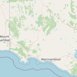
Map view of Grampians National Park

Use this park location map to pinpoint Grampians National Park in Australia, understand its exact geographic position, and read its mapped placement within the surrounding landscape more clearly.

Pigeon | © OpenStreetMap contributors
Park atlas

Discover the broader protected landscapes and adjacent geographic regions surrounding Grampians National Park.

Explore Other National Parks and Protected Areas Near Grampians, Victoria's Sandstone Ranges
After exploring Grampians National Park's dramatic sandstone ranges and Aboriginal heritage, continue your park discovery by browsing other national parks and protected areas in Victoria. Compare diverse landscapes, conservation efforts, and regional geographic contexts to deepen your understanding of Australia's natural and cultural heritage.
National park

Kara Kara National Park: Mapped Protected Landscape and Box-Ironbark Forest Ecology

Explore Victoria's protected natural geography and woodland habitats.

Kara Kara National Park is an essential protected area in Victoria, Australia, recognized for its significant box-ironbark forest ecosystems and the conservation of the endangered swift parrot. The park's geography is defined by the St Arnaud Range, offering a distinct topography of ridges and valleys that contrast with the surrounding plains. Understanding this park's mapped boundaries and its role within the regional landscape provides critical insight into its ecological value and its representation of historical woodland environments.

Area
139.9 km²
Established
2002
IUCN
II
Relief
Upland
National park

Budj Bim National Park: Ancient Volcanic Landscapes and World Heritage Protected Area

Explore the unique geography of Budj Bim National Park's crater lakes and lava tubes.

Budj Bim National Park offers an exceptional exploration of volcanic geography and ancient human ingenuity. This protected area features a dramatic landscape dominated by volcanic cones, lava tubes, and the picturesque Lake Surprise crater lake. Its significance is amplified by the presence of sophisticated Aboriginal aquaculture systems, developed thousands of years ago by the Gunditjmara people, which have contributed to its UNESCO World Heritage status. Discover the mapped terrain and protected land context of this geologically and culturally rich Australian national park.

Area
54.7 km²
Established
1960
IUCN
II
Relief
Mixed relief
National park

Little Desert National Park: Victoria's Semi-Arid National Park and Protected Landscape

Explore mapped boundaries and unique mallee heathland ecosystems.

Delve into the protected landscape of Little Desert National Park, a significant national park covering over 1,300 square kilometers of Victoria's semi-arid western region. This area is characterized by its deep sandy soils, mallee heathlands, and diverse wildlife, including important populations of native birds. Understanding its geographic setting and mapped boundaries provides crucial insight into Australia's conservation efforts and the preservation of unique desert ecosystems.

Area
1,326.47 km²
Established
1988
IUCN
II
Visitors
50K annual
National parkBarwon South West

Cobboboonee National Park: A Protected Landscape in Australia's Barwon South West Region

Explore its mapped geography and natural terrain.

Cobboboonee National Park represents an important protected area within the Barwon South West region of Australia. This destination offers users a deep dive into the park's specific geography, providing context on its mapped boundaries and the surrounding natural landscapes. It is designed for exploration of the park's protected-area identity and its place within the regional geography, offering structured data for landscape context.

Area
185.1 km²
Established
2008
IUCN
II
Climate
Temperate
National park

Lower Glenelg National Park: Dramatic River Gorge and Limestone Cave Protected Landscape

Explore its mapped boundaries and unique geological features.

Lower Glenelg National Park in Victoria, Australia, is a national park celebrated for its visually stunning Glenelg River gorge. This protected area showcases millions of years of geological history etched into its limestone cliffs and features the accessible Princess Margaret Rose Cave. Understand the park's mapped landscape, its diverse terrain from riverine woodlands to coastal wetlands, and its significance within regional geographic exploration.

Area
273 km²
Established
1969
IUCN
II
Visitors
200K annual
National parkSouth Australia

Naracoorte Caves National Park: Detailed Map and Protected Landscape Context in South Australia

Explore its unique protected geography and natural terrain.

Naracoorte Caves National Park represents a vital protected area within the diverse geography of South Australia. This entry provides an atlas-driven perspective, highlighting its identity as a national park, its mapped landscapes, and its regional significance. Engage with structured information detailing the park's protected status and geographic features, offering a clear view of its contribution to South Australia's natural heritage.

Area
6.6 km²
Established
2001
IUCN
II
Visitors
90.8K annual
National park

Mount Richmond National Park: Protected Area Atlas and Southwest Victoria Landscape

Explore mapped terrain and coastal woodland ecosystems.

Mount Richmond National Park is a vital protected area in Victoria's southwest, safeguarding coastal woodland and heath remnants on the region's volcanic plains. As a component of Victoria's national park system, it provides a geographically specific example of a protected landscape, contributing to the regional atlas of natural environments. Its landscape character is defined by eucalyptus woodlands and coastal influences, offering context for understanding conservation corridors and the mapped natural terrain of the southwestern Victorian coast. The park’s inclusion in long-distance walking routes also underscores its value for exploring protected natural areas.

Area
17.33 km²
Established
1960
IUCN
II
Relief
Mixed relief
National park

Discovery Bay Marine National Park: Victoria's Protected Coastal Marine Landscape

Mapped protected waters adjacent to Cape Bridgewater's unique geography.

Discover the geographic scope and protected landscape identity of Discovery Bay Marine National Park, an important marine national park located in Victoria, Australia, near Portland. This protected area safeguards a crucial stretch of the country's southern coastline, contributing to the ecological significance of the Southern Ocean marine region. Its position adjacent to the Discovery Bay Coastal Park highlights an integrated conservation approach, offering users a detailed view of its mapped marine boundaries and the distinctive geological context of the Cape Bridgewater area for atlas exploration.

Area
27.7 km²
Established
2002
IUCN
II
Climate
Temperate

Common questions about visiting, size, designation, and location context for Grampians National Park

Grampians National Park FAQs for park facts, access, geography, and protected area context
Find quick answers about Grampians National Park, including protected-area facts, park geography, trail and visitor context, and how the park fits into its surrounding country and regional landscape.
MoriAtlas Explorer

Continue Your Protected Areas Search Across the Global Atlas

Deepen your exploration by continuing the structured search for national parks and protected areas worldwide. Utilize the comprehensive filtering capabilities to compare different conservation landscapes and refine your understanding of global park geography. Discover more about the distribution and characteristics of protected natural areas.

Global natural geography